

Cape Scott Provincial Park is at the very northern tip of Vancouver Island. It’s a remote but beautiful place: old-growth rainforest, coastal bog, gorgeous white sand beaches, and lots of historical sites. It’s a 23.6km hike from the trailhead to the lighthouse at Cape Scott, so most visitors do it as a backpacking trip, staying at one of the campsites along the way.
I’ve done six or seven backpacking trips in the park (to research my book, Backpacking on Vancouver Island), so I’ve put together a full guide to the Cape Scott area for you. This post includes:
- how to get to Cape Scott Provincial Park, including driving directions and where to stay nearby
- how much it costs to hike and camp at Cape Scott
- a detailed trail description of the hike from the trailhead to Cape Scott lighthouse
- other hikes in the area including San Josef Bay
- where to camp in Cape Scott Provincial Park
- tips for making your Cape Scott trip a success
This is a sensitive wilderness area. Learn how to Leave No Trace to keep the wilderness wild. Make sure you are prepared by bringing the 10 Essentials. Get ready for adventure with this checklist of things to do before every hike.
Hey there: Some of the links in this post are affiliate links, which means I earn a small commission at no extra cost to you if you make a purchase. Thanks for supporting my website. -Taryn
Cape Scott Overview
Cape Scott Provincial Park is located at the northern tip of Vancouver Island in British Columbia, Canada. The main attractions in the park are the trail to Cape Scott at the northwest tip of the park, and the North Coast Trail, a challenging 5-day backpacking trip. (I’ve got a separate guide for the North Coast Trail, so I won’t go into details on it in this post.)
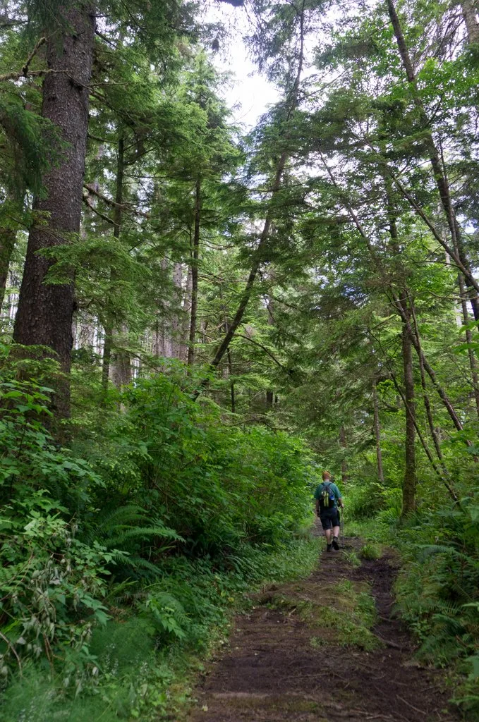
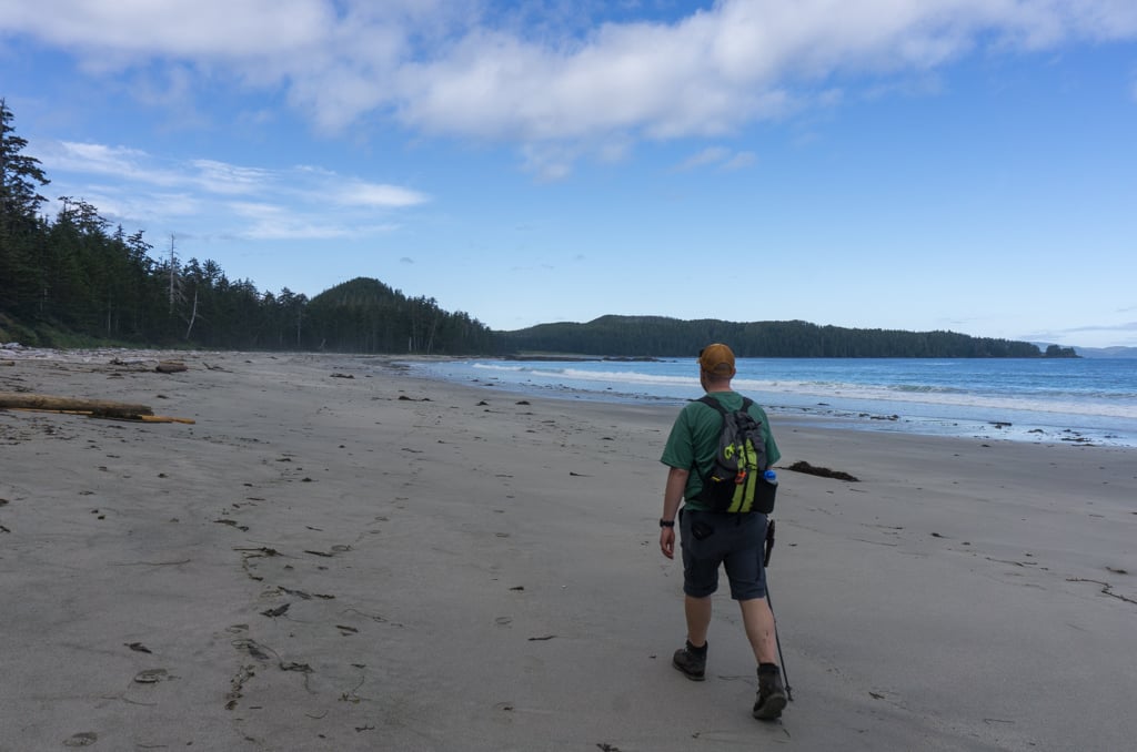
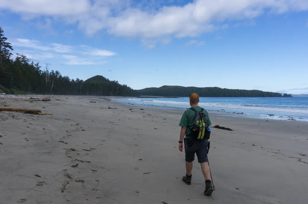
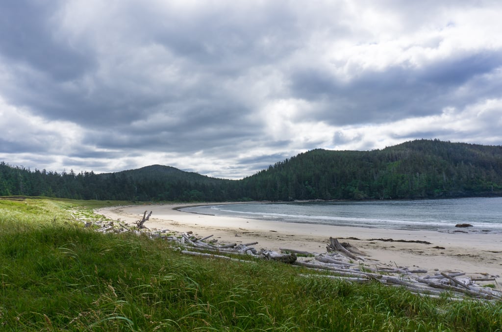
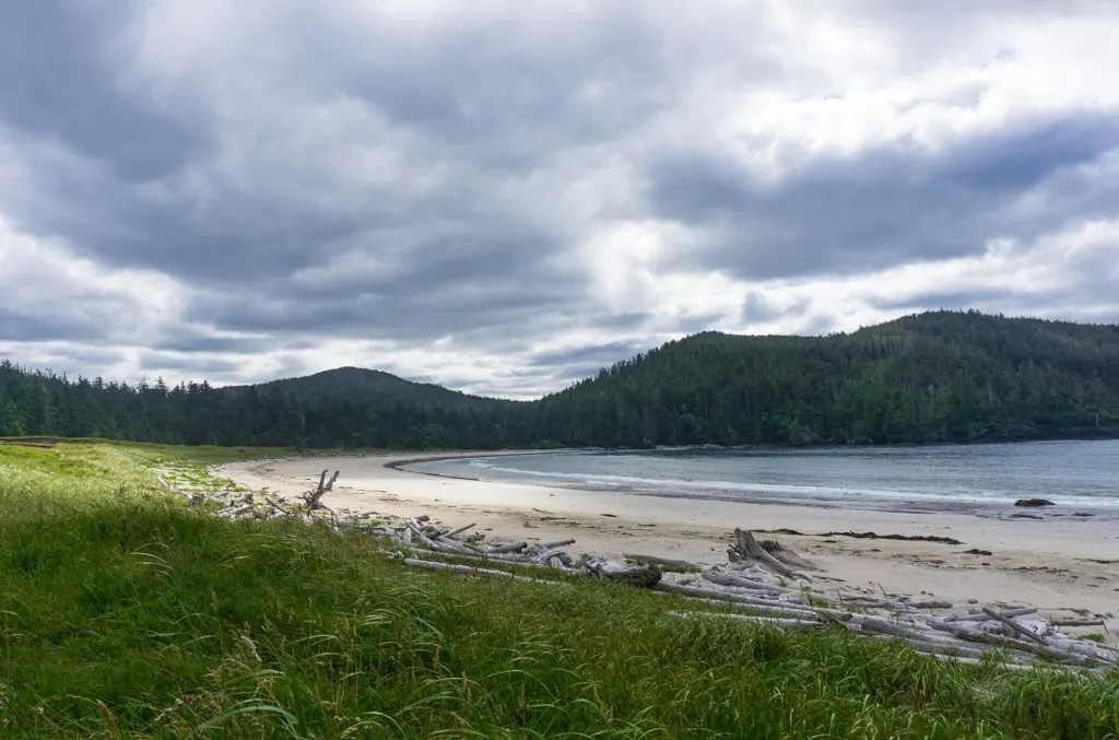
The trail to Cape Scott is 23.6km long from the trailhead to the lighthouse. Most of the trail is in thick coastal rainforest. After 16.8km in the forest, the trail emerges on the sandy beach of Nel’s Bight, where there is wonderful camping. From there, you can continue onwards to the Cape.
The Cape Scott area is the unceded traditional territory of the Kwakwaka’wakw peoples. They had a seasonal village at Experiment Bight and a permanent winter village at Cape Sutil. In the early 1900s, several hundred Danish settlers tried to homesteads and farms in the area. The trails you walk on the way to the cape today are remnants of their old roads and in some places you can see the remains of their settlements.
Cape Scott Basics
Trail Distance: 23.6km (one way from the trailhead to Cape Scott Lighthouse)
Trail Elevation Gain: 100m
How long does it take to hike to Cape Scott: 2-5 days
Best Time to Hike to Cape Scott: June to September
Cape Scott Weather: Cape Scott is usually cool and wet, even in the middle of summer. Temperatures between June and September are usually 8-15°C (46-59°F). June, July, and August are the driest months, but you can still expect lots of rain and fog.
Cape Scott Cost: $10/person/night for camping. Day hiking is free.
What to Bring to Cape Scott: Everything you need to be self-sufficient. Use my simple backpacking checklist to get your gear prepped for the hike.
Cape Scott Rules: No drones. No smoking, vaping, or cannabis. See the rules and tips section below for detailed rules about dogs and campfires.
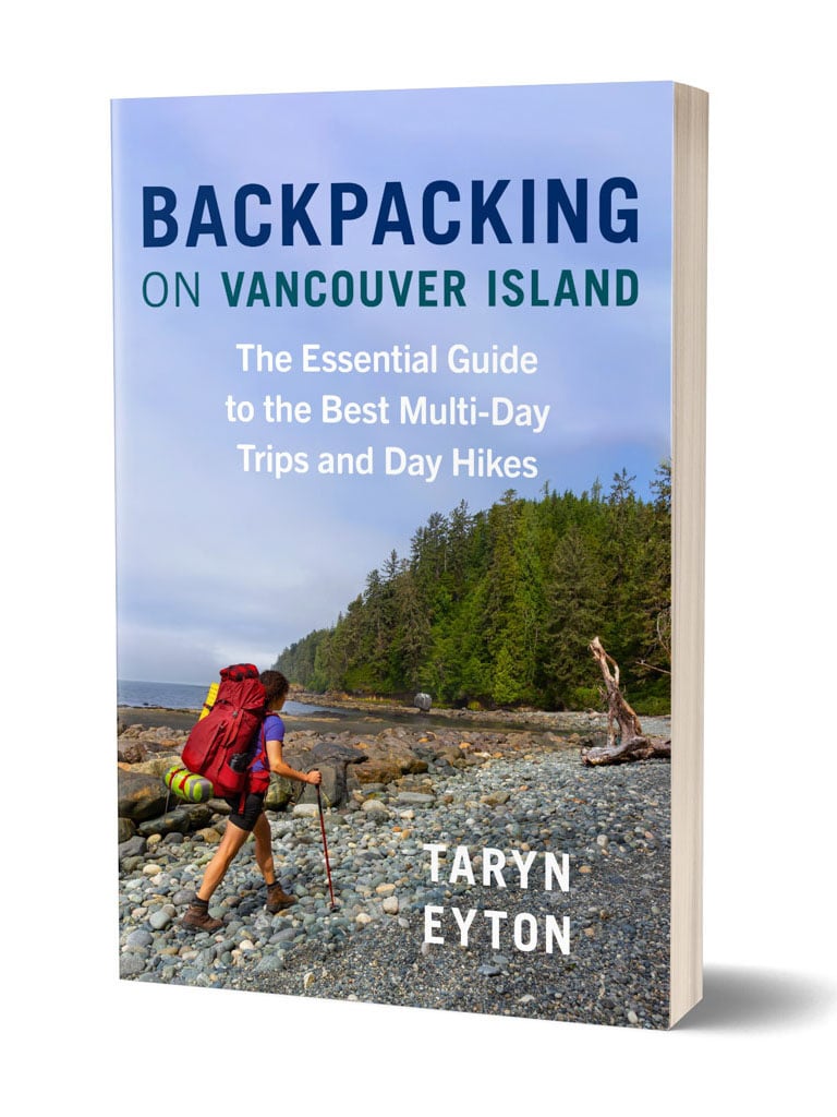
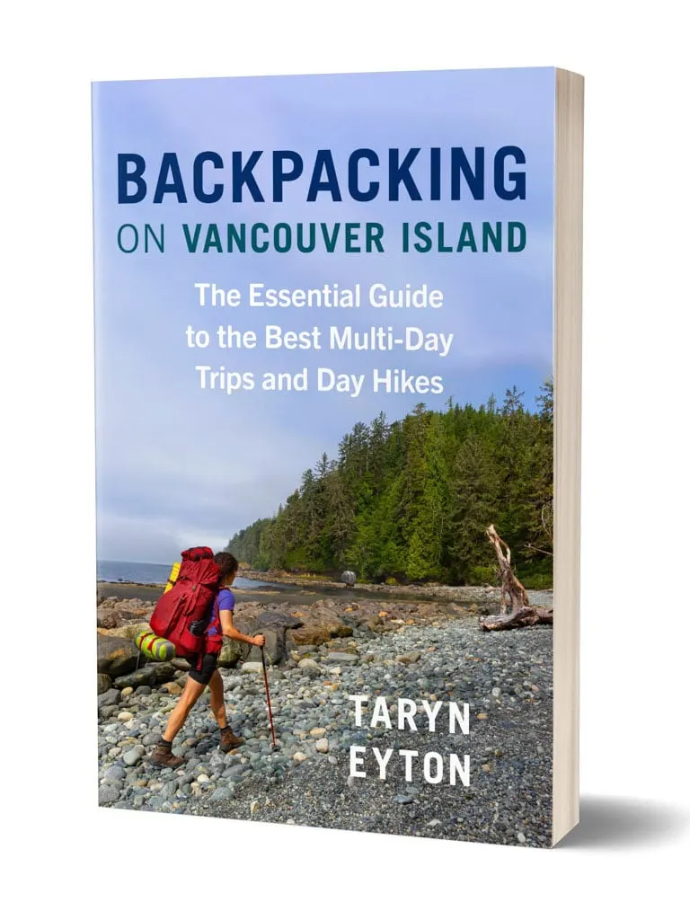
Further Resources: My book, Backpacking on Vancouver Island has a chapter about Cape Scott. Check the Cape Scott Provincial Park website before you go for trail updates and advisories. To find some of the historical items in the park, use this Cape Scott Park brochure. If you are interested in learning more about the area, I highly recommend picking up a copy of Cape Scott and the North Coast Trail by Maria Bremner. I used this book on my most recent trip to Cape Scott to find lots of off-the-beaten-path stuff.
Get My Book…
Backpacking on Vancouver Island
Discover Vancouver Island’s best day hikes and overnight trips
- 25 backpacking trips and 10 day hikes throughout Vancouver Island
- Info about permits, reservations and campground facilities
- Detailed maps and photos
- Advice for extending your trip
- Points of cultural and natural history

Join the Cape Scott Park Facebook group
Cape Scott Maps
Hiking to Cape Scott is straightforward, with signs at all junctions. For most hikers, the basic Cape Scott Provincial Park map is all you’ll need.
If you’re hiking the North Coast Trail or want a more detailed map, pick up a copy of the North Coast Trail Waterproof Map (which includes the Cape Scott Trail). It has some good info about history and points of interest. I’ve also used John Baldwin’s North Coast Trail map, but I don’t like it as much since it doesn’t have as much info.
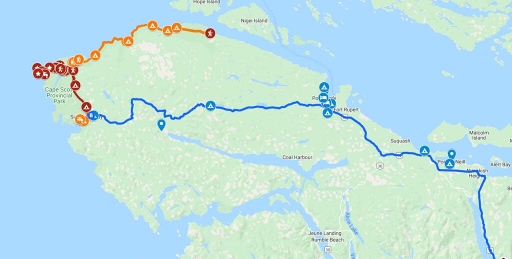
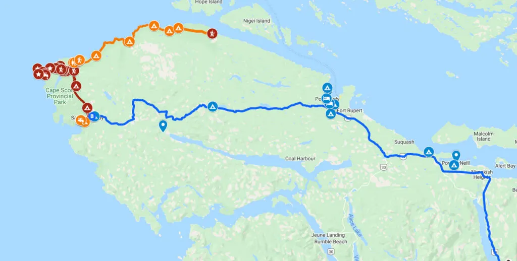
I also made a custom Google map for you. It includes all the places I mention in this post. The main campsites and points of interest along the trail to Cape Scott are in red, additional side hikes are in orange. Info on how to get to Cape Scott is in blue. Zoom in and click around to see everything.
How to Get to Cape Scott
Driving to Cape Scott
Cape Scott Provincial Park is located at the very northern tip of Vancouver Island. The drive from Nanaimo to Cape Scott takes about 6 hours. To get to the Cape Scott Trailhead, start by driving the Island Highway (Highway 19) north. Just before the highway enters Port Hardy, turn left onto Holberg Road.
The road quickly turns to gravel. The remaining 60+km is on gravel logging roads. They are usually fine for 2WD vehicles but they can be bumpy, dusty, and muddy. Bring a spare tire and know how to change it as flats are common.
You will be sharing the road with industrial traffic including fully loaded logging trucks, so use caution. Always drive with your headlights on. Go slow around blind corners. Pull over to let faster vehicles pass. And definitely pull over if you see a logging trucks – they are very heavy and cannot stop quickly.
All of the main junctions on the logging roads have signs with info about how to get to Cape Scott, so navigation is pretty easy. However, it can be helpful to bring a copy of the Vancouver Island BC Backroad Mapbook to stay on track.
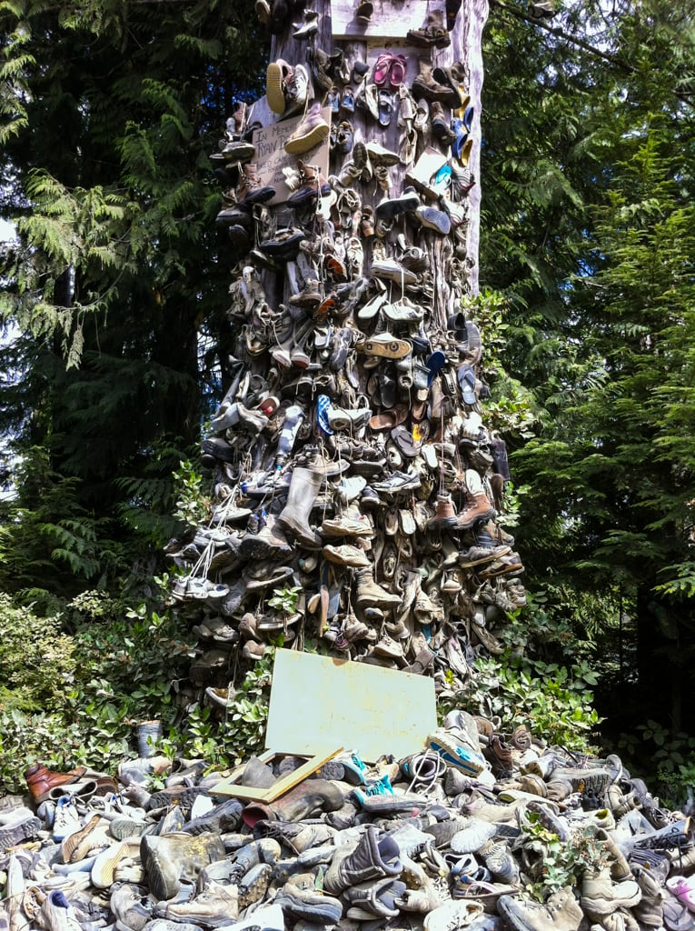
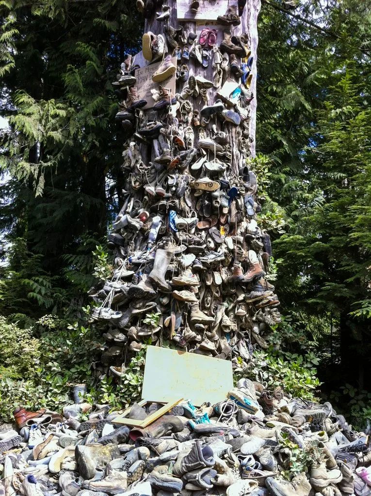
From the highway turnoff, follow Holberg Road for 29km passing Kains Lake and Nahwitti Lake on your right. Watch for the famous Shoe Tree – people have been leaving old shoes here since the 1970s!
After Nahwitti Lake take the left fork onto NE 60 Road. You may not even notice the fork since it will seem like you stay on the same main road. Continue for another 16km to the small forestry town of Holberg.
Follow the main road through the town, then turn onto the San Josef Main Road. Continue on this road, following signs for Cape Scott at all forks for another 19km. Turn left into Cape Scott Park and reach the gravel parking lot a few minutes later.
Cape Scott Shuttles and Water Taxis
If you don’t have your own car, you can also book a spot on the North Coast Trail Shuttle which leaves from Port Hardy. If you are hiking the North Coast Trail, you need to take a water taxi from Port Hardy to the start of the trail at Shushartie Bay.
You can get to Port Hardy without a car by taking the Island Link bus to Campbell River then the Wavin Flags Bus to Port Hardy. (Cape Scott, the North Coast Trail and San Josef Bay are on my list of the best car-free backpacking trips in BC.)
Where to Stay
Since it can take quite a long time to get to Cape Scott from southern Vancouver Island, many people choose to stay overnight in the area before their trip.
The nearest places to stay in a hotel are Port Hardy. When we hiked the North Coast Trail, we stayed at the Glen Lyon Inn in Port Hardy first. I also recently stayed at the indigenous-owned Kwa’lilas Hotel in Port Hardy. It’s gorgeous!
If you’re on a budget, the North Coast Trail Backpackers Hostel gets good reviews.
If you want to camp, here is a list of drive-in campgrounds on the way to the Cape Scott trailhead:
- Western Forest Products San Josef River Rec Site (Near the trailhead)
- San Josef Heritage Park (Near the trailhead)
- Nahwitti Lake Rec Site (In between Port Hardy and Holberg)
- Wildwoods Campsite (Port Hardy)
- Quatse River Campground (Port Hardy)
- Scotia Bay Resort (Port Hardy) – Phone (250) 949-6484
- Cluxewe Resort (Port McNeill)
- Broughton Strait Campground (Port McNeill) – Phone (250) 956-3224
- Cedar Park Resort (Port McNeill)
If you have time, plan to spend a few more days on northern Vancouver Island to experience the awesome whale watching, kayaking, indigenous sites, and grizzly bear tours. Read my post about the best things to do on North Vancouver Island.
Cape Scott Fees and Permits
Unlike other popular coastal hikes like the West Coast Trail, hiking to Cape Scott is cheap and easy. There are no reservations – everything is first-come, first served.
You do need to buy a backcountry camping permit if you hike between May 1 and September 30. They cost $10/person/night for adults. (Kids are $5/night.) Print out a copy of your permit or save a screenshot on your phone as the rangers will ask to see it.
The easiest way to get a permit is to buy one online via the Backcountry Permits section of BC Parks’ Discover Camping portal. The earliest you can buy a permit is 2 weeks before your trip. You can also pay in cash at the trailhead.
If you take the shuttle to the trailhead or are doing the North Coast Trail and need to take a water taxi, that will also add to your costs.
READ NEXT: How to Go Backpacking in BC Without Reservations
READ NEXT: How to Make Backcountry Camping Reservations in BC

Cape Scott Trail Description
Trailhead to Eric Lake Campground
Distance: 3km | Elevation Gain: 75m | Time: 1 hour
At the trailhead, you will find an outhouse and a covered area with picnic tables. A few steps down the trail, a yurt hidden behind some trees serves as a ranger station. There is an info board with a map. If you need to pay fees in person, there is a station where you can deposit money in an envelope.
Don’t leave any food in your car. On one trip we saw a car with part of its rear quarter panel ripped off. Apparently, a bear broke in to eat the dog food stored inside.
Leaving the trailhead, the trail is a smooth crushed gravel highway. In the first minute, look for some huge old-growth cedar trees on the north (right) side of the trail. After about 1km, reach a T-junction. The trail to San Josef Bay heads left and your route to Cape Scott turns right.
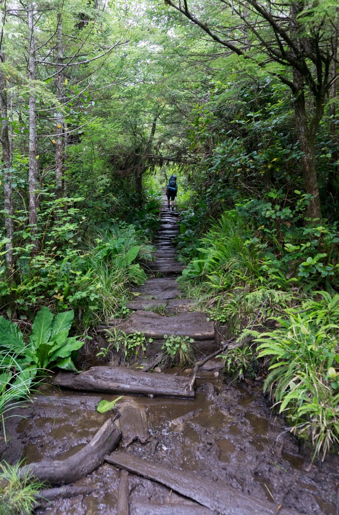
Immediately after the junction, the trail becomes much rougher. It heads slightly uphill and becomes very wet and slippery as you work you way over sections of old settlers corduroy road. In can be very muddy through here, with lots of puddles.

Just before the 2km marker, arrive at another T-junction. If you continue straight, you’ll reach a viewpoint at the southern end of Eric Lake. Turn right to continue around the lake to the campground.
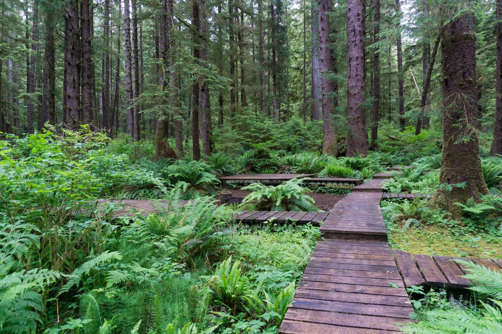
The next kilometre of trail features of lots of boardwalk that can be VERY slippery. The slower you walk, the less likely you will be to slip and fall. (Believe me, I’ve seen some nasty falls through here.)
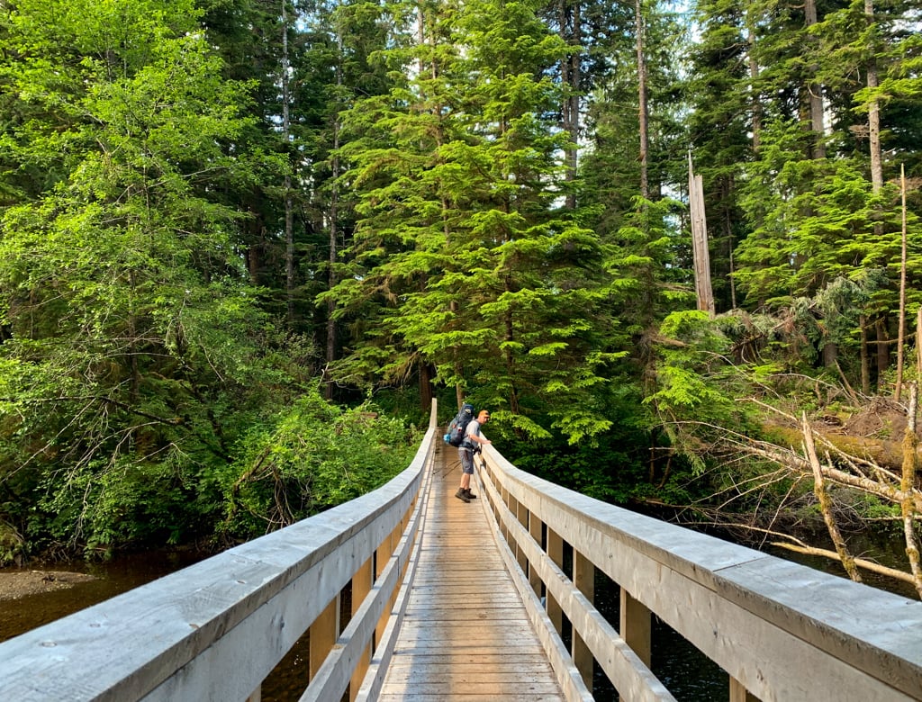
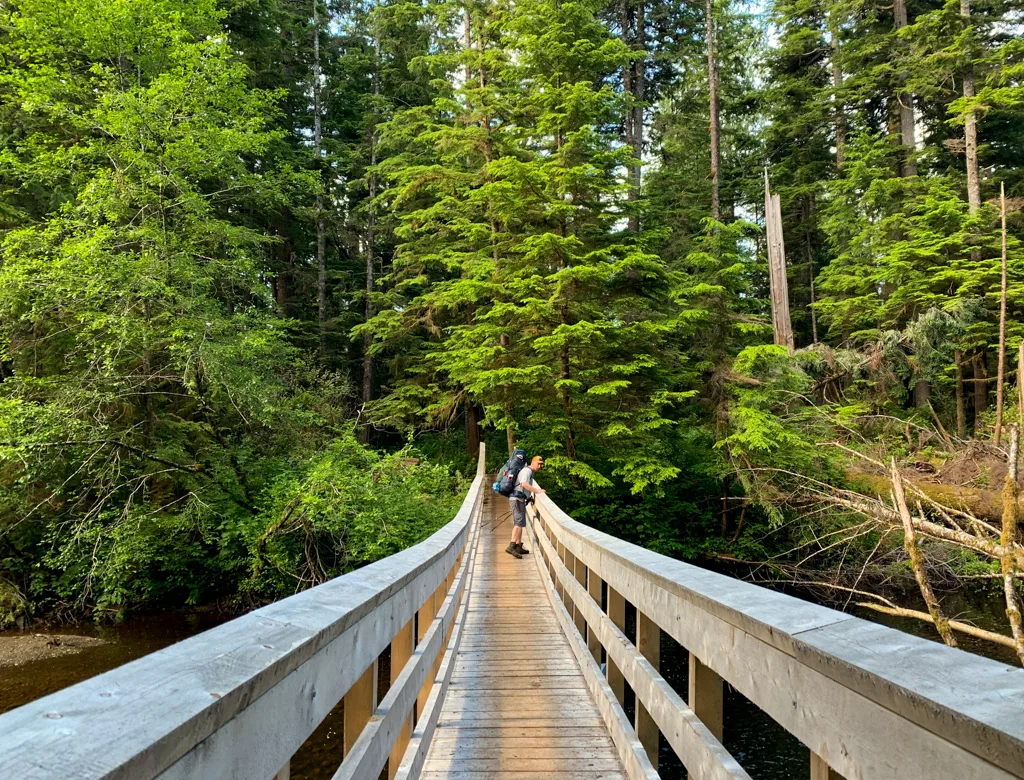
At about 2.7km from the trailhead, descend some stairs and cross a creek. The bridge here is made of a huge fallen log, with some railings for safety. However, the log surface can be slippery and there are only railings on one side, so be careful.
After the bridge, continue on boardwalk for a few more minutes to the Eric Lake campground.

Eric Lake to Fisherman River
Distance: 6.3km | Elevation Gain/Loss: none | Time: 2 hours
The Eric Lake campground has boardwalk paths to several tent platforms. Walk through the campground and cross a bridge. On the other side of the bridge is a junction. Going left will lead you down to the shore of Eric Lake and a small gravel beach that is a great place to take a break.
Turn right to continue towards Cape Scott. You’ll pass another cluster of tent platforms on your right, then the trail to the outhouse on your left.
Continue along the trail, following boardwalk for a few more minutes. The trail parallels Eric Lake, but you can’t really see it through the trees.
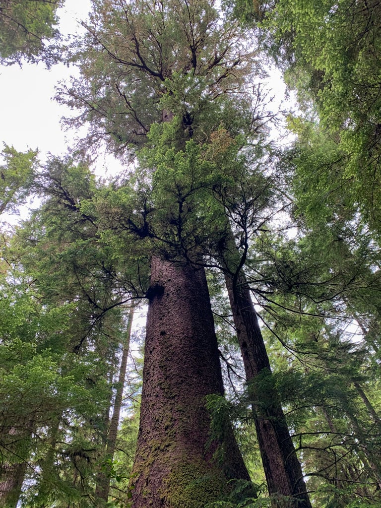
About 1km from the campground, look for a giant Sitka spruce tree beside the trail. It has a diameter of over 7m. Keep an eye for lots of other old-growth spruce trees in this section too.

The next section of trail follows the banks of St. Mary Creek. You can sometimes see it and hear it down the bank to your left, but you never get close to it. There are some awkward spots in this section as the trail is rocky and rooty. Watch for old telegraph wires strung along the trail.
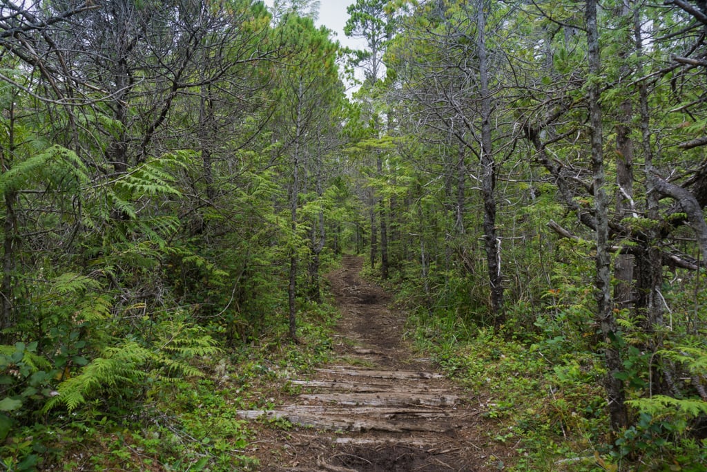
Just after the 8km marker, the trail veers away from the creek slightly. The vegetation changes from lush old-growth forest to spindly trees in a more open and boggy forest.
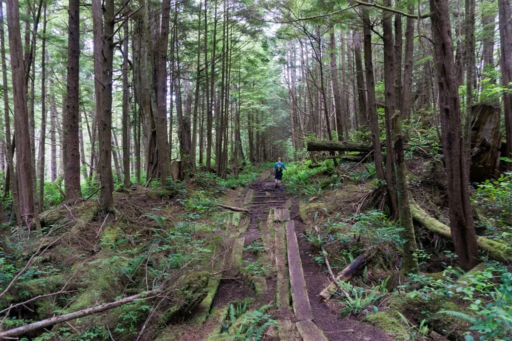
The trail also changes into a long straight section of old settler corduroy road. If you look carefully, you can still see the drainage ditches on either side.

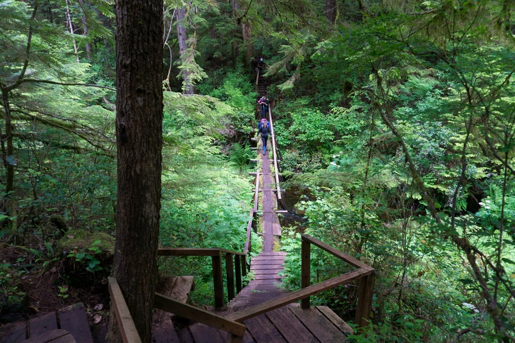
Just after the 9km mark, the trail gets a lot rougher. This section of trail is brand new, as the bridge over the Fisherman River was replaced a few years ago and this section of trail was built to connect it. Cross the fancy new bridge (built on top of a massive log).
Join the Backpacking in BC Facebook Group
Fisherman River to Nel’s/Nissen Junction
Distance: 3.8km | Elevation Loss: 60m | Time: 1.5 hours
On the other side of the bridge, follow the boardwalk and a small set of stairs to a junction. Turn right to go to the Fisherman River campground and outhouse. Go left to continue to Cape Scott.
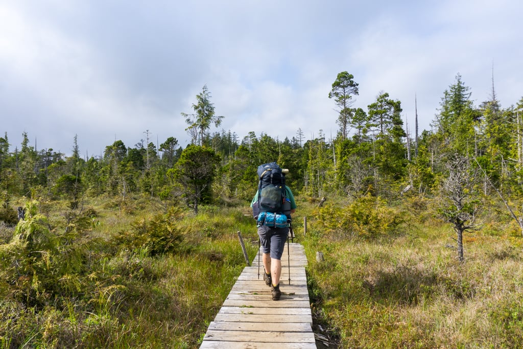
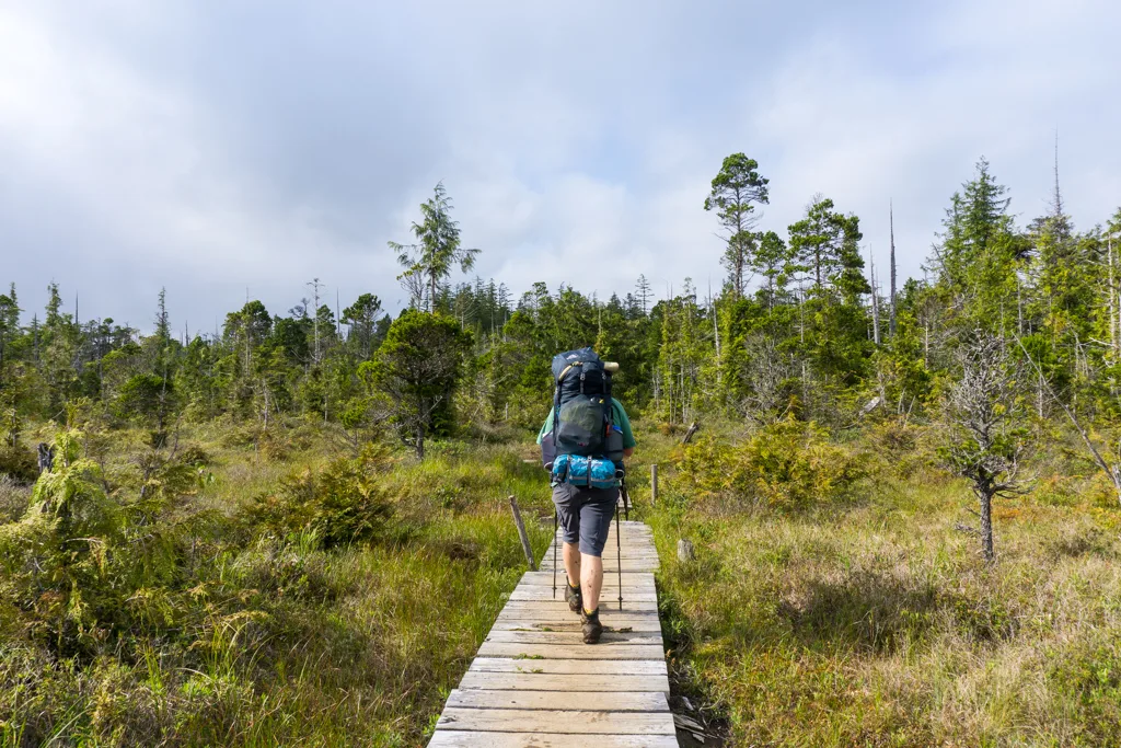
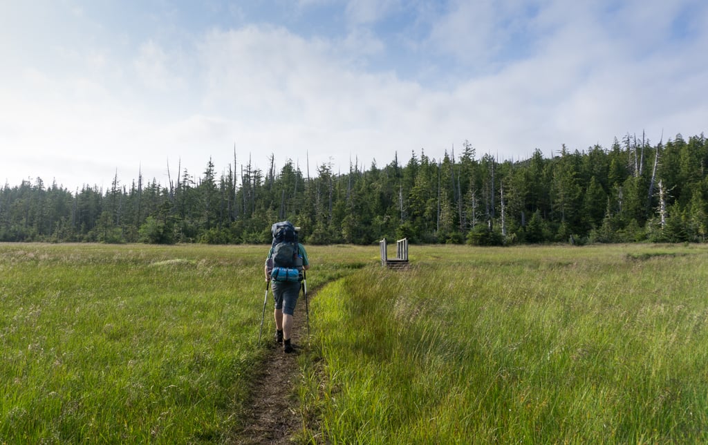
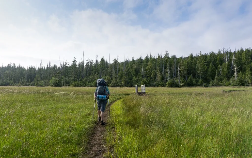
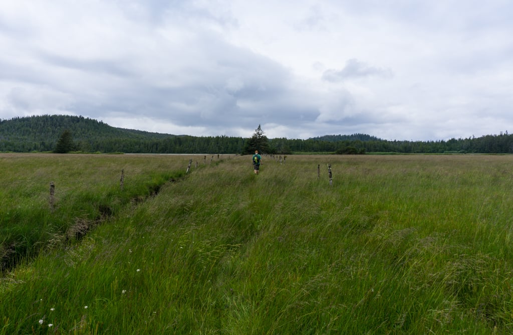
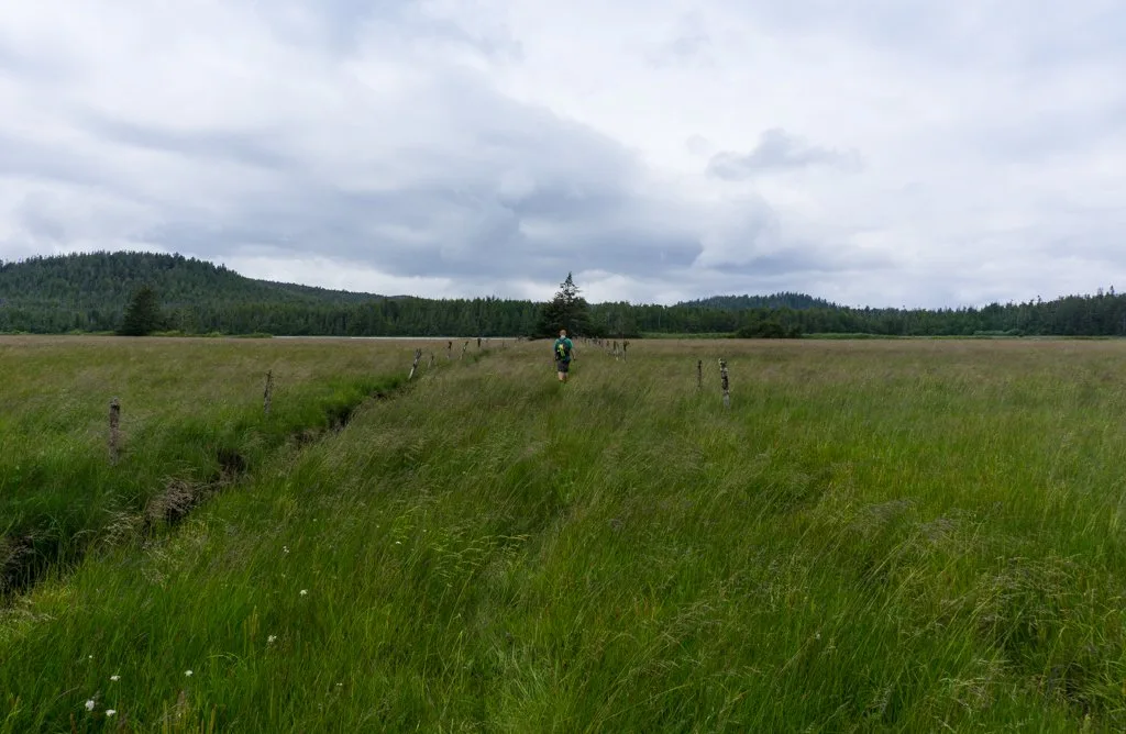
Almost immediately the lush rainforest around Fisherman River fades away and you emerge into a coastal bog. The landscape is dominated by small trees, lots of grass, and water running everywhere.
Thankfully there is lots of boardwalk through this section, and for the most part, the walking is easy. However, there are a few deep mud holes in between boardwalks that you will need to navigate around.
As the bog ends and you reenter the forest, you’ll reach another junction. If you continue straight, you’ll reach Nissen Bight in 1.9km, which is the western terminus of the North Coast Trail.
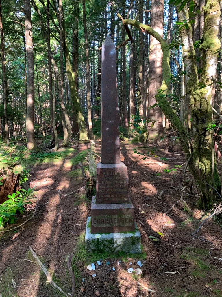
Turn left to continue to Cape Scott. If you want to check out some history, there are several graves near here. About 1 minute before the junction, an unmarked trail heads slightly uphill into the forest on the east (right) side of the trail. Follow it for a few minutes to a beautiful marble memorial. It commemorates the life of the 12-year-old son of one of the Danish settlers who died of tetanus.
A faint trail on the west (left) side of the trail leads to several graves hidden in the salal. It’s hard to read the inscription on the gravestones, but they are all from early Danish settlers.

Nel’s/Nissen Junction to Nel’s Bight
Distance: 3.7km | Elevation Loss: 60m | Time: 1.5 hours
From the junction, the trail heads downhill in the forest over some roots and rocks. A few minutes past the junction, arrive at an info board at the former Spencer Farm.
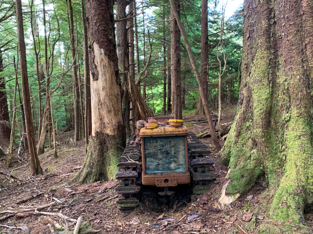
On the south (left) side of the trail, you will see the remains of a collapsed building. Look for a faint trail heading north (right) into the forest. Follow it through a grassy area and into heavy trees to find an old tractor wedged between two trees. It was the first motorized machine used at the Cape Scott settlement. There is also lots of historical garbage strewn around including parts of an old stove.

About 1.6km from the junction, the trail emerges from the forest into an open area at with an info board. A faint trail continues straight through the long grass towards Hansen Lagoon. Turn right to continue to Cape Scott.
After the info board, the trail crosses a wooden bridge over Hansen Creek. On the other side, it heads back into the forest through a particularly muddy patch. The remaining 1.7km to Nel’s Bight is flat and fairly easy.
At first, you’ll walk through old-growth forest. Look carefully to spot evidence of Danish settlers logging. Two trails marked with wooden signs on your left lead to the edge of Hansen Lagoon.
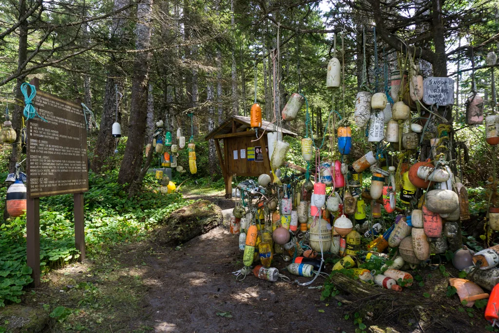
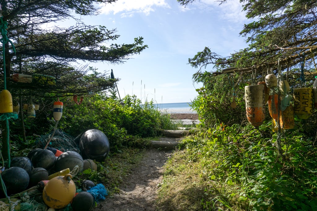
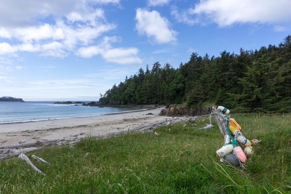
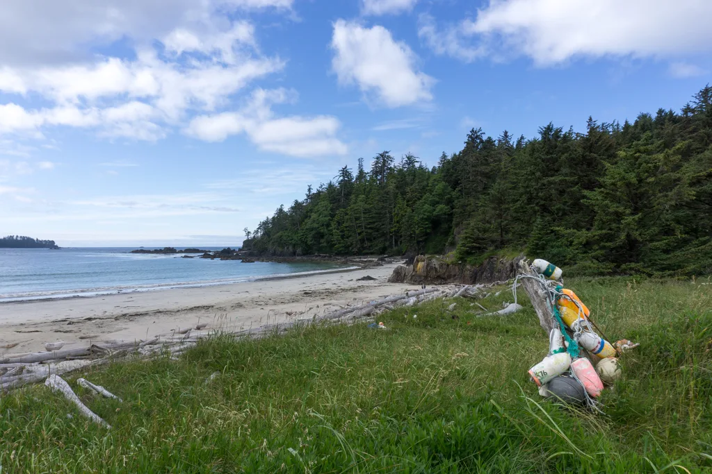
As you get closer to the beach, the forest opens up and thick salal bushes line the trail. Soon, you’ll arrive at an info sign and dozens of fisherman’s buoys hanging in the trees. Step out of the trees on the sand.
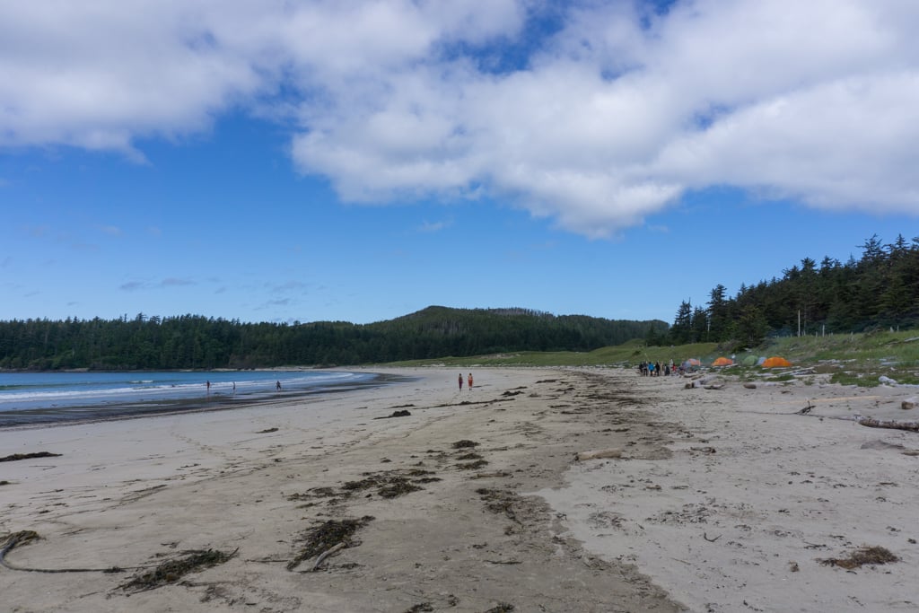
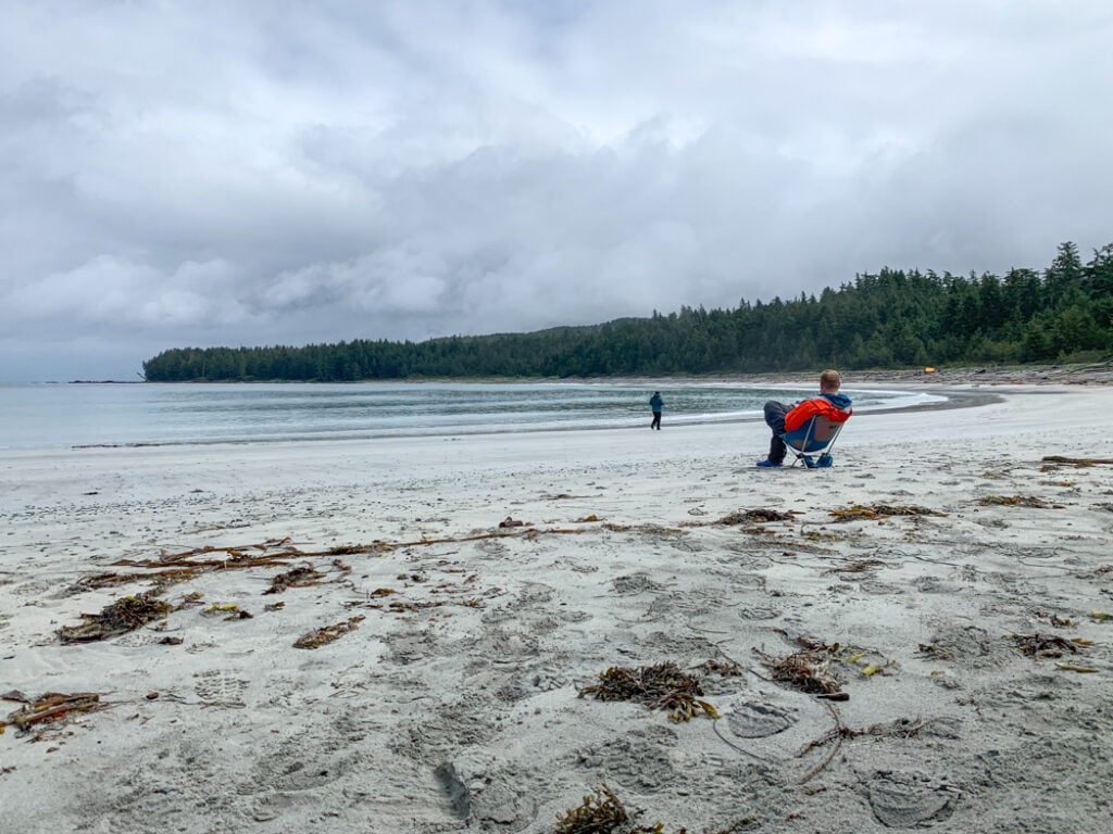
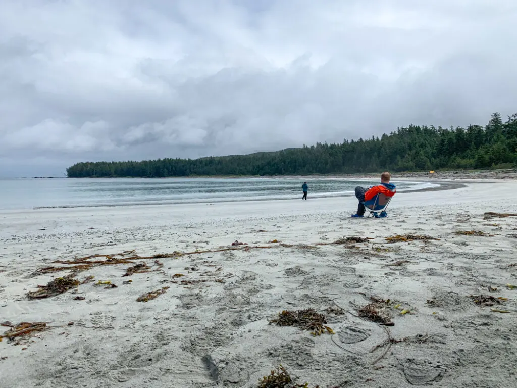
You’ve finally made it to the beach campground at Nel’s Bight! The Kwakwaka’wakw know this beach as Tsewunchas, meaning “winter place”.

Join the Cape Scott Park Facebook group
Get My Book…
Backpacking on Vancouver Island
Discover Vancouver Island’s best day hikes and overnight trips
- 25 backpacking trips and 10 day hikes throughout Vancouver Island
- Info about permits, reservations and campground facilities
- Detailed maps and photos
- Advice for extending your trip
- Points of cultural and natural history
Nel’s Bight to Guise Bay
Distance: 3.9km | Elevation Gain: 75m | Time: 1.5 hours
To continue towards the Cape Scott Lighthouse from Nel’s Bight, head to the west end of the beach. Cross the creek where it flows out onto the sand and follow the shoreline for a minute or so. Look for a trail heading into the forest, marked with a hanging buoy.
Since the coastline here is impassable, the trail climbs up into the forest, gaining 75m in less than a kilometre. It’s one of the steepest bits of trail on the entire hike.

About 2km from Nel’s Bight, the trail emerges from the forest onto Bowen Beach. Follow this sandy beach southwest for close to a kilometre. Watch for hanging buoys and follow them back into the forest.
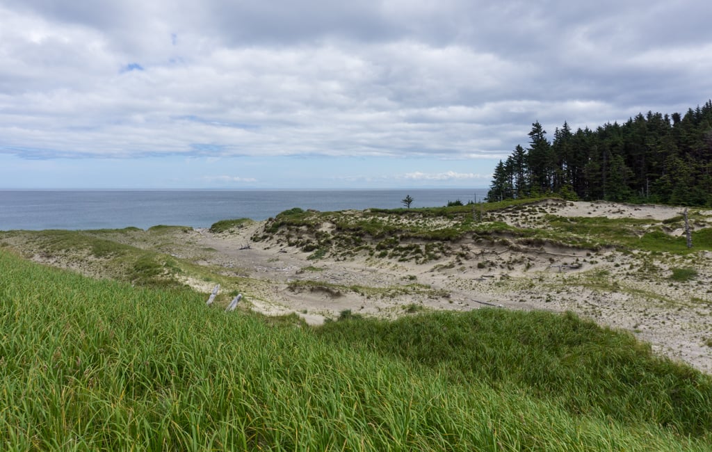
Walk along the old corduroy road until you emerge onto the white sand of Guise Bay. The Kwakwaka’wakw call it Yichaledaz (where the canoes run ashore in heavy swell).
Guise Bay to Cape Scott Lighthouse
Distance: 2.9km | Elevation Loss: m | Time: 1 hour
Turn right and head west across Guise Bay. At the far end of the beach (before the big rocks) clamber over driftwood towards buoys marking the trail. Ignore a side trail heading into the dunes and onward to Experiment Bight. Stay on the main trail as it heads into the forest.
Within a few minutes, you will encounter a huge section of blowdown. Hopefully, this section of trail will be repaired or a bypass trail will be built soon. In the meantime, clamber underneath the huge fallen trunks and pick up the trail on the other side.
Follow the WWII era plank road through the forest. If you look up, you may also see old power poles high above you.

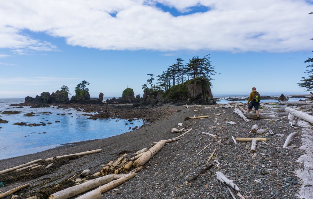
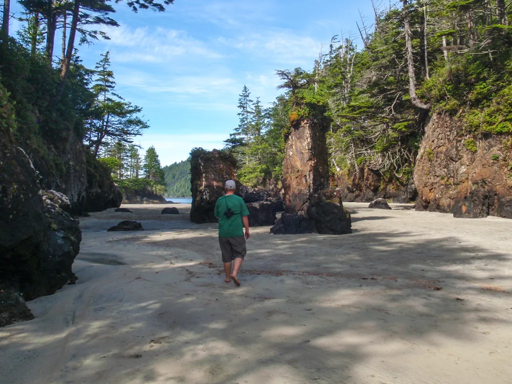
A few minutes past the blowdown, a signed trail on the left descends a short distance to a gravel beach with some beautiful sea stacks.

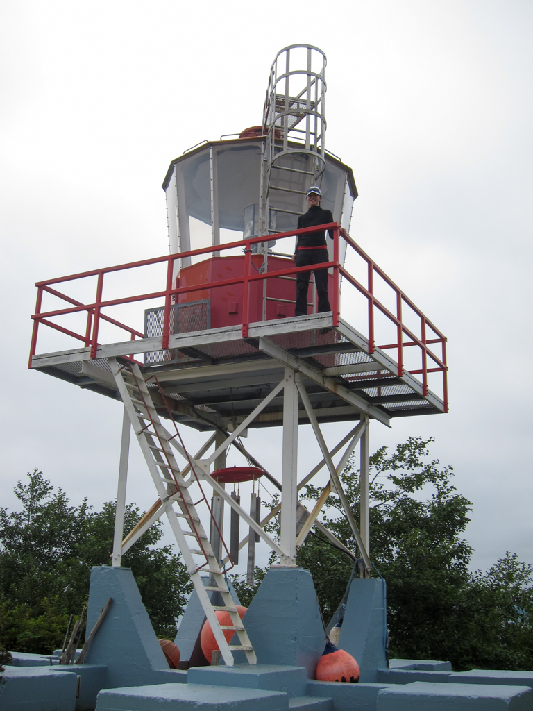
About 2km from Guise Bay the old plank road turns into a rough gravel road that the lighthouse keepers drive their tractor on. A short trail on the left leads out to a small beach. Follow the gravel road up the hill. Go left at a major fork, and arrive at the Cape Scott Lighthouse a few minutes later.
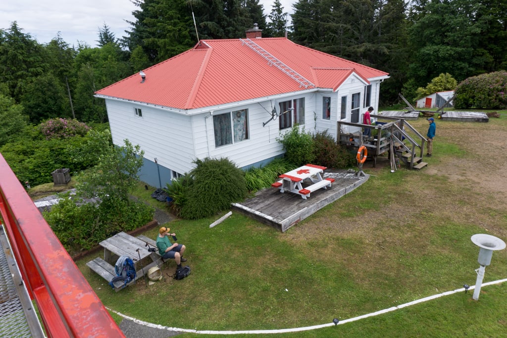

Two lighthouse keepers live here full time, so respect their privacy. However, they are often happy to come out and chat. There are two picnic tables where you can take a break. You can also climb the metal stairs up to the light for a great view.
The lighthouse keepers collect rainwater that tastes and looks much better than what you’ll find in the streams. If you want to fill your bottles, there’s a signed tap for hikers on the backside of the building on the far left as you approach the lighthouse complex. However, in dry weather, there may not be any water for hikers.
This is the end of the trail. There used to be a trail out to the end of the cape, but it had some dangerous bridges and boardwalks. It has been closed for several decades now.
Join the Backpacking in BC Facebook Group
Other Trails in Cape Scott Provincial Park
San Josef Bay
Distance: 2.5km | Elevation Gain/Loss: none | Time: 45 minutes
This short trail is mostly flat. It’s made of crushed gravel and boardwalk that is smooth enough to push a wheelchair or a stroller. (Although it’s definitely not pavement so use caution as there are some bumps and steeper bits).
From the trailhead, follow the trail nearly 1km to a junction. Turn left and continue through the old-growth cedar forest. Emerge on the beach at San Josef Bay.
Try to time your visit for low tide. You can explore beautiful sea stacks at the west end of the beach or continue around the headland to the second beach. You can camp here too.

Adventurous hikers can continue past San Josef Bay on a rough trail to the summit of 417m-tall Mount St. Patrick, 2km from west San Josef beach. The trail continues down the other side of the mountain to Sea Otter Cove (5.6km from San Josef) and Lowrie Bay (7.5km from San Josef).
These trails are rough and seldom-travelled, so they are best for experienced hikers only.
Nissen Bight
Distance: 1.9km | Elevation Loss: 60m | Time: 30 minutes
From the Nel’s/Nissen Junction, it’s an easy downhill hike to Nissen Bight. In wet weather, the trail can be very muddy and slippery. The path follows an old Danish settlers’ road. Just before the trail reaches the beach, a side trail heads right to Fisherman’s Bay.
The settlers would land boats full of supplies there, then haul them up this road to their homesteads near Hansen Lagoon. The Kwakwaka’wakw call this beach Kechegwis, which means “wood drifted on beach”.
Nissen Bight is a quieter alternative campsite to Nel’s Bight. It’s also the western terminus of the North Coast Trail.
Hansen Lagoon
Distance: Up to 1.5km | Elevation Gain/Loss: none | Time: Up to 40 minutes
The Kwakwaka’wakw call this tidal lagoon Wachlalis, which means “river on the beach in the bay”. Over 100 years ago, Danish settler built a series of dykes across Hansen Lagoon to convert the tidal salt marsh to pastures. Their dykes and fences survive today.
You can follow three different rough trails to see them. Watch for wildlife in the lagoon. We spooked a black bear on my last visit and saw over a dozen eagles feeding.
The first trail leaves from the signboard at Hansen Lagoon just before the bridge. Follow the grassy trail in between the old fence posts. There are a few drainage ditches to cross, which can be challenging.
The trail dead-ends behind the dyke. Some maps show trails branching off this trail to the south, but I couldn’t find them. I suspect they are very overgrown and boggy.
There are also two trails to Hansen Lagoon on the south side of the trail just before Nel’s Bight. They are both marked with wooden signs. Both trails wind through the woods for a minute before dead-ending in boggy areas.
The one marked Hansen Lagoon has a good view down the length of the lagoon. The other one, marked Second Dyke, deadends beside the tree-covered dyke.
Experiment Bight
Distance: 0.5km | Time: 15 minutes
Follow the trail over the dunes from the west end of Guise Bay to the sandy beach of Experiment Bight. You can see old Danish settler fenceposts in the dunes. There is a great view from the top of the dunes and you are likely to have the beach all to yourself.
The Kwakwaka’wakw call this area Gwigwakawalis, which means “whales on the beach”.

North Coast Trail
Distance: 43km | Time: 5 days
The North Coast Trail is billed as an alternative to the West Coast Trail. It starts at the east end of Cape Scott Provincial park with a water taxi drop off at Shushartie Bay.
From there, the trail follows the coast, sometimes through upland mud bogs, sometimes on rocky beaches. Cable cars help you across rivers and boardwalks keep you out of some (but not most) of the mud. The trail ends at Nissen Bight, and from there, hikers follow the Cape Scott trail out to the trailhead.
I hiked the trail in 2008, the first year it was open and again in 2021. It’s definitely a tough trail and is best for experienced backpackers. Read my compete North Coast Trail Guide to plan your trip.
Join the Cape Scott Park Facebook group
Camping at Cape Scott
Eric Lake Campground
The campground at Eric Lake is set in dense rainforest near the lakeshore 3km (1 hour) from the trailhead. It’s a good place to stay if you got a late start on the trail. Take the short trail to Eric Lake to relax on the gravel beach.
Campsites: 11 wooden tent pads connected by boardwalk
Toilet: outhouse on the left side of the trail towards Cape Scott
Water: collect from the stream running through the centre of the campground or from Eric Lake
Food Storage: Food lockers on the left of the trail in the centre of the campground

Fisherman River
This campsite is set in dense forest 9.3km from the trailhead and isn’t too appealing. However, it can be a good place to stay if you need to break up the long hike to Nel’s Bight or Nissen Bight into two days.
Campsites: 2 wooden tent pads
Toilet: outhouse at the entrance to the campground
Water: collect from Fisherman River next to the bridge
Food Storage: Food locker near the outhouse
Nel’s Bight
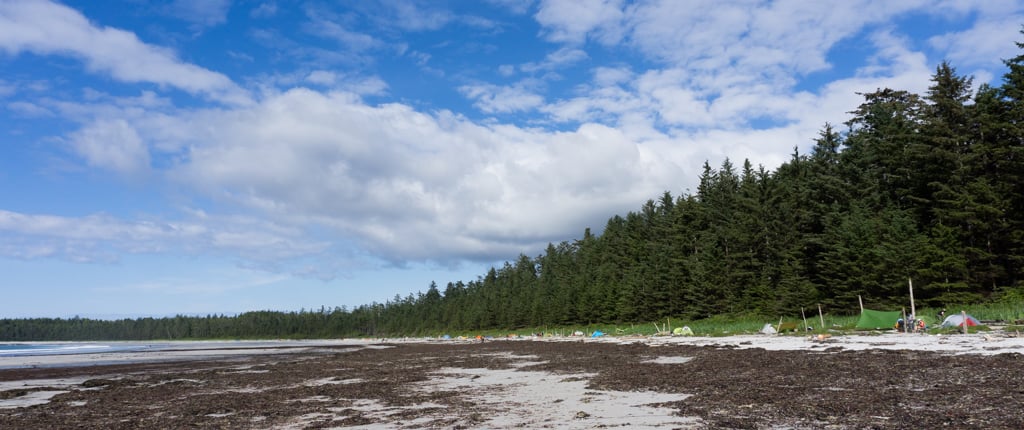
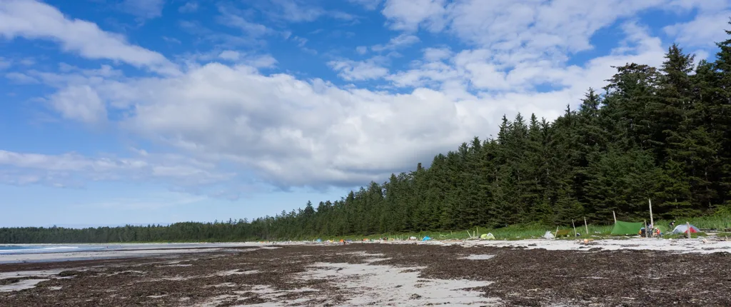
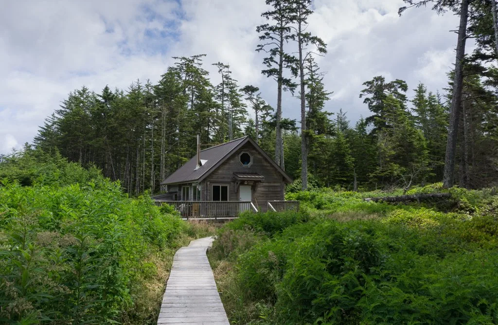
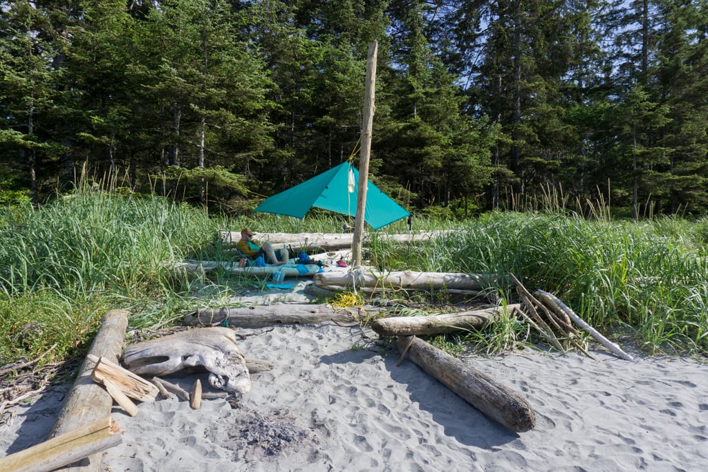
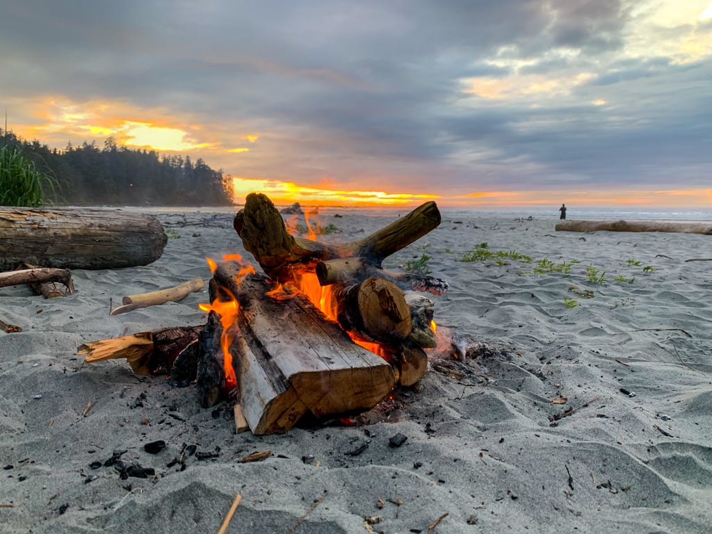
This is the most popular campground on the Cape Scott Trail, and arguably the most beautiful. You will hike 16.8km from the trailhead to get here. It’s a broad sandy beach that gets amazing sunsets.
It’s a great place to base yourself for a day hike to the cape. There’s a ranger on staff here in the summer, stationed in a cabin at the east end of the beach. If you visit in the winter, you can stay in the cabin!
Campsites: Unlimited space on the beach above the high tide line
Toilet: Three outhouses – one where the trail meets the beach, one just past the ranger station, and one on the other side of the creek
Water: Collect from the creek on the west side of the beach. Follow signs into the forest to pools in the creek
Food Storage: Food lockers where the trail meets the beach, next to the outhouse near the ranger station, and on the west side of the beach before you cross the creek.

Nissen Bight
Nissen Bight is 15km from the trailhead. It is smaller than Nel’s Bight and sees far fewer visitors. Many people camp here after finishing the North Coast Trail.
It’s a good spot if you reach the Nel’s/Nissen Junction and feel too tired to get all the way to Nel’s. I stayed here on one of my trips to Cape Scott, and it was definitely more chill than Nel’s Bight.
Campsites: Unlimited space on the beach above the high tide line
Toilet: Outhouse at the west end of the beach where the Cape Scott trail enters
Water: Collect from the creek on the east side of the beach near the North Coast Trail entrance. It’s a long 1km walk from the Cape Scott Trail entrance
Food Storage: Food lockers at the east and west ends of the beach.
Guise Bay
The beautiful white sand of Guise Bay is 20.7km from the trailhead. It’s a lot quieter than Nel’s Bight. From Guise Bay, it’s a short and easy hike to Cape Scott or to explore the nearby dunes and Experiment Bight.
Campsites: Unlimited space on the beach above the high tide line
Toilet: Outhouse on a spur trail to the left of the main trail
Water: Collect from the creek at the southeast end of the beach. It can run dry in late summer
Food Storage: Food locker near the outhouse.
San Josef Bay
At just 2.5km from the trailhead, San Josef Bay is a popular spot for families and beginners. Unfortunately, it can also attract partiers. There are actually two beaches here.
The first beach is right where the trail hits the sand. The second beach is past some sea stacks and around a rocky headland. It’s an easy walk on the beach to get there at low tide. At high tide, there is a rough, scrambly, and dangerous overland trail that is not recommended.
Campsites: Unlimited space on both beaches above the high tide line
Toilet: One outhouse at each beach
Water: Collect from the creek at the end of the second beach. Plan to collect water at low tide or pack in water from the trailhead
Food Storage: Food lockers at both beaches.
North Coast Trail
There are six wilderness campsites along the North Coast Trail: Shushartie Bay, Skinner Creek, Nahwitti River, Cape Sutil, Irony Creek (Shuttleworth Bight) and Laura Creek. They each have an outhouse and food locker. They all have a nearby water source except Shushartie Bay.
Read my North Coast Trail Itinerary and Section-by-Section Overview for full details on each campsite.
Wilderness Camping
Random wilderness camping is allowed throughout the park. Be prepared to hang your food in a tree out of reach of animals and use Leave No Trace practices for going to the bathroom.
Lowrie Bay and Experiment Bight see a handful of campers each year. Other pocket beaches on the trail can also be great campsites. Just be sure to put your tent well above the high tide line.
Join the Backpacking in BC Facebook Group
Cape Scott Rules and Tips
Coastal Hiking Tips
Coastal hiking and backpacking is a lot different than hiking in the forest or mountains. I’ve got some Cape Scott specific tips below, but for general advice, head on over to my coastal hiking tips post. After over 15 coastal hiking trips to beaches in British Columbia and Washington, I’ve got tons of coastal hiking pointers for you.
Wildlife at Cape Scott
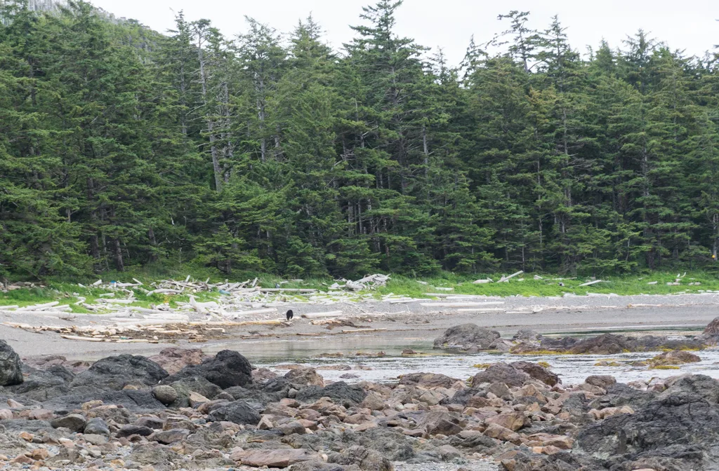
Cape Scott is home to a large black bear population. They like to forage for food along the beaches and in the estuaries. They often use hiking trails as travel routes. When I hiked the north coast trail we saw a LOT of bears. I’ve also seen bears in Hansen Lagoon.
On my most recent trip, we had an uncomfortable encounter with a bear on the sea stack beach on the way to Cape Scott. The bear was feeding on the beach, blocking our route back to the trail, and walking towards us. After yelling didn’t work, we had to fire bangers to scare it off the beach as it was habituated to people and didn’t want to move.
Make lots of noise as you hike. Carry bear spray. Never camp or linger near a dead animal. Read my tips for bear safety.

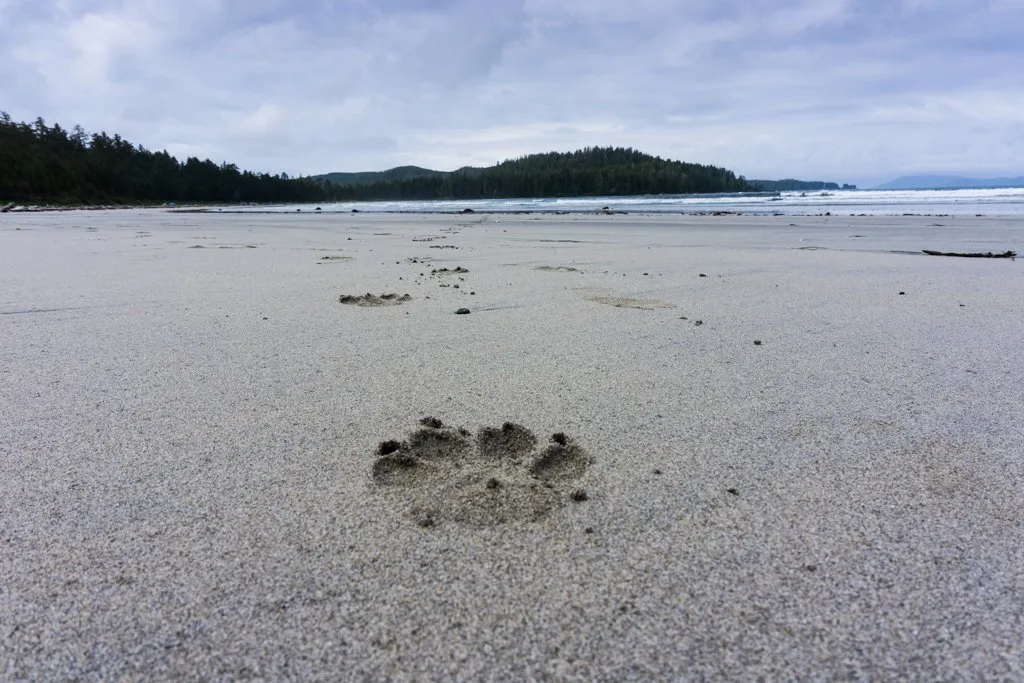
There are also lots of wolves at Cape Scott. A few years ago we had a wolf run right up to our campfire at Nel’s Bight. On my last visit, I saw lots of wolf tracks, but no actually wolves.
To avoid attracting wolves, keep a clean camp, and always store your food properly. Poop in outhouses since wolves are just big dogs and want to eat and/or roll in your poop.
If you see a wolf, scare it off by gathering your group together, making yourself look big by raising your arms or opening your coat, and yelling. Never run.
If a wolf attacks, fight back. Never camp or linger near a dead animal.

Cape Scott, like the rest of Vancouver Island, is also home to cougars. Cougar sightings are very rare. If you see a cougar, follow the same tips for wolves above.
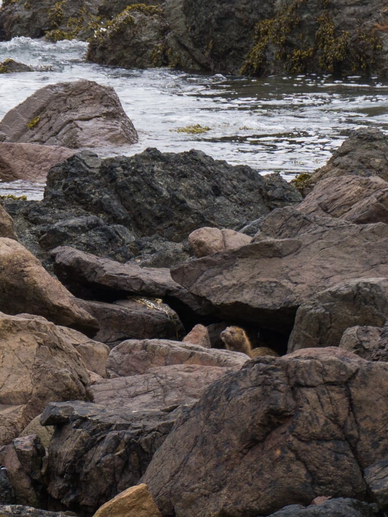
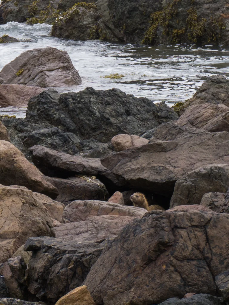
You can also spot lots of other wildlife at Cape Scott. I’ve seen whales, sea lions, mink, seals, and eagles.
Dogs at Cape Scott
Cape Scott has a large wolf population. Wolves are very territorial and will attack dogs since they see them as a threat. In most areas of Cape Scott Provincial Park, dogs are prohibited.
The only place dogs are allowed is at San Josef Bay, and they must be on a leash at all times. However, the best way to protect your dog from wolves is to leave him or her at home.
Join the Cape Scott Park Facebook group
Water Sources at Cape Scott
The terrain around Cape Scott is coastal bog, which means that freshwater can be hard to find, especially late in the summer and in periods of dry weather. All of the freshwater in the park has a dark tea colour from the tannins in the soil.
You should treat all water by purifying, filtering, or boiling it. If you use a filter, consider straining the water through a clean bandana or coffee filter first to get some of the silt and tannins out. Your filter may also get clogged, so make sure you know how to clean it.
Here are the main places to find water along the trail and at the campgrounds. See the trail description above for more details:
- Eric Lake
- Fisherman River
- West end of Nel’s Bight
- South end of Guise Bay
- Cape Scott Lighthouse
- Second (west) beach at San Josef Bay
- East end of Nissen Bight
Tides at Cape Scott
Unlike the West Coast Trail and most other coastal trails in BC, tides are not a problem on the main trail to Cape Scott. While you may have less beach to walk on at high tide, all parts of the trail are still accessible.
However, the North Coast Trail and the trail to Lowrie Bay do have tidal obstacles. The main reason to pay attention to the tides at Cape Scott is to pick a good campsite well above the high tide mark.
Print out the Cape Scott tide table and carry it with you. There may also be tide tables posted on the info boards at the trailhead and at Nel’s Bight.

Campfires at Cape Scott
Campfires are permitted in Cape Scott Provincial Park as long as there isn’t a regional fire ban in place. (Check the BC Fire Ban website before you go. Cape Scott is in the Coastal Region.)
At coastal campsites, collect driftwood from the beach. Build your campfire in an existing fire ring or make one below the high tide line. Make a small fire and don’t burn big driftwood logs so that there is lots of wood left for everyone.
Recently I learned that burning driftwood can create toxic smoke from the salt build up in the logs. So you may want to skip the campfire entirely.
When you are done, use water to douse your fire to make sure it is completely out. Don’t smother your fire with sand. It can continue to smoulder under the sand and can injure people. During my most recent trip to Cape Scott, a 12-year-old boy had to be evacuated by helicopter after he burned his foot by stepping in embers from an old campfire!
The inland campground at Eric Lake has a metal fire pit. If you must build a fire, do it in the metal fire pit instead of building your own. However, this campground is in dense coastal forest where finding dry firewood will be extremely difficult. Don’t cut down live trees for firewood as they don’t burn well. Instead, look around for small dry branches.
Cape Scott is such a special place, especially when the sun comes out. I’m sure you’ll have a great hike. If you need help planning your trip, as always, ask me in the comments. I love to help.
Get My Book…
Backpacking on Vancouver Island
Discover Vancouver Island’s best day hikes and overnight trips
- 25 backpacking trips and 10 day hikes throughout Vancouver Island
- Info about permits, reservations and campground facilities
- Detailed maps and photos
- Advice for extending your trip
- Points of cultural and natural history
More Vancouver Island Hiking Guides:
- North Coast Trail Guide: Backpacking on Vancouver Island
- Your Guide to the West Coast Trail in British Columbia
- Wild Side Trail: Hiking and Camping Guide
- Sunshine on the Edge of the World: Nootka Trail Trip Report
- Juan De Fuca Trail Guide: Backpacking on Vancouver Island
- 30 Best Backpacking Trips in BC
- 25 Spring Backpacking Trips in British Columbia
- How to Go Backpacking in BC Without Reservations
- Tatchu Trail Guide: Vancouver Island Coastal Backpacking
More Things to do on Vancouver Island:
- Things to do on North Vancouver Island
- Kayaking in the Johnstone Strait: Everything You Need to Know
- The Ultimate Guide to the Pacific Marine Circle Route on Vancouver Island
- How to Visit Avatar Grove, Big Lonely Doug and Other Big Trees on Vancouver Island
- 20+ Beautiful Weekend Getaways from Vancouver


- Things to Do on Newfoundland’s Great Northern Peninsula - July 29, 2026
- Best Sun Hoodies for Hiking - June 3, 2026
- Lower Stein Valley Trail Hiking and Backpacking Guide - May 27, 2026
Mike Trumper
Saturday 17th of May 2025
Just stumbled across your site. Hiked Cape Scott trail in 1976 with my parents and another family. Still one of the highlights of my life. Unbelievable wild life, especially around the lighthouse. Weather was challenging, with 2 out of 5 days torrential west coast rain. Trail looks to be in much better shape and more heavily travelled now.
Susan
Wednesday 13th of March 2024
Thoughts about camping solo in April?
Taryn Eyton
Wednesday 13th of March 2024
If you go on a weekend you'll likely see a few people but it will be pretty quiet. The trail will likely be very muddy and perhaps expect some trees down on the trail. Watch the weather forecast carefully before you go - if the forecast is bad it's miserable out there and in high winds, it can be a bit dangerous.
Allie
Sunday 15th of May 2022
Hi Taryn,
Thank you so much for this! I am planning to do this in August with some friends and your blog has helped me prepare immensely. Quick question for you, when your finished the hike how do you get back to your car in the parking lot? I am wondering if you had the shuttle pick you up to go back up to the parking lot? Thank you!!
Taryn Eyton
Monday 16th of May 2022
If you are just hiking to Cape Scott, it is an out-and-back trail. So you can drive to the parking lot, then hike back to your car at the end. However, if you want, you can park in Port Hardy, then take the shuttle bus to and from the trailhead. That way you don't have to do a lot of logging road driving.
Julie
Saturday 29th of January 2022
Hi! Great info :) It seems we share taste in our gear! I’m hoping to do this trail in the summer and wondering about parking at the trailhead and if you have any suggestions? I’ve read a few things about catalytic converters being swiped on cars there and curious if you have any tips about where to park or what your experience has been. Someone mentioned paying to keep your car at one of the campgrounds there. Cheers!
Taryn Eyton
Sunday 30th of January 2022
Every time we've parked at the trailhead we haven't had any problems with theft. (Although one year a bear had torn off someone's rear quarter panel to access dog food they had stored in their trunk.) However, I've also heard that the trailhead experiences problems with break ins from time to time. I don't know about parking at the nearby campgrounds - they are staffed somewhat sporadically so you could drive up there and ask in person on the day you arrive, but otherwsie it's pretty much impossible to get in touch with the campground host. If you're really concerned, the best thing to do would be to take the shuttle bus from Port Hardy. The shuttle has a parking area for your car.
Lee
Saturday 7th of August 2021
Hi Taryn, I appreciate all your blogs. Your information is so well laid out and interesting! I’m heading out to Cape Scott in 2 days. I looked at the weather forecast and the highs will be 17 and lows 14. Would you say a comfort level 5 degrees sleeping bag sufficient? Also are there 2 food caches at Nels Bight?
Taryn Eyton
Tuesday 10th of August 2021
I think that you will probably be plenty warm with a 5C sleeping bag at those temperatures as long as you have a good sleeping pad that provides some insulation (R value of at least 3). If you tend to sleep cold, you might be chilly.