
Heads up: The Juan de Fuca Trail was closed in summer 2025 due to significant storm damage. Mystic Beach and East Sombrio Beach are currently open. The full trail will re-open on July 1, 2026.
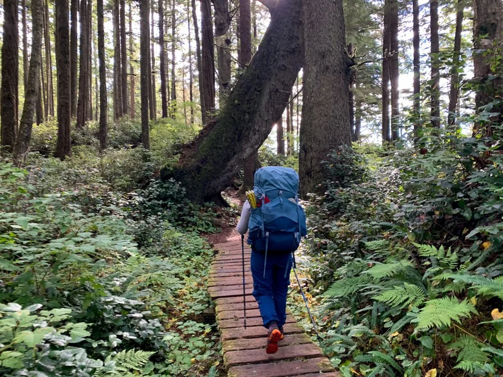
The Juan de Fuca Trail is a multi-day hike along the west coast of Vancouver Island in British Columbia, Canada. It is a challenging backpacking trip through the rainforest and across beaches. Along its 47 kilometre length you will experience lots of gorgeous scenery, old-growth trees, sandy beaches, and mud.
I hiked the Juan de Fuca Trail in twice (to research my book, Backpacking on Vancouver Island), so I’ve put together a full Juan de Fuca Trail guide for you. It includes:
- how to get to the Juan de Fuca Trail, including driving directions and info for booking the shuttle bus
- how much it costs to hike the Juan de Fuca Trail
- key Juan de Fuca Trail safety information on wildlife, tides, and drinking water
- information on the history and indigenous context of the Juan de Fuca Trail
WANT MORE JUAN DE FUCA TRAIL INFO? Check out these posts:
- Juan de Fuca Trail Itinerary and Section-by-Section Overview
- Juan de Fuca Trail Packing List
- Coastal Hiking Tips: Advice for Beach Backpacking
Hey there: Some of the links in this post are affiliate links, which means I earn a small commission at no cost to you. Thanks for your support. -Taryn
This is a sensitive wilderness area. Learn how to Leave No Trace to keep the wilderness wild. Make sure you are prepared by bringing the 10 Essentials. Get ready for adventure with this checklist of things to do before every hike.
Juan de Fuca Trail Quick Facts
Location: The southwest coast of Vancouver Island in British Columbia, Canada in Juan de Fuca Provincial Park. The closest towns are Port Renfrew and Sooke.
Distance: Officially 47 kilometres, but probably a little bit more.
Difficulty: Challenging
Time: 3-5 days
Cost: $30 + transportation
Best Time to Go: May to September (but the trail is open year-round and is on my list of the best spring backpacking trips in BC)
Juan de Fuca Trail Description
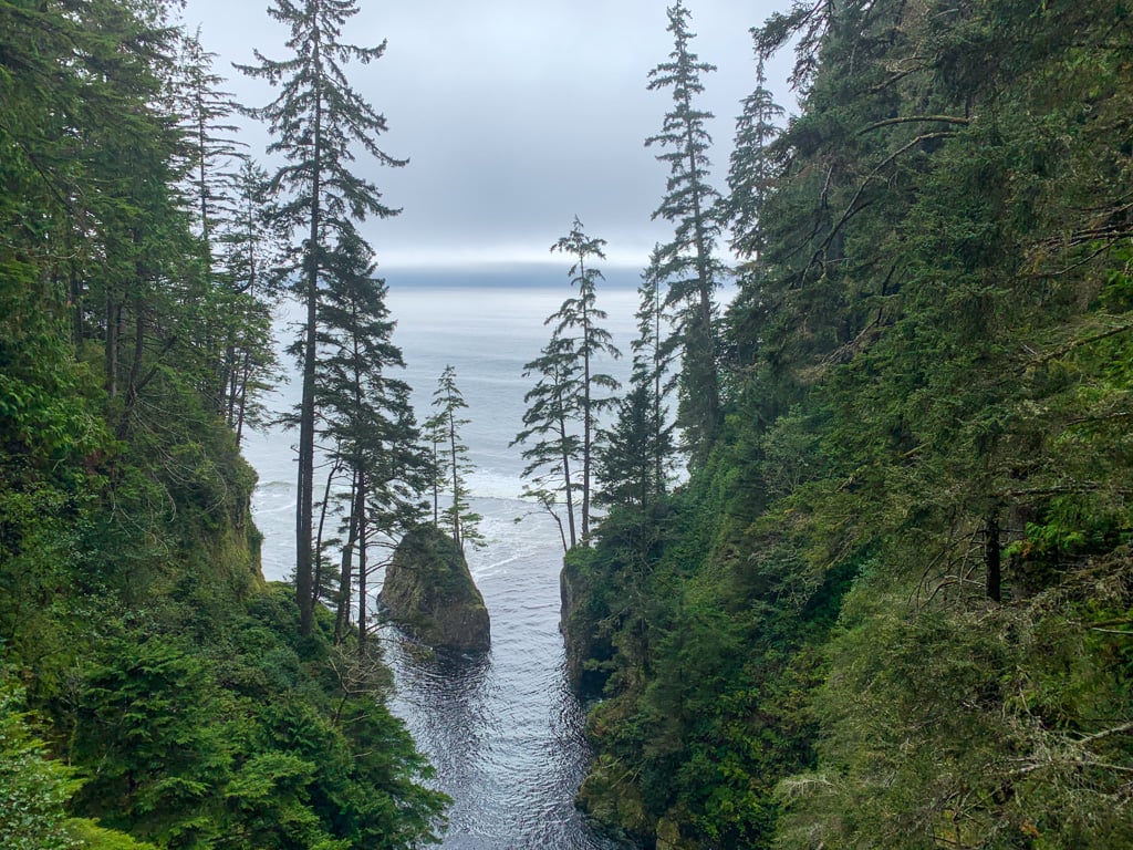
Officially known as the Juan de Fuca Marine Trail, the Juan de Fuca Trail (JDF) is a 47 kilometre long coastal trail that runs along the southwest coast of Vancouver Island in British Columbia, Canada. It is located just south of the West Coast Trail.
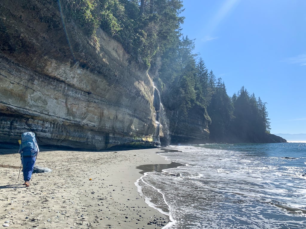
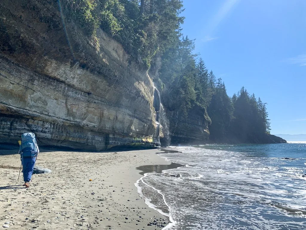
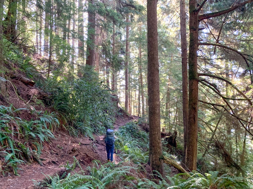
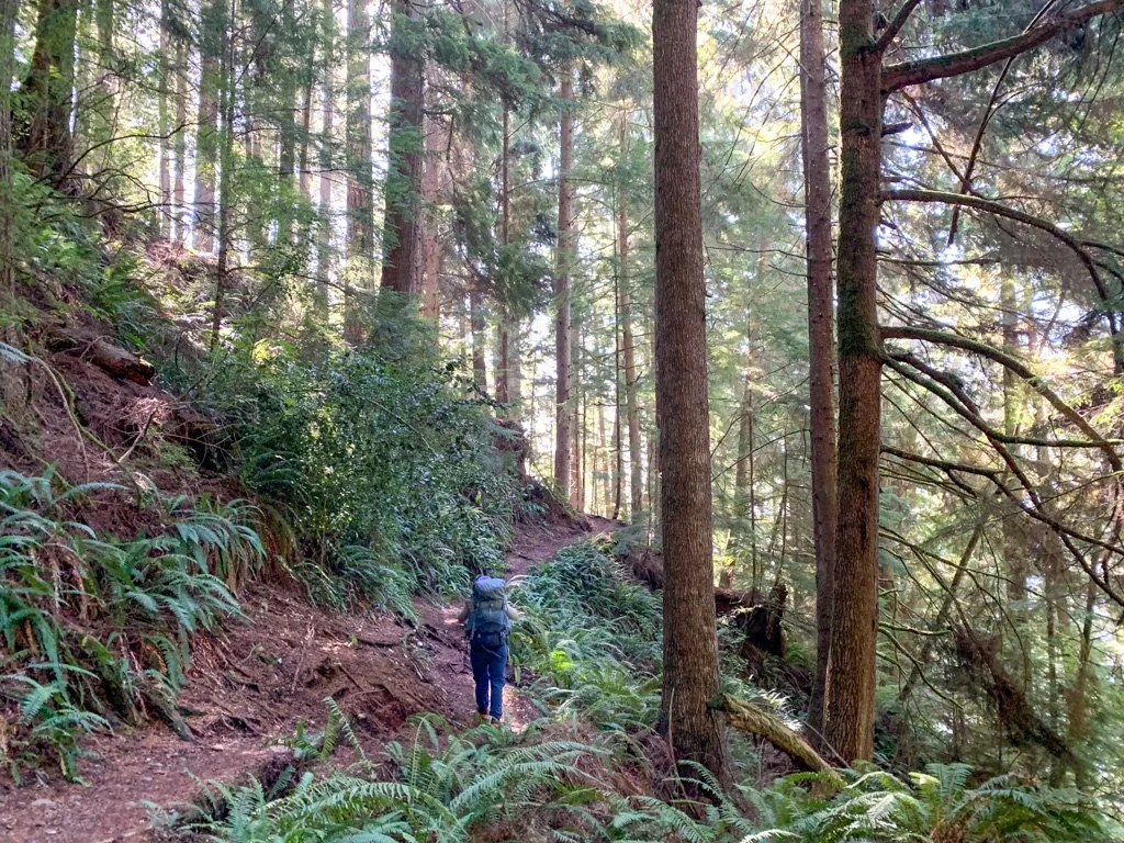
It is a rugged backcountry route that travels up and down hills through dense rainforest and along sections of beach. The Juan de Fuca hike has steep terrain and lots of rain, so it can be very muddy with lots of technical and treacherous trail.
READ NEXT: Juan de Fuca Trail Section-by-Section Overview

How Long is the Juan de Fuca Trail?
The official length of the Juan de Fuca Trail is 47 kilometres. That is the distance from the eastern trailhead at China Beach to the western trailhead at Botanical Beach. However, my GPS recorded a total distance of about 50.7km.
As well, the shuttle bus stop in Port Renfrew is 3.2 km away from the Botanical Beach trailhead, so that can add extra distance to your hike.
How Difficult is the Juan de Fuca Trail?
The Juan de Fuca Trail is fairly challenging. Compared to other coastal trails in BC like the West Coast Trail or the North Coast Trail, it has lots of hills, which are a workout. In total, you will climb about 1,400m of elevation gain, even though you are never far from the coast.
There are not as many beach sections as on some other coastal trails. However, the beaches are mostly easy walking.
It also has some sections of very technical terrain with lots of slippery tree roots and mud pits. In many sections, the aging infrastructure has not been repaired, making travel across broken staircases and boardwalks dangerous.
But it also has long sections of well-maintained inland trail that are very easy to walk.
In general, I think the Juan de Fuca Trail is much easier than the North Coast Trail. It about the same difficulty the West Coast Trail. Some hikers find in harder than the WCT due to the elevation gain and the broken infrastructure. I think that the mud bogs and ladders of the WCT make the JDF stack up evenly against it, but of course, everyone has their own opinion.
The Juan de Fuca Marine Trail is known for its muddy sections, but in my experience, it is not as muddy as the West Coast Trail and definitely not as muddy as the North Coast Trail.
Storms change the JDF each year, adding to the difficulty. Check the BC Parks website before you go for the latest conditions and closures.
Join the Backpacking in BC Facebook Group
Best Time to Hike the Juan de Fuca Trail
The hike is open year-round. However, the best months to hike the Juan de Fuca Trail are May through September since those months are warmer and have less rain.
April and October can also have pockets of good weather, which is why the JDF is one of the best spring backpacking trips in British Columbia. The winter months are often wet, cold, and stormy, but a few people do hike the trail between November and March.
If you plan to use the shuttle bus (see info below), keep in mind that it only runs between May and September.
The trail is very prone to storm damage and in washouts and downed trees are common, especially in the fall, winter, and spring. The trail is often closed for repairs in the spring so you may have to wait until late May for BC Parks crews to reopen it.
If possible, try to avoid hiking the Juan de Fuca Trail on long weekends as it can become very crowded and you will have a hard time finding a place to camp. July and August are by far the busiest months.
How Many Days is the Juan de Fuca Trail?
Most people take between 3 and 5 days to hike the Juan de Fuca Trail. I have hiked twice taking 5 days the first time and 4 the second time. I think that 4 days is the right amount of time for most people.
READ NEXT: Juan de Fuca Trail 4-Day Itinerary and More Itinerary Options
Which Direction to Hike the Juan de Fuca Trail?
The JDF starts and ends at Botanical Beach near Port Renfrew and at China Beach near Sooke. The trail runs roughly from Botanical Beach in the northwest to China Beach in the southeast.
BC Parks refers to the trail as running east to west so that is how I will describe it in this post. However, you may find other info online referring to Botanical Beach in the north and China Beach in the south.
There is no preferred direction to hike the Juan de Fuca Trail, and the hikers I surveyed were split nearly 50/50 on which direction they preferred. Both times I hiked the Juan de Fuca, we started in the west at Botanical Beach.
The hardest part of the trail is in the middle, so unlike the West Coast Trail, there isn’t an “easier” or a “more difficult” trailhead.
Which direction you hike the trail may depend on whether or not you use the Juan de Fuca bus service. I prefer to take the shuttle first, then hike back to my car. The easiest way to do that is to park at the eastern trailhead, get the shuttle in the morning, then hike the Juan de Fuca from west to east.
You can also complete half of the trail by starting at Sombrio Beach, roughly in the middle.
Juan de Fuca Permits
Unlike the West Coast Trail, the Juan de Fuca trail does not have a reservation system. All campsites are first-come, first-served and there is no limit to how many hikers can be on the trail.
However, you must purchase a backcountry camping permit for $10/person/night. You can buy a permit on the BC Parks website up to 2 weeks before your trip. You can also bring cash and pay at the trailhead.
READ NEXT: How to Make Backcountry Camping Reservations in BC
How Much Does the Juan de Fuca Trail Cost?
The short answer: The Juan de Fuca Trail costs about $30 per person + transportation
The long answer: It depends. Likely $60-135.
The main factor affecting cost is the number of nights you spend on the trail. Most hikers will spend three nights on the trail at $10 per night, for a total of $30/person.
The other factor is the shuttle bus. If you can arrange your own transportation to and from both trailheads, you won’t have any other expenses. But if you take the shuttle between trailheads or to and from Victoria, you will have extra expenses.
For example, the cheapest option is to drive yourself to one trailhead, then take the shuttle bus to the other. The fare for bus rides between China Beach and Port Renfrew is $30/person.
However, if you want to take the Juan de Fuca bus from Victoria to China Beach, and then from Port Renfrew back to Victoria, the fare is $105/person.
See the shuttle bus section below for more details.
How to Get to the Juan de Fuca Trail
Getting to the JDF and between trailheads is fairly easy. You can drive yourself, take the Juan de Fuca Trail shuttle bus, or hire a taxi. Info on each of those options is below. Many hikers report that hitchhiking is also easy, although it is technically illegal.
If you drive yourself, plan to spend some extra time exploring the area. The route to the trailheads is on the Pacific Marine Circle Route, one of the best road trips on Vancouver Island.
READ NEXT: The Ultimate Guide to the Pacific Marine Circle Route
Driving Directions to the China Beach Trailhead
From Victoria, take Highway 1 west, then follow Highway 14 west through Sooke. A few minutes after the town of Jordan River, pass the entrance to the China Beach campground. Make your next left into the parking lot, following signs for the China Beach Day Use Area.
Driving Directions to the Sombrio Beach Trailhead
From Victoria, take Highway 1 west, then follow Highway 14 west. A few minutes after you pass the China beach turn off, look for signs for the Sombrio Beach trailhead on your left. This steep gravel road descends to the trailhead over 2km. It can be very rough so go slow.
Note that this road may be closed on long weekends to prevent partying at Sombrio Beach. There is no parking on the highway, but you can get dropped off and walk down the road into the park.
Driving Directions to Parkinson Creek Trailhead
From Victoria, take Highway 1 west, then follow Highway 14 west. A few minutes after you pass the Sombrio Beach turn off, look for signs for the Parkinson Creek trailhead on your left. This gravel road descends to the trailhead over 3km. It is usually in good condition.
Driving Directions to the Botanical Beach Trailhead
From Victoria, take Highway 1 west, then follow Highway 14 west to the end of the highway near the Port Renfrew pub. Turn left onto Cerantes Road and follow it to its end at the Botanical Beach trailhead 3.2 km away.
From Nanaimo, take Highway 1 south, then highway 18 west to Lake Cowichan. In Lake Cowichan, take South Shore Road through town, then turn left on Pacific Marine Road. Follow it for 50 km, then turn left onto Deering Road and take that into Port Renfrew. Turn right on Highway 14 (Parkinson Road) and follow it to the Port Renfrew pub. Turn left onto Cerantes Road and follow it to its end at the Botanical Beach trailhead.
Trailhead Parking
All of the official trailheads have free parking, but unfortunately, break-ins are common. Do not leave anything of value in your vehicle. The parking lots can get very full on long weekends.
Juan de Fuca Trail Bus
The West Coast Trail Express runs a shuttle bus service between Victoria and all trailheads for the Juan de Fuca Trail. (It passes by the Juan de Fuca on the way to the West Coast Trail and serves both trails on each run.) Since it’s so easy to get to the Juan de Fuca Trail, it’s on my list of the best car-free backpacking trips in BC.
It runs once a day in each direction. In the morning it goes from Victoria in the southeast to Bamfield in the northwest, passing the JDF trailheads between 8 and 9am. In the afternoon, it runs from Bamfield back to Victoria, passing the Juan de Fuca trailheads between 5:45 and 6:45pm. See their website for the latest schedule.
You can take the bus round-trip from Victoria to any trailhead, and back again. Or you can drive yourself to one trailhead and catch the Juan de Fuca Trail shuttle bus to another trailhead.
All shuttle bus stops are on the highway. At China Beach, it’s a 200m walk from the trailhead to the highway. Sombrio Beach is a 2km walk from the highway. At Parkinson Creek, it’s a 3km walk. Botanical Beach is a 3.2km walk from the highway.
Taxi to the Juan de Fuca Trail
If the trail bus schedule doesn’t work for you or you want to hike the trail in the winter when the shuttle isn’t running, you can take a taxi to the trailhead with Orange Taxi in Sooke.
Juan de Fuca Trail Maps and Books
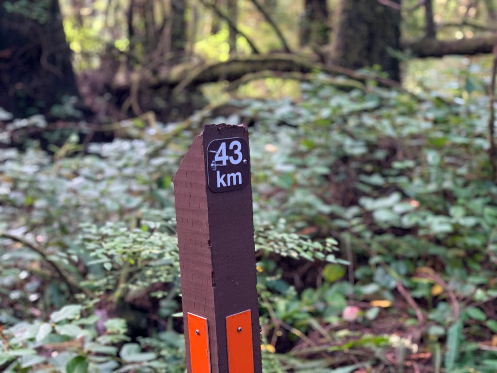
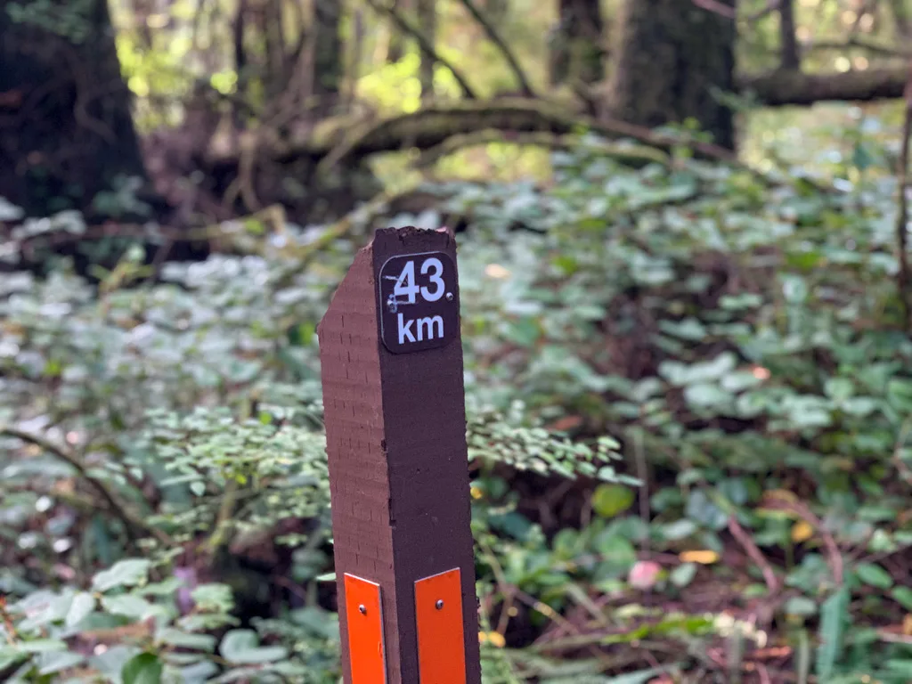
For the most part, navigation on the Juan de Fuca Trail is very easy. There are signs at key intersections and numbered kilometre posts along the way to mark your progress.
BC Parks publishes a good Juan de Fuca Trail map that is helpful to have on the trail. It has info on distances between landmarks as well as the locations of sections of beach that are cut off a high tide. Print it out and bring it with you.
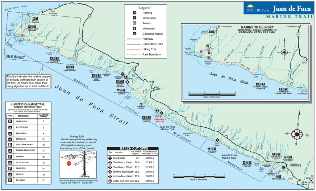
The map also assigns a difficulty rating to each section. However, those difficulty ratings were developed when the trail was newly constructed. Over the years erosion and failing infrastructure have changed the character of the trail and I don’t think the difficulty ratings are still accurate. My section-by-section overview has my assessment of current difficulty ratings.
READ NEXT: Juan de Fuca Trail Section-by-Section Overview
On my trip, I also used the Gaia GPS app. It was really helpful for tracking our progress, especially during the long inland sections that seemed to go by really slowly. (Psst! Want to save 20% off a premium Gaia annual membership, which includes the maps I used on my trip? Use this link.)
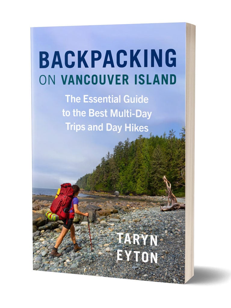
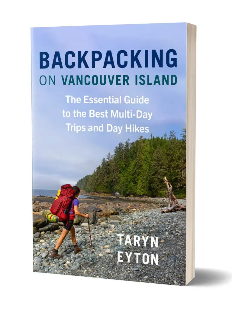
You can find more information about the Juan de Fuca hike in several books. The most detailed one is Giant Cedars, White Sands by Donald C. Mills. It is out of print and a bit dated, but it’s still a good resource. My book, Backpacking on Vancouver Island also has a Juan de Fuca Trail section.
Get My Book…
Backpacking on Vancouver Island
Discover Vancouver Island’s best day hikes and overnight trips
- 25 backpacking trips and 10 day hikes throughout Vancouver Island
- Info about permits, reservations and campground facilities
- Detailed maps and photos
- Advice for extending your trip
- Points of cultural and natural history

What to Pack for the Juan de Fuca Trail
You will need to be totally self-sufficient on the JDF and carry in everything you will need for your trip. The last places to buy supplies are Sooke near the eastern trailhead and Port Renfrew near the western trailhead.
To avoid carrying a stupidly heavy pack, choose lightweight hiking gear rather than heavy conventional camping gear. The lighter you can get your pack, the happier you will be. In general, aim for a pack weight that is 1/3 to 1/4 of your body weight or less. Read my tips for reducing your pack weight.
The weather on the coast is also often very wet so be sure to pack accordingly.
For lots more information, check out my West Coast Trail packing list, since the gear list is identical to what you’ll need to pack for a Juan de Fuca Trail hike. It’s a complete guide to everything you need to bring including specific gear recommendations from my hikes.
READ NEXT: West Coast Trail Packing List
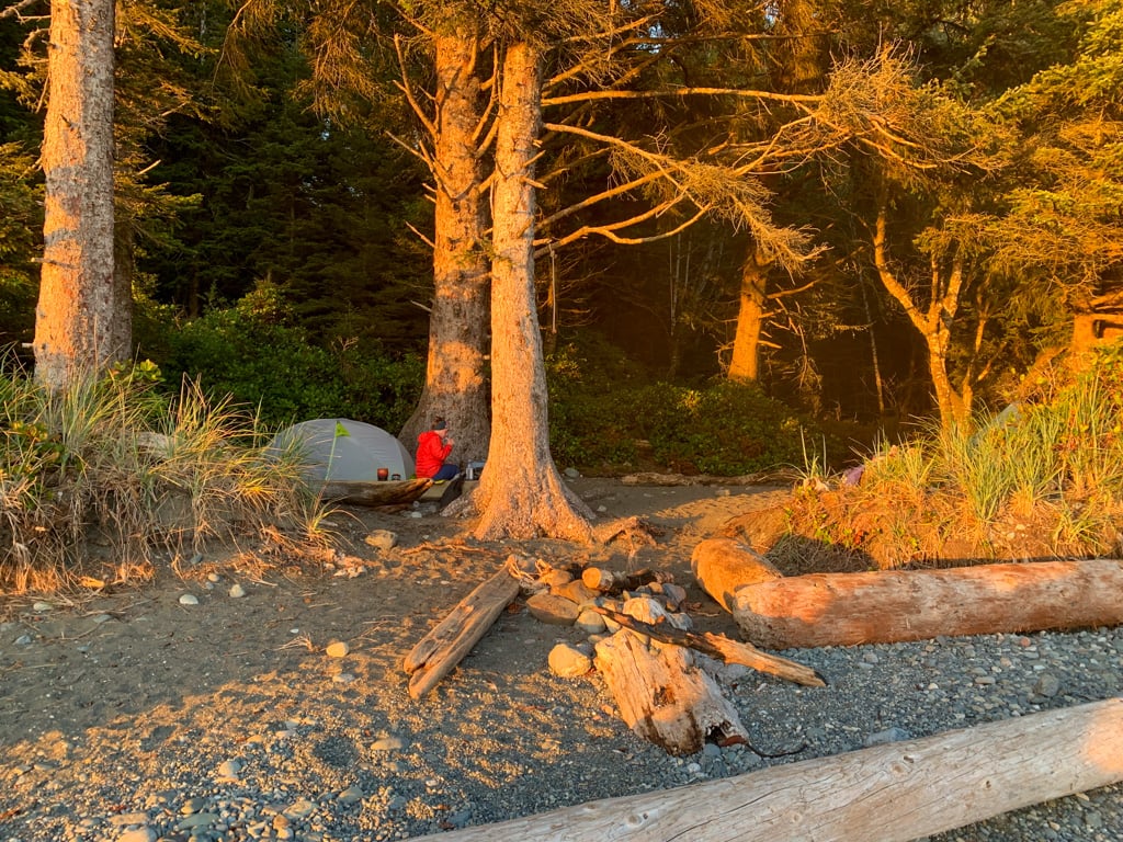
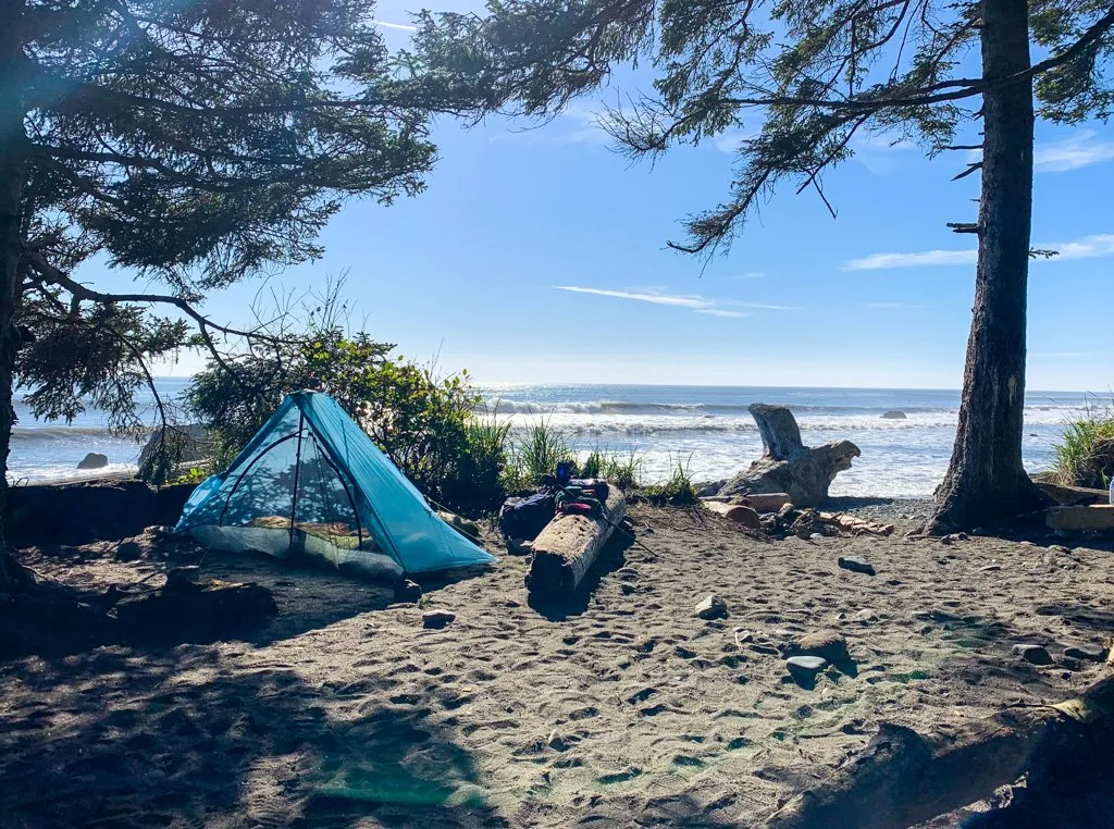
Camping on the Juan de Fuca Trail
There are six official campgrounds on the Juan de Fuca Trail. They all have:
- pit toilet(s)
- access to fresh drinking water from a nearby creek
- metal food storage locker(s)
- cleared campsites in the forest AND/OR campsites on the beach sand (Be sure to pitch your tent WELL above the high tide line.)
My Section-by-Section Overview has full details on each campground.


All campsites are first-come, first-served. At busy times of the year, some of the campgrounds can get full. As well, some campgrounds have very little food locker space so store your food early or be prepared to hang it.
You are not allowed to camp elsewhere along the trail, but in practice, this would be close to impossible anyway. The forest is thick with few flat clearings. And besides the designated beach campsites, most other beaches are inundated with water at high tide.
READ NEXT: Juan de Fuca Section-by-Section Overview
Drinking-Water Sources on the Juan de Fuca Trail
Unlike some other coastal trails in BC, such as the North Coast Trail, there are plenty of freshwater sources along the Juan de Fuca Trail. But all of the water flows down from the highway and logging operations up-slope, so you should treat all water by purifying, filtering, or boiling it.
You will reach a creek every few kilometres (and in some areas much more often than that). However, some are down in deep gullies and hard to access.
Tides on the Juan de Fuca Trail
You will need to bring a tide table and pay attention to the tides on the Juan de Fuca Trail. Use the Port Renfrew tide table available from Fisheries and Oceans Canada. Make sure you print out the predicted tide height for each hour of the day. It’s much more helpful than just using the daily highs and lows.
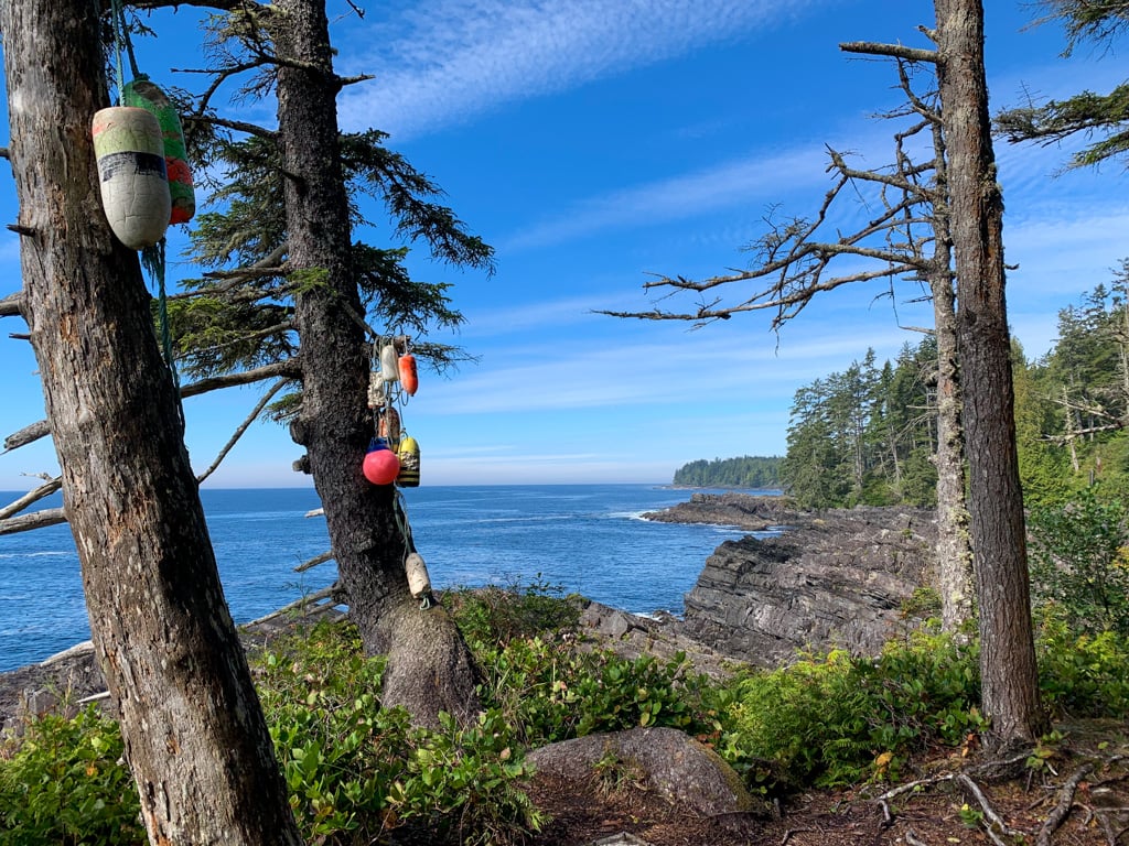
There are a few tidal obstacles on the Juan de Fuca Marine Trail where the beach is impassable at high tides. The main tidal obstacles are located at Bear Beach, Chin Beach, and Sombrio Beach.
When hiking beach sections, watch for coloured fishing buoys hanging in the trees. They mark the exits from the beach onto the forest trail. For full details, see my section-by-section Juan de Fuca Trail hike overview.
You will also want to refer to tide tables when you camp on the beach to ensure that you pitch your tent well above the high tide line. Look at the line of seaweed on the beach to estimate how high the last tide came up.

Juan de Fuca Trail Weather
Before your trip, check the weather forecasts for Port Renfrew and Jordan River, the two communities closest to the trail.
June, July, August, and September are the warmest months on the Juan de Fuca Trail with lows of 11-13°C and highs of 18-22°C. Winter temperatures between November and April are typically 3-12°C.
July is the driest month, with about 59mm of rain on average. August (85mm) and June (103mm) are also fairly dry. The spring and fall months can also have periods of good weather, but are wetter – May sees about 154mm of rain and September gets 149mm. The winter months are very wet with between 246 and 552mm falling each month between October and April.
READ NEXT: The Best Weather Apps for Hiking
How to Stay Safe on the Juan de Fuca Trail
The JDF tackles some pretty rugged terrain. And the trail is in a remote area where getting help takes time. Make sure you are physically and mentally prepared. Take a first aid kit.
Consider bringing a satellite messenger or marine radio because there is no cell reception. I brought my Garmin inReach Mini on my 2021 Juan de Fuca hike. Thankfully we didn’t need it, but I did use it on the North Coast Trail to assist a pair of hikers who were unprepared for the difficulty of the terrain.
Leave a trip plan at home with a friend or family member. That way someone knows where you are going and when you expect to be back.
Be prepared to turn back or stop and make camp if the weather gets too bad or you are having difficulty with the hike. If you keep pushing forward, you may just make your situation worse by injuring yourself. Most injuries on the trail happen when the weather is bad or hikers are tired. (Or both!)
Take extra time on stairs, boardwalks, and bridges. Watch your step on any wooden structure – they can be REALLY slippery or have exposed nails. And in many places they are rotting and can collapse.
Use caution at cliff edges. There was a fatality on the clifftops near Bear Beach in 2004.
Be careful crossing streams. Make sure they aren’t flooding and if possible, cross at low tide.
Keep your tide table handy and consult it along with your map whenever you choose a beach route. Only take the official marked beach routes – other routes have dangerous cliffs and surge channels.
Step carefully on beaches. Many have slick sandstone that can be very slippery. Others have lots of round rocks where it is easy to twist your ankle.
Join the Backpacking in BC Facebook Group
Wildlife on the Juan de Fuca Trail
The Juan de Fuca Trail hike is a remote wilderness area so it’s home to lots of wildlife. You might encounter a black bear, wolf, or cougar. On my trips I saw lots of bear scat and a few bears. I’ve heard reports that in some years there have been habituated bears hanging around some of the campgrounds, but I didn’t experienced that.
To minimize the risk of a negative encounter, hike in groups, make lots of noise, and carry bear spray just in case. At campgrounds, store your food and toiletries in the bear bins and camp well away from your cooking area.
READ NEXT: Bear Safety for Hikers, Campers and Backpackers
Mice can also be a problem at many campgrounds so don’t keep anything in your pack or tent.
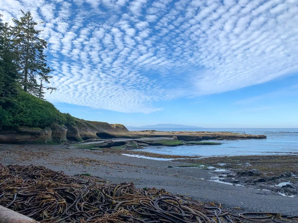
There is also lots of marine life just offshore along the JDF. There are lots of curious seals and sea lions surfacing along the beaches and you can even spot whales and porpoises.
My husband uses a compact GoSky Titan monocular that he found on Amazon. It’s pretty light and not too expensive, but it still has 12×50 magnification.
Juan de Fuca Trail Rules
Dogs: BC Parks allows dogs on the Juan de Fuca Marine Trail as long as they are on a leash. However, they also caution that the backcountry is not suitable for dogs due to wildlife issues. The trail includes lots of steep and scrambly terrain, so it’s best for experienced dogs with responsible owners only.
Beachcombing: You aren’t allowed to take home anything natural from the trail. That includes shells, rocks, sand, wood, etc. However, you are encouraged to take home anything man-made, such as fishing floats.
Smoking, vaping, and cannabis: Smoking tobacco and cannabis, using e-cigarettes, and vaping are not permitted on the Juan de Fuca Trail or in any BC Park.
Drones: Drones are not allowed on the Juan de Fuca Trail or in any BC Parks without a specific permit, issued only to licenced drone pilots.
Campfires: Campfires are allowed on the Juan de Fuca Marine Trail on the beach below the high tide line as long as there is no fire ban for that part of Vancouver Island. Fires are not allowed at any of the forest campsites. (Check the BC Fire Ban website before you go. The JDF is in the Coastal Region.)
Build your campfire below the high tide line. Make a small fire and don’t burn big logs so that there is lots of wood left for everyone. Recently I learned that burning driftwood can create toxic smoke from the salt build-up in the logs. So you may want to skip the campfire entirely.
When you are done, use water to douse your fire to make sure it is completely out. Don’t smother your fire with sand. It can continue to smoulder under the sand and can injure people. During my 2020 trip to Cape Scott, a 12-year-old boy had to be evacuated by helicopter after he burned his foot by stepping in embers from an old campfire!

Juan de Fuca Trail Hiking Tips
Coastal hiking and backpacking are a lot different than hiking in the forest or mountains. Head on over to my coastal hiking tips post. After over 15 coastal hiking trips to beaches in British Columbia and Washington, I’ve got tons of coastal hiking pointers for you… including how to cope with the EPIC MUD!
READ NEXT: Coastal Hiking Tips: Advice for Beach Backpacking
Indigenous Context on the Juan de Fuca Trail
Indigenous people have lived in this area of Vancouver Island along the present-day Juan de Fuca Trail since time immemorial. The area is in the traditional territory of the Pacheedaht people. The word “Pacheedaht” translates to “Children of the Sea Foam”.
Before European colonization, the Pacheedaht had several village sites in the area including Qwa:qłis, a seasonal village at what is today known as Sombrio Beach. The location benefited from a salmon-bearing river with lots of access to ocean fishing and edible plants.
There were also Pacheedaht villages at Botanical Beach (łi:xwa:p) and China Beach (Tł’ehib).
Juan de Fuca Trail History
The Indigenous Pacheedaht people have lived along the coast since time immemorial. Juan de Fuca (born Apostolos Valerianos), a Greek explorer working for the Spanish sailed up the coast from Mexico in 1592 and was likely the first European to visit the area. In 1787 a British expedition officially named the Strait after Juan de Fuca.
European ships frequently wrecked in this area in the late 1800s thanks to the fog and rough conditions. This part of the coast became known as the “Graveyard of the Pacific”.
In 1899 a telegraph line was constructed between Bamfield and Victoria. The West Coast Trail and Juan de Fuca Trail both have their origins as a path to service the line.
By the 1960s a small squatter community of surfers lived in shacks at Sombrio Beach. As the West Coast Trail became more popular in the late 1970s and 80s, local hikers started exploring other areas of the coast. Members of the Victoria Sierra Club lobbied to have the area around the Juan de Fuca Marine Trail protected.
At the time, extensive logging was occurring and the club brought several lawsuits to try to stop it. In the 1990s the provincial government acquired the land. It was formally declared a park in 1995 as part of the legacy around the 1994 Commonwealth Games in Victoria.
While a few repairs have been completed in the intervening years, most of the park’s wooden infrastructure is from the late 1990s and is showing its age.
Where to Stay Near the Juan de Fuca Trail
China Beach Campground: Forested campground in Juan de Fuca Provincial Park a few minutes from the China Beach trailhead with 79 campsites, most of which you can reserve. The campground is open from mid-May to early September. More info
Prestige Oceanfront Resort: Waterfront resort hotel with great views of Sooke Harbour. It’s a 40-minute drive to the China Beach Trailhead. Check prices
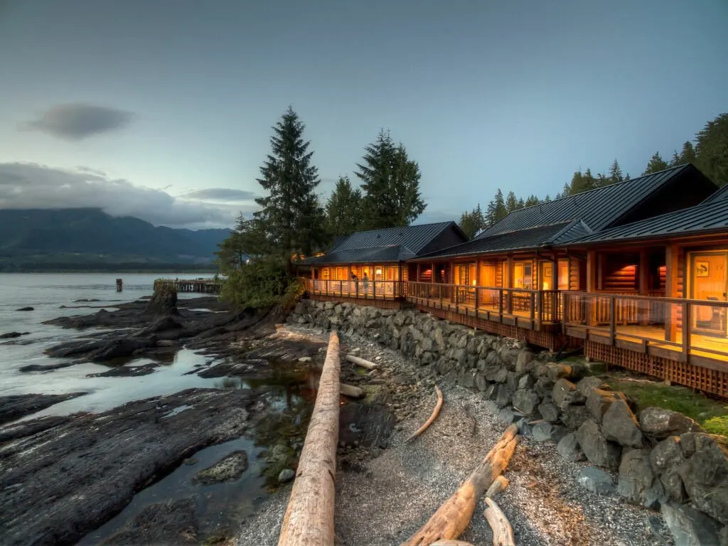
Wild Renfrew Seaside Cottages: Gorgeous cabins with porches that are steps from the surf in ‘downtown’ Port Renfrew. I loved my stay here a few years ago. It’s a 5-minute drive to Botanical Beach Trailhead. Check prices
Trailhead Resort: Budget hiker-friendly accommodations near ‘downtown’ Port Renfrew and a 5-minute drive to Botanical Beach Trailhead. Check prices
Pacheedaht Campground: Beautiful campground with beach and ocean sites a few minutes from Port Renfrew and a 15-minute drive from the Botanical Beach Trailhead. More info: (250) 647-0090

The Juan de Fuca Trail is a great alternative to the West Coast Trail or the North Coast Trail since it is much easier to get to, doesn’t require reservations, and is much less expensive. It also has some of the best old-growth coastal forests you can visit in BC along with beautiful coastal scenery.
This post and its companion, the section-by-section overview of the Juan de Fuca Marine Trail, should give you all the info you need to have a safe and fun hike. If you have questions about the Juan de Fuca Trail, ask them in the comments. I’d love to help!
Join the Backpacking in BC Facebook Group
READ NEXT:
- Juan de Fuca Trail Itinerary and Section-by-Section Overview
- Coastal Hike Packing List: Everything You Need to Bring
- 20+ Ways to Reduce Your Backpack Weight
- Coastal Hiking Tips: Advice for Beach Backpacking
- 25 Spring Backpacking Trips in British Columbia
- How to Go Backpacking in BC Without Reservations
- How to Make Backcountry Camping Reservations in BC
MORE VANCOUVER ISLAND BACKPACKING TRIPS POSTS:
- Guide to the West Coast Trail in British Columbia
- North Coast Trail Guide: Backpacking on Vancouver Island
- Cape Scott Trail Guide: Hiking and Camping on Northern Vancouver Island
- Tatchu Trail Guide: Vancouver Island Coastal Backpacking
- Sunshine on the Edge of the World: Nootka Trail Trip Report
- 30 Best Backpacking Trips in BC


- Things to Do on Newfoundland’s Great Northern Peninsula - July 29, 2026
- Best Sun Hoodies for Hiking - June 3, 2026
- Lower Stein Valley Trail Hiking and Backpacking Guide - May 27, 2026
Kyra
Wednesday 22nd of May 2024
Hi Taryn! I am planning on doing this hike alone, as I have no buddies who are available to go with me (I have literally one free week per year). You mentioned in the wildlife section you suggest going in groups. I'm wondering, will I be at risk if I go alone?
Taryn Eyton
Thursday 23rd of May 2024
Hiking alone is always riskier for wildlife, no matter where you go. If you are going during the summer, especially on a weekend, you'll see lots of other hikers. If you hike alone at a quieter time of year, especially in early spring when the bears are just waking up or late fall when they are getting ready to hibernate, be extra vigilant about bears. Make lots of noise, especially near creeks and in thick vegetation. Conflicts with bears happen most often when they are surprised. Bears don't want to bother us, but will if they are surprised.
Daniel
Friday 5th of January 2024
Hi Taryn,
I am very thankful for sharing your experience and to find the Juan De Fuca Trail on your website. I got a lot of quality information from you now. I was looking for the west coast trail and spent days of research about the trail, transport, costs, and so on. I decided to try to get a permit just for the northern half of the west coast trail. To me the Juan De Fuca Trail looks like a similar trail, but with less costs and less trouble to get to the trail and transport back. Can you tell me, if the scenery of the Juan De Fuca Trail looks about similar to the west coast trail ?
Thank you for your response and enjoy every trail you do.
Best regards, Daniel
Taryn Eyton
Friday 5th of January 2024
In a broad sense, the Juan de Fuca has similar scenery to the WCT since it is in the same ecological region. However, the Juan de Fuca spends more time inland in the forest and much less time on the coast compared to the WCT. To get an idea of the differences in scenery between the two, have a look through the photos in my West Coast Trail guide and my Juan de Fuca guide. They are quite representative of the terrain you will encounter. You will see more forest on the JDF and more beaches on the WCT. Also only one ladder on the JDF, but tons on the WCT. Transportation to both trails is the same as the West Coast Trail Express bus runs to both trails. The only difference is that it is a shorter travel time to the JDF.
Allison
Monday 25th of July 2022
Thank you for this amazing article! I am planning on hiking the JDF August 1-4. I know the trail will be busy during this time. Can you give me an idea of how busy it might be? What does "busy" look like and feel like on the JDF? Any tips for dealing with the business?
Taryn Eyton
Tuesday 26th of July 2022
You are planning to start your trip on the last day of the long weekend so it won't be as bad as if you had been on the trail during the long weekend. But it will be very busy. Expect full or overflowing parking lots at trailheads. Expect campsites to fill up early in the afternoon - plan to finish your day early to get a good spot or be prepared to camp in marginal campsites especially at the forest campsites or at smaller campsites like Mystic and Chin. Expect food caches to be full - get your food into them early in the evening or bring rope to create a hang. In general everyone is friendly and accommodating - there will just be more people out thee.
Cristina
Monday 7th of March 2022
Thank you for this super informative and very detailed article. I'm planning a trip to do the JDF trail in early September and have bookmarked this page so I can check back through all your links! Thanks again.