

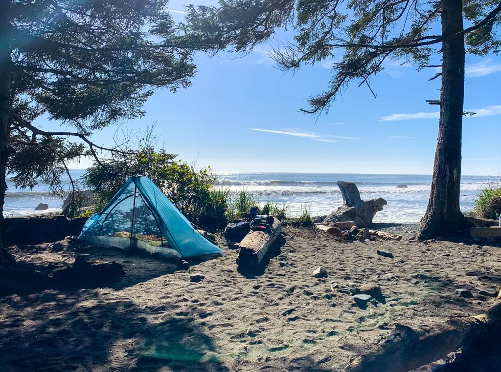
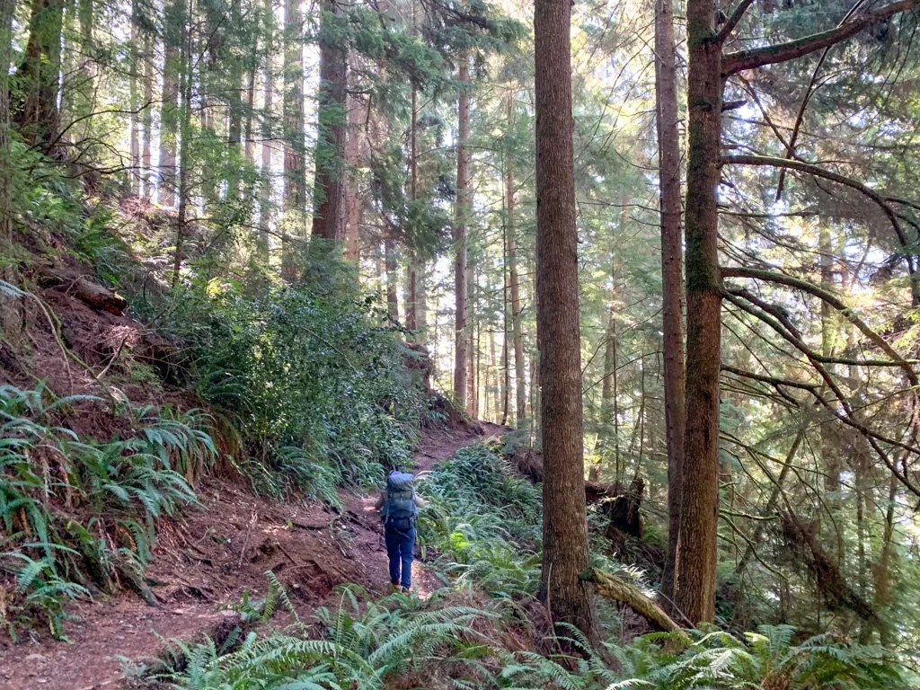
After a long winter, I’m usually in a rush for summer to start so I can go backpacking. But it can be frustrating since most trails are snow-covered well into June and July. However, if you know where to look, there are lots of places to go on spring backpacking trips in British Columbia.
While this post is aimed at locations where you can go on an overnight hiking trip in spring, most of these trips make great fall backpacking trips in British Columbia too.
In BC, most mountain trails are snow-covered between late October and mid-June. However, there are lots of lower elevation trails that are snow-free between March and November. There are even a few on this list that you can backpack year-round.
This list of 25 spring backpacking trips in British Columbia includes:
- Destinations near Vancouver, on Vancouver Island, and in BC’s interior
- Trips ranging in difficulty from beginner to expert
- Hikes between 2 and 8 days long
- Trails that are usually snow-free by March, April, or May and stay snow-free until October or November
- Tips for spring backpacking trips in British Columbia
- Bonus: Spring backpacking suggestions for Washington State
This is a sensitive wilderness area. Learn how to Leave No Trace to keep the wilderness wild. Make sure you are prepared by bringing the 10 Essentials. Get ready for adventure with this checklist of things to do before every hike.
Hey there: Some of the links in this post are affiliate links, which means I earn a small commission at no cost to you. Thanks for your support. -Taryn
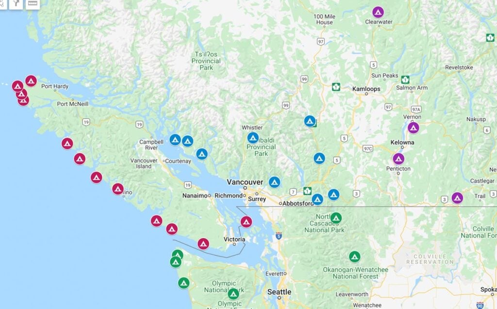
Map of Spring Backpacking Trips in British Columbia

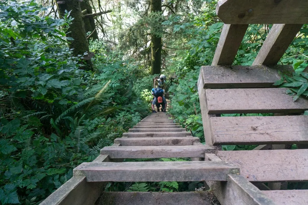
Tips for Spring Backpacking in British Columbia
Backpacking in the spring has its own challenges. Here are a few things to watch out for:
Weather: In spring, the weather is colder and wetter than in summer. It’s also less predictable. Pack accordingly and be prepared to cancel your trip or switch to a different destination if the forecast looks bad. (Use these picks for the best weather apps for hiking.)
Trail Conditions: Many trails suffer blow-downs, wash-outs, and flooding over the winter. Often, parks staff and volunteers do trail maintenance in late May or June, which means trails can be in rough shape before then. (Here are my tips for how to check trail conditions.)
Mud: Wet and muddy trails are inevitable in spring. Come prepared with waterproof hiking boots and gaiters.
Creek crossings: Streams run high in the spring with a combo of snow-melt and rain. Bridges may be washed out and fords may be dangerous. Be prepared to turn back.
Bears: As they wake up from hibernation and tend to new cubs, bears are more active in spring, especially in valley-bottom and coastal locations where there are lots of things for them to eat at this time of year. Read more about bear safety for backpackers.
Seasonal closures: Some parks and trails are closed in the off-season, or may have temporary closures to due damaged infrastructure. Check park and trail websites before you go.
Trailhead access issues: In spring, logging roads that access trailheads may be muddy or washed out. If you’re heading to a trail that requires a water taxi or floatplane, fog and rough weather may delay or cancel your trip. Shuttle services between trailheads may not start operating until May.

Spring Backpacking Trips in Southwestern British Columbia
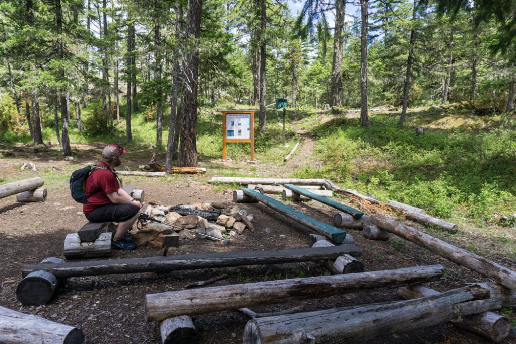
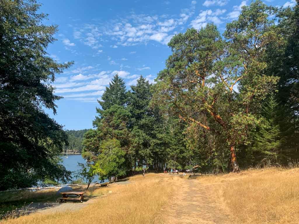
Viewpoint Beach and Halfmoon Beach, Golden Ears Provincial Park

Heads up: Day passes are required at Golden Ears Provincial Park in summer. However, if you have a backcountry permit registration, you don’t need a day pass. Learn more in my guide to BC Parks day passes.
Duration: 2 days
Distance: 9.6 to 19.4 km round trip
Best Months: April to November
Difficulty: Easy
Elevation Gain: 170 to 275 m
Fees and Reservations: Reservations are required. Camping fees charged.
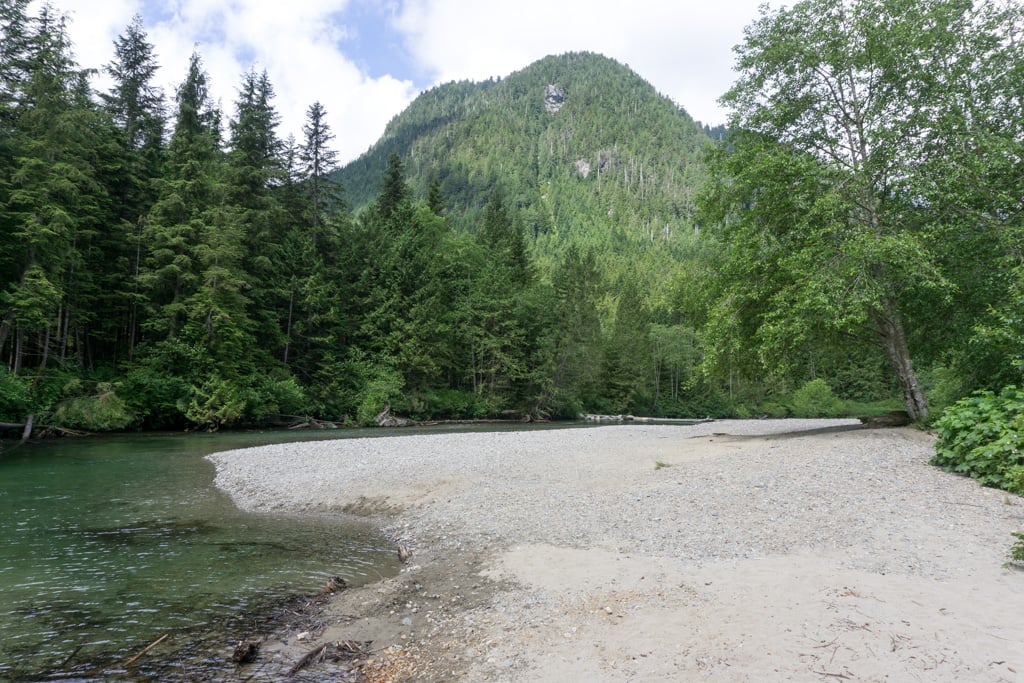
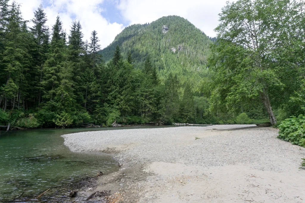
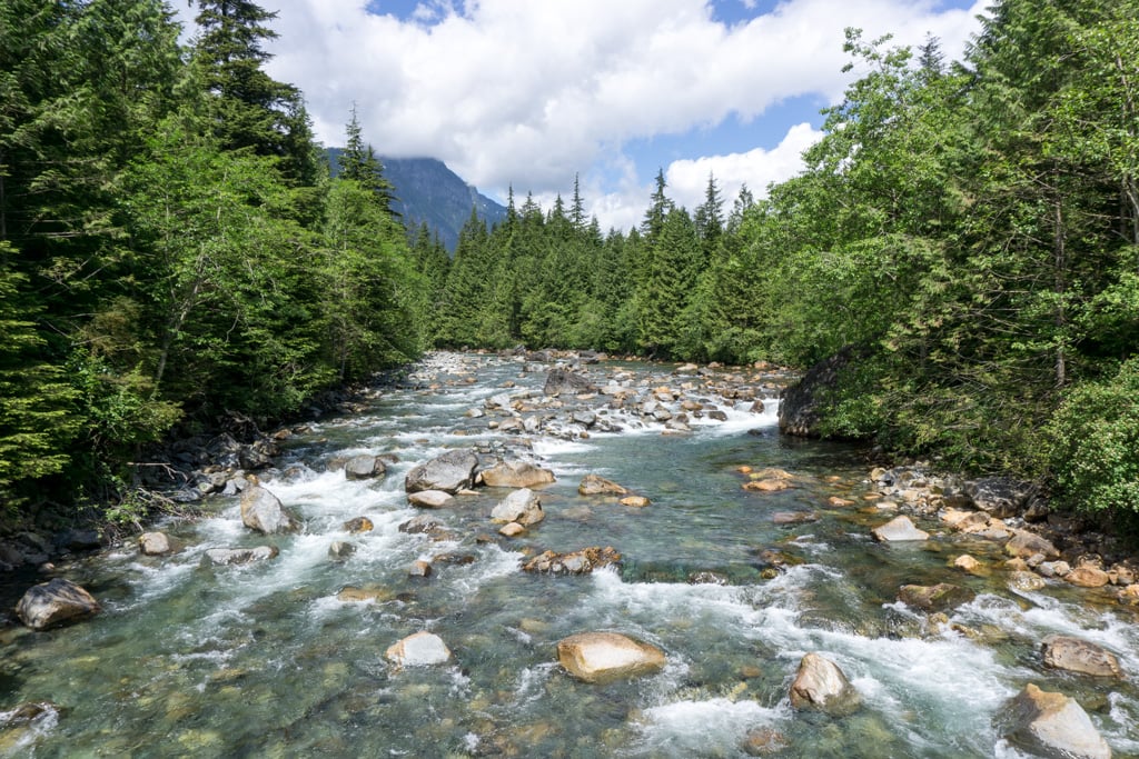
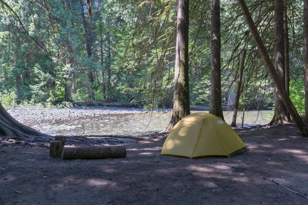
This easy hike in Golden Ears Provincial Park follows the banks of Gold Creek. There are trails on both the west and east sides of the creek, connected by a bridge, so loop trips are possible. You can camp at Viewpoint Beach or venture further upstream to Halfmoon Beach.
This is the closest place to Vancouver that you can take a spring backpacking trip in British Columbia and also made my list of the best easy backpacking trips in BC.
More Info: Find details on this hike in my book, Backpacking in Southwestern British Columbia. For info on camping fees, see Golden Ears Provincial Park.
READ NEXT: How to Make Backcountry Camping Reservations in BC
Lindeman and Greendrop Lakes, Chilliwack Lake Provincial Park

Duration: 2 days
Distance: 3.4 to 11 km round trip
Best Months: April to early November
Difficulty: Easy/moderate
Elevation Gain: 200 to 350 m
Fees and Reservations: Camping fees charged. All campsites are first-come, first-served.
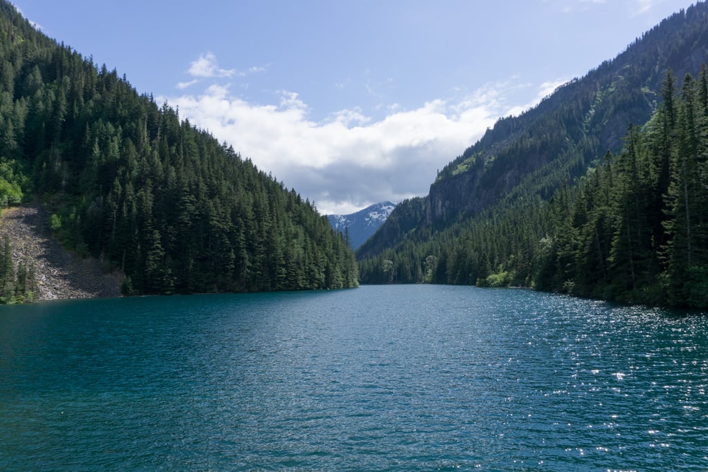
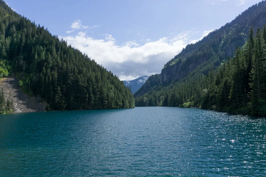
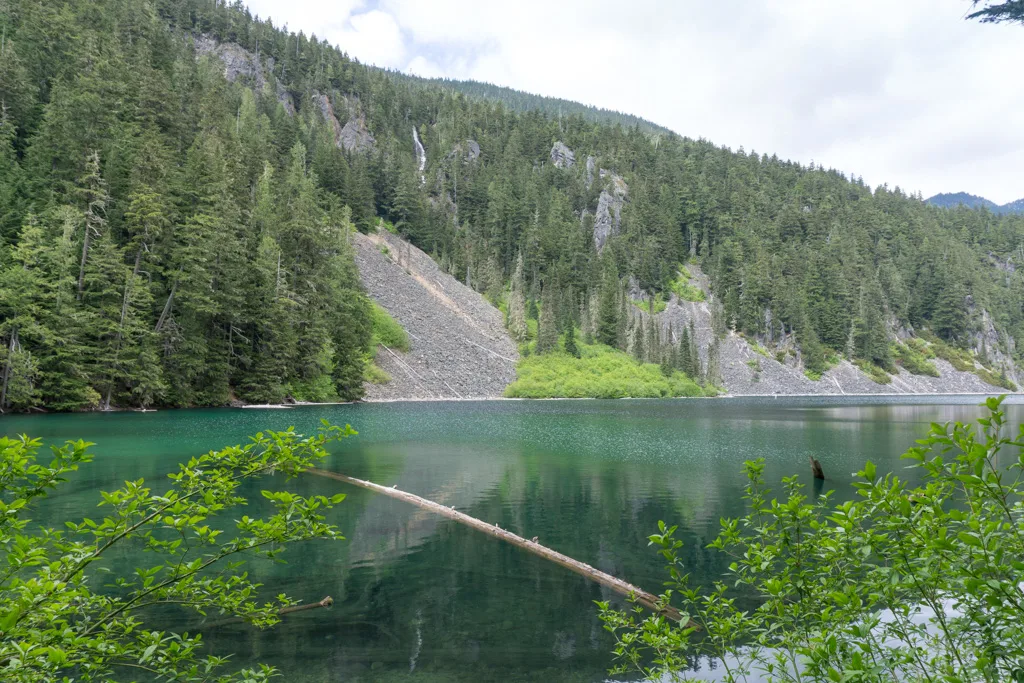
It’s a short hike to picturesque Lindeman Lake where you can camp next to the tranquil turquoise waters. If you have more energy, carry on along the rougher trail to Greendrop Lake. Lindeman Lake is often snow-free in April, but Greendrop Lake holds snow into May.
Lindeman Lake is also one of my picks for beginner-friendly backpacking rips in BC.
More Info: Find details on this hike in my book, Backpacking in Southwestern British Columbia. For info on camping fees, see S⨱ótsaqel / Chilliwack Lake Provincial Park.
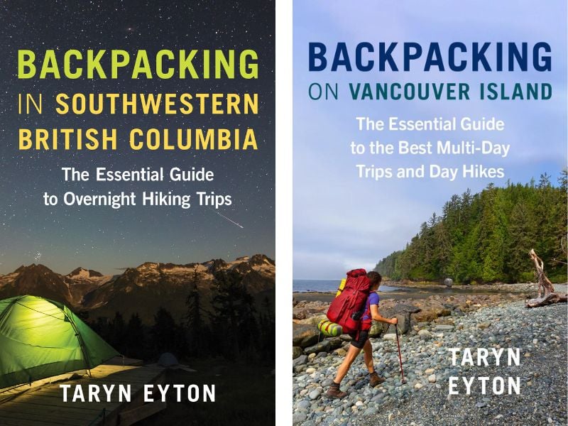
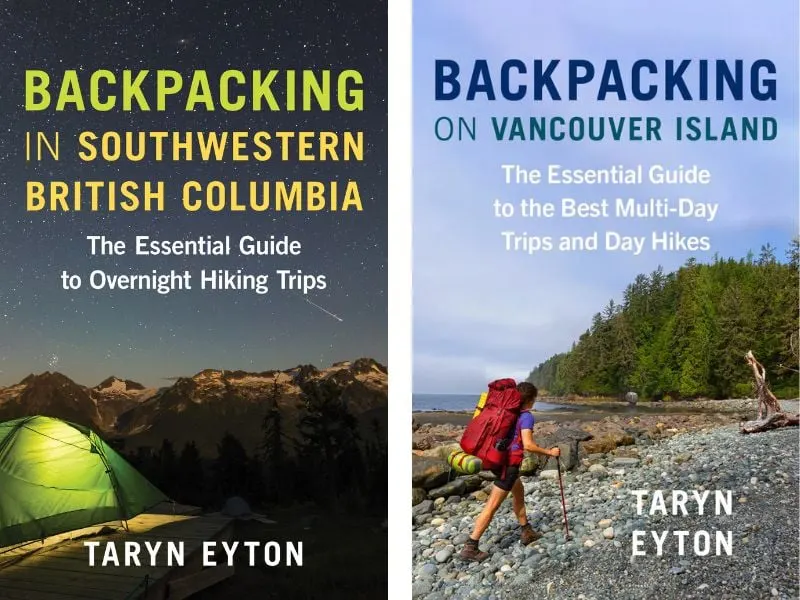
Get My Book…
Backpacking in Southwestern British Columbia
A one-stop resource for backpackers in beautiful British Columbia.
- 40 backpacking trips within a few hours of Vancouver
- Info about permits, reservations, and campground facilities
- Detailed maps and photos
- Advice for extending your trip
- Points of cultural and natural history

Skagit River Trail, Skagit Valley Provincial Park


Note: Access to this trail was disrupted by the November 2021 storms. The river has changed course at the Sumallo Grove trailhead and the bridge is not accessible at times of high water. In late summer, it’s an easy ford. However, western trailhead on Silver-Skagit Road in Skagit Valley Provincial Park is open between mid-April and November, so you can access it from that direction.
Duration: 2 days
Distance: 8 km round trip or 14 km traverse
Best Months: April to November
Difficulty: Easy
Elevation Gain: 75 m
Fees and Reservations: None.
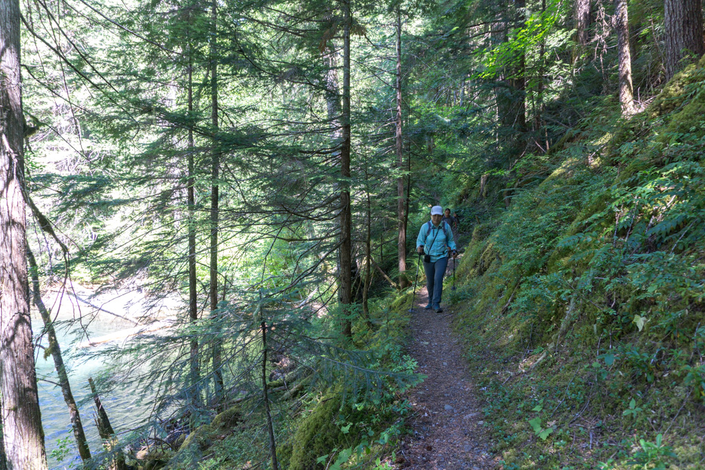
This laid-back hike follows a historic fur-trade route along the banks of the Skagit River as it flows downstream. You can do an 8 km round trip hike from the Sumallo Grove Trailhead in Manning Provincial Park, camping at Delacy Camp. If you have two cars, you make a 14 km traverse from Sumallo Grove to Silver-Skagit Road.
The Skagit River Trail is one of the best easy backpacking trips in BC.
More Info: Find details on this hike in my book, Backpacking in Southwestern British Columbia and the E.C. Manning & Skagit Valley Provincial Parks map from Clark Geomatics.
Join the Backpacking in BC Facebook Group
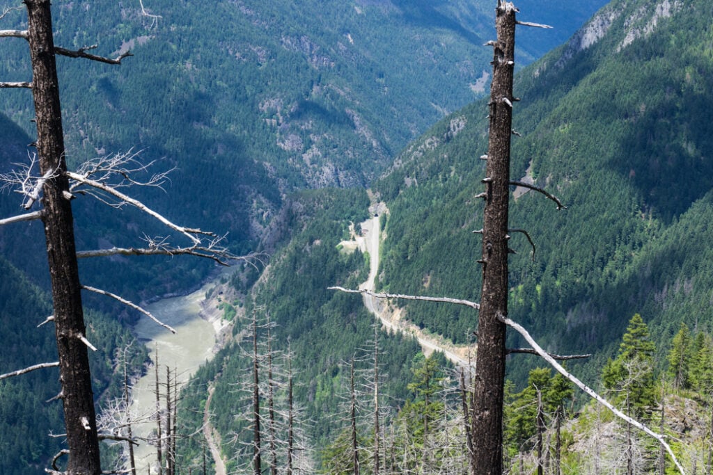
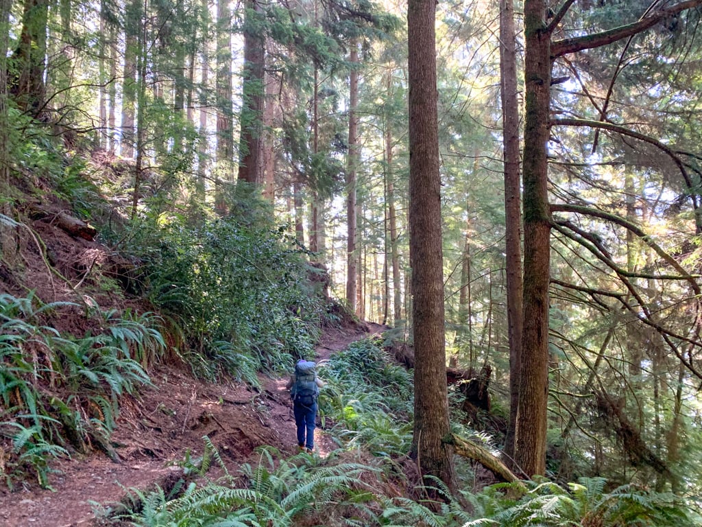
Tikwalus Heritage Trail, Fraser Canyon


Duration: 2 days
Distance: 13 km round trip
Best Months: May to October
Difficulty: Challenging
Elevation Gain: 790 m
Fees and Reservations: None
This historical Indigenous and fur trade route leads steeply up from Highway 1 in the Fraser Canyon to several spectacular lookouts. Camp high on a bluff near several small lakes. The trail takes its name from a former Nlaka’pamux village near the trailhead.
More Info: Find details on this hike in my book, Backpacking in Southwestern British Columbia.
READ NEXT: How to Go Backpacking in BC Without Reservations
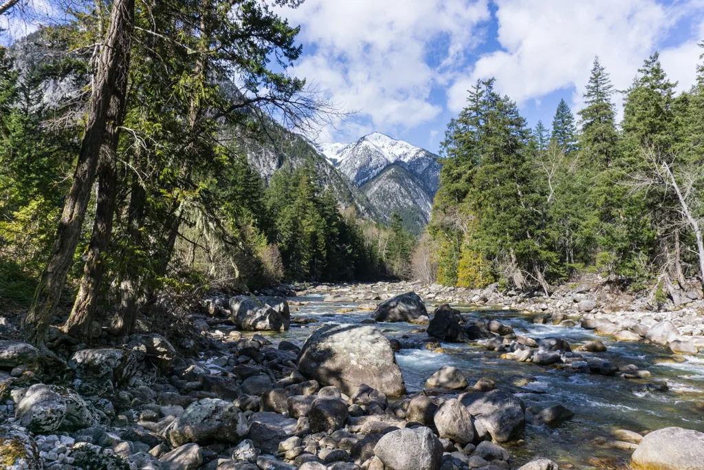
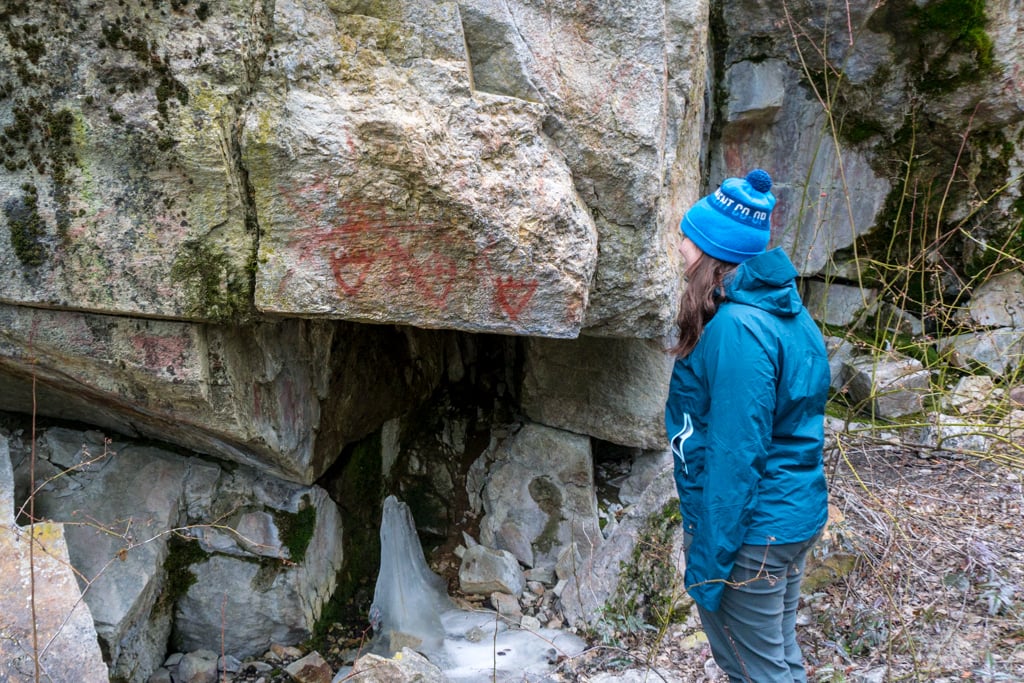
Lower Stein Valley, Stein Valley Nlaka’pamux Heritage Provincial Park


Note: A large wildfire burned the lower Stein Valley trail in July and August 2023. As of early 2026, the trail is currently only open up to Earl’s Cabin camp 10.5 km from the trailhead.
Duration: 2 days
Distance: 4 to 26 km round trip
Best Months: April to October
Difficulty: Easy
Elevation Gain: 30 to 350 m
Fees and Reservations: None.
The warm, dry climate in Lytton makes the Lower Stein Valley my favourite choice for spring backpacking trips in British Columbia – Over the years, I’ve been there six times in March, April, and May. The valley is a spiritual place for the local Nlaka’pamux First Nation.
The trail travels next to the Stein River passing Indigenous pictographs and culturally modified trees. Choose from five different campgrounds spaced out along the lower section of the trail. This is one fo the best places for beginner backpacking in BC.
More Info: Find details on this hike in my Lower Stein Valley Trail guide.
READ NEXT: How to Make Backcountry Camping Reservations in BC
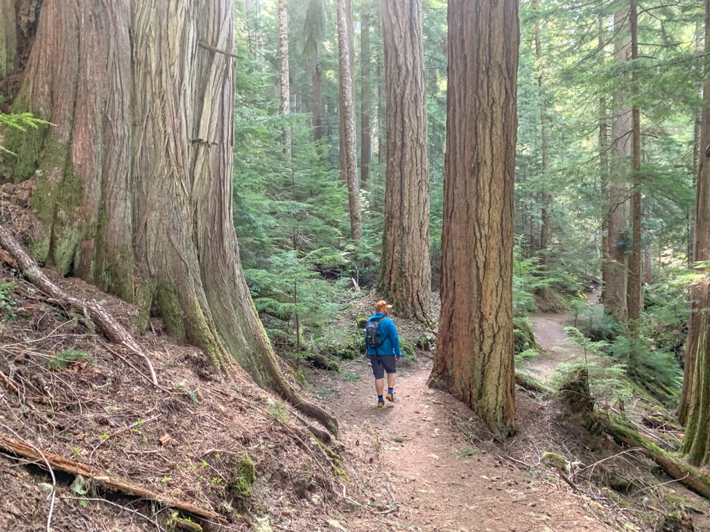
Cheakamus Lake, Garibaldi Provincial Park


Heads up: Day passes are required at Cheakamus Lake in summer. However, if you have a backcountry camping reservation, you don’t need a day pass. Learn more in my guide to BC Parks day passes.
Duration: 2 days
Distance: 7 to 14 km round trip
Best months: May to early November
Difficulty: Easy
Elevation Gain: 50 m
Fees and Reservations: Reservations are required. Camping fees charged.
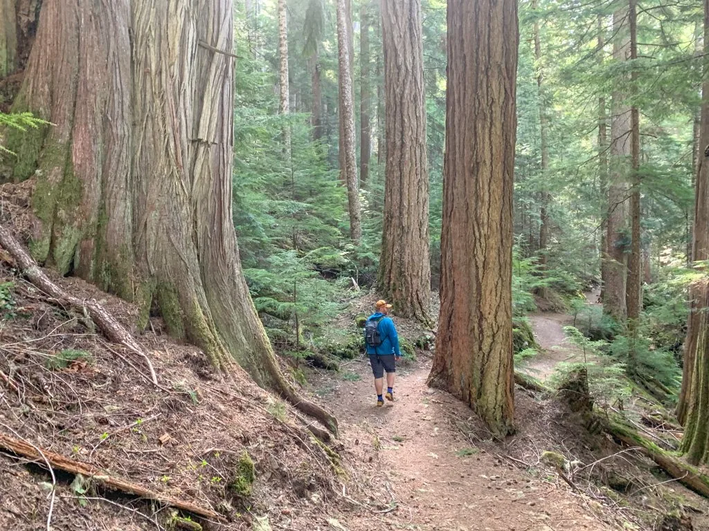
As the lowest elevation trail in Garibaldi Provincial Park, Cheakamus Lake is a good spring backpacking destination. The flat and easy trail leads through old-growth forest to the beautiful glacially-fed lake. Camp at the lake outlet or follow the trail along the shoreline to camp at Singing Creek.
This trail is my number one pick for easy backpacking near Vancouver.
More Info: Find details on this hike in my book, Backpacking in Southwestern British Columbia and the Garibaldi Provincial Park Map by Clark Geomatics. For info on camping fees and reservations, see Garibaldi Provincial Park.
Psst! You can get to this hike without a car! It’s on my list of car-free backpacking trips in BC.
Get My Book…
Backpacking in Southwestern British Columbia
A one-stop resource for backpackers in beautiful British Columbia.
- 40 backpacking trips within a few hours of Vancouver
- Info about permits, reservations, and campground facilities
- Detailed maps and photos
- Advice for extending your trip
- Points of cultural and natural history
Fairview Bay/Saltery Bay Loop, Sunshine Coast Trail


Duration: 2 to 3 days
Distance: 12 km round trip or 18 km loop
Best Months: April to November
Difficulty: Moderate
Elevation Gain: 150 to 570 m
Fees and Reservations: None
Portions of the Sunshine Coast Trail are snow-covered most of the year, but you can tackle this low elevation section starting at the southern terminus in Saltery Bay. Hike along the coast to Fairview Bay hut as an out-and-back trip, or take on the full loop, camping at either Fairview Bay Hut or Rainy Day Lake Hut.
The trip to Fairview Bay is on my list of the best easy bacpacking trips in BC.
More Info: Find details on this hike in my book, Backpacking in Southwestern British Columbia.
Psst! You can get to this hike without a car! It’s on my list of car-free backpacking trips in BC.
Join the Backpacking in BC Facebook Group
Confederation Lake and Fiddlehead Landing, Sunshine Coast Trail


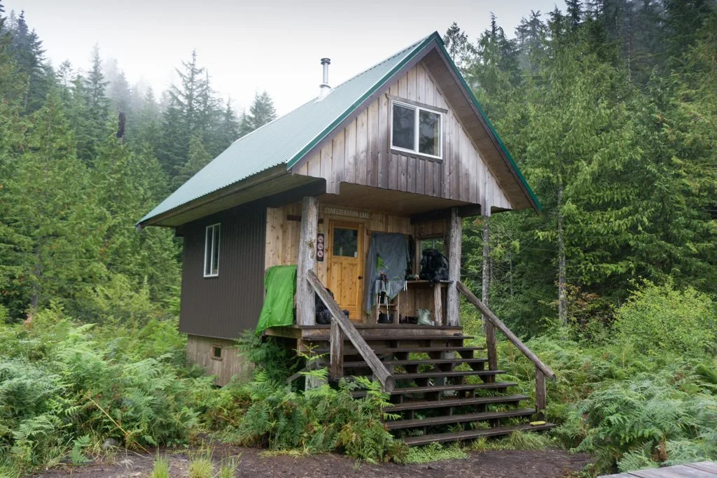
Duration: 2 to 3 days
Distance: 15 to 30 km round trip
Best Months: April to November
Difficulty: Moderate/Challenging
Elevation Gain: 650 m
Fees and Reservations: None
Here’s another low elevation section of the Sunshine Coast Trail (SCT) that is perfect for a spring backpacking trip. The trail starts at Inland Lake, then climbs steeply through thick old-growth forest to a hut on the shores of Confederation Lake. Follow the SCT downhill to Fiddlehead Landing on the shores of Powell Lake and another hut.
More Info: Find details on this hike in my book, Backpacking in Southwestern British Columbia.
Sarah Point to Powell River, Sunshine Coast Trail
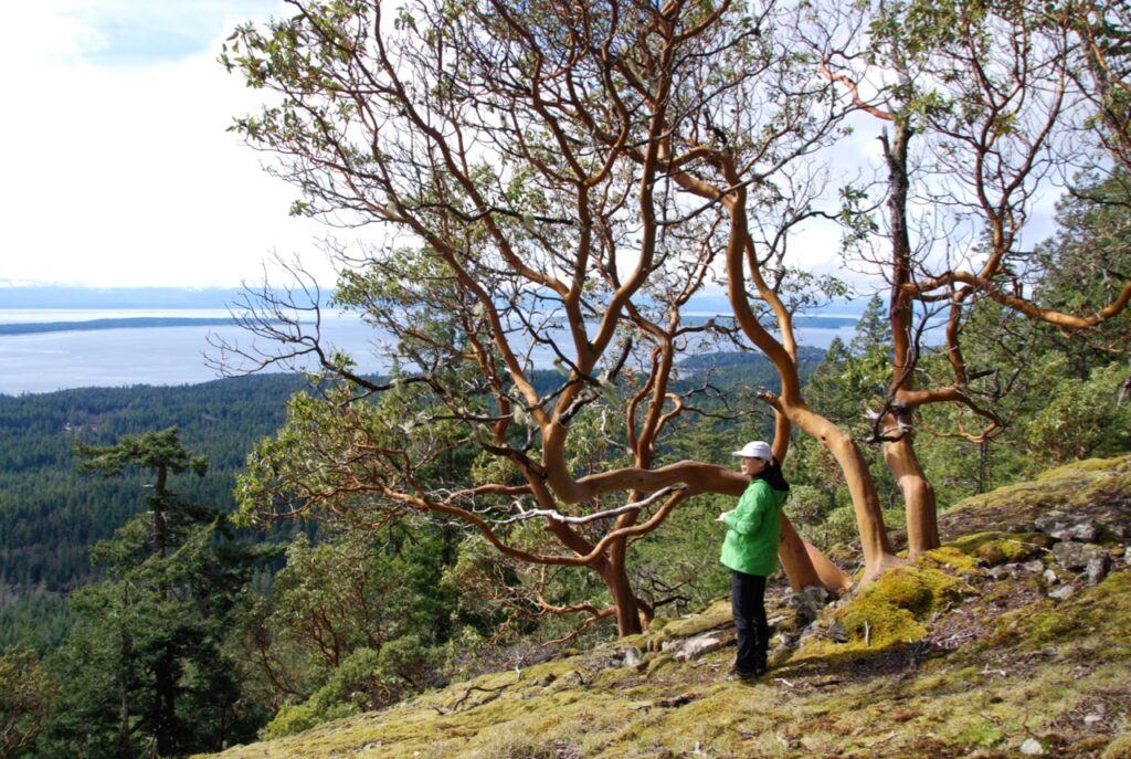
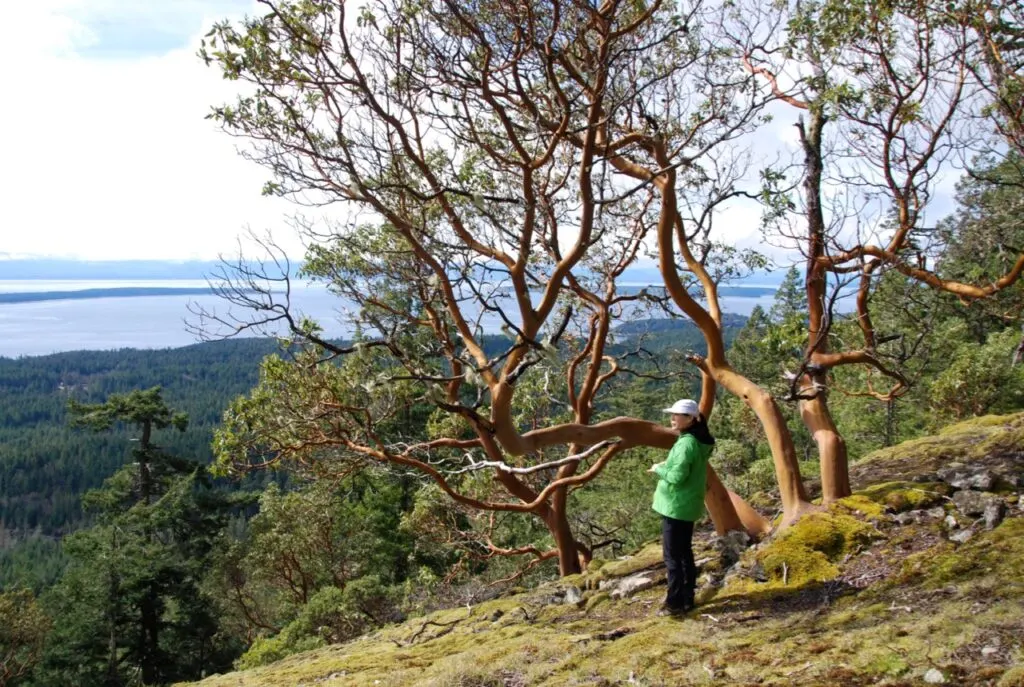

Duration: 3-4 Days
Distance: 50 km traverse
Best Months: March to November
Difficulty: Moderate
Elevation Gain: 375 m
Fees and Reservations: None
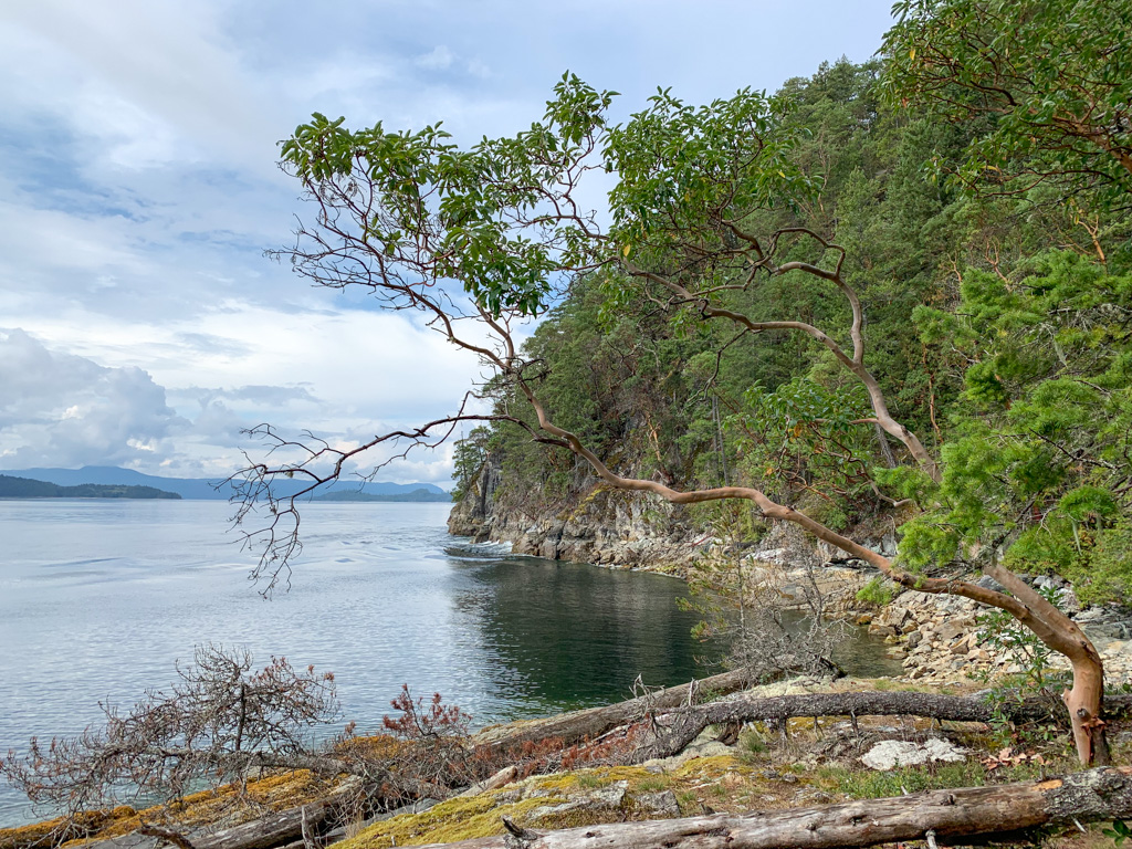
This northern section of the Sunshine Coast Trail is an ideal spring backpacking destination. Arrange a water taxi or 4WD shuttle to the trailhead at Sarah Point or skip the first few kilometres by taking the shortcut trail to Wednesday Lake from Sarah Point Road. Finish your trip at the Shinglemill Pub in Powell River. Along the way, walk along bluffs speckled with arbutus trees, through old-growth forest, and past small lakes.
More Info: Read my trip report from my March backpacking trip on the northern section of the Sunshine Coast Trail. Part of this section is also featured in my book Backpacking in Southwestern British Columbia.
Psst! You can get to this hike without a car! It’s on my list of car-free backpacking trips in BC.
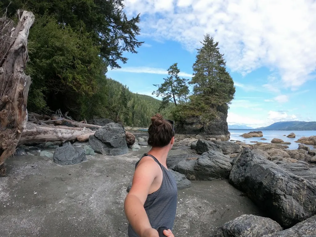
Spring Backpacking Trips on Vancouver Island
Narvaez Bay, Saturna Island

Duration: 2 days
Distance: 3.5 km round trip
Best Months: Year-round
Difficulty: Easy
Elevation Gain: 80 m
Fees and Reservations: Reservations are required. Camping fees charged.
This oceanfront campground is located on the southeastern side of Saturna Island in Gulf Islands National Park Reserve. It’s an easy hike in from the trailhead and the trail is also open to bikes. FYI: There is no potable water here so you’ll have to pack in your own. It’s also on my list of the best easy backpacking trips in BC.
More Info: Find details on this hike in my book, Backpacking on Vancouver Island. See Gulf Islands National Park Reserve for camping reservations.
Psst! You can get to this hike without a car! It’s on my list of car-free backpacking trips in BC.
READ NEXT: BC Backpacking Reservation Dates You Need to Know
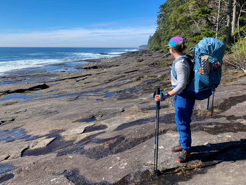
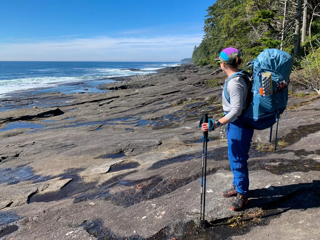
Juan de Fuca Trail, Juan de Fuca Provincial Park
Note: The Juan de Fuca Trail was closed in summer 2025 due to significant storm damage. Mystic Beach and East Sombrio Beach are currently open. The full trail will re-open on July 1, 2026.
Duration: 3 to 5 days
Distance: 47 km traverse
Best Months: Year-round
Difficulty: Challenging
Elevation Gain: 190 m
Fees and Reservations: Camping fees charged. All campsites are first-come, first-served.
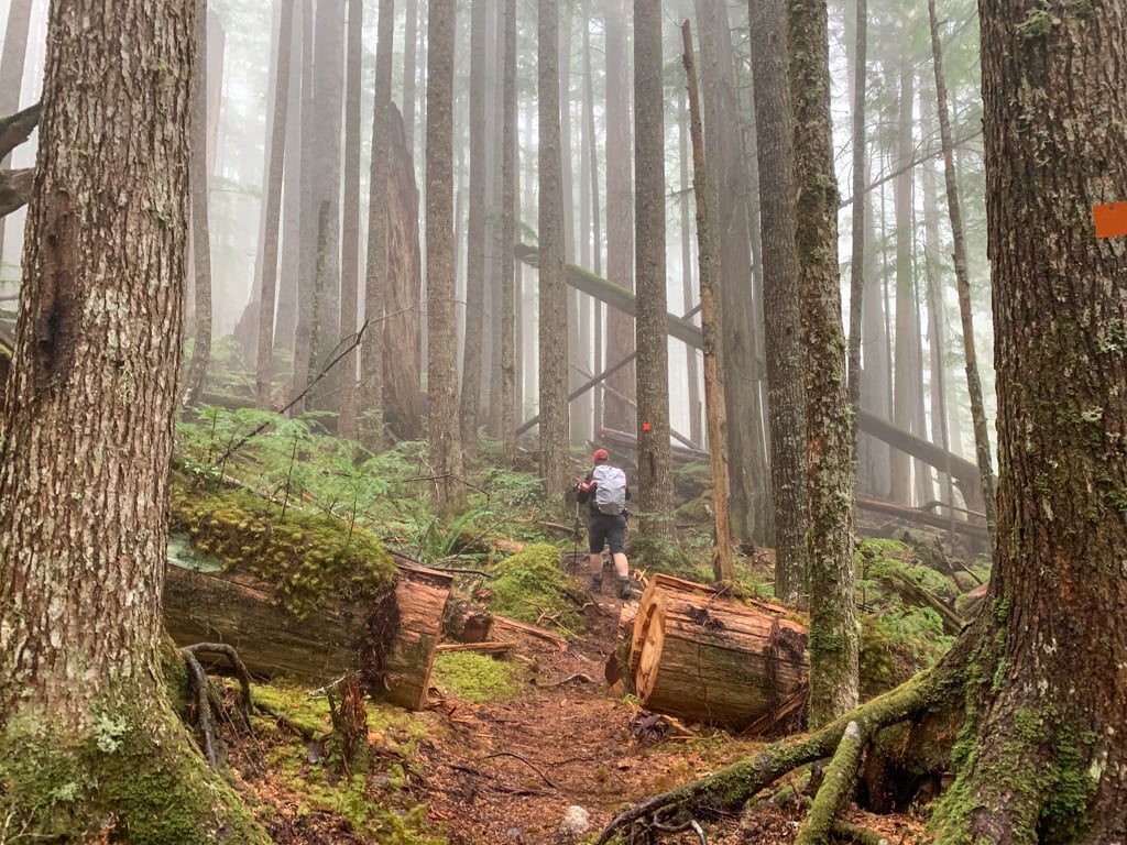
The rugged Juan de Fuca Trail runs along the coast from near Jordan River to Port Renfrew. It’s a little shorter than the West Coast Trail, its famous neighbour to the north, but it’s just as rugged and has more hills. This trail crosses lots of steep gullies, so it is prone to washouts in the spring, fall, and winter months.
More Info: Read my Juan de Fuca Trail guide for full details. Find details on this hike in my book, Backpacking on Vancouver Island. For camping fees, see Juan de Fuca Provincial Park.
Psst! You can get to this hike without a car! It’s on my list of car-free backpacking trips in BC.
READ NEXT: Juan De Fuca Trail Guide: Backpacking on Vancouver Island
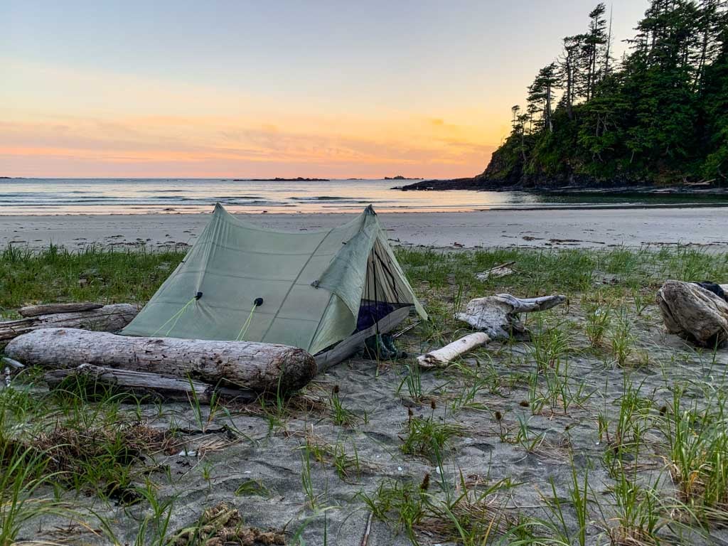
West Coast Trail, Pacific Rim National Park


Note: The West Coast Trail is open from May 1 to September 30 each year. The National Park officially closes the trail from October to the end of April.
Duration: 5-8 days
Distance: 75 km traverse
Best Months: May to September
Difficulty: Challenging
Elevation Gain: 225 m
Fees and Reservations: Reservations are required. Trail fees and National Park entry fees charged.
The West Coast Trail is Canada’s most famous multi-day hike. Since it opens in May, it also makes a great spring backpacking trip. The 75-kilometre-long trail follows the wild shoreline with the help of bridges, ladders, and cable cars. Each night you will camp on a wilderness beach.
More Info: Get details on this hike in my West Coast Trail guide. Find details on this hike in my book, Backpacking on Vancouver Island. For info on reservations, trail fees, and National Park fees, see Pacific Rim National Park.
Psst! You can get to this hike without a car! It’s on my list of car-free backpacking trips in BC.
READ NEXT: Your Guide to the West Coast Trail in British Columbia
Get My Book…
Backpacking on Vancouver Island
Discover Vancouver Island’s best day hikes and overnight trips
- 25 backpacking trips and 10 day hikes throughout Vancouver Island
- Info about permits, reservations and campground facilities
- Detailed maps and photos
- Advice for extending your trip
- Points of cultural and natural history
Keeha Beach, Pacific Rim National Park

Note: Keeha Beach is open from May 1 to early October each year. The National Park officially closes the trail from early October to the end of April.
Duration: 2 days
Distance: 7 km round trip
Best Months: May to early October
Difficulty: Moderate
Elevation Gain: 45 m
Fees and Reservations: Reservations are required. Camping fees and National Park entry fees charged.
This sandy beach is located just north of the West Coast Trail. It’s a short hike to get there, but allow plenty of time as the trail is very rough with lots of slippery roots and tons of mud. (The mud is pretty epic – comparable to the North Coast Trail.) You can also day hike to the nearby Cape Beale Lighthouse.
More Info: Find details on this hike in my book, Backpacking on Vancouver Island. For trail fees, and reservations, see Pacific Rim National Park.
Psst! You can get to this hike without a car! It’s on my list of car-free backpacking trips in BC.
Join the Backpacking in BC Facebook Group
Della Falls Trail

Duration: 2-5 days
Distance: 32 km round trip
Best Months: Mid-May to September
Difficulty: Moderate
Elevation Gain: 540 m
Fees and Reservations: None
At 440-metres-tall, Della Falls is one of the tallest waterfalls in Canada. To get there, you first have to canoe, motor boat, or water taxi across Great Central Lake. Then hike up through a river valley to the base of the falls. Don’t miss a side trip on the Love Lake trail for incredible views of the falls.
The water taxi starts running on May 15 each year when the falls are in full flow. However, snow can linger in May and early June in the upper valley and on the Love Lake Trail, so go prepared.
More Info: Get all the details in my Della Falls Trail guide and join the Della Falls Facebook group. Find details on this hike in my book, Backpacking on Vancouver Island.
Psst! You can get to this hike without a car! It’s on my list of car-free backpacking trips in BC.
READ NEXT: Della Falls Trail Hiking Guide
Wild Side Trail, Flores Island

Note: The Wild Side Trail is open from May to October each year. The Ahousaht Nation officially closes the trail from November to April.
Duration: 2 days
Distance: 22 km round trip
Best Months: May to October
Difficulty: Easy
Elevation Gain: 30 m
Fees and Reservations: Trail fees charged.
The Wild Side Trail has one of the best effort to reward ratios of any of Vancouver Island’s coastal trails. It’s one of my favourite spring backpacking trips in British Columbia – I’ve done it twice in May! This trail is also one of my picks for the best beginner backpacking trips in BC.
It’s an easy walk along beaches and through the forest to a gorgeous campsite at Cow Bay. There are also two other campsites along the way. The hike is located in Ahousaht First Nation territory on Flores Island near Tofino, so you’ll need to arrange a water taxi.
More Info: Get details on this hike in my Wild Side Trail guide. Find details on this hike in my book, Backpacking on Vancouver Island. For info on trail fees and camping fees, see the Wild Side Trail website.
Psst! You can get to this hike without a car! It’s on my list of car-free backpacking trips in BC.
READ NEXT: Wild Side Trail: Hiking and Camping Guide
Hesquiat Peninsula Trail, West Coast Vancouver Island
Duration: 4 to 5 days
Distance: 50 km traverse
Best Months: April to October
Difficulty: Very Challenging
Elevation Gain: 50 m
Fees and Reservations: None
If you’re looking for an off-the-beaten-path adventure, take a water taxi or floatplane to the remote Hesquiat Peninsula on the west coast of Vancouver Island. This informal trail follows the rugged coastline as it bucks and dips across rocky headlands, through surge channels, and along beaches. There are no facilities or formal campsites.
More info: See Hiking the West Coast of Vancouver Island by Tim Leadem, and Hesquiat Peninsula Provincial Park.
Get My Book…
Backpacking on Vancouver Island
Discover Vancouver Island’s best day hikes and overnight trips
- 25 backpacking trips and 10 day hikes throughout Vancouver Island
- Info about permits, reservations and campground facilities
- Detailed maps and photos
- Advice for extending your trip
- Points of cultural and natural history
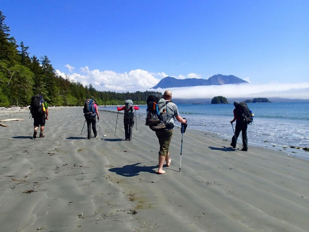
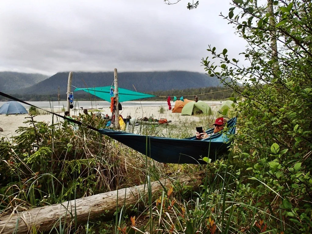
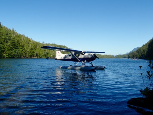
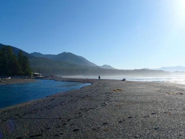
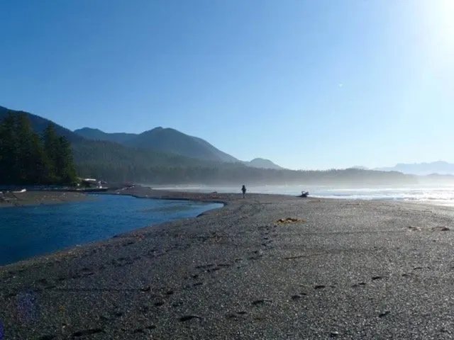
Nootka Trail, West Coast Vancouver Island

Duration: 3 to 5 days
Distance: 36 km traverse
Best Months: April to October
Difficulty: Moderate
Elevation Gain: 50 m
Fees and Reservations: Trail fees and a landing fee charged. All camping is first-come, first-served.
The Nootka Trail is my favourite coastal hike in BC. It’s located on Nootka Island off the west coast of Vancouver Island, so you need to take a water taxi or floatplane to get there. What makes this trail special is that it is almost entirely on the beach. There are no formal facilities or campsites.
More info: See my Nootka Trail trip report. Find details on this hike in my book, Backpacking on Vancouver Island. For info on fees, see Yuqot.ca, the Mowachaht-Muchalaht First Nation website.
READ NEXT: Sunshine on the Edge of the World: Nootka Trail Trip Report
Tatchu Peninsula Trail, West Coast Vancouver Island

Duration: 3 to 4 days
Distance: 20-40 km (traverse or out-and-back)
Best Months: May to October
Difficulty: Moderate/Very Challenging
Elevation Gain: 30 m
Fees and Reservations: None.
The Tatchu Peninsula is a wilderness hike on the west coast of Vancouver Island. The hike traces a route down the west side of the peninsula, linking numerous beaches with short overland trails. There are no formal facilities or campsites. You can do the easier (and more scenic) northern section as an out-and-back or complete a very challenging traverse.
More info: See my Tatchu Trail guide, Rugged Point Provincial Park. Find details on this hike in my book, Backpacking on Vancouver Island.
Raft Cove, Raft Cove Provincial Park
Duration: 2 days
Distance: 4 km round trip
Best Months: Year-round
Difficulty: Moderate
Elevation Gain: 70 m
Fees and Reservations: Camping fees charged between May and September. (Otherwise, it is free.) All campsites are first-come, first-served.
Raft Cove is a remote beach on the north end of Vancouver Island, reached by a maze of logging roads from the tiny town of Holberg. It’s a short walk into the beach, but the rough and muddy trail makes it seem longer. Camp on the sandy beach and watch surfers work the waves just offshore.
This is one of my picks for the best easy backpacking trips in BC.
More info: Find details on this hike in my book, Backpacking on Vancouver Island. See Raft Cove Provincial Park for info and camping fees.
Join the Backpacking in BC Facebook Group
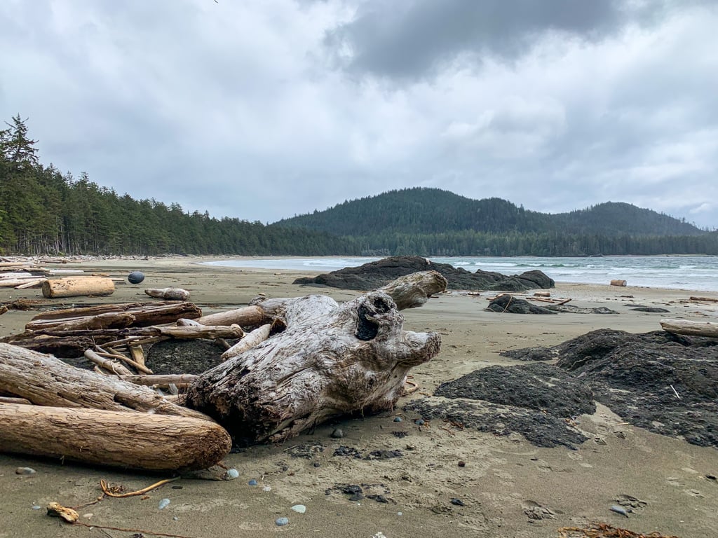
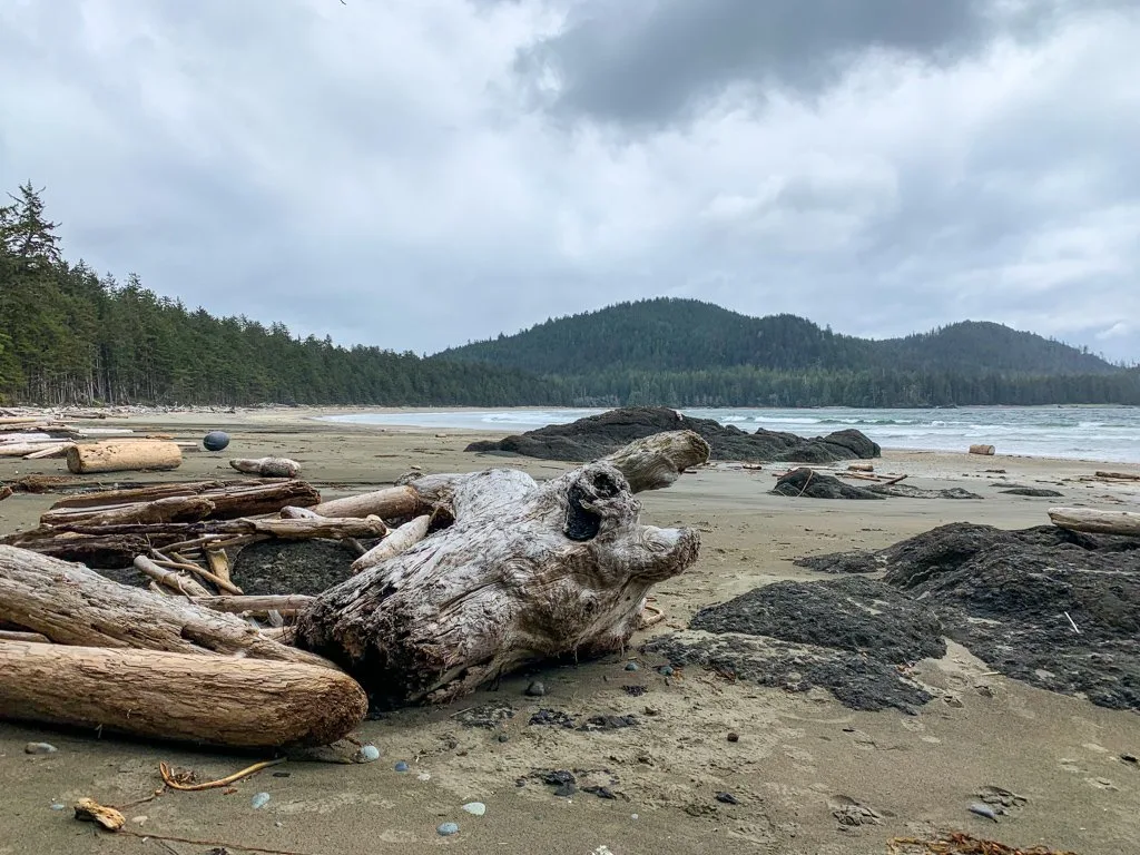
San Josef Bay, Cape Scott Provincial Park

Duration: 2 days
Distance: 5 km return
Best Months: Year-round
Difficulty: Easy
Elevation Gain: 45 m
Fees and Reservations: Camping fees charged between May and September. (Otherwise, it is free.) All campsites are first-come, first-served.
This is the easiest trail in Cape Scott Provincial Park, but it still has spectacular scenery. The trail winds through the coastal forest and ends at a beautiful beach. At low tide, you can explore incredible sea stacks. There are two beaches to camp on separated by a headland that is impassable at high tide.
The flat trail makes it one of the best easy backpacking trips in BC.
More info: For more info, see my Cape Scott guide, the North Coast Trail Map by John Baldwin, and the North Coast Trail Waterproof Map by Wild Coast. Find details on this hike in my book, Backpacking on Vancouver Island. For camping fees, see Cape Scott Provincial Park.
Psst! You can get to this hike without a car! It’s on my list of car-free backpacking trips in BC.
READ NEXT: Cape Scott Trail Guide: Hiking and Camping on Northern Vancouver Island
Get My Book…
Backpacking on Vancouver Island
Discover Vancouver Island’s best day hikes and overnight trips
- 25 backpacking trips and 10 day hikes throughout Vancouver Island
- Info about permits, reservations and campground facilities
- Detailed maps and photos
- Advice for extending your trip
- Points of cultural and natural history
Cape Scott Trail, Cape Scott Provincial Park
Duration: 2 to 3 days
Distance: 41.5 km round trip
Best Months: Year-round
Difficulty: Moderate
Elevation Gain: 100 m
Fees and Reservations: Camping fees charged costs between May and September. (Otherwise, it is free.) All campsites are first-come, first-served.
While the north end of Vancouver Island gets a lot of rain, the Cape Scott Trail can be a great spring backpacking destination if you get a window of good weather. It’s a long hike through bog and coastal forest on old settler trails to the campsite at Nel’s Bight. From there, you can day hike to Cape Scott, the northernmost point on Vancouver Island.
More Info: Get details on this hike in my Cape Scott Trail guide, the North Coast Trail Map by John Baldwin, and the North Coast Trail Waterproof Map by Wild Coast. Find details on this hike in my book, Backpacking on Vancouver Island. For camping fees, see Cape Scott Provincial Park.
Psst! You can get to this hike without a car! It’s on my list of car-free backpacking trips in BC.
READ NEXT: Cape Scott Trail Guide: Hiking and Camping on Northern Vancouver Island
North Coast Trail, Cape Scott Provincial Park

Duration: 5 to 6 days
Distance: 43 km traverse
Best Months: Mid-April to early October
Difficulty: Very Challenging
Elevation Gain: 245 m
Fees and Reservations: Camping fees charged between May and September. (Otherwise, it is free.) All campsites are first-come, first-served.
The tough North Coast Trail traverses the northern end of Vancouver Island. It starts with a water taxi drop-off in Shushartie Bay and ends when it intersects the Cape Scott Trail at Nissen Bight. In between, there is lots of muddy and rough trail through coastal bog and old-growth forest, and a few gorgeous beaches.
More Info: Get details on this hike in my North Coast Trail guide. Find details on this hike in my book, Backpacking on Vancouver Island. For camping fees, see Cape Scott Provincial Park.
Psst! You can get to this hike without a car! It’s on my list of car-free backpacking trips in BC.
READ NEXT: North Coast Trail Guide: Backpacking on Vancouver Island
Spring Backpacking Trips in British Columbia’s Interior
Okanagan Mountain Provincial Park
Duration: 2 to 3 days
Distance: 22 to 40 km
Best Months: Mid-March to October
Difficulty: Moderate/Challenging
Elevation Gain: 200 to 1100 m
Fees and Reservations: None.
This large park between Kelowna and Naramata has several different spring backpacking options. You can hike to Divide Lake and Baker Lake near the summit of Okanagan Mountain. You can also follow the Wild Horse Canyon Trail to campsites on the shores of Okanagan Lake. A connecter trail links the two, so you can make a big loop. Spring and fall are the best time to visit this park, as it is too hot in the summer.
More info: See Okanagan Mountain Provincial Park.
Psst! You can get to this hike without a car! It’s on my list of car-free backpacking trips in BC.
READ NEXT: How to Go Backpacking in BC Without Reservations
Okanagan High Rim Trail
Duration: 3 to 4 days
Distance: 58 km traverse
Best Months: May to October
Difficulty: Moderate/Challenging
Elevation Gain: 800 m
Fees and Reservations: None.
This trail follows an elevated route above the Okanagan Valley between Vernon and Kelowna. In most years, it is snow-free by early to mid May. This trail is only a few years old and crisscrosses lots of forestry roads in between great viewpoints and small lakes.
More Info: Get the details from the Okanagan High Rim Trail Association.
Psst! You can get to this hike without a car! It’s on my list of car-free backpacking trips in BC.
Join the Backpacking in BC Facebook Group
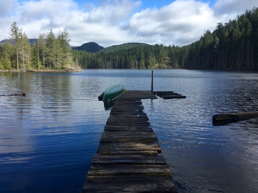
Deer Point Trail, Gladstone Provincial Park
Duration: 2 days
Distance: 12 to 22 km round trip
Best Months: April to October
Difficulty: Moderate
Elevation Gain: 150 m
Fees and Reservations: Camping fees charged. All campsites are first-come, first-served.
The low elevation Deer Point Trail along Christina Lake in Gladstone Provincial Park near Grand Forks make a good spring backpacking destination. You can camp at Trapper Creek partway along the trail or at Troy Creek at the north end of the lake. Both campsites are open to boaters as well.
More Info: Get info on the trail and camping fees from Gladstone Provincial Park.
Flatiron Trails, Wells Gray Provincial Park
Duration: 2 to 3 days
Distance: 10 to 46 km round trip or 25 km traverse
Best Months: April to October
Difficulty: Moderate
Elevation Gain: 250 to 500 m
Fees and Reservations: Camping fees charged. All campsites are first-come, first-served.
Note: In 2023, a few key bridges washed out and with high water, it is currently not possible to cross the creeks and reach any of the campsites.
Even though it is near the entrance to the park, Flatiron area of Wells Gray Provincial Park is a bit under-the-radar. A network of trails follows creeks to the banks of the Clearwater River and there are three backcountry campgrounds. You can access the area from three different trailheads, making loop trips or a traverse possible.
More Info: Get info on the trails from Exploring Wells Gray Park by Roland Neave. For camping fees see Wells Gray Provincial Park.
Get My Books
Backpacking in Southwestern British Columbia and Backpacking on Vancouver Island
Discover BC’s best backpacking trips
- 40 backpacking trips within a few hours of Vancouver
- 35 backpacking trips and day hikes on Vancouver Island
- Info about permits, reservations, and campground facilities
- Detailed maps and photos
Spring Backpacking Trips in Washington


Since it is a short trip across the border, it’s worth mentioning a few spring backpacking locations in Washington State.
Olympic Coast: The wilderness coast in Olympic National Park is accessible year-round. With several access points, lots of different trips are possible. As a bonus, it’s easier to get permits in the spring. For trip ideas, see my guides to Shi Shi Beach, Ozette Loop, and Toleak Point.
Enchanted Valley: Follow the East Fork Quinault River Trail into the Enchanted Valley in the rainforest of Olympic National Park.
East Bank Trail, Ross Lake: This trail in North Cascades National Park follows the shoreline of Ross Lake. See my East Bank Trail trip report.
Chelan Lakeshore Trail: This 17-mile-long trail in Okanogan-Wenatchee National Forest begins and ends with a ferry on Lake Chelan. The trail finishes at the boat-access-only village of Stehekin in North Cascades National Park.
So that gives you 25 different spring backpacking trips in British Columbia to choose from! Which one would you choose? I’ve hiked most of these trails (some of them several times) so feel free to ask me more about them in the comments.
READ NEXT:
- 30 Best Backpacking Trips in BC
- 24 Easy Backpacking Trips In BC For Beginners
- How to Go Backpacking in BC Without Reservations
- BC Backpacking Reservation Dates You Need to Know
- How to Make Backcountry Camping Reservations in BC
- Backpacking Checklist: Gear You Need To Go Backpacking


- Best Sun Hoodies for Hiking - June 3, 2026
- Lower Stein Valley Trail Hiking and Backpacking Guide - May 27, 2026
- The Best Things to Do in Vernon, BC - May 21, 2026
Bill Kinkaid
Saturday 11th of June 2016
The Skagit Valley from Sumallo Grove is also good in May, though maybe not April. But it's also known for lots of deadfall in spring and the trail is subject to flooding.
Mat
Tuesday 10th of May 2016
Yup, spring in the Stein is tick time. Pulled 9 ticks off me one day, no less than one a day. Dozens on my pack, in my dry bag of food. Unreal.
Taryn Eyton
Wednesday 11th of May 2016
Wow, that sounds like a lot of ticks. I've only ever encountered one or two, but that would be on Easter weekend. Just curious when your experience was? I'm guessing a bit later after it warmed up.
Andy
Thursday 3rd of March 2016
Okanagan Mountain Park is another early-season backpack option - we did it over the Victoria-Day weekend a few years back. Lots of wildflowers in May, especially in the burned areas, although it's a bit of a tick-fest as well, which is a bit of a downer. We did have to extricate one tick... yuck.
It could have been the heat, it could have been the rougher-than-expected trail, or it could have been the fact we had to be on guard about ticks the whole time, but it was a really tiring trip. Good thing there was a winery or fifty to stop at for refreshment afterwards!