
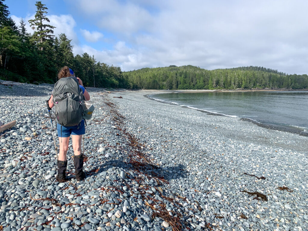
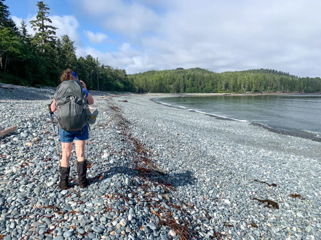
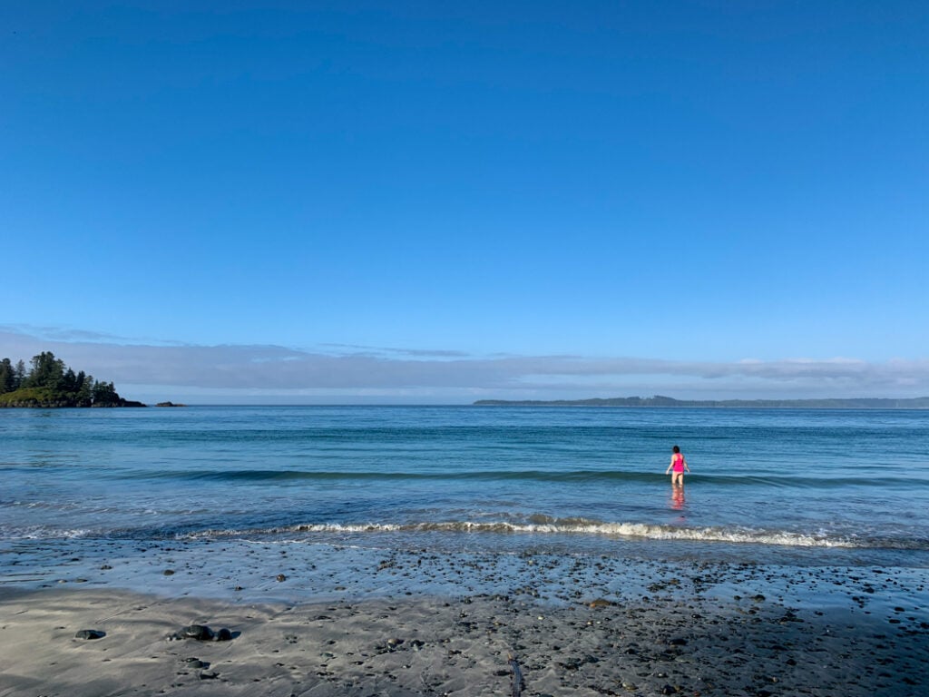
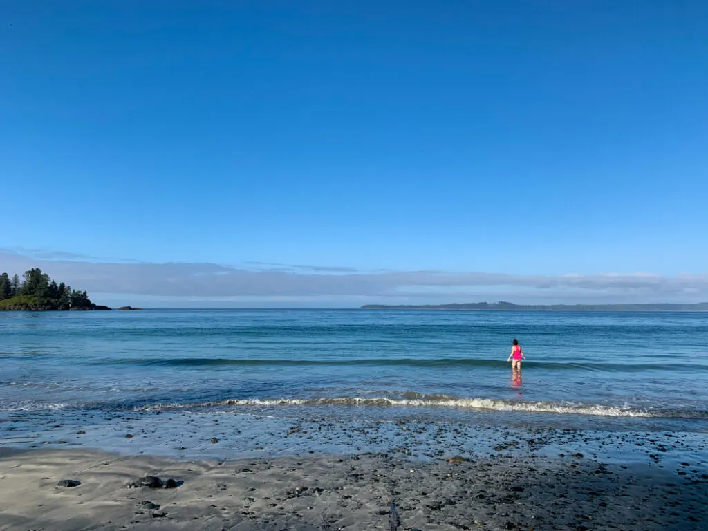
The North Coast Trail is a challenging 43km multi-day backpacking trip along the northern tip of Vancouver Island in British Columbia. I hiked the trail twice (to research my book, Backpacking on Vancouver Island).
I’ve put together a section-by-section overview of the North Coast Trail to give you a taste of the trail and help you get prepped for your trip. It’s got info on distances, difficult, hiking times, and things you won’t want to miss for each section. There are also loads of photos! I also have step-by-step North Coast Trail itineraries for the standard 6-day trip, plus lots more shorter and longer itinerary options.
Use this North Coast Trail itinerary and section-by-section overview to help you plan your trip. It includes:
- details on what each section is like including distances, time to complete, and must-sees
- info on each campsite and trailhead
- itinerary for a standard 6-day trip plus seven more itinerary options
WANT MORE NORTH COAST TRAIL INFO? Check out these posts:
- North Coast Trail Basics
- North Coast Trail Packing List: Everything You Need to Bring
- Cape Scott Trail Guide – add a side trip to your North Coast Trail trip
Hey there: Some of the links in this post are affiliate links, which means I earn a small commission at no cost to you. Thanks for your support. -Taryn
Key Distances on the North Coast Trail
A Quick Note: I’ve chosen to layout this guide from east to west because most hikers travel in the trail in that direction. As anyone who has hiked the trail with GPS can tell you, the distances that BC Parks gives for each section can be much longer than hikers will experience. So for each North Coast Trail section below, I’ve given the “official distance”. You may find that you travel much further than the official distance!
| KM | Location |
|---|---|
| 0 | Shushartie Bay Trailhead and Camp |
| 8.1 | Skinner Creek Camp |
| 11 | Nahwitti River Camp |
| 14.5 | Tripod Rock Tidal Obstacle |
| 16 | Cape Sutil Camp |
| 23.8 | Irony Creek (Shuttleworth Bight) Camp |
| 35.6 | Laura Creek Camp |
| 43.1 | Nissen Bight Camp |
| 43.2 | Fisherman Bay |
| 44.9 | Nissen Bight/Cape Scott Trail junction |
| 48.7 | Fisherman River Camp |
| 55 | Eric Lake Camp |
| 58 | Cape Scott Trailhead parking lot |
Join the Cape Scott Park Facebook group
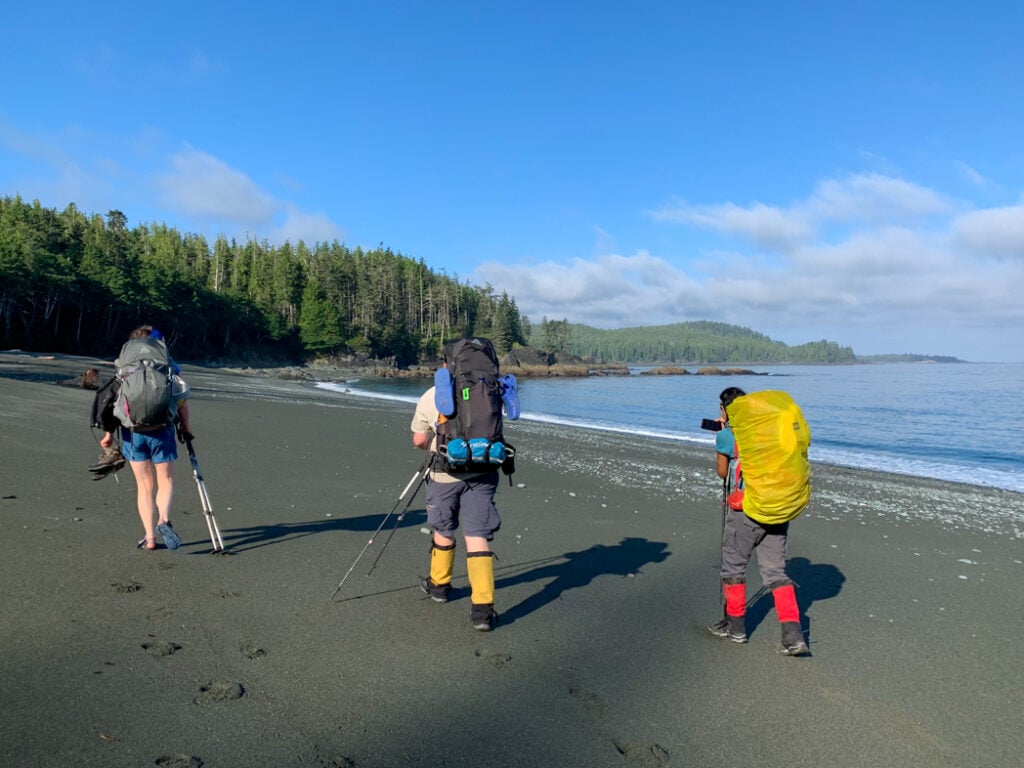
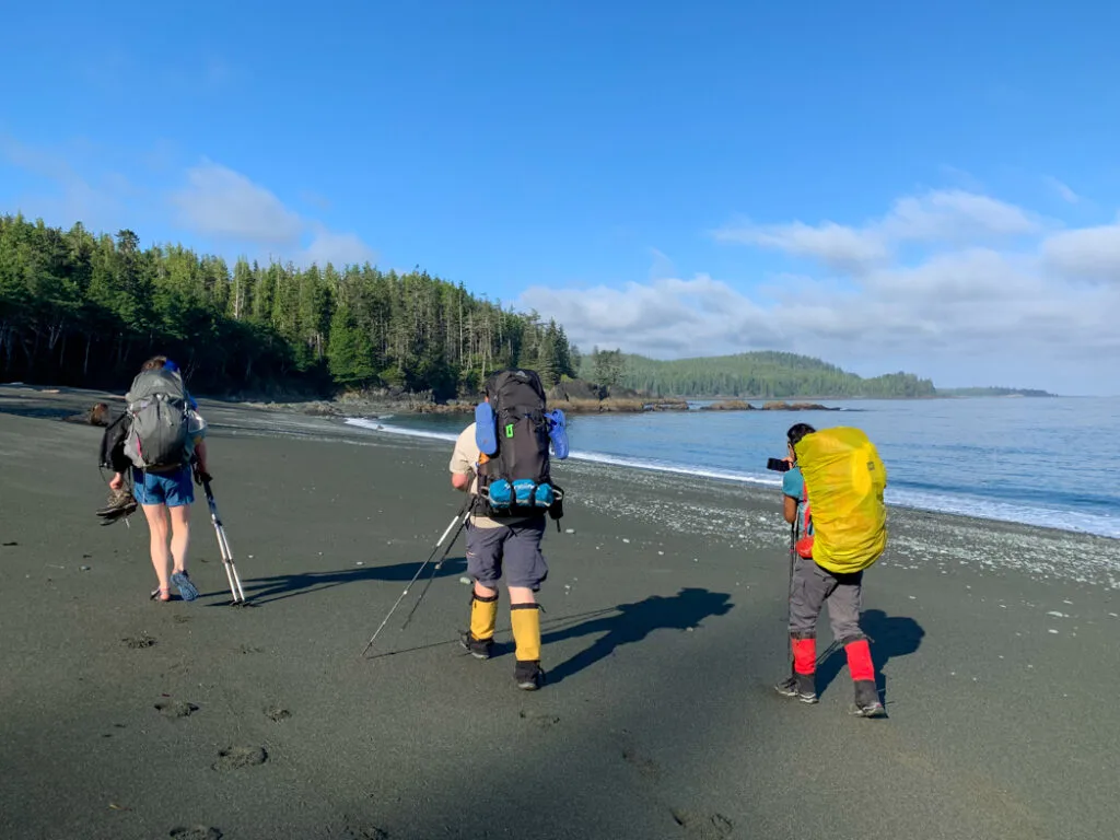
Shushartie Bay Trailhead and Camp
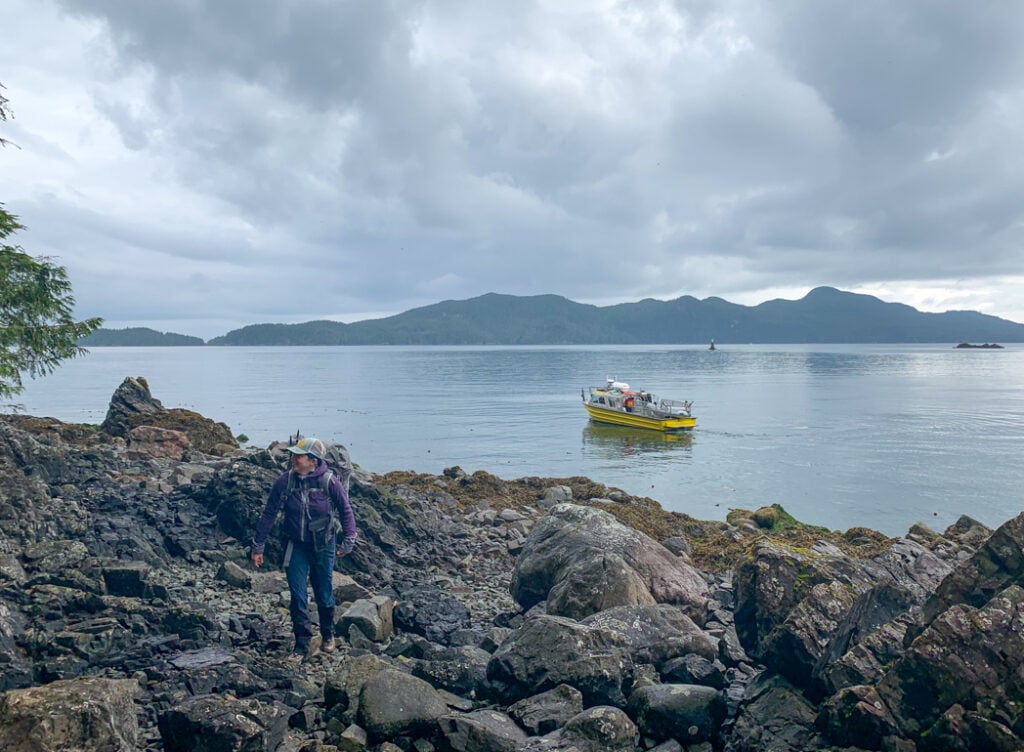
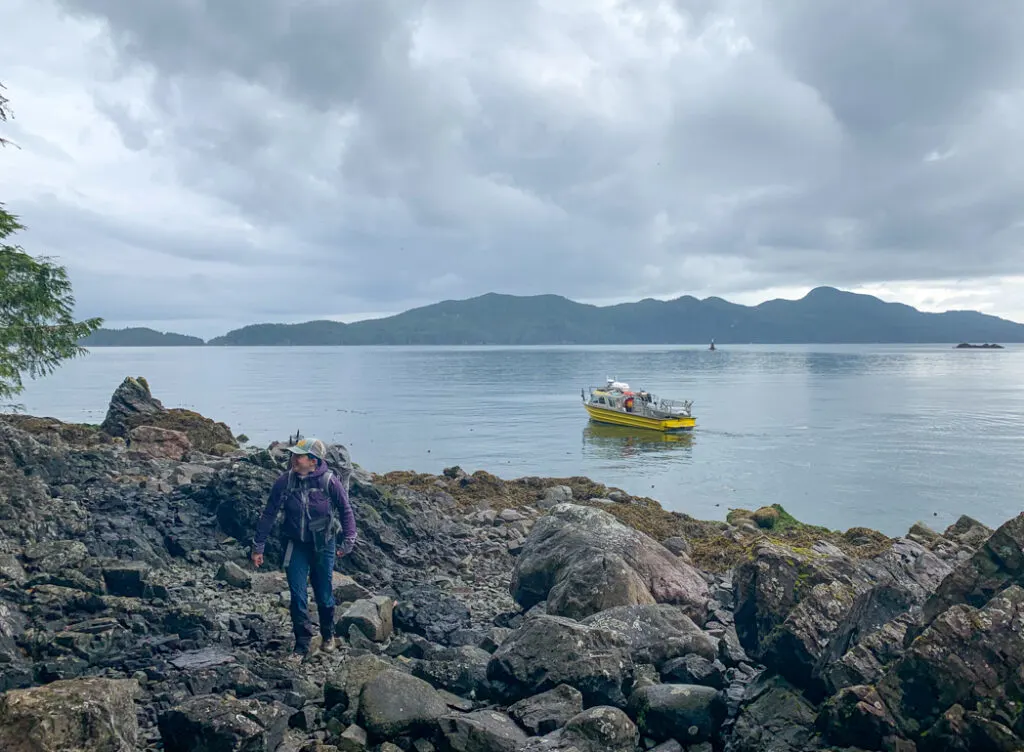
The Shushartie Bay Trailhead is on the west side of Shushartie Bay. The only way to reach the trailhead is by boat. There is no dock. The water taxi operator will nose the boat against a large rock and hikers will clamber directly onto the shore. The rocks are covered in barnacles and slippery seaweed, so it’s an exciting start to the trail. See the North Coast Trail Water Taxi section of my North Coast Trail Guide for details.
The small Shushartie Bay Camp is located two minutes up the trail from the trailhead. It is seldom used but is helpful in an emergency. It has three tent pads, a pit toilet, and a food cache. The campsite is set into a steep slope in dark forest.
There is no official water source here, but I’ve heard that you can get water by heading northwest along the coast at low tide for 15 minutes to the second of two beaches. Since water is so hard to access here, it’s best to arrive on the water taxi with full bottles.
Shushartie Bay to Skinner Creek
Official Distance: 8.1 km
Time: 6-7 hours
Highlights: Upland bog with lots of boardwalk and mud
Actual Distance: 9.6 km
Difficulty: Challenging
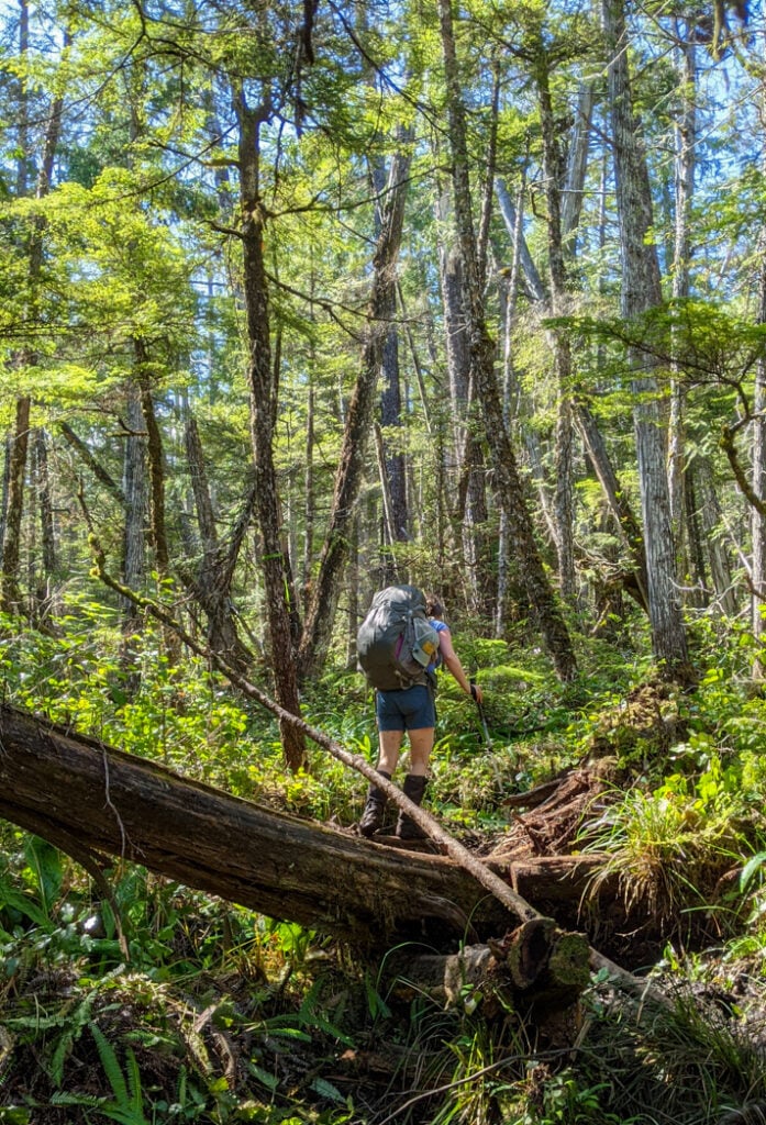
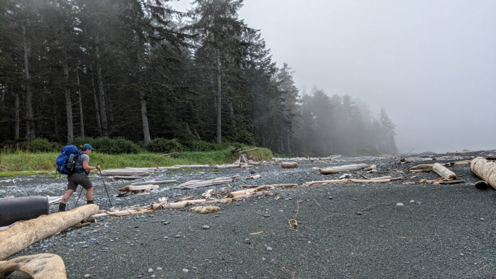
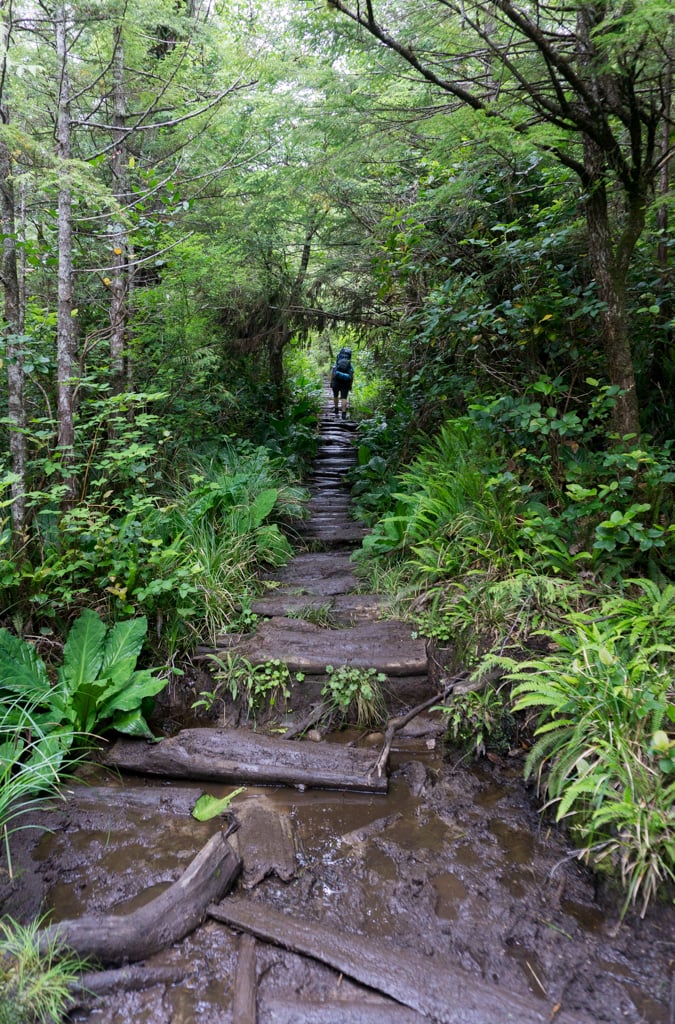
The first section of trail is entirely inland – you won’t see the ocean again until you emerge at Skinner Creek. Travel through this section can be very slow due to a steep initial ascent and some very technical trail. Give yourself lots of time. While you will be walking through mud bog, there are no good creeks for water until Skinner Creek.
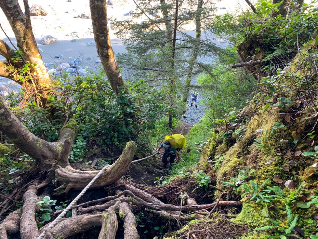
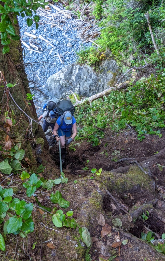
From the trailhead sign, you’ll climb steeply uphill past the Shushartie Bay Camp, using a few fixed rope handlines to help you. The first kilometre is the steepest, which will be further exacerbated by full backpacks.

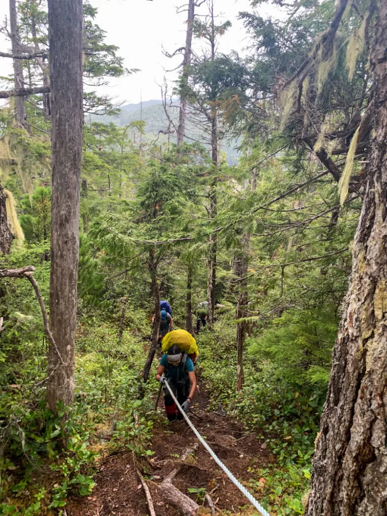
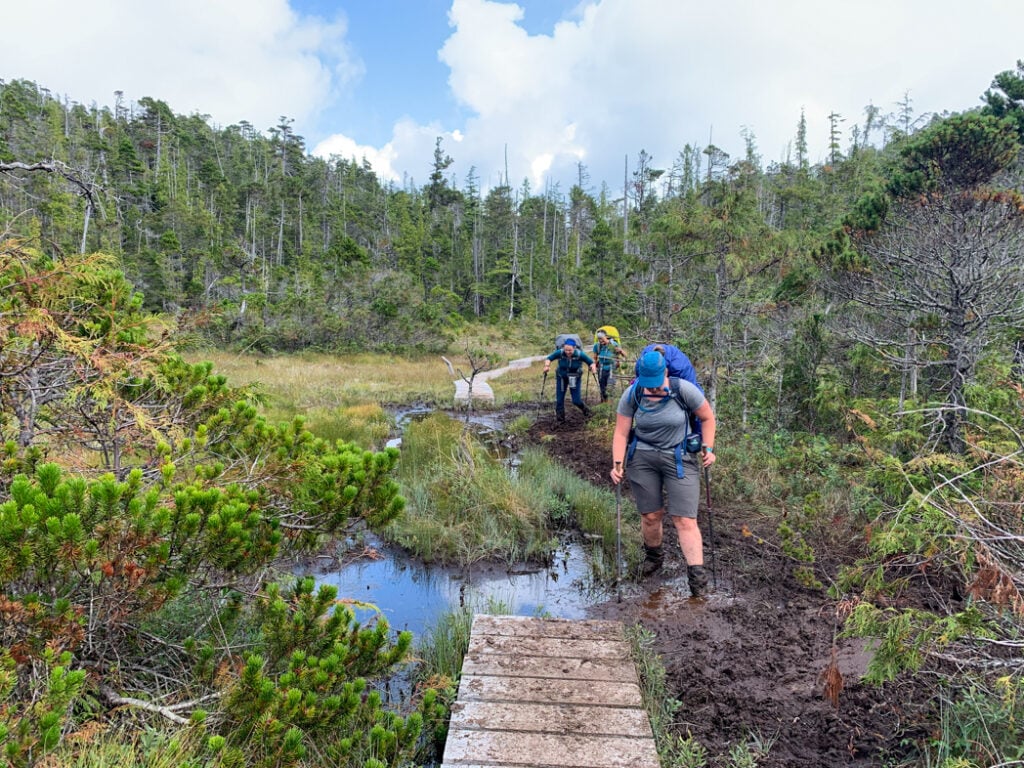
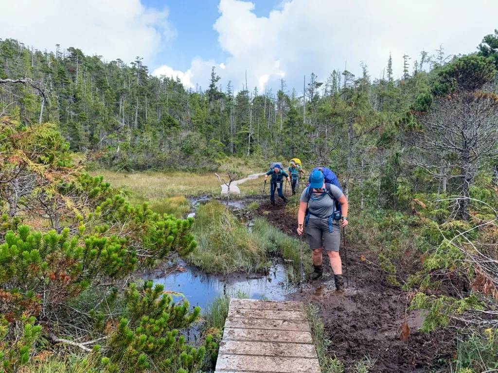
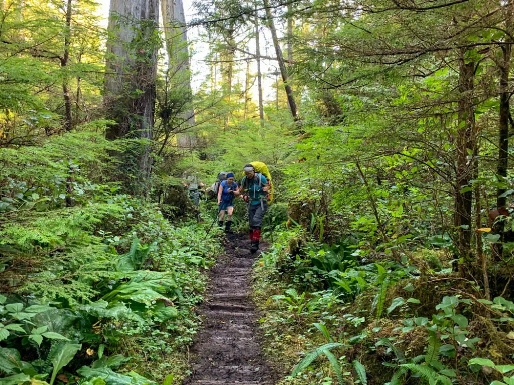
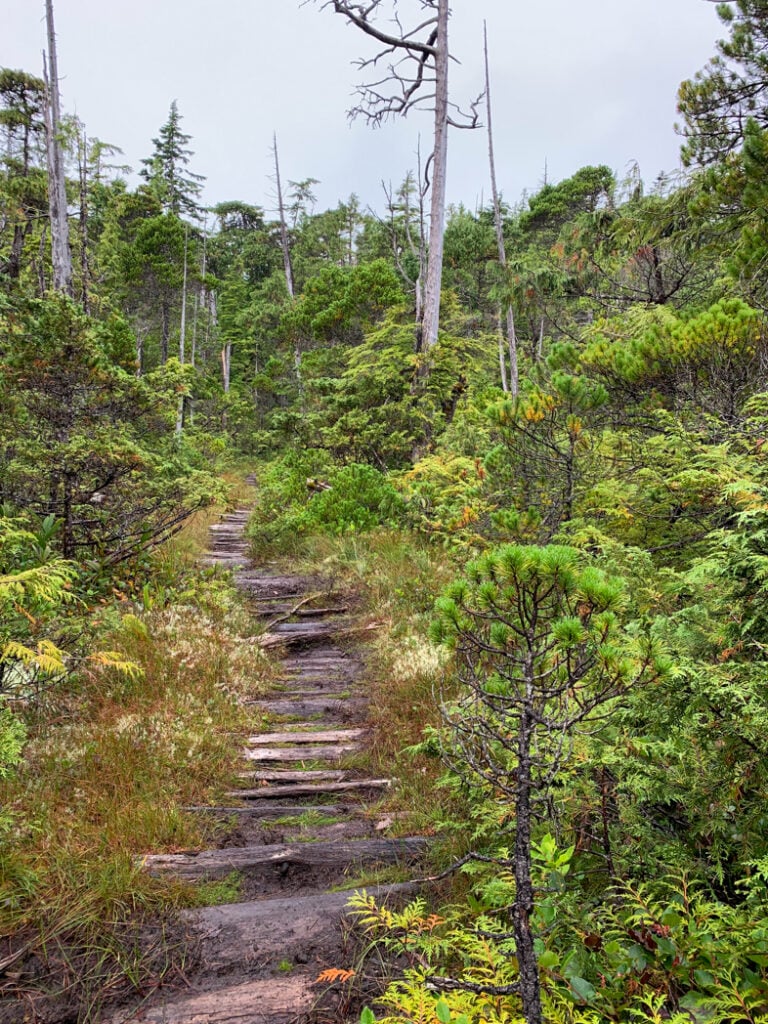
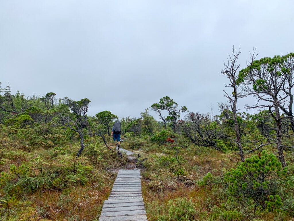
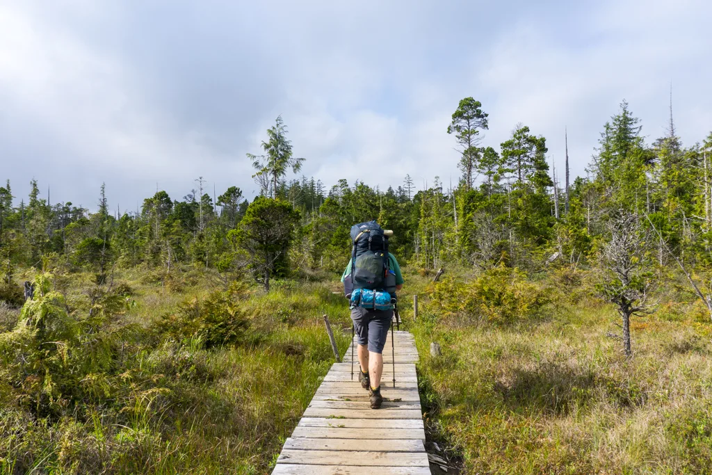
The grade eases after about one kilometre as you begin a more gentle ascent. You have reached the upland bog portion of the trail with open grassy meadows, stunted trees, and lots of standing, murky water. You can look forward to fast travel on many sections of weathered gray boardwalk.
Unfortunately, travel is much slower where there is no boardwalk as wet ground creates huge mud pits, some of which might just be bottomless. Use trekking poles to probe below the surface to find tree roots, discarded planks, and rocks to stand on. If possible, avoid braiding the trail to prevent further damage to this unique ecosystem.

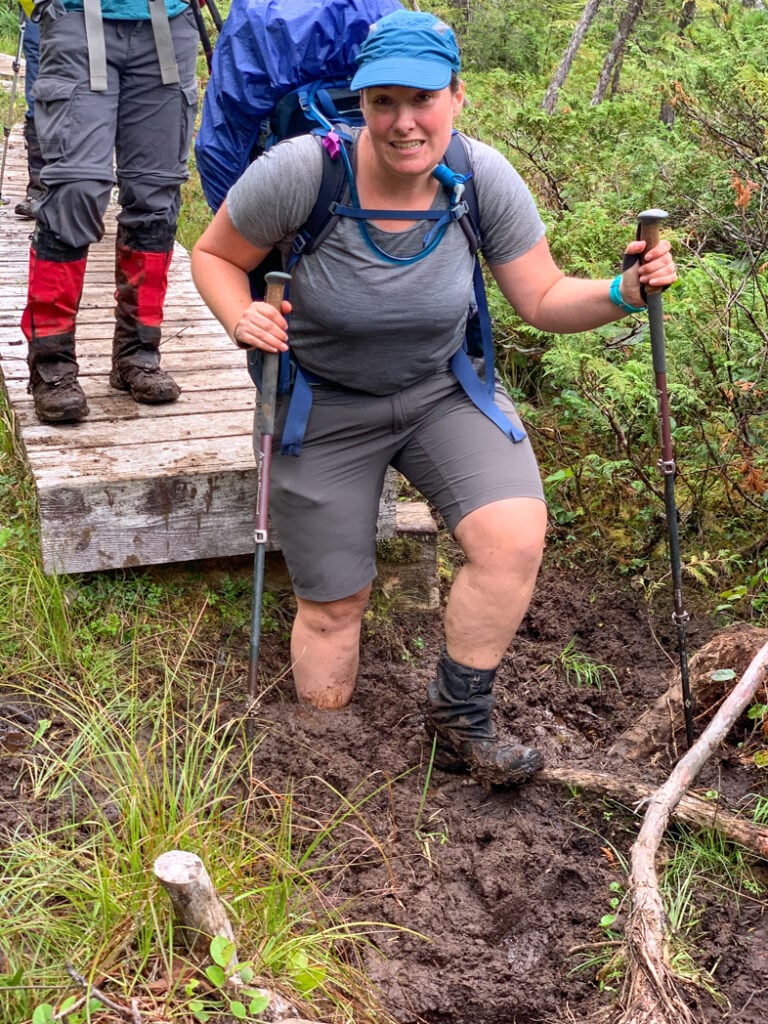

Reach the trail’s highpoint at a lofty 245 metres about 2.5km from the trailhead. The trail continues to alternate between boardwalks and deep mud as it heads slowly downhill towards the coast. Watch for a sign on your right near the 4 km mark announcing the halfway point. Past here, the trail gets slightly easier, even though the mud is still relentless.
About 8km from the trailhead you’ll walk the last boardwalk and start your descent into coastal forest. As you begin to hear the ocean, head downhill on a staircase to Skinner Creek. Follow the creekbed to the beach, ducking under fallen logs along the way. (Look for flagging to choose the best route.)
Skinner Creek Camp
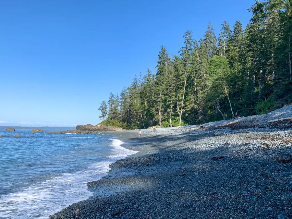
The Skinner Creek Camp is a welcome sight after the struggle through the inland section. It’s a wide sand and pebble beach with views of Hope Island across Goletas Channel. At night, look for the blinking navigation light on Godkin Point.

There is a small clearing in the forest on the way to the outhouse that will hold one tent. Otherwise, the best camping is on the beach. The sandbars on either side of the creek make great campsites. You can also camp above the high tide line, although there are not as many flat spots.
The food cache and outhouse are located down a short trail on the west side of the creek. Collect drinking water from the creek, but be sure to go upstream to avoid contamination from the many seagulls.
Skinner Creek to Nahwitti River
Official Distance: 2.9 km
Time: 1-1.5 hours
Highlights: Tidal obstacle, beach hiking
Actual Distance: 2.5 km
Difficulty: Moderate
Leaving Skinner Creek you can walk the first kilometre on the beach if the tide is in your favour. At high tides (over about 2.8 metres) the beach is inaccessible as a tidal obstacle and you’ll have to take a rough forest route that heads uphill behind the outhouse. Apparently, the forest trail passes the remains of an old settler cabin, but I’ve never taken that route so I haven’t visited it.
At the end of Skinner Beach look for fishing buoys marking the steep, rope-assisted climb into the forest. The next section rambles through the forest and incorporates a few sections of old settler’s corduroy road, made from stacking logs parallel to each other. Thanks to the long-ago labours of the settlers, this section isn’t too muddy.


The trail emerges from the forest onto a gravel beach. Walk down the beach for about half a kilometre to reach the Nahwitti River Camp, just east of the river mouth. On my most recent trip, we were treated to the sight of humpback whales and sea otters feeding in the kelp beds just offshore. The river estuary is also a common place to see bears and seabirds.
Nahwitti River Camp
If you caught an early water taxi and are a strong hiker, Nahwitti River Camp is a good option for your first night. It tends to be much quieter than Skinner Creek so you might have it to yourself. There are four tent pads in the forest behind the beach along with an outhouse and food cache. You can also camp on the beach but it may be too sloped to be comfortable.
To find drinking water, follow the trail into the forest for a few minutes to the banks of the Nahwitti River. Try to get water at low tide to avoid saltwater. Do not collect water near the river mouth since it is too salty.
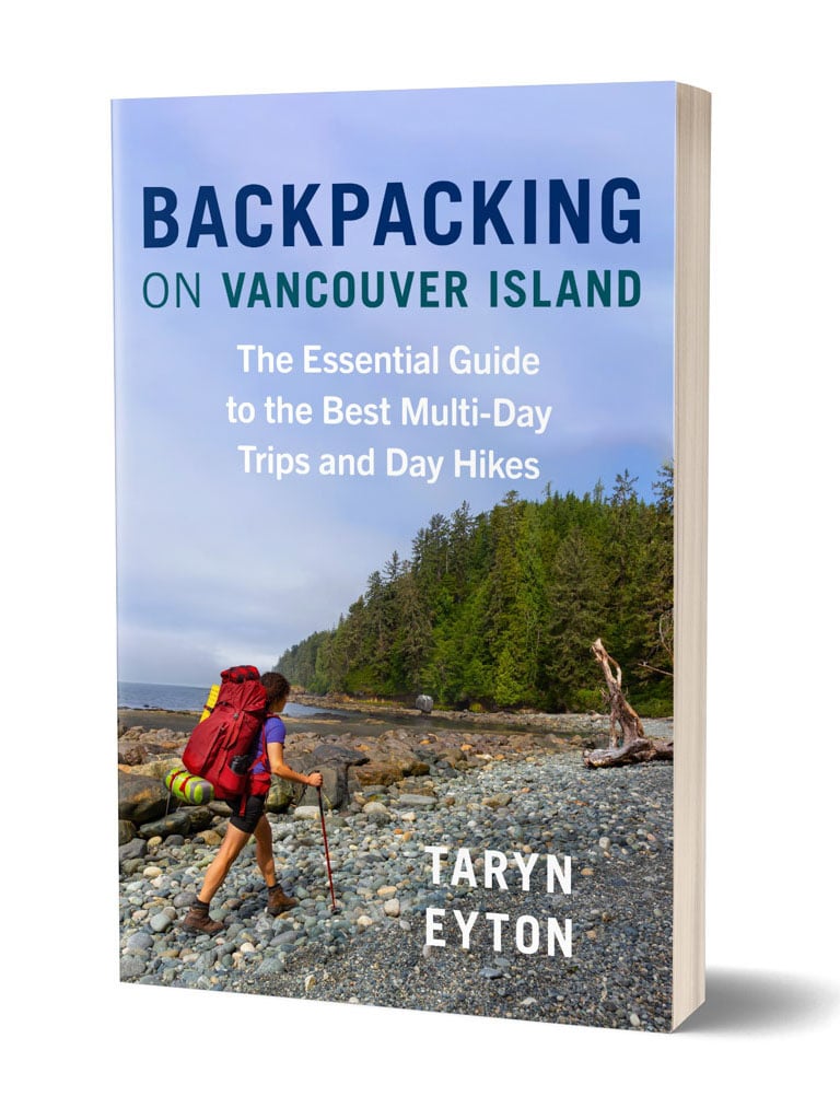
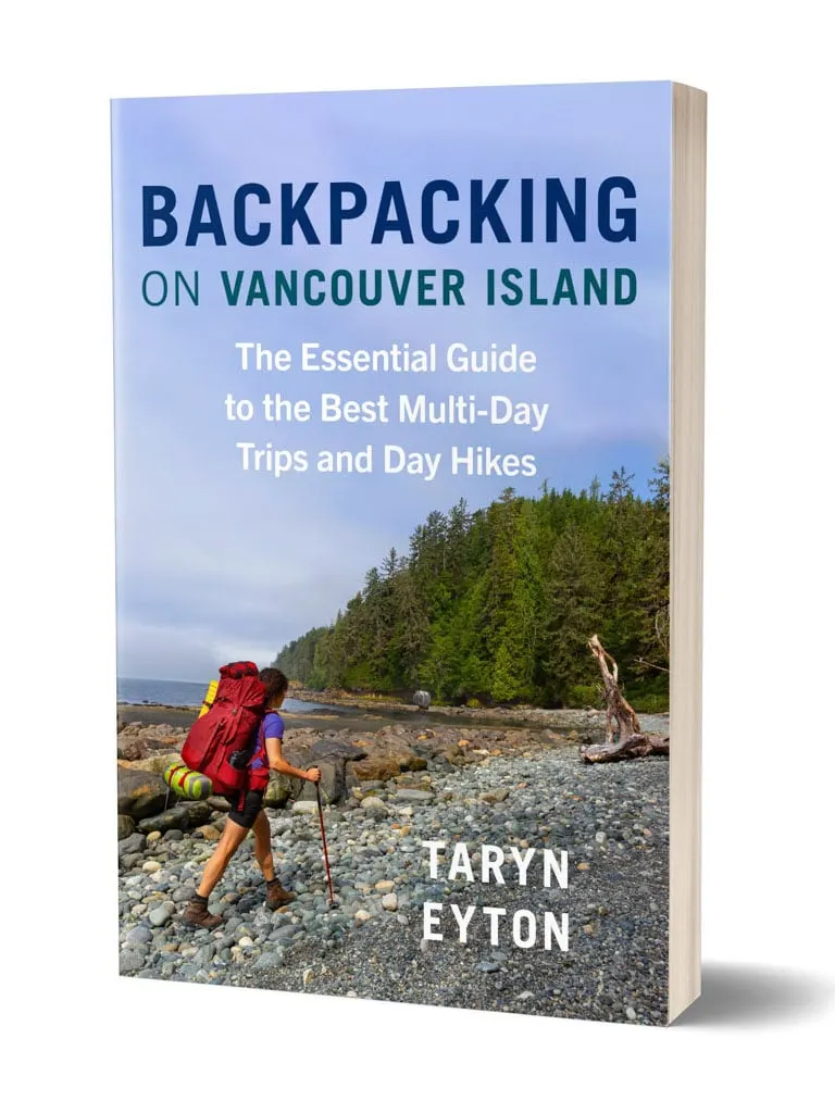
Get My Book…
Backpacking on Vancouver Island
Discover Vancouver Island’s best day hikes and overnight trips
- 25 backpacking trips and 10 day hikes throughout Vancouver Island
- Info about permits, reservations and campground facilities
- Detailed maps and photos
- Advice for extending your trip
- Points of cultural and natural history
Nahwitti River to Cape Sutil
Official Distance: 5 km
Time: 3-4 hours
Highlights: Cable car, tidal obstacle, steep headlands
Actual Distance: 6.5 km
Difficulty: Very Challenging
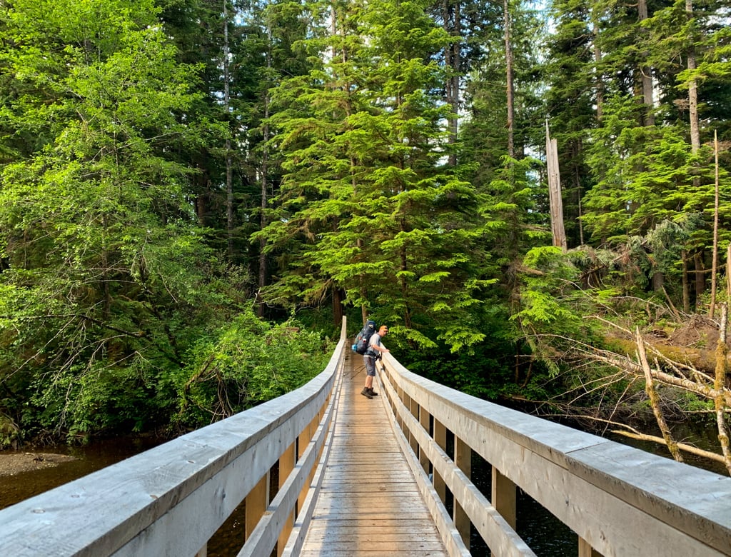
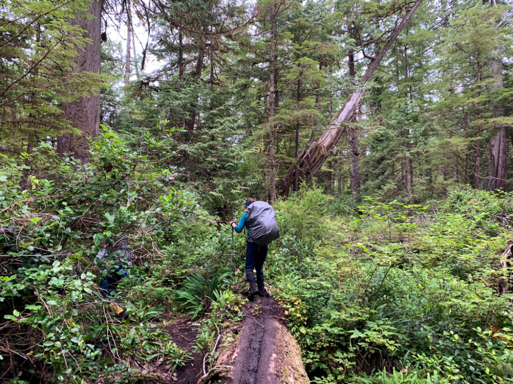
Leaving Nahwitti River Camp, the first kilometre is an easy walk through the forest inland along the east bank of the Nahwitti River. Cross the river using the cable car, the first of two on the route. After the cable car, the trail follows the west bank of the Nahwitti River for a few minutes before climbing back up into the forest. The next few kilometres take you up and over a 120m-high-hill.
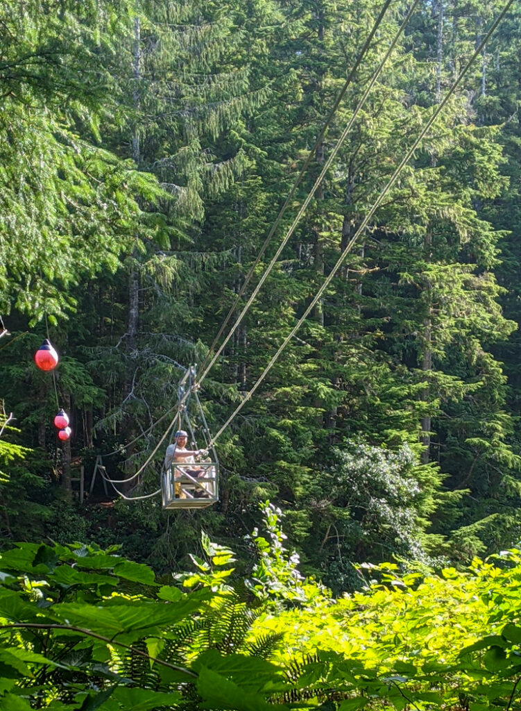
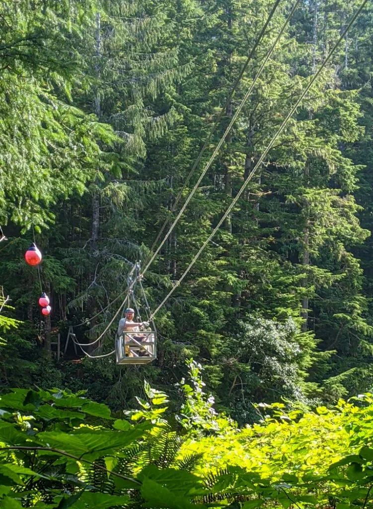

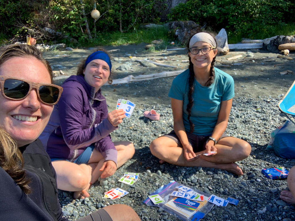
About 4km from Nahwitti River Camp you’ll start to hear the ocean again as you descend over 200 wooden stairs at Long Leg Hill and emerge onto pebbly Tripod Beach. The cliffs at the west side of the beach are impassable at tides above about 2.5 metres and there is no inland trail. Be sure to time your hike well or else you could be stuck waiting here for hours. Thankfully when we had to wait for the tides on my most recent trip it was a beautiful sunny day and we had a great time playing cards! (See my North Coast Trail Guide for info on tide tables for the North Coast Trail.)


If you do get stuck on the beach overnight there is room for one or two tents above the high tide mark and a creek in the centre of the beach for drinking water. There is no food cache here so be prepared to hang your food. There is also no outhouse so use Leave No Trace practices if you go to the bathroom.
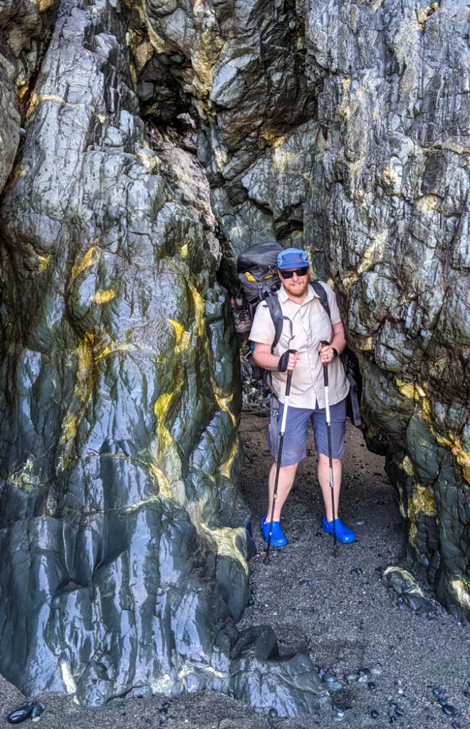
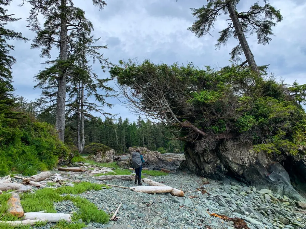
Once you are past the cliffs, take a minute to ogle at the unique three-legged basalt Tripod rock that gives the beach its name. The remainder of the hike to Cape Sutil is very challenging as you ascend steep headlands with fixed ropes, then plunge back down to pocket beaches before doing it all again. Take your time and be careful on the ropes and muddy slopes. A fall here could mean serious injury.
At low tides, you may be able to skirt around some of the headlands on the beach, but use caution as many of them have very slippery cobblestones.


After the final headland, you’ll break out onto a beautiful sandy beach. Walk a few hundred meters to the Cape Sutil Camp at the west end of the beach.
Cape Sutil Camp
The campsite at Cape Sutil is located at the west end of the sandy beach, which is great for swimming. Cape Sutil is the northernmost point on Vancouver Island, but unfortunately, you cannot visit it since it is inside the Nahwitti First Nations reserve and off-limits to visitors. Please be respectful of this indigenous site. See the Indigenous context section of my North Coast Trail guide or the excellent book, Cape Scott and the North Coast Trail by Maria I. Bremner for more information. You can follow a short trail over a headland to the next beach where the water taxi lands, but do not proceed further.
There are lots of places to camp along the beach above the high tide line, but the best tent spots are towards the west end of the beach. There is a pit toilet and bear cache a few minutes along the main trail leading west from the beach. There is also another bear cache behind the beach about 1/3 of the way down from the end. It’s marked with a small sign that can be easy to miss.

The water source at this beach is not always obvious. Look for buoys or flagging about halfway down the beach. Follow a short trail into the forest to access a small pool. In early season or after heavy rains, the creek may also flow directly onto the beach.
There is also a BC Parks yurt near the west end of the beach. The yurt used to open to the public in the winter, but that is no longer the case.
Cape Sutil to Irony Creek (Shuttleworth Bight)
Official Distance: 7.8 km
Time: 4-5 hours
Highlights: beach walking, steep headlands
Actual Distance: 8.4 km
Difficulty: Challenging
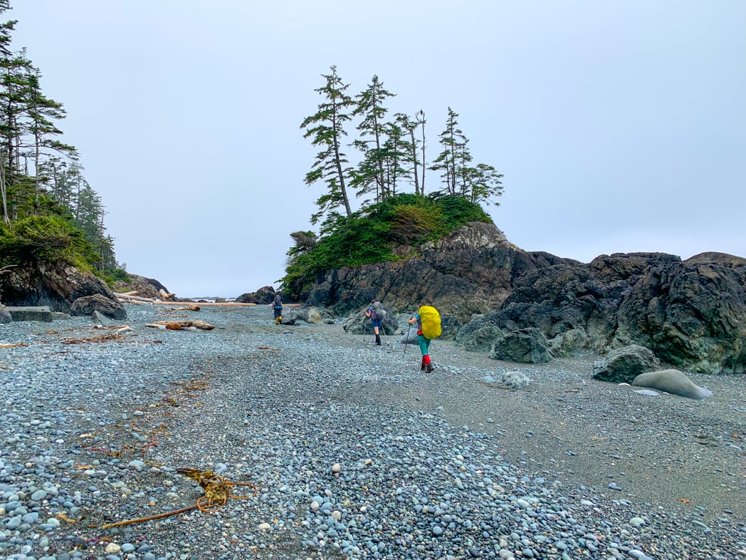
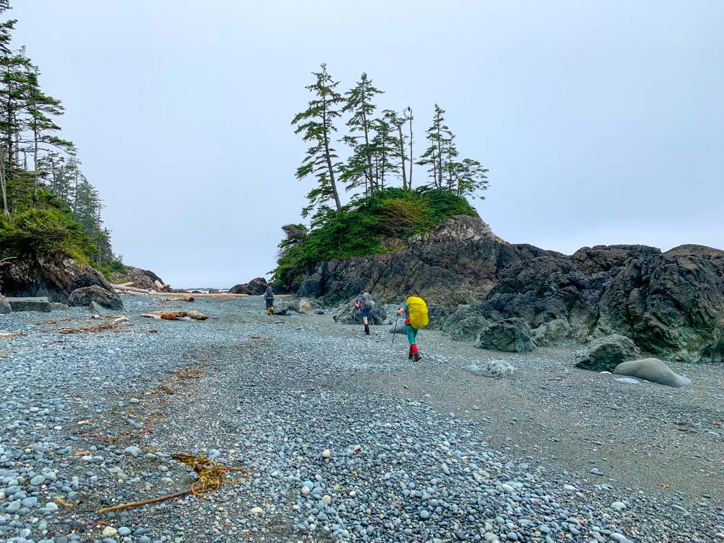
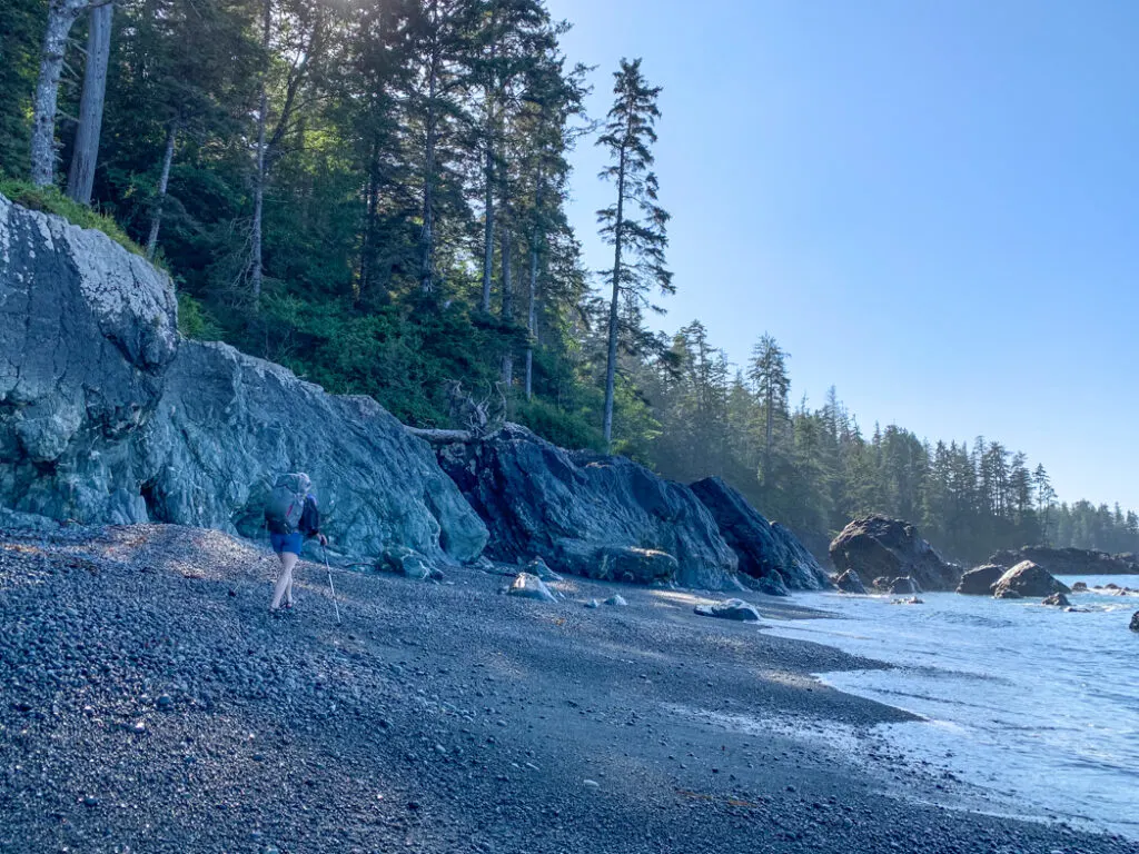
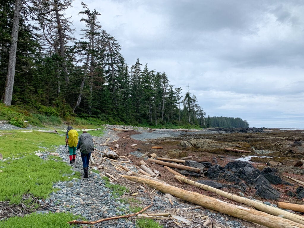
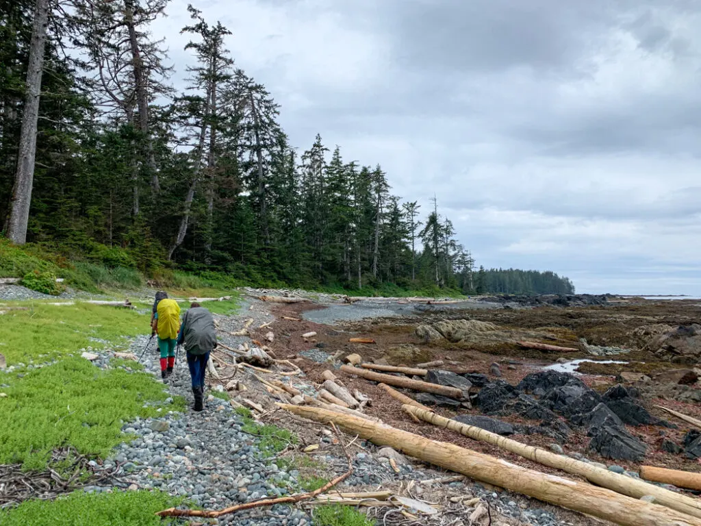
The route between Cape Sutil and Shuttleworth Bight is mostly on the beach, but there are also lots of short and difficult inland forest sections. The trail leaving Cape Sutil cuts across the neck of the cape for about half a kilometre before emerging on the first of many steep gravel beaches. Follow hanging buoys into the forest at the end of the beach to find the 100-metre-long trail to the next beach.
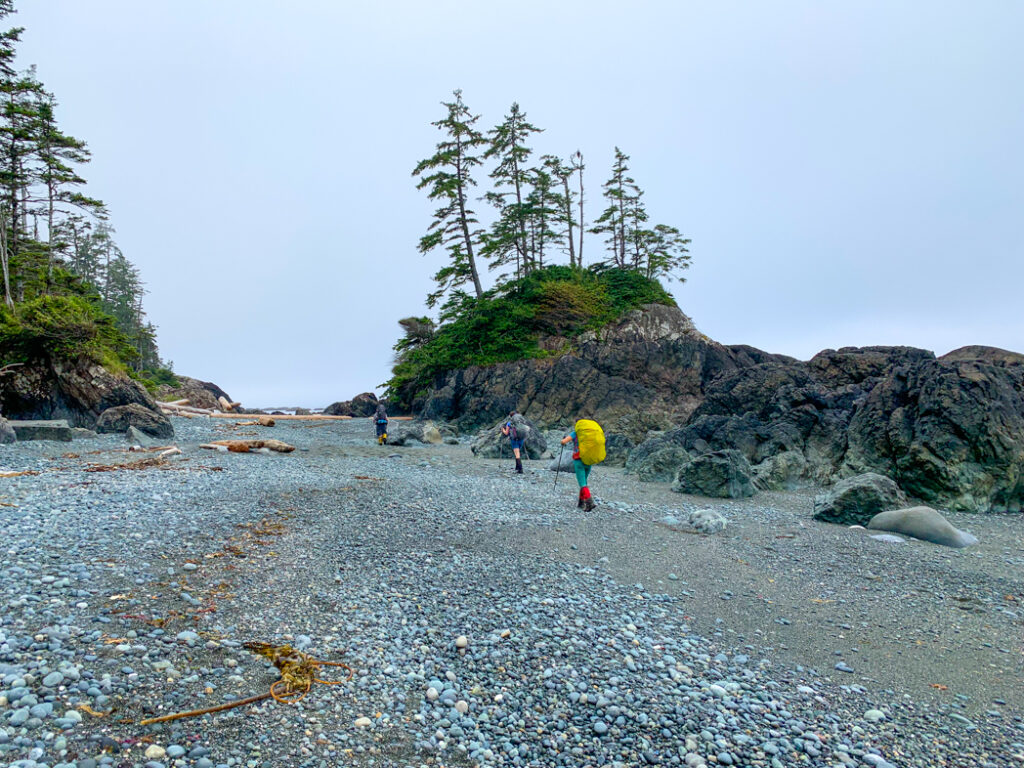
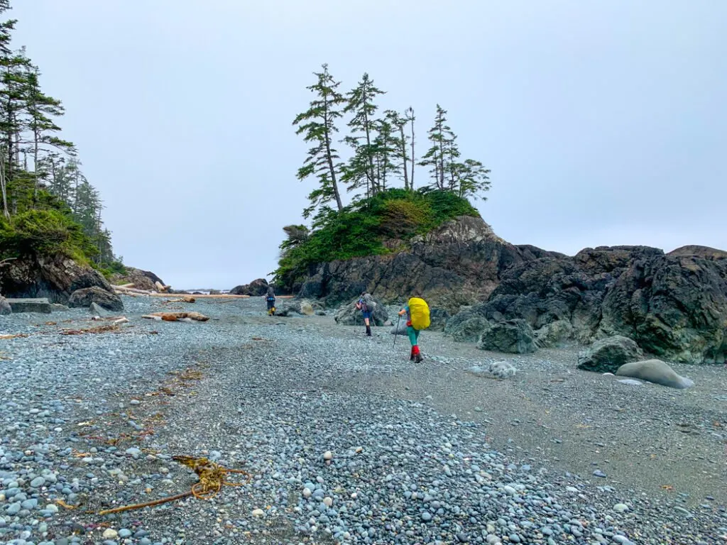

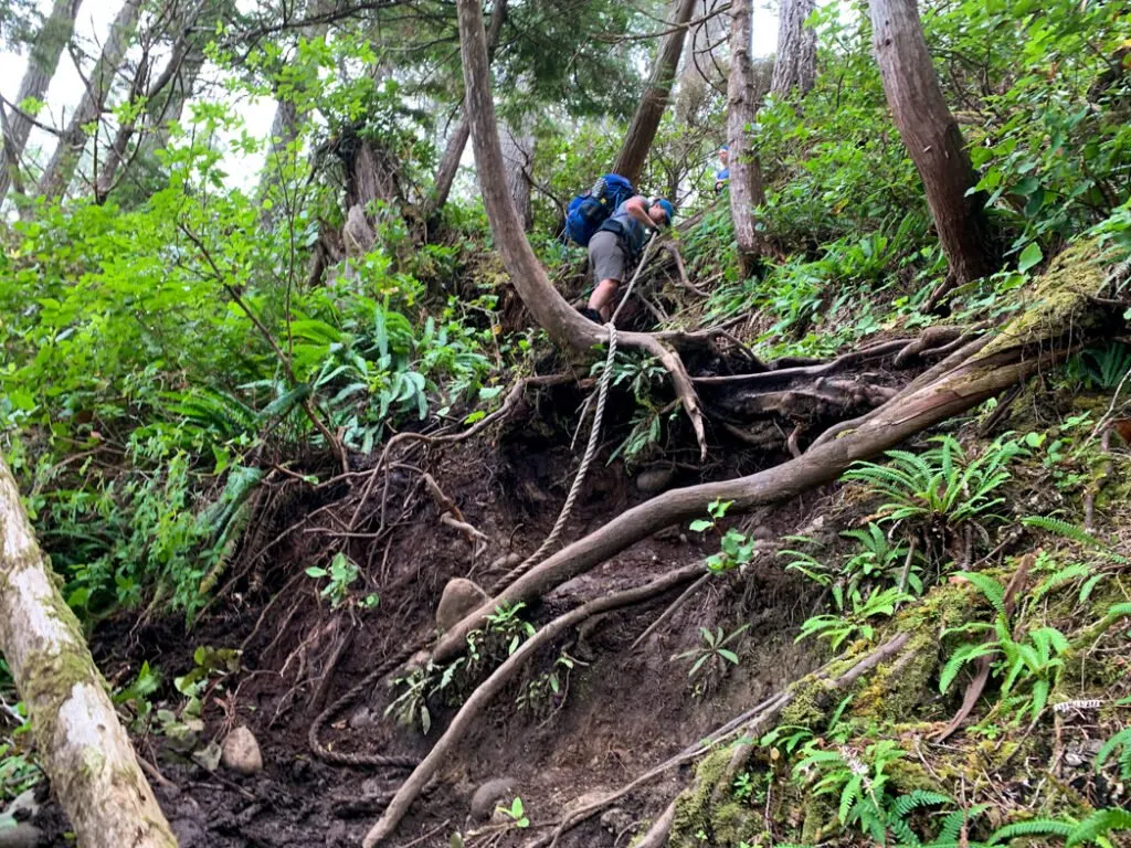
This cycle repeats a few more times: walk through a pocket cove, then through the forest. Some of the beach sections have inland trail alternatives you can use at high tide, but they tend to be quite overgrown. About 2km from Cape Sutil, make sure you take the last exit from the beach into the forest as the coast past here is impassable. All of the exits from the beach are steep, with ropes to help you up the slope.
Follow the trail up into the forest. You’ll be inland for about 700m as you navigate a steep climb and lots of mud. Next, you’ll pop out into a pocket cove, then head back into the forest for about 200m. After that, you have a kilometre-long stretch of beach. This stretch is like many you will encounter today: steeply pitched with lots of driftwood and seaweed above the storm tide line.


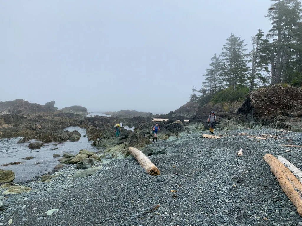
The beach ends with a few meters of forest walking to round a point about 3.5km from Cape Sutil. After that, follow buoys across several rocky headlands and through pocket coves for another few kilometres. The forest trails are often steep and challenging, and the beach walking is not easy, but the scenery is beautiful.
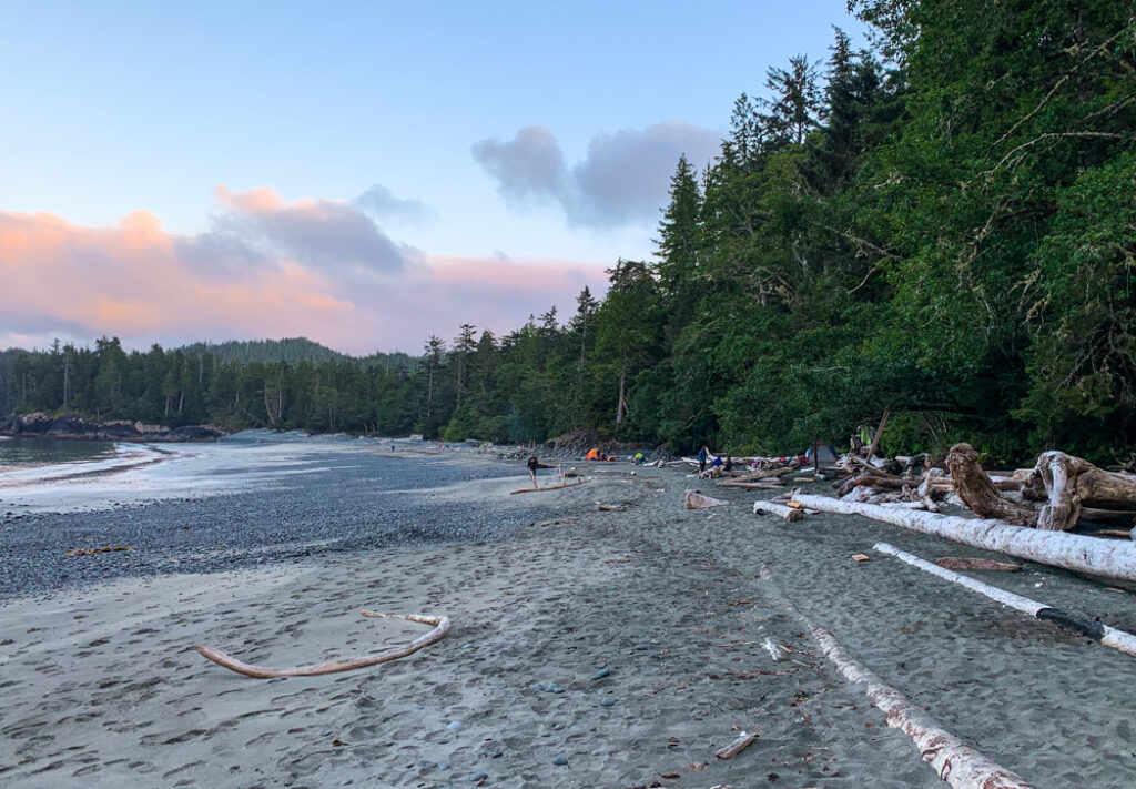
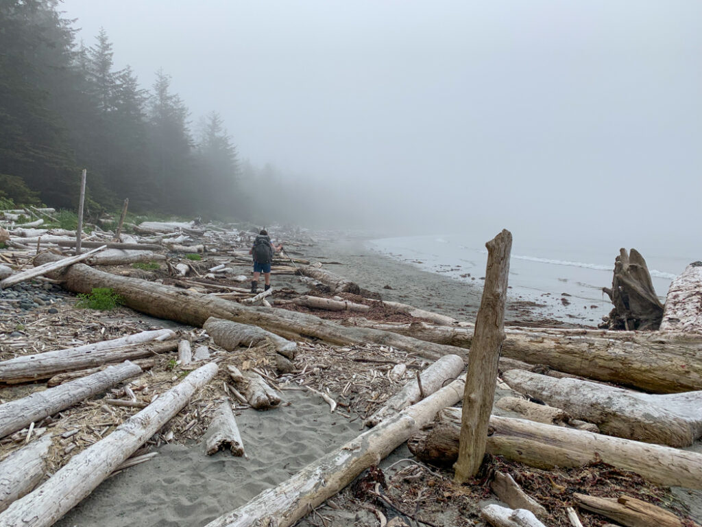
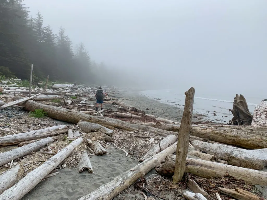
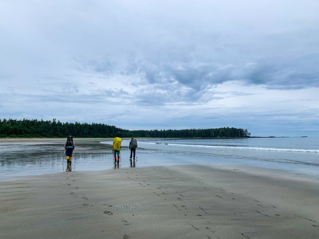
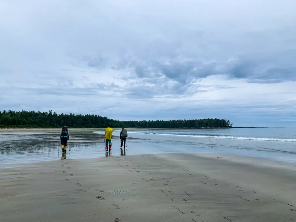
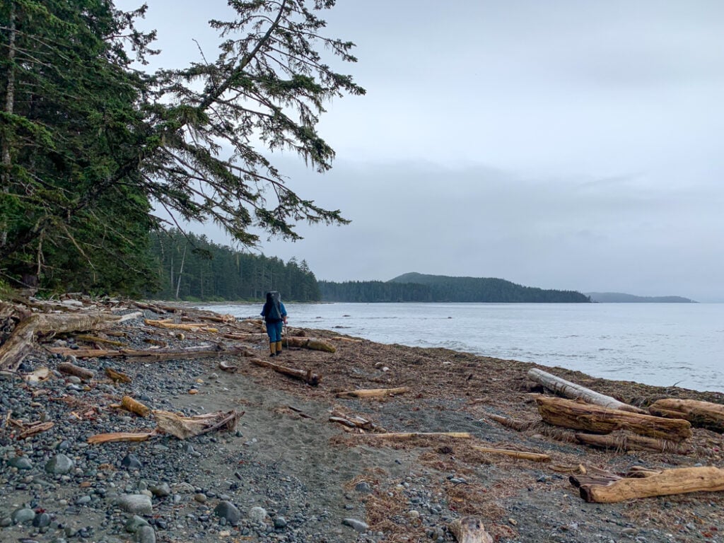
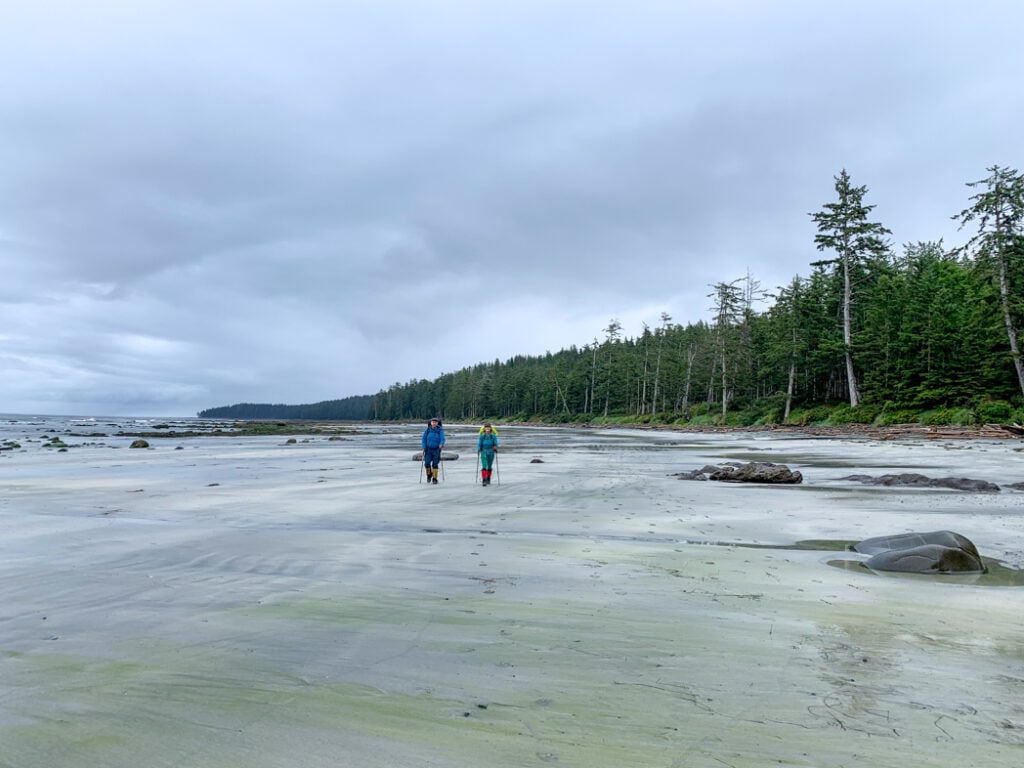
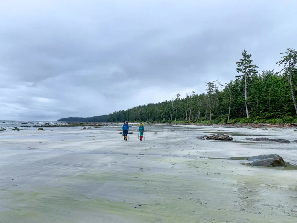
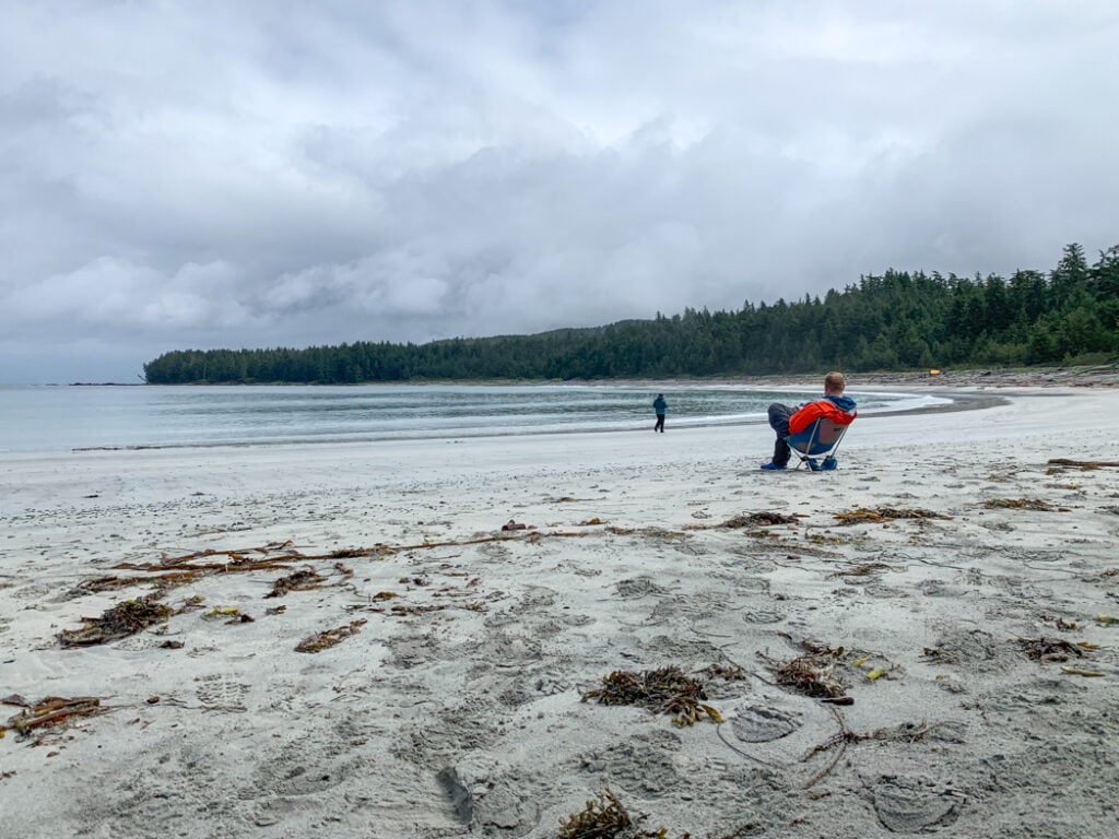
About 5.5km from Cape Sutil, you begin a long beach section. The remainder of your hike to Irony Creek on Shuttleworth Bight is on the beach, except for a few very short forest sections to get around rocky outcroppings. At around 7.5km you will round a point and enter Shuttleworth Bight. The eastern part of the bight has some small sandy coves, but push on to the broader expanse of sand on the east side and the excellent campsite at Irony Creek.

Join the Backpacking in BC Facebook Group
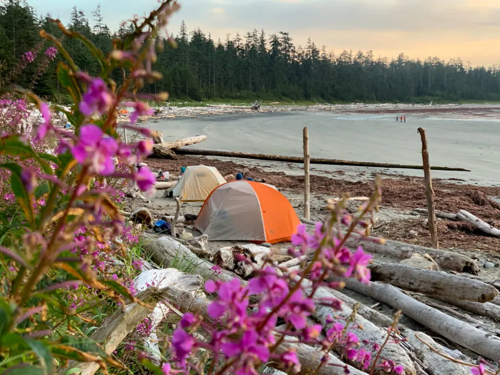
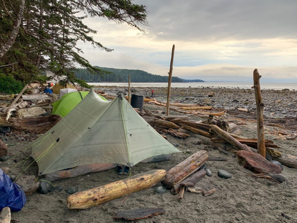
Irony Creek (Shuttleworth Bight) Camp
The Irony Creek Camp is the most beautiful campsite on the North Coast Trail. It’s set in the middle of sandy Shuttleworth Bight and makes a great place for a rest day if you choose to take one. The campsite is located on the west side of the creek, which provides great (if red-tinged) drinking water.
There are four tent pads, a toilet, and a bear cache in the forest just west of the creek. You’ll have to scramble over a big pile of driftwood to access them. There are also great beach campsites in the sand amongst the driftwood to the west.

Irony Creek (Shuttleworth Bight) to Laura Creek
Official Distance: 11.8 km
Time: 5-6 hours
Highlights: beach walking, cable car, Wolftrack Beach
Actual Distance: 12.9 km
Difficulty: Challenging
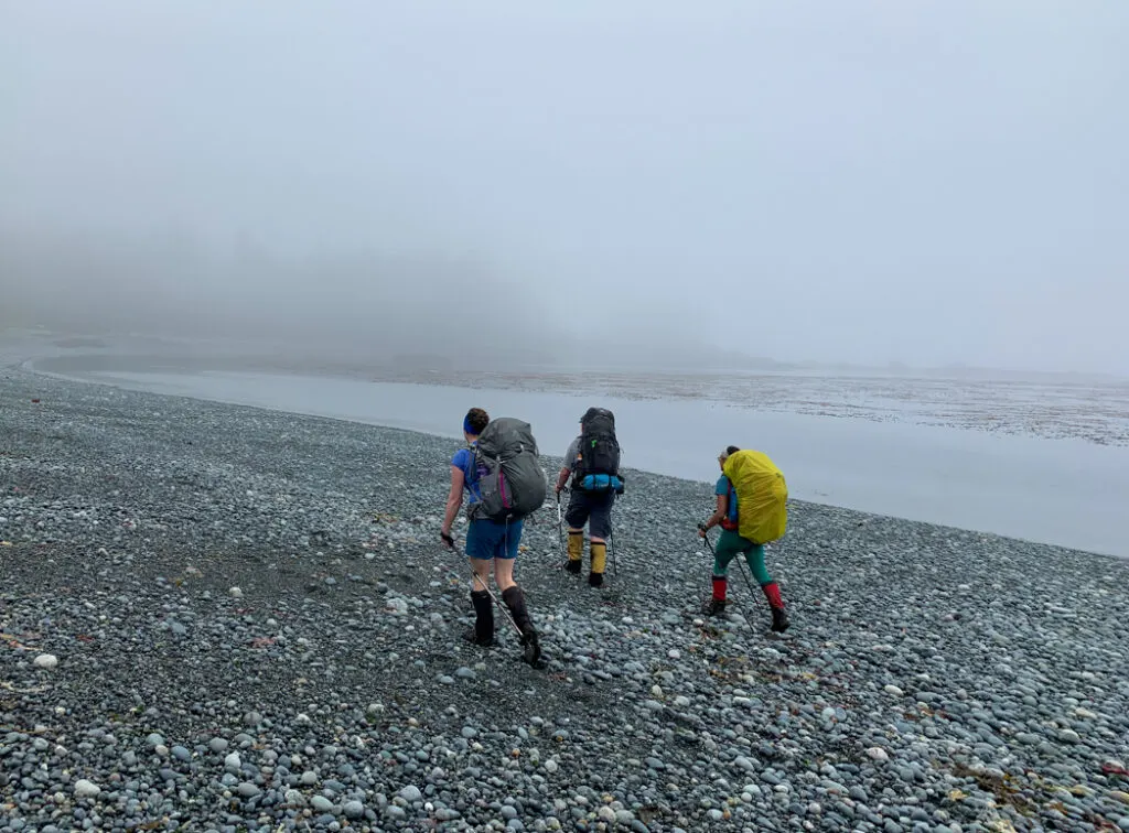
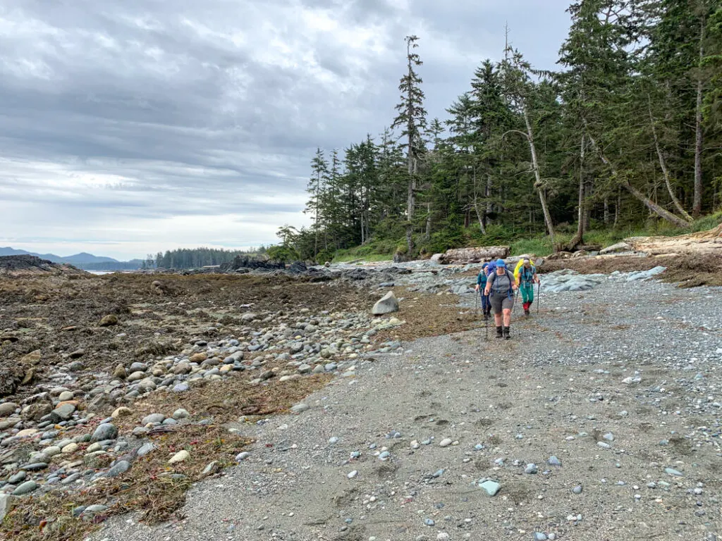
Thankfully, the section from Irony Creek to Laura Creek is mostly on the beach. However, most of the beaches have fairly tricky footing with lots of cobblestones, driftwood, seaweed, and steep angles. For the easiest walking, look for a faint boot-beaten path at the high tide line.
Use caution in this section as it sees a LOT of bear activity. On our most recent hike we spotted 39!!! piles of fresh bear scat on this stretch and saw three bears. All of the other hikers we met had numerous bear encounters here too. (Read my bear safety tips for backpackers.)
Leaving the Irony Creek Camp, you’ll start with about 1.5 kilometres of easy walking across the sand of Shuttleworth Bight. Towards the end of the beach, follow floats to find the forest exit. The trail heads along the east bank of the Stranby River for a few hundred meters to the Stranby River cable car. Unfortunately, the water here is too salty to drink.
Cross the cable car and follow the trail for another 1.5 kilometres of relatively easy walking through the forest. Your path parallels the river but it is rarely visible. The next section connects numerous pocket coves with short overland trails in a two-kilometre-long stretch.

About 7 kilometres from Irony Creek you will round a headland as trail starts to head more southwest. You have arrived at a beautiful sandy beach, nicknamed Wolftrack Beach or Sunny Bay by many hikers. There is a small stream here and the flat sand makes this one of the most popular unofficial campsites on the trail. If you stay here, be sure you know how to construct a bear hang and go to the bathroom the Leave No Trace way.
Past Wolftrack Beach the beach walking gets a bit more tiring as the gravel beaches are often steeply slanted, making hiking uncomfortable. Be sure to pay attention to your feet as blisters are common on this type of terrain. (Read my tips for preventing and treating blisters.) If the tide is low, try walking on the sand or rock shelf near the surf as it is more level.
At the end of the beach, head back into the forest for a short trail section and a few more pocket coves. About 2km past Wolftrack beach, reach Christensen Point, marked with a cluster of hanging fishing floats. From here it’s a straight shot down the beach to Laura Creek. This section is non-technical beach walking along the gravel but can feel very tiring after a long day on the trail.


Laura Creek Camp
You’ll arrive at Laura Creek first, your drinking water source. There are a few small campsites on the beach on the west side of the creek above the high tide line. However, use caution as they are very close to the surf at high tides and can get washed out if the creek floods.

The main campsite with four tent platforms, a bear cache, and toilet is located in the forest about three hundred meters west. One of the tent platforms is located right next to the bear cache and in the middle of the path to the toilet and other sites, so it’s not ideal.
The sites are in dense old-growth forest and are well sheltered from the elements, but the forest can seem dark and oppressive. This is the only site on the trail with limited beach camping so you may want to arrive early to make sure you get a spot.
Get My Book…
Backpacking on Vancouver Island
Discover Vancouver Island’s best day hikes and overnight trips
- 25 backpacking trips and 10 day hikes throughout Vancouver Island
- Info about permits, reservations and campground facilities
- Detailed maps and photos
- Advice for extending your trip
- Points of cultural and natural history
Laura Creek to Nissen Bight
Official Distance: 7.5 km
Time: 2.5-4 hours
Highlights: inland forest, Dakota Creek log bridge, Laughing Loon Lake
Actual Distance: 7.9 km
Difficulty: Moderate
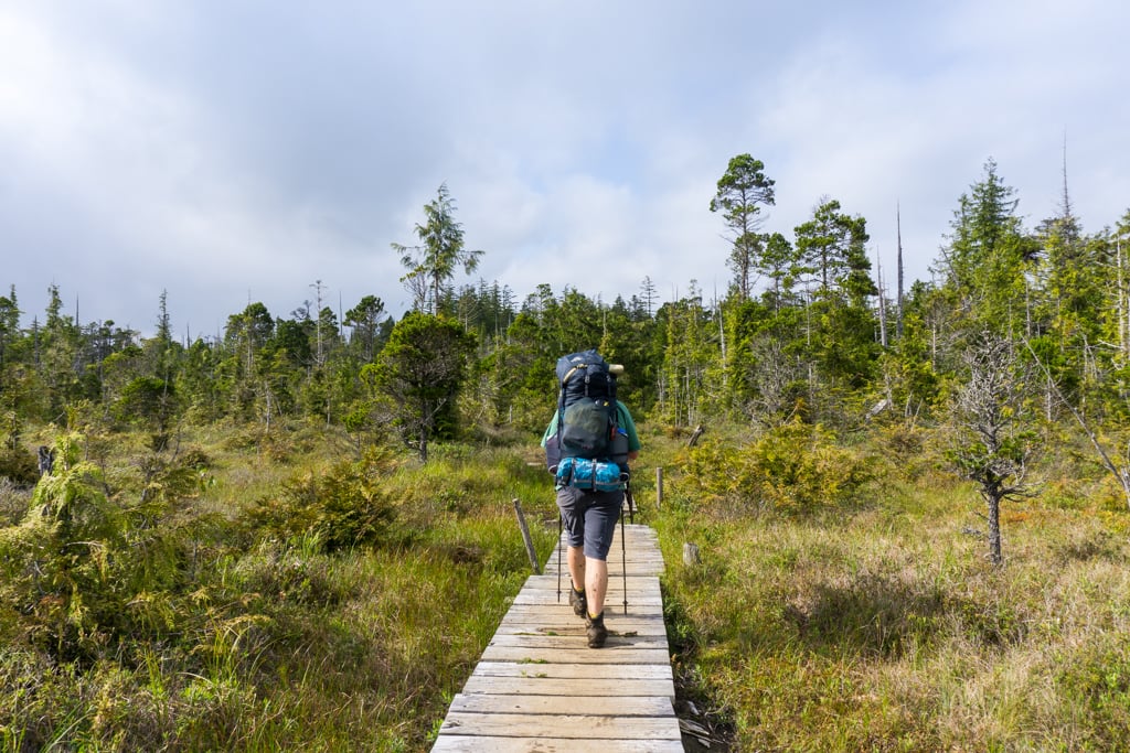
Today’s hike is mostly inland as it follows old settlers road up and around Nahwitti Cone. Start by walking 1 kilometre along the beach from Laura Creek, before following the buoys into the forest. The trail gains elevation immediately up a well-constructed staircase, then continues more gently uphill through muddy upland bog along the old settler’s trail.
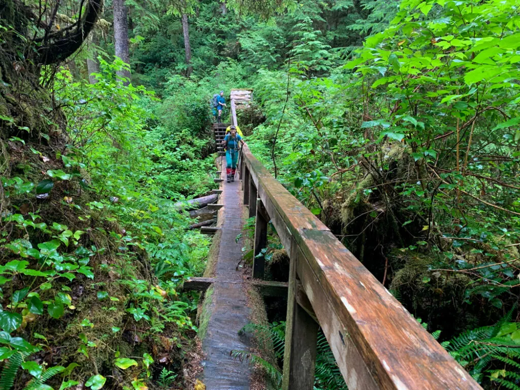
About 2.5km from Laura Creek the trail crosses several branches of Dakota Creek, which is a good place to get drinking water. The main crossing is a massive log bridge, which is a fun photo-op. The next crossing doesn’t have a bridge so you will have to rock-hop across. Follow flagging tape for the best route.

After the creek crossings, the trail heads uphill again to a bit of a plateau around Laughing Loon Lake around 4km from Laura Creek. The lake itself is very marshy so don’t plan to swim or get drinking water here. There are lots of good boardwalks through this section, but some epic mud bogs too.


Leaving the lakeshore, the trail begins a slow descent to the beach. This section is a bit more challenging with lots of mud, puddles, roots, and slippery sections. It can be slow going through here, which is even more frustrating since you are almost at the end! Once you can hear the ocean and are on the stairs, you’ll know you are close.
About 6.5km from Laura Creek, you will finally emerge on the beach at the east end of Nissen Bight. If you plan to camp here and need drinking water, follow a trail to the right just before the beach. If you are pressing on, walk along the wide sand beach for another kilometre to find the Nissen Bight Camp and the junction with the Cape Scott Trail.
Nissen Bight Camp
Nissen Bight is a wide expanse of sand. There are two main camping areas. The camping area at the east end of the beach has a new bear cache and outhouse. It is also close to the water source, which is on a short, marked side trail through the forest near the entrance to the North Coast Trail.
There is another, older camping area at the west end of the beach near the junction with the Cape Scott Trail. There are lots of established campsites amongst the driftwood above the high tideline. The food cache and outhouse are located a few meters down the trail to Cape Scott. However, if you camp here you’ll have to walk 1 km to the east end of the beach to find water.
Nissen Bight to Cape Scott Trailhead
Official Distance: 15.4 km
Time: 5-6 hours
Highlights: old settler road, Eric Lake, old-growth forest, historic sites
Actual Distance: 15.4 km
Difficulty: Moderate
For a more detailed description of the Cape Scott Trail and the Fisherman River and Eric Lake campgrounds, see my Cape Scott Trail guide.
Leaving Nissen Bight, follow the wide trail through the salal. After about 2 minutes, a trail branches off to the right to Fisherman Bay, where you can get picked up by Cape Scott Water Taxi.
The remainder of the 2 kilometre walk to the junction with the Cape Scott Trail is along an old settler’s road that climbs gently uphill. In wet weather, it is muddy and slippery. At the junction, turn left to head to the parking lot. Turning right will take you to Nel’s Bight and Cape Scott, a worthwhile side trip that will add an extra day to your trip. (Read my Cape Scott Trail guide to decide if you want to combine it with your North Coast Trail hike.)
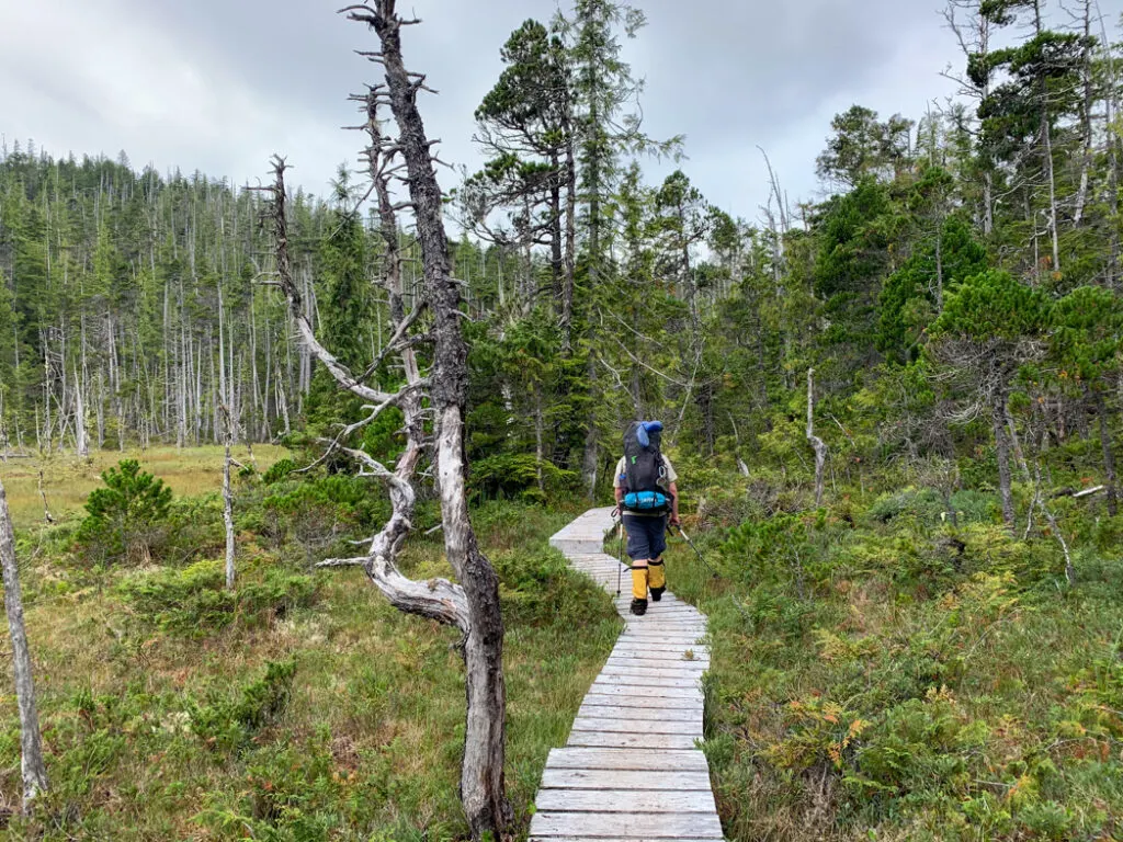
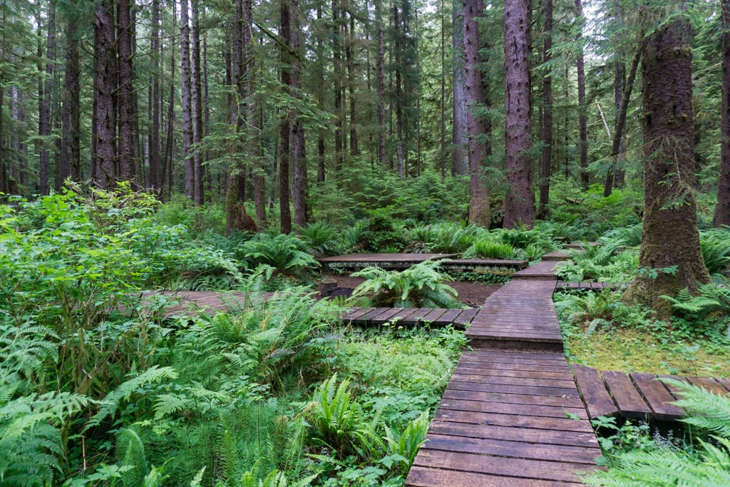
From the junction, the trail heads downhill in the forest before emerging in a bog. Unlike on the North Coast Trail, most of the bog sections on the Cape Scott section have boardwalk or good gravel underfoot, so the mud is not ever-present and never too deep.
About 4km from the junction reach the Fisherman River Camp and the new bridge over the river. On the other side, you’ll travel along a long, straight section of settler road with drainage ditches on either side, then high above the banks of St. Mary’s Creek through some rocky and rooty sections.
Around 12km from Nissen Bight, some boardwalk sections announce your arrival at Eric Lake Camp. The trail travels past an outhouse and numerous tent platforms. Follow a short spur trail to the lakeshore if you need a break.
Just past Eric Lake, the trail crosses a creek on a large fallen log, then heads into a long boardwalk section that can be slippery. About 13.5km from Nissen Bight reach the south end of Eric Lake and a spur trail leading to the lake.
The next section of trail is rough with badly eroded settler corduroy road heading slightly downhill. Go slowly here as you pick your way through mud and slippery terrain. Reach a junction at about 14.5km. Turn left to reach the parking lot. (Right goes to San Josef Bay.) The final kilometre is easy walking on a wide, well-maintained gravel trail.


Cape Scott Trailhead
The trailhead area has two parking lots, one up the hill from the other. If you are catching the Cape Scott Shuttle Bus, it picks up and drops off next to the trailhead. There is an outhouse and an info board with a map at the trailhead as well as a covered picnic shelter. There is also a ranger yurt in the trees a few meters down the trail.
Join the Cape Scott Park Facebook group
North Coast Trail Itineraries
Standard 6-Day North Coast Trail Itinerary
This is the itinerary that most people who hike the North Coast Trail use.
Day 1 – Shushartie Bay to Skinner Creek: 8.1 km (6-7 hours)
Day 2 – Skinner Creek to Cape Sutil: 7.9 km (4-5.5 hours)
Day 3 – Cape Sutil to Irony Creek (Shuttleworth Bight): 7.8 km (4-5 hours)
Day 4 – Irony Creek (Shuttleworth Bight) to Laura Creek: 11.8 km (5-6 hours)
Day 5 – Laura Creek to Nissen Bight: 7.5 km (2.5-4 hours)
Day 6 – Nissen Bight to Cape Scott Trail Parking Lot: 15.4 km (5-6 hours)
Abbreviated 5-Day North Coast Trail Itinerary with Water Taxi Pick-up
If you want to skip the walk out to the Cape Scott Trailhead, this abbreviated 5-day itinerary is a good option. I chose this North Coast Trail itinerary on my most recent trip because I had already hiked the Cape Scott Trail four times.
Day 1 – Shushartie Bay to Skinner Creek: 8.1 km (6-7 hours)
Day 2 – Skinner Creek to Cape Sutil: 7.9 km (4-5.5 hours)
Day 3 – Cape Sutil to Irony Creek (Shuttleworth Bight): 7.8 km (4-5 hours)
Day 4 – Irony Creek (Shuttleworth Bight) to Laura Creek: 11.8 km (5-6 hours)
Day 5 – Laura Creek to Fisherman Bay water taxi pickup: 7.6 km (2.5-4 hours)
Fast 5-Day North Coast Trail Itinerary
This itinerary is suitable for strong hikers who have the stamina to spend most of the day on the trail.
Day 1 – Shushartie Bay to Nahwitti River: 11 km (7-8.5 hours)
Day 2 – Nahwitti River to Irony Creek (Shuttleworth Bight): 12.8 km (7-9 hours)
Day 3 – Irony Creek (Shuttleworth Bight) to Laura Creek: 11.8 km (5-6 hours)
Day 4 – Laura Creek to Nissen Bight: 7.5 km (2.5-4 hours)
Day 5 – Nissen Bight to Cape Scott Trail Parking Lot: 15.4 km (5-6 hours)
Super-Fast 4-Day North Coast Trail Itinerary
Fast and experienced hikers could use this super-fast North Coast Trail itinerary. The last day is long, but doable since the terrain is much easier than the rest of the route.
Day 1 – Shushartie Bay to Nahwitti River: 11 km (7-8.5 hours)
Day 2 – Nahwitti River to Irony Creek (Shuttleworth Bight): 12.8 km (7-9 hours)
Day 3 – Irony Creek (Shuttleworth Bight) to Laura Creek: 11.8 km (5-6 hours)
Day 4 – Laura Creek to Cape Scott Trailhead: 22.9 km (7.5-10 hours)

Relaxed 7+ Day North Coast Trail Itinerary
This more relaxed itinerary 7-day North Coast Trail itinerary includes a rest day at Irony Creek. If you want to split up the trail even more you could add an extra night at Nahwitti River between Skinner Creek and Cape Sutil, or one at Wolftrack Beach (no facilities) between Irony Creek and Laura Creek. You could also break up the hike out to the Cape Scott Trailhead with an overnight at the Fisherman River Camp.
Day 1 – Shushartie Bay to Skinner Creek: 8.1 km (6-7 hours)
Day 2 – Skinner Creek to Cape Sutil: 7.9 km (4-5.5 hours)
Day 3 – Cape Sutil to Irony Creek (Shuttleworth Bight): 7.8 km (4-5 hours)
Day 4 – Rest Day at Irony Creek
Day 5 – Irony Creek (Shuttleworth Bight) to Laura Creek: 11.8 km (5-6 hours)
Day 6 – Laura Creek to Nissen Bight: 7.5 km (2.5-4 hours)
Day 7 – Nissen Bight to Cape Scott Trail Parking Lot: 15.4 km (5-6 hours)
4-Day Half North Coast Trail Itinerary
If you are worried about the rigors of the first two days of trail, or you want to prioritize beach scenery, you may want to consider doing half of the North Coast Trail. To do this, you’ll need to arrange a water taxi drop-off at Cape Sutil instead of at Shushartie Bay.
Day 1 – Cape Sutil to Irony Creek (Shuttleworth Bight): 7.8 km (4-5 hours)
Day 2 – Irony Creek (Shuttleworth Bight) to Laura Creek: 11.8 km (5-6 hours)
Day 3 – Laura Creek to Nissen Bight: 7.5 km (2.5-4 hours)
Day 4 – Nissen Bight to Cape Scott Trail Parking Lot: 15.4 km (5-6 hours)
7-Day Cape Scott + North Coast Trail Itinerary
If you are already in the area, it makes sense to add an extra day to your North Coast Trail itinerary to go to Cape Scott. The beach at Nel’s Bight is one of the most beautiful campsites in the park and the day hike to the lighthouse is worthwhile. See my Cape Scott Trail Guide for all the details.
Day 1 – Shushartie Bay to Skinner Creek: 8.1 km (6-7 hours)
Day 2 – Skinner Creek to Cape Sutil: 7.9 km (4-5.5 hours)
Day 3 – Cape Sutil to Irony Creek (Shuttleworth Bight): 7.8 km (4-5 hours)
Day 4 – Irony Creek (Shuttleworth Bight) to Laura Creek: 11.8 km (5-6 hours)
Day 5 – Laura Creek to Nel’s Bight: 11.2 km (4-5.5 hours)
Day 6 – Day hike to Cape Scott from Nel’s Bight: 13.6 km return (5 hours)
Day 7 – Nel’s Bight to Cape Scott Trailhead Parking Lot: 16.8 km (6 hours)
7-Day San Josef Bay + North Coast Trail Itinerary
Add an extra day to your North Coast Trail itinerary by adding on a day at San Josef Bay. The beautiful sandy beach and sea stacks make a great destination for your final day on the trail.
Day 1 – Shushartie Bay to Skinner Creek: 8.1 km (6-7 hours)
Day 2 – Skinner Creek to Cape Sutil: 7.9 km (4-5.5 hours)
Day 3 – Cape Sutil to Irony Creek (Shuttleworth Bight): 7.8 km (4-5 hours)
Day 4 – Irony Creek (Shuttleworth Bight) to Laura Creek: 11.8 km (5-6 hours)
Day 5 – Laura Creek to Nissen Bight: 7.5 km (2.5-4 hours)
Day 6 – Nissen Bight to San Josef Bay: 17 km (5.5-6.5 hours)
Day 7 – San Josef Bay to Cape Scott Trailhead Parking Lot: 2.5km (40 minutes)
Join the Backpacking in BC Facebook Group
So that’s my section-by-section breakdown of the North Coast Trail and all the info you need to choose your North Coast Trail itinerary. For your first time, I recommend the standard 6-Day North Coast Trail Itinerary. If you’re planning your hike and have questions, let me know in the comments. I’d love to help.
READ NEXT:
- North Coast Trail Guide
- Cape Scott Trail Guide: Hiking and Camping on Northern Vancouver Island
- Coastal Hiking Tips: Advice for Beach Backpacking
- North Coast Trail Packing List: Everything You Need to Bring
- 20+ Ways to Reduce Your Backpack Weight
MORE VANCOUVER ISLAND POSTS:
- Things to do on North Vancouver Island
- Your Guide to the West Coast Trail in British Columbia
- Kayaking in the Johnstone Strait: Everything You Need to Know
- How to Visit Avatar Grove, Big Lonely Doug, and Other Big Trees on Vancouver Island
- Your Guide to the West Coast Trail in British Columbia
- Juan De Fuca Trail Guide: Backpacking on Vancouver Island
- 30 Best Backpacking Trips in BC
- 25 Spring Backpacking Trips in British Columbia


- Best Sun Hoodies for Hiking - June 3, 2026
- Lower Stein Valley Trail Hiking and Backpacking Guide - May 27, 2026
- The Best Things to Do in Vernon, BC - May 21, 2026
Keira Vanderbeck
Wednesday 14th of August 2024
Just a note that there is now an outhouse and bear caches at both ends of Nissan Bight. We just finished on Aug 10, and were able to camp on the side of the beach closest to the NCT and the water rather than having to walk alll the way to the other side of the beach. It was a lovely way to end our 'official' time on the NCT before rejoining the masses in Cape Scott.
Taryn Eyton
Wednesday 14th of August 2024
Thanks for the update Keira. I had heard about that and put it in on the updates page for my Vancouver Island book but I had forgotten to update this post. Thanks for the reminder!