

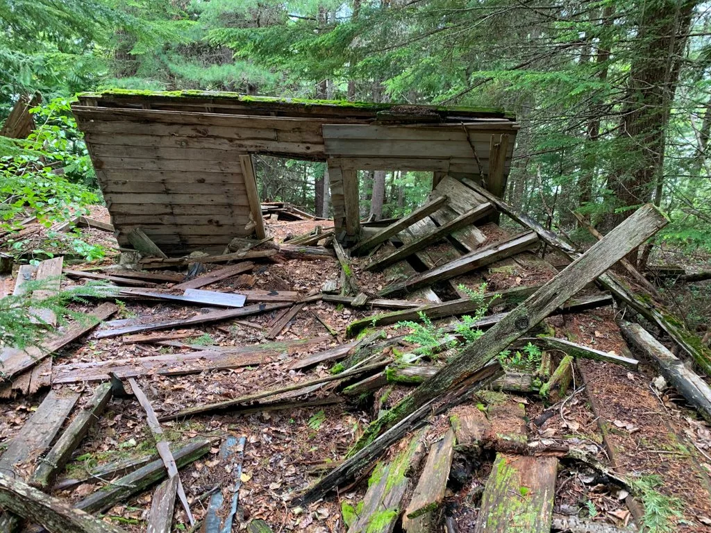
If you want to get off-the-beaten-path in Whistler, try hiking to Parkhurst Ghost Town. This former logging settlement on the shores of Green Lake is littered with historical artefacts including collapsed buildings, abandoned cars, old stoves, and even an intact cabin. The town has been uninhabited since the 1960s and is slowly being reclaimed by the forest.
The hike to get there is fairly easy walking, however, there are lots of confusing trail junctions, so I’ve put together a complete trail guide for you. I even made you a custom map! This post includes:
- How to get to the Parkhurst Ghost Town trailhead
- Custom map of the Parkhurst Ghost Town hike
- Complete hiking directions for a loop hike to Parkhurst Ghost Town
- Where to find the coolest abandoned buildings and cars at Parkhurst
- Two alternative ways to get to Parkhurst Ghost Town
Psst: Looking for a full list of Whistler activities? Check out my list of the best things to do in Whistler. It includes over 80 ideas!
This is a sensitive wilderness area. Learn how to Leave No Trace to keep the wilderness wild. Make sure you are prepared by bringing the 10 Essentials. Get ready for adventure with this checklist of things to do before every hike.
Parkhurst Ghost Town Basics
Description: The Parkhurst Ghost Town is an abandoned town on the far side of Green Lake in Whistler. It’s one of the best hikes in Whistler. You can take a short loop hike through a network of mountain bike trails to reach it.
History: Parkhurst was a logging settlement on the shores of Green Lake. It was founded in the 1920s and was abandoned in the 1960s. The settlement had a mill, bunkhouses, and a few private homes. Up to 70 men worked at the mill each summer. If you want to learn more about Parkhurst, there is lots of information on the Whistler Museum website.
Distance: 6.5 km loop
Elevation Gain: 100 m
Difficulty: Moderate (but only due to route finding)
Time: 2-3 hours
Best time to go: The trail is usually snow-free from April to October. You will need snowshoes and good route-finding skills between December and March. (See my list of Whistler snowshoeing trails.)
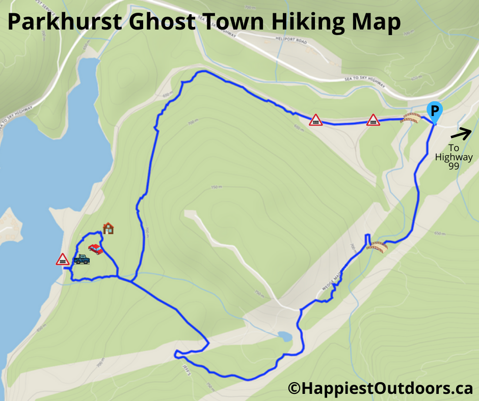
Parkhurst Ghost Town Map
The hike to Parkhurst Ghost Town in Whistler can be a bit confusing as there are a lot of junctions. I couldn’t find a good map of the trails in the area, so I made one for you.
However, I also recommend that you use a GPS app like Gaia GPS, Alltrails, or Trailforks while you are on the hike. That way you can check which trail you are on as you walk.

How to Get to the Parkhurst Ghost Town Trailhead
Driving to the Parkhurst Ghost Town Trailhead from Whistler is pretty straightforward.
Go north from Whistler on Highway 99 (Sea to Sky Highway). Just past the end of Green lake, follow signs for the Wedgemount Lake trail and turn right onto Wedge Creek Forest Service Road.
Immediately off the highway, cross a set of train tracks, then a single lane bridge over the Green River. On the other side, turn right at the fork, following signs for Whistler Paintball. The road has potholes but is 2WD accessible. Follow the road for about one kilometre. Ignore a turn off to the left to Whistler Paintball.
After the road goes under the power lines and passes two locked yellow gates on the left, pull over and park. Here is a link to Google Maps driving directions to the Parkhurst Ghost Town trailhead.
If you don’t have a car, you can also hike to the Parkhurst Ghost Town directly from Whistler. See the alternate route description below.
Parkhurst Ghost Town Hiking Directions
From the trailhead, follow the gravel road behind the second yellow gate under the power lines. Continue on the road up the hill, ignoring another gravel road on the left.
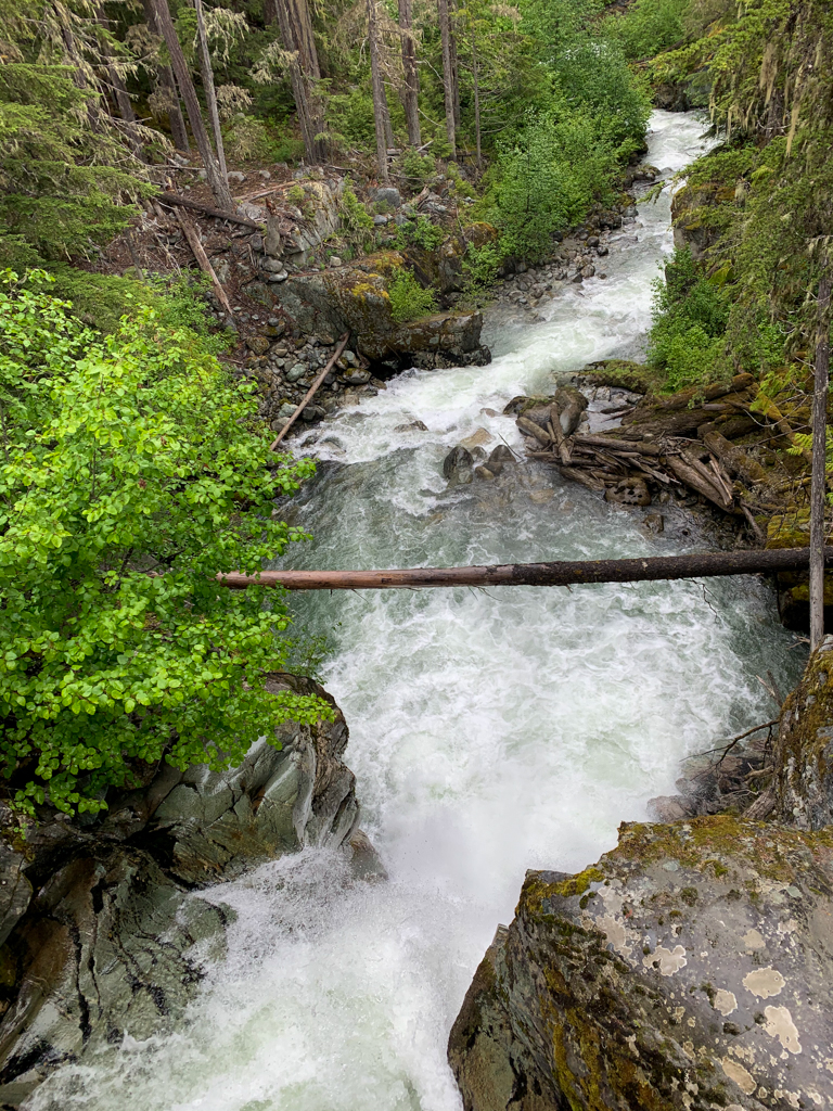
In this section of the hike, keep an eye out for Sea to Sky Trail signs – you want to follow the Sea to Sky Trail (which is sometimes on the road). About 750m from the trailhead, cross a bridge high above Wedge Creek.

On the other side of the bridge, stay on the road as it goes around a tight hairpin turn. (Ignore the path to the right). A few minutes later, go left to follow a section of singletrack Sea to Sky Trail. It’s a pretty piece of pathway, but it soon emerges on the same gravel road.
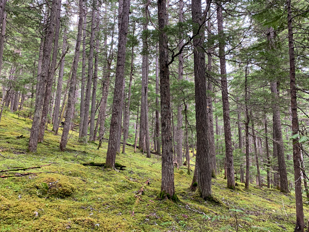
Turn left and follow the road. In another minute, turn left again to follow another road down into a small hollow. Turn left to experience another singletrack section of the Sea to Sky Trail through a cut block. Climb up a small rise, and meet Jeff’s trail, a mountain bike trail, coming in from the left.

Continue straight to meet another gravel road near a power transmission tower on top of a rocky bluff. Turn right and walk up the hill past the bluff on the road, then down around the other side.
Go left on a long-abandoned road signed as the Parkhurst Trail. Follow this straight trail downhill through mossy forest for about 500m to a junction. Your route to the Parkhurst Ghost Town goes straight ahead. The trail to the right is the other half of the loop back to your car.

For now, go straight towards Parkhurst. Walk another minute or two, and reach another junction. This is the start of the loop through the Parkhurst Townsite. You can go either way around the loop, but I recommend going left so you can save the best sites for last.
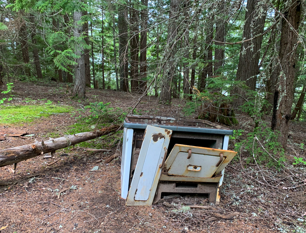
Hike down the trail, keeping an eye out for historical artefacts (or more accurately, old garbage). Follow faint side trails off the main trail to discover more relics hiding in the forest. But be careful where you step as rusty metal, broken glass, and hidden holes are everywhere.
The first thing you will see is an old stove and some piles of very rusty old trash. The remains of a collapsed building are also nearby.

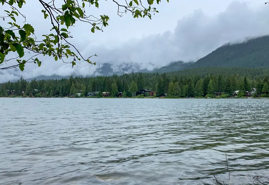
Continue following the trail as it curves around to the north. The CN railway line is just downhill to your left. You can follow a spur trail down to the tracks, then to the shores of Green Lake.
Use caution when crossing as this is an active rail line and trains can come past at any time. You can get a great view of some fancy houses on the other side of the lake. During Parkhurst’s heyday, there were no roads in the area and the only way to reach it was by train.

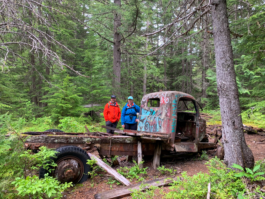
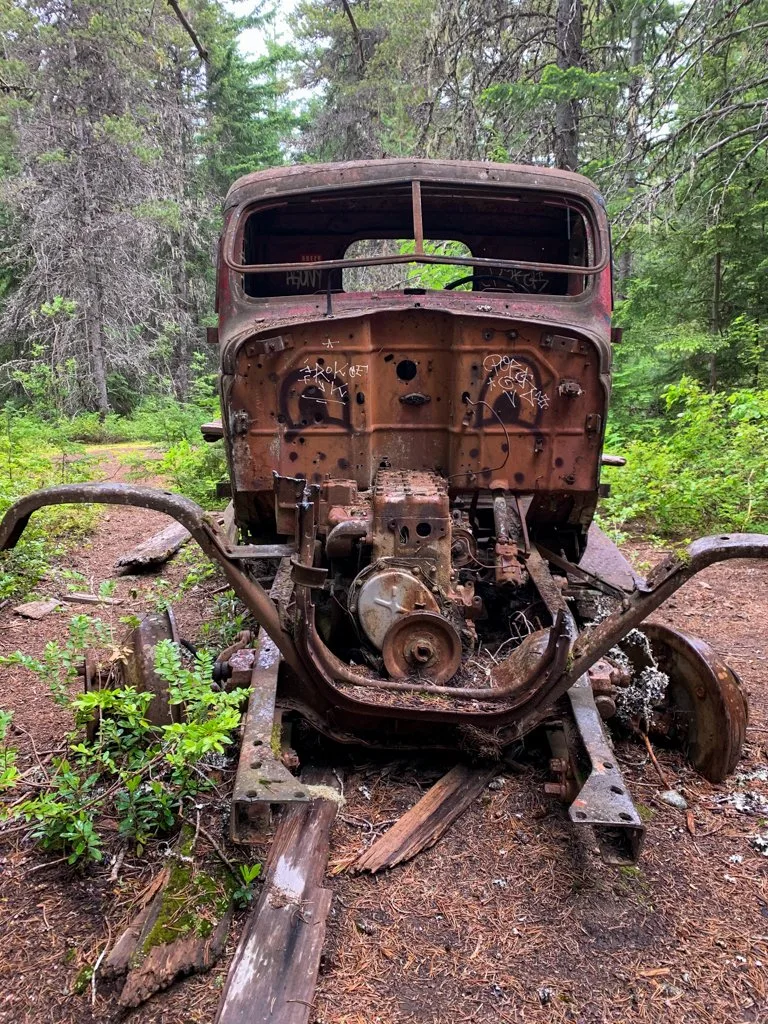
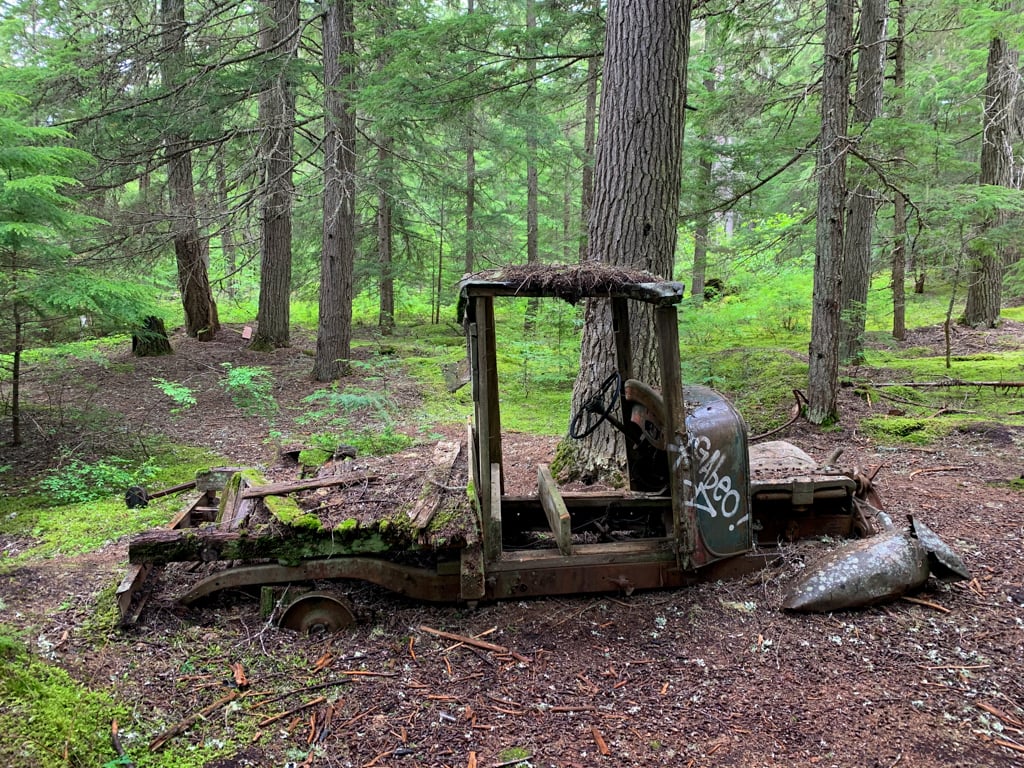
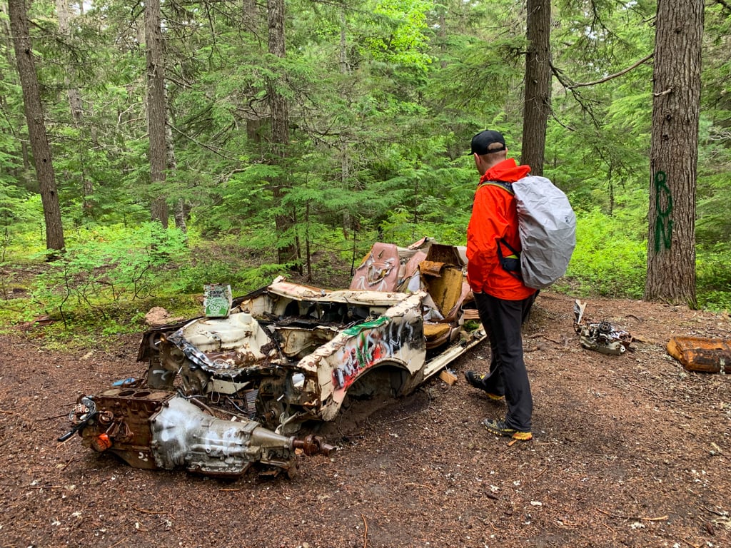
Back on the main trail, you will pass through the heart of Parkhurst. There are collapsed buildings, an abandoned truck, and lots of rusty garbage on both sides of the trail. Explore faint paths up into the forest to the right to find even more old trucks.


Keep walking on the main trail, sometimes recognizable as the old road through the town. A spur trail leads steeply downhill to the railway tracks again. There is a huge abandoned logging caterpillar on the edge of Green Lake near here, but it is best viewed from the lake. (See the canoeing directions below.)
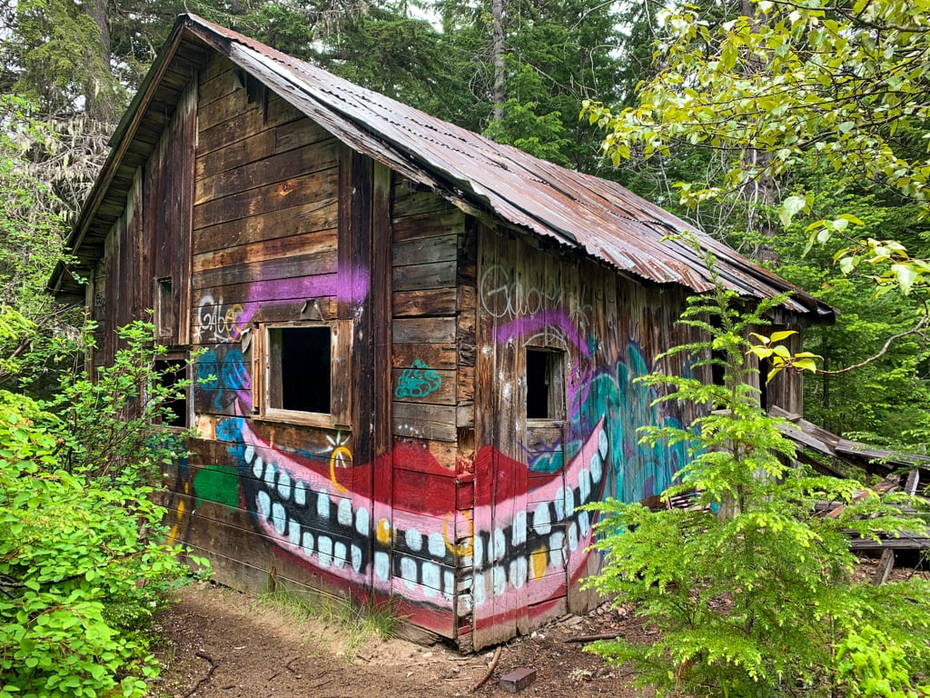
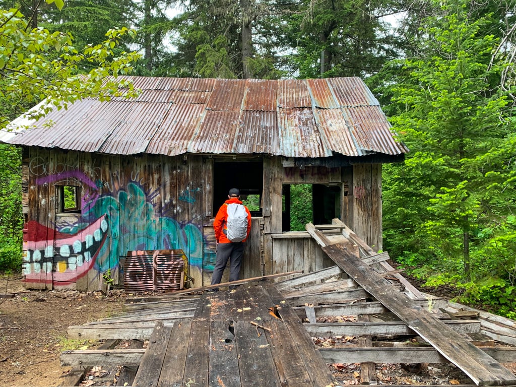
As the main trail curves east and starts to go uphill, you will reach the only building that is still standing. The graffiti-covered cabin is in pretty bad shape, so it’s best not to go inside.

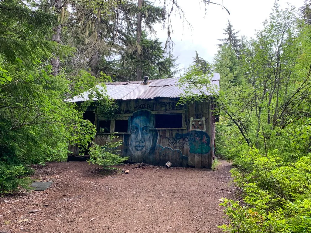

Just past the cabin, you’ll come across the final historic relic/garbage on the trail: an abandoned car. This car is actually much newer than the rest of the garbage near here and was probably abandoned in the area after logging roads reached here in the 80s: it’s a late 70s Chevrolet Chevette. (We did some internet sleuthing based on the body shape and engine type to figure that out!)

A few minutes past the car, reach the junction at the end of the Parkhurst Townsite loop. Turn left to head back uphill the way you came. To continue on the loop back to the trailhead, turn left again on the Parkhurst North Trail.
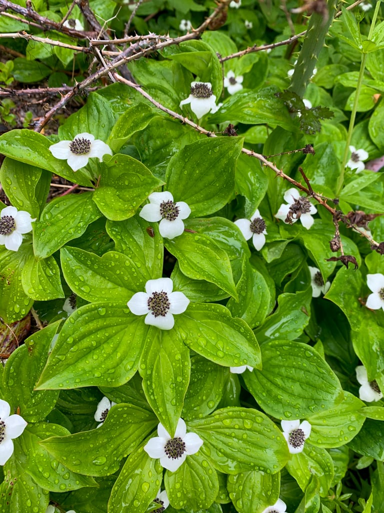
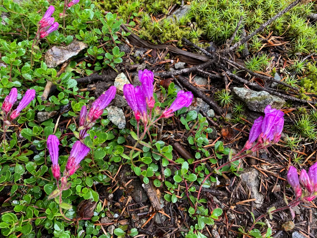
Although you are just over 2km from the car, this trail has some rough, rocky, and steep sections so it is not quick walking. Follow the trail through the forest and up and over a few rocky bluffs. There are a few spots where you can look down at Green Lake. Look for beautiful purple Davidsons penstemon wildflowers in the rocky sections.

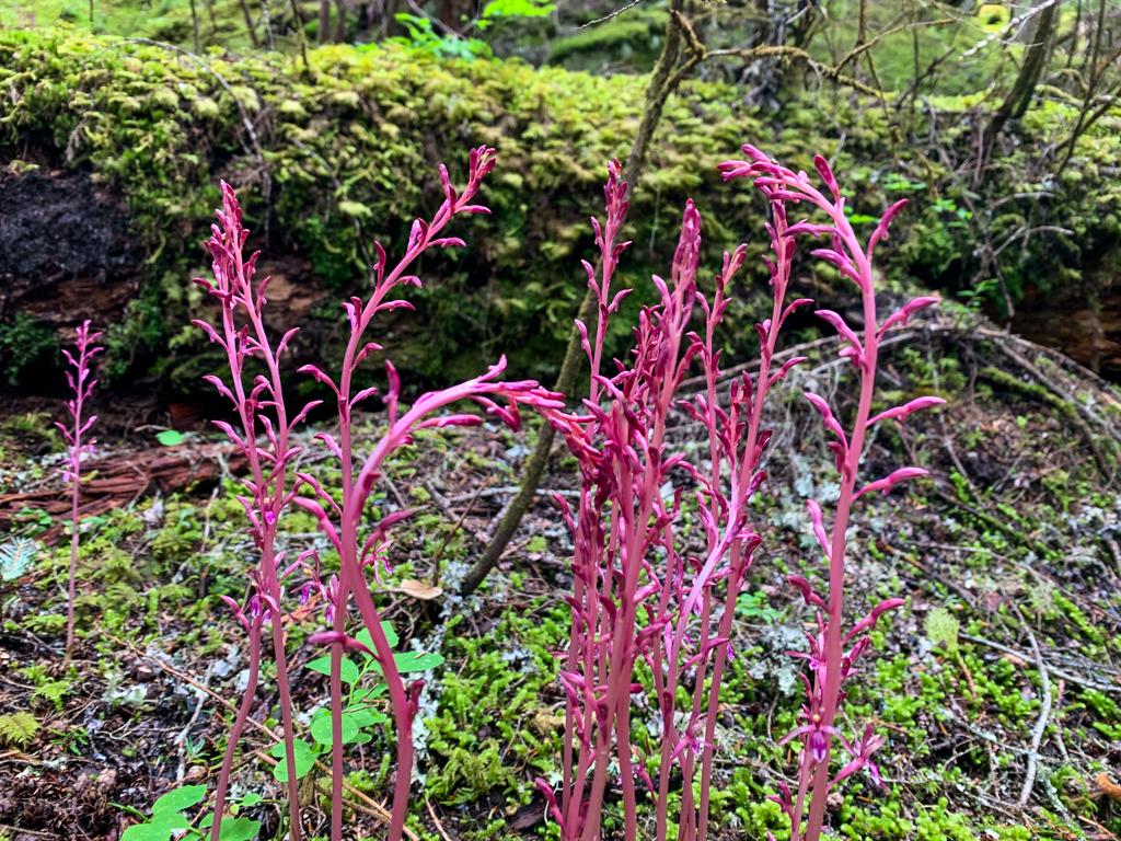
The trail descends steeply from the final rock bluff, heading towards the Green River and the railway tracks. About 1.2km after the junction, the trail meets an old road. Turn right to follow the road through the forest beside the railway tracks. Look for pink coralroot growing amongst the trees.

After a few hundred meters, the road meets the railway tracks. You will need to walk along the tracks for a short section. Use caution and watch for trains. Walk alongside the main tracks. Don’t follow the spur lines that branch away to the south – see the map above. (They actually form a triangle called a wye – basically a place for trains to turn around.)
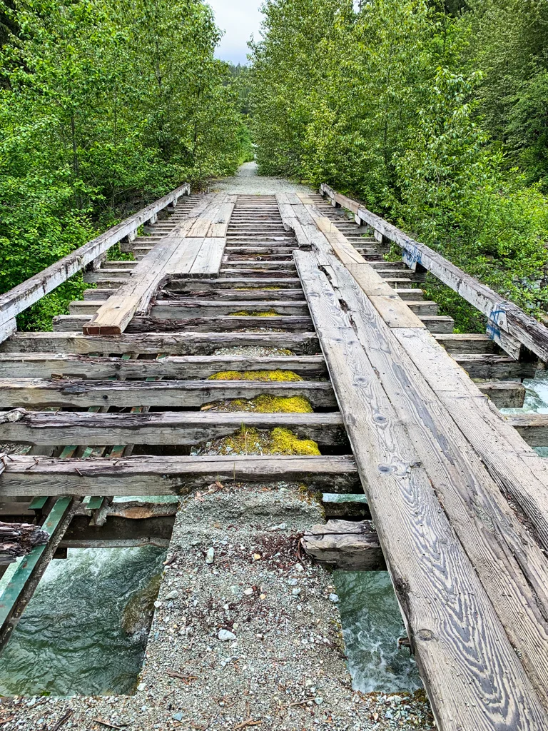
After about 400m of walking along the train tracks (and after you cross both sets of tracks that go south into the wye) rejoin the road on the right side of the tracks. Follow the road for a few more minutes to a deteriorating bridge over Wedge Creek. Be careful when crossing.

On the other side of the bridge, the road continues for another few minutes before veering right, passing some concrete barriers, and arriving at the trailhead and your parking spot.
Alternate Route: Hiking to Parkhurst from Whistler Village
It is also possible to hike to Parkhurst from Whistler Village. (Full disclosure, I haven’t done this version of the hike.) This hike is 10km return with 100m of elevation gain. These are mountain bike trails, so be prepared to share the path.
This hike starts at the intersection of Mons Road and Mons Court near the Riverside Camping and RV Resort in Whistler’s Spruce Grove neighbourhood. There is limited parking on the shoulder but watch for parking restrictions signs. If you don’t have a car, you can get there on the bus or walk via the Valley Trail.
Continue straight on Mons Road as it turns to dirt. Cross over the paved dyke trail and continue on the dirt road under power lines. Turn right and cross a bridge over Fitzsimmons Creek on the Lost Lake Connector Trail.
Follow the trail up the hill to a newer road under some powerline towers. Continue on the road for a minute, then go right and head uphill on the Hydro Hill Trail when it forks. A couple minutes later, go left onto the Green Lake Loop.
Follow the Green Lake Loop trail for a few minutes, then turn left onto the Sea to Sky Trail. Stay on the Sea to Sky Trail for 1.3km. Reach a junction with the Green Lake Loop Trail and turn left. Walk for nearly a kilometre, then turn left onto the Parkhurst Trail. The loop trail around the Parkhurst site is a few minutes away.
Canoeing to Parkhurst
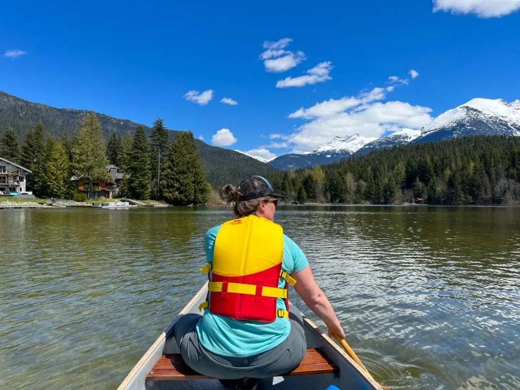
You can also paddle to Parkhurst. Launch your canoe or SUP at Green Lake Boat Launch in the Emerald Estates neighbourhood. Or launch at Alta Lake, then paddle the River of Golden Dreams to Green Lake.
From the boat launch, head straight across the lake, keeping to the left of the peninsulas where the lake narrows. There is a small wooden dock a little ways down the shoreline to the north. Tie your canoe up here, then scramble up the rough stairs to the railway tracks.
Cross the tracks and pick up a faint trail on the other side, which climbs up a steep slope on a traversing line. Before long, the trail hooks in with the network of trails in the heart of the abandoned town. Follow the description above to make a loop around the town.
If you want to see the giant abandoned caterpillar, paddle south to the other side of the peninsula.

So that’s everything you need to know to plan a hike (or paddle) to the Parkhurst Ghost Town in Whistler. Have questions about the trail? Let me know in the comments. I’m always happy to help.
MORE Whistler and Sea to Sky Posts:
- The Best Hikes in Whistler: A Guide to All the Trails
- Visiting Whistler, BC in Summer (By a Local)
- 80+ Things to Do in Whistler (By a Local)
- Camping in Whistler, BC: The Best Campgrounds
- 40+ Cheap and Free Things To Do in Whistler
- Sea to Sky Highway Road Trip Guide: Driving from Vancouver to Whistler


- Best Sun Hoodies for Hiking - June 3, 2026
- Lower Stein Valley Trail Hiking and Backpacking Guide - May 27, 2026
- The Best Things to Do in Vernon, BC - May 21, 2026
Leilani
Sunday 13th of February 2022
Thank you so much for all the detail included in this post. these pictures are absolutely incredible. Knowing that there was a small town here is so cool! I'm also a fellow citizen of our beautiful province British Columbia. I've been on a couple different hikes but I don't go very often. after reading through your blog, it has made me realize that there is more to Vancouver other than just Stanley Park, haha.
Tina
Thursday 17th of June 2021
Thanks Taryn!