

As a local, I’ve lost track of how many times I’ve driven the Sea to Sky Highway from Vancouver to Whistler. When I lived in Vancouver, I drove it at least twice a year, and now that I live in Squamish, I drive it about twice a month.
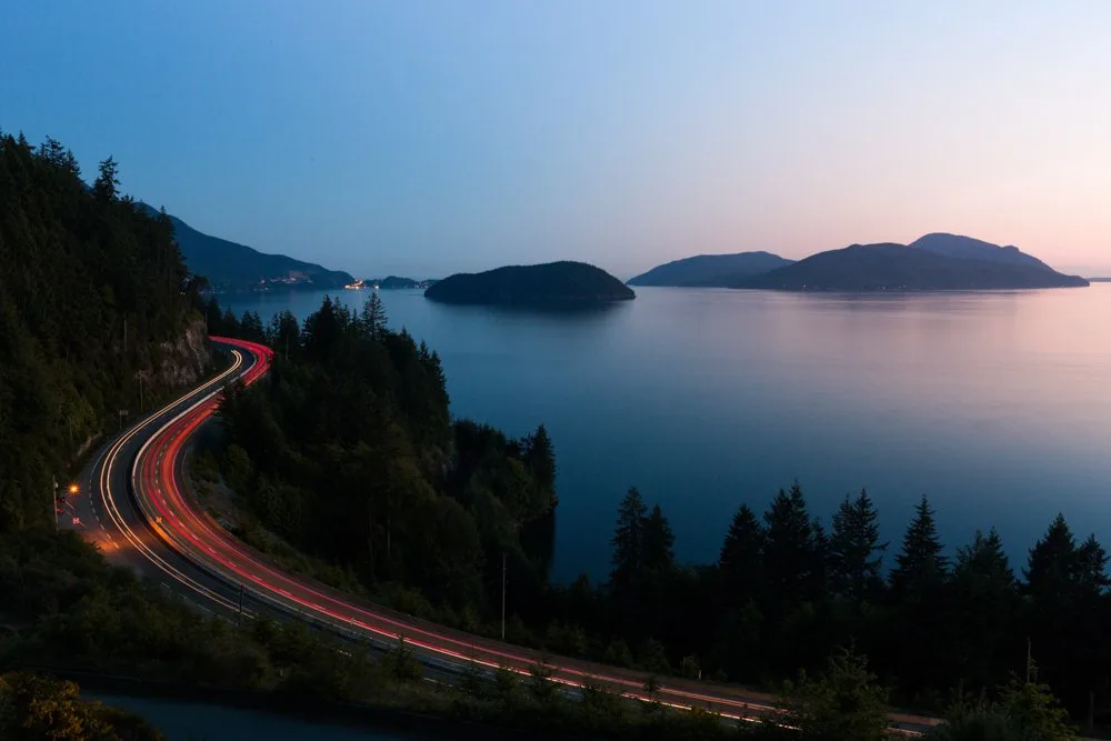
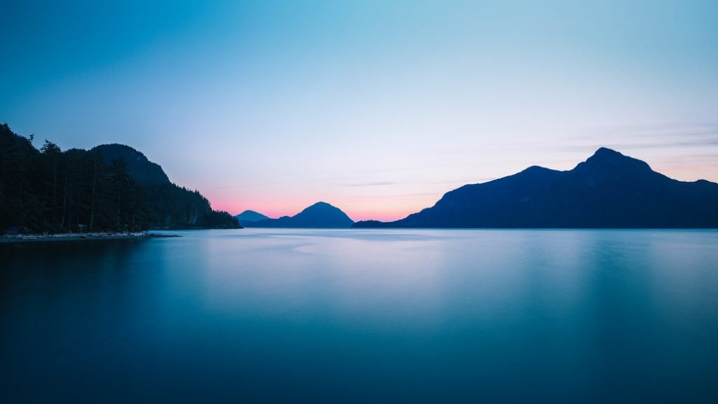
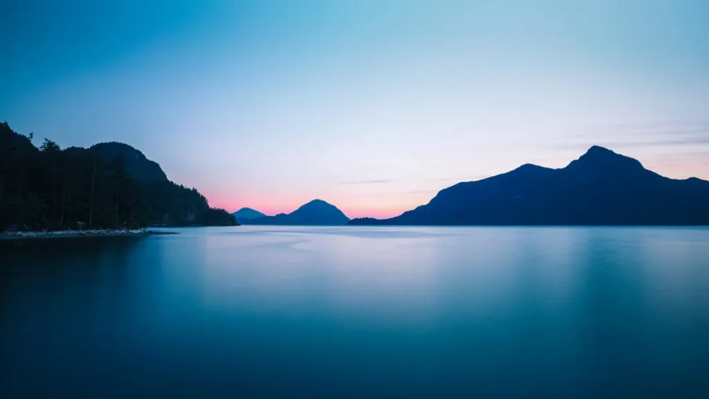
The Sea to Sky Highway is a gorgeous drive along the side of Howe Sound, an ocean fjord, and then up into the snowy mountains to the Whistler ski village. Along the way you’ll pass through the town of Squamish (where I live), one of the best small towns in Canada for outdoor adventures and home to world class hiking, mountain biking, and rock climbing.
Instead of just speeding through all the way to Whistler, take a little longer and get out of your car. There are so many amazing places to stop including viewpoints, waterfalls, hikes, swimming, picnic spots and museums.
In this guide I’ll give you directions to all my favourite places along the Sea to Sky Highway, plus include tips for driving and recommendations for where to eat and stay.
This post includes:
- Sea to Sky Highway driving directions
- Sea to Sky Highway map including locations of all the places I recommend to stop
- How long it takes to drive the Sea to Sky Highway
- Sea to Sky Highway road conditions and driving tips
- How to take a Sea to Sky Highway road trip without a car – shuttle bus services, tours, and more
- The best places to stop on the Sea to Sky Highway – 20 of my favourite places to stop
- My favourite places to eat and drink on the Sea to Sky Highway
- Where to stay along the Sea to Sky Highway: hotels, cabins, hostels, and more
- Sea to Sky Highway FAQ: all your Sea to Sky road trip questions answered
Hey there: Some of the links in this post are affiliate links, which means I earn a small commission at no cost to you. Thanks for your support. -Taryn
This is a sensitive wilderness area. Learn how to Leave No Trace to keep the wilderness wild. Make sure you are prepared by bringing the 10 Essentials. Get ready for adventure with this checklist of things to do before every hike.
Sea to Sky Highway Driving Directions

Total Distance: About 120km from Vancouver to Whistler
The Sea to Sky highway (also known as Highway 99) runs from West Vancouver to Whistler, passing Squamish about half way between the two. It also extends past Whistler to the towns of Pemberton and Mount Currie before ending at Lillooet.
To get to the Sea to Sky Highway, take the Lions Gate bridge from Vancouver. Once over the bridge, follow the signs left for Highway 99 and Whistler. Turn right onto Taylor Way, continuing to follow the signs. Go up the hill on Taylor Way. Then go under the highway and turn left to merge on to the highway.
At this point you are on a highway that is both Highway 1 and Highway 99. Continue for about 10km. Watch for the signs for Whistler where the highway splits. Stay in the left lane to continue onto Highway 99 (the Sea to Sky Highway). Continue following the Sea to Sky Highway for another 100 kilometres to Whistler. You stay on the same highway the whole time so it’s easy to follow.
Click here for Google maps driving directions.
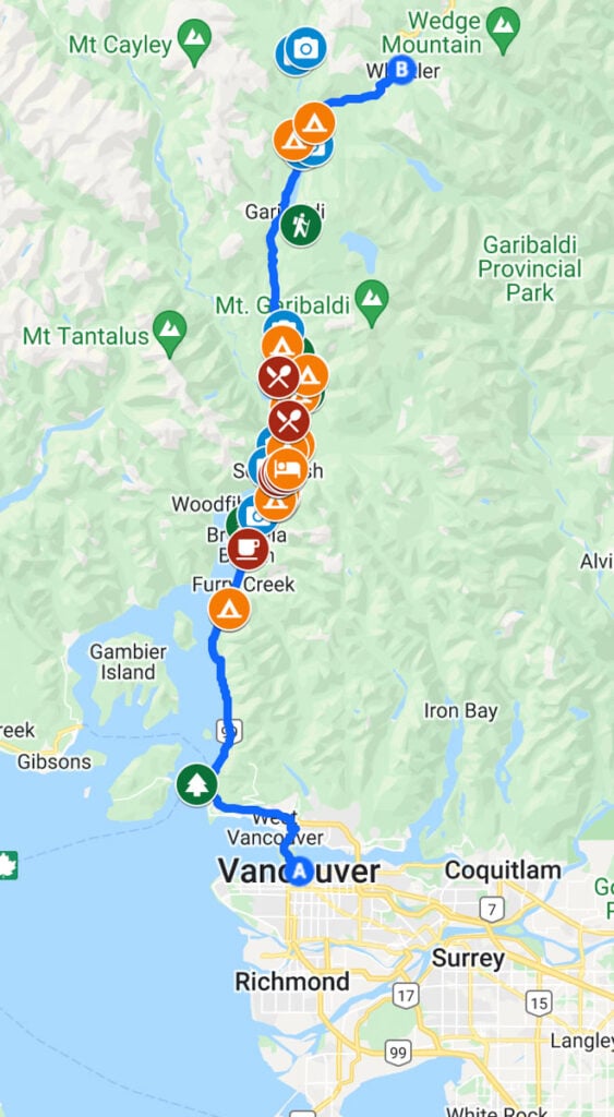
Sea to Sky Highway Map
I’ve made a custom clickable map of the Sea to Sky Highway for you showing all my recommended stops including places to eat and sleep.
Sea to Sky Highway Driving Times
Driving Time: Minimum 2 hours
If traffic is light and the weather is good, you can drive the entire Sea to Sky Highway from Vancouver to Whistler in about 2 hours. However, if you want to make a lot of stops, allow a full day. If you want to make any longer stops, I’d recommend splitting the trip up over 2 or 3 days.
Sea to Sky Highway Road Conditions and Driving Tips
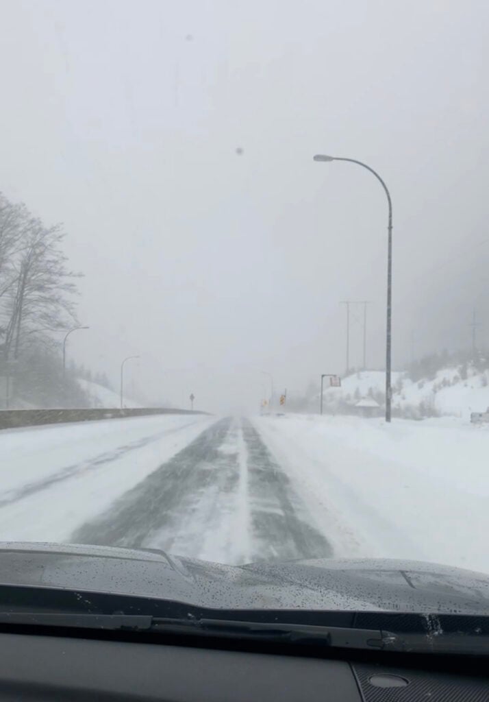
Best time to drive the Sea to Sky Highway: June-September
You can drive the Sea to Sky Highway all year, but the best time to go is from June to September when the snow has melted and the hiking trails are accessible. The most popular time is July and August on the weekend. If possible, try to go mid-week.
The Sea to Sky Highway was upgraded for the 2010 Vancouver Olympics, so it’s in much better shape than it was before. However, it is still narrow in a few places and very winding, especially south of Squamish. Accidents are common so take your time and go slow (even if the locals are speeding).
The weather can also be a huge factor when you drive from Vancouver to Whistler. There can be lots of snow in the winter. Heavy rain and fog can make the drive treacherous any time of the year. You can check conditions before you go on the highway webcams.
From October 1st to March 31st you must have winter tires on your car to drive the Sea to Sky highway. If you don’t, you could be fined.
There are lots of gas stations, restaurants and shops in Squamish, but there are few services along the rest of the drive.
The Sea to Sky Highway is in the ancestral territory of the Squamish (Skwxwú7mesh) and Lil’wat First Nations. Along the way there are interpretive signs in kiosks in the shape of traditional cedar bark hats. If you want to learn more about First Nations culture and history, be sure to stop when you see one.
The highway can be busy with a mix of tourists who want to go slow to enjoy the view and locals who are in a hurry to get home. Be a courteous driver and stay out of the left lane, except to pass.
It’s easy to rent a car in Vancouver or at the Vancouver International Airport (YVR). I use Discover Cars since they let you compare prices between tons of different rental companies.
Experiencing the Sea to Sky Highway Without a Car
If you don’t want to drive yourself, you have a few options for experiencing the Sea to Sky Highway.
Sea to Sky Shuttle Bus Services
There are several bus services that go from Vancouver to Squamish and Whistler. These services are intended to get you to your destination. They don’t stop at any attractions. However, you will still get great views out the window.
For the best views, sit on the left side of the bus on the way to Whistler and the right on the way back.
Local companies currently offering shuttle services include:
- YVR Skylynx (Vancouver airport, downtown Vancouver, Squamish, and Whistler)
- Epic Rides (Downtown Vancouver, Whistler)
- Whistler Shuttle (Vancouver airport, Whistler)
- Squamish Connector (Downtown Vancouver, West Vancouver, Squamish)
Sea to Sky Tours
Several companies offer Sea to Sky bus and small group van tours.
A popular option is a 10-hour Sea to Sky small van tour that goes from Vancouver to Whistler and back, stopping at popular spots like Shannon Falls and Porteau Cove along the way. Check prices.
If you want to include the Sea to to Sky Gondola, book a Sea to Sky Gondola and Whistler day trip. The tour includes stops at Shannon Falls, the Sea to Sky Gondola, and Whistler. Check prices.
Taxis, Limos, and Private Transfers
You can also take a taxi, limousine or private transfer from Vancouver to Whistler. Prices vary depending on what you book and how many stops you want to make.
Some Vancouver taxi companies will pick you up at the airport or downtown and take you to Whistler. However, it’s fairly expensive (about $350 one way) and the driver won’t want to make any stops since they will be in a hurry to get back to Vancouver to get their next customer.
If you want to customize your itinerary or are travelling with a group, a private transfer in a limo or van makes the most sense. With vehicles ranging from town cars to luxe mini buses, they can come up with a quote and itinerary that works for your group. Check prices.
Places to Stop on the Sea to Sky Highway
Whytecliff Park

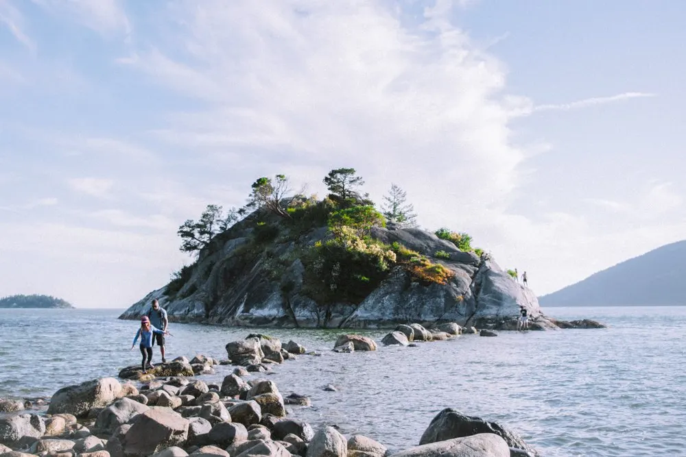
This beautiful park is nestled into a pocket cove surrounded by fancy West Vancouver mansions. Head down to the beach for great views of Howe Sound and the nearby Sunshine Coast. Or explore the trails to various bluff-top viewpoints.
At low tide you can scramble across the rocks out to Whyte Islet, the rocky island just offshore.
Getting there: 7102 Marine Dr, West Vancouver. From the highway, take exit 2 for Eagleridge Drive. Go right at the round about and continue past the the ticket booths for the ferry terminal. Turn left onto Marine Drive.
At next two roundabouts, go straight to continue on Marine Drive. Stay on Marine Drive as it winds through the neighbourhood and ends at the Whytecliff parking lot. Click here for Google maps driving directions.
Lions Bay
The tiny village of Lions Bay (population 1300) is perched on the side of the steep mountainside. If you need a snack, there is a small general store and cafe accessed via the Lions Bay Avenue exit. There are also several small beaches (Lions Bay Beach, Kelvin Grove Beach), but parking is quite limited.
One of the main reasons to visit Lions Bay is the hiking trails. Challenging routes lead high into the mountains to the summits of iconic peaks like the Lions (for which the town is named). An easier and equally picturesque option is the 4 hour hike to Tunnel Bluffs, which has an incredible view.

READ NEXT: My guide to the Tunnel Bluffs Hike in Lions Bay
Porteau Cove
This small provincial park is wedged between the Sea to Sky Highway, a rail line and the deep waters of Howe Sound. The day use area is a great place to stop and stretch your legs. Be sure to take a walk out on the pier for great views of the surrounding mountains.
Fun fact: The pier actually doubles as an emergency ferry terminal in case parts of the Sea to Sky Highway are impassable. However, it’s never actually been used for that purpose.
Getting There: Turn left at the sign for Porteau Cove Provincial Park. Click here for google maps driving directions.
More info: Porteau Cove Provincial Park
Psst! Porteau Cove Provincial Park is on my list of the best places to camp near Vancouver and the best places to camp near Squamish.
Britannia Mine Museum
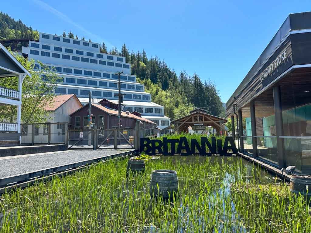

This little village of Britannia Beach used to be home to the largest copper mine in the British Commonwealth. These days the mine is a museum and the village is exploding with new condo developments.
The museum is pretty cool. They have lots of old hulking machinery on display, including a GIANT truck. But I found the historical displays the most interesting. They explain the history of the village and what it was like for the miners and their families who lived there. In the mine’s heyday, there was no road to Britannia so it was a pretty isolated spot.
The highlight of the museum is the underground mine tour. You get to ride on an old mine train, wear a hardhat and experience what it was actually like to mine for copper. (Hint: It was LOUD!)
They also have a new multimedia show called BOOM! that provides a behind the scenes look at what the giant mill building looked, sounded, and smelled like when it was operational. I sometimes find shows like this to be a little cheesy, but this one was really well done.
Getting There: 1 Forbes Way, Britannia Beach. Turn right off the Sea to Sky Highway onto Copper Drive at the traffic light in Britannia Beach. Click here for Google Maps driving directions.
More Info: Britannia Mine Museum
Detour: If you’re hungry, don’t miss Mountain Woman Take-Out. This tiny old-school shack of a restaurant in Britannia Beach has great fish and chips. If you’re looking for something a bit more hip, check out Outbound Station, also in Britannia Beach. They have great burgers and coffee.
Murrin Provincial Park
On summer weekends you’ll be lucky to get a spot in the parking lot at Murrin Provincial Park. That’s because tiny Browning Lake is a super popular swimming spot with warm water and a nice sandy beach. It’s a nice spot for a picnic any time of year too. Keep an eye out for rock climbers on the nearby cliffs.
If you are adventurous, there is also a fun hike up onto the bluffs with incredible views. However, it involves a bit of scrambling so it’s best for experienced hikers.
Getting There: Turn left at the flashing yellow light and signs for Murrin Provincial Park. Click here for Google Maps driving directions.
More info: Murrin Provincial Park
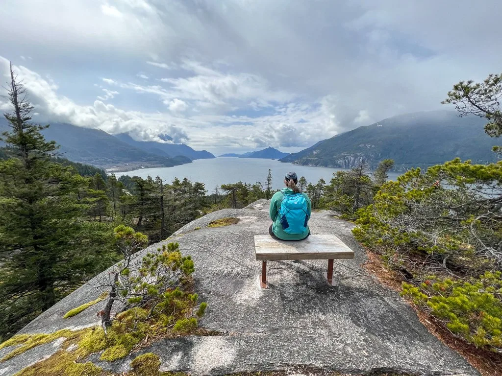
Nch’kay Viewpoint
As you round the corner into Squamish, you’ll see a pull out on the left. This is the Nch’kay viewpoint. From here you get a great view of Mount Garibaldi, known as Nch’kay in the Indigenous Skwxwu7mesh language.
Mount Garibaldi is a huge dormant volcano that towers over the town. If the weather is clear, pull over here for a quick photo op of Nch’kay and the town of Squamish.
Getting there: Turn left into the pullout about 1.5km after Murrin Park.
Shannon Falls
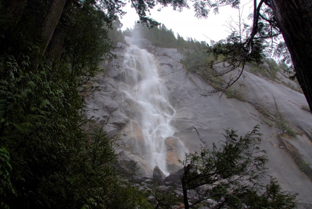
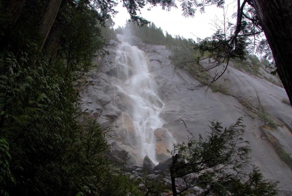
At 335m tall, Shannon Falls is the 3rd highest waterfall in BC. It’s a short 5 minute hike to the falls. Be sure to check out both the upper and lower viewing platforms to see the falls from different vantage points.
Getting there: Turn right at the Darrell Bay Road traffic light and follow the park road into the parking lot. Click here for Google Maps driving directions.
More info: Shannon Falls Provincial Park, my guide to Vancouver area waterfall hikes
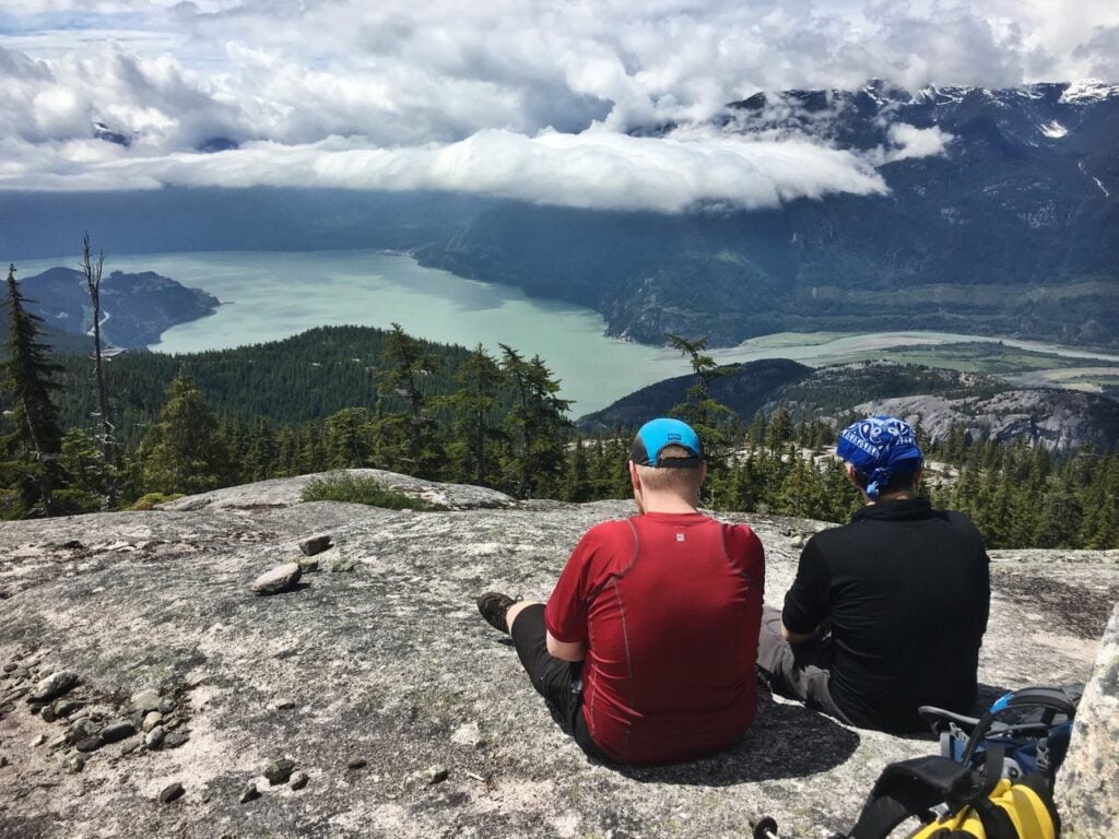
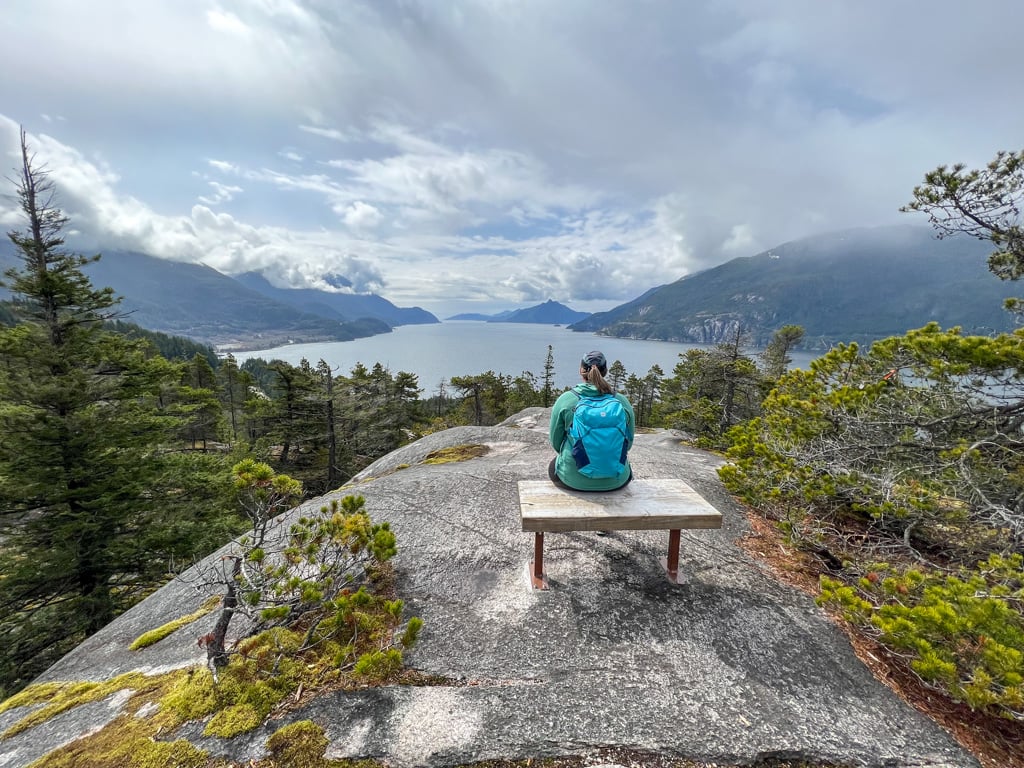
Sea to Sky Gondola
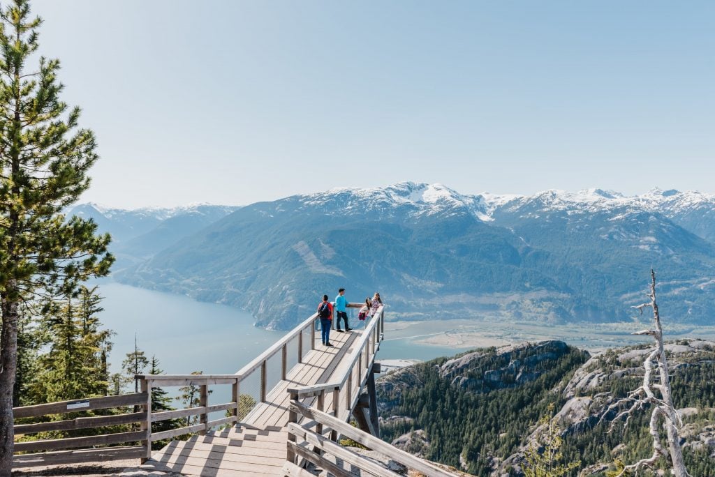
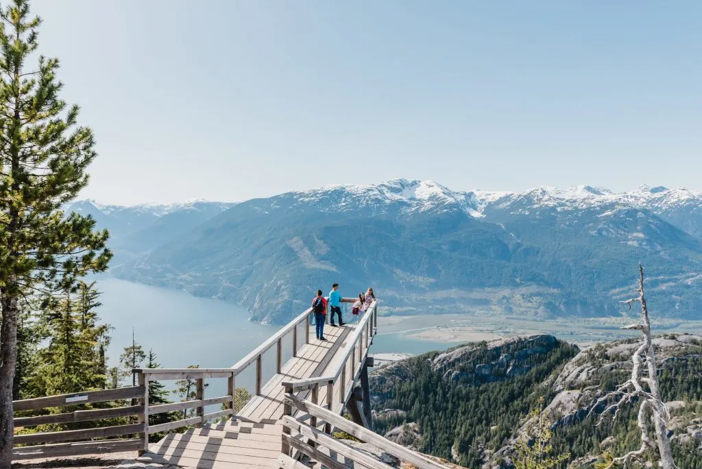
Opened in 2014, the Sea to Sky gondola is one of best attractions in between Vancouver and Whistler. I have an annual pass and head up there every few months.
The gondola carries passengers from the side of the highway, up past granite cliffs to a lodge perched high above Howe Sound. It’s an easy way to get up into the mountains without a breaking a sweat. (Although it will give your wallet a minor workout.)
If you want to save some money, you can also hike up to the top via the challenging Sea to Summit Trail. It climbs 900m over 7km and will take most people about 3.5 hours. If you want, you can take the gondola down for a fraction of the price it costs to go up.
Once you arrive at the top, be sure to check out the viewing platforms and suspension bridge near the lodge. For more epic views, walk the Panorama Trail. It’s mostly flat and quite easy and at only 1.6km long, it’s short enough for almost everyone.
If you are up for a longer hike, Al’s Habrich Trail made my list as one of the best hikes near Vancouver. In the winter, the Sea to Sky Gondola also has some of the best snowshoeing trails in Squamish.
If you get hungry, the lodge has a small cafe. Grab a bowl of poutine and a beer, then sit out on the patio in the sunshine and enjoy the views.
Tip: Save time by buying your Sea to Sky Gondola tickets ahead of time.
Getting there: 36800 Highway 99, Squamish, BC. Watch for the entrance on the right hand side of the Sea to Sky highway just after the Darrell Bay Road traffic light. Click here for Google Maps driving directions.
More info: Sea to Sky Gondola
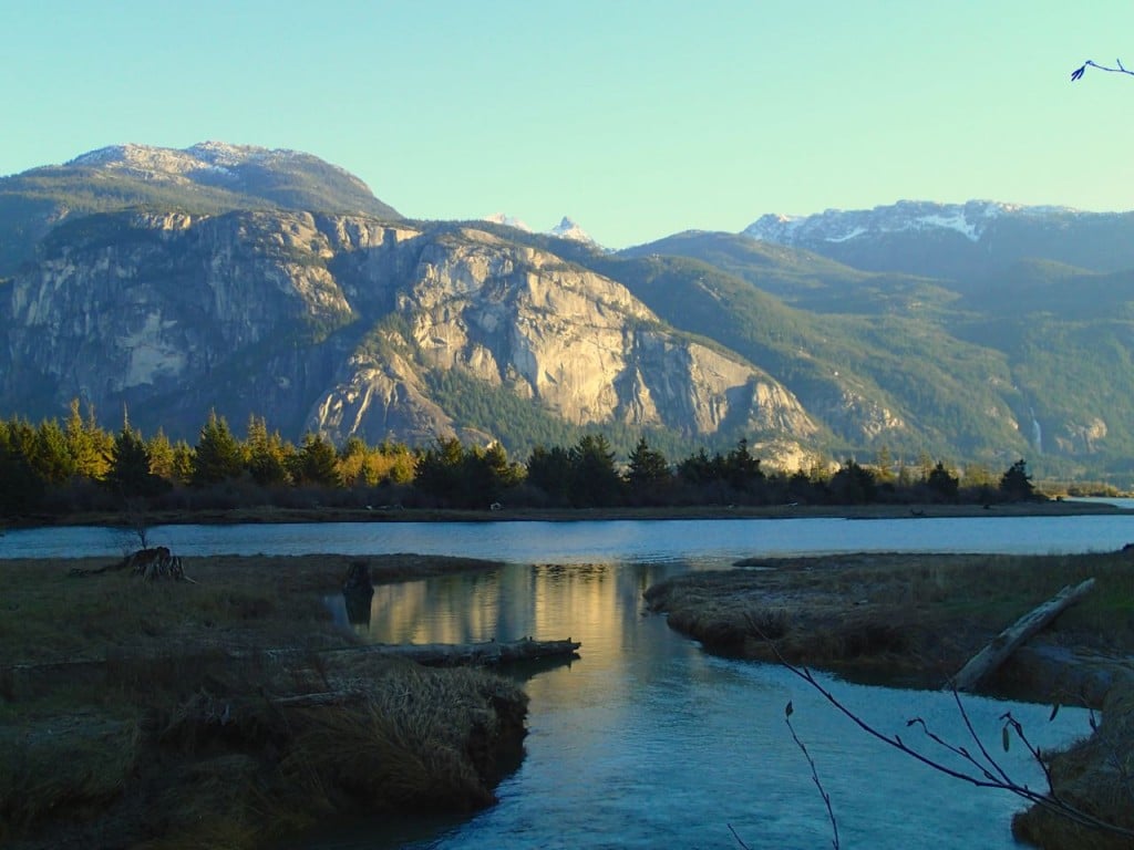
Stawamus Chief

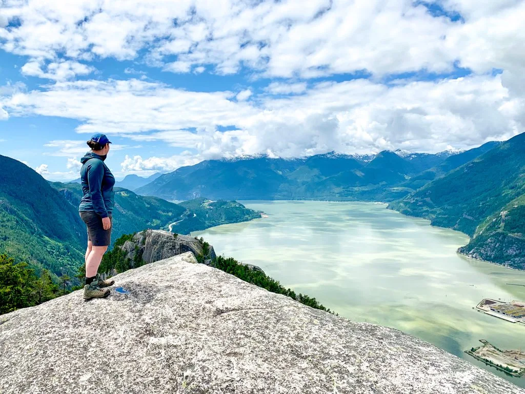
The Stawamus Chief is a huge granite dome that towers over the town of Squamish. The Sea to Sky highway passes right beneath the base. The Chief is 700m tall and is one of the largest granite monoliths in the world.
If you just want to pull over for a quick look, the best place is the roadside parking lot just after the pedestrian overpass. See if you can spot rock climbers high above you! If you want to try it out, you can go on a guided rock climbing trip that’s geared for beginners.
However, you don’t need a rope and harness to get to the top. There’s a steep hike up the backside of the Stawamus Chief that takes you all the way to the top of the cliffs. Be careful as there are no railings and it’s a LONG way down! This is a popular hike and is one of Vancouver’s most Instagrammed hikes.
Getting there: For the best view, turn right off the Sea to Sky highway into the parking lot next to the highway just past the pedestrian overpass. (This isn’t the main parking lot.) Click here for Google maps driving directions.
More info: Stawamus Chief Provincial Park
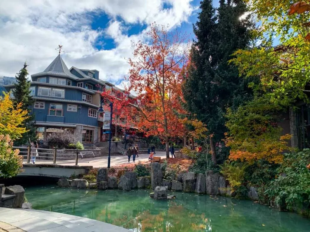
Downtown Squamish

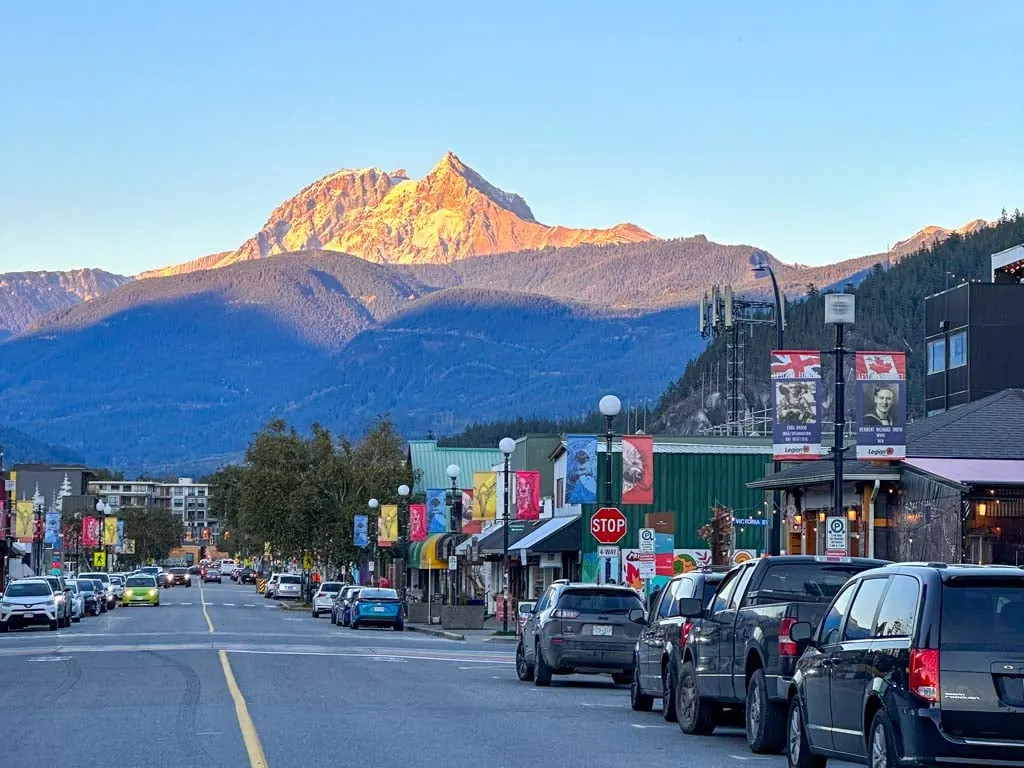
Be sure to turn left off the Sea to Sky Highway to explore downtown Squamish along Cleveland Avenue. As a local, my favourites are Billie’s House for house plants and home goods, Empire of Dirt for gifts and housewares, Lucas Tea, and Xocolat chocolates.
If you are driving the Sea to Sky Highway on a Saturday in the spring, summer, or fall, be sure to stop in at the Farmer’s Market for local produce, baked goods, crafts, and live music.
Getting There: Turn left at Cleveland Avenue and follow it a few blocks into downtown Squamish. Click here for Google Maps driving directions.
More Info: Squamish Farmer’s Market
Psst! Looking for even more things to do in Squamish? Check out my Squamish activities guide – it has over 70 ideas.
Railway Museum of British Columbia
I’m not into trains, so I have to be honest and say I’ve never been here. However, my nephew loves it and has been several times. The Railway Museum of British Columbia has all kinds of vintage train cars, engines, and parts (over 90 of them!) Some of them are over 100 years old.
They also have a miniature railway that is popular with kids. At Christmas they have a special Polar Express Event. There’s also a Thomas the Tank Engine event in the spring.
Getting There: 39645 Government Rd, Squamish, BC. Turn left off the Sea to Sky Highway onto Commercial Way. Go straight through the roundabout, then turn right on Queens Way. Follow Queens Way as it curves around to the left and becomes Government Road. Cross the railway tracks and find the entrance to the West Coast Railway Heritage Park on your right. Click here for Google Maps driving directions.
Hours: The museum is only open on Saturdays in the summer. The rest of the year they are open for special events like the Polar Express and Thomas the Tank Engine.
More Info: Railway Museum of British Columbia
Squamish Estuary and Spit

For the best view of the Stawamus Chief, head to the Squamish Estuary and Spit. This finger of land sticks out into Howe Sound at the mouth of the Squamish River. There are several short, flat trails where you can spot birds and other wildlife.
But for the best views, head out to the end of the spit. Squamish means Mother of the Wind, and the spit is the windiest place in Squamish. There are usually lots of kitesurfers and windsurfers playing in the waves just offshore.
Getting There: Turn left on Commercial Way. Go straight through the roundabout, then turn right onto Queen’s Way. Follow this road as it curves around to the left and becomes Government Road. Cross the train tracks and keep going on Government.
Look for Spit Road on your right. It’s gravel, and can be very bumpy, but it’s fine for 2WD vehicles if you go slow. Follow Spit Road to a T-junction and turn left. Keep going to the end of the road. Click here for Google Maps driving directions.
Brackendale Eagle Viewing

Squamish has more eagles than anywhere else in the world, usually around 1,300 every year. Many eagles migrate to Squamish in the fall to feed on spawning salmon, then stay for the winter. Head to the dykes along the Squamish River in the Brackendale neighbourhood to see them.
From November until January there are volunteers along the dyke on weekends with telescopes to help you get a better look. You can also bring your own binoculars of course!
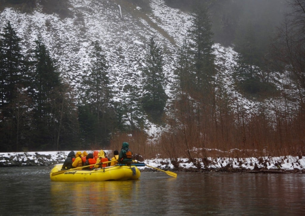
Another great way to see the eagles is on a floating raft tour. I did this eagle float tour a few years ago and had a great time.
Getting There: Turn left off the Sea to Sky Highway onto Garibaldi Way. Turn right at Government Road and follow it as it approaches the river. Park in the gravel parking lot on the right just before the Watershed Grill or on the shoulder. Cross the road and follow the path to the top of the dyke. Click here for Google Maps driving directions.
Alice Lake Provincial Park
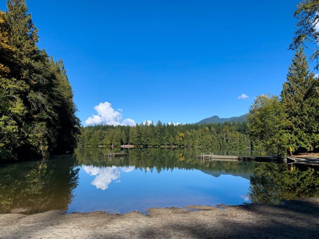

Alice Lake has a popular campground and picnic area that makes a great place for break when driving to Whistler. You can go for a swim in the lake or rent a paddleboard or kayak. It’s also a great place to swim on a hot day.
There’s also an extensive network of hiking and mountain biking trails. If you’re looking for an easy hike, I like the Four Lakes Trail. It’s mostly flat and only takes 2 hours to complete. Details are in my guide to hiking in Squamish.
Getting There: Turn right off the Sea to Sky Highway at the flashing yellow light at Alice Lake Road. Follow the road into the park. On busy summer weekends when the parking lot fills up park rangers may close the entrance gate. Click here for Google Maps driving directions.
More Info: Alice Lake Provincial Park
Psst! Alice Lake Provincial Park is on my list of the best places to camp near Vancouver and the best places to camp near Squamish.
Cat Lake

This small lake 15 minutes north of Squamish gets fairly warm in the summer. It also has several docks you can jump off. The lake is surrounded by walk-in campsites. It’s a popular spot for partiers on the weekend, but during the week you can have it mostly to yourself.
Getting There: Turn right off the Sea to Sky Highway onto the Cheekeye Forest Service Road about 3 minutes after you pass the turn off to Alice Lake. Follow the gravel road about 2.5km to the parking lot. Click here for Google Maps driving directions.
More Info: Cat Lake Recreation Site
Brohm Lake

From the highway Brohm Lake looks pretty marshy. However, if you head around the corner you’ll discover a pretty little lake surrounded by forest and granite bluffs. There’s a trail around the lake so you can stake out your own lakeside spot.
There is also a great network of hiking trails that lead to several viewpoints. Get more details in my guide to the best hikes in Squamish.
Locals love to swing into the water from the rope swing or jump off the short cliffs. The parking lot is small so go early on summer weekends to get a spot.
Getting There: Turn left off the Sea to Sky highway at the sign for Brohm Lake. There’s a small left-hand turn lane. It’s just past the turn off for Cat Lake. Click here for Google Maps driving directions.
More Info: My guide to Brohm Lake trails
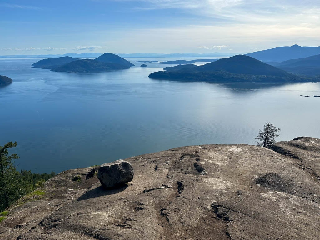
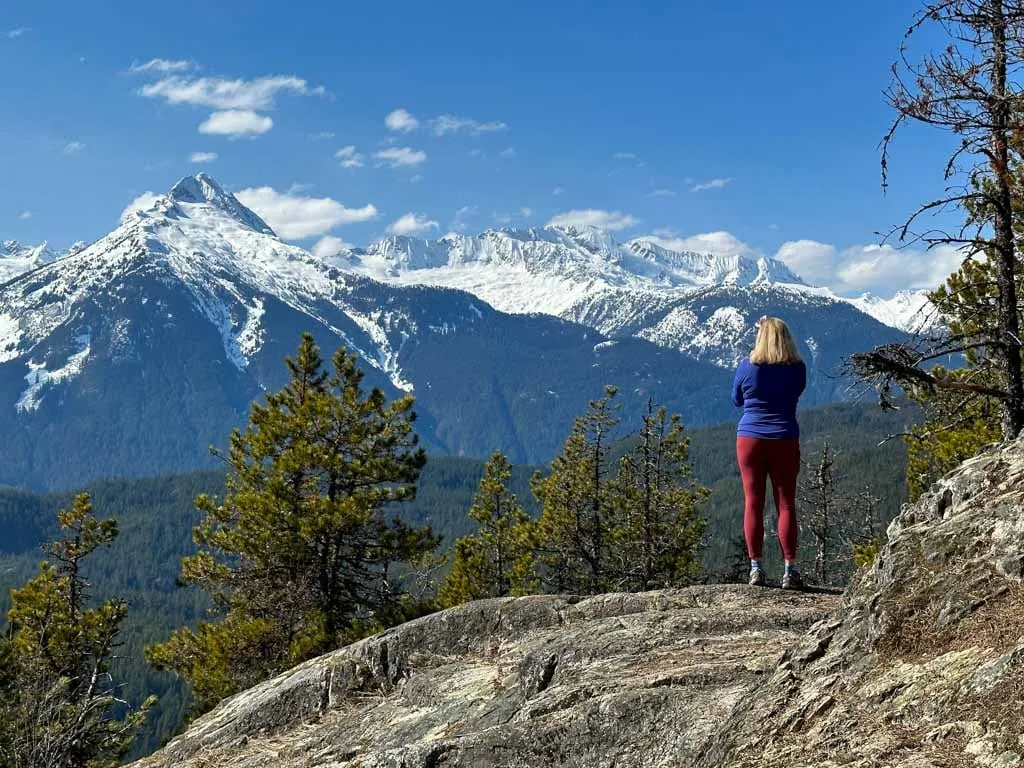
Tantalus Lookout

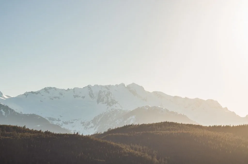
The snow-capped mountains on the west side of the Squamish River are called the Tantalus Range. There are no roads and just a few trails that access the jagged peaks. But you can get a great view just by pulling off the road.
Getting There: Turn right off the highway at the viewpoint sign. It’s about 2.5km past the Brohm Lake turnoff. Follow the road uphill for a few meters to a parking lot on the left. Click here for Google Maps driving directions. (Use these if you are going northbound.)
There’s actually an even better view, but you can only access it when you are driving southbound from Whistler to Vancouver. Look for it on the west side of the highway. (You can’t turn left going northbound so save it for the drive home.) Click here for Google Maps driving directions. (Use these if you are going southbound.)
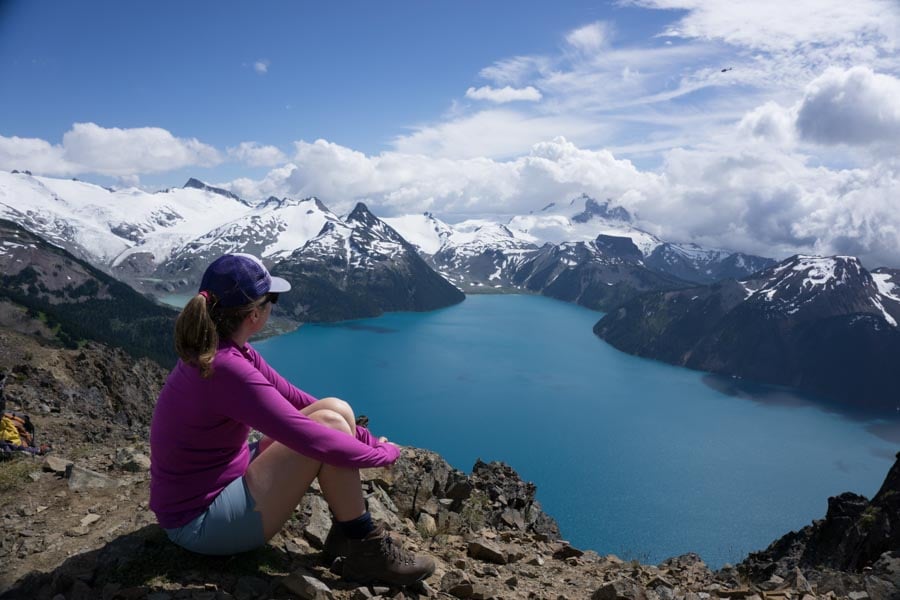
Garibaldi Lake

Heads up: Day passes are required at Garibaldi Provincial Park in summer 2023. Learn more in my guide to BC Parks day passes.
The hike to Garibaldi Lake is one of the most popular (and most beautiful) hikes in BC. It’s a long hike so allow a full day to get there. It is 18km return with 800m of elevation gain and will take at least 5 hours. Make sure to leave enough time at the top to take photos or even go for a dip in the freezing cold glacial lake.
If you’re really keen, you can add on the hike to Panorama Ridge. The views are great but it will add another 12km, 700m and 6 hours to your hike. You can also camp overnight.
(FYI: Garibaldi Lake is on my list of the 10 best hikes near Vancouver, so if you’re a hiker, you shouldn’t miss it.)
Getting there: Watch for the sign for Garibaldi Provincial Park, then turn right on Daisy Lake Road just after going over a bridge. The trailhead is 2.5km down the road from the Sea to Sky Highway. Click here for Google Maps driving directions.
More Info: Garibaldi Provincial Park
Brandywine Falls
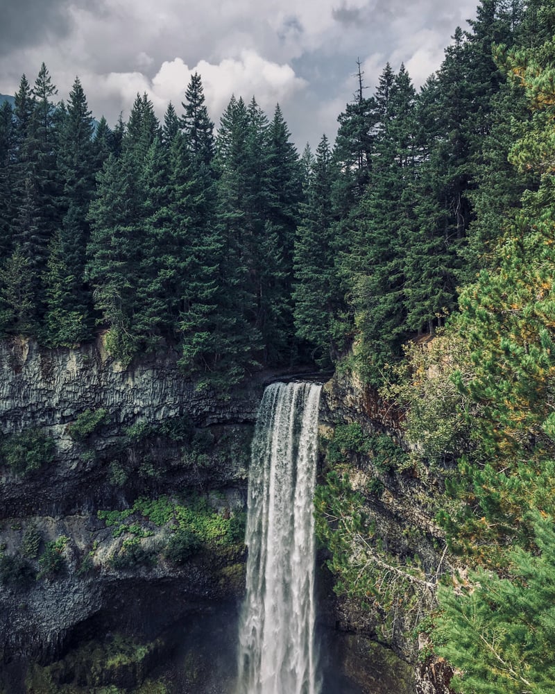

The 70m tall Brandywine Falls are pretty spectacular since they have carved a huge canyon into lava columns. The waterfall is one of the Sea to Sky Highway’s best known attractions. It’s a short half-kilometre hike to the viewing platforms.
There’s a steep and dangerous trail down to the bottom of the falls, but it’s officially out of bounds so I don’t recommend it.
If you visit in the winter, the trails around Brandywine Falls are also one of the best places near Squamish to go snowshoeing.
Getting there: Turn right off the highway at the sign for Brandywine Falls. Click here for Google Maps driving directions.
More info: My Brandywine Falls hiking guide
Alexander Falls
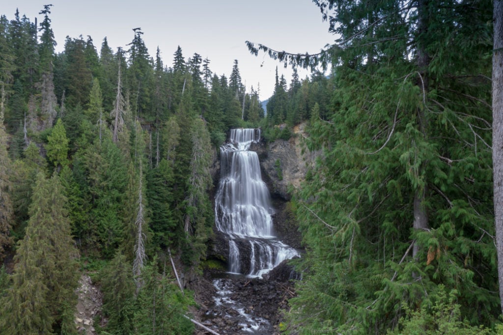

It’s a bit off the beaten track, so Alexander Falls doesn’t get as much buzz as Brandywine Falls or Shannon Falls. But I’d argue that it is equally impressive. It’s 43m tall and drops down over several tiers. You can drive right up to the viewing platform.
Getting there: Watch for the sign for Whistler Olympic Park, and turn left off the Sea to Sky Highway onto Callaghan Road. Follow the road for about 10 minutes. Look for the Alexander Falls Recreation Site sign on the left and turn into the gravel parking lot. Click here for Google Maps driving directions.
Whistler Olympic Park
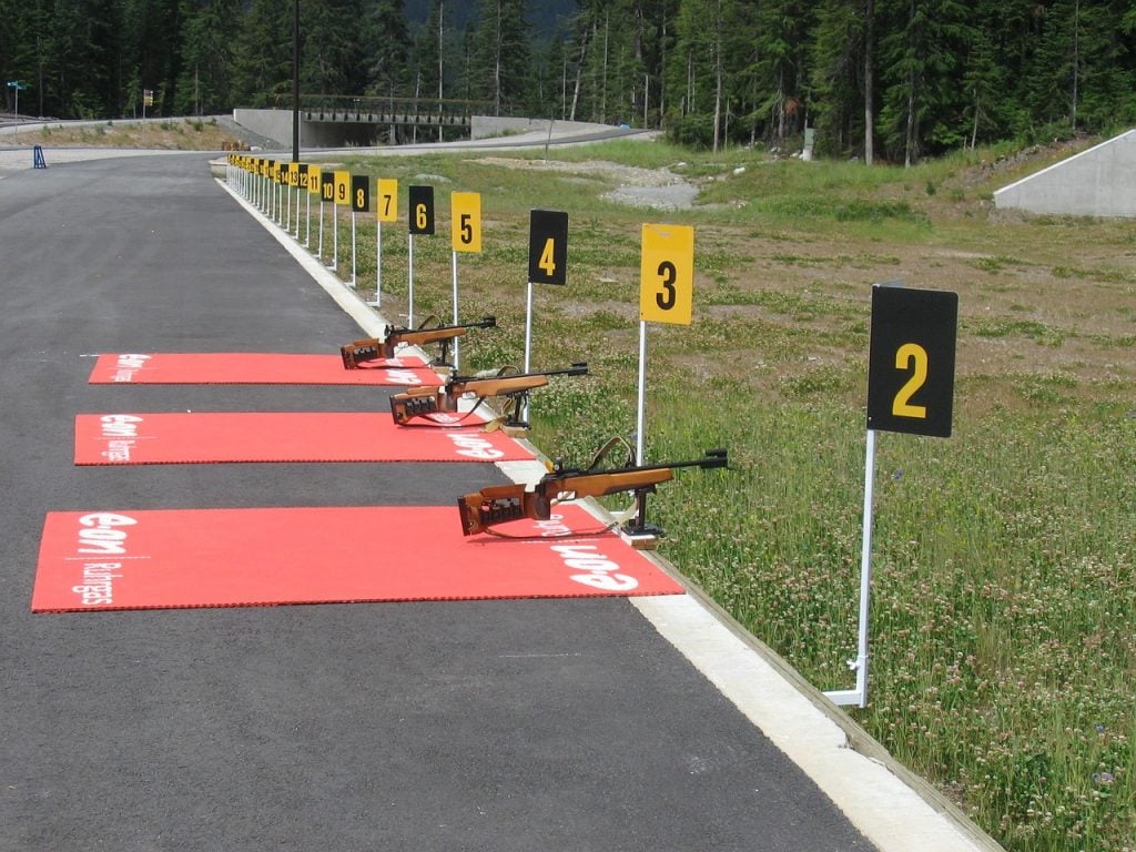
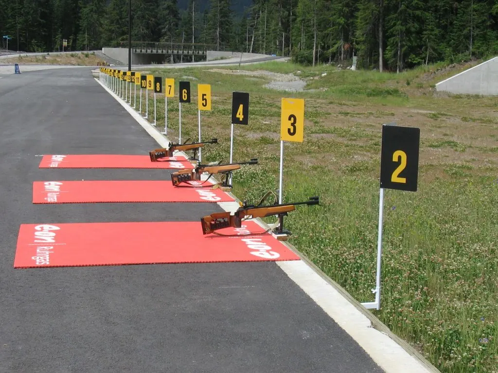
During the 2010 Olympics and Paralympics, the nordic skiing, biathlon and ski jump events were held at Whistler Olympic Park in the Callaghan Valley. In the winter you can cross country ski or snowshoe here. (Checkout my guide to snowshoe trails.)
The trails are open in the summer too, including hiking up the ski jump. You can also sign up for biathlon lessons and shoot on the same course as the Olympians! There’s a small fee to get in.
It’s also worth a drive up this road as its one of the best places in the Sea to Sky corridor to see bears. If you see a bear, stay in your car and take photos from a distance. Never, ever feed a bear! Read more about bear safety.
Getting there: 5 Callaghan Rd, Whistler, BC. Watch for the sign for Whistler Olympic Park, and turn left off the Sea to Sky Highway onto Callaghan Road. Follow the road for about 15 minutes to the lodge, passing Alexander Falls along the way. Click here for Google Maps driving directions.
More info: Whistler Olympic Park
Whistler Bungee
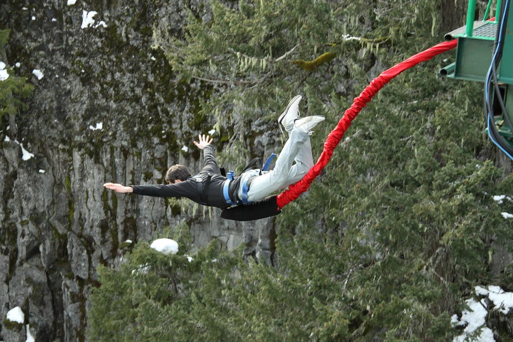

I’m a chicken and have never bungee jumped. (And I likely never will unless someone is paying me to do it!) But if bungee jumping is on your bucket list, you can do it in Whistler.
You’ll plummet 50 metres (160 feet) off a narrow bridge into the Cheakamus River canyon. The river is glacially fed so it’s a beautiful bright blue colour. Even if you don’t jump, it’s worth a detour to see the canyon. If you’re up for a slightly longer hike, you can also get to Brandywine Falls from here.
Getting there: Calcheak Forest Service Rd, Whistler, BC. Just after the turn-off to Whistler Olympic Park, turn right off the Sea to Sky Highway onto Cal-Cheak Forest Service Road. You’ll cross train tracks right away and then the road turns to gravel. Follow the road for about 7 minutes to the bungee bridge. Click here for Google Maps driving directions.
More info: Whistler Bungee
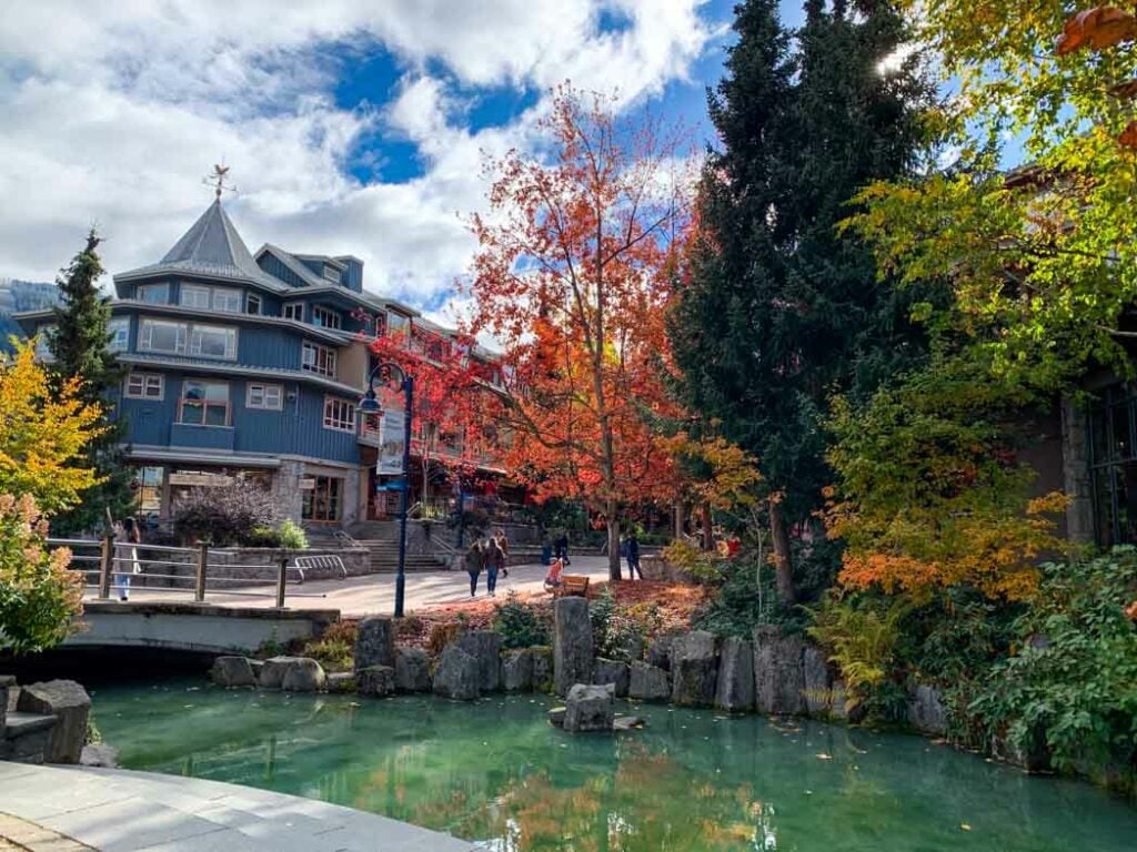
Whistler
From skiing to mountain biking, to hiking, to food, Whistler has something for everyone. I’ve got a huge list of the best things to do in Whistler.
Best Places to Eat and Drink on the Sea to Sky Highway
As a Squamish local, I’ve eaten at pretty much every restaurant along the Sea to Sky Highway. Here are my favourites.
Taka Ramen & Sushi
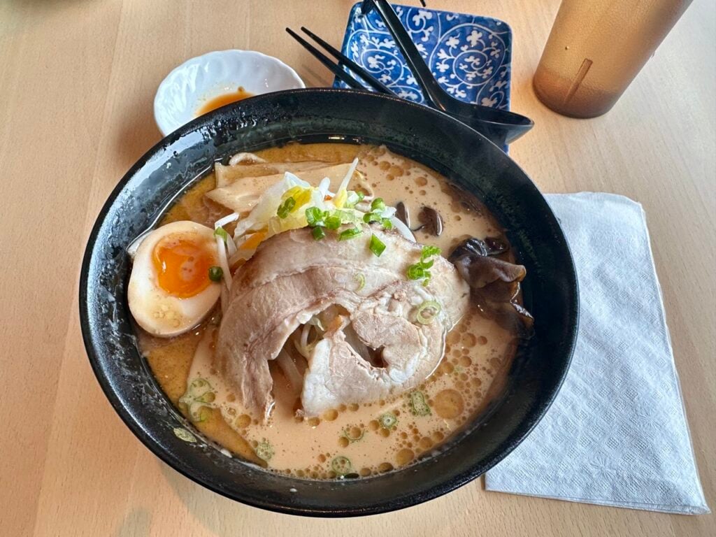
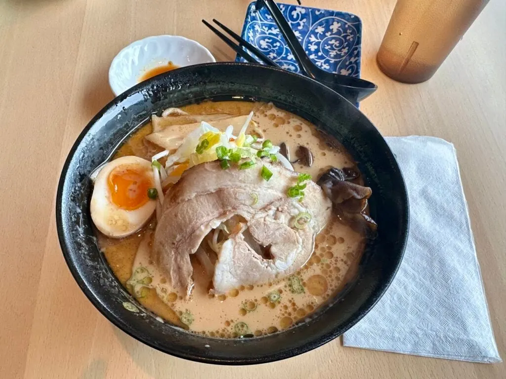
The BEST Japanese food in the Sea to Sky area. Top notch sushi, delicious ramen, and great staff. The only downside is that they don’t take reservations, so you often have to wait for a table.
Getting There: 38065 Cleveland Avenue, Squamish. From Highway 99, turn left onto Cleveland Avenue and follow it for a few blocks. Click here for Google Maps driving directions.
Fox & Oak
This is my favourite spot in Squamish for coffee and a sweet treat. The interior is gorgeous with sleek wood, tile, and lots of plants They have under cover outdoor seating too. Their coffee is great, but the real reason to visit is their artisanal doughnuts.
They have cake doughnuts, brioche doughnuts, and vegan doughnuts in classic flavours like chocolate glaze and more experimental flavours like Earl Grey tea. I always get the mango passion fruit.
Getting there: 1396 Main Street, Squamish. From Highway 99, turn left on Cleveland and follow it for a few blocks to the intersection with Main Street. Click here for Google Maps driving directions.
Zephyr Cafe
Want a healthy meal in Squamish? Head to Zephyr Cafe downtown. They serve breakfast and lunch, including lots of vegan, vegetarian and gluten-free options. I usually get the qunioa bowl with their delicious sesame dressing.
Getting there: 8084 Cleveland Ave, Squamish. Turn left off Highway 99 onto Cleveland Avenue. Zephyr Cafe is on the left hand side about half a block past Winnipeg Street. Click here for Google Maps driving directions.
Luz Tacos at Geo Cider
Squamish has several great places to get Mexican food, but I think Luz tacos is by far the best. Their burritos are huge and oh so good. They are located inside Geo Cider, so you can get your food to go or enjoy it along with their tasty cider.
Getting there: 1201 Commercial Way, Squamish. From Highway 99, turn left on Industrial Way. Go right at the T-junction on to Queens’s Way, then turn right at the first driveway into the parking lot. Click here for Google Maps driving directions.
Watershed Grill
The Watershed Grill in Brackendale is one of my favourite places to eat in Squamish. It’s right on the banks of the river, so the patio has a great view. They have tasty pub-style food. It’s a locals hangout so expect crowds on nights when there’s hockey on TV.
Getting There: 41101 Government Rd, Brackendale. Turn left off the Sea to Sky Highway onto Garibaldi Way. Turn right at Government Road and follow it as it approaches the river. Look for a gravel parking lot on the right just after a cross walk. Park here and cross the road. The restaurant is just ahead behind the trees. Click here for Google Maps driving directions.
Fergie’s Cafe
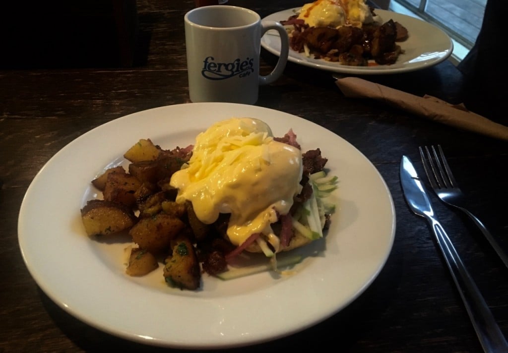
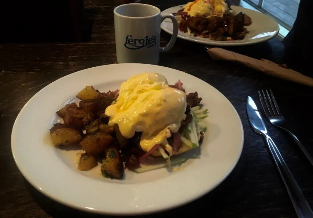
Fergie’s Cafe has some of the best food in Squamish. In fact, I think they have the best eggs Benedict I’ve ever had! This small restaurant is attached to the Sunwolf resort. They moved into a new building a few years ago with a mix of indoor and outdoor seating. They’re just open for breakfast and brunch. Go early (especially on wekends) to get a table as they don’t take reservations.
Getting There: 70002 Squamish Valley Rd, Brackendale. Turn left off the highway at the flashing yellow light onto Squamish Valley Road. Look for the entrance to Fergie’s on the right hand side just before going over a bridge. Click here for Google Maps driving directions.
Where to Stay Along the Sea to Sky Highway
If you really want to make the most out of your Sea to Sky Highway road trip, you should break it up over a few days and stay overnight.
The easiest place to base yourself is in Squamish where there are lots of options from cabins to hotels to hostels. (In fact, Squamish made my list of the best weekend getaways from Vancouver.)
I’ve got a whole guide to the best hotels in Squamish that you should check out. It’s got details on the best places for families, groups, those on a budget, and more.
Camping
For a complete list of campgrounds on the Sea to Sky Highway, check out my guides to camping in Squamish and camping in Whistler.
Some campgrounds require advance reservations while others are first-come, first served. Plan ahead on summer weekends as it can get REALLY busy.
Boutique Hotel: Howe Sound Inn
The Howe Sound Brewing Company also has their own boutique hotel, the Howe Sound Inn. It’s right in the heart of Squamish so you can walk to shops and cafes. And if it’s raining, you don’t even have to go outside – just go downstairs to the brew pub! Check rates.
Hotel Suites: Executive Suites Hotel
Every room at the condo-style Executive Suites Hotel has a kitchen, which is great if you want more space or prefer to cook for yourself. It’s also one of the more upscale hotels in town. It’s located north of downtown Squamish, but there is a restaurant on site and lots of hiking trails nearby. Check rates.
Cabins: Sunwolf
I stayed at the Sunwolf cabins a few years ago. It’s an old fishing lodge right next to the Cheakamus River in Brackendale. The cozy wooden cabins have river views and fireplaces, but no TVs – just what you need for a wilderness getaway. Plus its on the same property as Fergie’s! Check rates.
(Want even more cabin options? Check out my list of the best cozy cabins near Vancouver.)
Hostel: Squamish Adventure Inn & Hostel
The Squamish Adventure Inn has both dorms and private rooms, a kitchen, and patios. It’s located just off the highway next to the river. If you’ve had enough driving, it’s within walking distance to bike trails, hiking, rock climbing, restaurants and groceries. My sister stayed here for the weekend and says it’s a great place to meet other travellers to go hiking or exploring. Check rates.
Sea to Sky Highway FAQ
No. However, most drivers should be fine if they pay attention. If you are used to driving straight and flat highways, you will find the Sea to Sky Highway a bit challenging. But it is not dangerous or difficult in good weather. The road has many sharp turns and hills, which are fine if you pay attention to the speed limits and warning signs. In bad weather, such as rain or snow, slow down and be careful as skids and slides are common at high speeds.
The Sea to Sky Highway starts in the Horseshoe Bay neighbourhood of West Vancouver. Many people think it ends in Whistler, but it actually continues to Pemberton, about 30 minutes past Whistler.
Yes. Between October 1 and March 31 you must have winter tires to drive the Sea to Sky Highway. Any tires with a snowflake symbol on them qualify as winter tires for this rule. This includes snow tires, M+S tires, and all season tires. However, the tires can’t be bald – they need to have at least 3.5 mm of tread. As a local, I can tell you that the police do random spot checks and issue tickets to people without winter tires.
Yes! There are stunning views the entire way, starting with ocean views over Howe Sound, then transitioning to mountain views of then Tantalus Range as you get closer to Whistler. There are also lots of great viewpoints, hikes, and waterfalls to stop at along the way.
In most places, the Sea to Sky Highway is four lanes – two in each direction. However, there are several long stretches where there is just one lane in each direction, especially south of Squamish.
The highway starts at the sea – the Pacific Ocean in West Vancouver and then climbs into the mountains near Whistler – the sky!
Either drive yourself or take a bus tour.
Yes! The Sea to Sky Gondola is one of the best things to see along the Sea to Sky Highway. It is expensive, but worth it. On a clear day it has incredible views of the ocean and mountains. The walking trails near the lodge are easy and great for most visitors. Hardy hikers will want to venture onto the tough trails that lead up into the mountains.
Porteau Cove, Shannon Falls, the Sea to Sky Gondola, Squamish, and Brandywine Falls are the best places to stop on the Sea to Sky Highway between Vancouver and Whistler. I have details on these, and 15 more great stops in this guide.
The following places have public bathrooms and are right on the highway: Porteau Cove, Shannon Falls, Sea to Sky Gondola, Squamish, Brandywine Falls.
You can drive the entire route in about 2 hours. However, if you want to make any stops, plan to spend an entire day. A better option is to split the trip up over two days, spending the night in Squamish.
With all that info, you should be ready to head out on your own Sea to Sky Highway road trip. What’s your favourite spot to stop between Vancouver and Whistler? Do you have questions about driving the Sea to Sky highway? Let me know in the comments.
More Whistler posts:
- The Best Things to Do in Whistler (By a Local)
- 42 Cheap and Free Things To Do in Whistler
- Visiting Whistler, BC in Summer (By a Local)
- 44 Best Things to Do in Whistler in Winter
- The Best Hikes in Whistler: A Guide to All the Trails
- Camping in Whistler
- Where to Go Snowshoeing in Whistler
More Squamish posts:
- 70+ Things to do in Squamish (By a Local)
- 10 Best Hotels in Squamish
- Camping in Squamish
- Where to Go Snowshoeing in Squamish
More Vancouver posts:
- 20+ Beautiful Weekend Getaways from Vancouver
- Cozy Cabins near Vancouver Perfect for a Weekend Getaway
- Camping Near Vancouver, BC: 40+ Best Campgrounds


- Things to Do on Newfoundland’s Great Northern Peninsula - July 29, 2026
- Best Sun Hoodies for Hiking - June 3, 2026
- Lower Stein Valley Trail Hiking and Backpacking Guide - May 27, 2026
Dana
Saturday 21st of February 2026
We are coming in April 4-8. How is the drive then? We rented a minivan.
Taryn Eyton
Saturday 21st of February 2026
Snow tires are no longer required in April. You likely will have no weather issues with the drive. However, at that time of year, big rainstorms are possible. Drive to the conditions and you'll be fine.
mike bondy
Monday 9th of February 2026
we are a tour company and will be driving highway coach on this hwy in mid April. Is this concenring?
Taryn Eyton
Monday 9th of February 2026
There are buses on this highway every day of the year in all weather conditions with very few issues. Winter tires are not required after March 31. In April you may encounter heavy rain with water pooling and possible hydroplaning. However, it's not likely - just a few days a month in spring. I would recommend using a local bus driver who is familiar with the route if possible. Otherwise, just go slow (buses do this anyway) and be sure to pull over to let other pass in the areas with passing lanes.
Mary
Monday 14th of July 2025
Taryn, I am so thrilled I found your guide to Sea to Sky highway! What an incredible day we had stopping along the way. Your pictures, descriptions and Google maps made it so easy to find the spots we wanted to see and that would be accessible for my partner who has limited hiking abilities. Some of the most beautiful country we have ever seen!
Arlene Perricone
Monday 5th of August 2024
Dear Taryn, I'm so happy I came across this blog. This is exactly what I needed to help us plan our Vancouver to Whistler trip this coming September. (9/21-9/24) Based on reading here are some questions I have. I think I can follow the travel itinerary and if I follow it the way you have it laid out it will get me to all points of interest along my route from Vancouver to Whistler without any back tracking? I.e. start using sea to sky highway stop in Whyte Cliff, then head to Porteau Cove then Britannia.... is that correct? Think we would like to take two days to do the trip. Stopping along the way, stay over in Squamish, then next day do trip to Whistler. Do have similar points of interest for the Squamish to Whistler portion of our trip? I Should have mentioned renting a 4wd SUV in Vancouver for the drive. Thinking of heading up Monday to avoid the weekend crowds and drive back to Vancouver Tuesday night. Thoughts? We are not spring chickens (lol) but husband and I do love sight seeing and small hikes and walks are doable. I feel that your blog gave us all the information we need to get around the "hiking" yet get outdoors nd enjoy. Any additional suggestions are greatly appreciated.
Taryn Eyton
Tuesday 6th of August 2024
Hi Arlene, I would recommend you your first day driving from Vancouver to Squamish and your second day going from Squamish to Whistler and then exploring Whistler. There are tips for where to stop between Squamish and Whistler in this post, and then I have several posts about things to see in Whistler. I would spend your third day driving from Whistler back to Vancouver. Or better yet, take four days so you have a free day in Whistler. If you aren't a hardcore hiker, you don't need a 4wd - any car is fine.
Donna
Wednesday 1st of May 2024
I'm so glad I found your blog. This is such great information and the photos are wonderful. We are going on an Alaskan cruise at the end of June, but I have a feeling our journey on the Sea to Sky Highway will be a favorite part of our trip. Thank you!