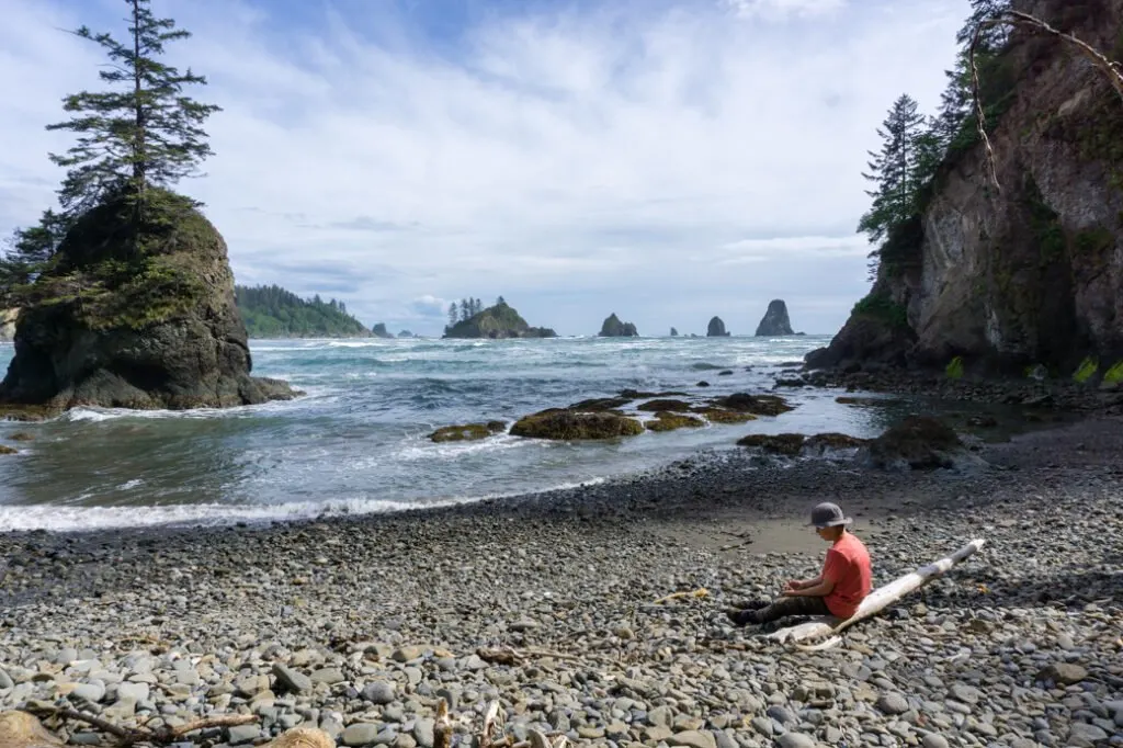
If you’re looking to explore some of Olympic National Park’s rugged coastline, I recommend hiking to Toleak Point from Third Beach. It’s a moderately challenging trail that travels along beaches and across steep headlands. The area around Toleak Point is dotted with dozens of offshore islands and sea stacks, making it really picturesque. Plus there are ah-mazing sunsets! You can hike there and back in a full day, but I think you should make it a backpacking trip and stay the night. The Toleak Point area isn’t as popular as the easier Ozette Loop or Shi Shi Beach hikes, which means you’ll experience more solitude.
However, you will have to work a bit harder for that solitude by climbing up ropes and carefully planning for the tides. I’ve done quite a few trips to the Olympic Coast so far, and I think Toleak might just be my favourite. There’s enough challenging terrain to make it a bit of an adventure, without it being too hard to be enjoyable. And the scenery… oh the scenery. If you are planning your own hiking or camping trip to Toleak Point, I’ve got all the info you need to make your trip incredible.
Hey there: Some of the links in this post are affiliate links, which means I earn a small commission at no extra cost to you if you make a purchase. Thanks for supporting my website! -Taryn
This is a sensitive wilderness area. Learn how to Leave No Trace to keep the wilderness wild. Make sure you are prepared by bringing the 10 Essentials. Get ready for adventure with this checklist of things to do before every hike.
Third Beach to Toleak Point Hike Basics
Pronunciation: It’s “toe-lee-ack”. If you say “too-leek” the Rangers will giggle.
Indigenous Land: This route is on the traditional territories of the Quileute and Hob people’s. Toleak means “hole in the rock” in the Quileute language and is likely a reference to the large window in the sea stack just north of Toleak Point.
Distance: 6.5 miles (10.5km) one way
Difficulty: Moderate. There are some challenging ladders and rope-assisted bluffs to climb.
Time: Depends on the tides. One overnight or at least 3.5 hours each way.
What to Bring: Everything you need to be self-sufficient. Use my simple backpacking checklist to ensure you have the gear you need.
Permits: Olympic National Park pass required. Overnight visitors require a camping permit.
Tide Info: La Push Tide Table. You will want to look into the tides when planning your trip as they can make a BIG difference.
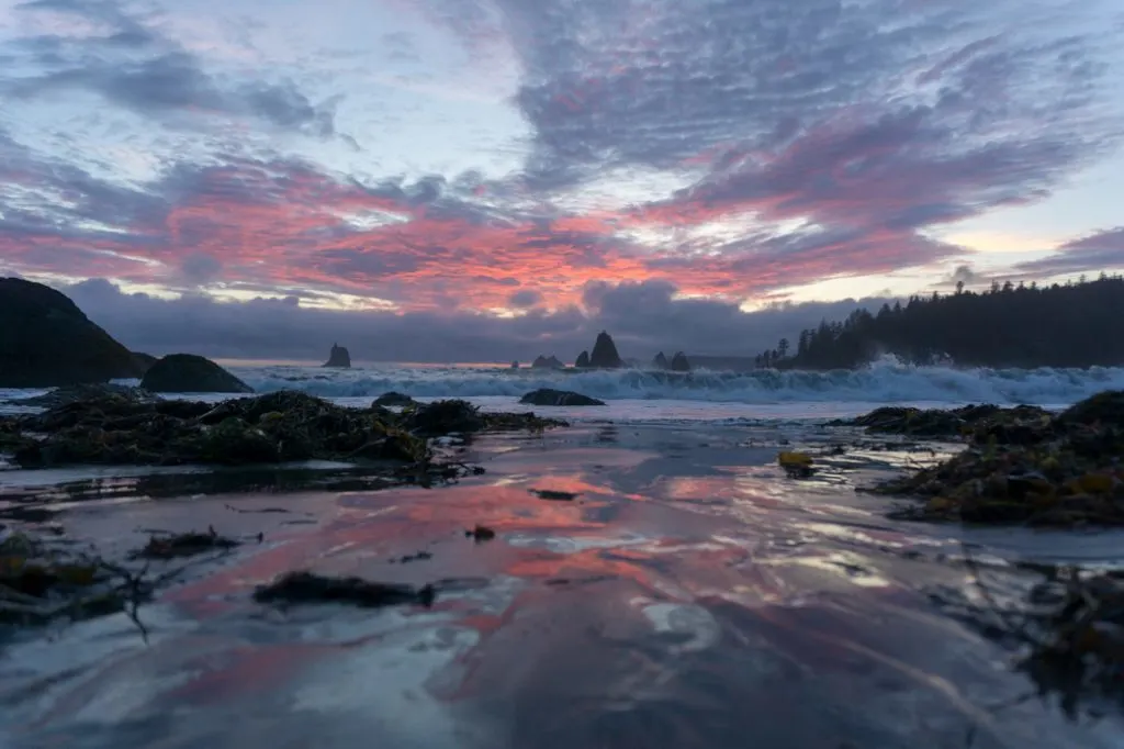
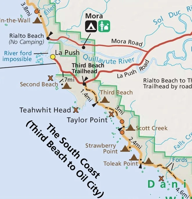
Toleak Point is on the coast in Olympic National Park. It’s actually part way along the South Coast Wilderness Trail, which is a longer and more difficult route from La Push in the north to Oil City in the south. The scenery on the northern section up to Toleak Point is just SO good. I think it’s worth heading into Toleak Point for a day trip or an overnight backpacking trip.
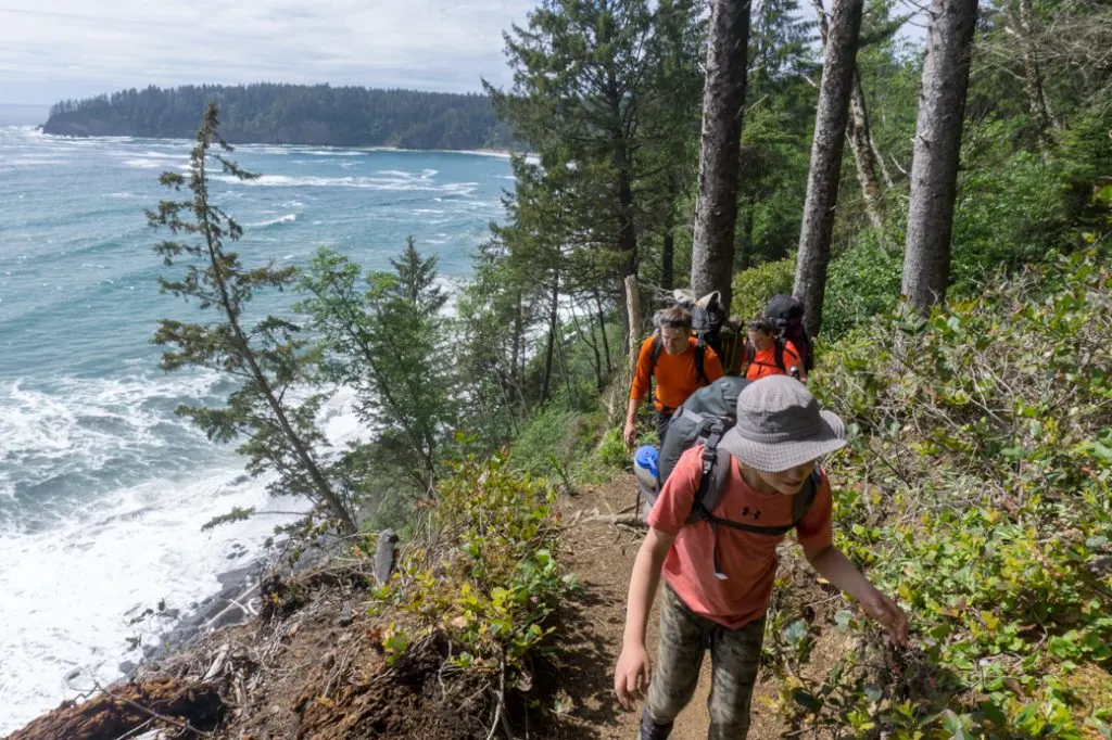
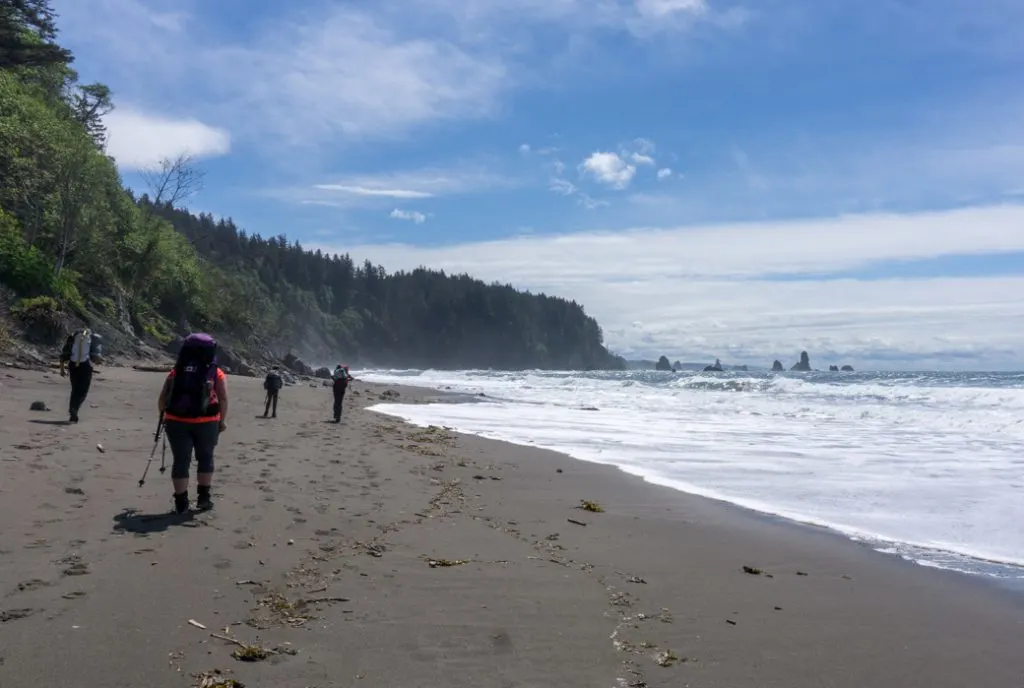
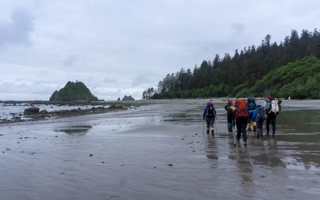
The trip starts at the Third Beach trailhead on La Push Road. Along the way, you’ll walk on sandy beaches, pass by sea stacks, climb up headlands and walk through gorgeous coastal rainforest. You’ll have to time your trip with the tides since there are some areas that require a low tide to pass. As well, there are several headland bypass trails that you can only access by hauling yourself up steep slopes with a rope. Since the wild Pacific North West weather keeps changing the landscape, the ladders and ropes are often not in very good condition.
Even though this seems like a fairly short hike, the tides and the ropes make it much more challenging. (And I think they make it much more rewarding too!) I did the trip with a group that included kids and people who are afraid of heights. Everyone made it through just fine. However, this might not be a good trail to pick for very young children or people with a severe fear of heights.
Getting There
The easiest way to get to the Third Beach trailhead is to drive yourself. However, it is possible (but VERY) time-consuming to take public transit. From Seattle, take the Bainbridge Island Ferry. Then take Clallam County bus 123 to Port Angeles, and switch to the 14 from to Forks. In Forks, transfer to bus 15 that goes to La Push. Get off at the Third Beach stop before La Push. Have a look at the Clallam County Transit schedules to plan your route. It may also be possible to book a shuttle van to the trailhead – call the Wilderness Information Center at Olympic National Park for more info.
Part of the appeal of the Olympic coast is its remoteness. But that means it takes a long time to get there. It’s about 4 hours from Seattle or 6 hours from Vancouver, BC. Keep in mind that you’ll need to take a ferry across Puget Sound at either Bainbridge Island, Edmonds or Coupeville on Whidbey Island. Book ahead for the ferry if possible.
Since it’s a long way out to the coast, you may want to consider staying overnight before or after your hike. I stayed in Olympic National Park’s Mora campground before my trip. It’s first-come, first-served. The campground is in gorgeous mossy rainforest and is a 10-minute drive from the Third Beach trailhead.
If you’d rather stay indoors, book a hotel in nearby Forks. Forks is actually where the Twilight books and films were set (although they weren’t shot here). The town has really embraced the theme with lots of fun Twilight themed sights. The closest hotel to the trailhead is the Quillayute River Resort, which also has the best reviews.
Toleak Point Fees and Permits
Unlike some of the other popular coastal areas in Olympic National Park, you don’t need a reservation to camp at Toleak Point. There is no cap on the number of permits available. However, you do need to register for a backcountry permit at the Wilderness Information Center in Port Angeles. Camping fees are $8 per person per night plus a flat $6 permit fee per group. Kids under 15 are free. You will also need to rent a bear canister at the WIC (see the food storage section below for more info).
You’ll also need to buy a Park Entrance pass for your car. It’s $30 per vehicle for 7 days. You can buy your pass at the WIC at the same time as you pick up your permit. Leave it on the dash at the trailhead and any time you park your car inside the National Park.
Toleak Point Trail Description
Trailhead
The trail starts at the Third Beach trailhead on Highway 110/La Push Road. There is a long gravel pull out on the side of the road for parking but it does fill up on summer weekends. There are “No Parking” signs along the highway for a mile on either side of the parking lot, so get there early to get a spot. Unfortunately, there are also signs warning about theft from cars. Don’t leave anything of value in your car. I saw broken glass on the ground, but we left two cars parked there for two nights and didn’t have any problems.
There is a pit toilet at the trailhead. Use it as it’s the nicest toilet anywhere on the trail. There are also a few info boards with a map of the trail and some educational info about the local ecosystem.
Trailhead to Third Beach
Distance: 1.4 miles
Elevation Change: Descend 260 feet
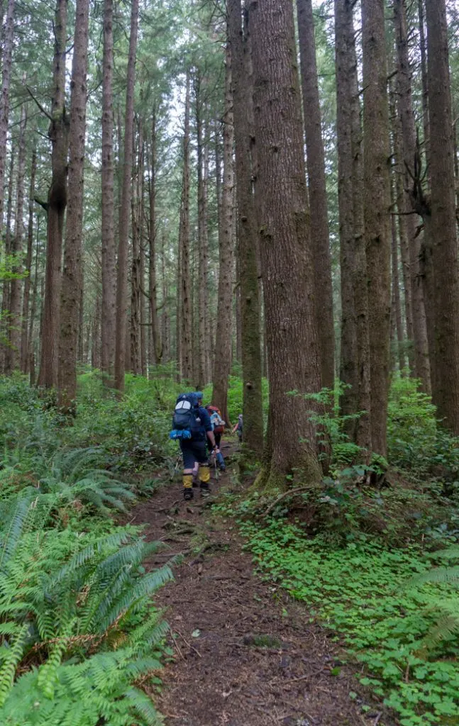
The first mile of the trail towards Third Beach is quite flat. It meanders through beautiful mossy forest on a trail that looks like it was a road long ago. The final section of trail loses 260 feet of elevation as it descends towards Third Beach. Some parts are a bit steep with stairs to help you climb down. The trail emerges in the middle of sandy Third Beach. Cross the log jam over Newbert Creek to get to the beach. There’s a campsite here, but pushing onwards to Toleak Point is worth it. (See camping section below for more info on where to camp.)
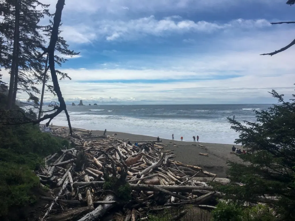
Third Beach to Taylor Point Overland Trail
Distance: 1.6 miles
Elevation Change: Ascend 180 feet, descend 60 feet, ascend 140 feet, descend 260 feet
From Third Beach, turn left and walk along the beach for 0.4 miles. About halfway along there is a persistent landslide of rocks and trees that may block the beach at tides over 5 feet. However, you can easily scramble up the bank and over it on a very short unofficial trail.
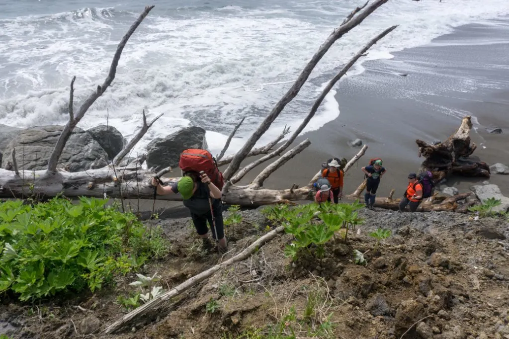
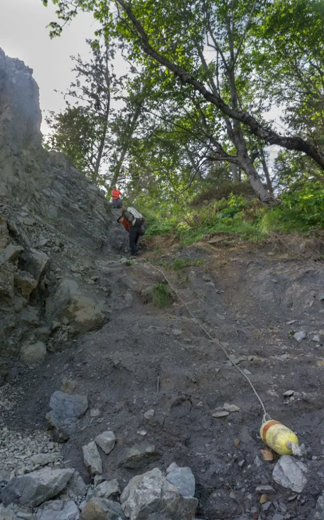
Towards the end of the bay, there is a beautiful waterfall cascading down the cliffs. Look for the tidal bypass trail marker leaving the beach towards the end of the sign. There’s a fixed rope here to help you climb up the steep bank. This is the first of several ropes you’ll need to use along the trail to climb up steep slopes about 50 feet high.
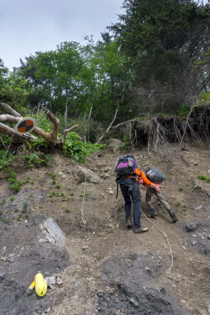
After the rope, you’ll continue climbing steeply through the forest using a hanging ladder and another rope. After about 0.2 miles, the worst of the steep climbing is over.
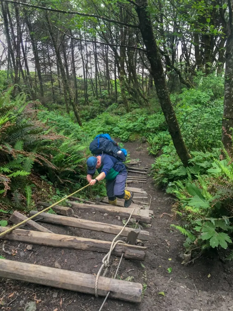
At about 0.3 miles you’ll descend gently to the banks of a stream. This is creek feeds the waterfall you saw on the beach earlier. There is a clearing here that is large enough to hold two tents if you need to camp in an emergency.
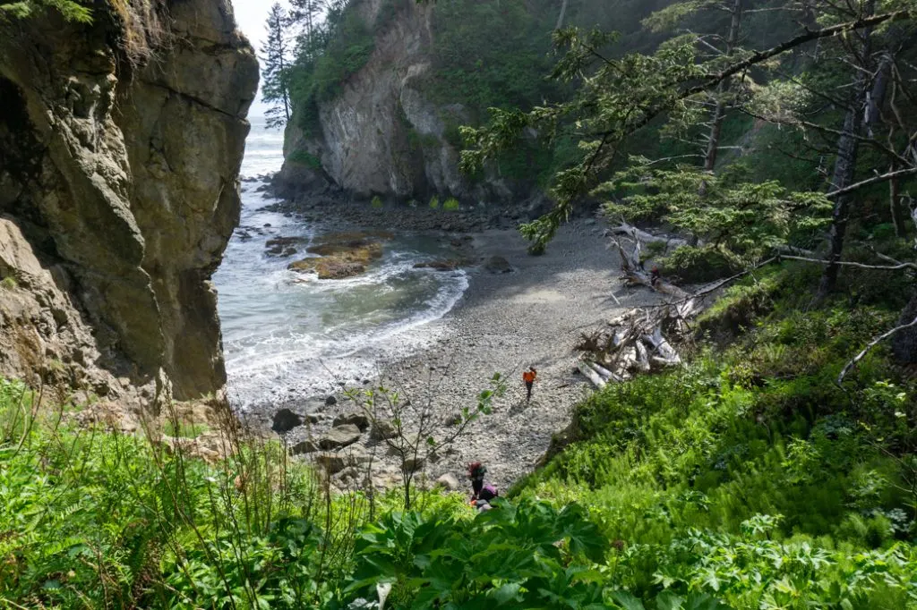
From the stream, the trail continues for another mile through lush, green coastal rainforest. Most of the trail is flat, but there are a few short climbs. The last 0.1 miles is a steep descend down to a rocky cove. There is another emergency campsite on a flat bluff just before you make the final descent into the cove.
Taylor Point Overland Trail to Scott Creek
Distance: 1 mile
Elevation Change: Ascend 50 feet, descend 50 feet, ascend 60 feet, descend 60 feet.
From the rocky cove at the end of the Taylor Point Overland Trail, you’ll need to consult the tides. If the tide is below 4.5 feet, you can continue on the rocks around the point to get out of the cove.
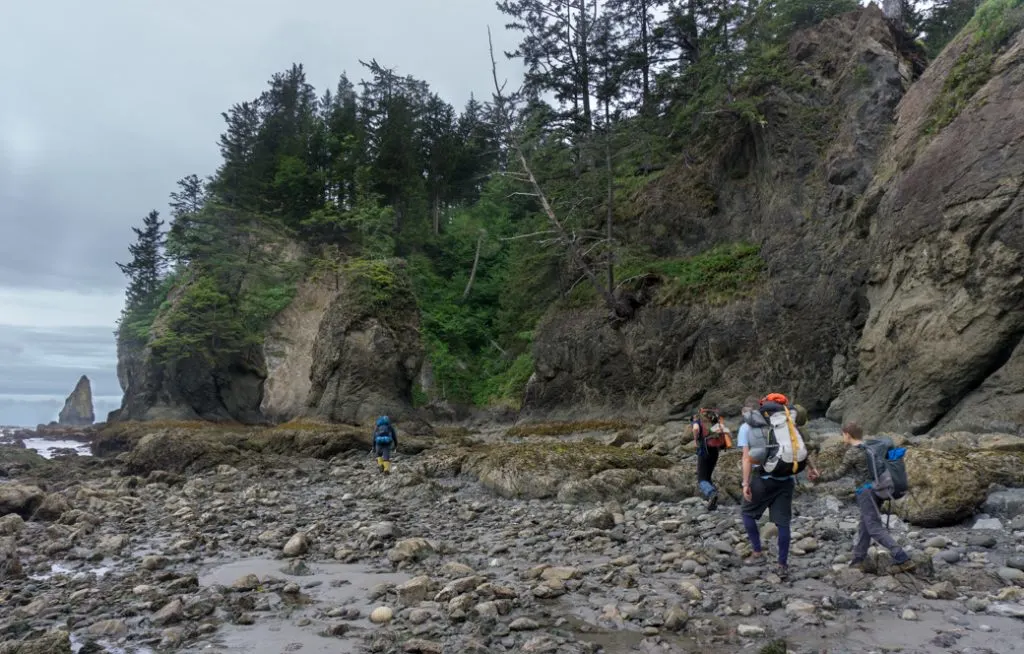
However, at higher tides, you’ll need to go up the bank on a very short overland trail. It’s a short walk up to the top with a rope to help if you need it. At the top, you plunge steeply down the other side. There’s a rope for assistance. It looks dauntingly steep from the top, but once you are on the slope it’s not so bad.
Once you are out of the cove, continue for 0.6 miles along the sandy beach. Look for the steep overland trail ascending into the forest at Scott’s Bluff. If the tide is over below 1 foot, you can continue on the beach. If it’s over 1 foot you’ll need to go up into the forest. The forest route is 0.4 miles long and the beach route is 0.3 miles long. However, the beach route requires a lot of scrambling and climbing over slippery boulders. Having done it both ways, I don’t know if the beach is any faster.
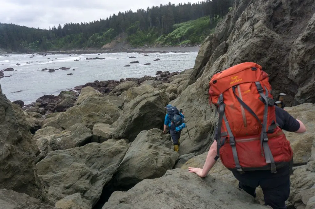
The forest route starts with a long and steep rope-assisted climb off the beach. It then continues through coastal rainforest before descending much more gently to the sand at Scott Creek. There’s a campsite here and a creek with good water.
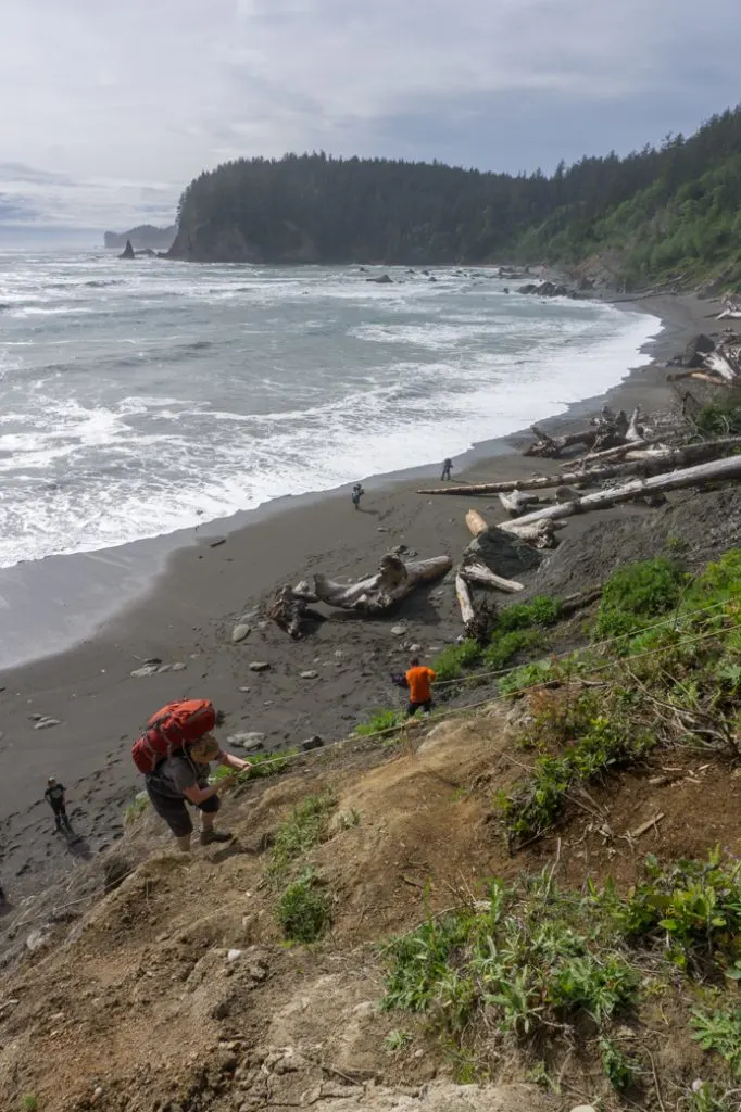
Scott Creek to Toleak Point
Distance: 2.4 miles
Elevation Change: none
Past Scott Creek the trail is all on the beach. You’ll round Graveyard Point and Strawberry Point before arriving at Toleak Point. Just before Graveyard Point, the bluff comes right up against the beach. You’ll need a tide of 4 feet or lower to get past this point. Unfortunately, there is no overland trail so at high tide you’ll just have to wait it out.
This section of coast is the most beautiful part of the trail. There are lots of small islands and sea stacks offshore. You’ll pass by a small campsite at Strawberry Point. As you get closer to Toleak Point, watch for campsites up the bank in the trees.
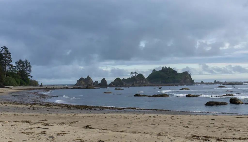
Camping Options from Third Beach to Toleak Point
There are a few different options for camping in between Third Beach and Toleak Point. When you pick up your permit at the Wilderness Information Centre you’ll need to say which campsite you’ll be staying at. Here are your options:
Third Beach
Basics: 1.4 miles from the trailhead, creek for water, pit toilet
Campsite at Third Beach is a good option for people who want an easy walk into camp. Since it is very close to the trailhead, it can get busy and sometimes people party here. As well, at very high tides it will be difficult to find much beach to camp on. Reportedly, there is a basic toilet hidden back in the trees on the south side of the creek. It’s near where the trail meets the beach, but I couldn’t find it.
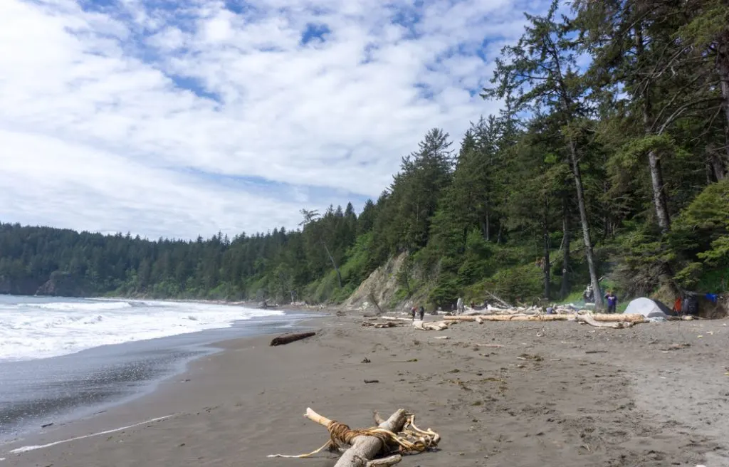
Scott Creek
Basics: 4 miles from the trailhead, creek for water, pit toilet
Scott Creek is not a popular campsite so its good if you want solitude. There is room for a tent or two on the bank above the sand. At very high tides, the entire beach may be covered so read your tide table carefully before you set up your tent on the sand. There’s a basic pit toilet back in the trees.
Strawberry Point
Basics: 5.2 miles from the trailhead, no water, no toilet
There’s one small site in the trees, right at the point. It has incredible views across to the sea stacks offshore. If the tide is not super high, you could also camp on the sand. There is no water at this campsite, but in the spring there may be a seeping stream just south of the point. The rest of the year you’ll have to haul water in from Scott Creek or the creek just beyond Toleak Point.
Toleak Point
Basics: 6.5 miles from the trailhead, creek for water, toilet
By far the best camping on the route between Third Beach and Toleak Point is right at Toleak Point. There are campsites spread out on both sides of the point. Many of the best ones are up the bank in the trees on the north side of the point. We stayed at a great one just inland from a sea stack that is joined to the beach at low tide. Some of them have hammocks, swings or tables that people have built out of driftwood.
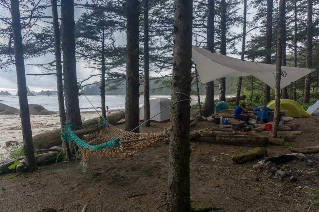
There is a very basic toilet on the north side of the point just behind some of the campsites and also one on the south side of the point. Get water from Jackson Creek on the south side of the point. It reaches the beach at a huge log jam. You’ll need to scramble over the log jam and head into the forest to collect water.
Toleak Point Camping Rules and Tips
Food Storage
The raccoons on the Olympic Coast are pretty smart and have figured out that hikers have tasty food. Olympic National Park now has a Wilderness Food Storage Policy. All backcountry campers must store their food in bear canisters. You can rent canisters from the WIC when you pick up your permit. The WIC even has a handy drop slot if you need to return your canister after they have closed for the night.
Travelling with a bear canister requires a bit of advance planning. All of your scented items (toiletries, etc.), garbage and food need to be stored in the canister at night or if you aren’t right next to it. (For example, if you are off on a day hike). Plan lightweight and compact meals and bring minimal toiletries. If you pack efficiently you can usually share one canister between two people for a two-night trip.
Most people choose to put the canister inside their pack as they are difficult (though not impossible) to strap to the outside. In camp, store your canisters away from your tent and kitchen area in a place where they can’t be rolled away (or into the water!) You can find more info about using a bear canister on REI’s site.
I recommend: If you plan to do multiple trips in areas where bear canisters are required or recommended, it’s easier to just buy your own. That way you don’t have to rely on renting one. I own both the Garcia Machine Backpackers Cache and the Bear Vault versions and recommend them both. If I had to pick one, I’d say the Bear Vault since it has straight sides so it’s easier to pack, and it’s clear so you can see what’s at the bottom. Shop: REI| Amazon.
Toilets
There are a few toilets on this route at Third Beach, Scott Creek, and Toleak Point. However, they are VERY basic. Just a toilet and partial wall to shield you from view. They are NOT very private. As well, some of them can be hard to find or are very far from the places you’ll actually want to camp. And on my trip, the ranger actually warned us that the toilet at Toleak Point was full so we couldn’t use it.
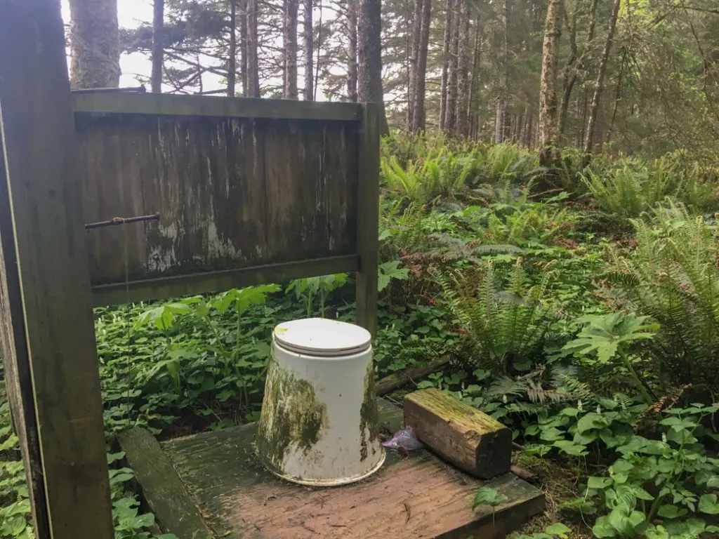
Due to all of that, you should be prepared to go without a toilet if you are hiking and camping between Third Beach and Toleak Point. Practice Leave No Trace when going to the bathroom. Unfortunately, many campers don’t know the best way to do this and have left literal piles of poop near the campsites. Don’t let this be you! Go 70 big steps away from trails, water sources, and campsites. Dig a hole 6-8 inches deep and fully bury your waste. (I pack an ultralight trowel to make digging a hole easier. But you can use a stick, tent peg or the heel of your boot.) Pack out your toilet paper in a plastic bag. New to pooping in the woods? Read more about Leave No Trace and why it’s important.
Water Sources and Water Treatment
There are a few creeks along the way, as I mentioned in the hike overview above. Most of the smaller ones will dry up later in the summer. The most reliable ones are Newbert Creek at Third Beach, the stream above the waterfall on Taylor Point, Scott Creek and Jackson Creek at Toleak Point. The water drains coastal swamps and can be quite tea coloured. Some people prefer to add drink powder to their water to disguise the colour. As well, streams in the area have been known to harbour the parasites cryptosporidium and giardia. Iodine is not an effective treatment for parasites so filter or boil your water before drinking.
I recommend: For coastal camping I use the Platypus Gravity Works filter. You can fill up the dirty water reservoir at the creek, carry it back to the campsite, then let gravity do the work of filtering your water. We have the 2L size, but our friends have the 4L size which is great for groups. Buy REI | Platypus | Amazon.
Having good water treatment for the bad water on the coast is one of my top tips for beach backpacking.
Tides
Knowing the tides is really important on the hike from Third Beach to Toleak Point. You will want to know the tides for a few reasons. First, so you can get around the tidal obstacles on the trail and don’t get caught by the waves. Second, so that you can be sure your tent is up above the high tide line. And third, so that you know when low tide is so that you can explore the sea stacks and arches. You should print out and bring the La Push tide table along with a watch. I recommend consulting the tides when planning your trip to see if you can time them to avoid using some of the overland trails.
Campfires
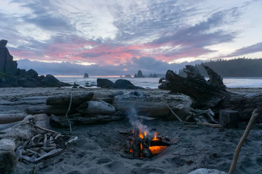
Campfires are permitted in this portion of Olympic National Park. However, you may only collect driftwood and can’t collect wood from the forest. (The driftwood burns better anyway.) Build your campfire in an existing fire ring or make one below the high tide line. Make a small fire and don’t burn big driftwood logs so that there is lots of wood left for everyone. Recently I learned that burning driftwood can create toxic smoke from the salt build up in the logs. So you may want to skip the campfire entirely.
Dogs
Dogs are not permitted in Olympic National Park so you can’t bring your dog on this trip.
More Resources
You can find more information about the Third Beach to Toleak Point Route on the Olympic National Park website.
The National Park also has a good overview map of the park with campsites and trails marked.
For actual travel on the trail, you should buy the North Olympic Coast topographic map by Custom Correct maps. It has trails, distances, and tidal obstacles marked. You can buy it at the WIC in Port Angeles.
Before you hike the trail check the trail conditions page on Olympic National Park website.
Read my coastal hiking tips to get prepped for the terrain.
Now you have all the info you need to plan your trip to Toleak Point. If you have any questions about hiking and camping on the south Olympic Coast, let me know in the comments. I’m always happy to help!
More Olympic Coast Hiking Info:
- Shi Shi Beach Hiking and Camping Guide
- Ozette Loop Backpacking Trip Guide
- Coastal Hiking Tips: Advice for Beach Backpacking
- Washington Backpacking Reservation Dates
Coastal Hikes in British Columbia:
- Your Guide to the West Coast Trail in British Columbia
- Wild Side Trail: Hiking and Camping Guide
- Sunshine on the Edge of the World: Nootka Trail Trip Report
- Coastal Hiking in Vancouver
- Cape Scott Trail Guide: Hiking and Camping on Northern Vancouver Island
- North Coast Trail Guide: Backpacking on Vancouver Island
- Lake O’Hara Packing Lists for Hikers and Campers - April 25, 2025
- BC Parks Day Passes 2025 – Everything You Need to Know - April 24, 2025
- Best Women’s Hiking Pants (Picks for Every Body Type) - April 21, 2025

Jenn SC
Wednesday 4th of June 2025
Hi - I used this blog to hike this trail over two nights/three glorious bluebird days in early June 2025 (camped at Third Beach and Toleak Point and then back to the trailhead on day three). It's a completely stunning area and this is coming from someone who lives on Vancouver Island! All the information you provided is still relevant and it was very useful! I think I even stayed at the same campsite for Toleak! Happy to send some updated photos if you like, the "ladders" look like they have been replaced and the toilets are much nicer now :) Only other comment is that the water source at Toleak was a lot farther around the point then I was expecting so I may have chosen a different site if I did it again. Oh also, the trail to the Third Beach toilet is just to the south of the creek log jam and is now signed and marked. It's a bit of a hike up to it but it was clean and totally enclosed, as was the one at Toleak.
Taryn Eyton
Thursday 5th of June 2025
So glad to hear that you enjoyed your trip Jenn. If you have updated photos of the ladders and toilets I would love to use them. Email them to me: [email protected]
Laurance Price
Sunday 26th of March 2023
I am planning a hike with my 13 year old daughter as part of her batmitzvah adventure passage during Spring Break and your detailed account of the Toleak Point trail is so helpful. Thank you for sharing your insights and advice. Feeling grateful and admiring your generosity of spirit.
Mari
Saturday 22nd of May 2021
Thank you so much! One quick question: Do you know if there is cell phone reception at Toleak Point? I'm planning a trip there but need to take an important call during that week...not sure if I should risk it or not. I have Verizon if that helps at all. Thanks!
Taryn Eyton
Sunday 23rd of May 2021
I don't think there is coverage there. I usually have my phone in airplane mode when I hike so I don't know for sure. Check the Verizon coverage map to be sure - there may be some pockets of coverage.
Michael Lieberman
Wednesday 5th of May 2021
Thank you, Taryn! I am heading out to Toleak in early August with two friends. This resource is extremely helpful and it raised the stoke for the trip to quite high levels :-)
Jennifer
Thursday 12th of September 2019
What an amazing resource to plan a safe trip! Thank you for the incredible details! Wow! And your photos are beautiful as well!
Taryn Eyton
Thursday 12th of September 2019
Awww thanks Jennifer. I hope you have a great trip.