

The 32 km-long Della Falls Trail takes hikers through a beautiful river valley deep in the mountains of Strathcona Provincial Park on Vancouver Island. From your riverside campsite, hike to the base of the falls or a spectacular viewpoint on the Love Lake Trail.
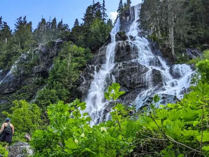
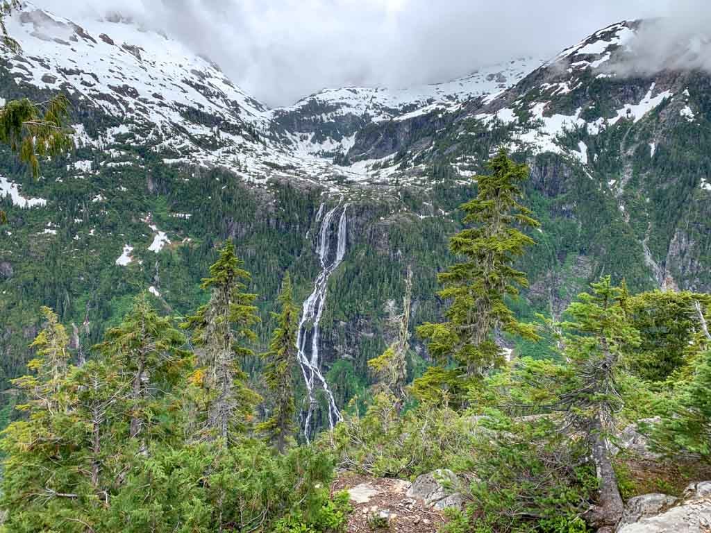
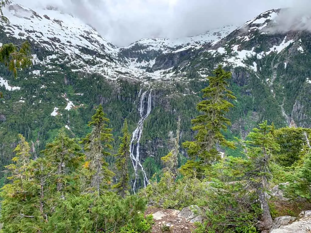
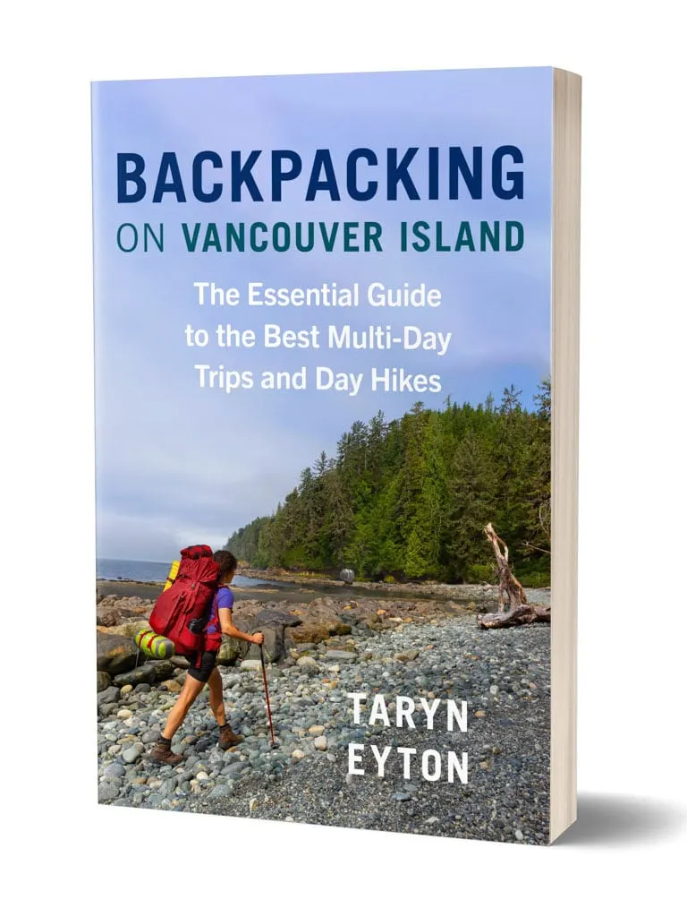
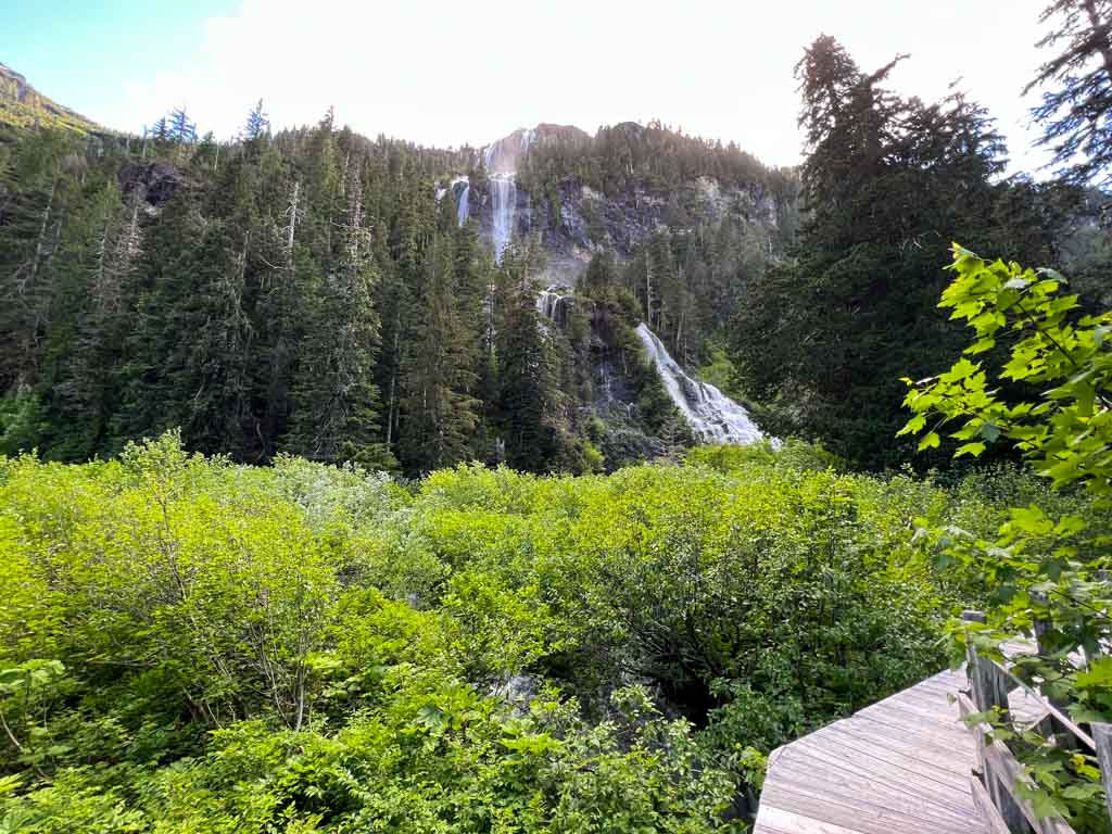
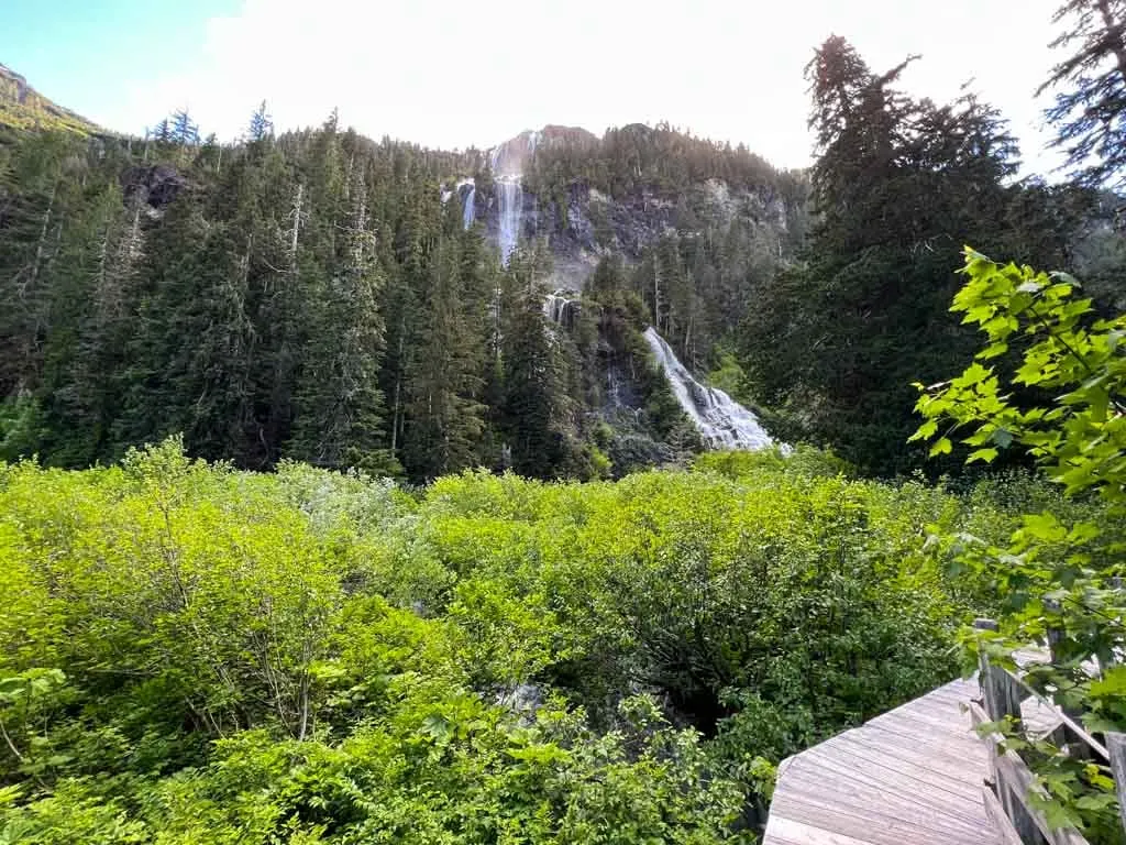
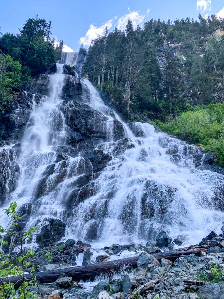
At 440-metres-tall, Della Falls is one of the tallest waterfalls in Canada and one of the best multi-day hiking trips on Vancouver Island. It’s even featured in my book, Backpacking on Vancouver Island.
I hiked the trail over three days in early July and have put together a HUGE Della Falls Trail guide for you. It includes:
- Quick facts about the Della Falls Trail
- How to get to Della Falls including water taxi, canoe, and motorboat options
- Key distances on the Della Falls Trail
- Detailed Della Falls Trail description, broken up into sections
- Della Falls Trail itinerary options from 2-5 days
- Della Falls FAQ including questions about distance, difficulty, bears, weather, transportation, and more
This is a sensitive wilderness area. Learn how to Leave No Trace to keep the wilderness wild. Make sure you are prepared by bringing the 10 Essentials. Get ready for adventure with this checklist of things to do before every hike.
Hey there: Some of the links in this post are affiliate links, which means I earn a small commission at no cost to you. Thanks for your support. -Taryn
Della Falls Trail Quick Facts
Location: Della Falls is located at the southern end of Strathcona Provincial Park in the middle of Vancouver Island. It is in the mountains north of Great Central Lake.
Distance: 32 km round trip
Elevation Gain: 540 m
Difficulty: Easy/Moderate
Time: 2-3 days
Cost: Free if you have your own motor boat or canoe. Otherwise its $185-210 per person for the water taxi.
Best time to go: Mid-June to mid-July when the waterfall is in high flow and the trail to Love Lake is mostly snow-free. Anytime between mid-May and mid-September is also good.
Indigenous Context: Great Central Lake and the lower Drinkwater Creek valley are in the overlapping territory of the Tseshaht and Hupačasath Nations, both speakers of the Nuu-chah-nulth language. Della Falls and the upper valley are the traditional territory of the Hupačasath. I have included Nuu-chah-nulth place names throughout the trail description where possible.
More info: My book, Backpacking on Vancouver Island.
How to Get to the Della Falls Trail
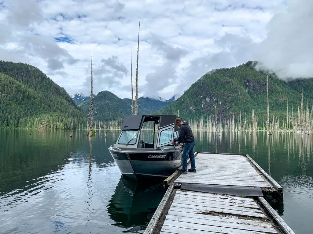
The only way to get to Della Falls is first by boat, then by hiking. There are no roads to the trailhead. You have three main options for boating: book a water taxi ride, paddle a canoe or kayak, or drive your own motorized boat.
Della Falls Water Taxi
The Della Falls Water Taxi is a small, family-run business. It leaves from the Great Central Lake Resort. See the section below for driving directions. It shuttles hikers from the marina to the trailhead, which takes about 1 hour one-way. The boat holds a maximum of 5 hikers.
Their schedule is as follows:
Leave Great Central Lake Marina: 8 am, 10:30 am, 1 pm, 3:30 pm
Leave Della Falls Trailhead: 9 am, 11:30 am, 2 pm, 4:30 pm
I have more details about which water taxi time you should book in the itinerary section below.
Groups of 1-2 people pay $210 per person round-trip. Groups of 3-5 people pay $185 per person. There are discounts for kids and seniors.
They operate between May 15 and early September each year. Reservations are essential as they book up fast. Most years, the their reservation bookings open in early February. Use the contact form on their website to book.
Drive Your Own Boat
You can drive your own motorboat to the trailhead. Larger craft need to launch at the Great Central Lake RV Resort and Marina. See the driving directions below.
Great Central Lake is 35 km long and can be very windy, so plan travel times and fuel accordingly.

Paddle a Canoe or Kayak
Before the water taxi business opened, most hikers travelled to the trailhead by canoe or kayak. Paddling is less popular today.
It is a 35 km paddle from Great Central Lake RV Resort or 24 km from Scout Beach Recreation Site (see driving directions below), and takes a full day. The lake can be very windy, especially in the afternoon, so stay close to the shoreline.
Since the paddle is so long, many groups chose to camp along the way. An informal site at Clark Point on the north shore of the lake, about 10 km from Scout Beach is the best option.
There are other options along the north shore of the lake, but water levels fluctuate and some may be inundated at high water levels. You can also camp at the trailhead campground – see details in the trail description below.
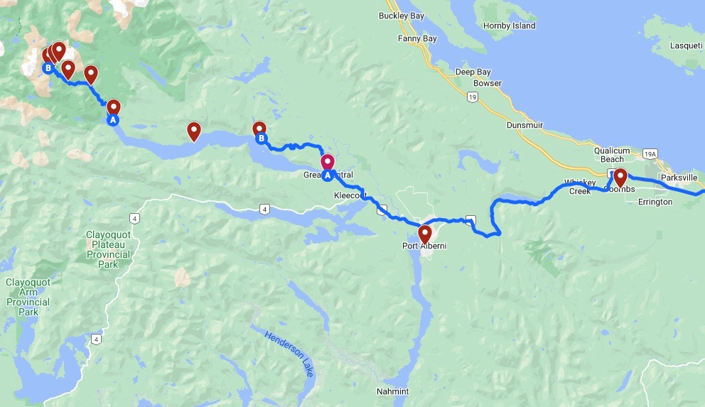
Driving Directions to Great Central Lake RV Resort and Marina
Hikers taking the water taxi or launching their own motor boat will leave from the Great Central Lake RV Resort and Marina.
To get there from Nanaimo, go north on Highway 19, then take Highway 14 west from Coombs. Go past Port Alberni, then turn right onto Central Lake Road about 7 km after the bridge over the Somass River.
Follow the road for 7 km, then turn right into the marina. There is free parking on the shoulder of Central Lake Road. It’s a 90-minute drive from Nanaimo. Click here for Google Maps driving directions.
Driving Directions to Scout Camp Recreation Site
Scout Camp Rec Site is located on a confusing network of unpaved logging roads. Use the Vancouver Island Backroads Mapbook or a GPS app to find your way.
Use the driving directions above for Great Central Lake RV Resort and Marina. From there, go north on Ash Main FSR, crossing the bridge over the Ash River. Stay on Ash Main for 6.6 km, then turn left onto Ash 286, which may have signs for Browns Bay Dryland Sort.
At the fork 0.8 km later, stay right. Turn left 8.3 km later, then immediately left again to arrive at Scout Beach Rec Site. The rustic campground has a few campsites, an outhouse, and access to the beach to launch small boats.
Getting to Della Falls Without a Car
Della Falls is on my list of car-free BC Backpacking trips. From Nanaimo, take the Tofino Bus to Port Alberni. From there you can take a taxi for 20 minutes to the Great Central Lake Marina to catch the Della Falls water taxi to the trailhead.
Where to Stay Near Della Falls
Since most hikers will need to catch an early morning water taxi, it makes the most sense to stay nearby the night before.
If you want to camp, Sproat Lake Provincial Park is just 10 minutes from the marina. The upper campground has 44 sites. The lower campground has 5 walk-in sites and 14 RV sites. Reservations required.
We stayed at the Best Western Plus Barclay Hotel. It’s by far the nicest hotel in Port Alberni but it isn’t too expensive. The rooms were modern and clean the hotel restaurant had good breakfast.
There are several other motels in Port Alberni, but they are older and a bit run-down so I don’t recommend them. However, they are cheap!
Port Alberni also has several B&Bs that cater to hikers and salmon fishers. The Hummingbird Guesthouse, Beaver Hut Bed and Breakfast, and Cedar Wood Lodge Bed and Breakfast Inn all get good reviews.
Join the Backpacking in BC Facebook Group
Key Distances on the Della Falls Trail
| KM | Landmark |
| 0 | Boat dock and trailhead campground |
| 2.8 | Unbridged creek |
| 3.9 | Unbridged creek |
| 6.5 | Margaret Creek campground |
| 11.5 | Cable car campground |
| 12.5 | Bridge over Drinkwater Creek |
| 14.5 | Love Lake Trail junction |
| 15 | Saw Blades campground |
| 15.8 | Della Falls campground |
| 16 | Base of Della Falls |

Della Falls Trail Description
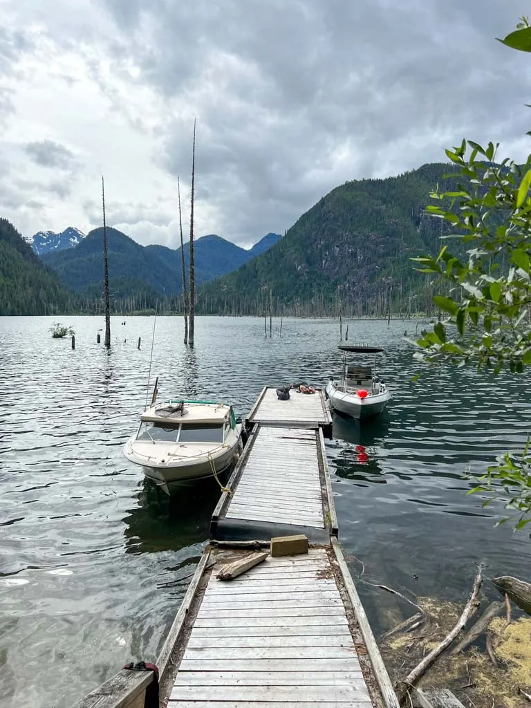
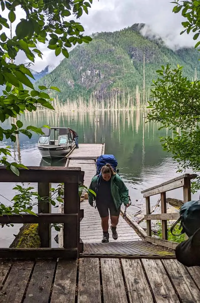
Trailhead Dock
The trailhead is at a dock at the west end of Great Central Lake. The Hupačasath call the lake ʕa-ʔuk-k̓uk mu̓u-ḥuł, pronounced Moo-hoolth-aht. The name refers to a forest fire sparked from a lightning storm before Europeans arrived. Part of the name comes from m’uuh-u which means “burned ground”.
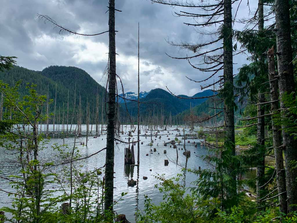
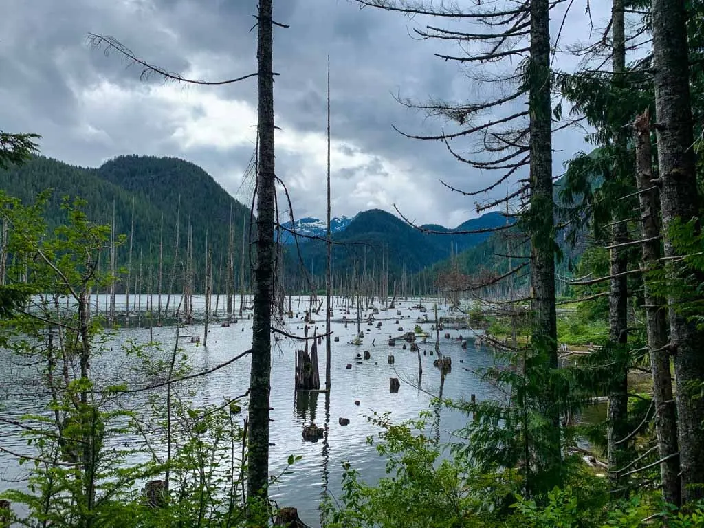
Great Central Lake was dammed in 1925 for hydroelectric power generation, which raised the water level. It flooded the end of the lake so there are lots of dead trees in the water near the dock.
If you drove your own boat, be careful pulling in to the shallow water near the dock as there are deadheads underwater. Be sure to moor your boat out of the way of other boats. Leave room for the water taxi to dock.
To start the trail, walk along the floating dock, then up the stairs. The Trailhead Campground is straight in front of you. The trail to Della Falls starts next to the info sign to your left.
Canoers and kayakers can unload on the dock, then carry their boats up to the canoe rests at the entrance to the campground.

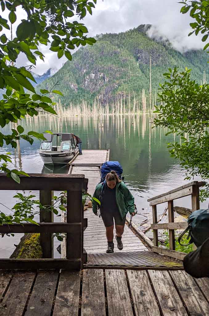
Trailhead Campground
The large campground at the trailhead is a good place to stay on your first or last night if you paddled to the trailhead. You might also want to stay here if you have a morning water taxi pick-up scheduled.
It has 16 numbered tent pads, some of which have picnic tables. However, many of them are quite overgrown. Back when most groups canoed to the trailhead, this campground must have been quite busy, but these days, it doesn’t seem to get much use.
There are two pit toilets at the back of the campground accessed via separate trails, one of which has a lot of stairs. There is also a metal food locker on a spur trail behind the lower outhouse. Collect and filter drinking water from Great Central Lake.
Trailhead to Margaret Creek Camp
Distance: 6.5 km
Elevation Gain: 75 m
Time: 1.5-2.5 hours
Difficulty: Easy
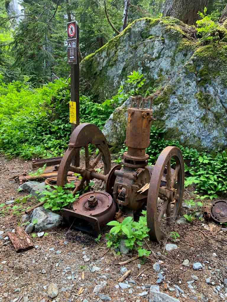
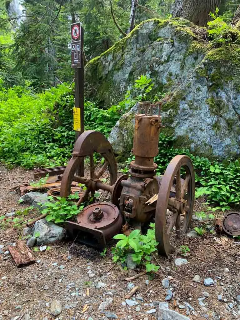
Follow the trail from the north side of the campground. The trail is actually an old mining and logging road. Joe Drinkwater was the first to discover the mineral deposits in the 1890s and named the falls after his wife, Della.
The Ptarmigan Mine opened in 1906 on nearby Big Interior Mountain. The miners built a trail up the Drinkwater Valley to the base of the falls. From there, an aerial tramway brought buckets of ore down to the site of today’s Saw Blades Camp.
The ore was carried out to Great Central Lake on packhorses, then down the lake by boat. The mine closed in 1916, but prospectors continued to use the trail to work smaller claims. Later, logging companies widened the trail into a road and logged the lower valley.
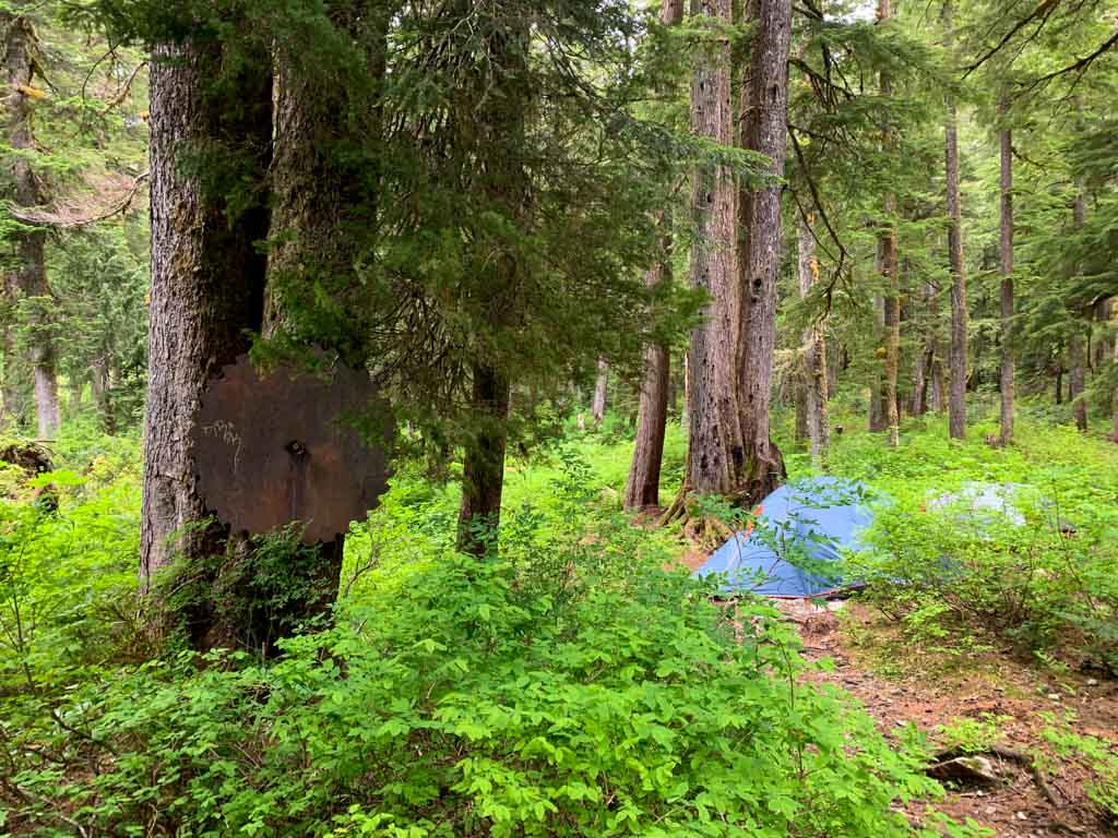
Look for abandoned machinery, tools, and “historical” garbage as you hike. The most obvious example is the giant saw blades affixed to trees at Saw Blades Camp.
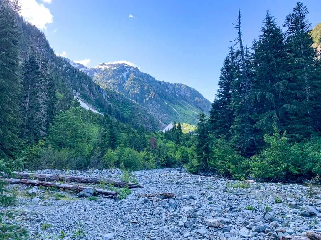
Follow the old road as it parallels the end of the lake, then the Drinkwater Creek delta. Before too long, the creek is out of sight down the slope to your left.
In Hupačasath, Drinkwater Creek is called c̓aa-ʕa-tus, pronounced Sa-ah-tuss. It means “creek running downhill”.
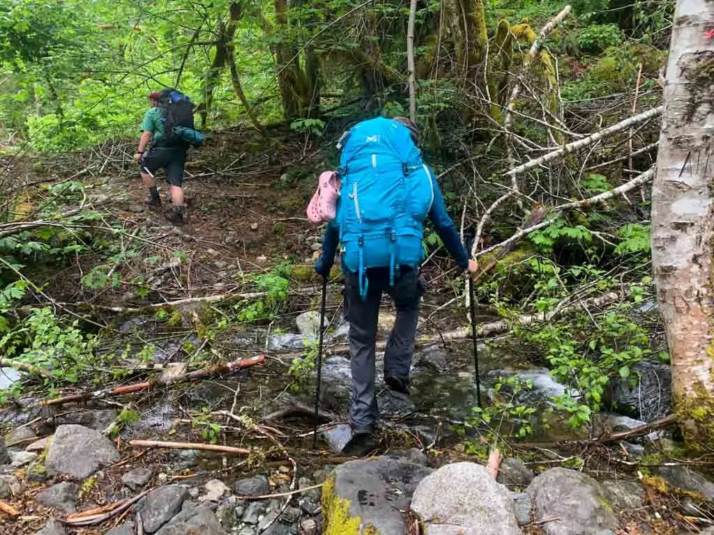
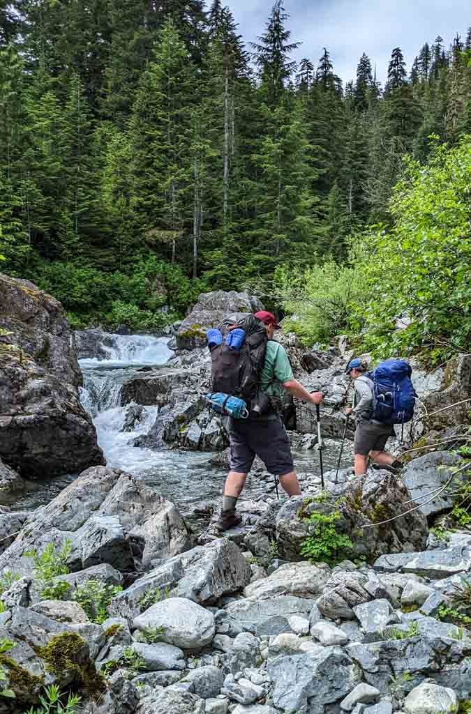
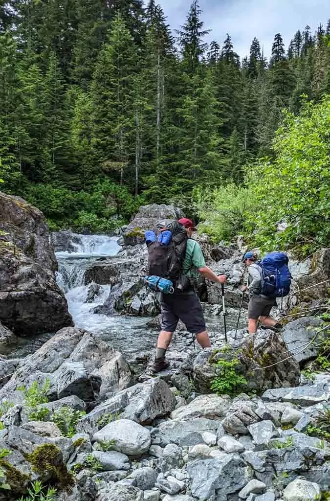
In most places, the trail is flat, wide, and easy to follow. However, early in the season, it can be a bit overgrown with lots of salmonberry, thimbleberry, and devil’s club encroaching on the footbed.
As well, winter wind storms often blow trees down across the trail. The Della Falls Trail sees very little maintenance from BC Parks, so fallen trees can stack up. On my July 2022 hike, we had to duck under, climb over, and detour around dozens of fallen trees, which was exhausting.

The lower section of the trail is also notorious for thick clouds of mosquitos in June and early July. Mosquito repellent, long sleeves, pants, and a headnet are essential. The mosquitos seem to be more of a problem between the trailhead and Margaret Creek – they lessen as you head upstream.
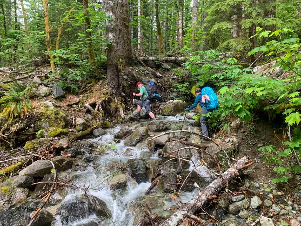
The trail crosses unbridged creeks at 2.8 km and 3.9 km. In the early season or in times of high flow you may need to take off your boots and wade. But for the rest of the year, it should be an easy rock-hop across. The second one also has a fallen log to use if you are acrobatic.
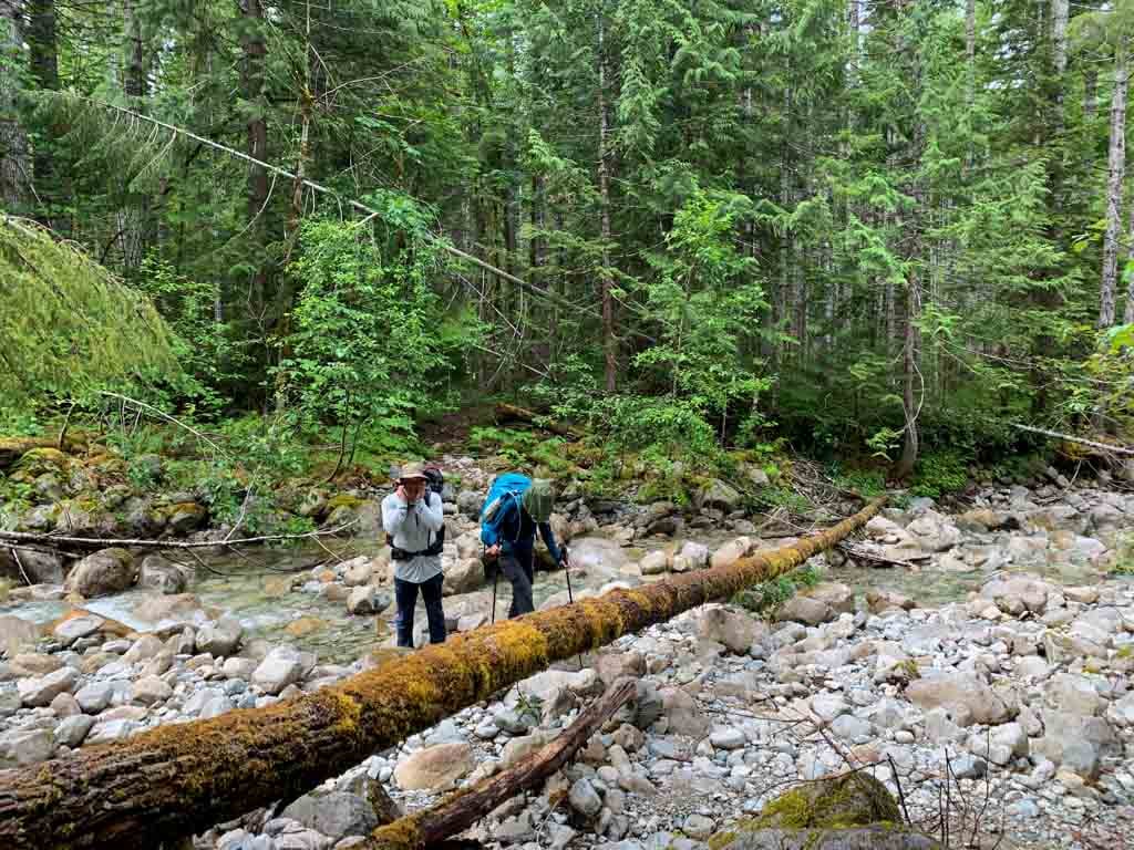

On my trip, I kept my boots off for the first one but had to take them off for the second one as the log crossing looked too precarious for me.
In a few places, the old road bed is swampy so the trail heads up onto berms beside the trail. Follow flagging tape to find these detours, which can be a bit rough.
Margaret Creek Campground
If you want to break up the long hike to Saw Blades Camp or Della Falls Camp, stay at Margaret Creek, 6.5 km from the trailhead.
The Margaret Creek campground is just a wider part of the road next to Margaret Creek. The trail leaves the road to the right, and you can camp on the remaining roadbed. There is space for five or six tents.
Find a plastic throne-style toilet on the downhill side of the trail just before the campsite, but it doesn’t have very much privacy.
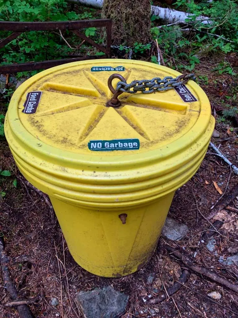
There is also a plastic barrel with a screw top-lid that acts as a food cache. Find it on the side trail to the toilet. Collect water from Margaret Creek. There are several social trails down to the water from the end of the old road.


Get My Book…
Backpacking on Vancouver Island
Discover Vancouver Island’s best day hikes and overnight trips
- 25 backpacking trips and 10 day hikes throughout Vancouver Island
- Info about permits, reservations and campground facilities
- Detailed maps and photos
- Advice for extending your trip
- Points of cultural and natural history
Margaret Creek to the Cable Car
Distance: 5 km
Elevation Gain: 210 m
Time: 1.5-2 hours
Difficulty: Moderate
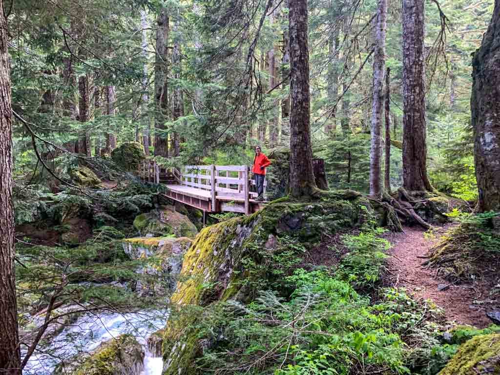
From the Margaret Creek Campground, follow the trail as it turns right and ascends the hill alongside Margaret Creek. This is the first place the trail leaves the old road and it is noticeably rougher.
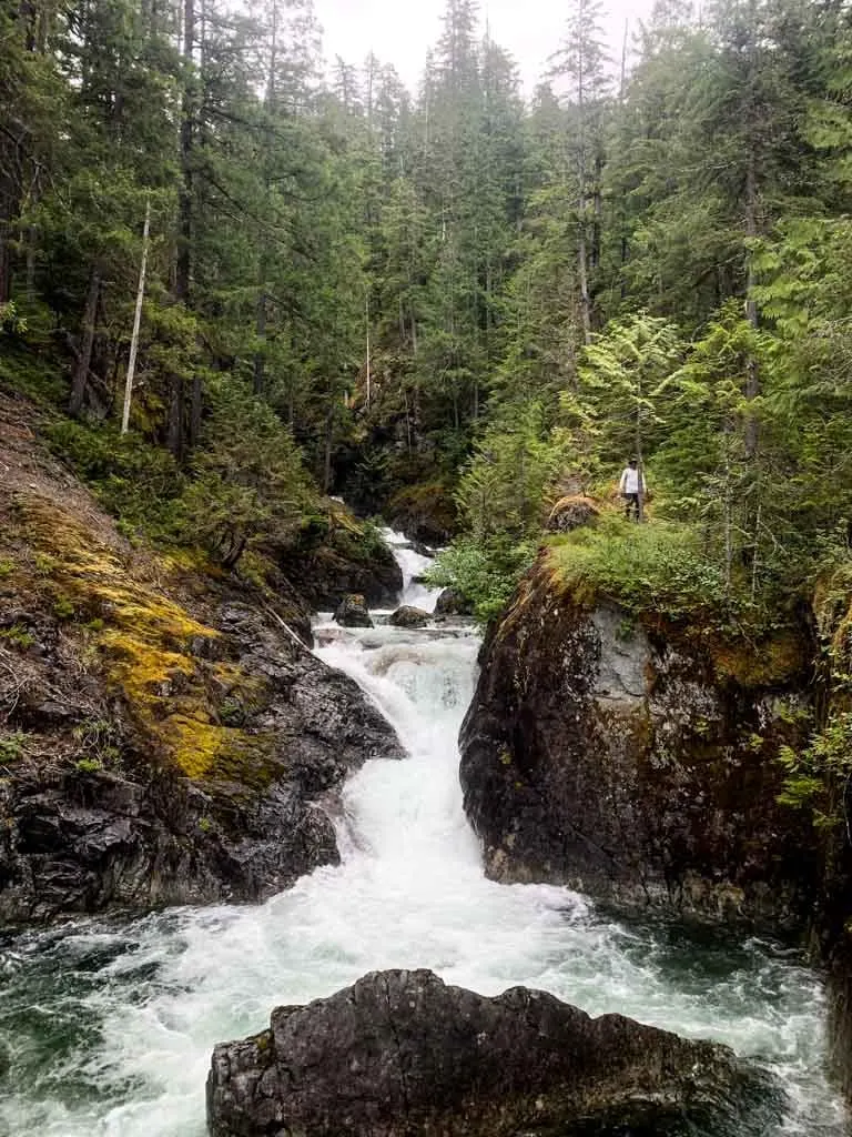
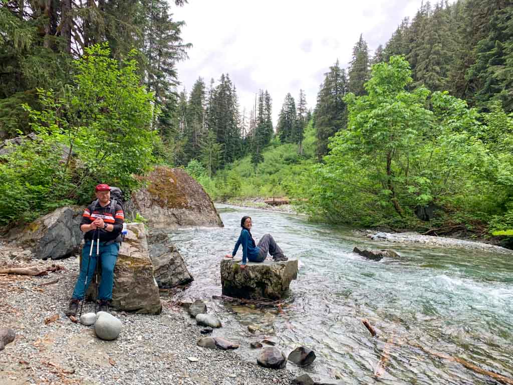
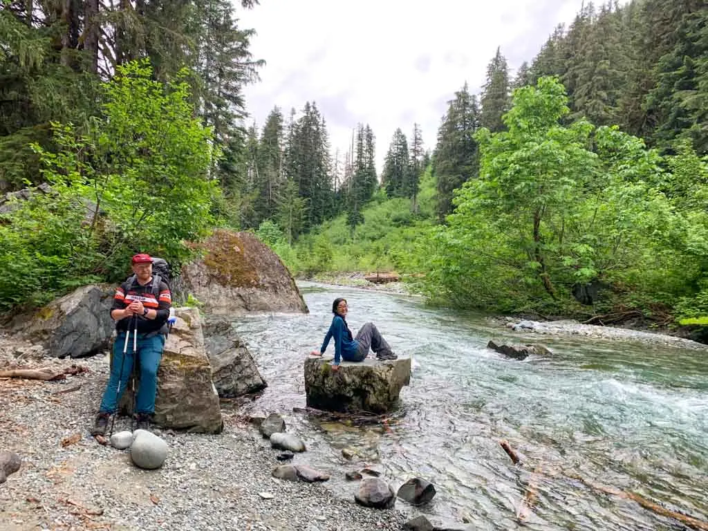
Arrive at the edge of a canyon with the creek rushing below you. A wide wooden bridge crosses the chasm. Be sure to pause in the middle to look upstream to the waterfall.
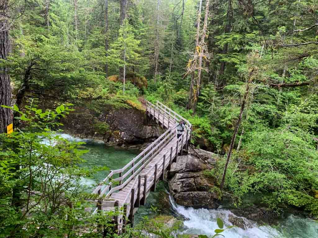

On the other side, follow a technical and rough trail steeply downhill back to the old road. Past here, the road continues gradually uphill.
In a few places, it crosses washed-out sections with groves of bigleaf maple trees. Early in the year or at times of high water you will need to step carefully to stay out of the water in these washes.

About 11 km from the trailhead the trail curls back to the right on a short switchback and heads uphill. After gaining elevation gradually from the trailhead, this is the first real hill of the trail, gaining 80 m in about 0.5 km.
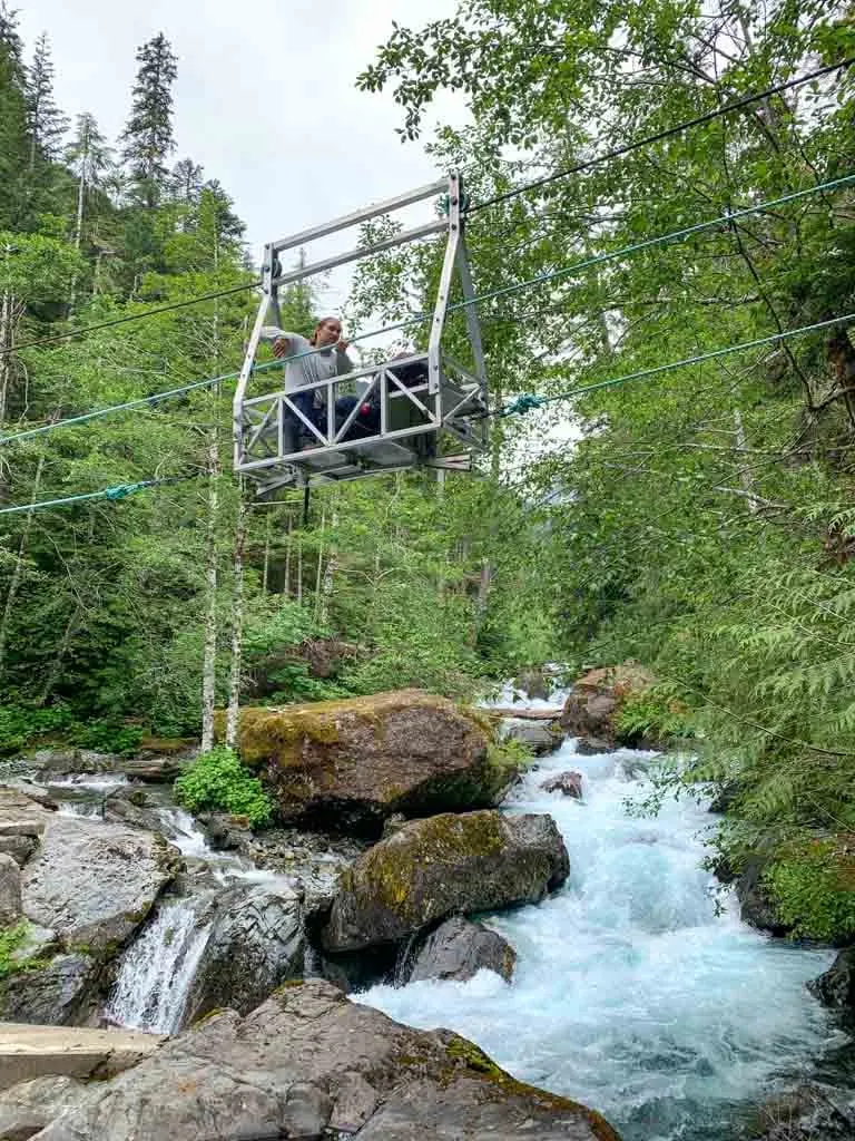
Arrive at the cable car and campground at the 11.5 km mark. There are impressive rapids on Drinkwater Creek here.
Cable Car Campground
It’s a bit generous to say there is a campground on the east side of the cable car. The old roadbed is wide enough to fit two or three tents, but there isn’t much room.
I wouldn’t plan to stay here. It’s only a good place to camp if you find yourself behind schedule and can’t make it all the way to Saw Blades Camp.
The campground has a metal food locker and you can collect water from Drinkwater Creek via a steep trail.
But there is no toilet, and that is a bit of a problem. You can head uphill from the trail into a boulder field to go the bathroom, but the rocky terrain makes digging a cat hole challenging.
Unfortunately, other hikers haven’t even tried to bury their waste and it is a toilet paper and shit minefield back there.
If you do stay at Cable Car camp or need to go to the bathroom here, please dig a hole and bury your waste. Or head back down the trail, and then uphill for a few minutes to find a better place to go.
READ NEXT: How to Leave No Trace (And Why it’s Important!)
Cable Car to Saw Blades Camp
Distance: 3.5 km
Elevation Gain: 185 m
Time: 1.5-2.5 hours
Difficulty: Challenging
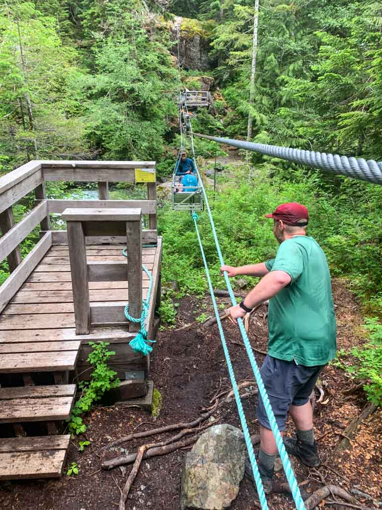
To continue towards Della Falls, climb the ladder onto the cable car platform and climb onboard. Cable cars are easiest to use in pairs as you can take turns holding the car stable as the other person climbs in and loads gear.
Let gravity carry you to the lowest point in the cable, then work together to pull yourself to the other side. If you have more people in your group, then can help by pulling on the cables from the platforms.


After the cable car, the next kilometre is along the west bank of Drinkwater Creek. This section is rough since it doesn’t follow the old road bed. There are lots of small ups and downs over roots and rocks.
The trail crosses two slide paths that can be very overgrown. Watch for flagging to stay on track. Depending on water levels, you may also have to dodge pools of water in the rocks at the bottom of the slides.
After the second slide path, arrive back at Drinkwater Creek. Two narrow metal bridges with cable railings span a narrow chasm above the rumbling creek.
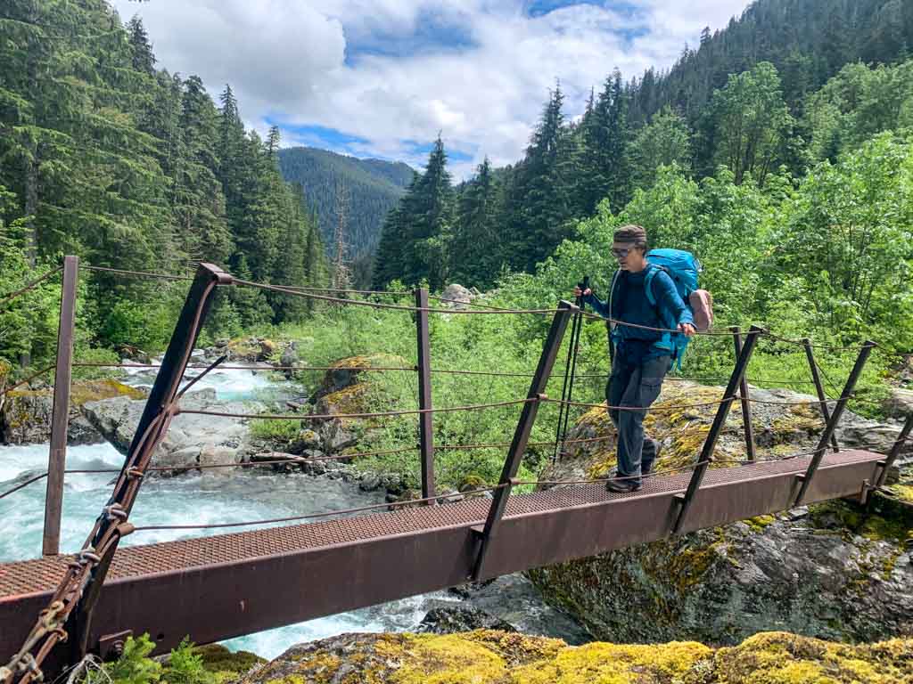

Once across the bridge, follow a rough flagged trail uphill into the forest, then quickly back down to creek level.
The trail follows the creek closely for a few hundred meters, weaving over and between giant boulders. In places, you will be nearly in the creek. A picturesque but tiny gravel beach partway along makes a good spot for a snack.
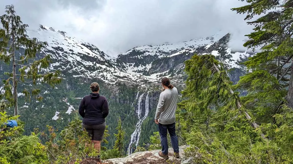
Continue climbing over rocks for a few more minutes before rejoining the old road. The road climbs gently but steadily through a long curve. Reach a wooden bridge at the 14 km mark. Soon after that, hit a straight stretch of trail. Look up for your first view of Della Falls high above you.
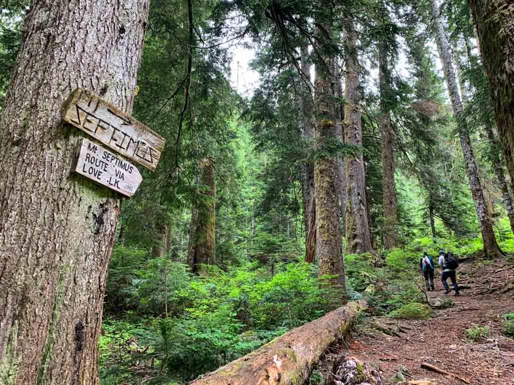
Cross another bridge a few minutes later, this time over Love Creek. The turn-off to the Love Lake Trail is a few more minutes along. About 0.5 km later, arrive at Saw Blades Camp at the 15 km mark.

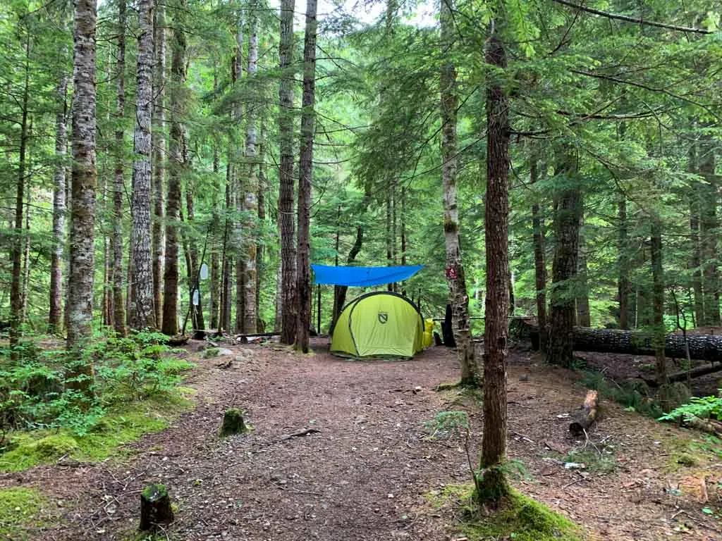
Saw Blades Campground
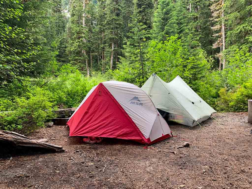
Most hikers stay at Saw Blades Camp as it is the largest campground on the Della Falls Trail and makes the best base camp for hikes to the base of Della Falls and to Love Lake. It holds about a dozen tents spread out across the campground.
The entrance to Saw Blades Camp is marked by two huge rusty saw blades attached to trees, left over from logging decades ago. There is a small, lumpy clearing next to the blades that holds a few tents, but the main camping area is further along.
Follow the brushy trail left across a small stream towards the banks of Drinkwater Creek. There are several tent sites carved out of the bushes alongside the trail as it parallels the edge of the creek. A few trails down to the edge let you collect drinking water.

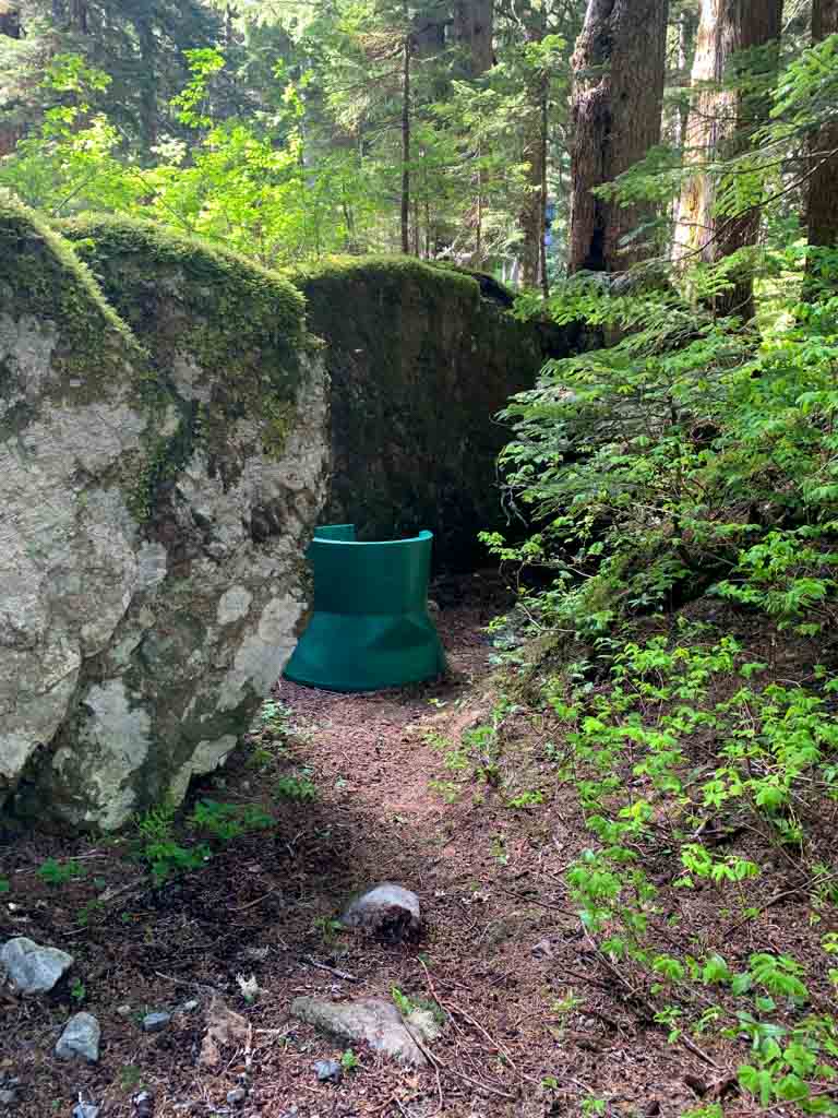

A spur trail to the right leads to a metal food cache and a plastic throne-style pit toilet that can get full.
If the toilet is not usable, bring a trowel and head back amongst the boulders away from the creek to dig a cat hole. This is a very popular campsite, and if you do not bury your waste, the area will quickly become contaminated.
The trail crosses Drinkwater Creek on a tall wooden bridge. On the other side, a faint trail to the left leads to an overflow camping area that will fit another three tents.
Join the Backpacking in BC Facebook Group
Get My Book…
Backpacking on Vancouver Island
Discover Vancouver Island’s best day hikes and overnight trips
- 25 backpacking trips and 10 day hikes throughout Vancouver Island
- Info about permits, reservations and campground facilities
- Detailed maps and photos
- Advice for extending your trip
- Points of cultural and natural history
Saw Blades Camp to Base of Della Falls
Distance: 1 km
Elevation Gain: 70 m
Time: 20-30 minutes
Difficulty: Moderate
The trail passes through Saw Blades Camp, then crosses a bridge over Drinkwater Creek. From there, it heads through beautiful old-growth hemlock forest for a few minutes.

The trail emerges from the trees in a brushy slide path with lots of boulders to weave through. Climb up onto a tall bridge over Della Creek, which has a good view of the falls. On the other side, the path heads back into the trees and passes Della Falls Camp (description of the camp below.)
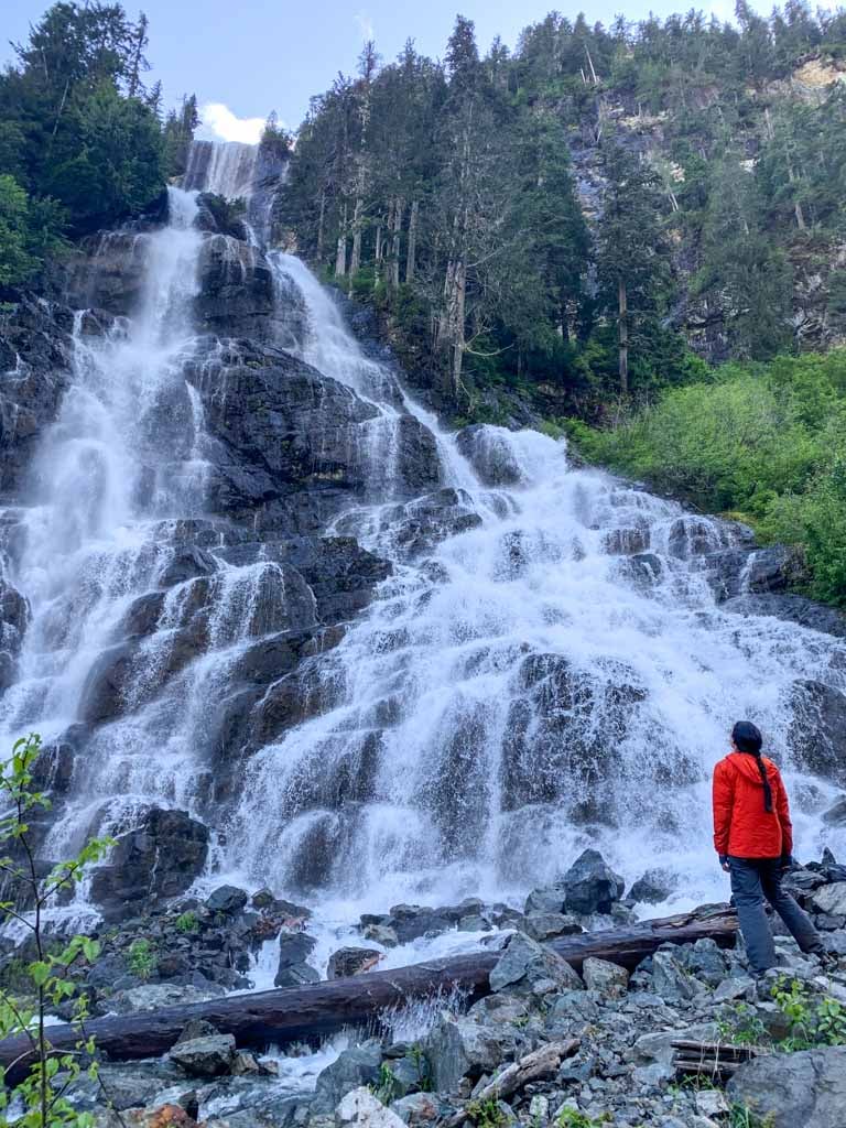
Follow the trail uphill through brush and more boulders to the base of the falls. Some of the boulders are the size of vans or small cottages and make good vantage points to watch the cascade. Wear a rain jacket as the mist and spray will soak you.

Della Falls Campground
This small campground is very close to the falls. It’s located in a grove of trees so it is very shady. It can also get misty from the falls. There is some old machinery here, left over from the mining days.
There is room for 2 or 3 tents in a small clearing. The spur trail behind the camp has a plastic throne-style pit toilet and a plastic barrel food cache.
The trail continues to gravel flats beside Drinkwater Creek. Collect water from the creek here. The gravel flats also work as an overflow camping area as long as water levels are low. However, the gravel is fairly coarse so it may take work to find a spot that isn’t too lumpy.

Love Lake Trail
Distance: 6 km round trip
Elevation Gain: 720 m
Time: 4-6 hours
Difficulty: Challenging
The hike to Love Lake is a must-do if you really want to see Della Falls. The viewpoint 2.5 km along is unparalleled. It lets you see all 440 metres of Della Falls at once. The hike starts 0.5 km before Saw Blades Campground.

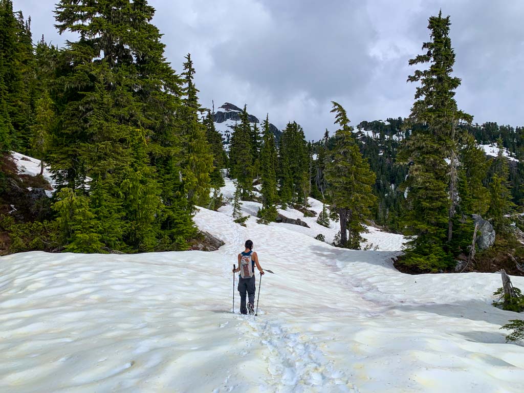
Love Lake holds snow until early to mid-July in most years. We brought microspikes and used them for the last section of trail. But hikers the week before we went used snowshoes. If you go in late June or early July, bring snowshoes or microspikes and read trail conditions online ahead of time.
Use caution if the trail is snow-covered as it is steep, travels through avalanche terrain, and can be hard to follow. It is best to wait until only the upper reaches of the trail are snowy (late June or early July) or the snow has melted entirely (late July to late September) to hike this trail.
The trail to Love Lake is an old miner’s track, and while it gains 720 m, lots of switchbacks make the grade a bit more manageable.
Be careful at a creek crossing in the first kilometre. The path runs across a slippery rock shelf above a waterfall. Step carefully as a fall would be catastrophic. Later in the season, the creek is drier and this area is safer.
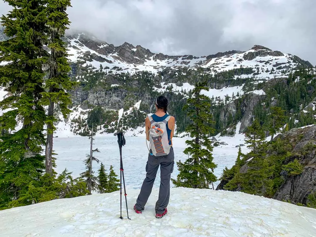
Work your way up the switchbacks to a long, rising traverse. After the traverse, a few more tight switchbacks take you up to the viewpoint on a bluff at 1180 m elevation. Stay and enjoy the view of Della Falls with Della Lake above it as well as Big Interior Mountain to the right and Nine Peaks to the left.
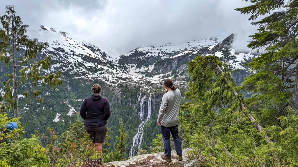
Carry on another 0.5 km with 100 m of elevation gain to Love Lake. On my visit, it was completely frozen over so we didn’t go down to lake level.

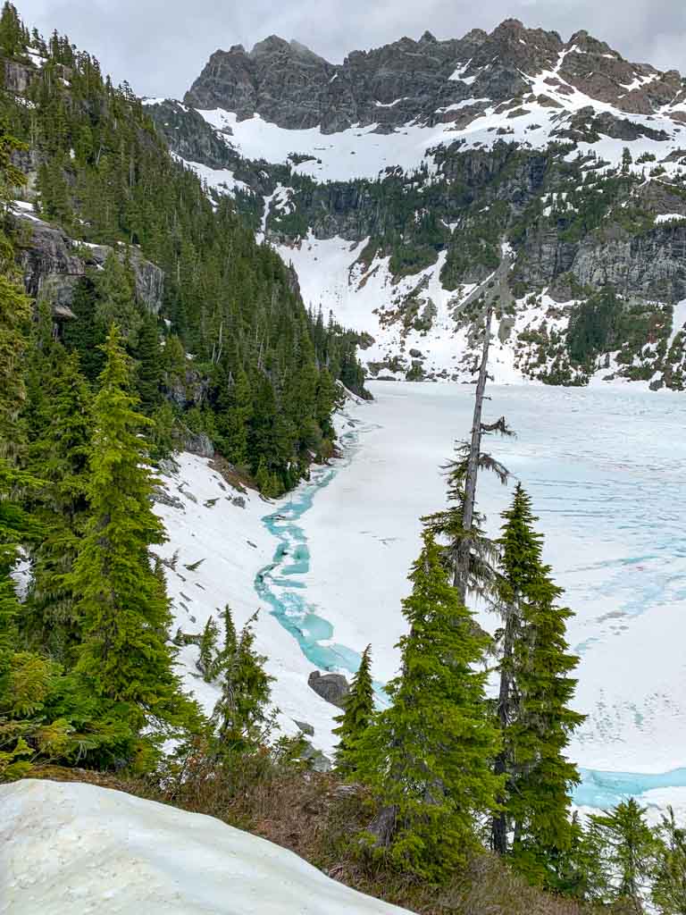

When it is snow-free, the glacier-polished rocks along the shoreline of Love Lake look fun to explore and the icy lake would be refreshing on a hot day.
The craggy peaks of Mount Septimus, Mount Rousseau and the Misthorns loom over the lake. When you have enjoyed the view, retrace your steps back to the Della Falls Trail.
Della Falls Itineraries
Most people complete the trail in three days, using the middle day to hike to Love Lake. But a few options are possible. I’ve got 4 different Della Falls itineraries for you below. They each include recommended water taxi times.
Standard 3-Day Della Falls Itinerary
Most hikers use this 3-Day itinerary. It’s enough time to visit the base of the falls and go to Love Lake. You can visit the base of the falls at the end of the day on day one, or before or after your hike to Love Lake.
Day 1 – Catch the 8 am (preferred) or 10:30 am water taxi. Hike trailhead to Saw Blades Camp: 15 km, 470 m elevation gain, 4.5-6.6 hours. Then day hike Saw Blades Camp to Base of Della Falls, return: 2 km, 70 m elevation gain, 40-60 minutes.
Day 2 – Day hike Saw Blades Camp to Love Lake, return: 6 km, 720 m elevation gain, 4-6 hours.
Day 3 – Hike Saw Blades Camp to Trailhead, 15 km, 470 m elevation loss, 4.5-6.5 hours. Catch the 2 pm or 4:30 pm water taxi.

Quick 2-Day Della Falls Itinerary
If you don’t have time for three days, skip the trip to Love Lake and just go to Della Falls.
Day 1 – Catch the 8 am (preferred) or 10:30 am water taxi. Hike trailhead to Saw Blades Camp: 15 km, 470 m elevation gain, 4.5-6.5 hours. Then day hike Saw Blades Camp to Base of Della Falls, return: 2 km, 70 m elevation gain, 40-60 minutes.
Day 2 – Hike Saw Blades Camp to Trailhead, 15 km, 470 m elevation loss, 4.5-6.5 hours. Catch the 2 pm or 4:30 pm water taxi.
Relaxed 4-5 Day Della Falls Itinerary
This itinerary is good for beginners, families, and groups who take a little longer on the trail. You can plan to hike all the way out to the trailhead on the fourth day or split up that journey as well.
Day 1 – Catch the 10:30 am or 2 pm water taxi. Hike trailhead to Margaret Creek Camp: 6.5 km, 70 m elevation gain, 1.5-2.5 hours.
Day 2 – Hike Margaret Creek Camp to Saw Blades Camp: 8.5 km, 395 m elevation gain, 2.5-4.5 hours. Then day hike Saw Blades Camp to Base of Della Falls, return: 2 km, 70 m elevation gain, 40-60 minutes
Day 3 – Day hike Saw Blades Camp to Love Lake, return: 6 km, 720 m elevation gain, 4-6 hours.
Day 4 – Hike Saw Blades Camp to Trailhead, 15 km, 470 m elevation loss, 4.5-6.5 hours. Catch the 2 pm or 4:30 pm water taxi. OR Hike Saw Blades Camp to Margaret Creek Camp: 8.5 km, 395 m elevation loss, 2.5-4.5 hours.
Optional Day 5 – Hike Margaret Creek Camp to Trailhead: 6.5 km, 70 m elevation loss, 1.5-2.5 hours. Catch the 11:30 am or 2 pm water taxi.
5-Day Della Falls Itinerary for Paddlers
Day 1 – Paddle Scout Beach Rec Site to Trailhead Camp: 24 km, 4-6 hours (depending on lake conditions).
Day 2 – Hike Trailhead Camp to Saw Blades Camp: 15 km, 470 m elevation gain, 4.5-6.5 hours. Then day hike Saw Blades Camp to Base of Della Falls, return: 2 km, 70 m elevation gain, 40-60 minutes.
Day 3 – Day hike Saw Blades Camp to Love Lake, return: 6 km, 720 m elevation gain, 4-6 hours.
Day 4 – Hike Saw Blades Camp to Trailhead Camp, 15 km, 470 m elevation loss, 4.5-6.5 hours.
Day 5 – Paddle Trailhead to Scout Beach Rec Site: 24 km, 4-6 hours (depending on lake conditions).
Della Falls FAQ
No. The only way to get to Della Falls is to take a boat to the end of Great Central Lake and then hike 16 km to the base of the falls. Google maps shows a logging road going to the trailhead, but it doesn’t exist. I’ve tried to report the error, but it’s still on there!
To get to Della Falls you need to take a boat across Great Central Lake, then hike 16 km to the base of the falls.
It is 16 km one way from Great Central Lake to the base of Della Falls.
It is a moderate trail. Most of the trail is easy, but there are a few challenging sections, and it is long, giving it an overall rating of moderate.
You can hike from the trailhead to Della Falls in one day. It takes about 7 hours one-way.
The best time to hike is from mid-June to late July because the falls are in full flow and there is no snow on the trail. The may be a bit of snow on the trail to Love Lake at this time, but not enough to stop you from hiking.
You can also hike the trail in August and September, but the falls will not be as powerful. From mid-May to mid-June the falls are very powerful, but the trail can have some snow. In winter, the trail is snowy and the water taxi doesn’t run so it’s not a good time to hike.
There are no fees to hike the Della Falls Trail. It is free. However, unless you have your own boat or a canoe, you will need to take a water taxi to the trailhead, which costs $150-175 per person.
No. You do not need a permit or reservation to hike the Della Falls Trail. All campsites are first-come, first-served.
The Della Falls Trail is a wilderness backpacking trip in a river valley with frequent mist and rain. Choose lightweight backpacking gear and bring warm, waterproof clothing. Your backpack should weigh no more than 25-30% of your body weight. See my backpacking packing list for a full run-down of everything you will need.
Della Falls is in a deep river valley high in the mountains of Strathcona Park so it is often cold and rainy. The warmest months are July and August with temperatures between 13 and 25°C. June and September are also warmer with temps of 10-22°C.
July, August, and September are the driest months. May and June are a little wetter. The rest of the year is very wet with an average of 108-266 mm of rain per month.
I use a pinpoint weather forecast from Spoxtwx to plan trips in the mountains. It’s on my list of the best hiking weather apps.
No. Due to forest fire risk and ecological damage, campfires are not allowed on the Della Falls Trail or anywhere in the backcountry of Strathcona Provincial Park.
Yes, dogs are allowed on the Della Falls Trail but they must be on a leash.
No. The Della Falls Trail is inside Strathcona Provincial Park. Drones are not allowed in any BC Provincial Park without a specific permit, issued only to licenced drone pilots.
Yes. Bears live in the valley along the Della Falls Trail. You may see bear prints, poop, and claw marks. The most common time to see bears is in May and early June when the snow is melting. However, you can see bears at any time of year.
Hike in a group, make noise, and keep your dog on a leash. Keep a clean camp and store your food in the food caches. Read my bear safety tips for backpackers for more info.
No. Della Falls has a total height of 440 metres. Many sources say it is the tallest waterfall in Canada, but that isn’t true. Della is number 16 on Wikipedia’s list of tallest waterfalls in Canada and 23rd on the World Waterfall Database’s list.
Since most of Canada’s tallest waterfalls are located in British Columbia, it’s not even the tallest waterfall in BC.
There are several ways to count the height of a waterfall. Some measures count the overall height while others count the longest single drop. Della Falls is not the highest waterfall in Canada by either of those measures.
However, it is still really spectacular!

That’s everything you need to hike to Della Falls, one of the tallest waterfalls in Canada. If you have questions about the hike, leave them in the comments. I’d love to help.
MORE VANCOUVER ISLAND POSTS:
- How to Go Backpacking in BC Without Reservations
- Things to do on Northern Vancouver Island
- 31 Best Backpacking Trips in BC
- Juan De Fuca Trail Guide: Backpacking on Vancouver Island
- Your Guide to the West Coast Trail in British Columbia
BACKPACKING TIPS:
- Backpacking Checklist: Gear You Need To Go Backpacking
- 20+ Ways to Reduce Your Backpack Weight
- Bear Safety for Hikers, Campers and Backpackers
- The 10 Essentials: Things You Should Bring on Every Hike
- The Best Weather Apps for Hiking
- 16 Things to do Before a Hike


- Best Sun Hoodies for Hiking - June 3, 2026
- Lower Stein Valley Trail Hiking and Backpacking Guide - May 27, 2026
- The Best Things to Do in Vernon, BC - May 21, 2026
Sandy Blacquiere
Friday 5th of September 2025
Just a bit of advice, while the trail is great for bringing your dog the ladder to the cable car and the cable car itself are not great for larger dogs. We have a 120lb shepherd and reached the rather high ladder only to realize we could not get him up the ladder. It also would've been too precarious to fit him into the cable car as the rails are quite low and the car too small for him to lie down. Sadly, we had to turn around and hike back down to the campsite which we then had to stay at for 2 nights as it was the water taxi driver’s day off the next day. People with smaller dogs that they can carry up the ladder and that would fit comfortably in the cable car would be fine. Disappointing as it is an expensive hike (travel costs for us plus water taxi). Hopefully one day we will try again without our canine pal!
Lisa
Wednesday 19th of February 2025
The Della falls looks great! I’m interested in going there. Not sure if I should canoe or hire a water taxi. Is it easy to canoe across and can it be choppy? Also, I’m wondering if there are a lot of mosquitoes during the month of July.
Thank you for all your information!
Taryn Eyton
Thursday 20th of February 2025
Hi Lisa, As I mention in the post, the lake can be windy and choppy so it depends on your paddling skill and comfort level. Most people take the water taxi. There will definitely be mosquitos in June and early July, especially closer to Great Central Lake. Each bug season is different (it depends on weather and snow melt) so it's hard to predict when the bugs will be the worst, but in general, the earlier you go the worse they will be.
Riley
Sunday 2nd of July 2023
Wondering if you need to reserve a spot at della falls campsite. I read all the article and it says first come first serve. Let me know if I'm wrong bc I'm always right oops.
Taryn Eyton
Tuesday 4th of July 2023
You do not need to reserve at Della Falls. As I said in the article, all campsites are first-come, first-serve.