

Update March 2025: With changes to the Instagram algorithm and the rise of Tiktok, the metrics I used to create this list in the past are no longer relevant so I won’t be updating this list going forward.
This list of the most Instagrammed hikes in Vancouver was first published in February 2017. I update the numbers each year. I’ve run the numbers fresh for 2024… (drumroll please)… and this year the hikes on the list haven’t changed – but their order has a bit. (You’ll still have to read the whole post to see which hike is number 1!)
Tons of people location tag their photos when they go hiking and post them to Instagram. (I know I do!) So it’s a great way to figure out which Vancouver hikes are the most popular. I scrolled through a lot of hashtags before coming up with this list of the most Instagrammed hikes in Vancouver.
If you’re looking to up your ‘gram game this is the list you need. And if you like solitude, here are the top 10 hikes you should avoid!
Before you scroll down and read the list, can you guess which hikes made the top 10?
Of course Vancouver isn’t the only city with Instagram-worthy trails. If you’re in San Diego, you have to hike to Potato Chip Rock. Looking for some Instagram inspiration? Check out this huge list of adventure quotes that make great Instagram captions.
This is a sensitive wilderness area. Learn how to Leave No Trace to keep the wilderness wild. Make sure you are prepared by bringing the 10 Essentials. Get ready for adventure with this checklist of things to do before every hike.
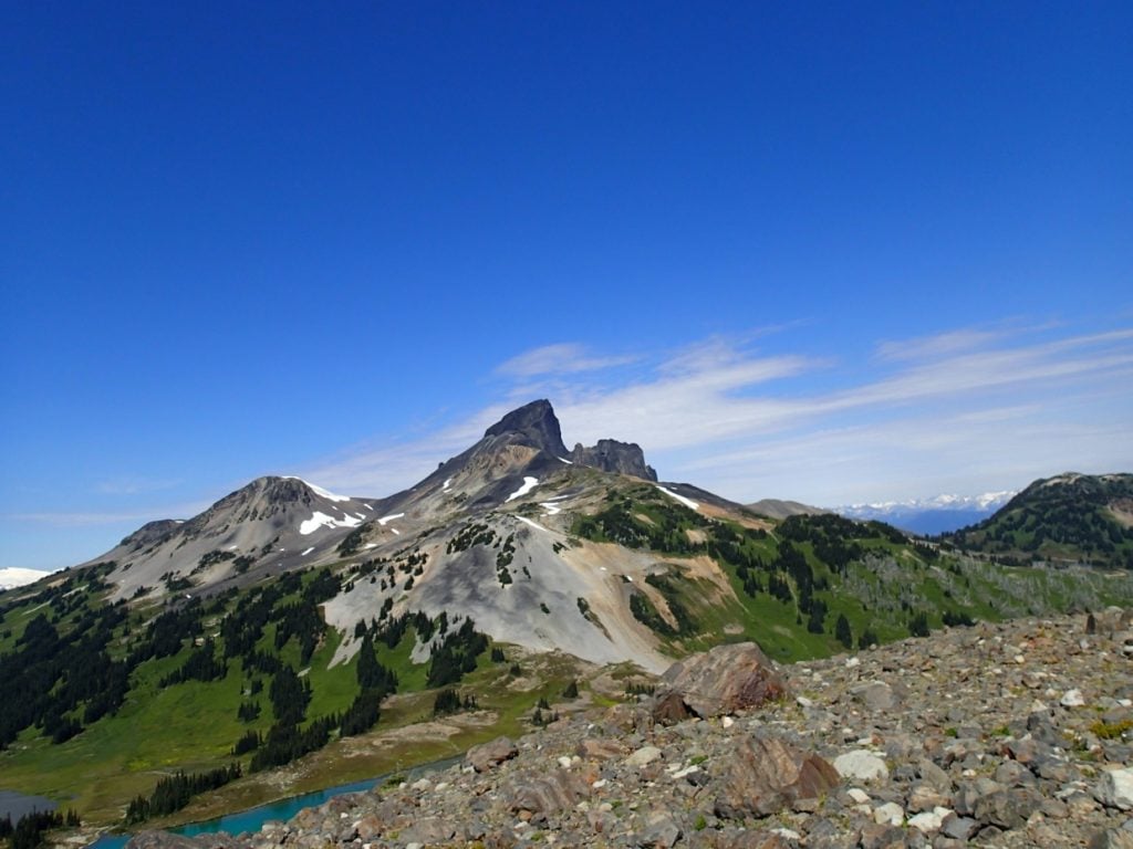
10. Black Tusk

Heads up: Day passes are required at Garibaldi Provincial Park in summer. Learn more in my guide to BC Parks day passes.
Trail Info: Black Tusk is an iconic Sea to Sky landmark. (It’s one of the best hikes in Whistler too.) As of 2024, there are 40.6k photos hashtagged #BlackTusk on Instagram (up from 39.4 k in 2023, 38k in 2022, 35.8k in 2021, and 33.7k in 2020).
The trailhead for Black Tusk is the same as for Garibaldi Lake. But instead of going right to the lake, you go left through Taylor Meadows campground and then ascend on loose volcanic rocks above treeline. (Climbing to the top of Black Tusk is technically a scramble or a rock climb, so most people should stop at the base. Get directions and more info in my book, Backpacking in Southwestern British Columbia.
Stats: Black Tusk is a long, hard hike. It is 29km round trip with 1750m of elevation gain. It takes most people 11 or 12 hours (or you can camp overnight at the Taylor Meadows or Garibaldi Lake campgrounds.)
Where to Get the Shot: As you get close to the base of the Tusk there is a BC Parks sign indicating that you have reached the end of the marked trail. It is not crazy steep in that area so its a popular place to sit down for a snack and take some photos of the incredible view.
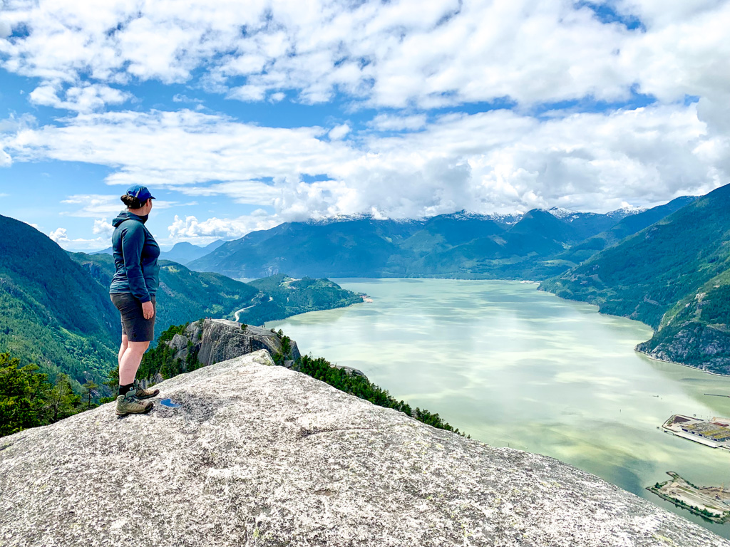
9. Stawamus Chief
Trail Info: Between #StawamusChief and #SquamishChief, the Chief (as it is sometimes known) has 46k hashtagged photos on Instagram (up from 44.2 k in 2023, 41.8k in 2022, 37.4k in 2021, and 34.1k in 2020).
Located next door to the Sea to Sky Gondola, it is one of the best hikes in Squamish even though it’s super steep. (It’s the steepest hike on my list of Grouse Grind Alternatives.) You’ll climb up stairs, ladders and even use chains to reach the top where you can look down the sheer cliff face. Get directions and more info on the Stawamus Chief Provincial Park website.
Stats: This steep hike has three peaks to choose from: First Peak 3km round trip with 540m elevation gain; Second Peak 3.4km round trip with 590m elevation gain; Third Peak 1.8km 3.6km round trip with 630m elevation gain. It takes about 2.5 hours to do the first peak, and 5 or 6 hours if you want to do all three.
Where to Get the Shot: You’ll find great locations for photos at the tops of each of the peaks. For the most dramatic shots head to third peak where you can get shots of the other two peaks (and all the tiny hikers on them).
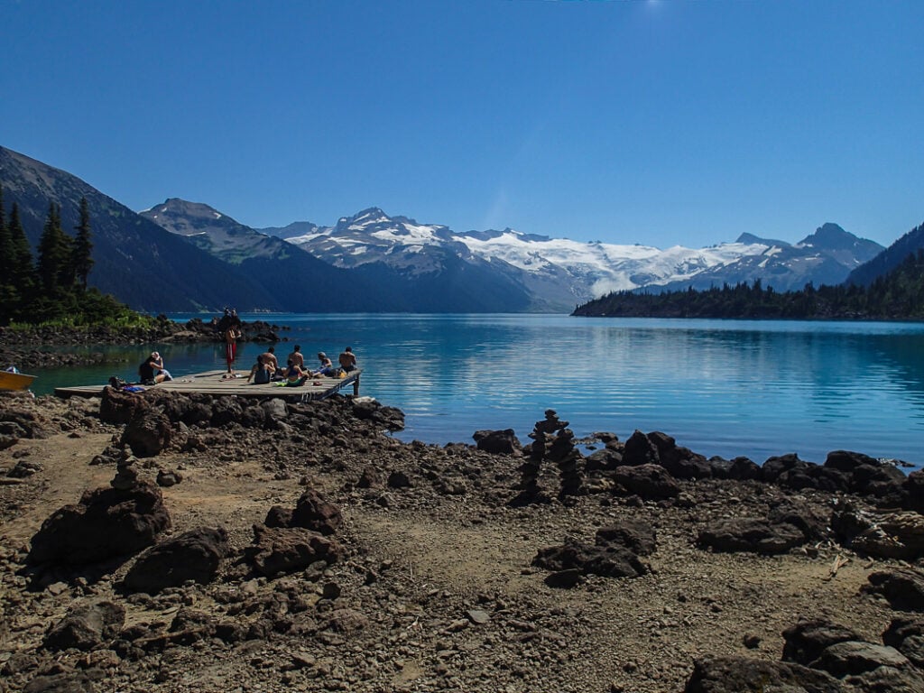
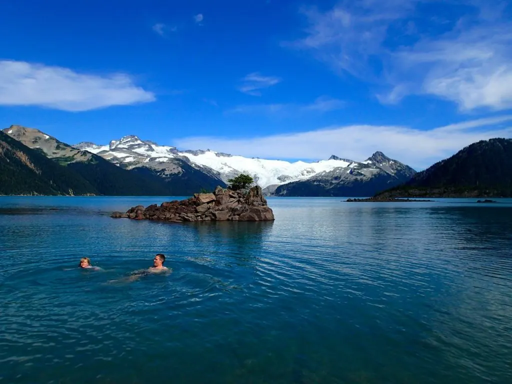
8. Garibaldi Lake

Heads up: Day passes are required at Garibaldi Provincial Park in summer. Learn more in my guide to BC Parks day passes.
Trail Info: #GaribaldiLake is one of the best hikes in Whistler and has been drawing Vancouver hikers for years, so it’s no surprise it has 51k hashtagged photos on Instagram (up from 48.7k in 2023, 46.6k in 2022, 42.7k in 2021, and 39.8k in 2020).
The first half of the trail switchback steadily uphill through the forest, then passes by the Barrier and two smaller lakes before finally emerging on the shores of the massive Garibaldi Lake. Get directions and more info in my book, Backpacking in Southwestern British Columbia.
Stats: It’s an 18km round trip hike with about 900m of elevation gain so allow 6 or 7 hours for the trip.
Where to Get the Shot: Many people take shots on the beach where the trail first enters the campground. However, you can get some more spectacular photos by continuing along the shore past the campground to the ranger’s boat dock.
7. Golden Ears

Heads up: Day passes are required at Golden Ears Provincial Park in summer. Learn more in my guide to BC Parks day passes.
Trail Info: There are tons of short hikes in Golden Ears Provincial Park and the 60k photos on the #GoldenEars hashtag reflects that. (Up from 57.7k in 2023, 54.8k in 2022, 49.8k in 2021, and 44k in 2020.) Golden Ears and Lighthouse Park keep leapfrogging each other in the rankings. Last year Golden Ears was #6, but Lighthouse Park took that spot this year.
But if you want the pinnacle hiking experience, you need to summit Golden Ears. It’s a long hike with a steep climb towards the peak. You’ll pass the emergency shelter on Panorama Ridge before crossing a snowfield to the true summit. Get directions and more info in my book, Backpacking in Southwestern British Columbia.
Stats: It’s a 24km round trip with 1700m of elevation gain. Allow 12 hours (or consider staying overnight at Alder Flats or Panorama Ridge campgrounds).
Where to Get the Shot: On a clear day the summit and the area around the emergency shelter have great views.
6. Lighthouse Park

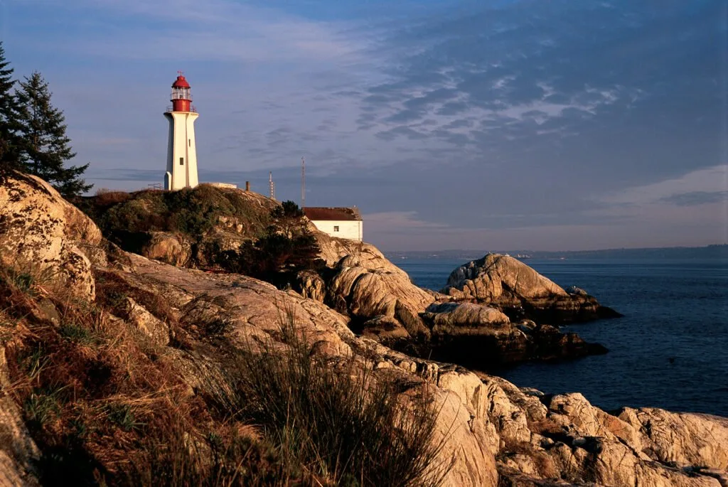
Trail Info: There are lots of trails at Lighthouse park, from a simple 10 minute walk on an old road to the lighthouse to longer routes. It’s a popular place, with 60.3k photos hashtagged #LighthousePark. (It had 57.7k photos in 2023, 55.8k in 2022, 49.8k photos in 2021, and 44k in 2020.)
My favourite route involves a loop around the perimeter of the park that visits lots of bluffs with ocean views. You can find a map and directions for this route on my Coastal Hiking in Vancouver post.
Stats: The loop around the park is only 6km but there are plenty of side trails to viewpoints to distract you. And even though there is no real elevation gain, there are many short, steep hills. Allow 3 hours for this hike.
Where to Get the Shot: It depends what you want shots of, as you are spoiled for choice here. For iconic shots of the Lighthouse take the West Beach Trail. For beautiful city shots, go to East Beach. And for views of Howe Sound and Bowen Island go to Juniper Point or Shorepine Point.
5. Quarry Rock

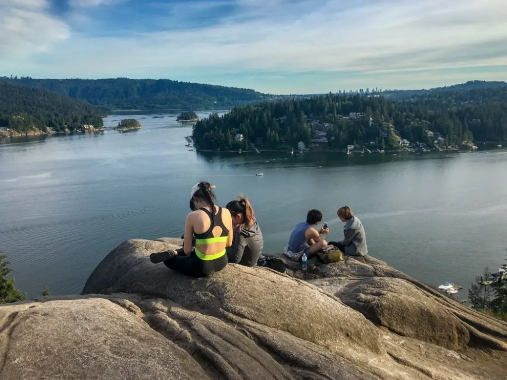
Trail Info: The hike to Quarry Rock is relatively short but has a huge payoff, so it’s no surprise that is fairly popular on Instagram with 64.5k photos hashtagged #QuarryRock. (It had 62k in 2023, 61.4k in 2022, 59.7k in 2021, and 57.9k in 2020.)
The trail heads through the forest and crosses several bridges over fern festooned streams. At the end it emerges on to a big granite bluff with great views of Deep Cove and Belcarra. Get directions and more info on Vancouver Trails and Outdoor Vancouver.
Stats: It’s a short 4km round trip hike with just 100m of elevation gain (although it feels like more). It only takes about 1.5 hours to do the hike.
Where to Get the Shot: The money shot is of course on the granite bluffs of Quarry Rock at the end of the hike. However, there are lots of beautiful forest scenes on the mossy wooden bridges throughout the hike.
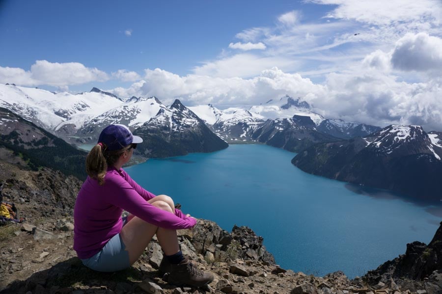
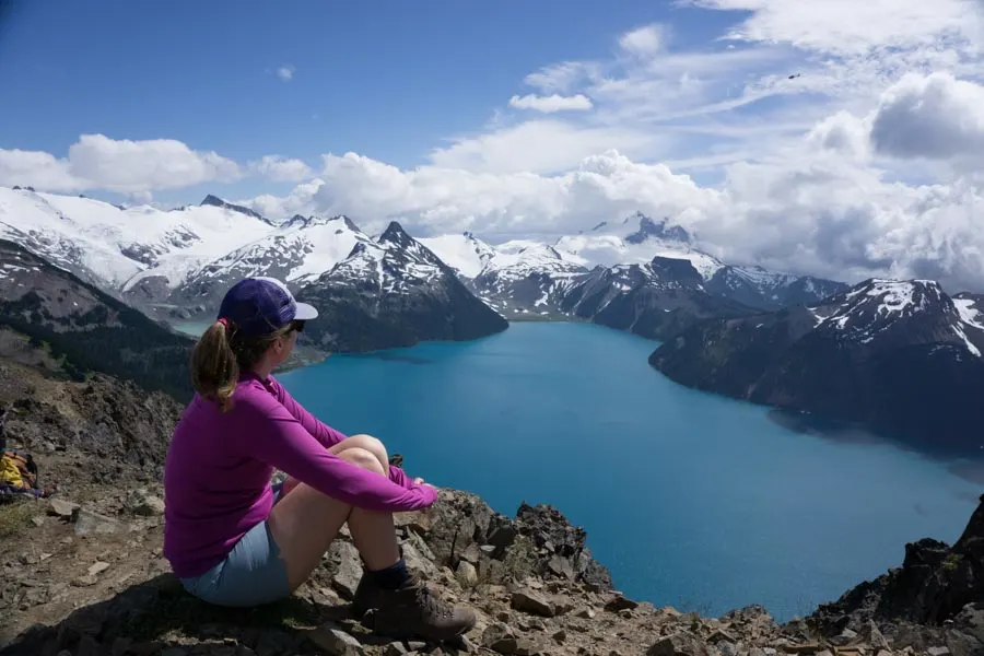
4. Panorama Ridge
Heads up: Day passes are required at Garibaldi Provincial Park in summer. Learn more in my guide to BC Parks day passes.
Trail Info: At 68.5k hashtagged photos, the success of #PanoramaRidge on Instagram can probably be explained by its particularly epic view. (It had 65.9k in 2023, 62.6k in 2022, 55.1k in 2021, and 45.9k in 2020.)
It’s a long and difficult hike to get there but I think everyone who’s been would agree it’s worth the slog. Try to time your visit for late July or early August to see the wildflower meadows in bloom along the way.
If the trail is too much for you to tackle in one day, stay overnight at Taylor Meadows or Garibaldi Lake campgrounds. Get directions and more info in my book Backpacking in Southwestern British Columbia. (Panorama Ridge is one of my favourite trails, and my pick for the top 10 hikes near Vancouver.)
Stats: The 30km round trip to the viewpoint gains about 1520m. Most people hike it in 11-12 hours.
Where to Get the Shot: For views of the lake, head to the very top. If you take the trail to the left along the ridge, you’ll have fewer people trying to get the same shot. For pics of Black Tusk, take them on the way up or at the top.
3. Grouse Grind
Note: The Grouse Grind is closed in winter and during periods of bad weather. See the Grouse Mountain Regional Park website for opening info.
Trail Info: For three years running, the #GrouseGrind was the most Instagrammed hike in Vancouver. But in 2020 it was finally unseated and it’s been dropping in the stats since then – it was second in 2023, but has dropped to third this year. In 2024 it has 78.7k hashtagged photos (compared to 78k in 2023, 76k in 2022, 73.8k in 2021, and 72.2k in 2020).
Many people hike it weekly to stay in shape. It climbs steeply up through the forest on stairs and rocks. (In fact it is often called Mother Nature’s Stairmaster.) There are no views until you emerge from the trees just below the Grouse Mountain Lodge.
You are not permitted to hike down the Grind. Instead you can pay $20 to take the gondola down (and save your knees!) You can find more information on the Grouse Mountain Regional Park website.
Stats: It’s a brutally steep 2.9km hike with over 800m of elevation gain. It takes most people 1.5 to 2 hours to hike. The fittest people run it in under an hour and the all-time record is just 25 minutes!
Where to Get the Shot: The viewpoint just below the lodge is a popular place for sweaty and triumphant selfies. There are also some cheeky motivational signs along the way that make cute photos. (The one that says “Legs, you got this!” is my fave.)
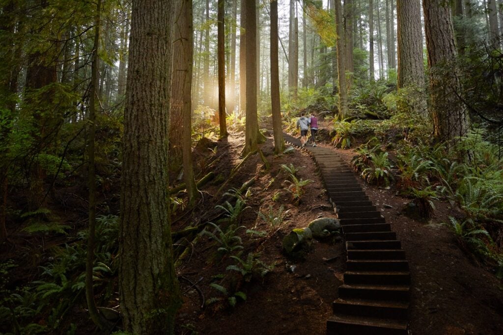
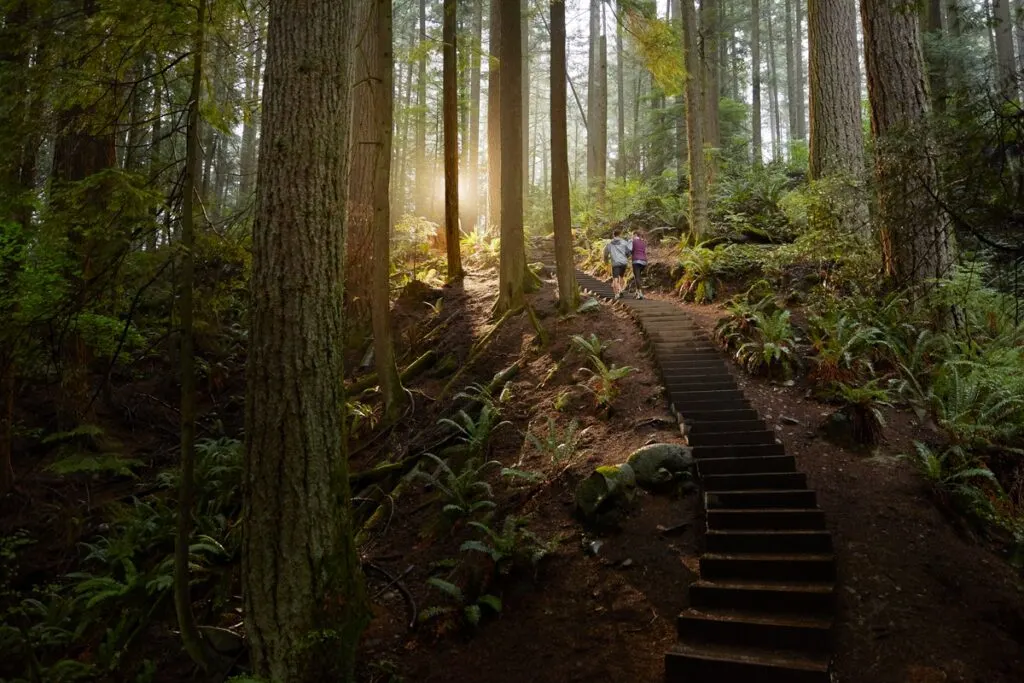
2. Lynn Canyon

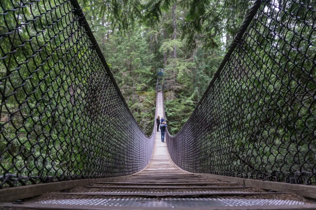
Trail Info: If you just want to see the famous Lynn Canyon suspension bridge, it’s only about 100m from the parking lot. Most of the 79.3k photos with the hashtag #LynnCanyon are of the bridge (up from 77k in 2023, 74k in 2022, 71.3k in 2021, and 69.5k in 2020).
But there is lots to see in the area so it’s worth heading out on a short hike. A popular loop route crosses the suspension bridge then heads downstream to the bridge at Twin Falls. Get more info and directions on Vancouver Trails. There are lots of trail options: bring a copy of the trail map and choose your own adventure.
Stats: The short Twin Falls loop is just 1.5km long with less than 100m of elevation gain. It takes about an hour to hike.
Where to Get the Shot: The classic shot is of the suspension bridge, of course. But you can also get great shots at Twin Falls and 30 Foot Pool.
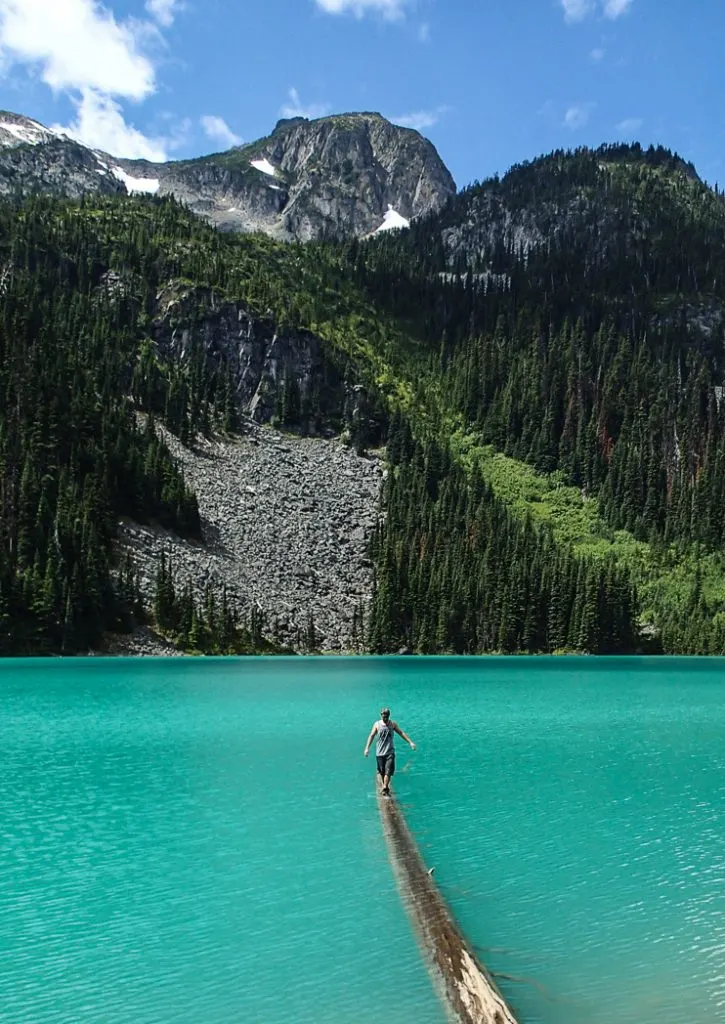
1. Joffre Lakes

Heads up: Day passes are required at Joffre Lakes Provincial Park in summer. Learn more in my guide to BC Parks day passes.
Trail Info: It’s no surprise that Joffre Lakes has topped the most Instagrammed hikes in Vancouver rankings since 2020 as it seems like most of Vancouver is up there on long weekends. There are now 98.5k photos hashtagged #JoffreLakes. (In 2023 there were 93.3k. There were 86.7k in 2022. In 2021, there were 79.7k. In 2020, there were 78.4k. There were 63.3k in 2019. In 2018, there were 43.7k photos. And in 2017, there were 25.6k photos. Those are some huge jumps.)
Joffre Lakes is actually just outside of Pemberton, a good 2.5 hour drive from Vancouver. But the three incredible turquoise lakes and glacier views are extremely popular with hikers. The first lake is just 10 minutes from the parking lot. The second lake is a steep uphill hike, and the hike finishes at the third lake where there is a campground.
In the summer, you may need a free BC Parks parking pass. Get more directions and more information in my Joffre Lakes hiking guide.
Stats: It’s a moderate 10km round trip hike to the Upper Lake with about 400m of elevation gain. Allow 4 hours for the hike (but lots more for photos).
Where to Get the Shot: The best views of the glaciers are a short spur trail across the rocks where the main trail first reaches Upper Joffre Lake. Another popular location for photos is the floating log along the shore of the Middle Lake. On sunny weekends there is often a line up of people waiting to walk out on to the log to take photos. (Many people up the difficulty factor by striking a yoga pose).
So there’s the list of the Top 10 Most Instagrammed Hikes in Vancouver as of early 2024. Were there any surprises on the list for you? Which ones did you guess right? Personally I’m surprised St. Mark’s Summit (still!) didn’t make the top 10.
More Awesome Hikes Near Vancouver:
- BC Parks Day Passes 2024 – Everything You Need to Know
- The 10 Best Hikes in Vancouver: A Local’s Guide
- The Best Hikes in Squamish, BC (From a Local)
- The Best Hikes in Whistler: A Guide to All the Trails
- 15 Unusual Hikes Near Vancouver
- Alternatives to the Grouse Grind
- 35 Vancouver Hikes You Can Get to on Transit
- Waterfalls Near Vancouver You Can Hike To
- 100+ Snow-Free Hikes in Vancouver: Trails You Can Hike Year Round


- Things to Do on Newfoundland’s Great Northern Peninsula - July 29, 2026
- Best Sun Hoodies for Hiking - June 3, 2026
- Lower Stein Valley Trail Hiking and Backpacking Guide - May 27, 2026
Kirtika saha
Thursday 20th of May 2021
Wow! This is such a comprehensive and super helpful guide. Great post with great pics. Thanks for sharing this information.
Kathy@DavesTravelCorner
Thursday 21st of March 2019
Wonderful photos! Truly, these are instagramable hikes. Thank you for sharing your impressive shots, Taryn.
Carie Neal
Tuesday 20th of November 2018
hello! I am making a trip to Vancouver December the beginning of December. It is my husband's and I's first trip. We are staying at the Kingston Hotel. We will not have a car. Are there any hikes we could get to that are relatively close to our hotel? I would really like to go on a hike while we are there. Thanks in advance!
Taryn Eyton
Tuesday 20th of November 2018
Since you'll be based in downtown Vancouver, it's pretty easy to get most places on public transit. Have a look at my list of easy hikes for visitors to Vancouver: https://happiestoutdoors.ca/easy-hikes-in-vancouver/ Most of them are accessible on public transit. Stanley Park would also be within walking distance for you if you're staying downtown
Josy A
Thursday 19th of July 2018
I guess it makes sense that the grind is the most instagrammed hike on this list, I mean, especially as it is the second most climbed mountain in the world... but I think it might be the least interesting of the places you've listed!
Taryn Eyton
Thursday 19th of July 2018
The list isn't called "most beautiful hikes in Vancouver" or even "most photogenic hikes in Vancouver" ;) Honestly I'm baffled by the popularity of the Grouse Grind, but lot so people seem to love it!
Cassandra
Thursday 27th of July 2017
These are all so awesome, definitely just added a few must's to my list next time I'm in Vancouver! I've only done the Grouse Grind on this list, but I really think Cypress Falls should be on the list such a great view of the ocean and Vancouver!! Thanks for sharing :)