
Heads up: The Juan de Fuca Trail is closed in summer 2025 due to significant storm damage. Mystic Beach and East Sombrio Beach are currently open. The full trail will re-open on July 1, 2026.
The Juan de Fuca Trail covers 47 challenging kilometres along the coast of southwestern Vancouver Island. I’ve hiked the trail twice, so I put together a Juan de Fuca Trail itinerary to help you get prepared for your trip.
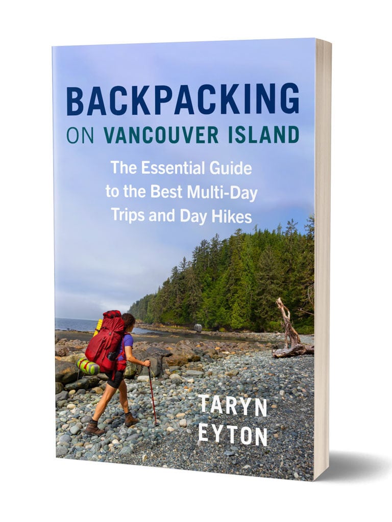
I also have several Juan de Fuca itinerary options for trips between 3 and 7 days and options for doing just part of the trail. (The JDF is also featured in my book, Backpacking on Vancouver Island.)
Use this Juan de Fuca itinerary and section-by-section overview to plan your trip. It includes:
- details on what each section is like including distances, difficulty, hiking time, and must-sees
- info on each campsite
- sample itinerary for a standard 4-day trip plus six more itinerary options
WANT MORE JUAN DE FUCA TRAIL INFO? Check out these posts:
- Juan de Fuca Trail Basics
- Juan de Fuca Trail Packing List: Everything You Need to Bring
- Coastal Hiking Tips: Advice for Beach Backpacking
Hey there: Some of the links in this post are affiliate links, which means I earn a small commission at no cost to you. Thanks for your support. -Taryn
This is a sensitive wilderness area. Learn how to Leave No Trace to keep the wilderness wild. Make sure you are prepared by bringing the 10 Essentials. Get ready for adventure with this checklist of things to do before every hike.
Key Distances on the Juan de Fuca Trail
| KM | Location |
| 0 | China Beach Trailhead |
| 1 | Pete Wolf Creek Suspension Bridge |
| 2 | Mystic Beach and Camp |
| 8 | Start of Bear Beach |
| 8.6 | Bear Beach Camp East – Rosemund Creek |
| 8.7 | Bear Beach Tide Cut-off |
| 9.6 | Bear Beach Camp Centre – Clinch Creek |
| 10.5 | Bear Beach Camp West – Rock on a Pillar |
| 20.5 | Chin Beach East Bluff Camp |
| 20.6 | Chin Beach East Tide Cut-off |
| 21 | Chin Beach Camp |
| 21.3 | Chin Beach West Tide Cut-off |
| 22.1 | End of Extreme Low Tide Route |
| 23.8 | Loss Creek Suspension Bridge |
| 24.8 | Trail joins old logging roads |
| 26 | Trail leaves old logging roads |
| 26.5 | Sombrio Point Viewpoint |
| 27 | Sombrio Beach Camp Far East |
| 27.6 | Sombrio Beach Camp East |
| 28 | Sombrio Beach East Tide Cut-Off |
| 29 | Sombrio Beach West Camp and Sombrio Beach Trailhead |
| 29.2 | Sombrio River Suspension Bridge |
| 29.3 | Sombrio Beach Far West Camp |
| 29.6 | Sombrio Beach West Tide Cut-Off |
| 30.2 | Sombrio Beach West-West Tide Cut-Off |
| 32 | Minute Creek Suspension Bridge |
| 33 | Little Kuitshe Creek Camp |
| 37 | Parkinson Creek Trailhead |
| 38 | Start of optional reef shelf route |
| 39 | End of optional reef shelf route |
| 40 | Payzant Creek Camp |
| 41 | Side trail to Providence Cove |
| 45 | Botanical Beach |
| 47 | Botanical Beach Trailhead |
China Beach Trailhead to Mystic Beach
Distance: 2 km
Time: 30-45 min
Highlights: Pete Wolf Creek suspension bridge, Mystic Beach waterfall
Cumulative Elevation Gain: 105 m
Difficulty: moderate
The China Beach Trailhead is actually located at the China Beach Day Use Area, which is few minutes up the road from the China Beach Campground at Juan de Fuca Provincial Park.
There are two parking lots here – the upper parking lot on the right is where you’ll find the Juan de Fuca Trailhead. The lower parking lot on the left has the trail to China Beach. There’s an outhouse here if you need one.
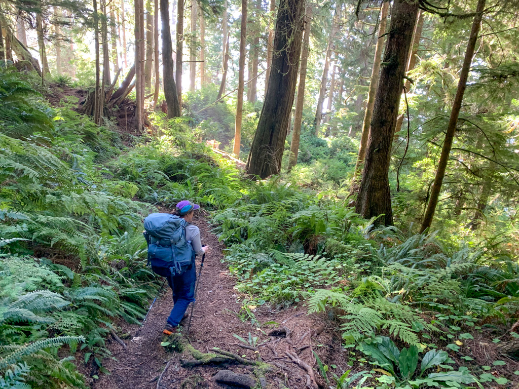
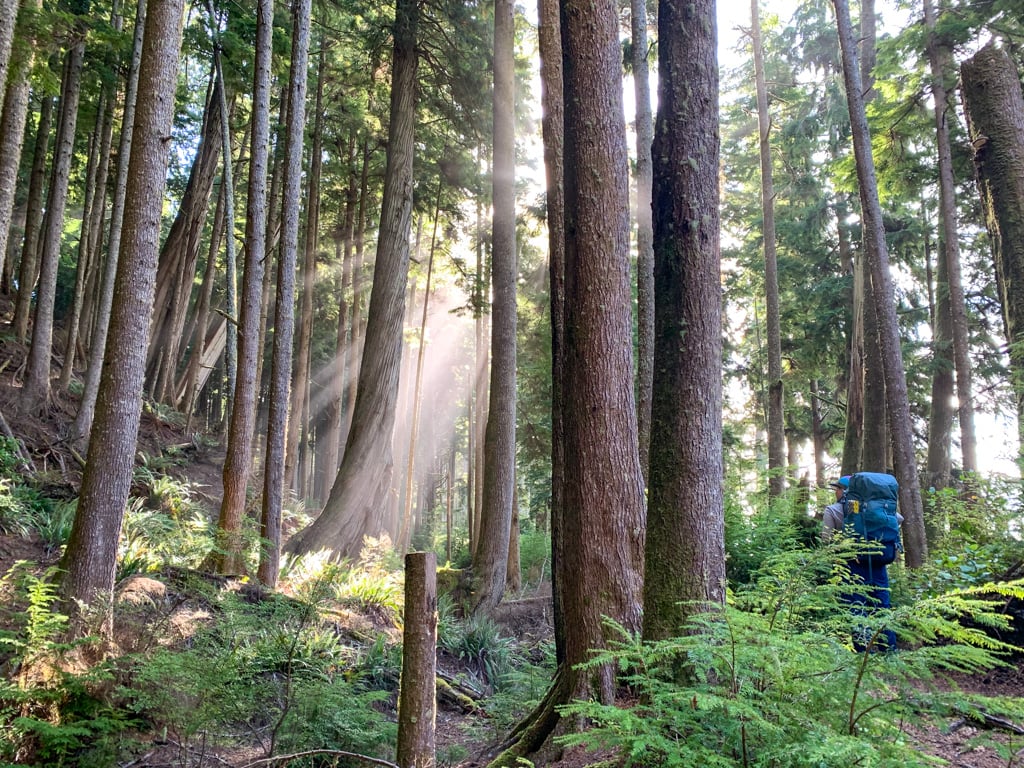
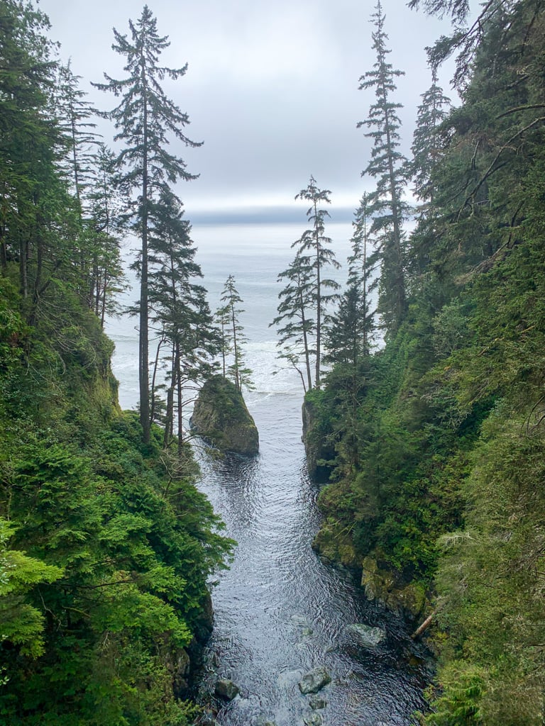
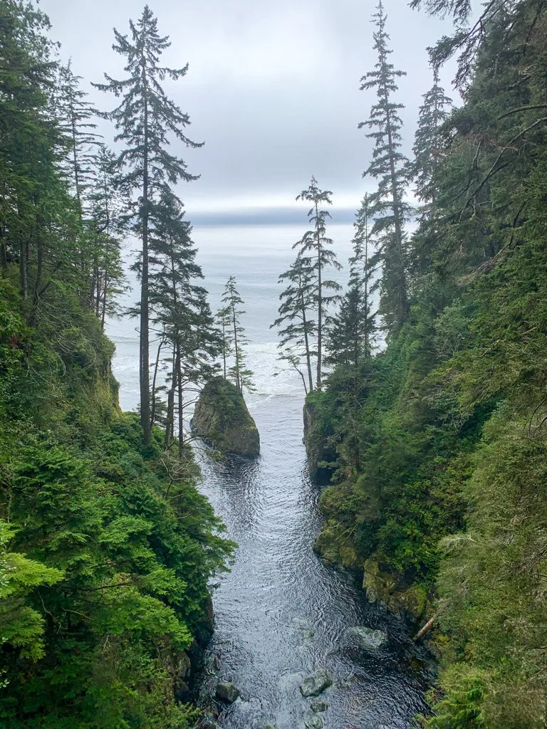
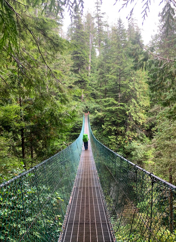
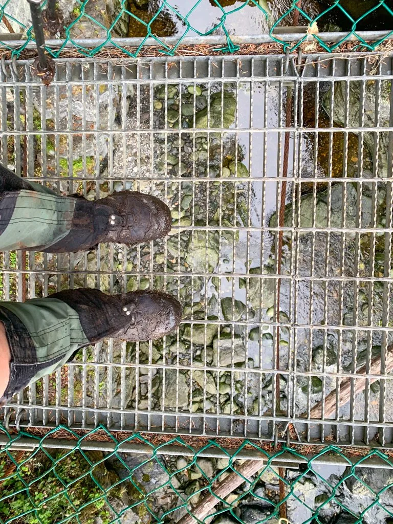
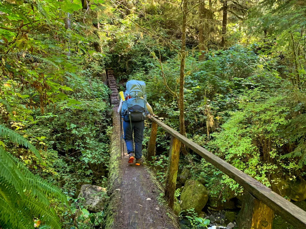
The first part of the Juan de Fuca Trail rambles through a fairly level section of forest. About 1km from the trailhead, cross the suspension bridge over Pete Wolf Creek. This is the first of several suspension bridges on the trail.
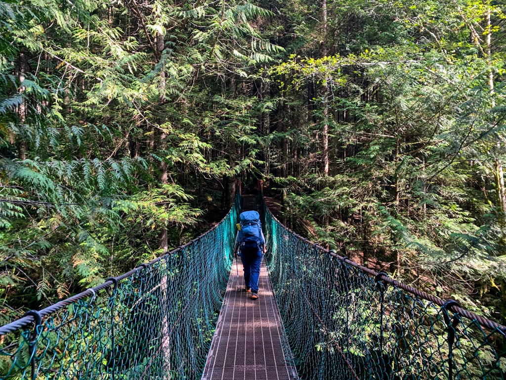

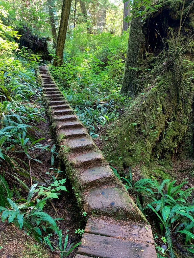
Shortly after the bridge, the trail curves left and starts heading downhill. You’ll start to hear and smell the ocean as you work your way down sets of stairs towards Mystic Beach.
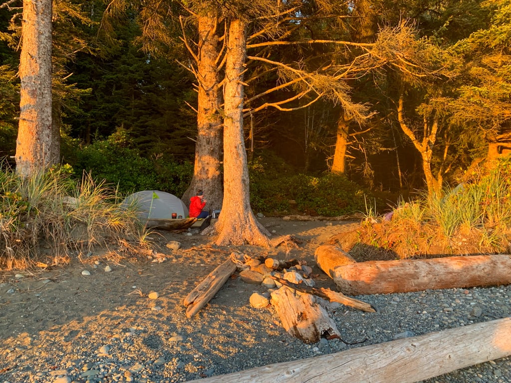
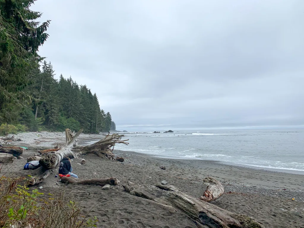
Mystic Beach Camp
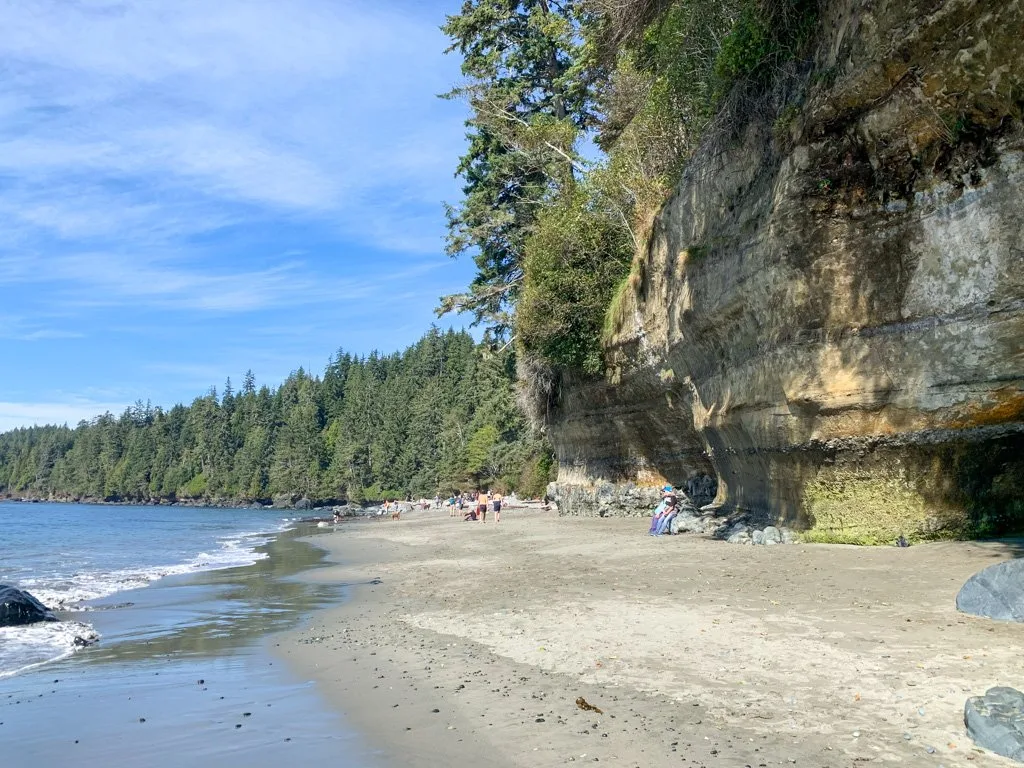
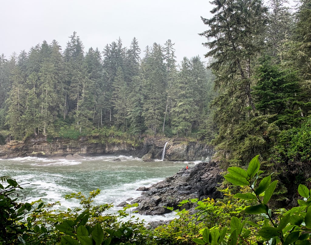
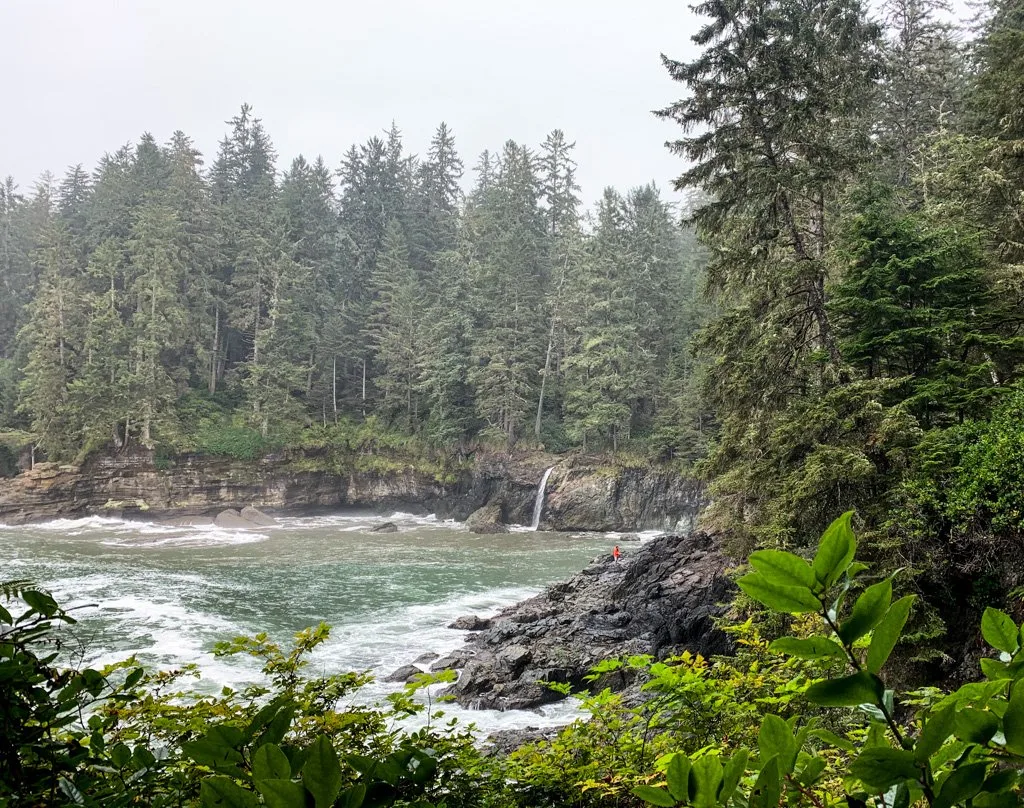
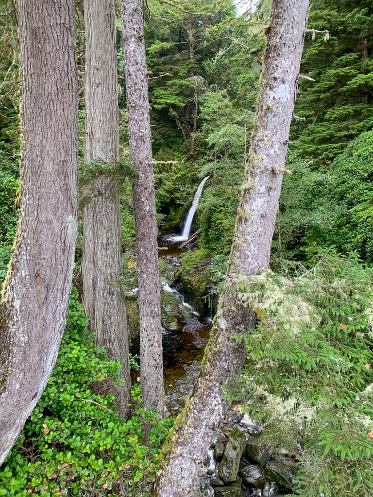
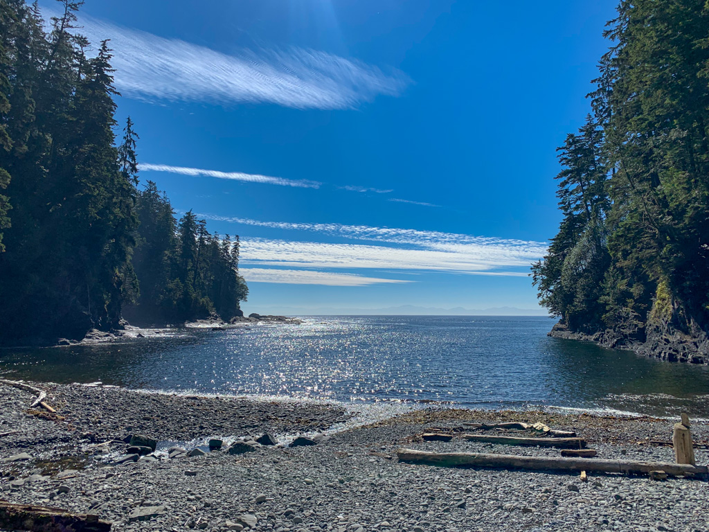
Mystic Beach is one of the smaller beaches on the Juan de Fuca Trail at just 350m long. The highlight here is the beautiful white sand and the waterfall that tumbles over the cliffs at the east end. Try to time your visit for low tide so you can go right up to the waterfall or explore a rock arch at the west end of the beach.
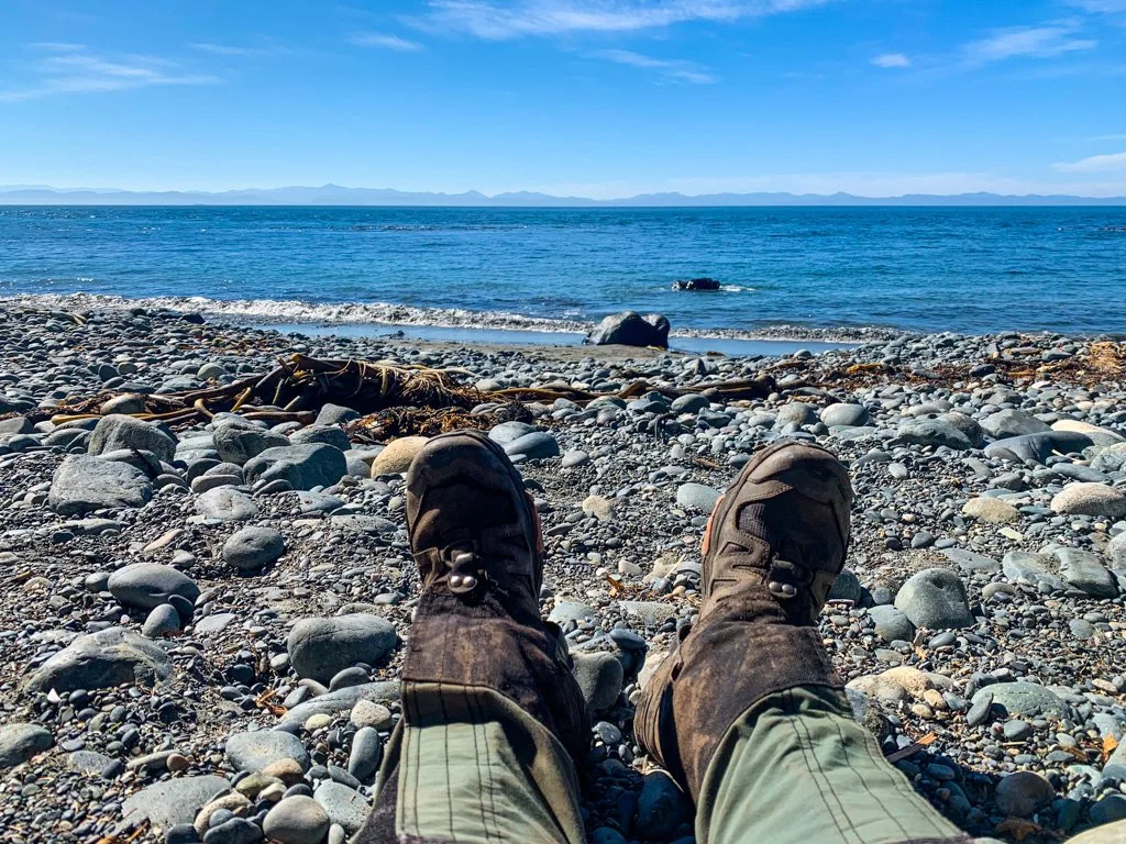

The trail hits the beach roughly in the center. Find the continuation of the Juan de Fuca Trail at the west end of the beach along with a creek to get drinking water.
The toilets and bear cache are located up a steep side trail just east of the route from the trailhead.
This beach doesn’t have that many campsite options. There are a few tent sites tucked into the forest behind the beach and flat clearings on the gravel as well as a few sandy spots near the path to the trailhead that may be underwater at higher tides.
Mystic Beach to Bear Beach
Distance: 7.6 km
Time: 2-3.5 hours
Highlights: beach hiking, ocean viewpoints
Cumulative Elevation Gain: 270 m
Difficulty: moderate
Leaving Mystic Beach, the trail climbs up onto a bluff and rambles along the top. There are some peek-a-boo views through this section. Around KM3, the trail heads uphill to a bridge over Pat Phillip Creek, then back downhill again.
The trail sticks fairly close to the edge of the bluff and travels through some beautiful forest. However, you can’t see the ocean. There are fresh clear-cuts just uphill and in a few places, they are visible from the trail.
The trail climbs back uphill again to cross Bent Creek around 5km. You descend briefly before ascending again to cross Fatt Creek around 6km. Watch for a brief viewpoint between the two.
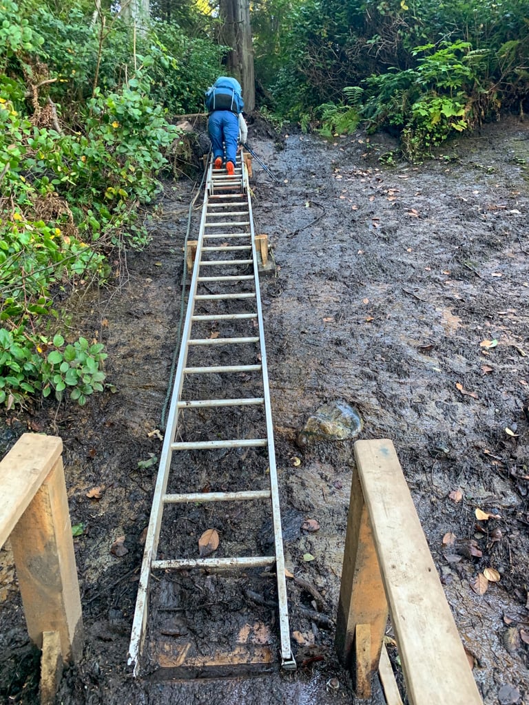
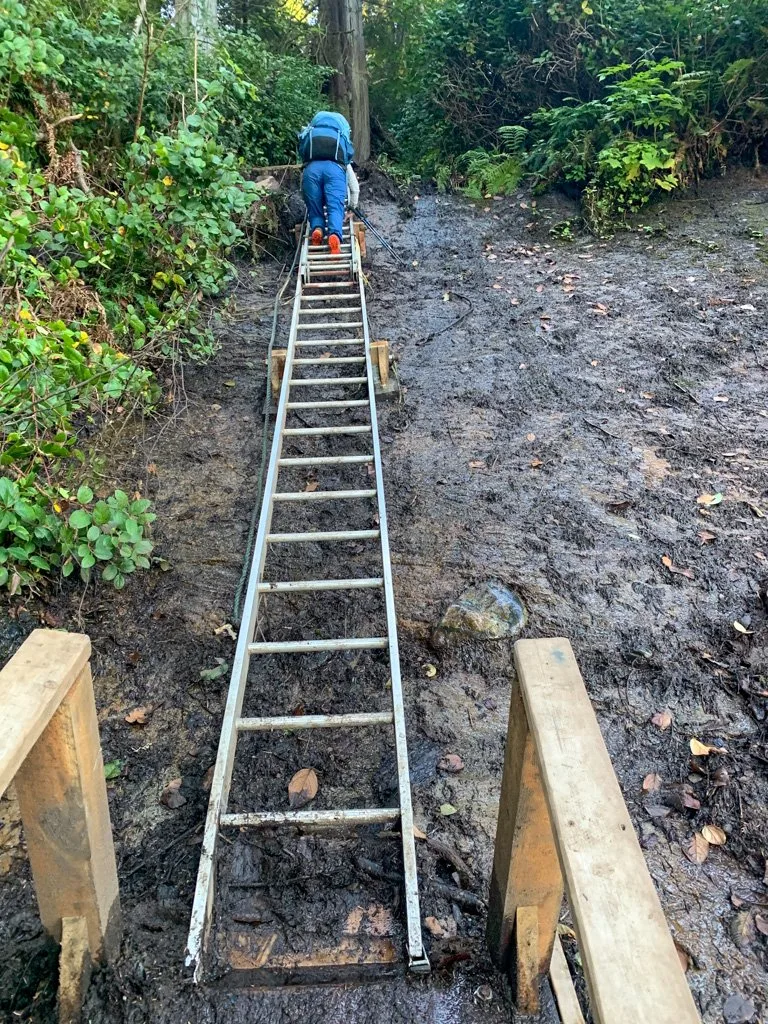
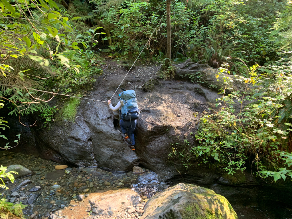
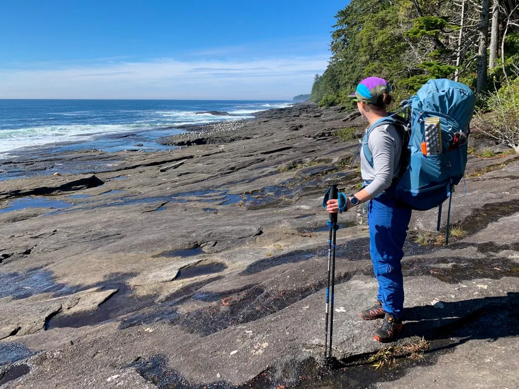
The trail descends steeply to the east end of Bear Beach around the 8km marker on a rough and muddy trail beside a waterfall.
BC Parks is doing trail maintenance in this area to stabilize the slope. When I hiked it, there was a temporary ladder bolted to the cliff (pictured below), but as of spring 2024 there are permanent ladders here.
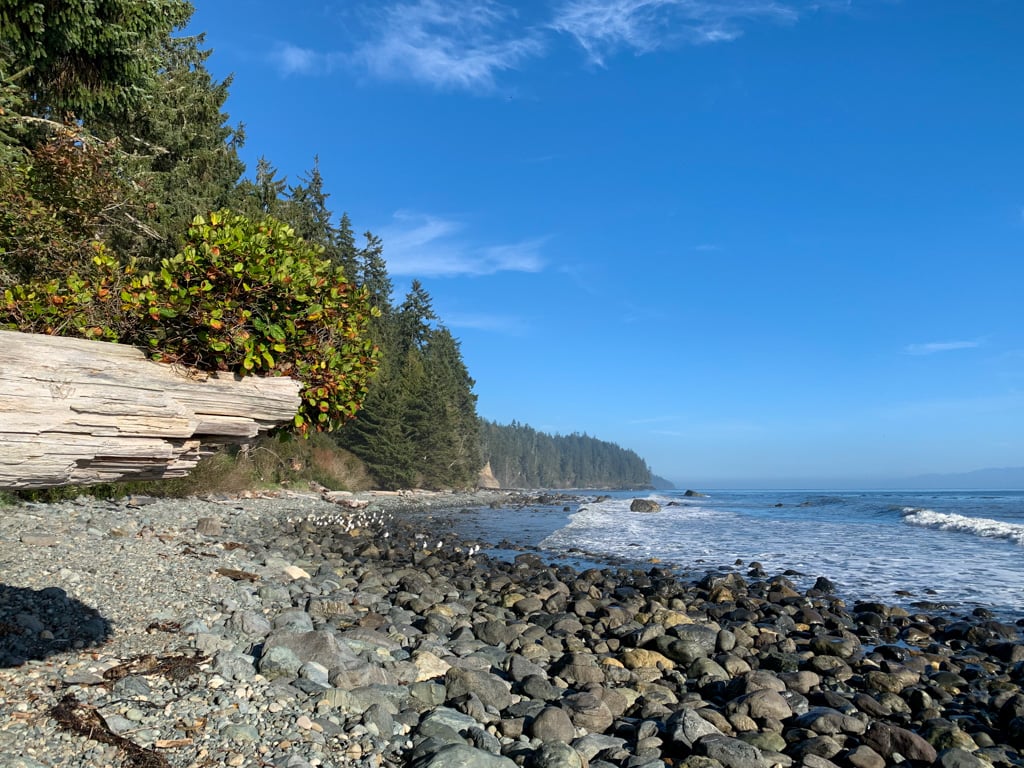
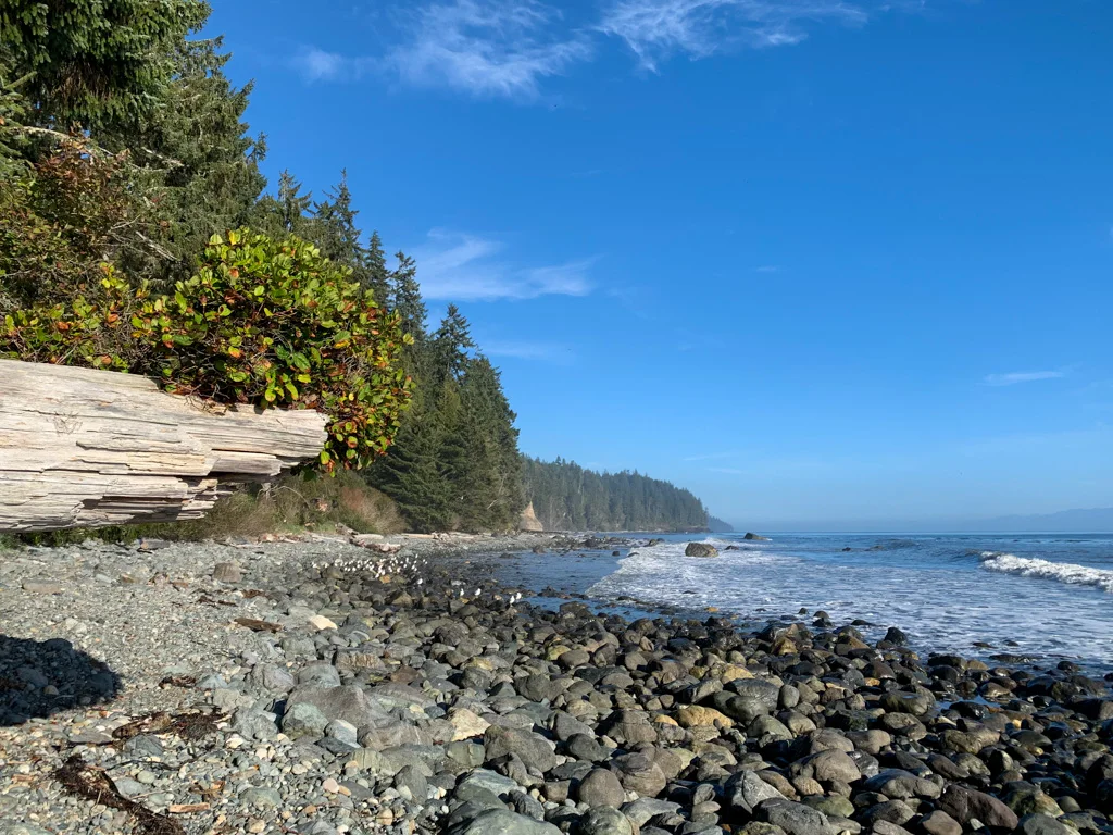
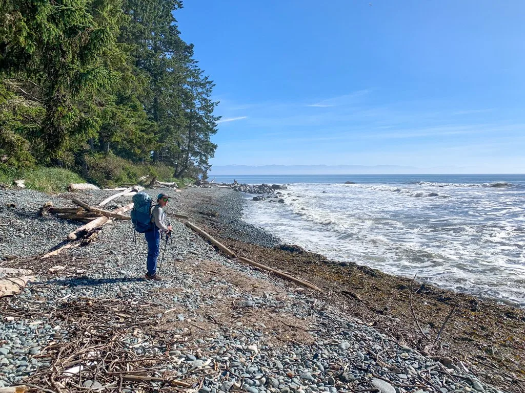
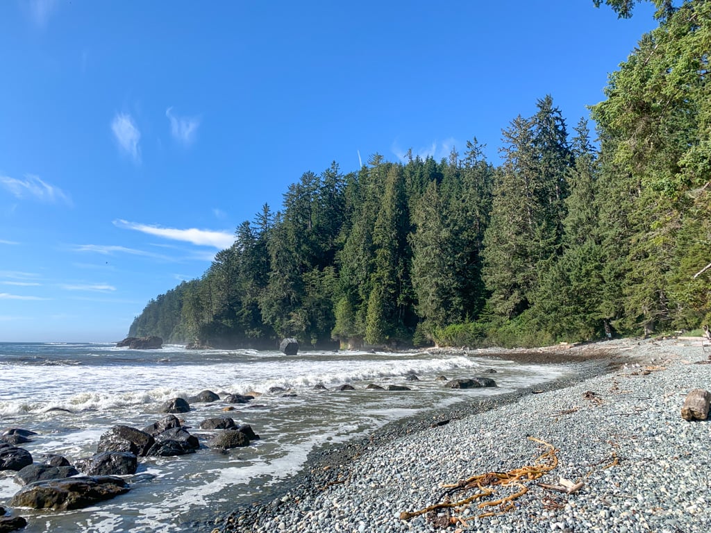
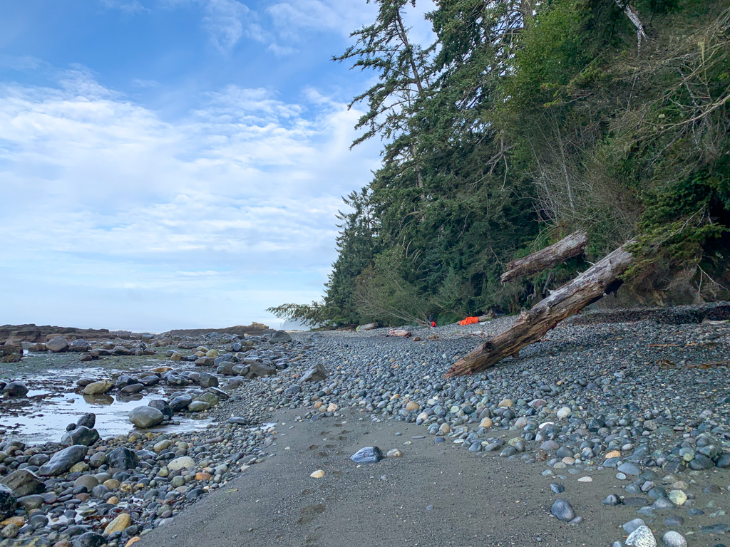
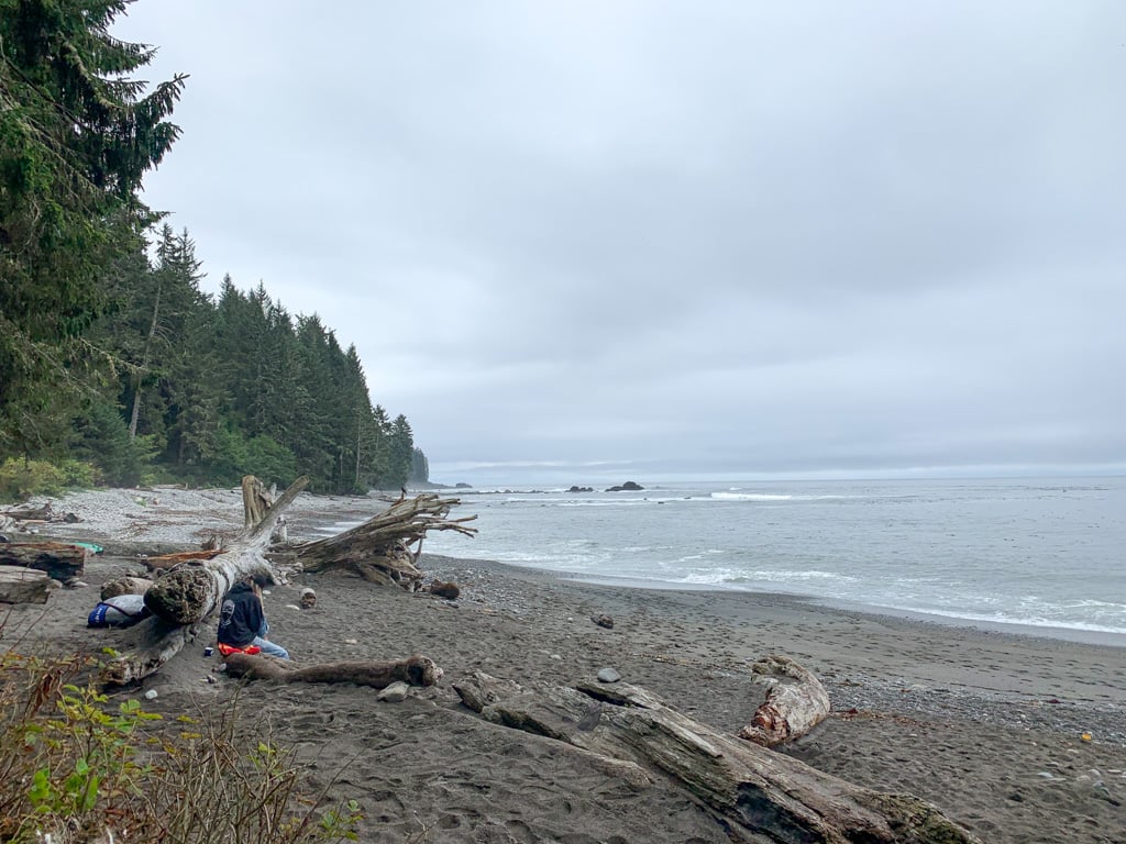
Bear Beach is one of the longest beaches on the Juan de Fuca Trail at over 2km long. It is fairly rocky so take your time as you navigate the slippery terrain. It’s very easy to twist an ankle.
There are three camping areas along the beach. (See the Bear Beach Camp section below for details.) Bear Beach East Camp at Rosemund Creek is just a few minutes from the spot where the trail meets the beach.
Just past the creek, you’ll encounter your first tidal obstacle of the trail. At tides above 3m, the ocean laps up against the cliffs for half a kilometre. There is no alternate route, so you’ll have to wait at high tide. This section has lots of large slippery rocks, so take your time.
Reach Clinch Creek and Bear Beach Centre camp at the other end of the cliffs about 9.6 km from the trailhead. Clinch Creek is named after the shipwreck of the D.L. Clinch, which ran aground here in 1860. At low tide, you can see pieces of the schooner.

If you need to get off the trail in an emergency, an unmarked trail heads up the hill from the east side of Clinch Creek. It’s a 1.5 km hike with 120m of elevation gain on this trail and then an old logging road to Highway 14.
Past here, continue along the rocky beach around the corner to reach Ledingham Creek and Bear Beach West Camp at Rock on a Pillar 10.5 km from the start.


Join the Backpacking in BC Facebook Group
Bear Beach Camp
There are three campsites spread out along Bear Beach.
Bear Beach East Camp is located at Rosemund Creek at 8.6 km. Find the toilet and bear cache just west of the creek. There are a few forest campsites on the way to the toilet and limited spots above the high tide line for tents.
Bear Beach Centre Camp is at 9.6 km on either side of Clinch Creek. I think this is the nicest campsite on the Juan de Fuca Trail. The outhouse and bear cache are located west of the creek, along with a few forest campsites. But the best sites are right next to Clinch Creek.


Bear Beach West Camp is at the far end of the beach next to Ledingham Creek, 10.5km from the trailhead. This camp is also known as Rock on a Pillar after the rock formation just offshore. It has a toilet and bear cache just back from the beach. There are only a few campsites here including a few hacked out of the salal and a couple of marginal sites on a flat gravel shelf on the beach.
Get My Book…
Backpacking on Vancouver Island
Discover Vancouver Island’s best day hikes and overnight trips
- 25 backpacking trips and 10 day hikes throughout Vancouver Island
- Info about permits, reservations and campground facilities
- Detailed maps and photos
- Advice for extending your trip
- Points of cultural and natural history
Bear Beach to Chin Beach
Distance: 11.4 km
Time: 4-6 hours
Highlights: beach hiking, old-growth forests
Elevation Gain: 540 m
Difficulty: Challenging
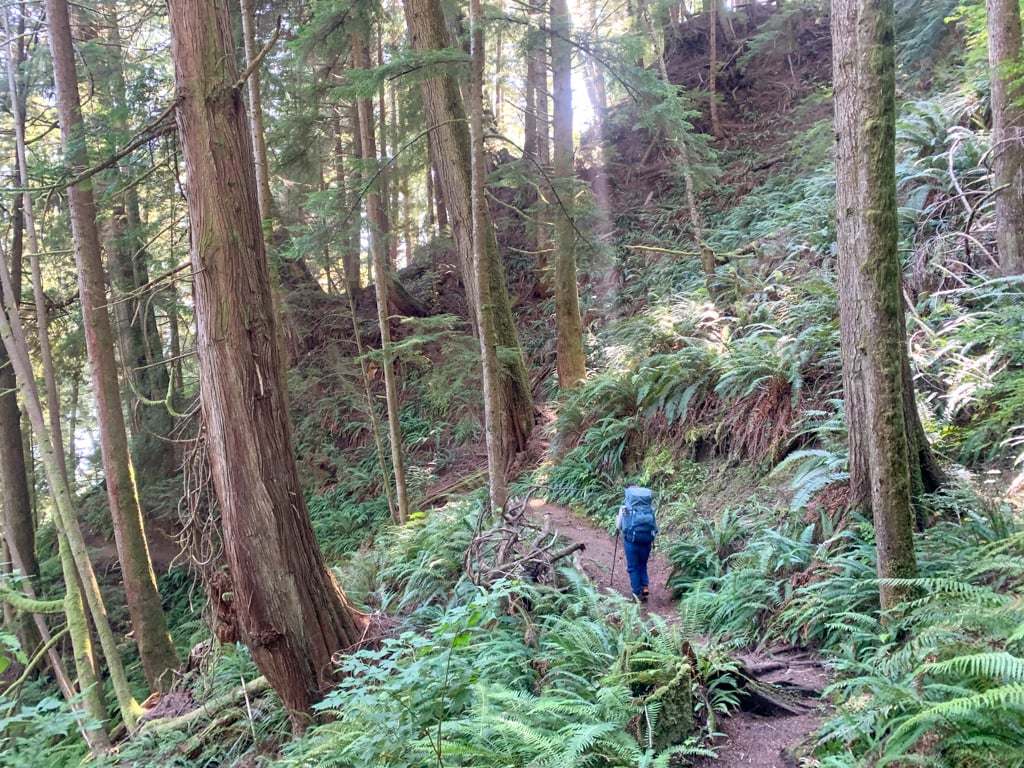
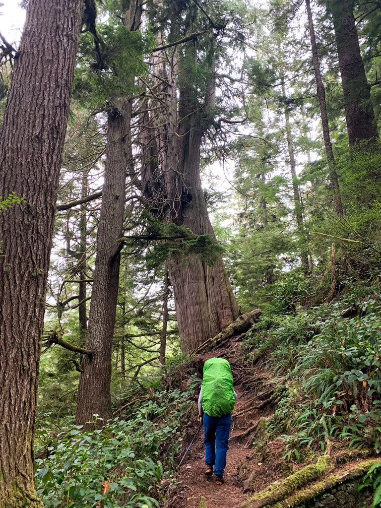
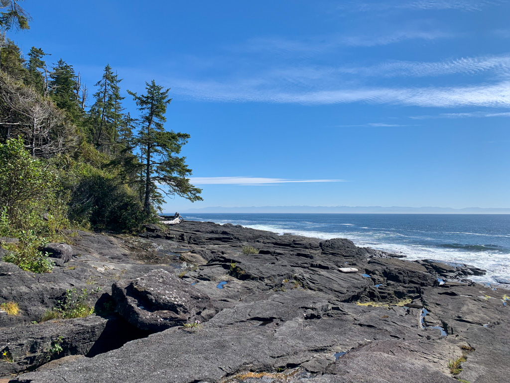
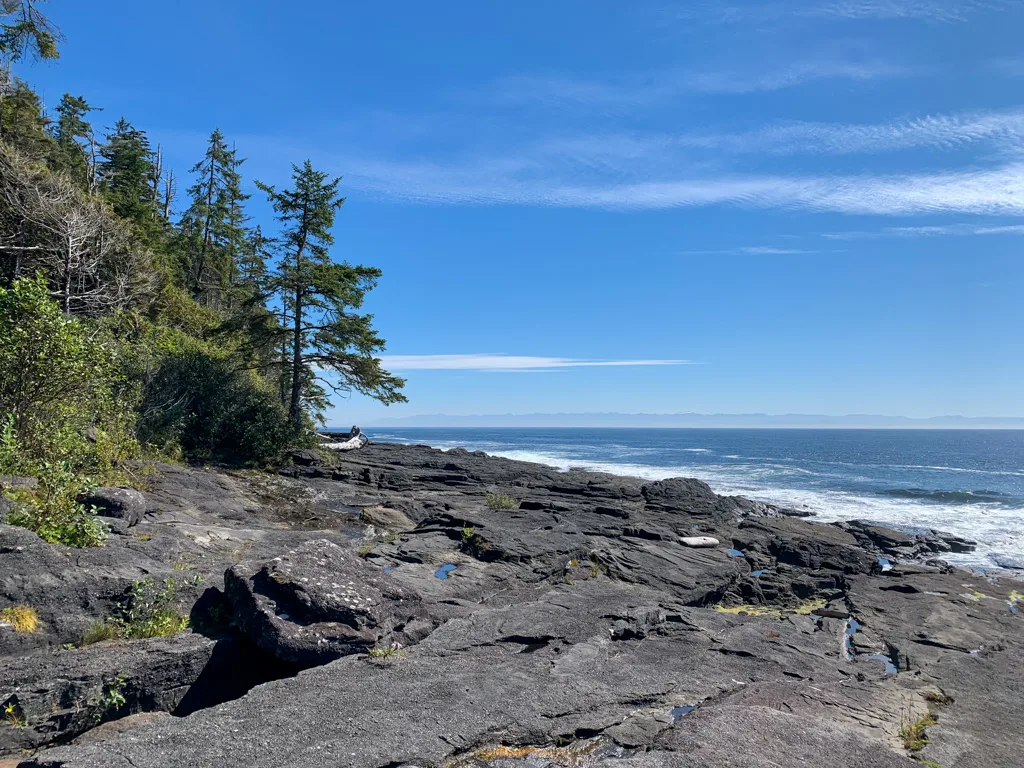
Although this section doesn’t have any beach walking, it does have some of the most beautiful old-growth forests of Western red cedar, Sitka spruce, and Western hemlock on the entire trail.


BC Parks rates this section as the most challenging part of the Juan de Fuca. However, I can’t say I agree. Yes, it does have a lot of steep hills and a few scrambly sections. And of course tons of mud. But I think some of the sections further west are equally challenging.
BC Parks’ ratings were developed when the trail was newly built and since the trail has eroded badly in some areas, that has changed the difficulty rating.
The route to Chin beach starts with a steep climb out of the Ledingham Creek valley. The next few kilometres have several sharp ups and downs. As you reach KM 13, the trail runs next to an old logging road for a few minutes through a brief flat section.
Descend gradually to Newmarch Creek at KM 14, then climb back up onto the bluff. The rest of the hike to Chin Beach is along the top of the bluff, although you will gain and lose the same 50m over and over again.
Use caution at the crossing of an unnamed creek at KM 16.5. A muddy fixed rope can help you descend the steep and slippery bank.

Cross Lines Creek on a tall bridge just before KM 19. The trail meanders along the top of the bluff in an old-growth forest for another kilometre.

Reach the Chin Beach East Bluff Camp on the bluff above the beach at 20.5km. This is the former location of the Chin Beach emergency shelter. It was removed in 2022 and in early 2023 a few tent pads and a bear cache were installed.
This campsite is a good place to stay if you get caught by the tide or if you want to avoid the crowds at Chin Beach. However, it doesn’t have a water source so you will need to plan ahead and haul in water. There are a few smalls creek a few minutes east along the trail.

Descend the steep trail to the east end of Chin Beach. The reef shelf at 20.6km is impassable at high tides above 2.75 m, so you may have to wait. Find Chin Beach campsite near KM 21 at the centre of the beach on either side of a creek.
An emergency exit trail leaves from behind the campsite. It’s a 1.5km walk with 210 m of elevation gain to Highway 14.
Chin Beach Camp
Chin Beach has limited camping space. Plan to arrive at this campsite early to get a spot.
There is space for about 10 tents in clearings in the forest behind the beach on either side of the creek, but many of the sites are very close together. There are also several marginal sites on the gravel bench above the high tide line.
The toilets and bear cache are located just west of the creek.
There is also an overflow area on Chin Beach East Bluff at the site of the former emergency shelter, described in the section above this one.

Chin Beach to Sombrio Beach
Distance: 8 km
Time: 3-4 hours
Highlights: Chin Beach, Loss Creek Suspension Bridge, Sombrio Point, Sombrio Beach, Sombrio Beach
Elevation Gain: 350 m
Difficulty: Very Challenging
This is one of the most challenging sections of the Juan de Fuca Trail. It has by far the biggest climb on the trail and some tricky terrain around Sombrio Point. However, it also has some beautiful ocean views and you get to cross the dramatic Loss Creek Suspension Bridge. And it has less mud than other sections.
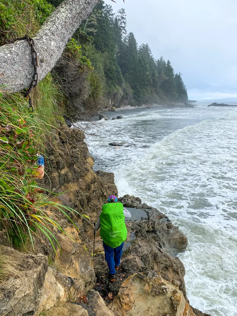
From Chin Beach camp, walk a few hundred meters along the rocky beach and look for the buoy in the trees pointing the way to the inland trail at 21.3 km. It’s a tough scramble up a rock. At high tides, you may have to time your ascent to avoid getting your boots wet.

At tides below 1m, you can continue along the beach past here for another 0.5km, but most hikers will need to take the forest route. The two routes converge at 22.1 km.
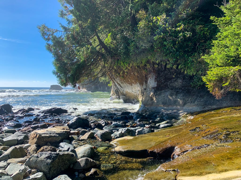
Climb a steep hill, then head down the other side for another section of rambling trail along the top of the bluff. Reach the Loss Creek Suspension Bridge at 23.8km. This is the most dramatic bridge on the trail since it is the longest and highest. Be sure to pause in the middle to admire the view of the sea stacks at the mouth of the creek.

On the other side of the creek, the big climb begins. Follow the trail as it switchbacks up the steep slope, gaining nearly 150m. The trail joins an old road just before KM 25. It’s easy walking along here until you leave the road near KM 26. Begin a steep descent along a narrow ridge with some large old-growth trees.

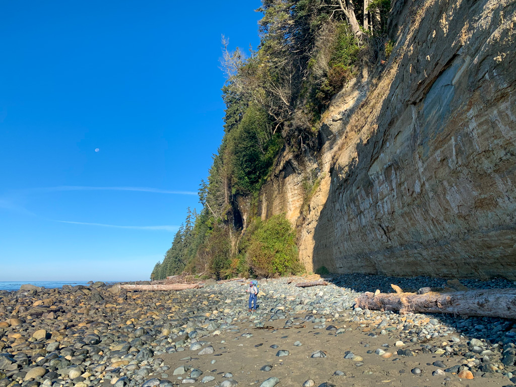
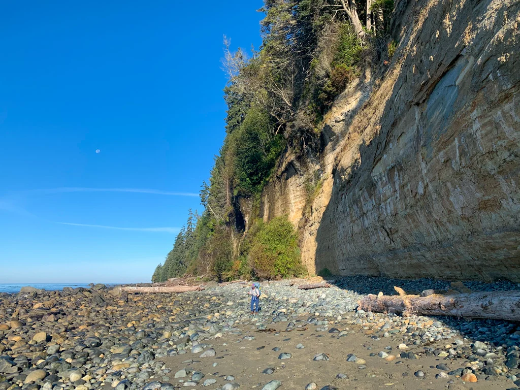
Pause at Sombrio Point at 26.5km and enjoy the spectacular views. You can see Sombrio Beach ahead of you to the west.
The remaining trail to Sombrio Beach is tough and technical. Follow the trail around the point and along the top of the cliff. In some places, a wire railing protects you from the steep drop. Be careful on a scramble across wet rocks.
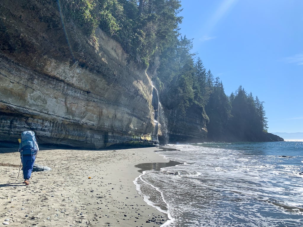
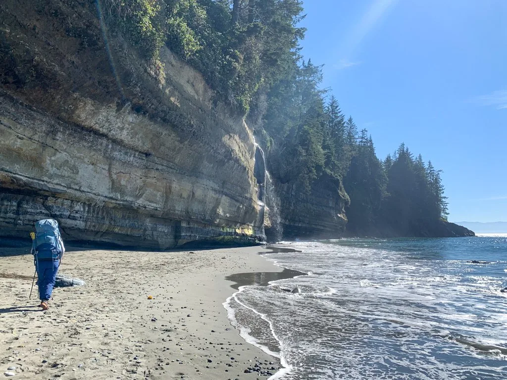
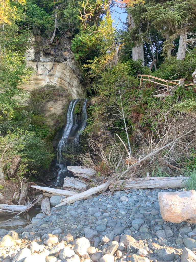
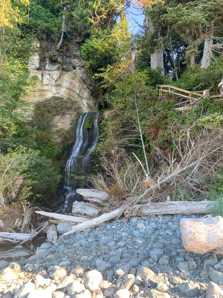
Watch for a pretty waterfall tumbling over the cliff. Cross the bridge above the waterfall, then begin the descent to Sombrio Beach.
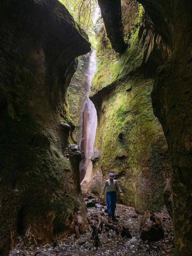
Immediately after you emerge on the beach, follow a faint side trail beside a stream for a few minutes. It leads to a unique waterfall deep in a mossy canyon. You may have to wade in the creek to get a closer look but it’s worth it. Please respect this beautiful place and do not add any graffiti.

On the other side of the creek, pass the campsites at Sombrio Beach Camp Far East at KM 27 and then Sombrio Beach East Camp at 27.6 km. Reach the Sombrio Beach East tidal obstacle near KM 28 which is impassable at tides above 3m. There is no alternative route, so if you arrive at high tide you’ll have to wait it out.
Past the tidal obstacle, arrive at Sombrio Beach West Camp and the side trail to the Sombrio Beach Trailhead at KM 29. You will likely encounter lots of surfers and day-trippers here enjoying the beach. Follow the trail past an outhouse towards the parking lot.
This area is known as Qwa:qlis and was the site of a Pacheedaht village. The area was also home to a thriving community of hippies and surfers who had squatters shacks here until the 1990s.
If you need to exit the trail here, the Sombrio Beach Road is 2km long and gains 120m on its way back to Highway 14.

Sombrio Beach Camp
The campsites at Sombrio are the most popular ones on the trail. Since it’s only a 10-minute walk from the Sombrio Beach parking lot, many camp here who aren’t doing the entire Juan de Fuca Trail. It’s also one of the best surfing spots on southern Vancouver Island.
If you want a more secluded experience stay at East Camp or Far East Camp. Most surfers and casual campers don’t bother to hike that far. We camped at Sombrio East in 2009 and it was much quieter than the partying occuring at Sombrio West.

The campsites are arranged into four main areas, but you may be able to find campsites elsewhere along the beach.
Sombrio Beach Far East Camp is located about 27km from the trailhead at the eastern end of the beach, just west of the spot where the trail leaves the beach and the hidden waterfall. There is good camping on the soft sand above the high tide line. An outhouse and bear cache are located in the brush behind the beach.
Sombrio Beach East Camp is a few hundred meters further along at 27.6km. There is lots of space for tents above the high tide line. A signed trail leads to an outhouse and food cache behind the beach.
Sombrio West Camp is the main campsite on Sombrio Beach at KM 29. This area is the most popular with casual weekend campers and surfers who don’t want to carry their gear far from the car. There are tent spots in cleared areas on the top of the bank as well as a few sites on the sand. But be careful of the high tide here! There are two outhouses and two food caches nearby on the trail to the parking lot.
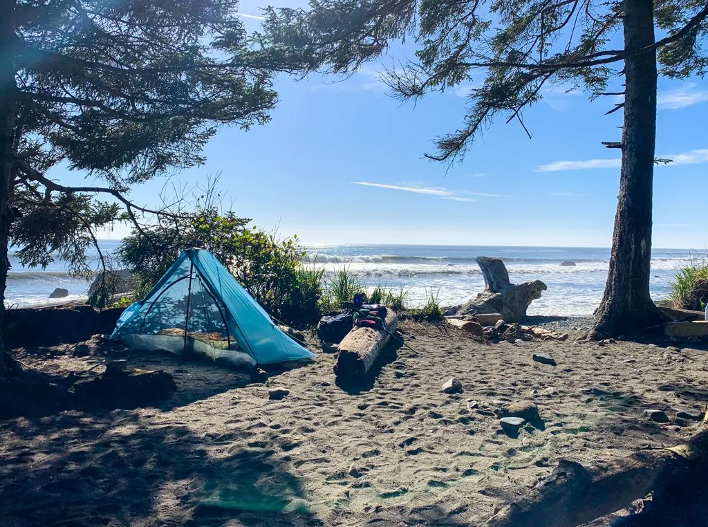
Sombrio Far West Camp is the only camping area on the west side of the Sombrio River at 29.2km. It has five wooden tent platforms in the forest where the trail from the suspension bridge meets the beach. There are also a few marginal sites on the beach above the high tide line. The outhouse and bear cache are located inland along the trail to the bridge.
Sombrio Beach to Little Kuitshe Creek
Distance: 4 km
Time: 1-2 hours
Highlights: Sombrio Beach, Sombrio River Suspension Bridge
Elevation Gain: 40 m
Difficulty: Moderate
The Juan de Fuca Trail between Sombrio Beach and Little Kuitshe Creek travels through a dense second-growth forest that can feel quite dark. You can often hear the ocean, but you won’t see it very much.
At the junction with the trail to the Sombrio Beach parking lot, go left towards the Sombrio River Suspension Bridge. In Spanish, Sombrio means shady. The early Spanish explorers named the river in the late 1700s. The beach and nearby Sombrio Point take their name from the river.

Cross the bridge at KM 29.2, then follow the trail on the west side back to the beach. The trail has been rerouted around a washout and is a bit rough.
Emerge on the beach at Sombrio Far West Camp at 29.3 km. Past here, the beach is very rocky, so watch your step, especially if it is wet. Encounter the Sombrio West tidal obstacle at 29.6km. At tides below 2.6m, you can stay on the beach around this cliff, but at high tides, you’ll have to wait.

Continue along the rocky beach. At KM 30.2, reach the Sombrio West-West tidal obstacle at a point. There is a 500m-long bypass trail around it through the forest if the tide is higher than 3m. You have arrived at the end of Sombrio Beach.
The trail climbs up to about 25m above sea level and stays near that elevation all the way to Kuitshe Creek. This section of the trail is in second-growth forest and salal tunnels that can be very muddy.
At KM32 cross the suspension bridge over Minute Creek, the final suspension bridge of the trail. Look up stream for a peek-a-boo view of a waterfall.


At 32.5km the trail runs closer to the edge of the cliff and you can look down into a surge channel. When big waves wash in, spray thunders out the top of the chasm.
Reach Little Kuitshe Creek Camp at KM33.
Join the Backpacking in BC Facebook Group
Little Kuitshe Creek Camp
This campsite is set in a dark and scrubby patch of second-growth forest on a bluff above the ocean. You can’t see the ocean from camp, but you can follow a very steep trail to a rock outcropping above the water. Honestly, I found this campsite a little depressing, but the ocean access saved it.

The toilet and bear cache are on a spur trail uphill from the main trail and most of the campsites are on a spur trail downhill.
The campground has 7 or 8 flat spots for tents but many of them are poorly drained, so be careful in wet weather. There are also several other marginal sites where you can camp in a pinch.
To collect drinking water, continue on the main trail for a minute as it heads downhill to Little Kuitshe Creek.
Get My Book…
Backpacking on Vancouver Island
Discover Vancouver Island’s best day hikes and overnight trips
- 25 backpacking trips and 10 day hikes throughout Vancouver Island
- Info about permits, reservations and campground facilities
- Detailed maps and photos
- Advice for extending your trip
- Points of cultural and natural history
Little Kuitshe Creek to Payzant Creek
Distance: 7 km
Time: 2.5-4 hours
Highlights: Parkinson Creek Trailhead, reef shelf tidepools
Elevation Gain: 100 m
Difficulty: Challenging
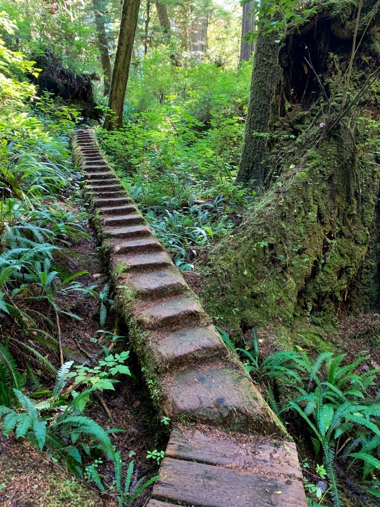
BC Parks rates the section between Little Kuitshe Creek and Payzant Creek as moderate, but I think it is challenging. It features lots of eroding trail, mud holes, exposed tree roots, broken boardwalk, and wooden stairs that are dangerously falling apart. That makes travel through here quite slow.
This section features lots of short, steep hills, but you never get much higher than 50m above sea level.
Leaving Little Kuitshe Creek, you’ll encounter several sections of broken stairs and boardwalk. But after a few minutes, you’ll also get to walk through a section of old-growth forest, spared from logging many years ago.
Around KM36 the trail gets less rough as you travel on an old logging road that climbs gently. Arrive at the Parkinson Creek Trailhead at KM37, which has an outhouse. If you want to exit the trail here, the Parkinson Creek Road is 3km long and gains 190m on its way to Highway 14.
There is no designated campsite here. To continue along the Juan de Fuca Trail, walk through the parking lot and pick up the trail on the other side. Follow the trail along old logging roads, watching for the sign indicating that the trail leaves the road and heads into a tight second-growth forest.
Near KM38, the trail emerges at the shoreline. This section features a rocky reef shelf. At low tide, it can be a fun place to explore and look for tide pools.
You can walk on the reef shelf between KM38 and KM39 at low tides. Watch for marker buoys in the trees to indicate when you must leave the beach and head back into the forest.
After the reef section, head back into the forest. Decaying boardwalks and wooden stairs in this area help you across some of the mud but may also slow you down as you try to navigate the tricky terrain.
Cross a creek with a small waterfall and arrive at Payzant Creek Camp at KM40.
Payzant Creek Camp
Payzant Creek Camp is set in a lush old-growth forest and does not have beach access. I stayed here on my 2009 hike and enjoyed the giant trees, but missed having an ocean view.
It has 12 prepared tent pads spread out across two spur trails downhill from the main trail. There are also a few overflow spots, but be careful as some collect water in wet weather.
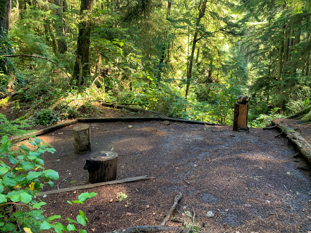
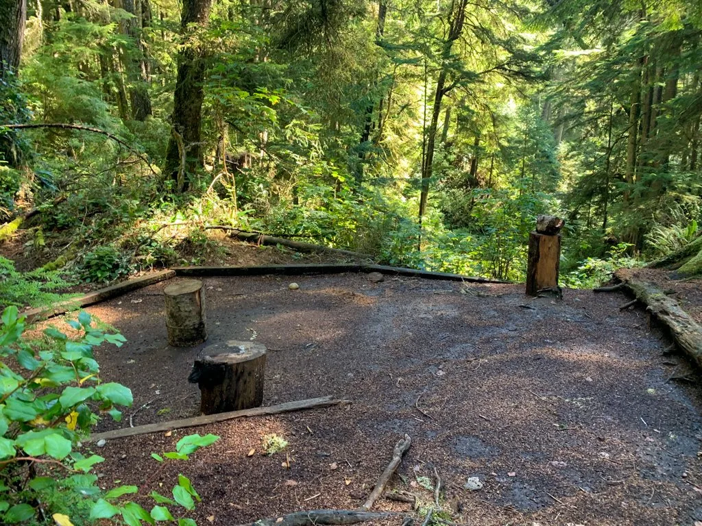
The outhouse is right next to the main trail and the food cache is a short distance away on a signed spur trail uphill. Collect drinking water from Payzant Creek just east of camp.
Payzant Creek to Botanical Beach Trailhead
Distance: 7 km
Time: 2-3 hours
Highlights: Providence Cove, reef shelf, tidepools, Botanical Beach Trailhead
Elevation Gain: 150 m
Difficulty: Moderate
Continue along the trail past Payzant Creek as it descends to cross Yauh Creek on a log bridge. On the other side, watch for a spur trail heading left towards the beach at Providence Cove at KM41. Camping is not allowed on the beach here, but it makes a great place for a break.


About 41.5km from the trailhead the path emerges from the forest on a rocky reef shelf. Follow the trail along the rocks for a few minutes, then watch for a marker buoy to show you the way back to the main trail.
The trail sticks close to the ocean for the next kilometre with lots of opportunities for views. You may be tempted to walk along the rocky reef shelf, but it is very scrambly, especially if you are carrying a heavy pack.
Follow the trail as it turns inland and climbs a small hill to a bridge over Soule Creek at 43.1km. You immediately head back towards the ocean with a few short sections of decaying boardwalk to make walking a bit faster. There are some big old-growth trees in this section.
Around KM44 there is a great view of the ocean from the bluff. About 0.5km later the trail runs behind the beach. You can stay on the muddy forest trail or walk along the shoreline and explore the rock formations and tide pools.
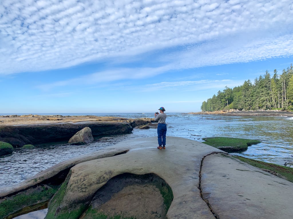

Reach Botanical Beach at KM45. The tide pools in this area are world-famous. Try to time your visit for tides below 1m to get the full experience. The Pacheedaht call this beach łi:xwa:p and they had a village with six big-houses here.
At KM 46 leave the beach on a set of stairs and arrive at an outhouse and junction. The trail to the parking lot and trailhead heads straight uphill on an old road. The rough trail to Botany Bay and more tidal pools heads left.
Follow the main trail up the hill for 1km, gaining 75m. Arrive at the Botanical Beach Trailhead at KM47, having completed the entire Juan de Fuca Trail. There are outhouses in the parking lot near the Botany Bay trailhead.
Join the Backpacking in BC Facebook Group
Juan de Fuca Trail Itineraries
Standard 4-Day Juan de Fuca Trail Itinerary
I think this standard 4-day itinerary is the best one for most people. It spreads out the effort fairly evenly across the days.
Day 1 – China Beach Trailhead to Bear Beach: 9.6 km (2.5-4.25 hours)
Day 2 – Bear Beach to Chin Beach: 11.4 km (4-6 hours)
Day 3 – Chin Beach to Little Kuitshe Creek: 12 km (4-6 hours)
Day 4 – Little Kuitshe Creek to Botanical Beach Trailhead: 14 km (4.5-7 hours)
Relaxed 5-Day Juan de Fuca Trail Itinerary
If you want to take it a little slower, this 5-day itinerary is a good choice. This is the itinerary I used when I hiked the trail for the first time in 2009.
Day 1 – China Beach Trailhead to Bear Beach: 9.6 km (2.5-4.25 hours)
Day 2 – Bear Beach to Chin Beach: 11.4 km (4-6 hours)
Day 3 – Chin Beach to Sombrio Beach: 8 km (3-4 hours)
Day 4 – Sombrio Beach to Payzant Creek: 11 km (3.5-6 hours)
Day 5 – Payzant Creek to Botanical Beach Trailhead: 7 km (2-3 hours)
Super Relaxed 6-Day Juan de Fuca Trail Itinerary
Beginner hikers, families, and those that just want to take their time and chill out will like this super-relaxed 6-day itinerary. You can also make it even more relaxed by adding a 7th day and camping at Mystic Beach on the first (or last) night.
Day 1 – China Beach Trailhead to Bear Beach: 9.6 km (2.5-4.25 hours)
Day 2 – Bear Beach to Chin Beach: 11.4 km (4-6 hours)
Day 3 – Chin Beach to Sombrio Beach: 8 km (3-4 hours)
Day 4 – Sombrio Beach to Little Kuitshe Creek: 4 km (1-2 hours)
Day 5 – Little Kuitshe Creek to Payzant Creek: 7 km (2.5-4 hours)
Day 6 – Payzant Creek to Botanical Beach Trailhead: 7 km (2-3 hours)

Fast 3-Day Juan de Fuca Trail Itinerary
If you want to blitz through the Juan de Fuca Trail, I recommend either of these two speedy 3-day itineraries. Option A avoids the boring forest campsites but has a punishing middle day. Option B has a brutal first day.
Option A:
Day 1 – China Beach Trailhead to Bear Beach: 9.6 km (2.5-4.25 hours)
Day 2 – Bear Beach to Sombrio Beach: 19.4 km (7-10 hours)
Day 3 – Sombrio Beach to Botanical Beach Trailhead: 18 km (5.5-9 hours)
Option B:
Day 1: China Beach Trailhead to Chin Beach: 21 km (6.5-10.25 hours)
Day 2: Chin Beach to Little Kuitshe Creek: 12 km (4-6 hours)
Day 3: Little Kuitshe Creek to Botanical Beach Trailhead: 14 km (4.5-7 hours)
3-Day Eastern Half of the Juan de Fuca Trail Itinerary
If you have less time or just want to sample the trail, you may want to consider just hiking the eastern half between China Beach and Sombrio Beach. In my opinion, this is the nicest section of the trail anyway.
Day 1 – China Beach Trailhead to Bear Beach: 9.6 km (2.5-4.25 hours)
Day 2 – Bear Beach to Chin Beach: 11.4 km (4-6 hours)
Day 3 – Chin Beach to Sombrio Beach: 8 km (3-4 hours)
Yo-yo 7-Day Juan de Fuca Trail Itinerary
To avoid having to arrange transportation or to spend more days on the trail, some people opt to hike the trail from one end to the other, then turn around hike back. This is often called a yo-yo hike. Here’s a sample 7-day itinerary for yo-yo-ing the Juan de Fuca Trail.
Day 1 – China Beach Trailhead to Bear Beach: 9.6 km (2.5-4.25 hours)
Day 2 – Bear Beach to Chin Beach: 11.4 km (4-6 hours)
Day 3 – Chin Beach to Payzant Creek: 19 km (6.5-10 hours)
Day 4A – Day hike without gear from Payzant Creek to Botanical Beach Trailhead and back to Payzant Creek: 14 km (4-6 hours)
Day 4B – Payzant Creek to Little Kuitshe Creek: 7 km (2.5-4 hours)
Day 5 – Little Kuitshe Creek to Chin Beach: 12 km (4-6 hours)
Day 6 – Chin Beach to Bear Beach: 11.4 km (4-6 hours)
Day 7 – Bear Beach to China Beach Trailhead: 9.6 km (2.5-4.25 hours)
So that’s my section-by-section breakdown of the Juan de Fuca Trail and all the info you need to choose your Juan de Fuca Trail itinerary. For your first time, I recommend the standard 4-Day Juan de Fuca Trail Itinerary. If you’re planning your hike and have questions, let me know in the comments. I’d love to help.
Join the Backpacking in BC Facebook Group
READ NEXT:
- Juan de Fuca Trail Basics
- Coastal Hiking Tips: Advice for Beach Backpacking
- Juan de Fuca Trail Packing List: Everything You Need to Bring
- 20+ Ways to Reduce Your Backpack Weight
- 25 Spring Backpacking Trips in British Columbia
MORE VANCOUVER ISLAND POSTS:
- The Ultimate Guide to the Pacific Marine Circle Route on Vancouver Island
- How to Visit Avatar Grove, Big Lonely Doug and Other Big Trees on Vancouver Island
- Your Guide to the West Coast Trail in British Columbia
- North Coast Trail Guide: Backpacking on Vancouver Island
- 30 Best Backpacking Trips in BC


- Best Sun Hoodies for Hiking - June 3, 2026
- Lower Stein Valley Trail Hiking and Backpacking Guide - May 27, 2026
- The Best Things to Do in Vernon, BC - May 21, 2026
N
Thursday 23rd of May 2024
Hi Taryn, preparing for our first Vancouver Island trip I've been reading all your posts on the Island. I love them! This summer we'll be camping at the Mystic Beach for a night with our family. After that we'll return and visit other nice places of the Pacific Marine Circle route. Our sons however will continue and walk the whole JDF trail. I'm not so sure if we can relay on the bear caches provided at the campsites along the trail - or should we carry our own? I understand that the trail is pretty popular, so the boxes might just be full at the end of the day? :/ What do you think? Thanks!
N
Saturday 25th of May 2024
@Taryn Eyton, thanks very much!
Taryn Eyton
Thursday 23rd of May 2024
The bear boxes on the JDF do get full but that is mostly on sunny summer weekends. If you are hiking at other times it won't be as busy. It is a good idea to bring a dry bag and some rope so you can construct a bear hang if the boxes are full.
Stephanie Strandt
Saturday 26th of August 2023
I refer to your site whenever I plan a new hike. I have done the WCT and NCT and I'm looking forward to doing the JDF trail next spring. Thank you for the attention to details. If you have any tips on how to successfully book the Rock Wall Trail I'd love some advice. I was dissapointed not get a spot for a second year in a row.
Taryn Eyton
Sunday 10th of September 2023
Hi Steph. I hear you on the difficulty of booking popular spots like the Rockwall. Have you read through my guide to making backcountry reservations in BC? There are some tips in there. As well, if you don't get a spot, it's worth it to subscribe to a campground cancellation app - they send you a notification when someone cancels so you can scoop up their booking! I got a few sites that way this summer. I've got more details in my review of a few Camping Cancellation Apps
Linda
Wednesday 2nd of August 2023
Hi Taryn, Thanks for all your super helpful info! :) I have a question about the campsite at Mystic Beach.
My brother and I are going to do the JdF next week. We're arriving at China Beach (with the bus) around 6:30pm, and are trying to decide if we should then hike 2km to Mystic and camp there our first night -- or not hike and just stay in a front-country campsite at China Beach.
Mystic sounds lovely, but you said it's small and we wouldn't get there until 7-7:30pm... it would be unfortunate to find that there aren't any spots available. (It'll be a Monday night.)
Do you have advice - camp at Mystic our first night, or stay in China Beach?
Thank you!
Linda
Thursday 3rd of August 2023
@Taryn Eyton, Thank you very much Taryn for your advice!
Taryn Eyton
Thursday 3rd of August 2023
If you plan to arrive on a Monday and are ok settling for a sub-optimal campsite, I think you will be ok. Just keep an eye on the tides as you may end having to choose a site close to the high tide line.
Melissa
Wednesday 5th of July 2023
Your section by section breakdown is so helpful! I'm looking to do a 2 night trip with my kids (11 and 8) who are very capable but not experienced hikers. Sombrio to Botanical was recommended to me by a friend but the camp spots don't look awesome (I'd prefer beach camping). You recommend the Eastern half instead. Is the Eastern half harder for kids? Thanks. Melissa
Taryn Eyton
Wednesday 5th of July 2023
The eastern half is a little harder because it has more hills. However, if your kids are capable I don't think it would be too much for them, but it would definitely be a challenge. If you are looking for a good two night trip on Vancouver Island for kids, I would recommend the Kwai Lake Loop at Paradise Meadows in Strathcona. You can camp at Kwai for 2 nights and do a day hike to Circlet Lake and/or Cruickshank Canyon viewpoint on the middle day.
Dave
Friday 13th of January 2023
Hi Taryn, I am an experienced hiker (WCT 8 times for sake of coastal reference) and am looking to yo-yo the JDT but start at Botanical Beach. Just working through logistics now but curious as to what logistics you may recommend if I start at that trailhead. Any input would be much appreciated. Thanks,
Taryn Eyton
Friday 13th of January 2023
If you are doing a yo-you, it may be easiest to drive yourself and leave it at the TH rather than taking the bus. But don't leave anything in your car - that trailhead isn't as bad for break-ins as China Beach, but it does happen. Itinerary, wise I think something like this may work: Day 1 – Botanical Beach Trailhead to Little Kuitshe Creek: 14 km (4.5-7 hours) Day 2 - Little Kuitshe Creek to Chin Beach: 12 km (4-6 hours) Day 3: Chin Beach to Bear Beach: 11.4 km (4-6 hours) Day 4: Bear Beach to China Beach Trail, return as a day hike: 19.2 km (5-8.5 hours) Day 5: Bear Beach to Chin Beach: 11.4 km (4-6 hours) Day 6: Chin Beach to Little Kuitshe Creek: 12 km (4-6 hours) Day 7: Little Kuitshe Creek to Botanical Beach Trailhead: 14 km (4.5-7 hours)