When most people think of Tofino, BC, they think of surfing or walking on one of the many sandy beaches. But did you know that by taking a short water taxi ride you can escape the crowds in town and hike and camp on a remote wilderness beach? Head over to Flores Island, just off the coast of Vancouver Island to visit the Wild Side Trail.
This 11km long route traverses sandy beaches and lush green rainforest, passing three wilderness campsites along the way. I’ve made two trips to this gorgeous area and I love how far away from everything it feels out there. In this post I’ll give you all the info you need to plan your own hike.
This is a sensitive wilderness area. Learn how to Leave No Trace to keep the wilderness wild. Make sure you are prepared by bringing the 10 Essentials. Get ready for adventure with this checklist of things to do before every hike.
Hey there: Some of the links in this post are affiliate links, which means I earn a small commission at no extra cost to you if you make a purchase. Thanks for supporting my website! -Taryn
Wild Side Trail Basics:
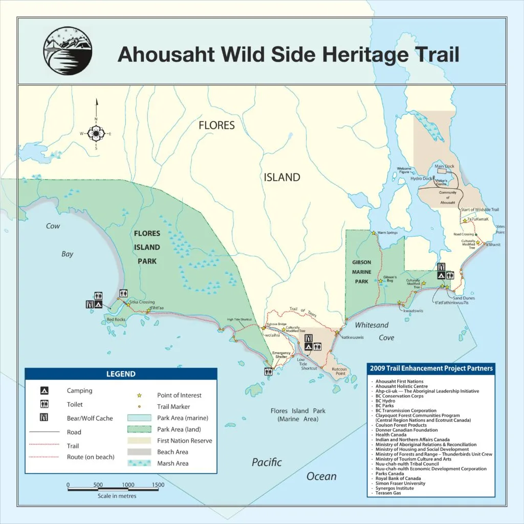
Location: The Wild Side Trail starts in the First Nations village of Ahousaht on Flores Island. Flores Island is located in Clayoquot Sound on the west coast of Vancouver Island, British Columbia near the town of Tofino and Pacific Rim National Park.
Distance: 11km one way from Ahousaht to the trail’s end at Cow Bay Beach.
Elevation Gain: While the inland sections do have some ups and downs, you are never more than 10-15m above sea level.
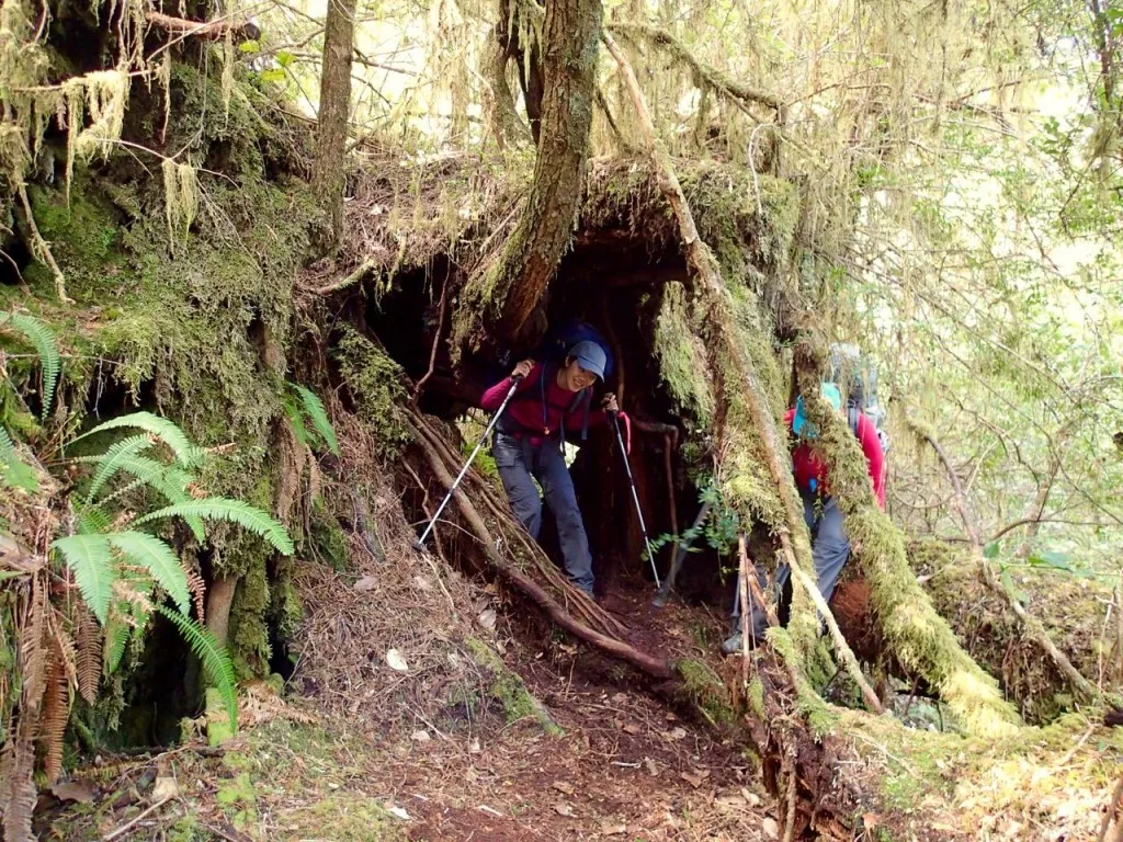
Difficulty: As a one way day hike or a backpacking trip, this trail is rated as easy as it is very flat. However, the inland sections can be quite rooty and muddy. As well, if you attempt the hike as a round trip in a single day, the 22km distance bumps the difficulty level up to moderate.
Hiking Time: 3-4 hours one way
What to Bring: Everything you need to be self-sufficient on the trail. Use my simple backpacking checklist to organize your gear.
Coastal Hiking Tips: Hiking on the beach is different than hiking in the forest or mountain. Read my tips for coastal hiking.
Getting to the Wild Side Trail: Transportation and Logistics
Getting to Tofino
The Wild Side Trail on Flores Island is located north of Tofino on Vancouver Island. To get to Tofino from the mainland you’ll need to first take a BC Ferry from the Vancouver area to Nanaimo BC and then make the 3 hour drive to Tofino. Reservations for the ferry are highly recommended, especially on holiday or summer weekends. There is also a bus service to Tofino.
Psst! The Wild Side Trail is on my list of the best car-free backpacking trips in BC.
Parking in Tofino
Tofino is a busy place and there are lots of parking restrictions. You can park on the street for free for up to 4 hours in many areas, but that isn’t long enough to do the trail. Your best bet is to park in pay lot at the corner of 3rd and main. The lot can get busy on weekends. Up to date info on pricing is on the District of Tofino parking page.
Water Taxis to the Wild Side Trail
Once you get to Tofino, you will need to take a water taxi to Ahousaht on Flores Island. All water taxis leave from the 1st street dock in Tofino.
There is usually scheduled service from Tofino to Ahousaht but the schedule changes often. The trip takes about 35 minutes. The price is currently $50 per person each way for non-members of the Ahousaht Nation.
You can also arrange a water taxi outside of the scheduled times. Just go down to the 1st street dock and ask if anyone is going to Ahousaht. If they aren’t, they will happily call another taxi on the radio for you. You can also try calling ahead to book a taxi, but be warned that the water taxi drivers aren’t always punctual and may forget to pick you up altogether. Here’s a list of Ahousaht water taxi phone numbers if you want to book ahead.
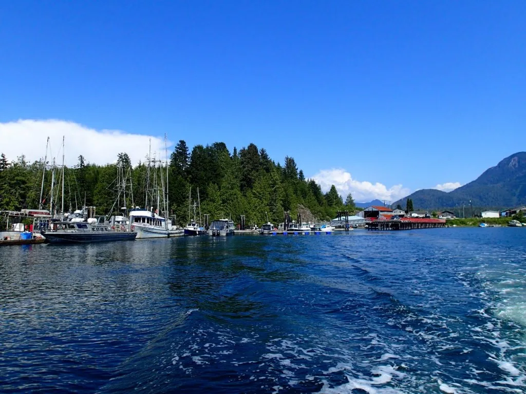
The water taxis are small metal boats that are typical for the region. They seat a dozen or so inside a small cabin and many have a small outside area as well. Your backpacks get loaded on the deck in the back. If you sit outside you’ll want to wear a jacket as it’s windy and in choppier seas you might get splashed. And of course don’t forget your camera!
The closest public washroom to the dock is at the Co-op grocery store on the corner of 1st Street and Campbell street in case you have to go in between a long car ride and the water taxi ride.
Join the Backpacking in BC Facebook Group
Trail Fees and the Walk the Wild Side Trail Organization
The trail travels through two provincial parks (Gibson Marine Provincial Park and Flores Island Marine Provincial Park) but the province doesn’t charge any fees for hiking and camping in these parks.
The Walk the Wild Side Trail organization maintains and manages the trail as an eco-tourism project of the Ahousaht First Nation to generate a sustainable tourism economy for their village and create jobs. They built the trail in the late 1990s along a route that follows their traditional trails in the area. The trail wasn’t used that much for a decade or so, but in 2009 the trail was officially re-opened and renovated. Currently the trail organization maintains the trail and gives orientation briefings.
There is a fee to hike any part of the trail outside the provincial parks and through Ahousaht traditional territory. As of 2024 the trail fee was $15 per person per day.
You can pay your fees in person at the trail office at the fuel dock in Ahousaht. You can also pay online in advance. There is currently no permit system or quota system in place – you just pay your fee.
READ NEXT: How to Go Backpacking in BC Without Reservations
First Nations Historical Sites on the Wild Side Trail
The trail is entirely within the traditional territory of the Ahousaht First Nation and is a important historical route for them. There are several plaques and interpretive signs along the trail highlighting culturally important places. You may be able to purchase a guidebook explaining the First Nations history on the trail or hire a guide at the trail office, but both of these services are not reliably available.
When to Hike the Wild Side Trail
The trail can be hiked year round, but the Wild Side Trail organization officially closes the trail during the winter months. Check their website or email them if you want to hike the trail between October and April as the trail may be closed due to winter storms or damaged trail sections.
The Wild Side Trail is one of my favourite spring bacpacking trips in British Columbia – I’ve hiked it twice in May.
How Long to Spend on the Wild Side Trail
The trail is 11km each way from the trailhead in Ahousaht to Cow Bay. Most people will want to spent at least two days and one night on the trail but fit people hike or trail run it in one day. It is also possible to hike the trail one way by using a water taxi pick up or drop off at Cow Bay.
Cow Bay is such a beautiful destination that you may choose to spend more than one night there or on another of the beautiful beaches along the way. In my opinion three days and two nights on the trail is ideal.
Wild Side Trail Description
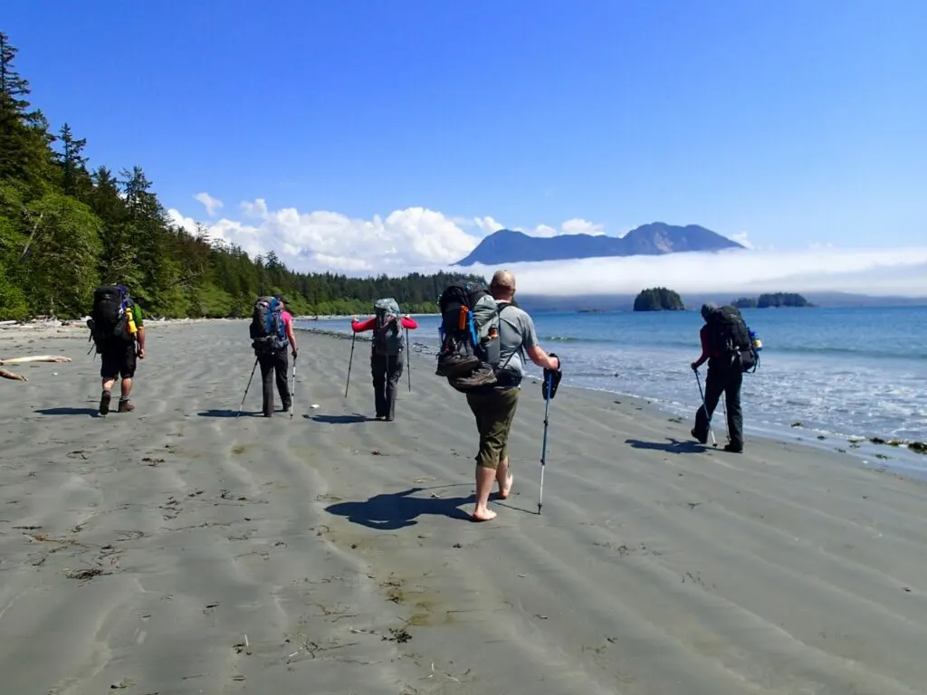
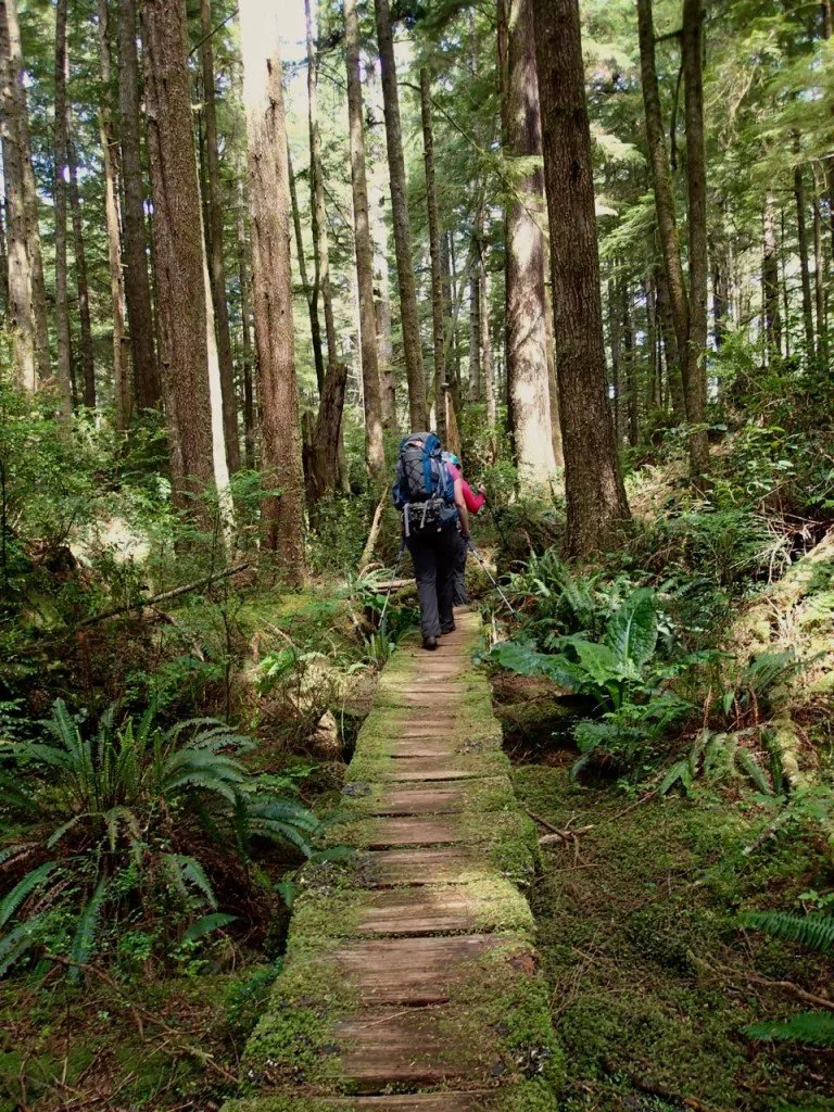
The trail is roughly 11km of beach walking with a bit of forest trail and boardwalk thrown in. The trail is generally easy to follow with signs at every junction.
Since this is a coastal trail, the trail enters and leaves the forest often. At each place where the trail leaves the beach look for fishing floats strung up in the trees to mark the trailhead. It’s pretty difficult to get lost here but there are a couple of confusing places, some side trails and trail options to choose from so I’ll discuss those in detail below.
You’ll want to carry the Wild Side Trail Map (available from trail office when you check in the to trail or click the link to view it now) and since this is a coastal trail, you should also carry a current tide table.
It’s helpful to know when the tide is low so you can do more beach walking below the high tide line as well as to know when high tide is so you know if your tent is pitched far enough up the beach. The other reason to carry a tide table is for tidal obstacles. There is only one notable tidal obstacle on the Wild Side Trail: the Kutcous River crossing, discussed below.
Getting to the Wild Side Trail trail head
Your water taxi will drop you off at the fuel dock in Ahousaht. Walk up the ramp to the fuel payment booth – it doubles as the trail office. You can check in to start the trail and pay your fees here. The trail staff will give you a briefing about the trail, answer any questions you might have and give you copies of the trail map.
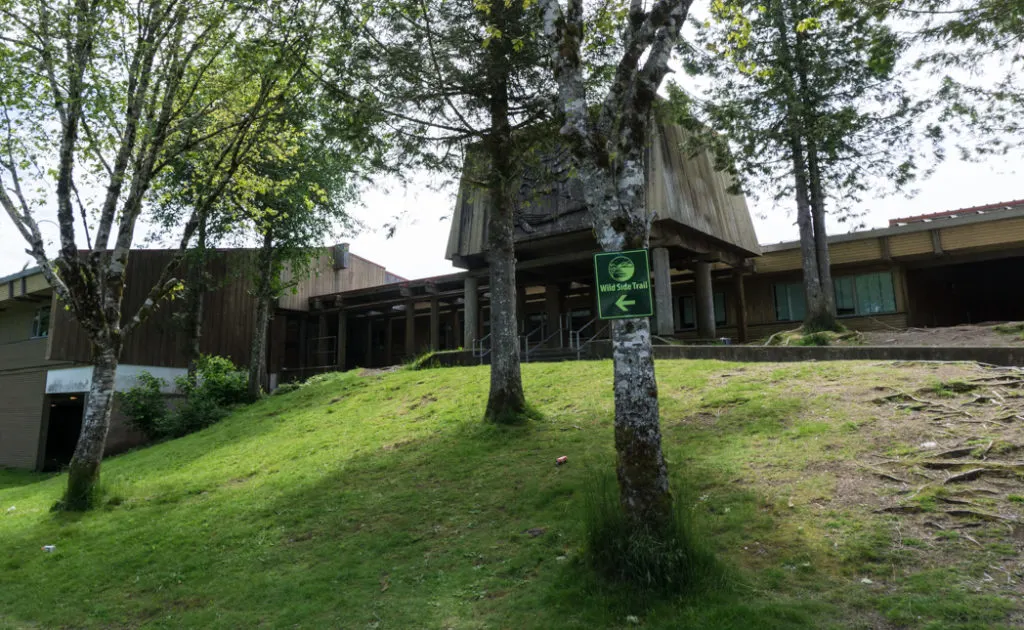
After you’ve checked in, follow the green and yellow Wild Side Trail signs through the town to the trailhead. There are quite a few turns, but if you get off track ask a local to point the way.
Just before you reach the beach, you’ll see a large mapboard and a sign for the Wild Side Trail. Follow the short trail across some hand carved boardwalks to emerge on the first beach.
Side Trail to the Warm Springs
The next few kilometers feature a mix of beach and inland trail that is mostly old boardwalk. You’ll pass by the first campsite at the sand dunes (see the Camping section of this post, below) and take an overland trail to reach the long beach of Whitesand Cove.
Near the east end of the cove look for buoys hanging in the trees to mark the start of a side trail to a naturally occurring warm springs. I haven’t taken the side trail but it is about 1 kilometre from Whitesand Cove to the springs and its reportedly very muddy. Apparently there is a man-made stone pool and the springs are slightly warmer than creek or ocean water but definitely not hot.
Side note: If you’re looking for true hot springs in the area, head to Hot Springs Cove in nearby Maquinna Provincial Park.
Trail of Tears
On the west side of Whitesand Cove is the trailhead for the Trail of Tears. This is a historic route for the Ahousaht First Nation and travels inland from the trailhead to meet up with the main trail at the metal bridge over the Kutcous River. I haven’t hiked this trail but I have heard it is overgrown, quite buggy and not recommended. The trail is of historical and cultural importance to the Ahousaht but doesn’t hold any particular appeal for hikers.
Kutcous River Crossing and the High Tide Short-cut Trail
After leaving Whitesand Cove you’ll take an inland trail across Kutcous point, then walk down the beach towards the Kutcous River where you’ll have to make a choice between a few different routes: the Low Tide Crossing, the Inland Trail on both the east and west sides of the Kutcous River to the bridge, and the High Tide Short Cut Trail.
Each of the three options has its own merits. To help you decide, here are the distances from the east side of the Kutcous River mouth to the junction of the High Tide Short-cut Trail and the regular beach route:
- The Low Tide Crossing is is 1.6km,
- The Inland Trail to the Bridge is 3.1km,
- The High Tide Short Cut is 1.5km.
Low Tide Crossing
To cross the Kutcous River at its mouth you need a tide of about 2 meters (6 feet) or lower. At tides between 1.5 and 2 meters you’ll have to walk about 100m upstream to near where the trail leaves the beach and goes into the forest and cross there as it is shallower. Prepare to get wet to about your knees and then scramble over the rocks on the other side back upstream to regain the trail.
At lower tides you can just cross the river right at the beach without getting too wet. And at high tides of course you can always swim it!
Inland Trail East to the Metal Bridge
If the river is too high to cross you can take the inland trail which actually has a few interesting things to see. Coming from the east follow the beach along the river down stream for about 100 meters then take the trail into the forest where it is marked by floats.
Keep an eye out for a large old growth cedar and then a few hundred meters later a huge culturally modified tree with a big box cut out of it. After about 800m of walking in the forest you’ll reach the large metal bridge over the Kutcous river and the junction with the Trail of Tears.
High Tide Shortcut Trail
After you cross the bridge you have two options: continue straight to take the High Tide Shortcut Trail or turn left to follow the river back to its mouth and continue along the coast.
The High Tide Shortcut is, as its name implies, shorter but it stays totally inland. When I first hiked it, the trail was new so it was a bit rough in places. However, I’ve heard from other hikes that it is still a bit rooty, but is fully brushed out and allows for much faster travel now. It’s a good option if the tide is too high to ford the river and you don’t have time for the longer coastal route.
Inland Trail West to the Cabin
If you aren’t in a rush you should take the trail back along the river mouth to the coast. This section has a few ups and downs that are a bit tougher than other parts of the trail.
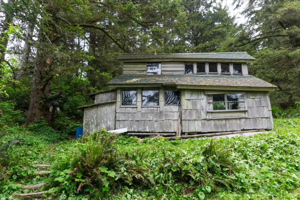
Once at the coast you’ll still be in the forest for a little bit to bypass some head lands. You’ll find an old cabin along this part of the trail that the trail society has adopted to serve as an emergency shelter. The cabin sits on the bank above a small pocket cove.
After passing the cabin, the trail continues in the forest for a short distance before emerging on a sandy beach that you’ll miss if you take the High Tide Shortcut Trail. The next pocket cove after this beach is where you’ll meet back up with the shortcut trail.
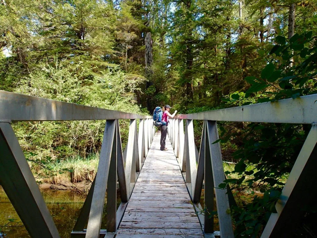
After this junction its straight forward walking across one long beach and a couple of inland sections to the log bridge crossing over a river and then on to Cow Bay. Once you hit the beach at Cow Bay you will be in the main camping area. You can walk along the beach to the northwest and explore the coves further along by scrambling over the rocky headlands or hunting for the overgrown trails that connect them.
Mount Flores Trail
Once at Cow Bay there is one more side trail to consider: the trail up to Mount Flores the highest peak on the island at 860m. While I haven’t hiked the Mount Flores trail I can tell you that everything I’ve read about it suggests that the trail is so overgrown that it is almost impossible to follow.
In all of the accounts I’ve read of people trying to get to the peak, they have failed to reach it as they either got lost or found the overgrown bush so tough to travel through that they ran out of time. I can’t say that I recommend this route or that it even sounds appealing. If you do decide to try this route it leaves from one of the coves on the west side of Cow Bay.
Join the Backpacking in BC Facebook Group
Camping on the Wild Side Trail
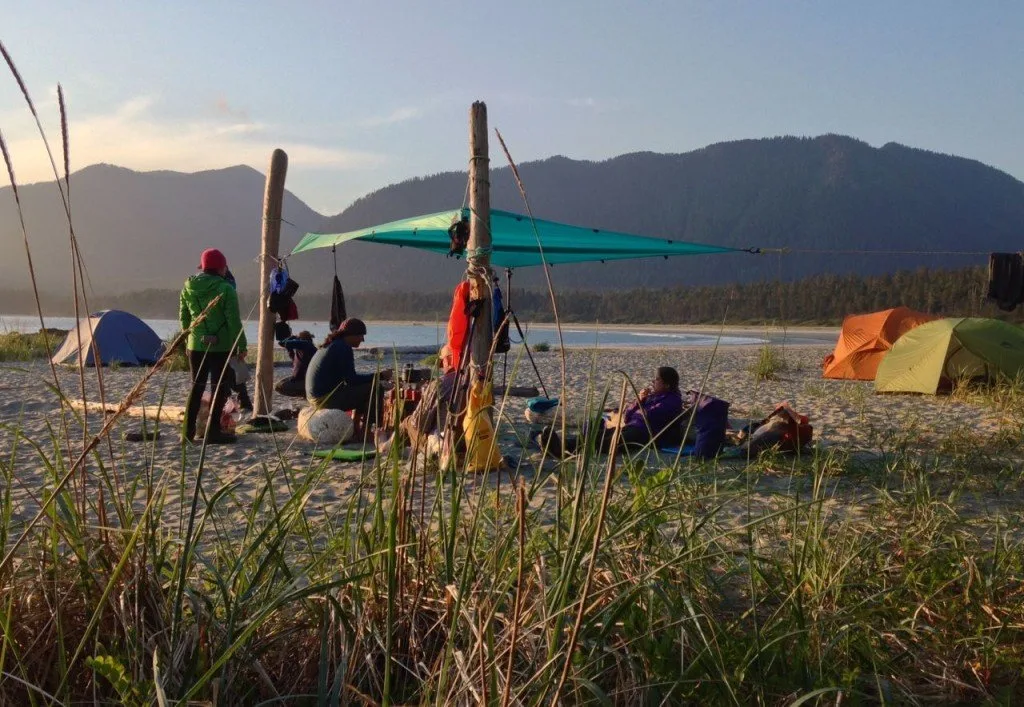
There are three designated campsites on the trail. The first one is about 2km from the trailhead at the sand dunes. The second is at the mouth of the Kutcous River at around 5km. And of course the final one is at Cow Bay at the end of the 11 kilometre long trail.
Sand Dunes Campsite
The dunes campsite has a couple of wooden tent pads or you can camp right back in the dunes. There is a metal food cache and an outhouse as well. You might find a trickle of a stream at the west end of the beach but in general you will have to bring your own water to this campsite as it doesn’t have a water source.
Kutcous River Campsite
The Kutcous River campsite has a two wooden tent platforms back in the brush behind the beach and space on the beach above the high tide line. There is also a plastic throne style outhouse (so no actual house) and a metal food cache. The mouth of the river is quite wide and tidally influenced so you may have to walk upriver quite a distance to get fresh water, especially at high tide.
Cow Bay Campsite
The Cow Bay campsite actually has two food caches and two outhouses. There is an outhouse located near where the trail meets the beach with the food cache located not far away but reached from the beach, not via the trail. At the far east side of the beach almost at the river mouth there is a trail that leads back from the beach to the tent platforms, second outhouse and second bear cache.
You can get water from the river at all but the highest tides as it descends a few feet before it meets the ocean so it doesn’t often get very salty. This stream is actually quite clear for a coastal stream and didn’t have the characteristic swamp tea colour that you often get on the coast so it didn’t tend to clog our water filter. There is also a smaller stream on the far west side of the beach if you want to camp away from the crowds.
Other Camping Options on the Wild Side Trail
There are countless pocket coves and long sandy beaches along the trail that would make great campsites. Of course there are no facilities at these campsites so you’ll have to bring your own water, hang your food in a tree and dig catholes to bury your waste.
There is also an old cabin at around the 6km mark (if you ford the Kutcous River; it’s at the 7.5km mark if you go the long way across the metal bridge). The cabin is now supposed to be used as an emergency shelter but it looks like people stay in it regularly. It has an outhouse nearby. There’s a rain barrel next to the cabin but it looks pretty gross. You might want to carry in water from the Kutcous River.
Remember that you are in a wild and beautiful backcountry location that is also an important place for the Ahousaht people. Keep a clean campsite, pack out what you packed in and follow the seven Leave No Trace principles. We want to ensure this amazing place stays pristine and beautiful so generations of hikers can continue to enjoy it.
Bears and Wolves on the Wild Side Trail
This is the West Coast so of course it is prime cougar habitat. Apparently bears are rarely seen along the trail but they do live in the area. Read up on bear safety for backpackers before your trip.
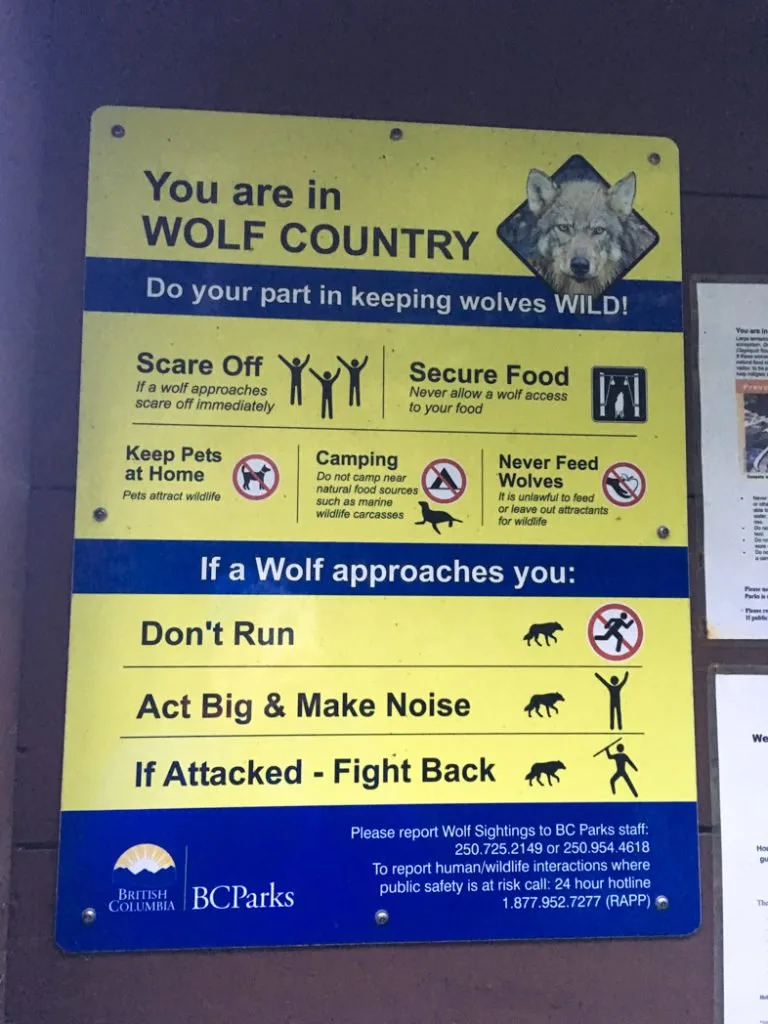
The other large mammal to be aware of in this area is the wolf. The wolf population on Flores Island and in the Clayoquot Sound area in general has rebounded in recent years and is thriving. This means that human-wolf interactions are on the rise.
Unfortunately there have been some unpleasant interactions, mostly in areas where people have been feeding wolves or where dogs are involved. In recent years there have been a number of dogs on Flores that have been attacked and killed. Some of these dogs are local dogs from Ahousaht and some are dogs belonging to hikers.
BC Parks and the Wild Side Trail organization both strongly discourage bringing dogs on the trail as they are a target for wolves. As well, many of the dogs in Ahousaht are strays and the local practice seems to be to let strays and owned dogs alike roam the town and the nearby beaches. The Ahousaht dogs have been known to follow hikers for the weekend and then get attacked by wolves in the hikers campsite. If you encounter Ahousaht dogs on the trail, actively discourage them from following you.
Besides leaving your dog at home, the other thing you can do to prevent negative wolf interactions is to keep a clean camp: cook a good distance from where you sleep, don’t leave food out, and don’t bury waste near camp. Remember, wolves are big dogs and they will eat your food scraps and your poo! BC Parks has more information on wolf safety.
More Information and Further Reading:
My book, Backpacking on Vancouver Island, includes a section about the Wild Side Trail.
Read my tips for coastal hiking to get ready for your trip.
And of course if you have questions I’d be happy to answer them. Leave them for me in the comments below.
Read Next: More Coastal Trips
- Coastal Hiking Tips: Advice for Beach Backpacking
- Sunshine on the Edge of the World: Nootka Trail Trip Report
- Ozette Loop Backpacking Trip Guide
- Shi Shi Beach Hiking and Camping Guide
- Your Guide to the West Coast Trail in British Columbia
- Cape Scott Trail Guide: Hiking and Camping on Northern Vancouver Island
- Kayaking in the Johnstone Strait: Everything You Need to Know
- North Coast Trail Guide: Backpacking on Vancouver Island
- Juan De Fuca Trail Guide: Backpacking on Vancouver Island
- 30 Best Backpacking Trips in BC
- 25 Spring Backpacking Trips in British Columbia
Was this post helpful? Pin it on Pinterest!
- Grasslands National Park Travel Guide - February 4, 2026
- The Best (and Worst) Backpacking Meals Reviewed - December 16, 2025
- My Favourite Hiking Gear of 2025 - December 9, 2025


Timothy
Thursday 13th of March 2025
Hello. Are there accommodations on Flores Island in case I get there late, or if I have to stay for the night?
Taryn Eyton
Thursday 13th of March 2025
The village of Ahousaht (also called Maaqtusis) is a small First Nations village. There a couple of small guesthouses but you should call to make sure they are operating.
Kim Marks
Sunday 10th of November 2024
Love how comprehensive this trail description is!
Kim
Wednesday 13th of July 2016
Thanks for the great information! How busy was the trail when you went? I'm looking to go camping there in July or August but like to try to avoid the crowds.
Taryn Eyton
Wednesday 13th of July 2016
We went on May Long weekend. Most of the trail was deserted but there were about 20 tents at Cow Bay - it turned out about half of them had chartered a boat in for a 40th birthday party and the rangers confirmed it was unusually busy. But Cow Bay is a big place so as long as you don't mind camping a bit of a walk from the outhouses and food caches, you can find some solitude. The other campsites don't seem very heavily used and of course you could always just find your own pocket cove somewhere to camp away from everyone else.
You can always email the wildside trail rangers to ask how typically busy it is - I would guess a dozen people on the trail would be busy for there.
Debbie
Friday 24th of June 2016
Thanks for the great report Taryn! Its been super helpful with my planning. I'm heading out there from Cloverdale with my husband and two kids in a couple weeks. We're planning on spending up to 4 nights (depending on the weather) just hanging out and exploring the beaches.
Taryn Eyton
Friday 24th of June 2016
Sounds like a great plan Debbie. Be sure to check in with the Wildside Trail staff for the latest on trail conditions - they were sooo helpful when planning my trip. Let me know how it goes.
Linda Knight
Thursday 3rd of March 2016
This is great information - I can only hope to have our weather in early May match what you experienced.
Taryn Eyton
Thursday 3rd of March 2016
Fingers crossed for sunshine for you Linda! Our first couple of days were a bit grey - the sun came out for our hike back to Ahousaht.