
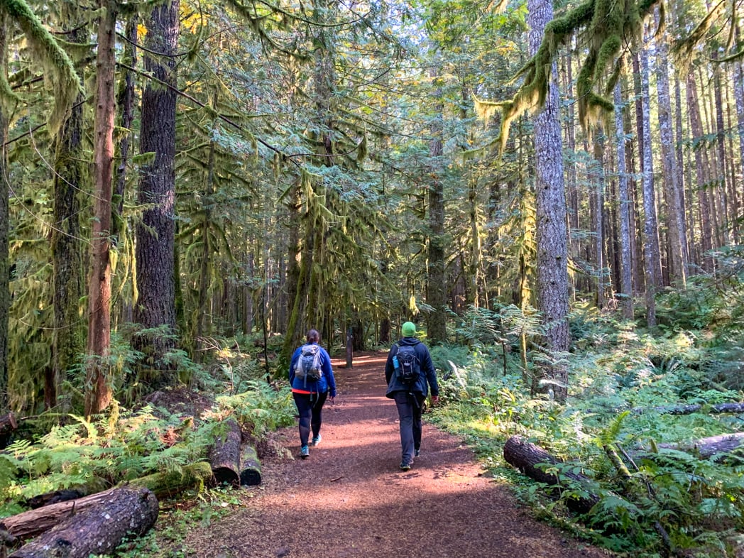

I’ve lived in Squamish for a few years now, but before I moved here, I hiked in Squamish all the time. I’ve done tons of hikes near Squamish so I’ve put together a list of the best hikes in Squamish.
Between hiking trails, mountain biking trails, and dirt bike trails, there are literally hundreds of hiking trails in Squamish. But in this post, I’ve got my local’s picks for just the best hikes in Squamish. The list includes over 20 hikes from easy to very challenging and from 1 km to 30 km.
Psst! Looking for more Squamish activities? Check out my list of the best things to do in Squamish – It has over 70 ideas!
This is a sensitive wilderness area. Learn how to Leave No Trace to keep the wilderness wild. Make sure you are prepared by bringing the 10 Essentials. Get ready for adventure with this checklist of things to do before every hike.
Hey there: Some of the links in this post are affiliate links, which means I earn a small commission at no cost to you. Thanks for your support. -Taryn
Squamish Hiking Basics
Getting to Squamish
Squamish is located in British Columbia, Canada, about an hour north of Vancouver. It’s an easy drive on Highway 99 (a.ka. the Sea to Sky Highway). You can drive yourself or take a shuttle bus.
READ NEXT: Sea to Sky Highway Road Trip Guide: Driving from Vancouver to Whistler
Backroad Driving in Squamish
To get to some Squamish trails, you will need to drive on unpaved backroads, also called logging roads. Some of these roads can be very steep, bumpy, and loose. But you can get to almost all of these Squamish hikes in a regular 2WD car. I’ve included access road notes for each hike about what kind of vehicle you will need.
Hiking Season in Squamish
Squamish sits on the ocean, surrounded by mountains. That means that valley bottom trails can be snow-free most of the year, while the high mountain trails are only accessible between June and September. I’ve included the “best months to go” for each hike below. (If you’re visiting in winter, use my guide to snowshoeing in Squamish.)
What to Bring Hiking in Squamish
Even if you are just going for a short hike, you need to be prepared for the weather and conditions. Don’t forget the 10 essentials. Rain gear and warm clothing are especially important since the weather can change quickly.
READ NEXT: 16 Things to do Before a Hike
Bear Safety
Squamish is home to both black bears and grizzly bears. Carry bear spray and make noise while you hike to reduce your risk of a negative bear encounter. Read my guide to bear safety for more tips.
Leave No Trace
The area around Squamish is sensitive wilderness. It’s also home for 20,000 residents of this small town. In recent years, locals have become concerned about increased garbage, human waste, and illegal camping. Be respectful. Learn about Leave No Trace principles to help keep the wilderness wild.
Indigenous Context
Squamish is located in the traditional territory of the Sḵwx̱wú7mesh Úxwumixw (Squamish) Nation. To learn more about the Indigenous context of the area, visit the Squamish Lil’wat Cultural Centre in Whistler. Online resources include the Squamish Nation website and the Squamish Atlas.
Squamish Trail Maps
Some hikes in Squamish are easy to find and have good trail markers. But some can be confusing to follow. I recommend using the Gaia GPS app. The premium version has detailed maps of this area that make it really easy to stay on track.
You can also buy a paper map of Squamish Trails at the Squamish Adventure Centre.
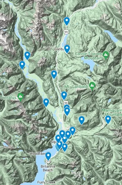
I made a custom Google map for you that shows all of the Squamish hiking trails on this list with the exact location of the trailhead. But don’t use Google maps once you are on the trails – they don’t have all of the trails and in some places, there is no cell service.

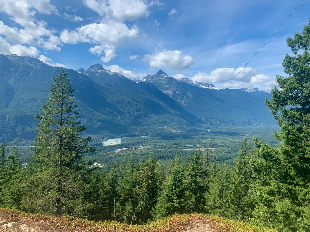
Murrin Loop and Jurassic Ridge
Difficulty: Moderate
Elevation gain: 160 m
Best time to go: March – November
More info: Murrin Park Trail Map
Distance: 3.5 km loop
Time needed: 2 hours
Dogs: Not allowed at the beach. Allowed on-leash elsewhere but not recommended due to steep terrain.
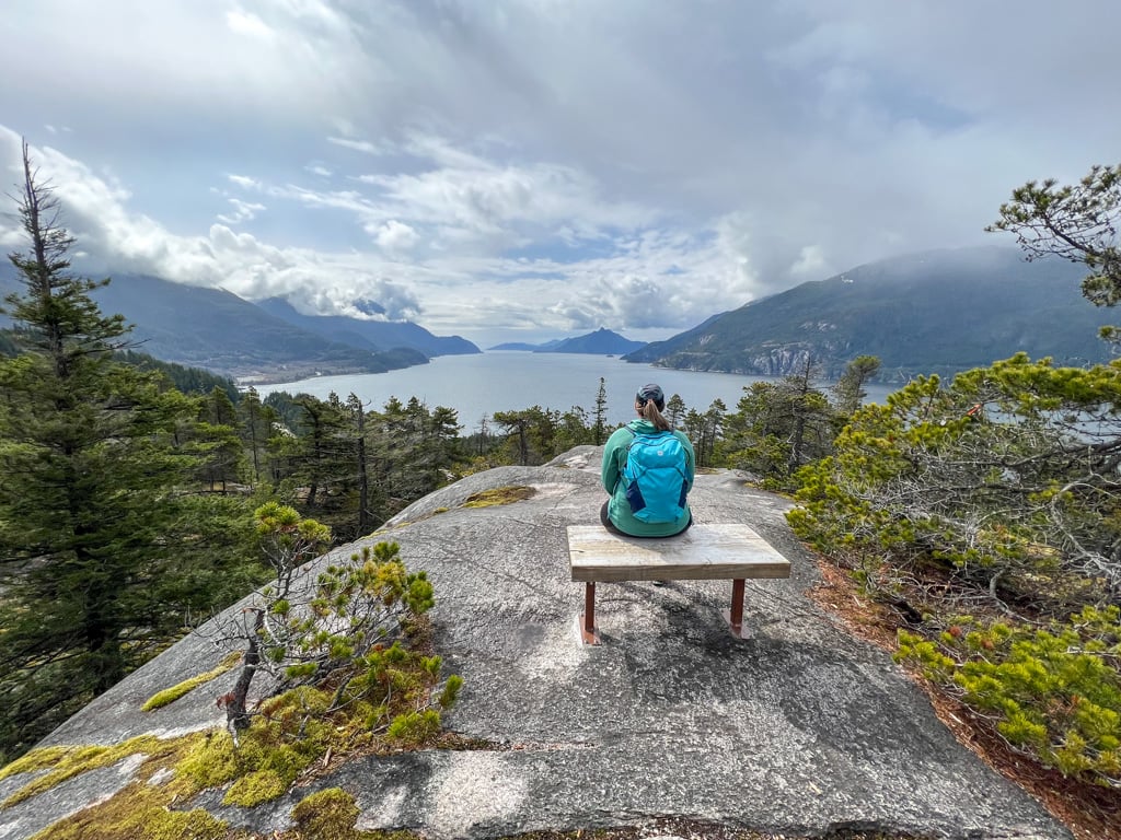
The granite outcroppings above Browning Lake at Murrin Provincial Park are popular with rock climbers. Steep trails loop through the rugged terrain to several gorgeous viewpoints. I recommend following the Loop trail and Jurassic Ridge trails to make a loop that passes the Quercus Lookout, Jurassic Peak (Watt’s Point), and Brian’s Lookout.
Choose a dry day for this hike as it traverses steep granite slabs that can be very slippery. And use caution: this hike involves steep terrain and a little bit of scrambling.
Getting there: Murrin Provincial Park is on the west side of Highway 99 9 km south of Squamish. The small parking lot fills fast on summer weekends. Click here for driving directions.
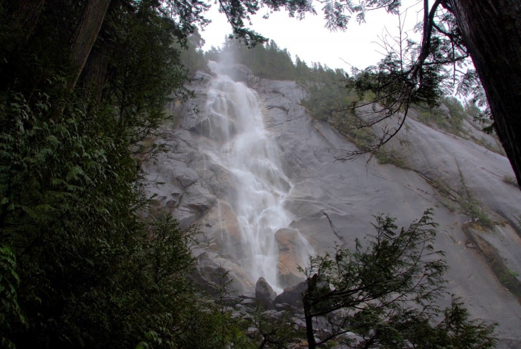
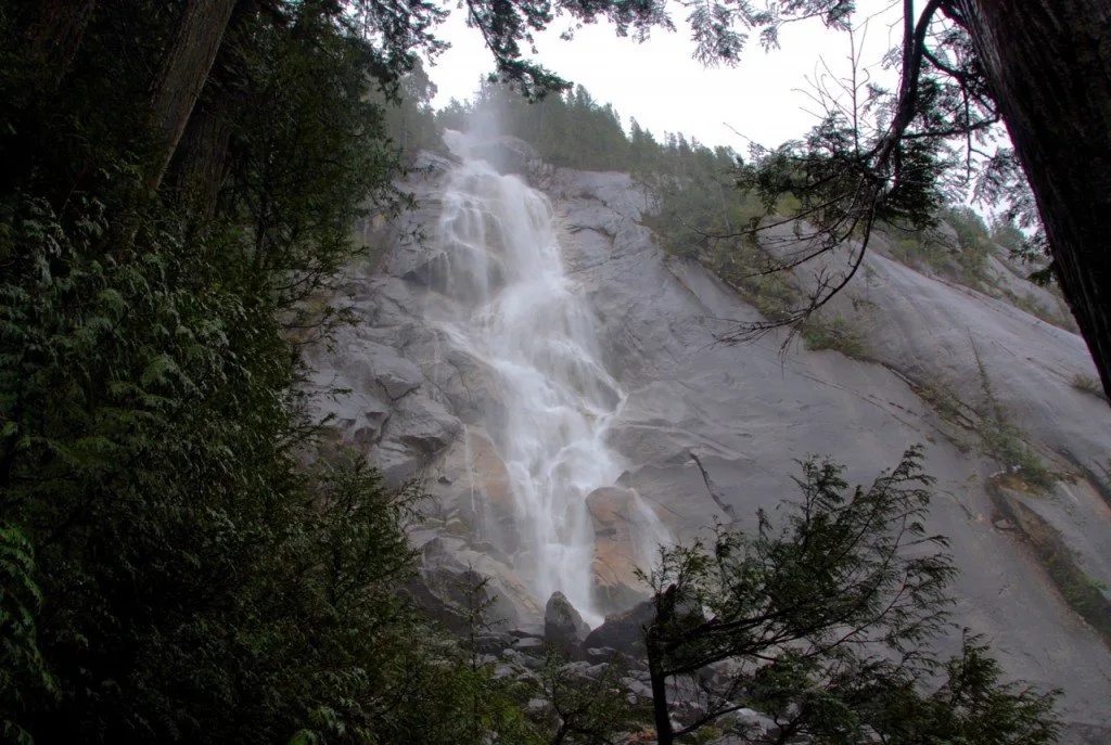
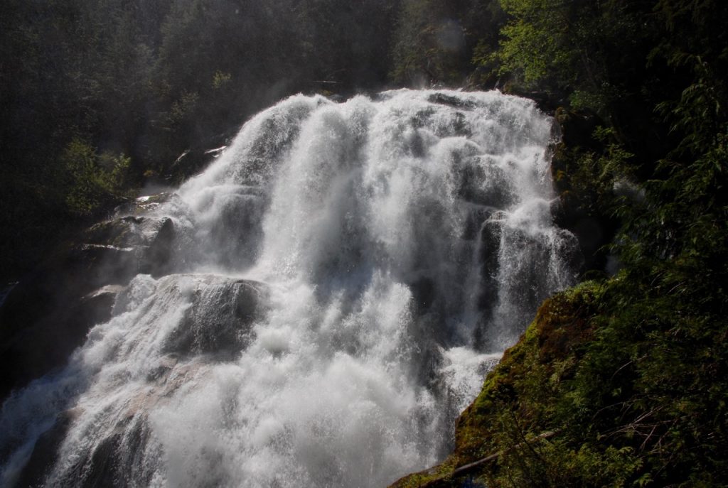
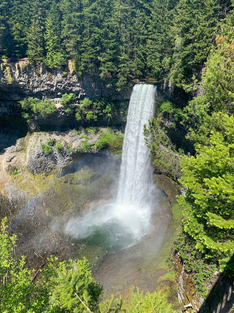
Shannon Falls
Difficulty: Easy
Elevation gain: 50 m
Best time to go: Year-round
More info: Shannon Falls Provincial Park
Distance: 0.75 km round trip
Time Needed: 30 minutes
Dogs: Allowed on-leash.
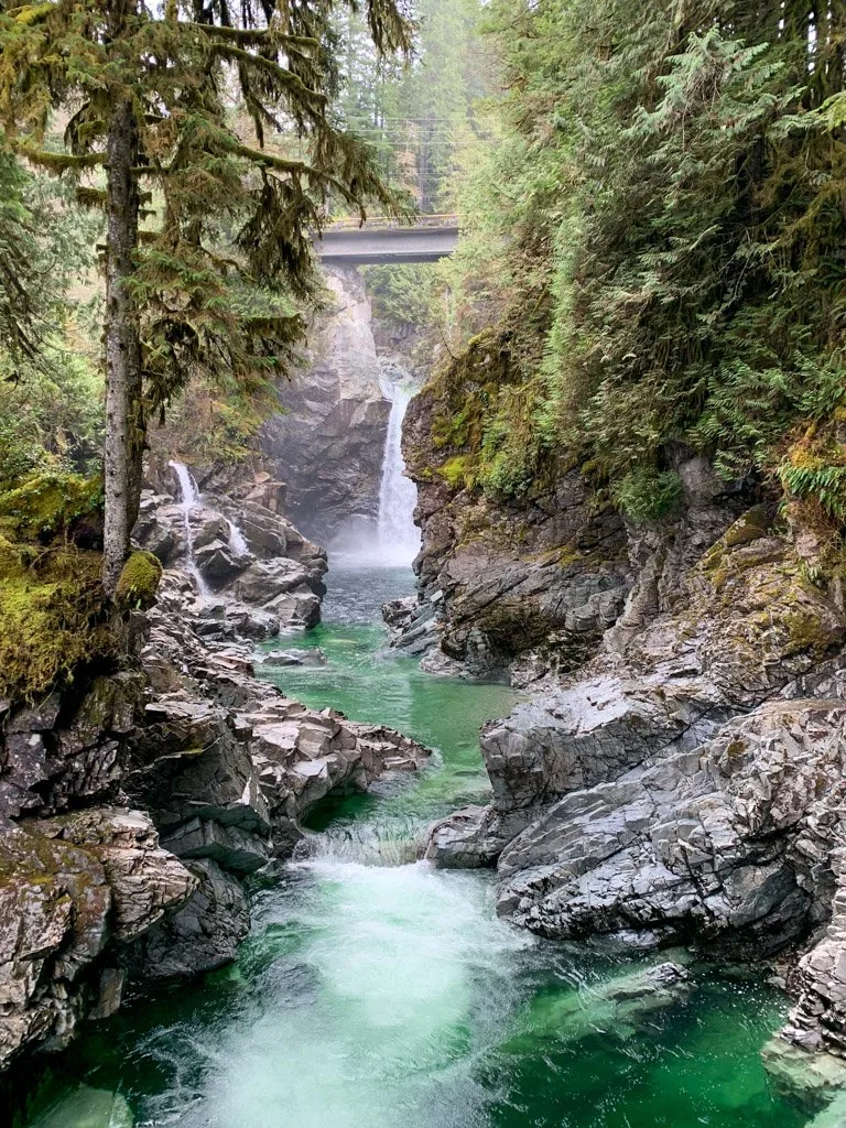
Spectacular Shannon Falls is the third highest waterfall in British Columbia at 335-meters-tall and one of the best waterfall hikes near Vancouver. A short trail leads uphill from the parking to several different viewing platforms.
Getting there: The parking lot is located on the east side of Highway 99 4 km south of Squamish. Click here for driving directions.
READ NEXT: 40+ Waterfall Hikes Near Vancouver
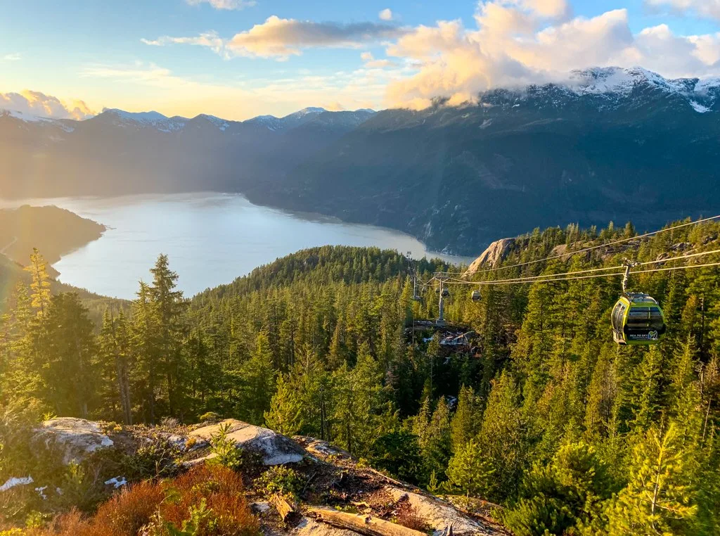
Sea to Summit Trail

Difficulty: Challenging
Elevation Gain: 918 m
Best Time to Go: March-November
More Info: Sea to Sky Gondola
Distance: 6.5 km one-way
Time Needed: 3-5 hours
Dogs: Allowed but only allowed on-leash in limited areas at the gondola.
This steep trail climbs from the valley floor to the top of the Sea to Sky Gondola – it’s reminiscent of Vancouver’s Grouse Grind. Along the way, it passes the rushing waters of Upper Shannon Falls and several spectacular viewpoints. In several places, you will need to scramble upwards over steep rocks with the help of ropes.
Note: This is typically completed as a one-way trail as most hikers take the gondola down for $20. Dogs are allowed on the gondola for download only. Check gondola hours before you go.
Getting there: The trail starts at the Sea to Sky Gondola parking lot on the east side of Highway 99 just south of the town of Squamish. Click here for driving directions.
Panorama Trail

Distance: 1.3 km loop
Time Needed: 30-45 minutes
Dogs: Not allowed.
There are several short and easy trails at the top of the Sea to Sky Gondola, but the Panorama Trail is the most scenic. It’s an easy loop with several spur trails that lead to viewpoints. You can hike it all year, but expect snow between November and April. (The snow is usually packed down enough that you won’t need snowshoes but you may want microspikes.)
Note: This trail starts at the top of the Sea to Sky Gondola. You can get there by hiking the Sea to Summit Trail (above) or by paying to ride the gondola.
Getting there: The trail starts at the top of the Sea to Sky Gondola. Find the parking lot on the east side of Highway 99 just south of the town of Squamish. Click here for driving directions.
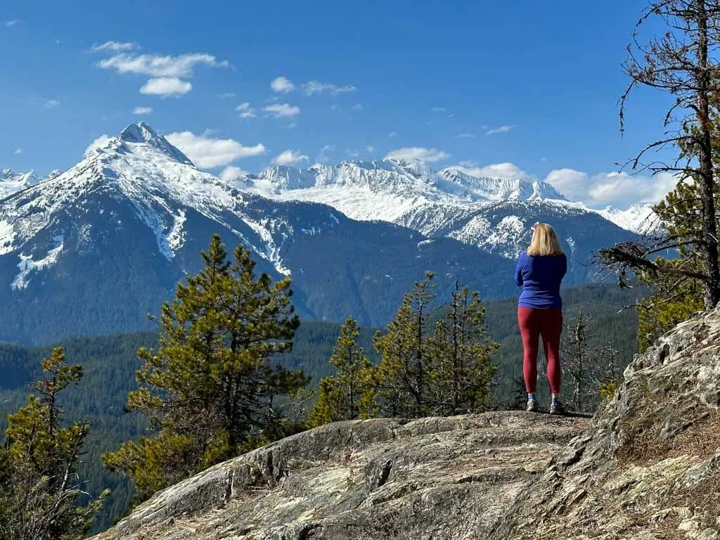
Al’s Habrich Ridge Trail

Difficulty: Challenging
Elevation Gain: 340 m
Best Time to Go: June to November
More Info: My Al’s Habrich Ridge Trail guide
Distance: 8.4 km round trip
Time Needed: 3-6 hours
Dogs: Allowed but only allowed on-leash in limited areas at the gondola.
This is the best backcountry trail at the Sea to Sky Gondola and one of my favourite hikes in Squamish. It follows an open granite ridge uphill with great views. After a steep climb in the forest, you emerge on an outcrop with an even better view. If you continue along the trail, you’ll travel through subalpine terrain past small ponds to a waterfall.
Note: This trail starts at the top of the Sea to Sky Gondola. You can get there by hiking the Sea to Summit Trail (above) or by paying to ride the gondola. Dogs are allowed on the gondola for download only.
Snowshoeing: Al’s Habrich Ridge Trail is one of the best places to go snowshoeing in Squamish.
Getting there: The trail starts at the top of the Sea to Sky Gondola. Find the parking lot on the east side of Highway 99 just south of the town of Squamish. Click here for driving directions.
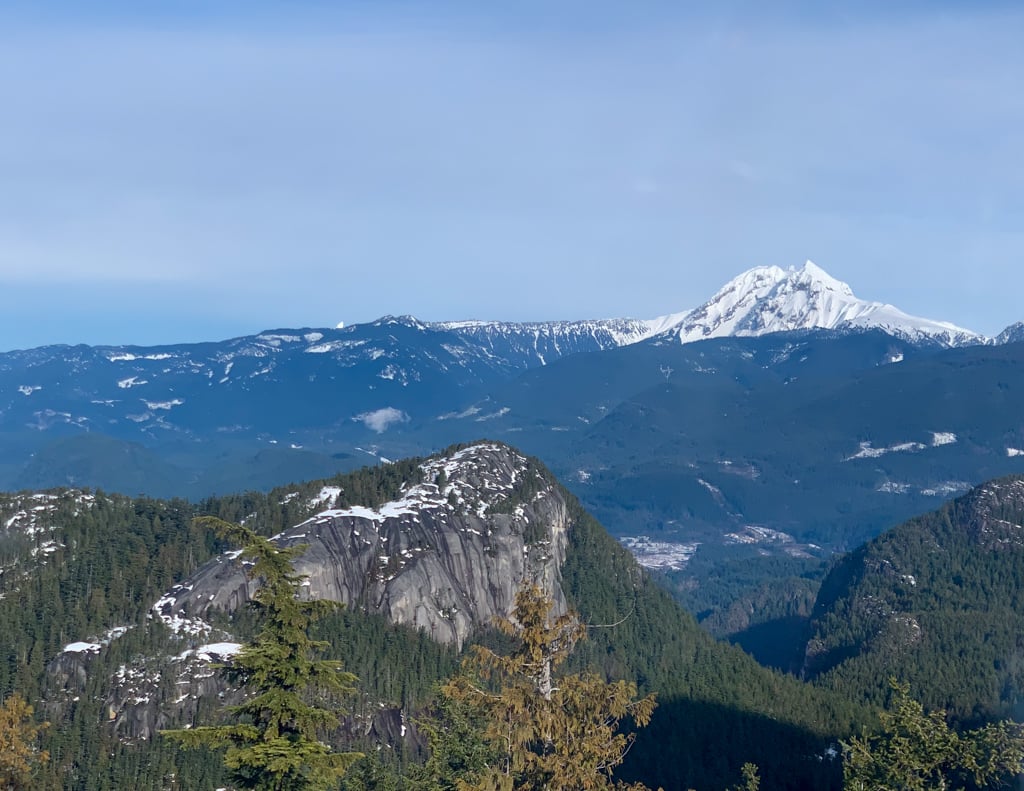
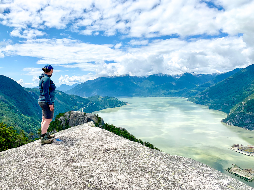
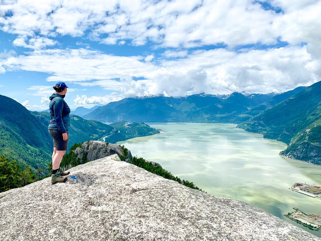
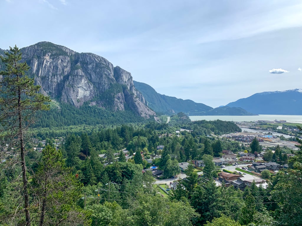
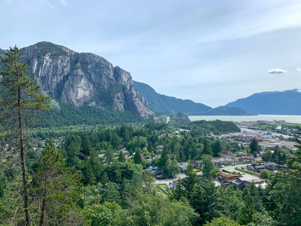
Stawamus Chief
Difficulty: Challenging
Elevation Gain: Up to 630 m
Best Time to Go: March to November
More Info: Stawamus Chief Provincial Park Map
Distance: 3-11 km round trip
Time Needed: 2.5-6 hours
Dogs: Allowed but not recommended due to steep terrain.
The imposing granite face of the Stawamus Chief towers over Squamish making the trail to the top a must-do hike in Squamish. The trails include lots of stairs and some have ladders and chains to help negotiate the terrain. In some spots, you’ll be close to precipitous cliffs. It’s even steeper than the Grouse Grind.
The main trail splits off into separate trails for the three peaks. You can hike to just one peak or take in all three. First Peak is the most popular, but I like Second and Third Peaks because they are quieter and you can get photos with First Peak in the foreground.
Getting there: Stawamus Chief Provincial Park is located on the east side of Highway 99 just south of the town of Squamish. The parking lots can fill up on sunny weekends. Click here for driving directions.
READ NEXT: Alternatives to the Grouse Grind: Steep Workout Hikes Near Vancouver
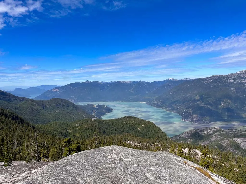
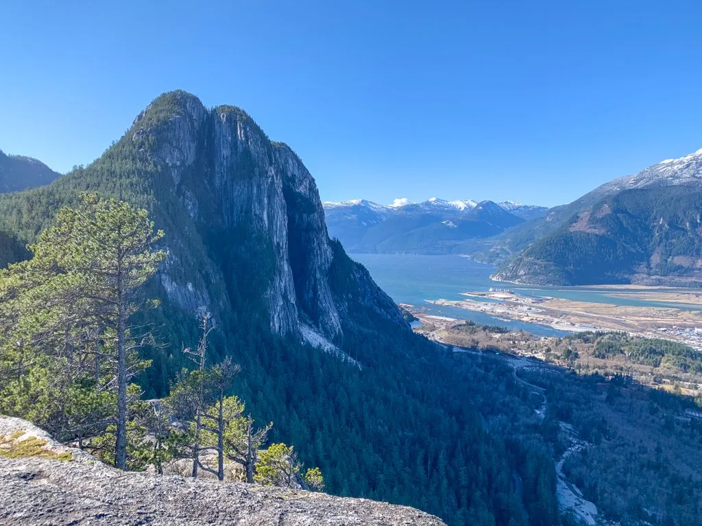
Slhanay

Difficulty: Challenging
Elevation gain: 610 m
Best time to go: March to November
More info: All Trails
Distance: 6 km round trip
Time needed: 2.5-3.5 hours
Dogs: Allowed but not recommended due to steep terrain.
Slhanay Peak is often overlooked because it sits behind the Stawamus Chief and doesn’t have the same spectacular cliffs. However, the real reason to visit Slhanay is for the incredible views of the Chief. The best viewpoint is part-way up, but the summit is also worth visiting.
The trail is very steep and since it is an informal trail, it is very rough. Trail markings are sparse and there is a huge trail network near the summit that can be confusing. Use a GPS app like Gaia to stay on track.
Getting there: The trailhead is located on the Mamquam Forest Service Road. The road is gravel and can be bumpy but is fine for 2WD vehicles. Click here for driving directions.
Mamquam Falls

Distance: 1.6 km loop
Time Needed: 1 hour
Dogs: Allowed.
This short hike leads to a spectacular waterfall in a granite canyon on the Mamquam River. While the falls are next to a power station and near roads, it’s still a spectacular spot. The easy loop hike is mostly on gated gravel roads, but the middle section travels on a rough trail next to the river that leads to a viewing platform.
Getting there: The trailhead is located on Powerhouse Springs Road, which is accessed from Mamquam Forest Service Road. The roads are gravel and can be bumpy but are fine for 2WD vehicles. Click here for driving directions.
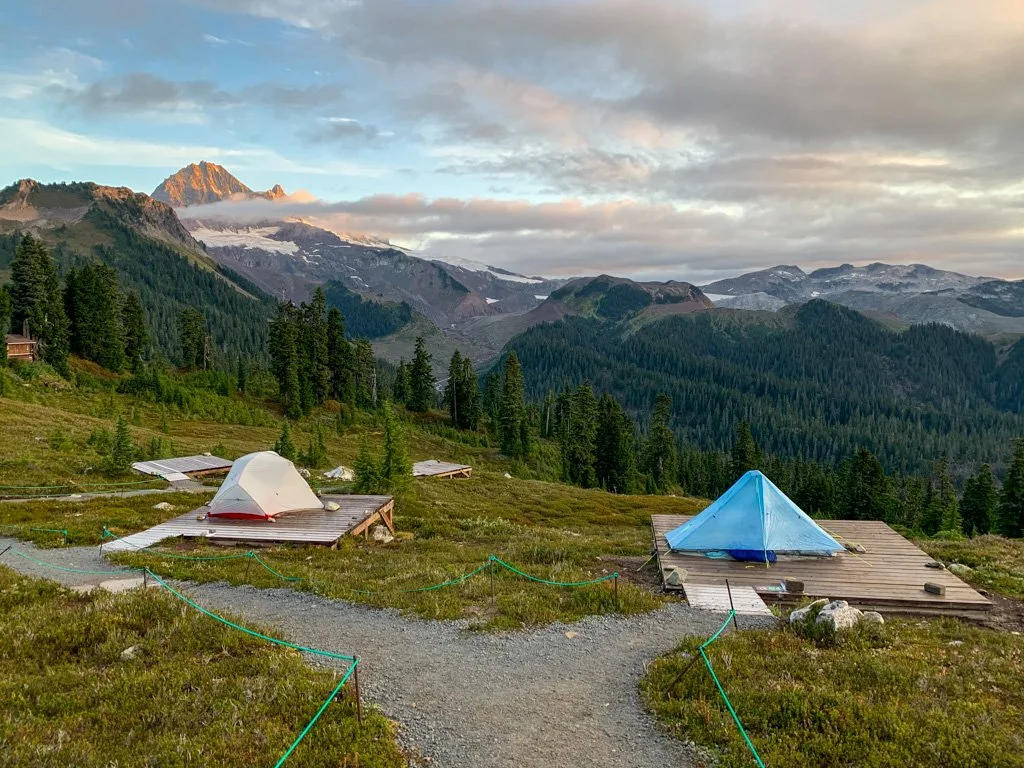
Watersprite Lake
Difficulty: Challenging
Elevation gain: 668 m
Best time to go: July-September
More info: Watersprite Lake trail map
Distance: 17 km round trip
Time needed: 7 hours
Dogs: Allowed.
Watersprite Lake is a gorgeous turquoise blue sub-alpine lake deep in the mountains and is one of the most popular hikes in Squamish. The lake is dotted with rocky islands and backed by a crumbling tower of granite, which makes it especially photogenic. The hike to the lake is mostly on old roads, but it does have great views of the surrounding peaks.
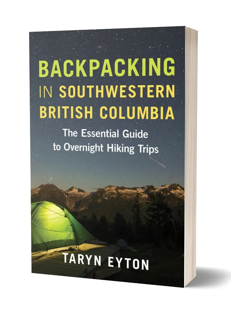
Backcountry camping: There is a backcountry campsite at the lake along with a hut. You can book a stay at either through the BCMC. For details on camping, see my book, Backpacking in Southwestern British Columbia.
Getting there: The trailhead is located on Skookum Forest Service Road, which is accessed from Mamquam Forest Service Road. The roads are gravel, bumpy, loose, and very steep. You will need a 4-wheel-drive vehicle to reach the trailhead. Click here for driving directions.
Get My Book…
Backpacking in Southwestern British Columbia
A one-stop resource for backpackers in beautiful British Columbia.
- 40 backpacking trips within a few hours of Vancouver
- Info about permits, reservations, and campground facilities
- Detailed maps and photos
- Advice for extending your trip
- Points of cultural and natural history

Mount Crumpit

Difficulty: Moderate
Elevation gain: 242 m
Best time to go: March to November
More info: My Mount Crumpit hiking guide
Distance: 7.9 km round trip
Time needed: 2.5-3.5 hours
Dogs: Allowed
The hike to the summit of Mount Crumpit is one of my favourite trails in Squamish. It has a great view of the Stawamus Chief and Slhanay from the top. There are a few steep sections, but overall, it’s a pleasant walk in the forest. And it’s never too busy.
However, the route travels through a confusing network of mountain bike, dirt bike, and hiking trails. Be sure to follow the turn-by-turn directions in my Mount Crumpit hiking guide. I also recommend using a GPS app like Gaia to stay on track.
Getting there: The trailhead is located in Squamish’s Valleycliffe neighbourhood at the intersection of Westway Avenue and Cherry Drive. Click here for driving directions.
READ NEXT: Hike to Mount Crumpit in Squamish
Estuary Trail
Difficulty: Easy
Elevation gain: None
Best time to go: Year-round
Distance: 4 km loop
Time needed: 1-1.5 hours
Dogs: Allowed on-leash only.
The hike through the Squamish River estuary is one of my favourite places to take visitors to Squamish. The flat and easy trail makes a loop next to a tidal channel in the estuary and then loops back along the Town Dyke trail. The views of Howe Sound, Shannon Falls, and the Stawamus Chief from the estuary are great.
Getting there: There are several places to start this hike. The easiest place to park is just before the gate on Bailey Street in downtown Squamish. Click here for driving directions.
Smoke Bluffs Loop
Difficulty: Moderate
Elevation gain: 200 m
Best time to go: Year-round
More info: Smoke Bluffs Loop trail map and directions
Distance: 3 km loop
Time needed: 1.5 hours
Dogs: Allowed.
The Smoke Bluffs is one of Squamish’s most popular rock climbing areas. But it’s also a great place to go for a hike since the granite outcroppings have great views of downtown Squamish, Howe Sound, and the Stawamus Chief. Even though the hike is short, it is steep with several staircases.
There is a maze of climbers’ access trails, but as long as you stay on the main Loop Trail, it’s easy to follow. You may want to use a GPS app like Gaia if you’re worried about getting lost.
Getting there: The trail begins at Smoke Bluffs Park parking lot on Loggers Lane near the Squamish Adventure Centre. Click here for driving directions.
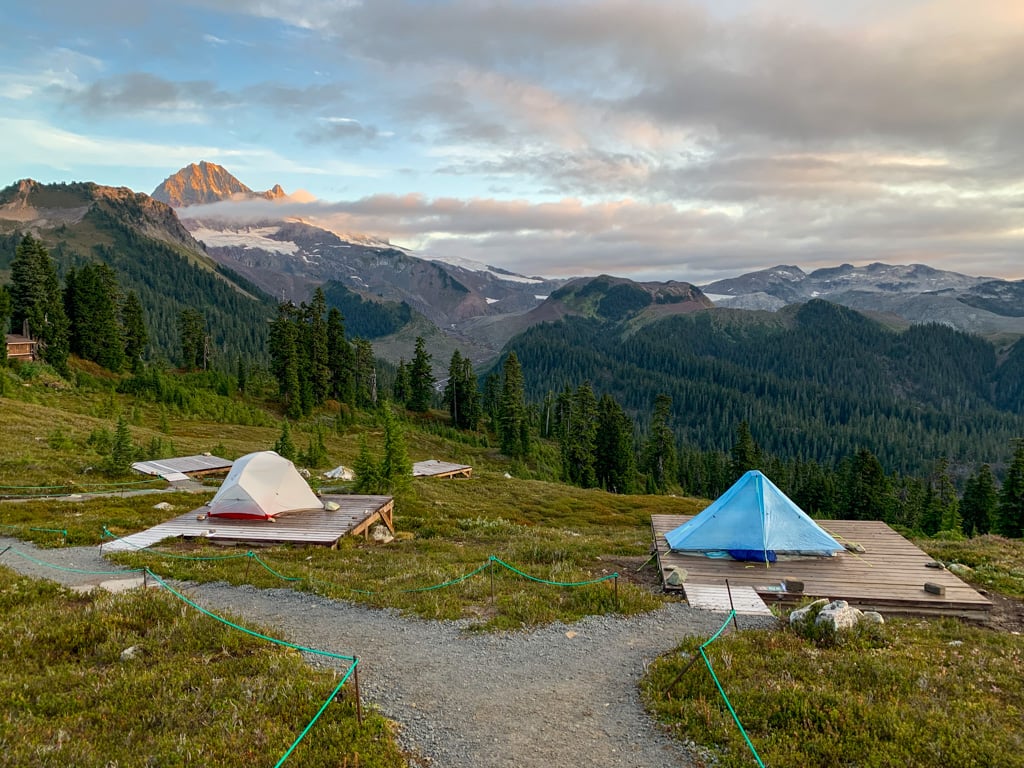
Elfin Lakes
Heads up: Day passes are required at Garibaldi Provincial Park in summer. Learn more in my guide to BC Parks day passes.
Difficulty: Challenging
Elevation gain: 615 m
Best time to go: Late June to October
More info: Vancouver Trails
Distance: 22 km round trip
Time needed: 6-9 hours
Dogs: Not allowed.
The hike to Elfin Lakes in Garibaldi Provincial Park is mostly along an old road. But you won’t mind because, after the first hour, you will get above the treeline onto a ridgeline where you will enjoy incredible mountain views. On hot days, you can swim in the larger Elfin Lake. (The smaller one is the water source.)
Backcountry camping: There is a backcountry campsite at Elfin Lake along with a hut. You can book a stay at either through BC Parks. For details see my Elfin Lakes hiking guide and my book, Backpacking in Southwestern British Columbia.
Snowshoeing: The Elfin Lakes trail is one of the best places to go snowshoeing in Squamish.
Getting there: The trailhead is on Garibaldi Park Road, which is accessed from the Garibaldi Highlands neighbourhood. It is a gravel road and can be bumpy, but is fine for 2WD vehicles. Click here for driving directions.
READ NEXT: Backcountry Huts in British Columbia and the Canadian Rockies

Four Lakes Trail
Difficulty: Easy
Elevation gain: 110 m
Best time to go: year-round
More info: Alice Lake Provincial Park map
Distance: 6 km loop
Time needed: 1.5-2.5 hours
Dogs: Allowed on-leash only, but not allowed on the beaches.
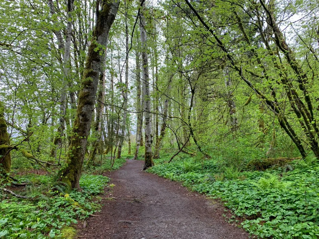
This easy trail passes four lakes and travels through a gorgeous mossy forest. Since it’s close to my house, I hike this trail often and I think it’s one of the best easy hikes in Squamish. In the summer, cool off with a dip in Alice Lake.
Getting there: The trail starts at the Stump Lake parking area in Alice Lake Provincial Park, located east of Highway 99 just north of Squamish. Click here for driving directions.
Debeck’s Hill
Distance: 4 km round trip
Time needed: 1.5-2 hours
Dogs: Allowed on-leash only, but not allowed on the beaches.
The route to the top of Debeck’s Hill uses a steep old gravel road. It’s also known as the Debeck’s Grind, a reference to Vancouver’s Grouse Grind. Along the way, it passes an old steam engine leftover from the logging days. The view from the top is spectacular. You can see the Squamish River Valley and the Tantalus Mountains.
Getting there: The trail starts at the South Beach parking area in Alice Lake Provincial Park, located east of Highway 99 just north of Squamish. Click here for driving directions.
Crooked Falls

Difficulty: Moderate
Elevation gain: 400 m
Best time to go: May to October
More info: My Crooked Falls hiking guide
Distance: 6 km round trip
Time needed: 3-4 hours
Dogs: Allowed.
Crooked Falls is a beautiful waterfall on Sigurd Creek that cascades onto a rock bluff, then makes a sharp 90-degree turn, giving it a “crooked” appearance. The hike to get there takes you up through a steep forest on a rough trail.
Getting there: The trailhead is on the Ashlu Forest Service Road. To get there, take Squamish Valley Road west from Highway 99. It is bumpy but fine for 2WD vehicles. Click here for driving directions.
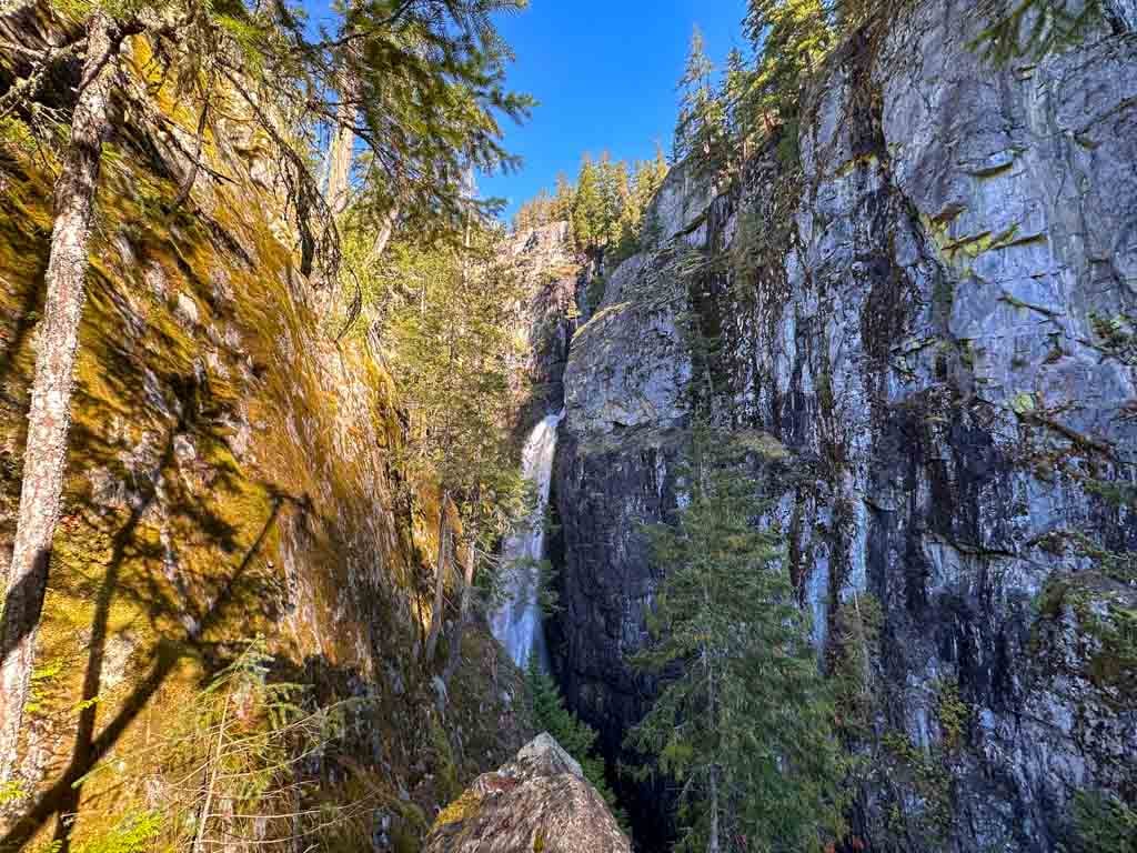
High Falls Creek
Difficulty: Challenging
Elevation gain: 615 m
Best time to go: April to November
More info: My High Falls Creek trail guide
Distance: 10.5 km loop
Time needed: 4-6 hours
Dogs: Allowed but not recommended due to steep terrain.
High Falls Creek is a rugged hike that follows granite bluffs beside a deep canyon. The route is steep and at times you will haul yourself up with ropes. There are several good viewpoints of waterfalls.
The terrain is too steep for easy downhill travel, so the return half of the loop is on a gravel logging road with great views of the Squamish River Valley.
Getting there: The trailhead is on the Squamish River Forest Service Road. To get there, take Squamish Valley Road west from Highway 99. It is bumpy but fine for 2WD vehicles. Click here for driving directions.
READ NEXT: 40+ Waterfall Hikes Near Vancouver
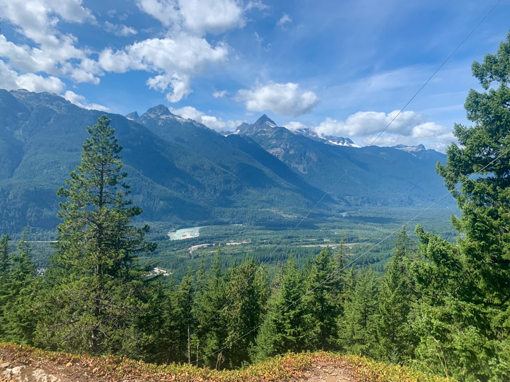
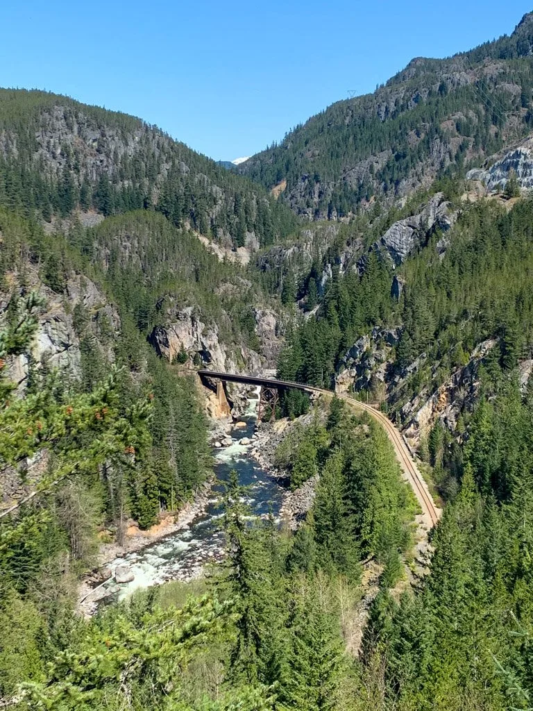
Cheakamus Canyon and Starvation Lake

Difficulty: Moderate
Elevation gain: 260 m
Best time to go: March to November
More info: Vancouver Trails
Distance: 7 km round trip
Time needed: 2.5-3 hours
Dogs: Allowed.
This trail follows a section of the Sea to Sky Trail from the end of Paradise Valley past Starvation Lake to the side of the Cheakamus River Canyon. There are great views of the river and on a warm day, you can finish with a swim in the lake. This trail is a bit of a hidden gem compared to better-known hikes in Squamish.
Getting there: The trailhead is located at the end of Paradise Valley Road. After the road turns to gravel, it is bumpy but fine for 2WD vehicles. Continue on gravel for another 3 km to a parking area. Click here for driving directions.
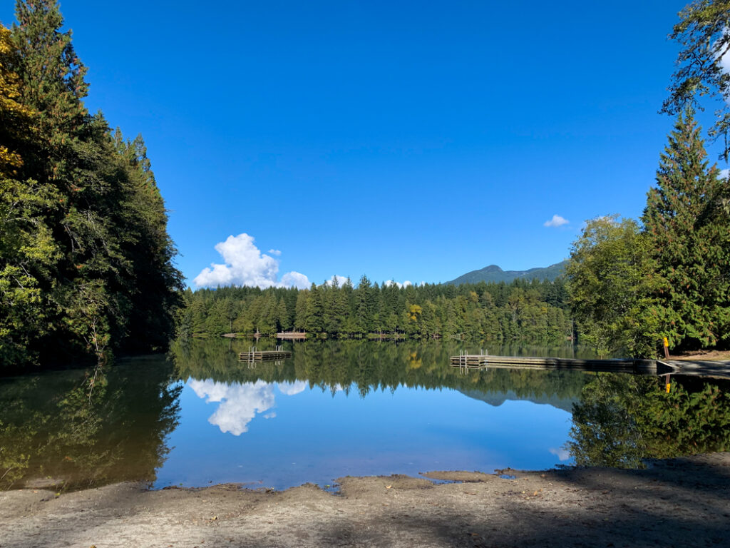
Brohm Lake

Difficulty: Easy/Moderate
Elevation gain: 50-150 m
Best time to go: March to November
More info: My Brohm Lake hiking guide
Distance: 3.5-10 km loop
Time needed: 1.5-4 hours
Dogs: Allowed on-leash.
From the highway, Brohm Lake looks marshy. But if you take the trail around the shoreline, you’ll find lots of rock outcroppings that are perfect for swimming on hot days. You can extend your hike by taking steeper trails up to viewpoints on the Cheakamus Loop, High Trail, and Powerline Trail.
Getting there: The main parking lot for Brohm Lake is located on the west side of Highway 99 15 km north of Squamish. It fills up on sunny weekends. Click here for driving directions.
READ NEXT: Brohm Lake Hike in Squamish (By a Local)
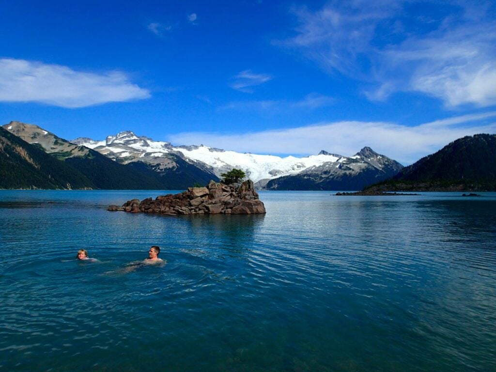
Garibaldi Lake
Heads up: Day passes are required at Garibaldi Provincial Park in summer 2023. Learn more in my guide to BC Parks day passes.
Difficulty: Challenging
Elevation gain: 820 m
Best time to go: July to September
More info: Vancouver Trails
Distance: 18 km round trip
Time needed: 6-7 hours
Dogs: Not allowed.
The hike to Garibaldi Lake is a classic, and I think it’s one of the best hikes near Vancouver. The trail climbs up through the forest past a great viewpoint and several small lakes. Garibaldi Lake is glacially fed, giving the water an unreal blue tinge and there are incredible views of the glaciers across the lake.
Backcountry camping: There is a backcountry campsite at Garibaldi Lake and nearby Taylor Meadows. You can book a stay at either through BC Parks. For details on camping and day hikes you can do from the campground, see my book, Backpacking in Southwestern British Columbia.
Snowshoeing: Garibaldi Lake is one of the best places to go snowshoeing in Squamish.
Getting there: The trailhead is located on Daisy Lake Road, accessed from the east side of Highway 99 33 km north of Squamish. Click here for driving directions.
READ NEXT: Where to Go Snowshoeing in Squamish
Black Tusk
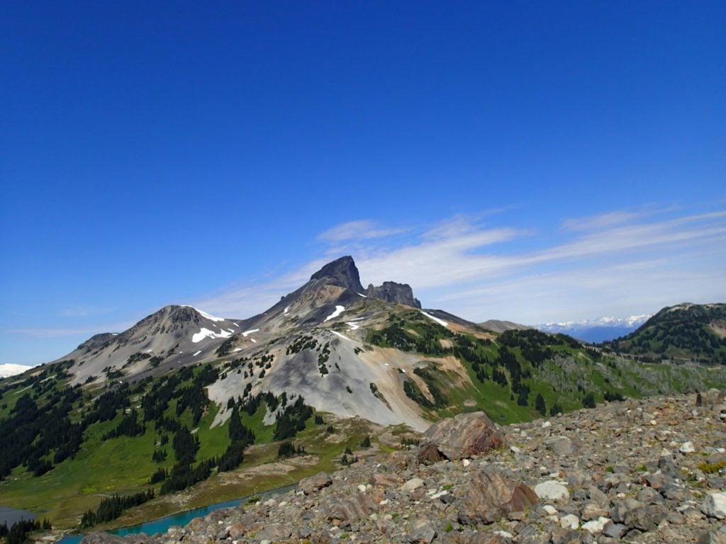
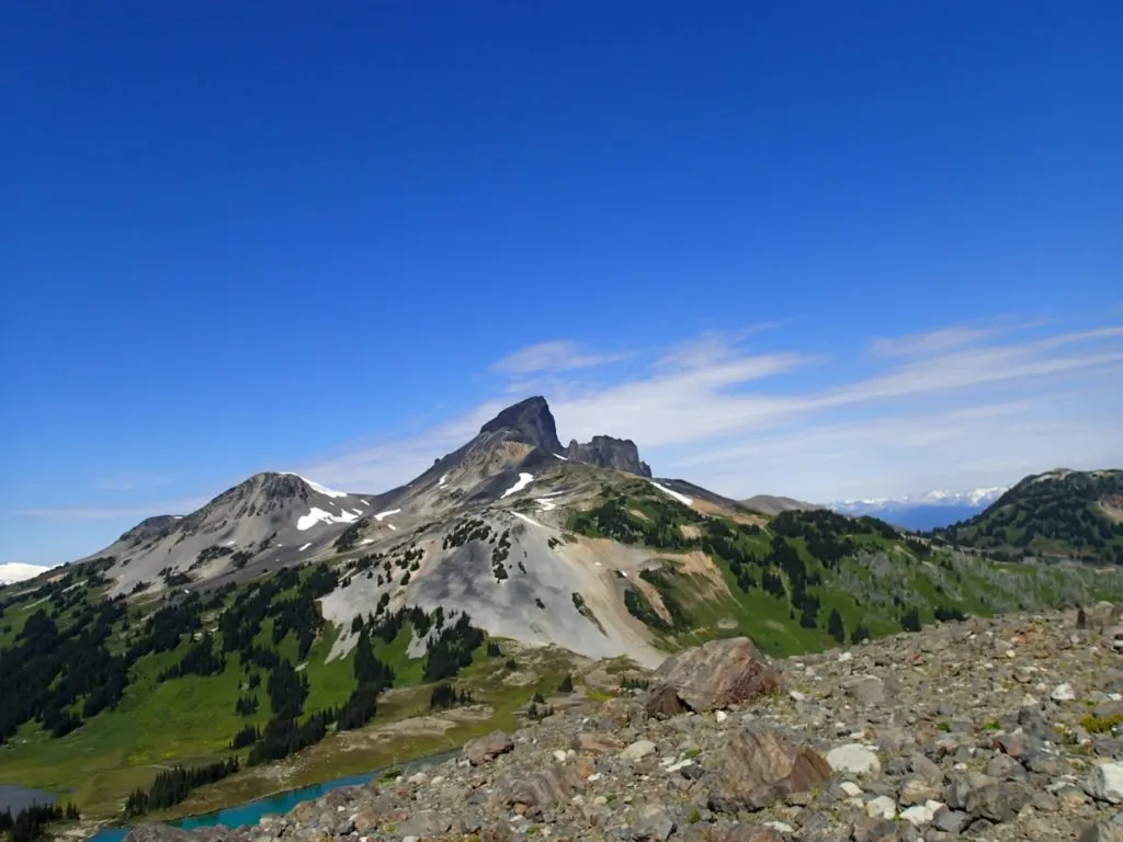
Heads up: Day passes are required at Garibaldi Provincial Park in summer 2023. Learn more in my guide to BC Parks day passes.
Difficulty: Very Challenging
Elevation gain: 1740 m
Best time to go: July to September
More info: Vancouver Trails
Distance: 29 km round trip
Time needed: 11-12 hours
Dogs: Not allowed.
Black Tusk is made of hardened lava from an extinct volcano. You can hike to the base of the Tusk, but only experienced rock climbers should make the final sketchy scramble to the summit. Your route starts on the Garibaldi Lake Trail to Taylor Meadows, then ascends a rocky slope to the base of the Tusk where you get great views of Garibaldi Lake.
Backcountry camping: There are backcountry campsites at Garibaldi Lake and Taylor Meadows, which you will pass on the way. You can book a stay at either through BC Parks. For details on camping and day hikes you can do from the campground, see my book, Backpacking in Southwestern British Columbia.
Getting there: The trailhead is located on Daisy Lake Road, accessed from the east side of Highway 99 33 km north of Squamish. Click here for driving directions.
Join the Backpacking in BC Facebook Group
Panorama Ridge
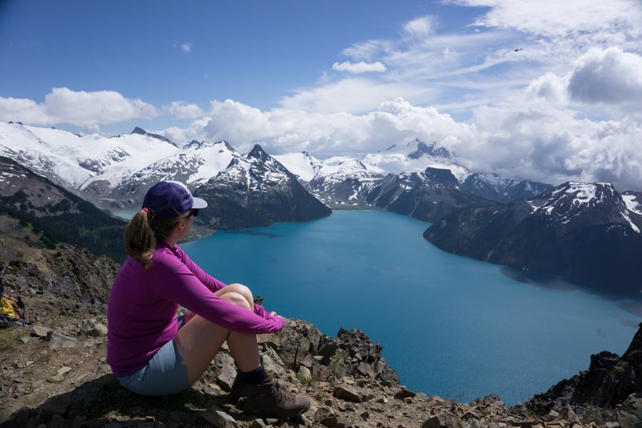
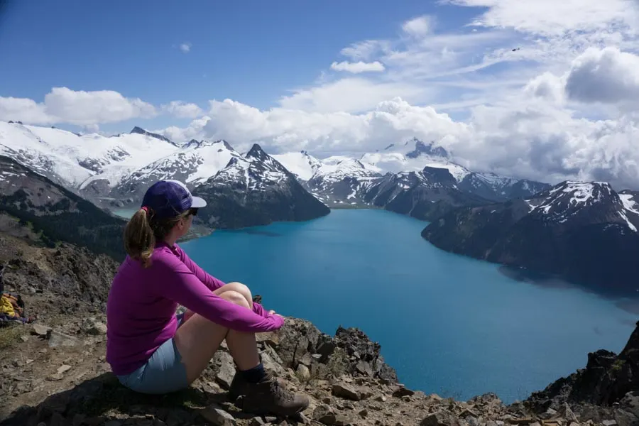
Heads up: Day passes are required at Garibaldi Provincial Park in summer 2023. Learn more in my guide to BC Parks day passes.
Difficulty: Very challenging
Elevation gain: 1520 m
Best time to go: July to September
More info: Vancouver Trails
Distance: 30 km round trip
Time needed: 11-12 hours
Dogs: Not allowed
Panorama Ridge is one of my favourite trails and one of my picks for the best hikes near Vancouver. It’s a long day on the trails, but the views from the summit are truly incredible. Your hike starts on the Garibaldi Lake Trail, then goes through Taylor Meadows and past the turnoff to Black Tusk. Ascend the slopes of Panorama Ridge for mind-blowing 360-degree views.
Backcountry camping: There are backcountry campsites at Garibaldi Lake and Taylor Meadows, which you will pass on the way. You can book a stay at either through BC Parks. For details on camping and day hikes you can do from the campground, see my book, Backpacking in Southwestern British Columbia.
Getting there: The trailhead is located on Daisy Lake Road, accessed from the east side of Highway 99 33 km north of Squamish. Click here for driving directions.
Get My Book…
Backpacking in Southwestern British Columbia
A one-stop resource for backpackers in beautiful British Columbia.
- 40 backpacking trips within a few hours of Vancouver
- Info about permits, reservations, and campground facilities
- Detailed maps and photos
- Advice for extending your trip
- Points of cultural and natural history
Brandywine Falls

Difficulty: Easy
Elevation gain: none
Best time to go: April to November
More info: My Brandywine Falls trail guide
Distance: 1 km round trip
Time needed: 30 minutes
Dogs: Allowed on-leash
This short and easy hike heads to one of the area’s most spectacular waterfalls: Brandywine Falls. It plummets 70 meters down volcanic basalt cliffs into the canyon far below. You can get a great view of the falls from a viewing platform and it’s one of the best easy hikes in Squamish. It’s also part of the much longer Sea to Sky Trail.
Getting there: The parking lot is located on the east side of Highway 99 about 40 km north of Squamish. Click here for driving directions.
Cheakamus Bungee Bridge Loop
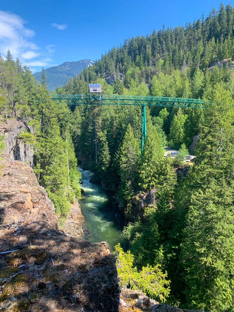

Difficulty: Moderate
Elevation gain: 45 m
Best time to go: April to November
More info: My Brandywine Falls trail guide
Distance: 9 km loop
Time needed: 2.5-3.5 hours
Dogs: Allowed on-leash
Many people don’t realize there are lots of trails at Brandywine Falls Provincial Park. You can connect the Sea to Sky Trail and Lava Lake Trail to make a big loop that visits the bungee bridge, a suspension bridge, and lots of little lakes.
Getting there: The parking lot is located on the east side of Highway 99 about 40 km north of Squamish. Click here for driving directions.
With over 20 trails to choose from, I’m sure you’ll find a Squamish hike on this list that you will love. Do you have other suggestions for the best hikes in Squamish? Tell me in the comments.
READ NEXT:
- BC Parks Day Passes 2023 – Everything You Need to Know
- The Best Hikes in Whistler: A Guide to All the Trails
- Camping in Squamish, BC: 22 Places to Camp Near Squamish
- Where to Go Snowshoeing in Squamish
- 70+ Things to Do in Squamish
- Sea to Sky Highway Road Trip Guide: Driving from Vancouver to Whistler
- Sea to Sky Trail from Squamish to Pemberton


- Best Sun Hoodies for Hiking - June 3, 2026
- Lower Stein Valley Trail Hiking and Backpacking Guide - May 27, 2026
- The Best Things to Do in Vernon, BC - May 21, 2026