

The High Falls Creek Trail is a great mini-adventure of a hike. It has gorgeous waterfalls in a steep canyon, mountain views, and the exhilaration of scrambling up some fixed ropes.
While the scrambling sections make the trail a bit of an adventure, it’s doable for most hikers. And since this is a loop hike, you don’t have to go back down the scary scramble sections. Instead, you’ll walk down a logging road that could be boring but actually has great views most of the way.
High Falls Creek is one of my favourite hikes in Squamish – I try to hike every year or two. In this guide, I’ve got everything you need to know to hike the High Falls Creek Trail. It includes:
- Trail stats including how long it takes, difficulty, best time to go, and more
- Tips for hiking to High Falls Creek including what to pack and how to prep
- Trail map that shows all the key locations I mention in this post
- How to get to the High Falls Creek Trail – detailed logging road driving directions
- Step-by-step hiking directions so you know what to expect
This is a sensitive wilderness area. Learn how to Leave No Trace to keep the wilderness wild. Make sure you are prepared by bringing the 10 Essentials. Get ready for adventure with this checklist of things to do before every hike.
Hey there: Some of the links in this post are affiliate links, which means I earn a small commission at no cost to you. Thanks for your support. -Taryn
High Falls Creek Trail Stats
Here are the basic stats that you need to know about hiking the High Falls Creek Trail in Squamish, BC:
Location: The High Falls Creek Trail is located off the Squamish River Forest Service Road west of Squamish.
Duration: 3-4.5 hours
Distance: 8.3 km loop (although if you track it yourself the canyon walls will cause your GPS signal to bounce around a lot so your GPS track will be about 10 or 11 km)
Difficulty: Moderate/Challenging
Elevation Change: 525 m of elevation gain
Best Time to Go: April to November when the trail is snow-free. Pick a clear day to enjoy the views. Avoid wet weather which will make the trail slippery and dangerous.
Toilets: There are no toilets on the trail or anywhere nearby. Brush up on your Leave No Trace bathroom skills: Bring a trowel to dig a cat hole well off the trail to bury your waste. Pack out your used toilet paper.
Drinking Water: There is no access to water on the trail: Pack all the drinking water you will need. While you are hiking in a creek canyon, the water is not accessible.
Dogs: Dogs are allowed on this trail but due to the steep terrain, roped sections, and sheer drop-offs, this might not be the best trail to bring dogs. You would likely have to carry them in some areas.
Bears: This area has both black bears and grizzly bears. Hike in a group, make noise, and carry bear spray.
Indigenous Context: The High Falls Creek Trail is in the traditional territory of the Skwxwu7mesh (Squamish) Nation. To learn more about Skwxwu7mesh history and culture, visit the Squamish Lil’wat Cultural Centre.

Tips for the High Falls Creek Hike
- Check the weather before you go. City weather forecasts are useless in the backcountry. Use an algorithmic spot forecast for High Falls Creek like Spotwx. (Read my guide to weather apps for hikers for more tips.)
- Check trail conditions online using AllTrails or Instagram. This is especially important in the spring or fall when the trail can be icy or snowy.
- Bring a rain jacket and warm clothing just in case. It can be much colder, windier, and rainier in the mountains than in the city.
- Wear trail running shoes or hiking boots. The trail is rocky and loose in places. Regular running shoes don’t have enough grip or ankle support.
- Bring the 10 Essentials. These are key safety items you should have on every hike.
- Pack out all your garbage. There are no garbage cans here so you must take your garbage home with you. Leaving it on the trails attracts animals.
- Be Bear aware: There are black bears and grizzly bears in this area. Hike in a group, make noise, and carry bear spray. Read my bear safety tips for more info.
- Be ready for steep terrain: If you have a fear of heights, this trail will challenge you. There are lots of areas with steep drop-offs near the trail. And you have to climb up some fixed ropes and scrambly slopes. Since it is a loop, most people (even those who hate heights) are ok going up the steep parts since they know they don’t have to go back down. The first roped parts are the scariest – if you can get up those, you’ll do fine on the rest of the trail.

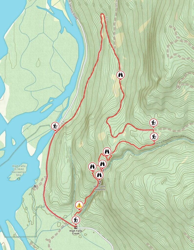
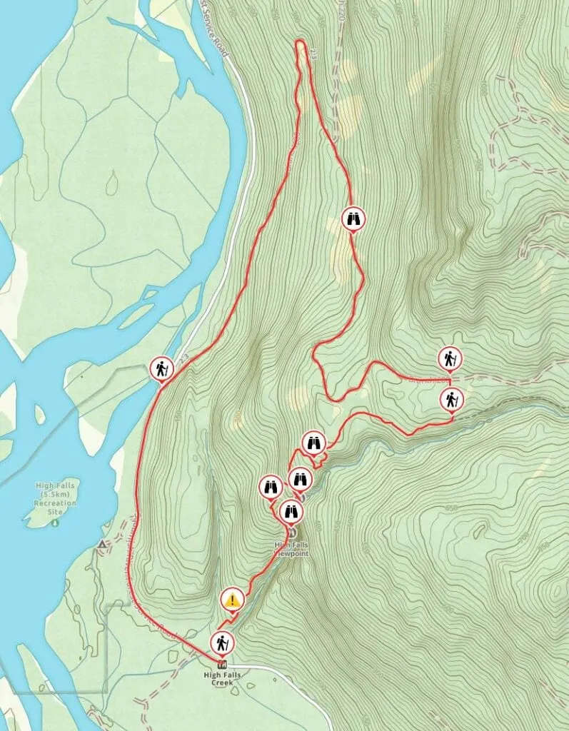
High Falls Creek Trail Map
Some sections of this trail don’t have very many trail markers and it is easy to get confused when the trail braids. I recommend using a GPS mapping app like All Trails+ or Gaia GPS to stay on track. The trailhead is also not that obvious, and All Trails+ can help with that too.
I made a map of the High Falls Creek Trail for you using Gaia GPS. Click through to zoom in (and download the GPX track).
High Falls Creek Driving Directions
The trailhead is about 1 hour and 45 minutes from Vancouver and about 45 minutes from Squamish. There is no public transportation to the trailhead so you will need to drive yourself. The last section of the drive is on a gravel road that is bumpy, but suitable for all vehicles. You’ll be fine in any 2WD vehicle.
Here are step-by-step driving directions to the High Falls Creek trailhead:
- From Vancouver go west on Highway 1, then switch to Highway 99 north. Drive through the communities of Lions Bay, Furry Creek, Britannia Beach and Squamish.
- Just after leaving Squamish, go left onto Squamish Valley Road at the flashing light. (The turn-off to Alice Lake Road is on the other side of the highway.)
- Follow Squamish Valley Road for a few minutes to the bridge over the Cheakamus River. On the other side, keep left at the fork to stay on Squamish Valley Road.
- Follow the road through lots of twists and turns. About 19 km after the fork, the road becomes gravel and switches names to become the Squamish River Forest Service Road.
- Continue on the Squamish River FSR. Drive past the Cheakamus Generating Station about 3.5 km from the end of the pavement. The trailhead and parking area about about 1 km further, just after a small bridge over a branch of High Falls Creek. (If you go over a second bridge, you’ve gone too far.)
Here are Google Maps driving directions. However, you will lose cell service a few minutes after leaving the highway. I recommend using All Trails+ or Gaia GPS for navigation.
Parking
The trailhead is on the right side and is marked with a small sign that can be easy to miss. There is room for a few cars to park in a pull-out at the trailhead and a few more at a pull-out on the other side of the road.
There are also several other pull-outs back the way you came. You can also parallel park on the side of the road, but be sure to pull over as far as you can.
High Falls Creek Hiking Directions
There are three main parts to the High Falls Creek Trail: the canyon (1.5 km), the forest (1.1 km), and the road walk (5.7 km).
High Falls Creek is usually hiked as a loop since the canyon section of the trail is so steep that descending it can be scary and even dangerous. While the road walk section is long and a bit tedious, it does have great views. And it’s much more enjoyable and safe than making an out-and-back hike that descends back through the canyon.
Key Distances
| Location | Distance | Elevation |
|---|---|---|
| Trailhead | 0 km | 60 m |
| Ropes | 0.3 km | 85 m |
| Lower Falls Viewpoint | 0.75 km | 275 m |
| First Valley Viewpoint | 0.9 km | 300 m |
| Upper Falls Viewpoint | 1.1 km | 365 m |
| Second Valley Viewpoint | 1.5 km | 440 m |
| Junction | 2.4 km | 545 m |
| Join Branch 200 FSR | 2.6 km | 585 m |
| Branch 220 FSR Junction | 4.6 km | 315 m |
| Join Squamish River FSR | 6.85 km | 55 m |
| Trailhead | 8.3 km | 60 m |
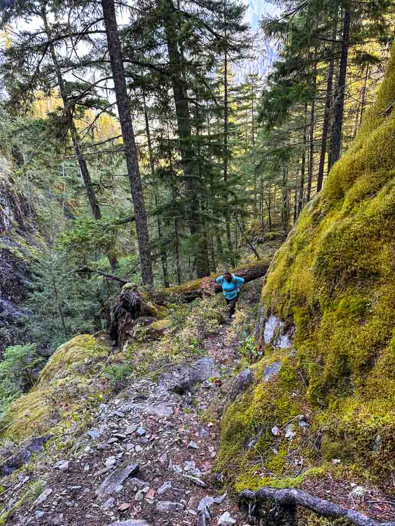
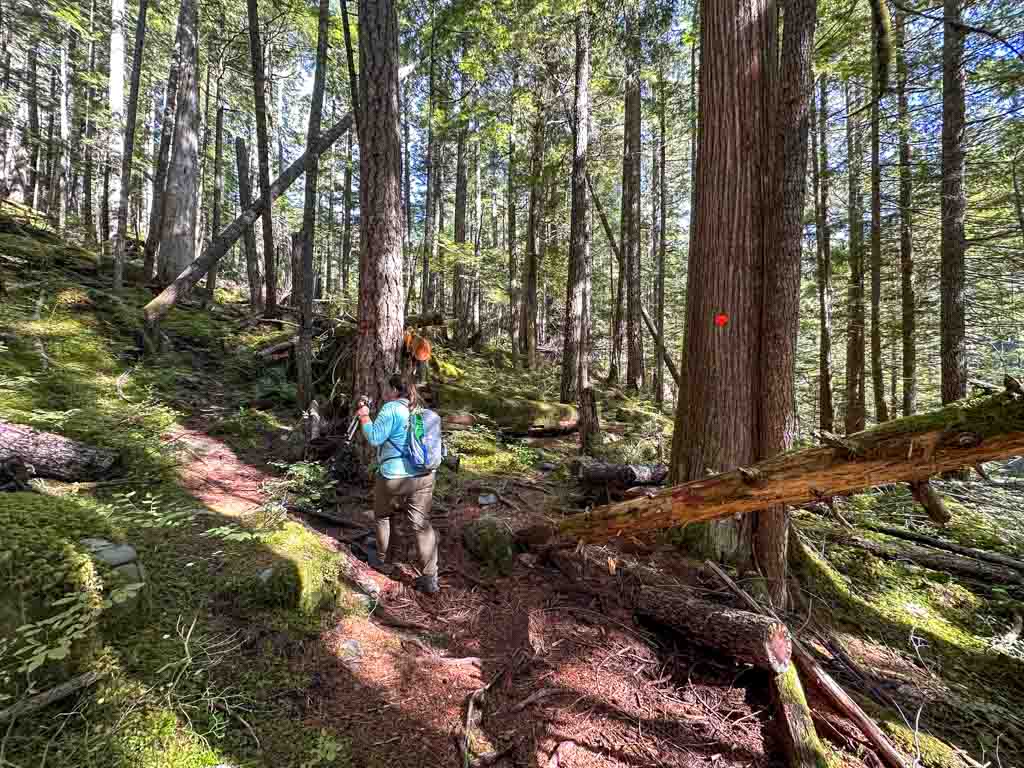
Canyon Section
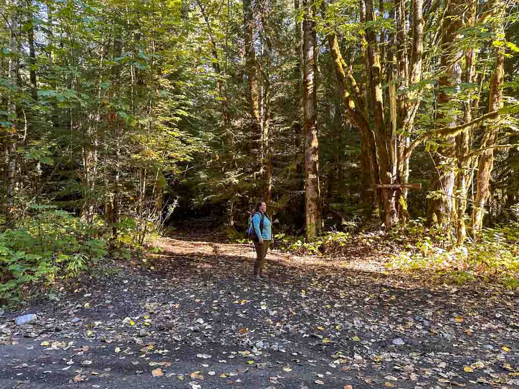
The trail begins as a wide path through the forest. But within the first minute, it narrows and crosses a bridge over High Falls Creek. Soon after the flat section ends.
Follow trail markers steeply up a series of rocky bluffs. There are fixed ropes and chains to help you up. This is the steepest section of the entire trail and can be daunting for those with a fear of heights. However, there is no real exposure. Take your time and climb carefully.
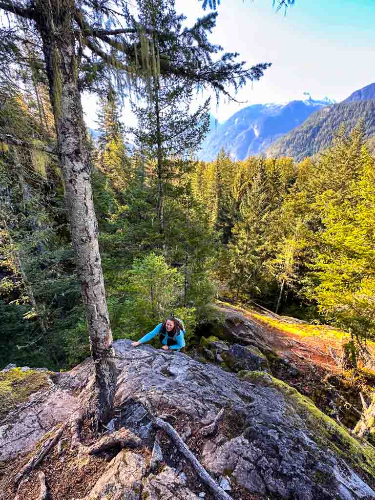
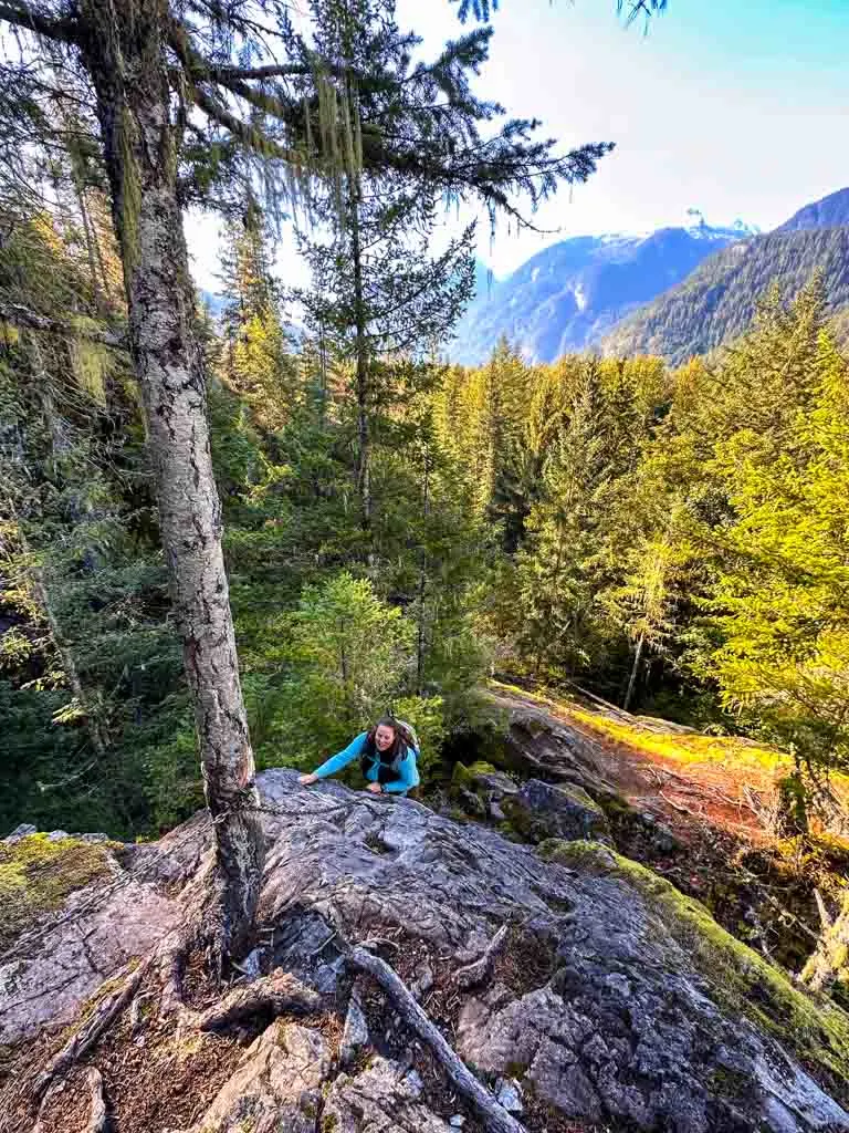
Continue following the steep trail upwards parallel to the canyon. There are a few more scrambly sections with more ropes and chains to assist you. In a few places the trail braids – choose the widest, most trodden path to stay on track.

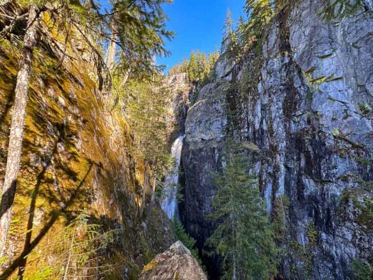
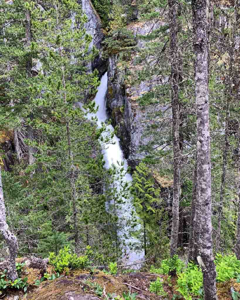
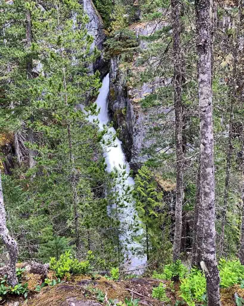
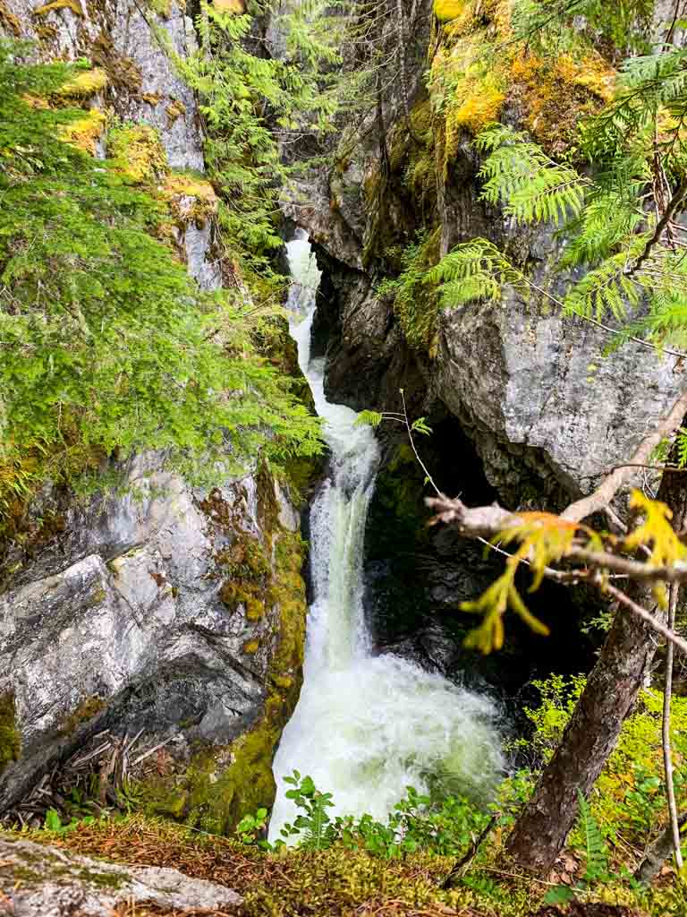
There are also a few faint spur trails to the right with views of the canyon. Most of the views are obscured by trees or the sheer steepness of the drop, but you can get some views of the waterfall that gives the creek its name. Be careful near the edges as a slip would be fatal.
About 0.75 km from the trailhead, watch for an obvious spur trail to the right. This leads to the main view of the falls. You can look along the length of the canyon to see the falls shooting off a ledge.

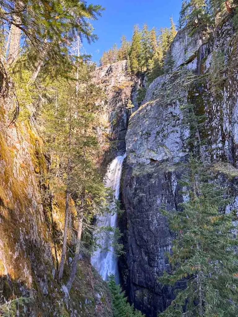
Continue along the trail as it stays beside the edge of the canyon and climbs up more cables. You will get more views of the falls through the trees here, but the growth prevents you from getting a clear view.
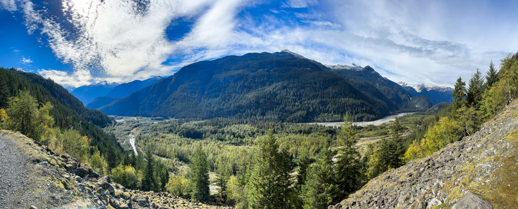
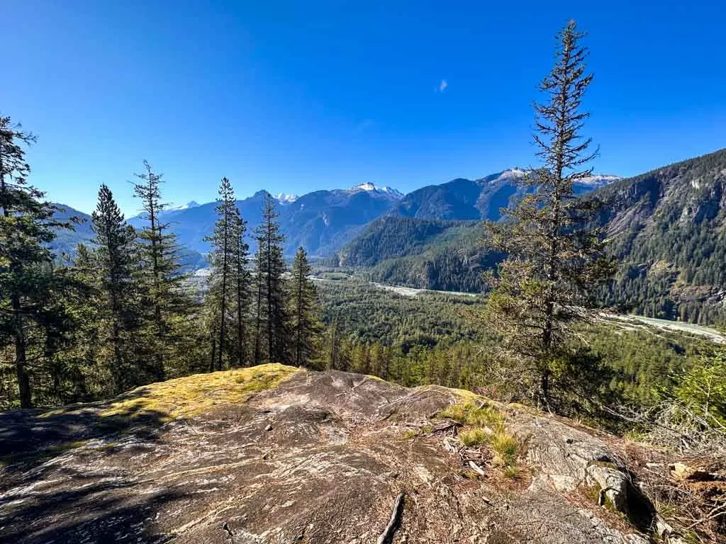
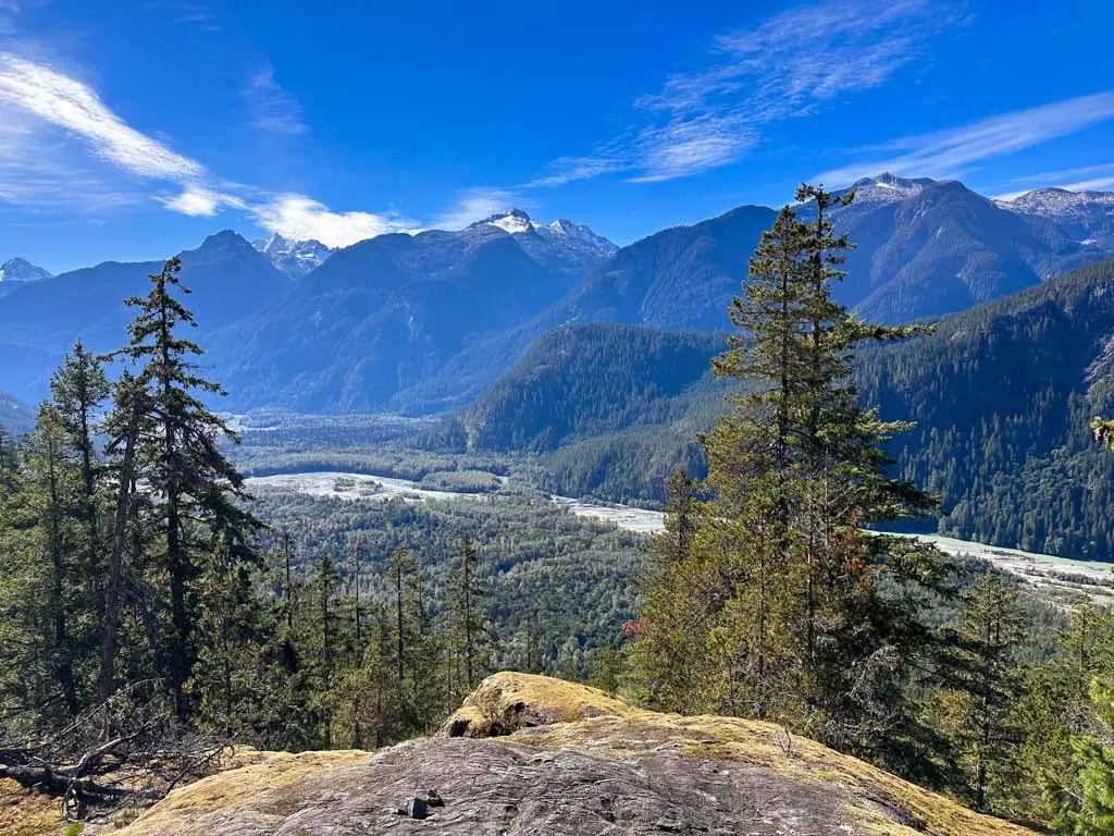
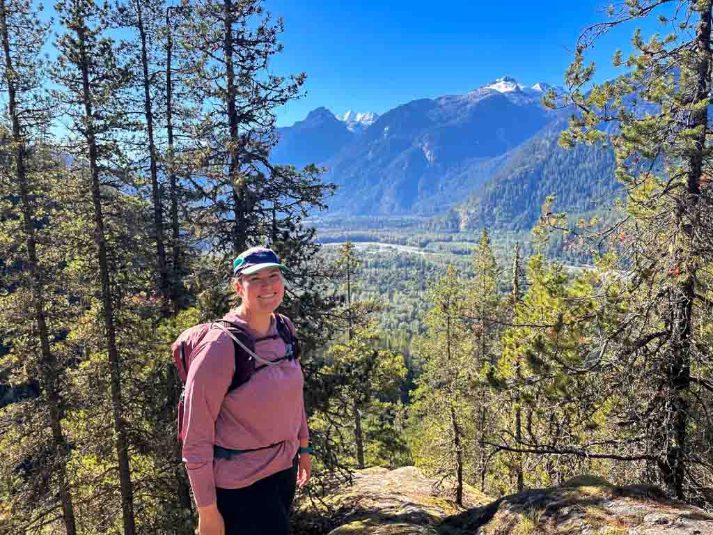
Be sure to follow a trail to the left to a great viewpoint on a rock slab for great views of the Squamish Valley and the Tantalus Mountains on the other side. You can also see Crooked Falls on the other side of the river.

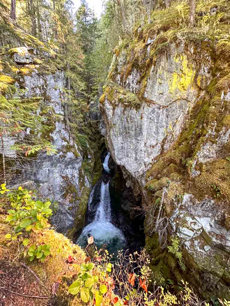
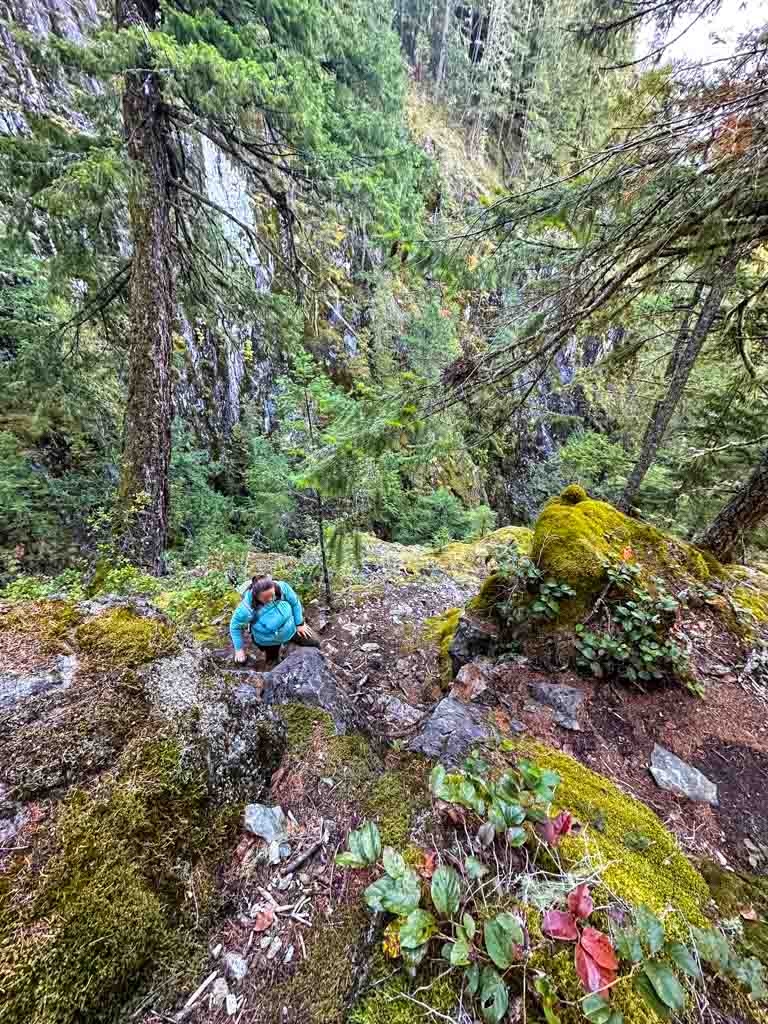
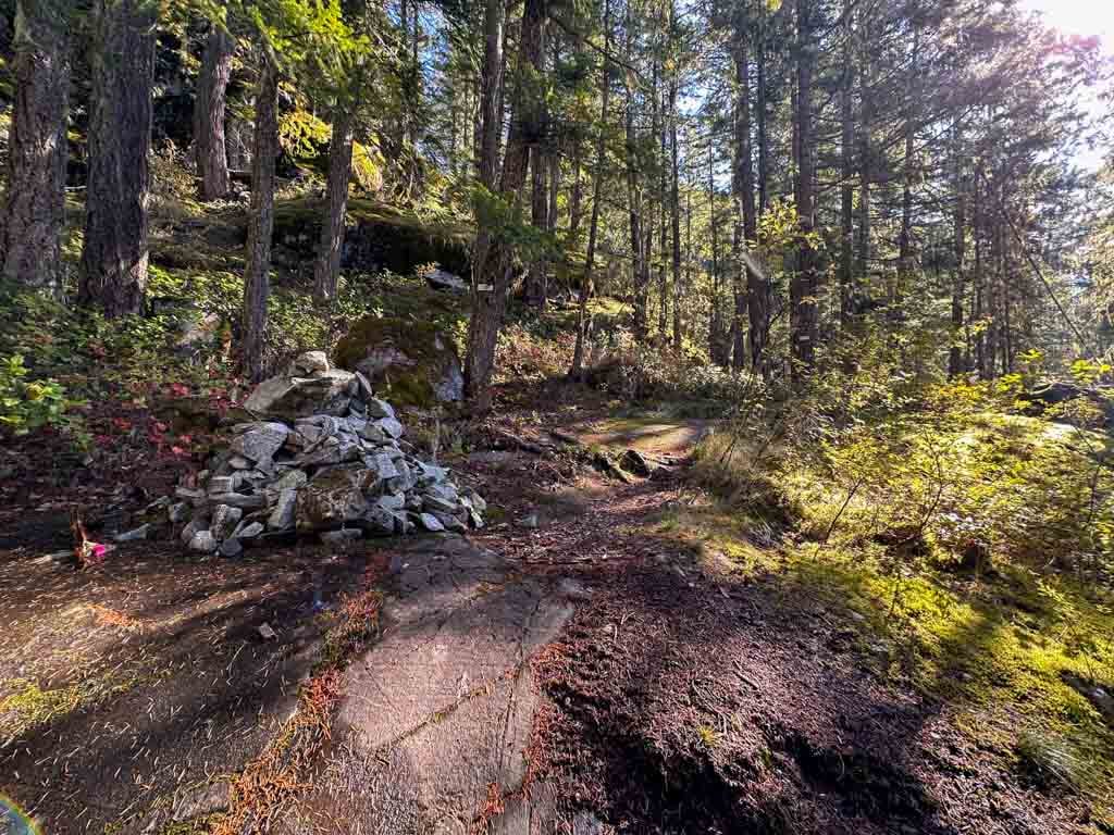
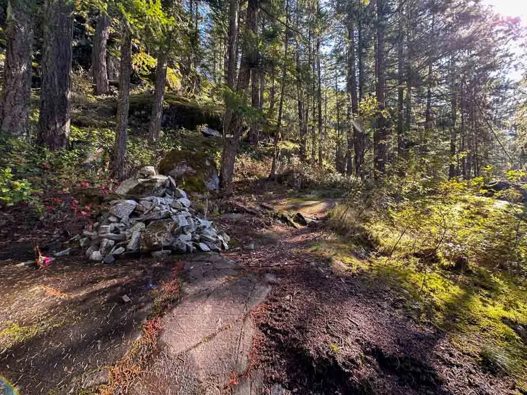
Keep climbing uphill through the forest and patches of rock slabs. Reach a large rock cairn that marks a junction. Go right for a few minutes to reach the Upper Falls viewpoint. You can look down into the pool at the top of High Falls Creek Falls and upstream to a smaller waterfall just above the main falls.

Retrace your steps back to the cairn and stay on the trail as it continues uphill with the help of another rope. Reach another scenic viewpoint on a rocky outcrop 1.5 km from the trailhead.

Forest Section
Follow the trail up a rock slab and into the forest. You have finished most of the climbing. Stay on the trail (marked with orange squares) as it meanders through old-growth forest. Watch for several gorgeous large Western red cedars and Douglas firs. There are also lots of mushrooms in fall.
Reach a junction 2.4 km from the trailhead and turn left. This is a short-cut up to your return route on the road. The original High Falls Creek Trail continues for another kilometre through the forest, but the scenery is similar and not worth hiking. These days most people take the shortcut so the original route is not very well travelled.
Follow the shortcut trail uphill through the forest for a few minutes until you pop out on a gravel road.
Road Section
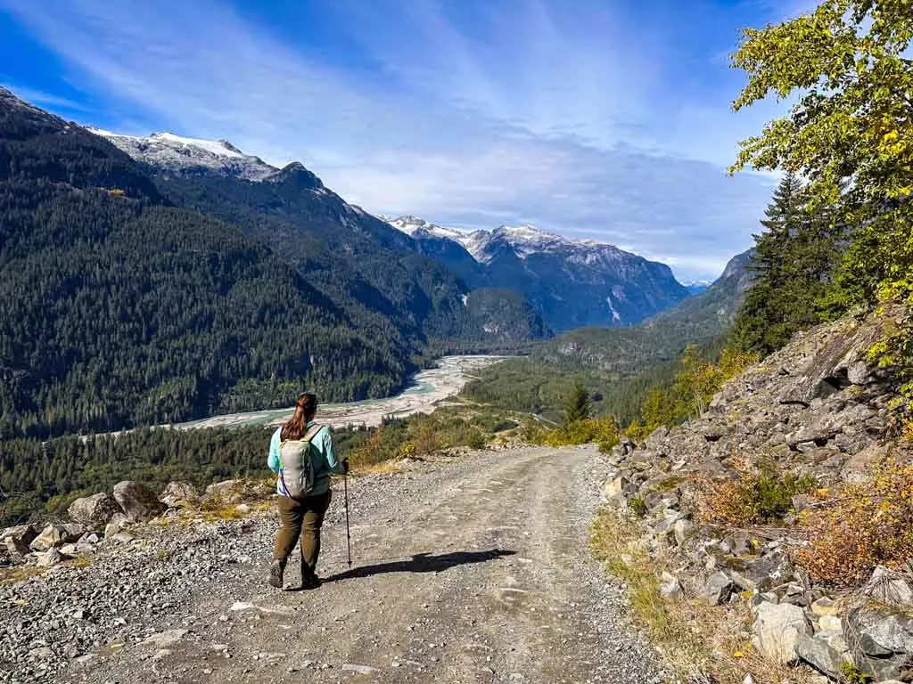
The remainder of your hike is on gravel forest roads. While the road walking is fairly boring, there are some great views, so it’s worth it. In places the road is steep and loose, but for the most part, it is easy walking.
From the spot where the shortcut trail meets the road, turn left and follow the road downhill through regenerating forest. You are on Branch 200 FSR which sees a little bit of vehicle traffic from hikers and 4x4ers heading to the Tricouni Peak and Cloudburst Peak areas. Listen for vehicles approaching and get out of the way.
About 4 km from the trailhead the road emerges into a talus field. There are great views in this section as you look north down the Squamish River Valley to the glaciers around Icecap Peak.

Ignore Branch 220 going uphill to the right at 4.6 km and continue downhill on Branch 200 as it goes around a hairpin curve. Reach the junction with the Squamish River FSR about 6.8 km from the trailhead.
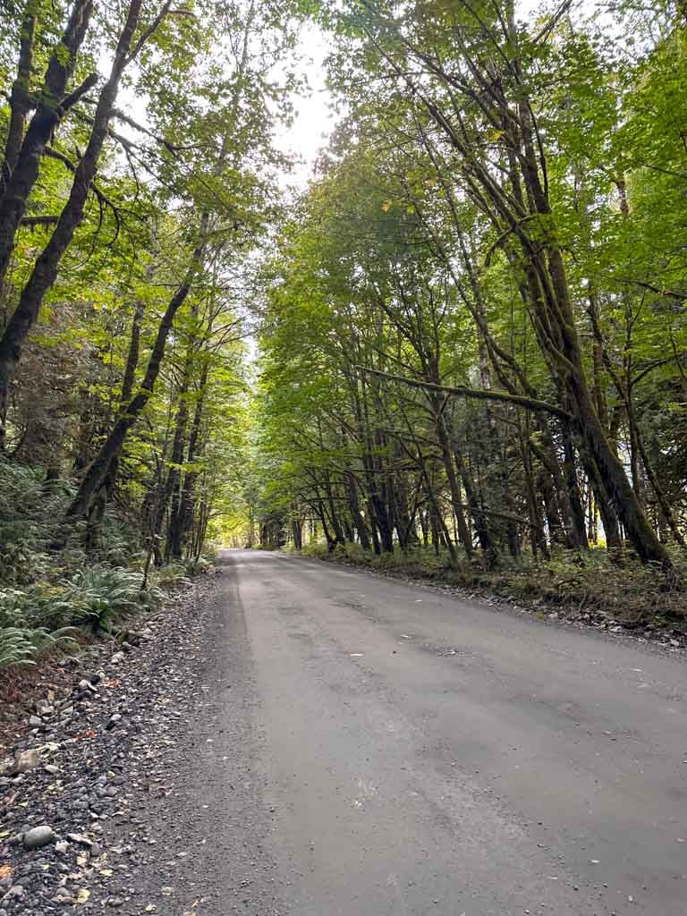
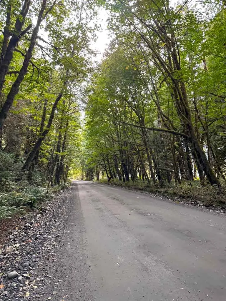
Turn left and walk along the alder and big leaf maple-lined Squamish River FSR for about 1.5 km back to the trailhead. This road sees a lot more traffic, so be sure to walk on the left facing traffic and stay well to the side. This part of the road can flood during the spring melt or fall storms and is dusty in summer.
You’ll pass the entrance to the High Falls Recreation Site campground halfway between the end of Branch 200 and the trailhead. If you want to go down to the river, walk through the campground and onto the river bank for another great view. (Psst! This campground is on my list of places to camp in Squamish.)
Arrive back at the trailhead and your vehicle about 8.3 km from your start to finish the High Falls Creek Trail loop.
The High Falls Creek Trail is one of my favourite Squamish hikes for spring or fall days when I want great views and a bit of an adventure. If you’ve got any questions about the trail, ask me in the comments.
READ NEXT:
- The Best Hikes in Squamish, BC (From a Local)
- Camping in Squamish, BC: 22 Places to Camp Near Squamish
- 70+ Things to do in Squamish (By a Local)
- Hike to Crooked Falls in Squamish


- Best Sun Hoodies for Hiking - June 3, 2026
- Lower Stein Valley Trail Hiking and Backpacking Guide - May 27, 2026
- The Best Things to Do in Vernon, BC - May 21, 2026