
As a Squamish local, I’ve done the Brohm Lake hike tons of times in all seasons. It’s a great easy hike around the lake. But to get to the best parts, you have to hike up to the viewpoints. That’s why Brohm Lake is one of my picks for the best hikes in Squamish.
Since I’ve hiked all the trails in the park (not just the easy route around the lake) I’ve put together a complete Brohm Lake hiking guide for you.
It includes everything you need to know about visiting Brohm Lake. I’ve also got step-by-step directions for my recommended loop hike – it visits three gorgeous viewpoints that many people miss.
This Brohm Lake hiking guide includes:
- Key trail stats for the hikes at Brohm Lake
- A Brohm Lake map
- Driving directions to three parking areas – including two that most people don’t know about
- An overview of all the main trails at Brohm Lake
- My recommended Brohm Lake hiking route that hits all the highlights
- A Brohm Lake FAQ that answers all your questions about the park
Psst! Looking for more Squamish activities? Check out my huge list of things to do in Squamish – it includes over 70 ideas!
This is a sensitive wilderness area. Learn how to Leave No Trace to keep the wilderness wild. Make sure you are prepared by bringing the 10 Essentials. Get ready for adventure with this checklist of things to do before every hike.
Brohm Lake Basics
Brohm Lake is a popular place for hiking, swimming, and paddleboarding just north of Squamish. The park is called Brohm Lake Day-use Recreation Site, but it is also known as the Brohm Lake Interpretive Forest. The park is managed by Recreation Sites and Trails BC.
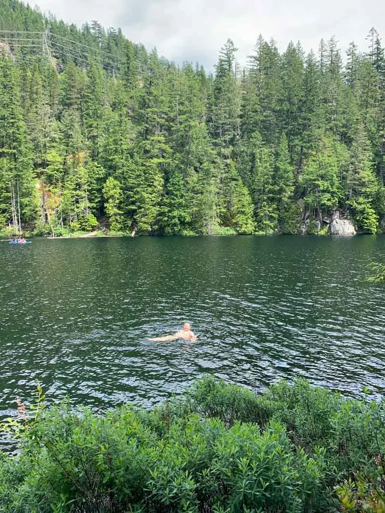
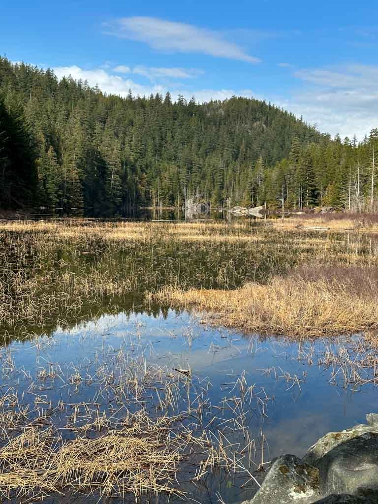
Swimming: While it looks marshy from the highway, the lake is actually deep and clear further back. Brohm Lake is great for swimming. There is no real beach on the 1 km-long lake, but there are lots of rock outcroppings that make getting into the water easy. However, you’ll have to hike around the lake to get to them.

Cliff jumping and rope swings: Cliff jumping is also popular in a few places around the lake. The cliffs are up to 12 meters (40 ft) high, so use caution. Check the water first to make sure your landing zone is clear. Sometimes there are rope swings set up, but the park staff often dismantle them as they can be dangerous.
Paddling: If you have a canoe, kayak, or SUP, Brohm Lake is a great place to paddle. It’s a short walk from the parking lot downhill to the launching area.
Indigenous context: The trail is located on the traditional territory of the Sḵwx̱wú7mesh Úxwumixw (Squamish). To learn more about the Indigenous context of the area, visit the Squamish Lil’wat Cultural Centre in Whistler. Online resources include the Squamish Nation website and the Squamish Atlas.
Hiking: Since most people come here for hiking, the rest of this post will focus on how to hike at Brohm Lake.
Brohm Lake Trail Stats
Distance: The park has 19 km of trails. Most visitors will want to do a 4 km loop around the lake or a 8 km loop that includes the lake plus a few viewpoints. See the hiking directions section for details on route options.
Elevation Gain: 30 to 340 m depending on route choice.
Duration: 1-3 hours depending on route choice.
Difficulty: Easy/Moderate depending on route choice.
Season: Year-round. (Bring spikes for ice and snow between December and February.)
Toilets: At the main parking area only.
Dogs: Allowed, but must be on a leash.
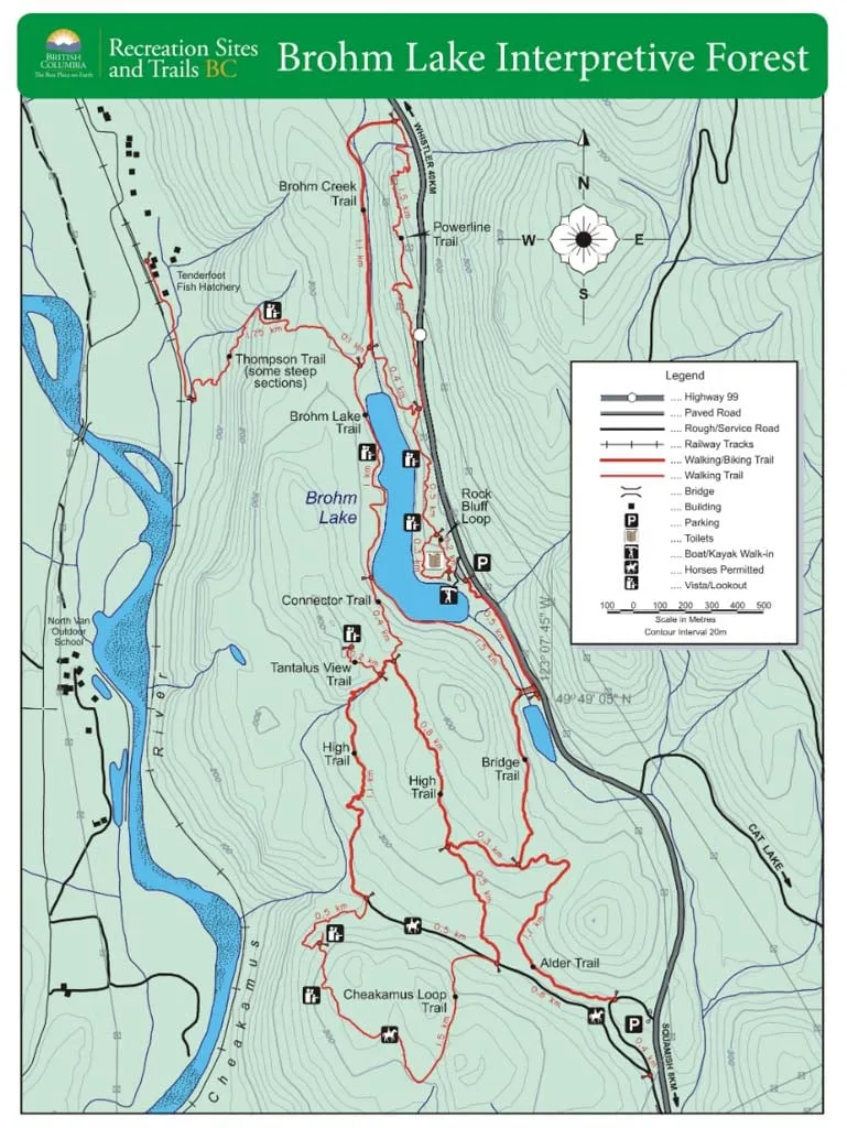
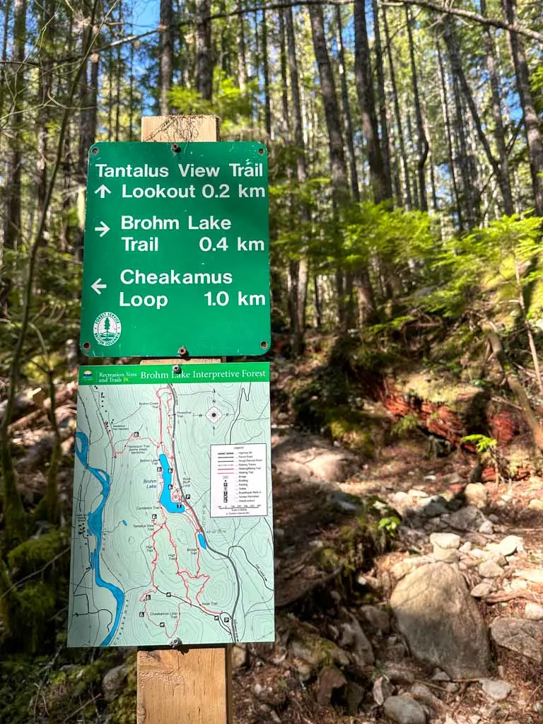
Brohm Lake Trail Map
The trails at have signs and maps at every junction, so it’s easy to see where you are. I’ve also added the Brohm Lake map to this post so you can plan your hike.


How to Get to Brohm Lake
There are three parking areas and trailheads for Brohm Lake. Most people park at the main parking on Highway 99. However, it is a small parking lot and fills fast on summer weekends.
The other trailheads are much less busy so it is easier to find parking. Do not park on the highway as you will get towed.
The map above has locations for all three trailheads. And keep reading for step-by-step driving directions to each one.
Brohm Lake Main Parking Lot Directions
If you put Brohm Lake into Google maps, this is where it will take you. The main parking area is next to the lake and has signs directing you to it from the highway.
To get to the main parking lot for Brohm Lake, take Highway 99 north from Vancouver to Squamish. Keep going north on Highway 99. About 5 km north of the turn-off to Alice Lake Park, turn left into the parking lot. There is a sign and a left turn lane here.
Click here for Google maps driving directions to the Brohm Lake main parking lot.
Brohm Lake South Parking Lot Directions
The south parking lot for Brohm Lake is right off the highway, but since it is far from the lake, it isn’t as popular. From this parking lot, it is a 2-kilometre hike to the Lake.
The south parking lot is located on the west side of the highway, and you can’t turn left to get into it if you are coming from Squamish. Instead, star by following the directions to the main parking lot above.
Once you have arrived at the main parking lot, do a U-turn, then turn right to go back towards Squamish on Highway 99. Watch carefully for a gravel parking lot on your right about 2 km later. This is the Brohm Lake south parking lot.
Click here for Google maps driving directions to the Brohm Lake south parking lot.
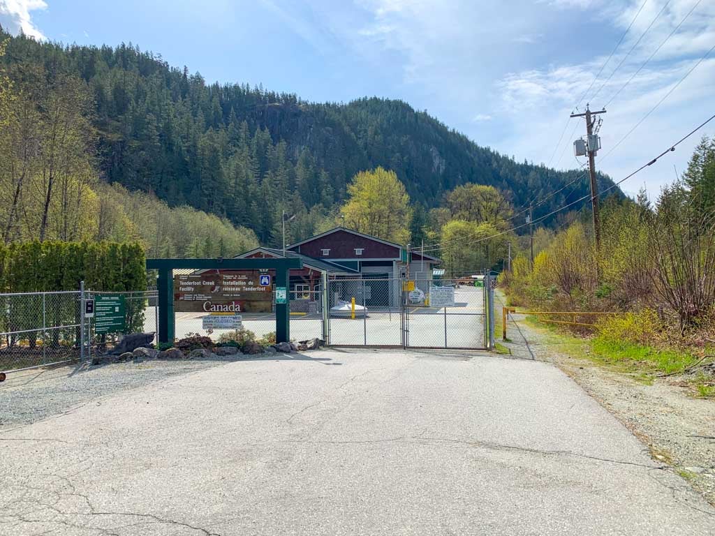
Tenderfoot Creek Hatchery Parking Lot Directions
An alternative access route to Brohm Lake is to park at the Tenderfoot Creek Hatchery in the Paradise Valley neighbourhood of Squamish. From there, it is a steep 2 km hike to the Lake via the Thompson Trail.
To get to this parking lot, take Highway 99 north from Vancouver to Squamish. Stay on Highway 99 through Squamish, then turn left at the flashing light onto Squamish Valley Road. (It’s across from the entrance to Alice Lake Provincial Park.)
Just after you cross the bridge over the Cheakamus River, take the right fork onto Paradise Valley Road.
Stay on Paradise Valley Road for 5 km, then turn right onto Midnight Way. Follow Midnight Way for a little over 1 km to the gate at the entrance to the Tenderfoot Creek Hatchery. Parallel park on the gravel shoulder and be careful not to block the hatchery gate or any private driveways.
Click here for Google Maps driving directions to the Tenderfoot Creek Hatchery trailhead.

Brohm Lake Hiking Options
With 19 kilometres of trails, there are lots of route options for hiking at Brohm Lake. Below I’ve got a brief overview of the main hikes in the park. Or skip to my recommended hiking route that includes all the highlights.
Brohm Lake Loop: An easy loop around the lake with some stairs. The loop is 4 km with 30 m elevation gain. Allow about a little over 1 hour.
Tantalus View Trail: A short and steep side trail that leaves from part way around the lake and heads to a bluff viewpoint and an old fire lookout. Adds 1.5 km round trip and 100 m to the Brohm Lake Loop. Allow 30-45 minutes for this detour.
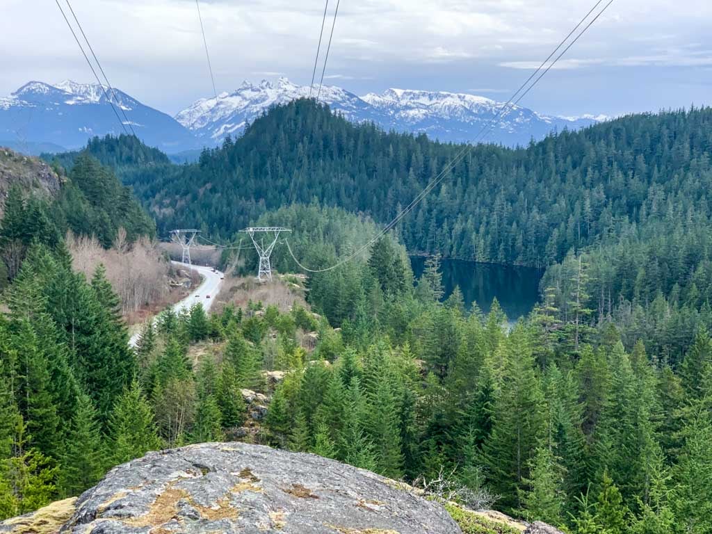
Cheakamus Loop: A loop on old logging roads to a spectacular cliff-top viewpoint overlooking the Cheakamus River. The loop is 2.5 km long with 80 m of elevation gain, but you’ll have to hike 1.2 km from the south parking lot or 2 km from the main parking lot to get to the start. Allow 45 minutes to 1 hour.
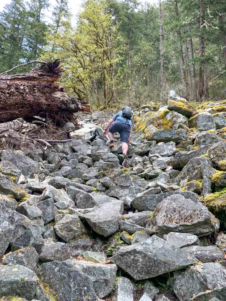
Thompson Trail: A steep trail through a rockslide that leads from the Tenderfoot Creek Hatchery to the north end of the Brohm Lake Loop. The trail is 1.75 km each way with 230 m of elevation gain. Allow 30 minutes to 1 hour uphill.

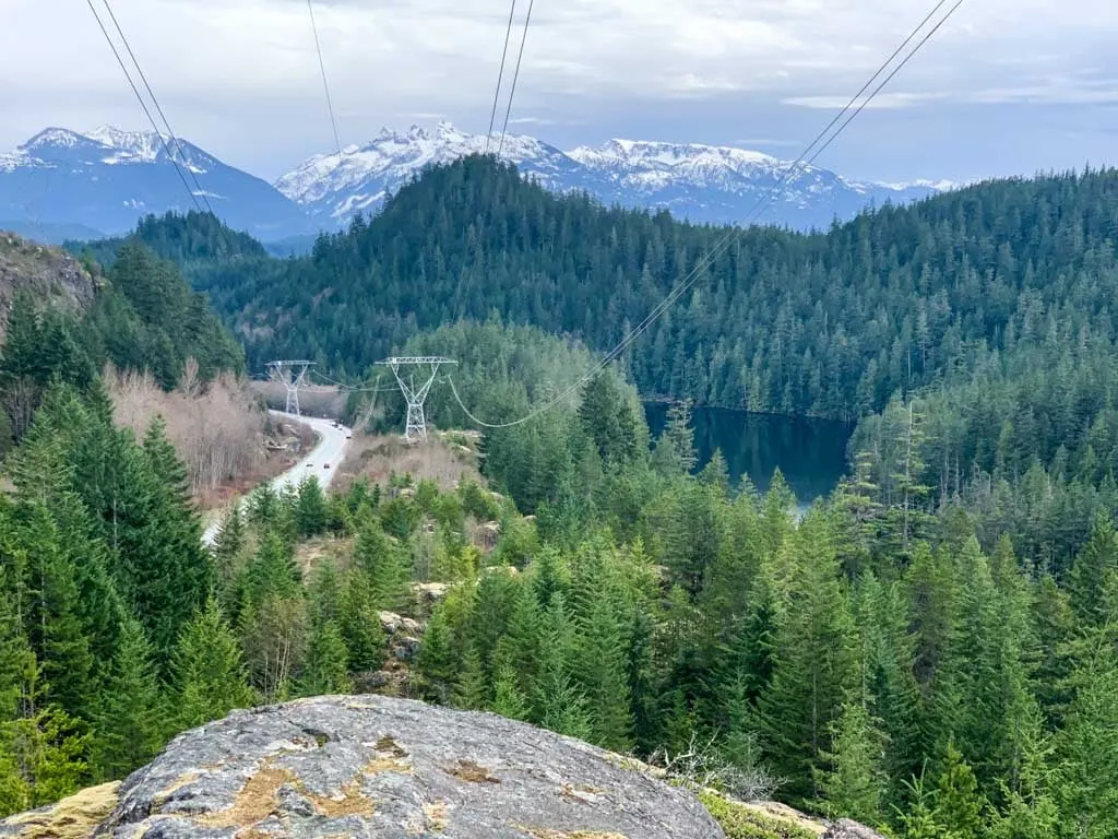
Brohm Creek/Powerline Loop: This loop branches off from the Brohm Lake Loop at the north end of the Lake. It can be overgrown in places. The first half follows Brohm Creek while the second half loops back across some rocky bluffs under the powerlines. The loop is 2.6 km long with 80 m of elevation gain. Allow 40 minutes to 1 hour.
My Recommended Brohm Lake Hiking Route
As a local, I’ve hiked at Brohm Lake more times than I can remember. This is the route that I recommend. It hits all the viewpoints and the best parts of the lake in a big loop route.
My recommended route is 8 km long and has 130 m of net elevation gain. However, the route has lots of small ups and downs, so your total elevation gain will be about 400 m. Allow 2-3 hours for this hike.
The route starts from the main parking lot. But you can also start it from the south parking lot or Tenderfoot Hatchery. I’ve got info at the bottom of this section about starting from those spots.
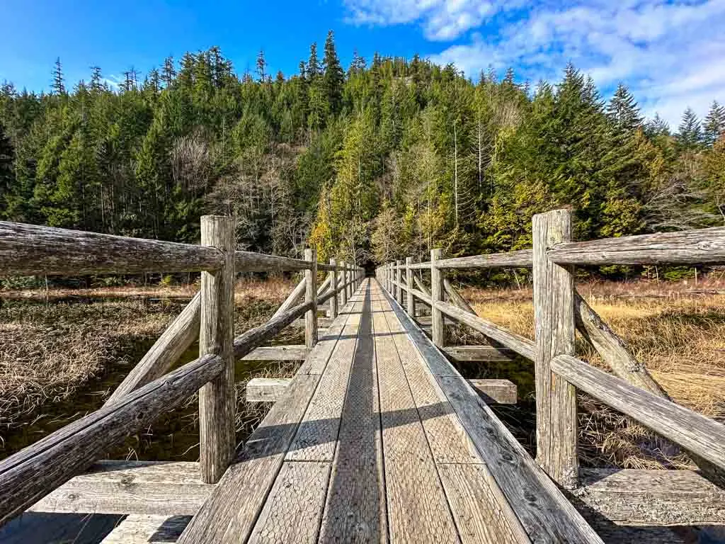
To start my recommended route, go south from the main parking lot on the Brohm Lake Loop Trail as it parallels the highway. Follow the trail across the big bridge at the south end of the lake. There are good views of the marshy end of the lake from here.


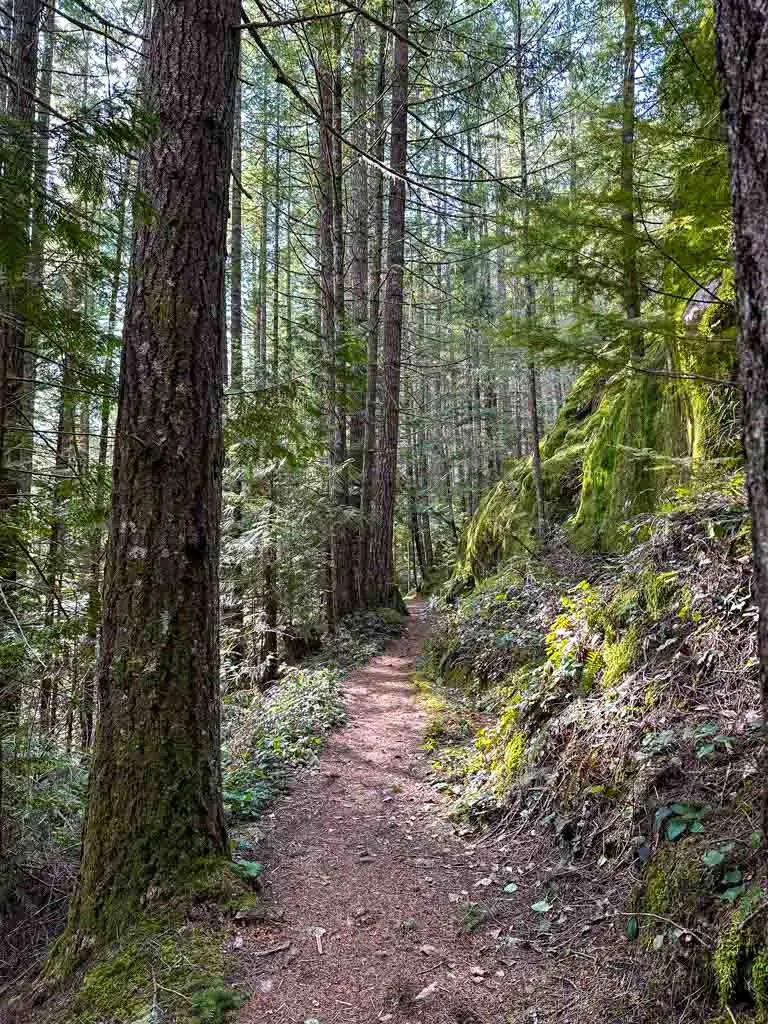
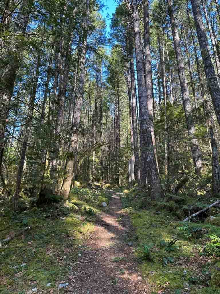
On the other side of the bridge, turn left onto the Bridge Trail and follow it gently uphill through a beautiful forest. A few minutes later, reach a junction with the Alder Trail. Go right to stay on the Bridge Trail.

Arrive at another junction 0.3 km later. This time, turn left to go downhill on the High Trail. The forest opens up as you arrive at a four-way intersection with an old logging road that is now a trail. Go straight across the intersection to join the Cheakamus Loop Trail.
Note: If you started from the south parking lot, there is where you will start my recommended route.
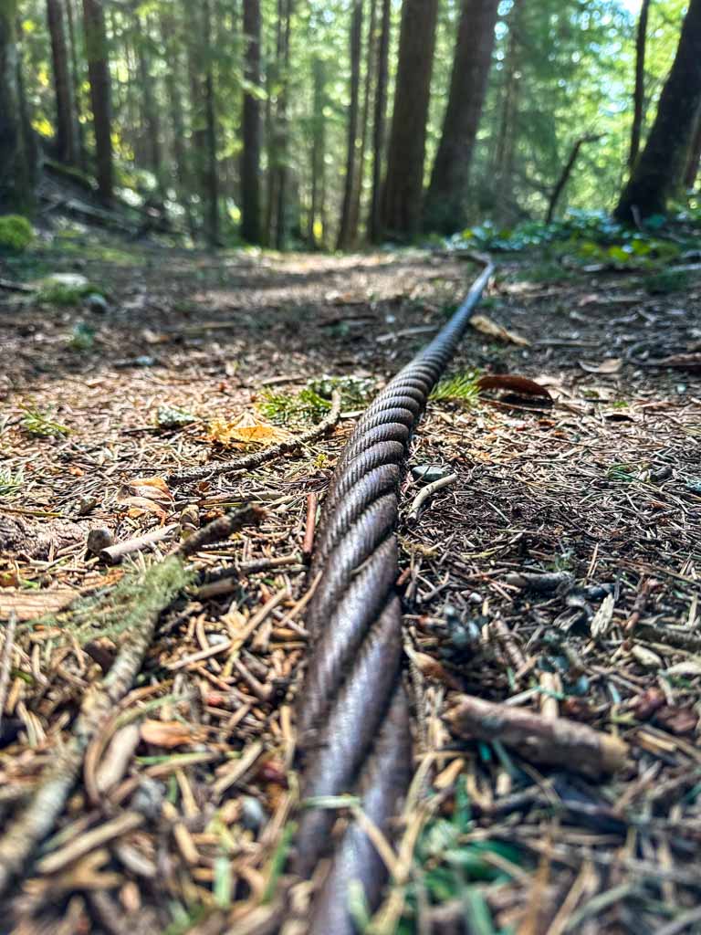
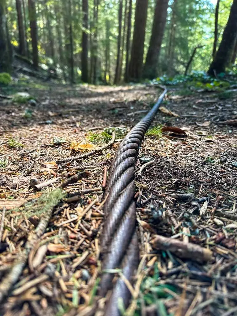
The Cheakamus Loop is another old logging road that climbs steeply uphill for a few minutes. However, it soon levels off and rambles through a beautiful salal forest. Keep an eye out for abandoned metal cables, a legacy from long-ago logging.
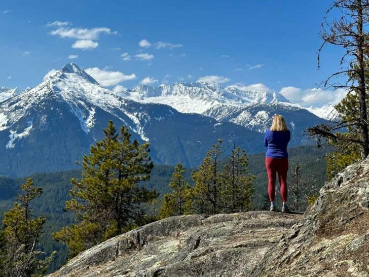
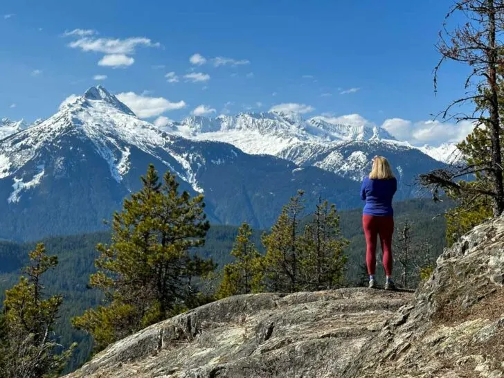
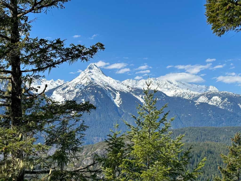
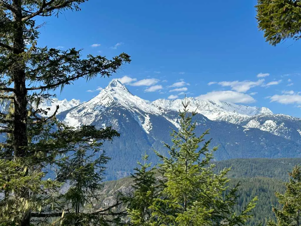
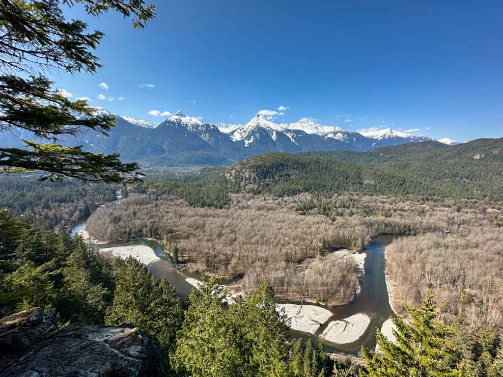
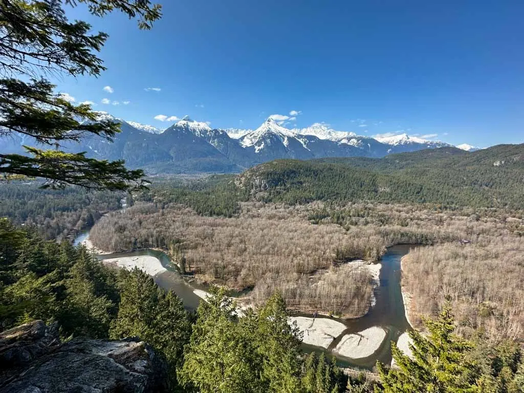
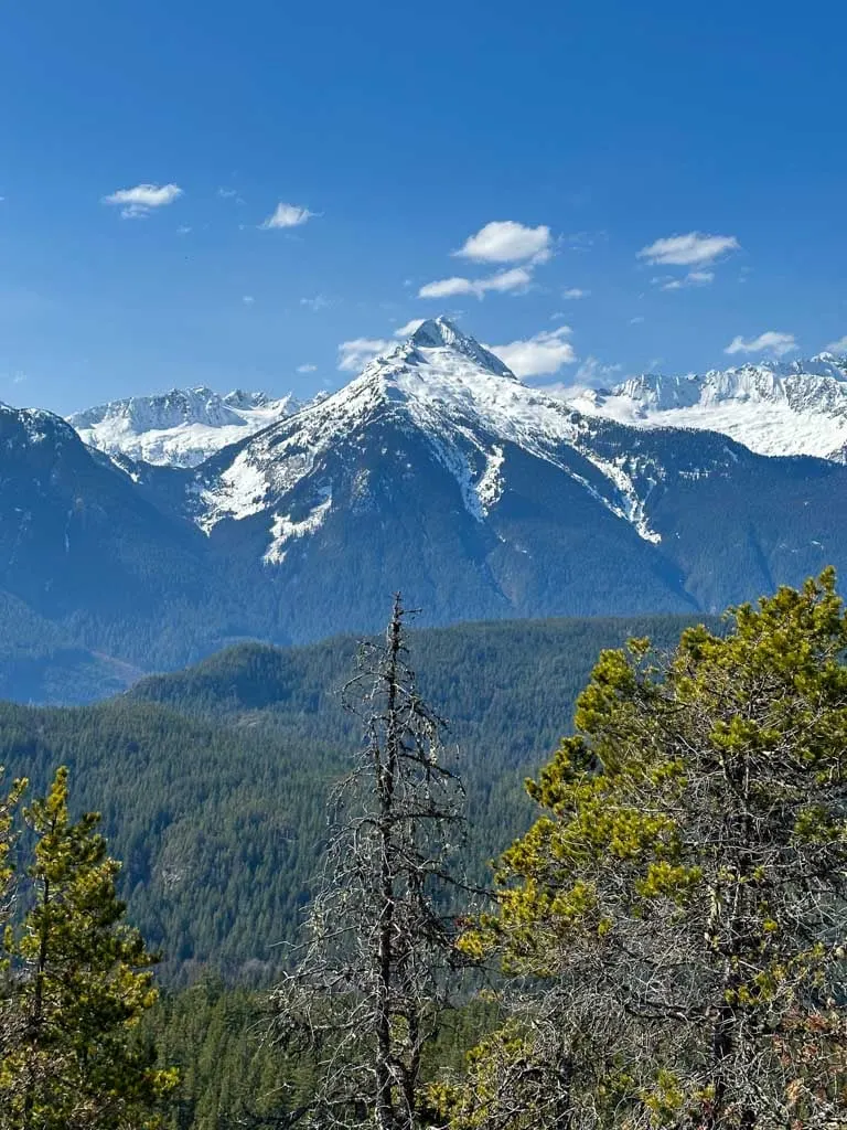
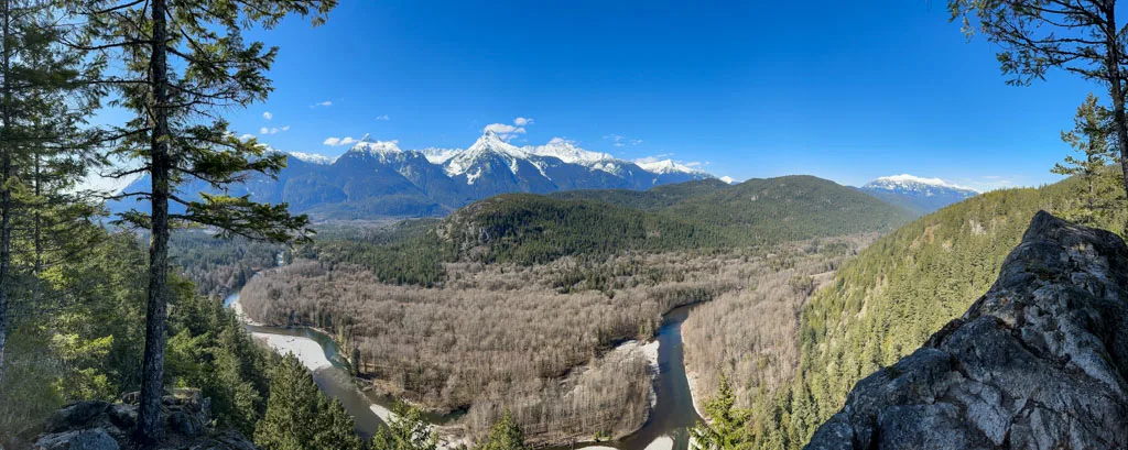
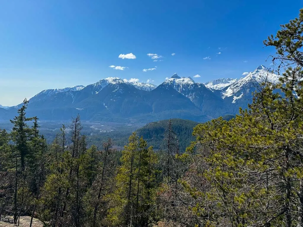
As the trail reaches its high point and the path narrows, look for a side trail heading left onto the top of a large open rock bluff. This is the first viewpoint. Look west to the snow-capped peaks of the Tantalus Range. The trees partially obscure your view, but it is still a good place to take a break.
Retrace your steps back to the main trail and follow it downhill through a series of quick switchbacks in a tight second-growth forest. A few minutes later, the trail arrives a the top of a precipitous cliff with a view. Informal trails follow the edge – but be careful as the drop-off is sheer.
From here you can look almost straight down to the Cheakamus River below you or across to the Tantalus Mountains. You can also look north to the rounded snow dome of Cloudburst Mountain.
When you are finished admiring the view, continue on the trail as it heads steeply downhill to the right. As you near the bottom, ignore a short spur trail to the left that leads to an overgrown picnic area. The Cheakamus Loop ends back at the old logging road.
Turn left at the end of the old logging road to follow the High Trail as it climbs slowly and steadily through thickets of salal.

Just past a marshy area, where the ground levels out, reach a junction with the Tantalus View Trail.
Turn left and follow the rough trail uphill over roots and rock slabs. In a few places, wooden stairs and a chain help you up the steepest bits. The view from the top is great as you look across to the Tantalus Range.

Did you know? You can reach the Tantalus Mountains on the hike to Lake Lovely Water. Get the details in my book, Backpacking in Southwestern British Columbia.
When you are ready, retrace your steps back to the junction and go left onto the Connector Trail. This path is steep and rocky, so take your time descending.
At the bottom, reach the shore of the lake in a thick old-growth forest. Turn left to follow the Brohm Lake Loop Trail around the lake. The trail rambles through the forest, gaining and losing elevation.
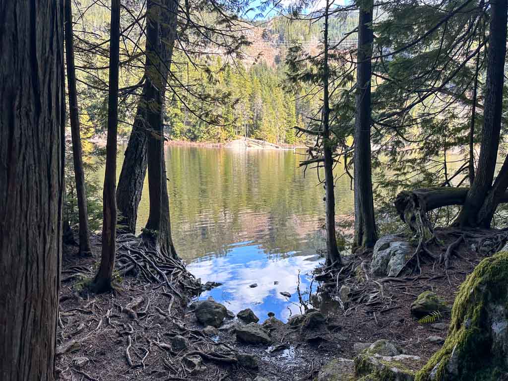
In a few places, faint spur trails leave to the right. These trails lead to granite bluffs on the shores of Brohm Lake – a popular place for a swim in the summertime and a great lunch spot at any time of year.
After about one kilometre along the lake, reach a junction. The Thompson Trail descends to the left and your right route continues around the end of the lake to the left.
Note: If you parked at the Tenderfoot Creek Hatchery, you will join the recommended loop route here.
A minute later, the Brohm Creek Trail goes left. Continue on the main trail around the lake. It goes uphill and uses some wooden platforms and stairs to get around a few steep rock bluffs.
A the top of the hill the Powerline Trail joins from the left. Stay on the main trail as continues through the forest with the lake steeply below you.
The trail heads downhill towards the outhouse. A short detour to the right takes you to the shore of the lake. Finish your hike back at the main parking lot.
Starting from the south parking lot
To start your hike from here, follow the old road-turned-trail from the parking lot. Ignore the Alder Trail and stay on the old road as it does a big C-shaped bend, then switchbacks to go east.
Pick up the recommended loop at the intersection with the High Trail by going left onto the Cheakamus Loop Trail.
Parking here will add 2.4 km to your hike.
Starting from the Tenderfoot Hatchery
To start the hike, follow the path between the hatchery and the railway tracks. Continue paralleling the tracks, then turn left onto a trail that son crosses a wooden bridge. Stay on the trail as it curls right and arrives at some large boulders.
Walk between the boulders then follow markers and paint uphill through a rockslide and then the forest to intersect the Brohm Lake Loop. Go left to follow my recommended loop.
Parking here will add 3.5 km and 230 m of elevation gain to your hike.

Brohm Lake FAQ
The loop around the lake takes a little over 1 hour. But there are lots of other trails to viewpoints that are worth spending the extra time to hike to.
The trail around the lake is 4 km long. However, the park has 19 km of trails that lead to lots of viewpoints.
Yes. It has wonderful clear water and it’s not too cold. However, you will need to hike around the lake to several rock outcroppings where you can get into the water.
No. There is no sandy beach. However, the lake has lots of beautiful rock outcroppings that you can use to wade or dive into the water.
The clear part of the lake is about 1 km long. If you count the marshy part, the total length of the lake is about 1.8 km.
Yes. Dogs are allowed but they must be on-leash.
Yes. The park is open year-round. However, the main parking lot is not plowed in the winter so the gate will be closed if there is snow.
Yes. The lake is stocked with rainbow trout and cutthroat trout. Fishing from a small boat or float tube is best, but you can fish from shore too. You must have a BC freshwater fishing license.
On summer weekends, Brohm Lake can be busy. The main parking lot is small and fills quickly. Get there early or be prepared to park at the south parking lot or Tenderfoot Creek Hatchery parking lot.

Now you have all the info you need to hike at Brohm Lake. (And since you have insider info, you won’t miss the viewpoints!) Do you have questions about the Brohm Lake Trail? Let me know in the comments.
MORE SQUAMISH POSTS:
- The Best Hikes in Squamish, BC (From a Local)
- 70+ Things to Do in Squamish
- Camping in Squamish, BC: 22 Places to Camp Near Squamish
- Hike to Mount Crumpit in Squamish
- Hike to Crooked Falls in Squamish
- Tunnel Bluffs Hike in Lions Bay
- Sea to Sky Highway Road Trip Guide: Driving from Vancouver to Whistler
- Where to Go Snowshoeing in Squamish


- Best Sun Hoodies for Hiking - June 3, 2026
- Lower Stein Valley Trail Hiking and Backpacking Guide - May 27, 2026
- The Best Things to Do in Vernon, BC - May 21, 2026
Alan Osborne
Tuesday 9th of May 2017
Thanks for the excellent review! I did this hike years ago from Paradise Valley, up the Thomson Trail, and around the lake; however, I don't think the Cheakamus loop existed then so I missed out on all the views. Definitely adding this one to my To Do list :-)
FYI, this is a much better map: http://naturevancouver.ca/sites/naturevancouver.ca/VNHS%20files/Brohm%20Lake%20Map_x.jpg
Taryn Eyton
Tuesday 9th of May 2017
Thanks for the link to the better map Alan. I'll add it to the post - it is waaay better! I haven't done the hike up from Paradise Valley yet but I do plan to check it out... maybe in the fall once the snow hits the mountains again.