

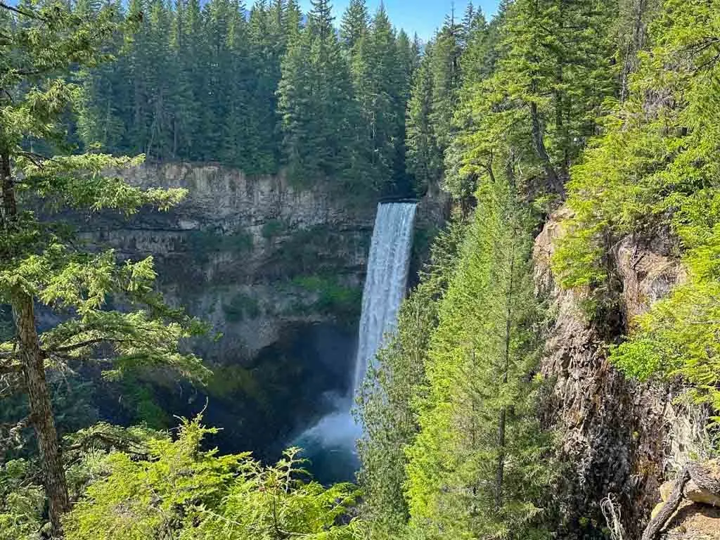
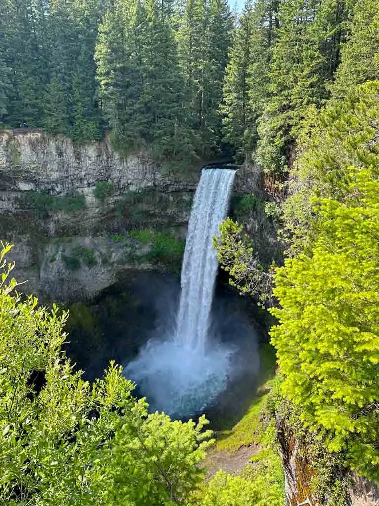
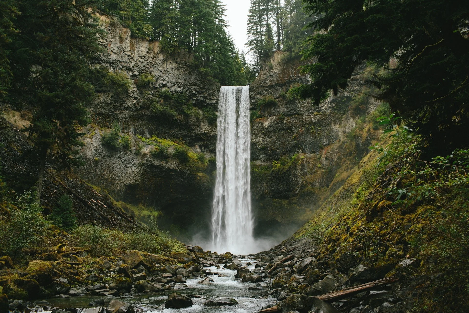
Brandywine Falls is one of the most popular stops on the Sea to Sky Highway near Whistler. It is a short and easy hike to the spectacular 70-metre-tall (230-foot) falls which cascade over volcanic rocks into a deep canyon. I live nearby in Squamish and visited the falls countless times.
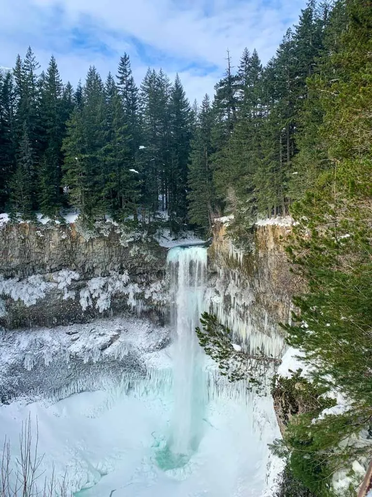
The falls are great in all seasons. In the spring they gush with snowmelt. The falls gets a little drier in the summer and you can see the rock formations better. In the fall, they gush again with rain. And in the winter they freeze up a little bit and the ice formations are really cool.
But the falls are not the only thing worth visiting at Brandywine Falls Provincial Park. Lots of people don’t know that there is a whole trail network here: you can visit another canyon with a bungee bridge, see other viewpoints, and go for a swim.
This guide to Brandywine Falls Provincial Park includes:
- Key trail stats for the hike to Brandywine Falls
- A Brandywine Falls trail map that I made just for you
- How to get to the park by car or on a tour
- Turn-by-turn hiking directions with lots of photos
- Hiking to the bottom of Brandywine Falls – is it allowed?
- Winter hiking and snowshoeing at Brandywine Falls including where to park legally
- Other hikes at Brandywine Falls – info for three other scenic trails
- Brandywine Falls FAQ – all your questions answered
This is a sensitive wilderness area. Learn how to Leave No Trace to keep the wilderness wild. Make sure you are prepared by bringing the 10 Essentials. Get ready for adventure with this checklist of things to do before every hike.
Hey there: Some of the links in this post are affiliate links, which means I earn a small commission at no cost to you. Thanks for your support. -Taryn
Brandywine Falls Trail Stats
Note: The trail stats below are just for the hike to Brandywine Falls. I’ve also got details on three more hikes in the park at the bottom of this post.
Distance: 1.2 km
Elevation Gain: 20 m
Duration: 30 minutes
Difficulty: Very easy
Season: April to November without snowshoes. November to March with snowshoes or microspikes. (Read my guide to the differences between microspikes and snowshoes.)
Toilets: Pit toilets at the trailhead.
Dogs: Allowed on-leash only.
Heads up: There are popular (and more advanced) hikes upstream of Brandywine Falls called Brandywine Meadows and Brandywine Mountain. Both of those hikes require logging road driving to reach the trailhead. They are not at Brandywine Falls Provincial Park.

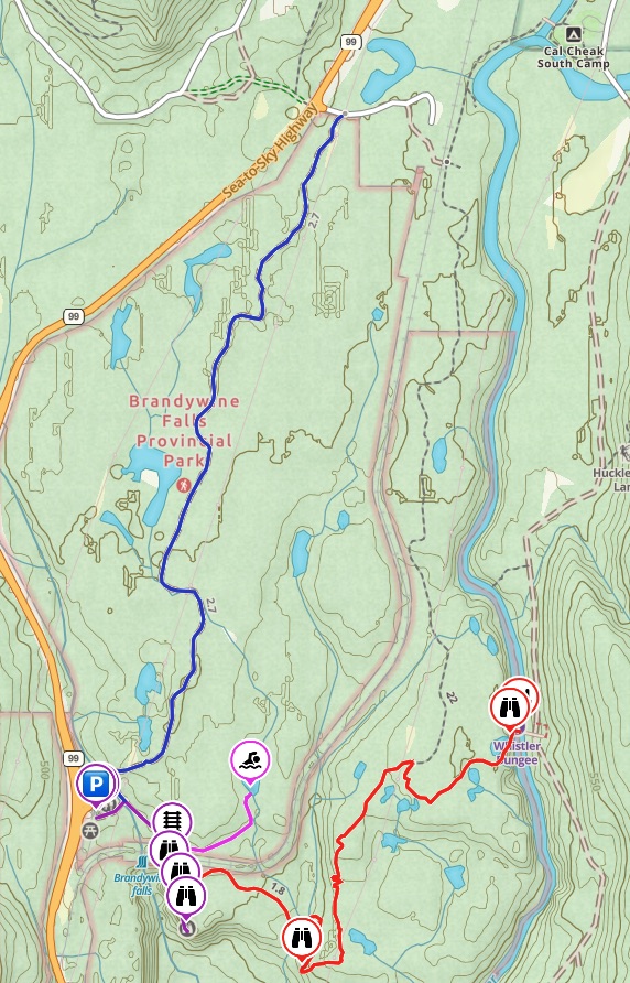
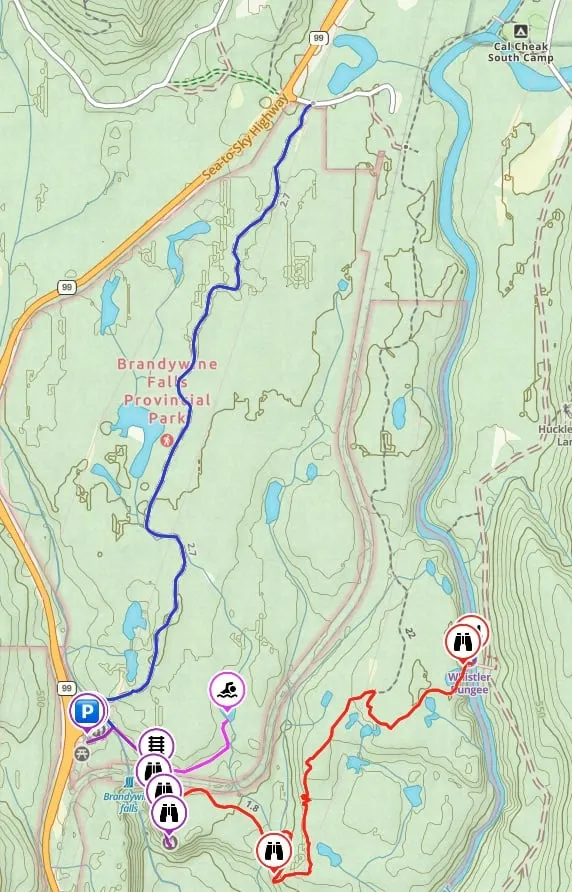
Brandywine Falls Trail Map
The trails at Brandywine Falls Provincial Park are well-signed and easy to follow. There are signs at each junction. But, I made you a trail map using Gaia GPS, my favourite GPS and mapping app. Click through to zoom in and explore.
How to Get to Brandywine Falls
Brandywine Falls Provincial Park is located between Squamish and Whistler on Highway 99.
To get there, go north on Highway 99 from Squamish. A few minutes after you pass the turn-off to Garibaldi Provincial Park and the Daisy Lake Dam, look for signs for Brandywine Falls on your right. Click here for Google Maps directions from Squamish.
If you are coming from Whistler, go south on Highway 99. About 8 minutes after the traffic light in Function Junction, look for the left turn lane and signs for Brandywine Falls on your left. Click here for Google Maps directions from Whistler.
The parking lot at has room for a few dozen cars and also has an RV and bus section. However, it does fill up on summer weekends, especially in the afternoon. There is no overflow parking. If you park on the highway you will get towed.
Unfortunately, there is no public transportation to the park. You could take a taxi from Whistler, which is about 15 minutes away.
Many Sea to Sky tours stop at Brandywine Falls. This highly-rated full-day bus tour includes stops at Brandywine Falls, the Sea to Sky Gondola, and Whistler. Or book a private tour of the Sea to Sky Highway that includes Shannon Falls, Brandywine Falls, and Whistler.
In winter, the parking lot is gated. Your car will get towed if you park in front of the gate. See the winter hiking and snowshoeing section below for more info.
Brandywine Falls Hiking Directions
From the parking lot, walk past a kiosk with info about Squamish and Lil’wat Indigenous culture and history. Continue past a few picnic tables to the covered bridge over Brandywine Creek.

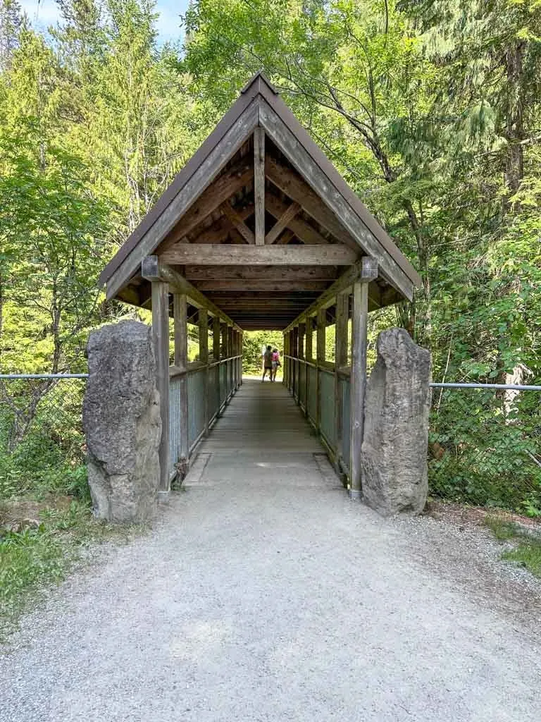
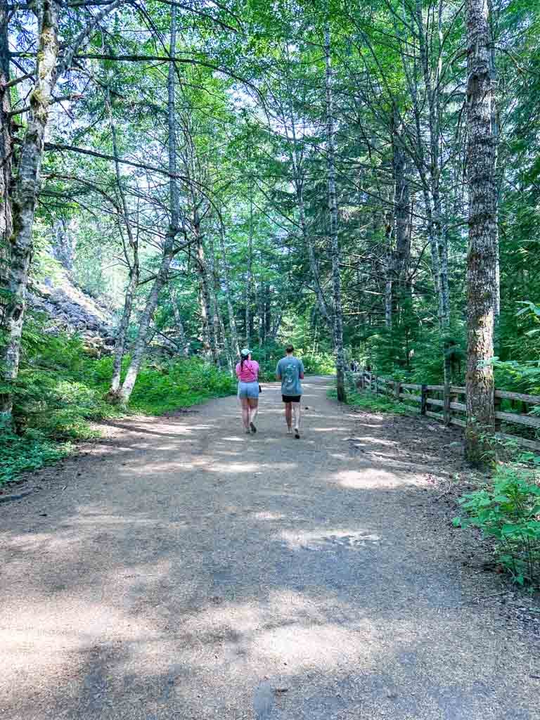
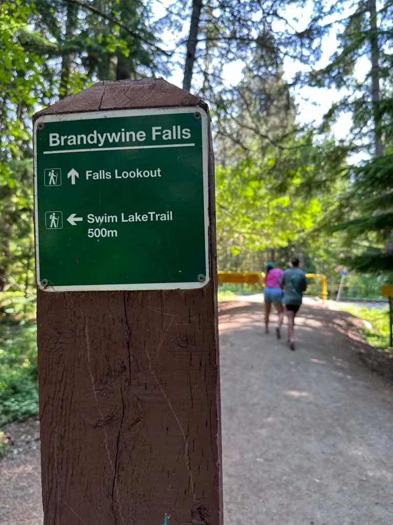
Cross the bridge and turn right on the other side to head towards the falls. (The trail to the right goes to Lava Lake.)The wide trail here heads slightly downhill through the forest.

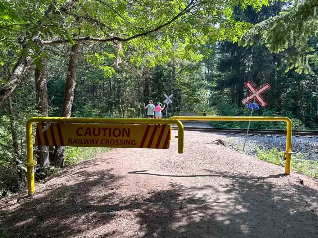
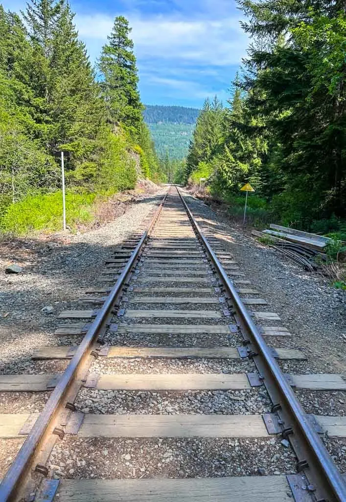
A few minutes later, ignore the signed Swim Lake Trail branching uphill to the left. Continue through the yellow gates to carefully cross the railway tracks.


On the other side, ignore the Sea to Sky Trail going left and continue straight. The first waterfall viewpoint is just ahead. There is a large wooden platform here with great views of the falls. Unfortunately as of summer 2023, a small tree is growing in front of the platform, which reduces the view a little.
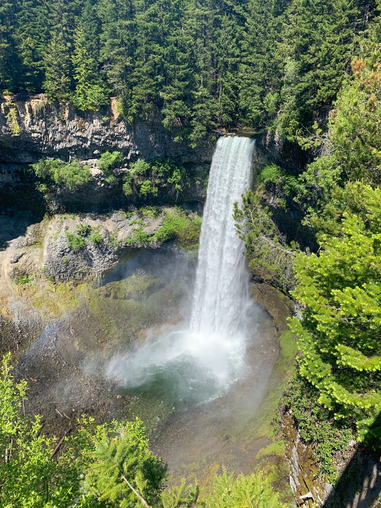

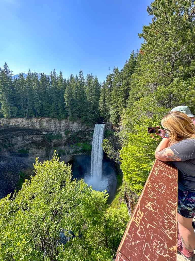

Some people turn around here because they don’t realize there are more views. Continue along the trail for another minute to another viewpoint. This one is from a bit further back, so you get a head-on view of the waterfall.
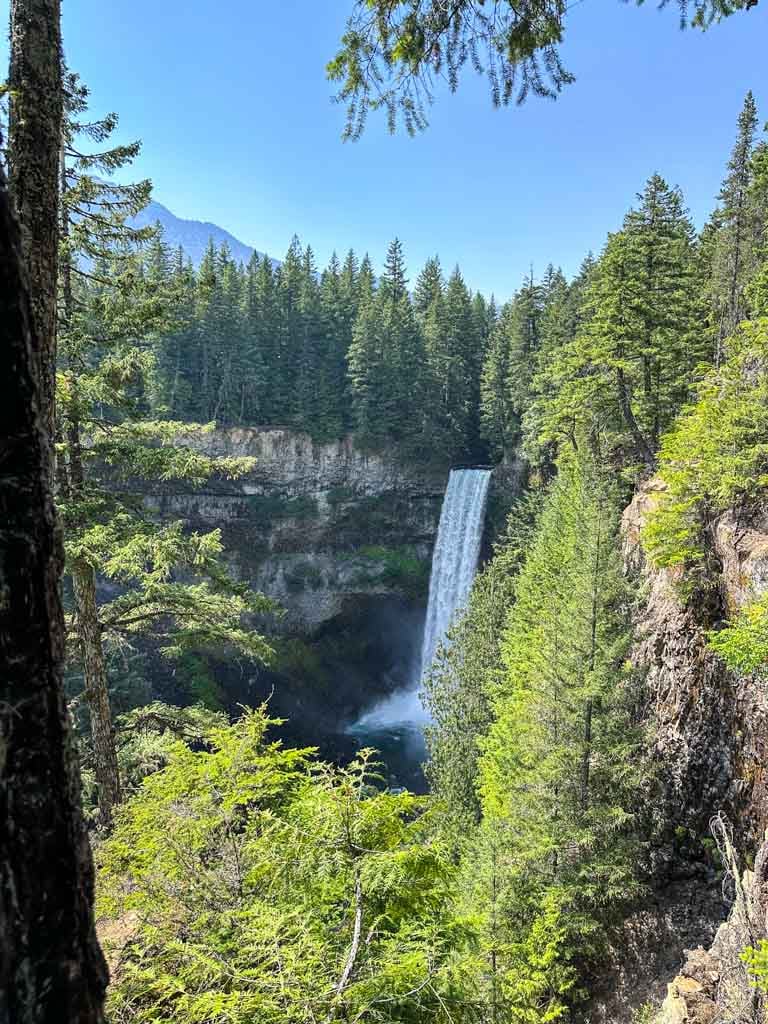
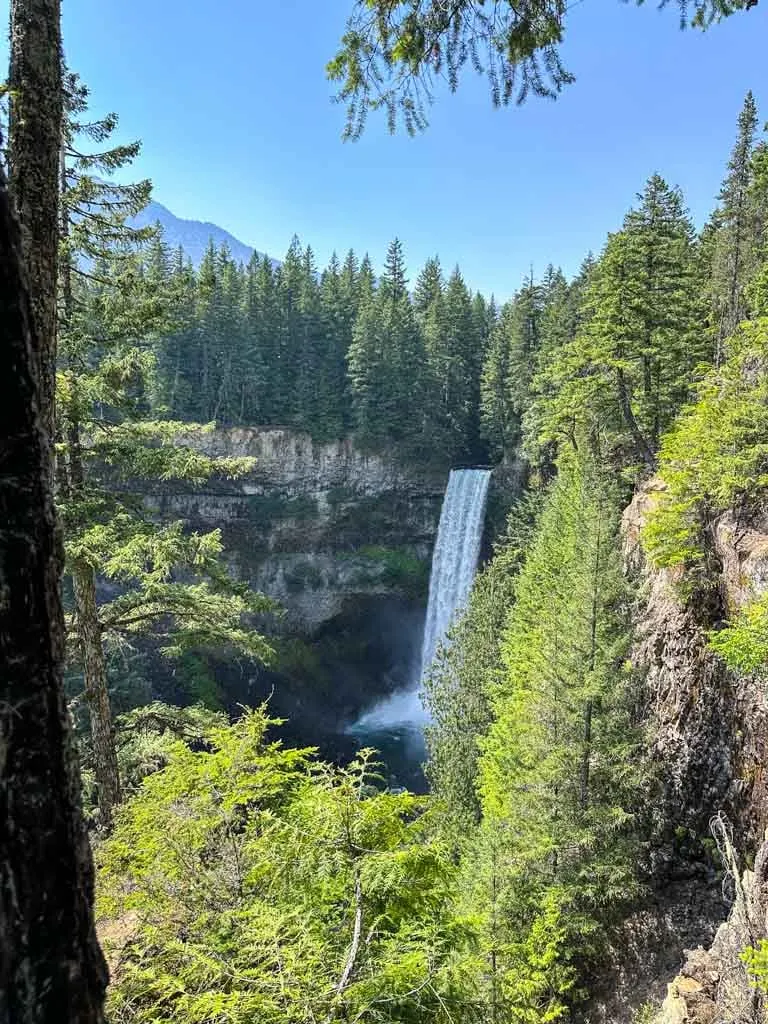
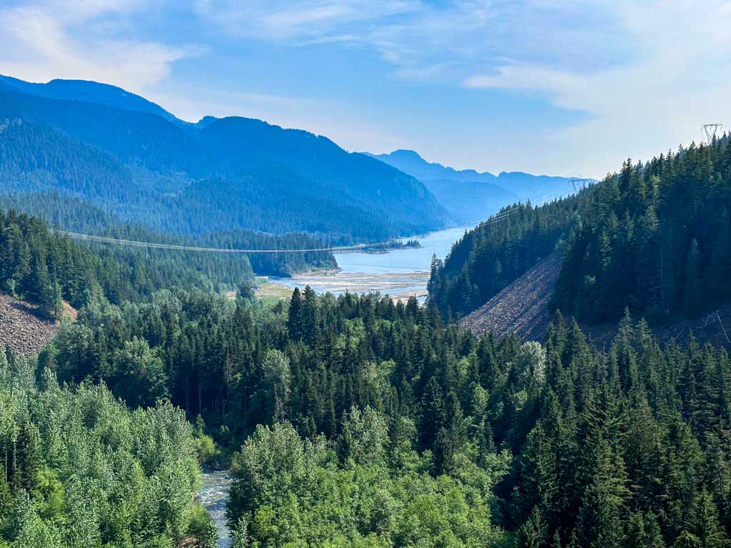
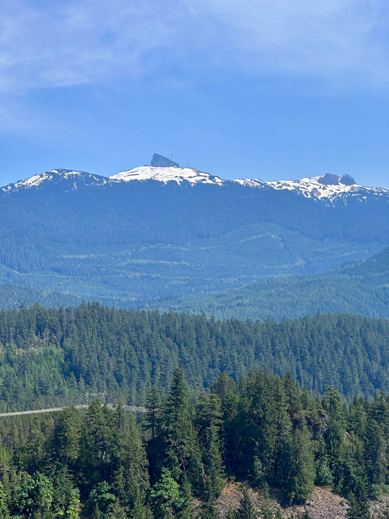
You can continue along the trail to its end at another viewpoint. This time you can look south to the turquoise waters of Daisy Lake, a human-made lake used as a reservoir for hydropower generation. You can also look back north and spot the volcanic peak of Black Tusk.


When you have finished enjoying the view, retrace your steps back to the parking lot.
Hiking to the Bottom of Brandywine Falls
You may have seen photos on social media of people at the bottom of the waterfall. Unfortunately hiking to the bottom of Brandywine Falls is illegal.

The Provincial Park website clearly states there is no access to the bottom of the falls since it is very unsafe due to unstable slopes and falling rocks.
As well, the start of the route to the bottom of the falls now has huge fences in front of it with signs warning people not to go down into the canyon. The signs also warn people that there are fines for going past the fence.
Winter Hiking and Snowshoeing at Brandywine Falls
The flat and easy trail to the waterfall as well as the other hikes in the park make great winter hikes or snowshoe trips. However, there is one big problem: the parking lot is closed in winter.
Unfortunately, it is not easy to snowshoe at Brandywine Falls since BC Parks locks the gate at the parking lot in the winter and doesn’t plow the parking lot. If you park outside the gate on the highway, you risk getting your car towed away or having it hit by a snow plow.
However, you can legally park in winter at the Whistler Bungee parking lot on Cal-Cheak Forest Service Road. From there it’s a 6 km round trip snowshoe to the falls. More details in my guide to snowshoeing in Whistler.

Other Hikes at Brandywine Falls Provincial Park
Most visitors to Brandywine Falls Provincial Park do the short hike to the waterfall viewpoint and then head back to their car. However, there are several other great hikes in the park. I’ve got details below.
Sea to Sky Trail to the Bungee Bridge
The hike to the Bungee Bridge makes a great add-on to Brandywine Falls. It’s a 4.5 km round trip from the main trail and takes about 1.5 hours. Click here to see the custom map I made of the route to the Bungee Bridge.
Just after crossing the railway tracks, turn left onto the Sea to Sky Trail. The trail is shared with bikes, but it is wide so there should be room for everyone. The trail heads downhill to a viewpoint of Daisy Lake, then works its way back up a short but steep hill.
The second half of the trail travels under the powerlines and into an old lava field, so there is no shade, which can be tough on hot days. Just after you pass under the powerlines, ignore a trail branching to the left and stay on the main Sea to Sky Trail.
A few minutes later pass some small lakes, then arrive at the edge of the Cheakamus River Canyon. There is a great view down into the canyon and of the Bungee Bridge a few minutes ahead. This is the best place to watch people bungee jump.
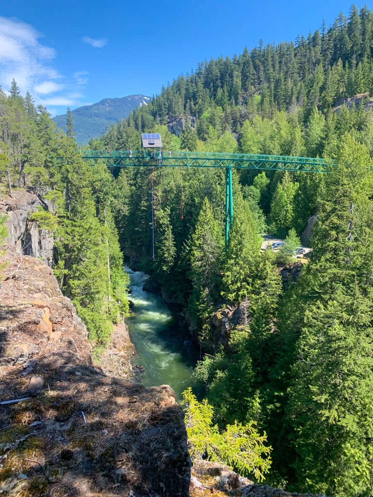

You can also carry on along the trail to the bridge and look directly down into the canyon. The bridge closes for a few minutes each time people bungee jump so you may have to wait to cross it. After you’ve enjoyed the view, retrace your steps back to the Brandywine Falls main trail.
Alternatively, you can follow the Sea to Sky Trail all the way to Whistler Village, 20 km to the north across the Bungee Bridge.
Swim Lake Trail
This short trail (0.8 km round trip) leads uphill through rocks and forest to the south shore of Swim Lake. The route to Swim Lake starts just before you cross the railway tracks on the main trail. Click here to see the custom map I made of the Swim Lake Trail.

You will encounter a much more rugged trail than the main Brandywine Falls Trail, but it’s not too long – the climb from the main trail to the lake takes about 10 minutes.
The shore of the lake is rocky in some places and marshy in others, so it can be tough to find a place to get in the water easily. It is refreshing on a hot day though.
Lava Lake Trail
This multi-use trail is shared with bikes, but it’s rarely used so you won’t see many people. It starts just after the covered bridge – go left to Lava Lake instead of right to Brandywine Falls. Click here to see the custom map I made of the Lava Lake Trail.
The hike to the end of the trail is 5.3 km round trip and takes about 1.5 hours. The trail is a wide old road that passes under some powerlines. Faint side trails lead to some interesting lakes formed by depressions in an old lava field.
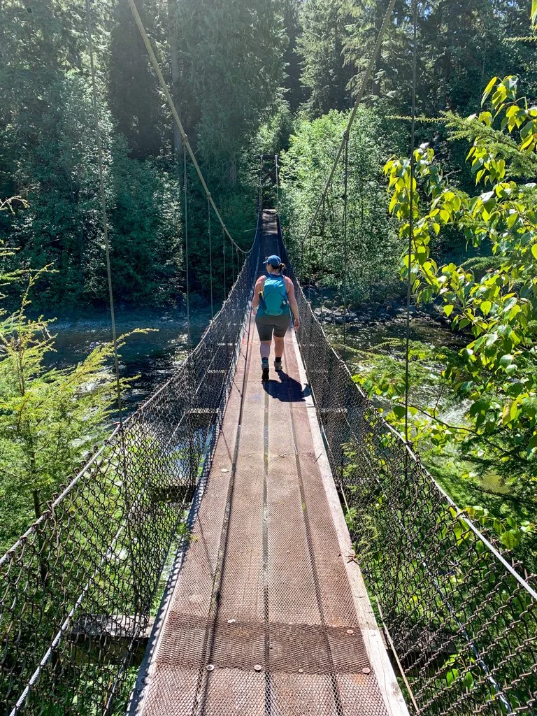
If you are up for some navigating, you can follow the road at the end of the trail out of the park, then across the railway tracks to meet up with the trail that goes to a cool suspension bridge over Callaghan Creek. You will end up at Cal-Cheak Campground, one of my picks for the best places to camp near Whistler.
If you choose to head outside the park, I recommend using All Trails+ or Gaia GPS app to find your way as the trails can be confusing.

Brandywine Falls FAQ
The hike takes about 10 minutes each way.
The waterfall is 70 metres (230 feet) tall.
No, it is free to visit. You do not need to pay for parking and you do not need a day-use pass.
Brandywine Falls is open from May to October during the day. It is gated at night. The main parking lot is closed between November and April since it is not plowed.
No. While there is a rough trail to the bottom of Brandywine Falls, it is illegal and dangerous. There are fences and signs warning of fines and rockfall hazards.
No. There was a small campground at Brandywine Falls, but it was closed in the early 2000s. The closest campground is the Whistler RV Park. Get more details in my guide to camping in Whistler.
Yes. Many facilities at the park are wheelchair accessible including the parking lot and some pit toilets. The trail to the falls is gravel with a slight slope and there are thresholds of a few mm to access the covered bridge and viewpoint. You can find more accessibility info on the BC Parks website.
Brandywine Falls flows across the top of an old lava flow, which is hard. But the rocks underneath the lava are softer. So when the water cuts through the lava rock, it forms a canyon with the waterfall at its head. Each year the waterfall cuts back a bit more rock and in thousands of years, it will reach the parking lot.
According to BC Geographical Names, there are two possible origins for the name of the waterfall. In the first, two surveyors in 1910 made a bet as to who could guess the height of the falls. One man offered a bottle of brandy if he lost, and the other offered a bottle of wine. In the second story, two trappers were travelling north on trails from Squamish around 1890. One had a bottle of brandy and the other had a bottle of wine. They stopped at the falls to make tea, consumed both bottles of alcohol, then passed out for 24 hours.
So that’s everything you need to know to hike at Brandywine Falls Provincial Park. If you have questions about the hike, leave them in the comments so I can help you out.
MORE WHISTLER HIKES:
- The Best Hikes in Whistler: A Guide to All the Trails
- Joffre Lakes Hike (By a Local)
- Whistler Train Wreck Hike
- Hike to Parkhurst Ghost Town in Whistler
- Rainbow Falls Loop Trail in Whistler
- Where to Go Snowshoeing in Whistler
MORE WHISTLER INFO:
- 80+ Things to Do in Whistler (By a Local)
- 42 Cheap and Free Things to Do in Whistler
- Camping in Whistler, BC: 18 Places to Camp Near Whistler
- Lost Lake in Whistler: Hiking, Swimming, Biking and More
- Sea to Sky Highway Road Trip Guide: Driving from Vancouver to Whistler


- Best Sun Hoodies for Hiking - June 3, 2026
- Lower Stein Valley Trail Hiking and Backpacking Guide - May 27, 2026
- The Best Things to Do in Vernon, BC - May 21, 2026