

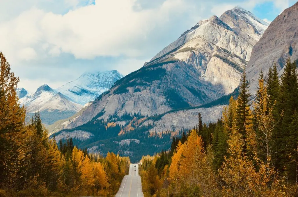
If you think of National Parks in Canada, you probably think of the famous National Parks in Canada’s Rocky Mountains near Banff. And yes, the mountain parks are spectacular. But… Canada is a REALLY big country with a REALLY varied landscape. And we have dozens of National Parks spread all the way from sea to sea, to sea. (That last “sea” is the Arctic if you weren’t sure.)
I have visited a lot of Canada’s National Parks. Recently I wanted to figure out how many parks I had left to visit, and the best way to see them. I’ve also driven across Canada twice, and I know it’s a beautiful trip.
I had a look at a map and figured out that while some Canadian National Parks are fly or boat-in only, most of them are easy to reach on a road trip. And actually, you could design a really epic road trip from coast to coast that includes most of the National Parks plus lots of Canada’s major cities.
So I sat down with google maps and worked one out for you! Here is my guide to the ultimate Canadian National Parks road trip. Enjoy!
Psst! Do you love national parks? Check out my list of the best Canadian national parks gifts
Hey there: Some of the links in this post are affiliate links, which means I earn a small commission at no extra cost to you if you make a purchase. Thanks for supporting my website! -Taryn
Canadian National Parks Road Trip Planning
As of 2019, Canada has 48 National Parks. Thirty-one of them have road-access. (You have to fly or boat into the others.) I’ve used Google maps to design a cross-Canada road trip that visits all 31 of those parks with the least amount of backtracking possible. In most places, the route stays close to the trans-Canada highway, so it’s easy to take short detours off the cross-Canada route to visit National Parks.
This road trip visits every single Canadian province and two territories. (Nunavut isn’t connected to the road network. That means it’s not even possible to road trip there!) It includes 31 National Park and also visits lots of major Canadian cities and provincial capitals, since you’ll have to to eat some great food and soak up some culture now and then.

The entire Canadian National Parks road trip involves over 19,000km (11,800 miles) of driving. And lots of the parks are REALLY big. For example, Wood Buffalo National Park is larger than the entire country of Denmark! (For more fun trivia, check out this list of 155 crazy facts about Canada).
At a minimum, it would take about a month or two to complete the entire trip, but it would be REALLY rushed. Ideally, I would set aside at least 4 months for this epic road trip, but ideally closer to 5 or 6 months to really spend time in each place.
Of course, that’s a lot of time off for most people, so if you don’t have that much time, take a few weeks to just do a section. Some of the areas I’ve enjoyed the most are the Rocky Mountain parks in BC and Alberta, and the Atlantic Canadian provinces, especially Newfoundland.
Weather in Canada is no joke. By far the best time of year to do this road trip would be the summer months of June to September. May and October are also nice unless you are in the north. Theoretically, you could do this trip at any time of year with good snow tires and some winter driving experience, but many of the parks have reduced services in the winter or close completely.
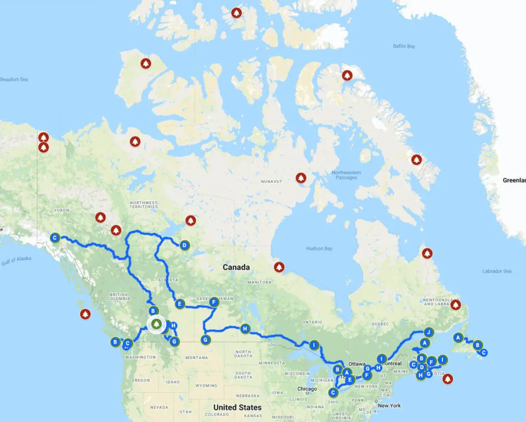
Canadian National Parks Road Trip Map
Here’s the custom google map of Canada’s National Parks I’ve made for you. Click to explore the map. The National Parks you can visit by car are in green. Parks you have to fly or boat into are in red. The blue line is the epic Canadian National Park road trip route.

Canadian National Parks Road Trip Itinerary
Here’s a list of every single National Park in Canada visited on the road trip, in order from west to east. It also includes important cities and provincial capital cities. I’ve listed every National Park and city I have visited in bold. That means I’ve been to 17 of the 31 parks on this road trip already! Just 14 to go!
- Victoria, British Columbia
- Pacific Rim National Park (Read about the West Coast Trail in Pacific Rim)
- Gulf Islands National Park
- Vancouver, British Columbia (Read Vancouver area posts)
- Mount Revelstoke National Park
- Glacier National Park
- Kootenay National Park (Read about the Rockwall Trail in Kootenay National Park)
- Waterton Lakes National Park
- Calgary, Alberta
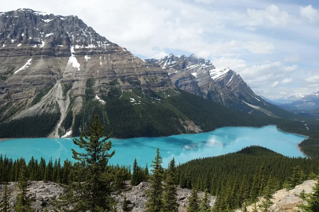
- Banff National Park (Read about how to visit Banff in the fall and what to do in Banff in the spring)
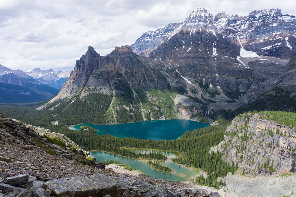
- Yoho National Park
- Jasper National Park
- Whitehorse, Yukon Territory
- Kluane National Park
- Wood Buffalo National Park
- Edmonton, Alberta
- Elk Island National Park
- Prince Albert National Park
- Saskatoon, Saskatchewan
- Grasslands National Park
- Regina, Saskatchewan
- Riding Mountain National Park
- Winnipeg, Manitoba
- Pukaskwa National Park
- Georgian Bay Islands National Park
- Bruce Peninsula National Park
- Point Pelee National Park
- Toronto, Ontario
- Rouge National Urban Park
- Thousand Islands National Park
- Ottawa, Ontario
- Montreal, Quebec
- La Mauricie National Park
- Quebec City, Quebec
- Mingan Archipelago National Park
- Forillon National Park (Read my friend Josanne’s guide to hiking and camping in Forillon National Park)
- Kouchibouguac National Park
- Fredericton, New Brunswick
- Fundy National Park
- Prince Edward Island National Park
- Charlottetown, Prince Edward Island
- Halifax, Nova Scotia
- Keijimkujik National Park
- Cape Breton Highlands National Park
- Gros Morne National Park (Read about the Long Range Traverse in Gros Morne)
- Terra Nova National Park
- St. John’s, Newfoundland and Labrador (Read my list of the best things to do in St. John’s)

Canadian National Parks Without Car Access
While they are difficult to get to, and in many cases pretty expensive, I’d love to visit some of Canada’s more remote National Parks. Here are the other 17 National Parks that require charter flights or boats to reach. I’ve included info on their location and how to get there if you’re curious.
Akami-Uapishkᵁ-KakKasuak-Mealy Mountains National Park Reserve: Located in southeastern Labrador, the only way to reach this park is to fly in from the town of Happy Valley-Goose Bay.
Aulavik National Park: This park is on the north end of Banks Island, an arctic island in the North-West Territories. To get there, you’ll fly in from Inuvik, NWT.
Auyuittuq National Park: To get to this park on the southern end of Baffin Island in Nunavut, you charter a flight from Iqaluit, NU.
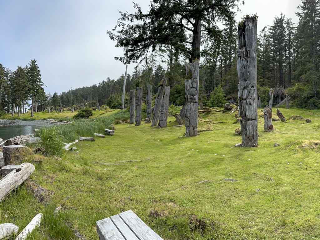
Gwaii Haanas National Park Reserve: This national park is located in the southern end of Haida Gwaii (also known as the Queen Charlotte Islands) off the west coast of British Columbia. To get to Haida Gwaii, drive your car onto the passenger ferry in Prince Rupert, BC. Once you’re on the island, you can take a boat or a float plane from Queen Charlotte City into the park. Read my guide to Gwaii Haanas National Park Reserve.
Ivvavik National Park: This park is located along the Arctic Ocean in the northern part of the Yukon Territory. The only way to get there is to charter a flight from Inuvik, NWT.
Nááts’įhch’oh National Park Reserve: This Canadian national park is located in the North West Territories near the border with Yukon Territory. To get there, you’ll need to fly to the remote communities of Norman Wells, Tulita, or Fort Simpson, NWT, and then charter a floatplane into the park.
Nahanni National Park Reserve: Located in the southwestern part of the North West Territories, you can only reach Nahanni National Park by floatplane. Charter one in Fort Simpson or Yellowknife (NWT), Watson Lake (YT), or Muncho Lake (BC).
Qausuittuq National Park: This park is located on Bathhurst Island in Nunavut’s high arctic. To get there, you can fly in from Iqaluit, Nunavut.
Quttinirpaaq National Park: Canada’s northernmost National Park, this park is located on Ellesmere Island. To get there, you’ll have to fly in from Iqaluit, Nunavut to Resolute Bay, then into the park.
Sable Island National Park Reserve: Located in the Atlantic Ocean off the coast of Nova Scotia, Sable Island is a giant sand bar with a population of wild horses. The only way to reach it is by charter flight from Halifax, NS.
Sirmilik National Park: This arctic National Park is on the northern end of Baffin Island in Nunavut. To get there, fly from Iqaluit to Pond Inlet or Arctic Bay, then snowmobile or boat into the park.
Thaidene Nene National Park Reserve: This brand new National Park was just created in 2019. It’s located on the eastern end of Great Slave Lake in the North West Territories. The only way to get there is by boat or floatplane from Yellowknife.
Torngat Mountains National Park: Located in northern Labrador, the easiest way to get there is to take a charter flight from Happy Valley-Goose Bay, Labrador to Saglek airstrip at the southern end of the park. From there you can take a boat or helicopter into the park.
Tuktut Nogait National Park: This northern park is located in the North West Territories near the border with Nunavut. To get there, book a charter flight from Inuvik, NWT.
Ukkusiksalik National Park: Located in Nunavut near Hudson’s Bay, the only way to reach this park is by charter flight from Baker Lake, Rankin Inlet, or Naujaat, Nunavut then boat or fly into the park.
Vuntut National Park: This National Park is located near the Alaska border in Yukon Territory. To get there, fly to Old Crow, Yukon, then fly or paddle into the park.
Wapusk National Park: Located in the heart of polar bear country on Hudson’s Bay in Manitoba, this park can be reached by boat, snowmobile, plane or dog team from the town of Churchill, Manitoba.
Canadian National Parks Resources
- Parks Canada’s website is your best source for up to date info on the parks. You can also buy National Parks passes online. For an extended trip, the best deal is the Discover Pass, which gets you in to all parks for a year.
- To help plan your trip (and get excited about what you’ll be seeing) the National Geographic Guide to the National Parks of Canada is a great choice. National Geographic also has a great bundle of maps of Canada. They’re waterproof and tear-resistant so they’re great on the road or for at-home planning.
- For general Canada travel advice, Lonely Planet’s Canada Travel Guide is great. We used an older version of this guide on our drives across Canada.
So there’s my itinerary for the most epic Canadian National Parks road trip. If you are planning a road trip across Canada, these 31 National Parks should be on your list.
Don’t have enough time for a full cross-Canada road trip? Here are some ideas for shorter Canadian road trips:
- Drive the Sea to Sky Highway from Vancouver to Whistler
- Explore the Pacific Marine Circle Route on Vancouver Island
- Take a hot springs road trip in BC and Alberta
Read Next:
- 20 Fabulous Canadian National Park Gift Ideas
- Best Small Towns in Canada for Outdoor Adventures
- The Best Canadian Adventure Books
- Your Guide to the Best Hot Springs in Canada
- Things to do in Mount Revelstoke National Park, Canada
- Your Guide to Camping and Hiking at Lake O’Hara in Yoho National Park
- Your Guide to the West Coast Trail in Pacific Rim National Park
- Hiking the Long Range Traverse in Gros Morne National Park
- Rockwall Trail in Kootenay National Park: Everything You Need to Know
- Cozy Cabins near Vancouver Perfect for a Weekend Getaway


- Best Sun Hoodies for Hiking - June 3, 2026
- Lower Stein Valley Trail Hiking and Backpacking Guide - May 27, 2026
- The Best Things to Do in Vernon, BC - May 21, 2026
Linda
Sunday 12th of May 2024
doDyou have any suggestions on less travelled highways ? Looking for quiet roads to travel across Canada. Thanks for your article.
Taryn Eyton
Monday 13th of May 2024
For the most part, if you stay away from Highway 1, the roads are very quiet. And in some places, even Highway 1 is quiet. Canada is a very big country and most of the population is clustered in the cities. The highways around the cities are very busy but pretty much everywhere else is quiet.
CarolAnn
Saturday 23rd of March 2024
Very well done and I really like the fact that you admit that this itinerary will take at least 4 months. People do not always understand how big Canada is. Thanks!
James Jee
Saturday 25th of June 2022
I have two questions: 1. What are A, B, C, .... meanings on the map? The map cannot be linked to the google map. 2. I plan to visit Acadia NP and across the border to visit Canada NP nearby. Would you please advise on the best road trip? James
Taryn Eyton
Tuesday 28th of June 2022
Sorry about that - the link is fixed now and you can click through to see everything in Google Maps now. The closest Canadian National Park to Acadian National Park is Fundy National Park in New Brunswick.
Barbara
Monday 31st of January 2022
Hello Taryn!!! My name is Barbara and my family and I are planning a 38 days epic road trip through national parks in the Northwest United States and Southwest Canada. I would love to talk to you about some of the planning logistics with you if you can reach out to me via email.
Taryn Eyton
Tuesday 1st of February 2022
Hi Barbara, That sounds like an incredible trip. Feel free to email me: taryn [at] happiestoutdoors [dot] ca if you're looking for help planning. I offer travel consultation services and custom itineraries.
Karen
Saturday 10th of July 2021
Can you please explain your map that has indexed A to I three different times on the map. Are they the same repeated or… please help I’m planning to go across Canada in the fall and like your site.
Taryn Eyton
Sunday 11th of July 2021
That's just a function of how google maps works - it has a limit on how many stops you can include in one trip. So I had to split it up into several segments. If you click through to the map you can see the entire route.