Way back in the summer of 2006 I was living in Halifax to go to university. I figured since I was on the East Coast for a few years, I should explore the Atlantic Provinces. I booked some time off from my summer job and headed to Newfoundland with some friends.
Our plan was hiking the Long Range Traverse. It’s just one of many things to do in Gros Morne National Park and made my list of the best hikes in Newfoundland. Shortly after I finished, I wrote a trip report. It’s been languishing in a far off corner of the internet since then, so I thought I’d give it a quick edit and post it here for you to enjoy (grainy 2006 photos and all).
This is a sensitive wilderness area. Learn how to Leave No Trace to keep the wilderness wild. Make sure you are prepared by bringing the 10 Essentials. Get ready for adventure with this checklist of things to do before every hike.
Preamble
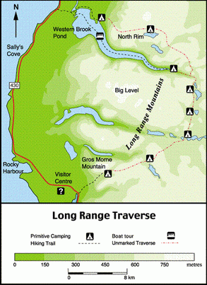
Soon after moving to Halifax from Vancouver, I discovered that the closest “real” mountains around were the Long Range Mountains in Newfoundland’s Gros Morne National Park. I had also heard that the must-do trip in the park was a 35km off-trail traverse from Western Brook Pond to the base of Gros Morne Peak. Of course Greg and I had to do it! Our friends G and R (both also Vancouver ex-pats) came along too.
In the few months before our August long weekend departure date were full of preparations: We worked out the transportation logistics. We booked our campsites. I dehydrated mountains of food. And we took one brief overnight training hike with G and R to Nova Scotia’s Kejimkujik National Park. When the time came to leave I felt only slightly prepared and quite scared since we hadn’t really ever done any off-trail hiking. But, I had never been to Newfoundland and was craving some mountains. My enthusiasm for new places and being a good distance above sea level won out, and off we went.
Day 0: Halifax to Gros Morne National Park
Our trip began on a Friday night with a long drive to Sydney on Cape Breton Island where we took the overnight ferry to Port-au-Basque, Newfoundland. After a few hours of driving on Saturday, we arrived at the park headquarters at Rocky Harbour in the afternoon.
Gros Morne National Park has an orientation process that you must go through before hiking the Long Range Traverse. As part of our orientation we were required to watch a video, get a briefing from a ranger and pass a map and compass test. We were also issued a transceiver to carry in our packs so they could find us with a helicopter if we failed to come back on time. The whole process seemed rather daunting and we weren’t sure what we had gotten ourselves into – especially the part about needing a helicopter rescue. Like the orientation for the West Coast Trail, the purpose of the orientation for hiking the Long Range Traverse seems to scare you out of going.
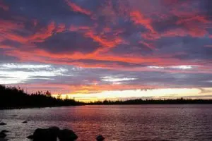
Having survived the orientation process, and still determined to go, we checked into the car campground at Berry Hill to sort gear and prepare for the traverse. After dinner we went for a walk around Berry Hill Pond near our campsite. We were excited to see a beaver near its large dam, as well as our first moose of the trip. She didn’t seem at all bothered by us and continued to feed directly in our way on the trail, despite all of our attempts to get around her. As we watched her munch away on the vegetation we were treated to a beautiful purple sunset. It was our first night there, yet already Western Newfoundland was a magical place for me.
Day 1: Western Brook Pond to Little Island Pond
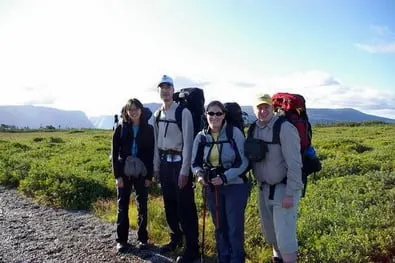
The journey really began on Sunday morning with some transportation logistics. We drove our car to our end point at the base of Gros Morne Mountain and hopped into the taxi we had arranged. From this point onwards, we would be trying to get back to our parked car.
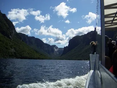
The taxi took us 30 minutes north to the trailhead for Western Brook Pond. From there it was a 3km walk to the dock to catch the boat tour. The boat would drop us at the head of Western Brook Pond. (While it is called a “pond”, Western Brook Pond is actually really big. It used to be a fjord but is now a lake.) After about 40 minutes on the boat with the tourists, we were dropped off. The boat’s tour guide explained to the tourists the long and arduous journey we were embarking on. I believe I even heard a few gasps from the crowd!
After dramatically waving goodbye to the tourists, we shouldered our packs and set off. The path was obvious at first, but it soon disappeared into a meadow of vegetation taller than me in places. On the other side of the meadow we discovered we were on our own navigation-wise. Although there is no official trail, there was a beaten path in a few places (and the odd piece of very welcome flagging tape). Since we were in a gorge and all we needed to do was head up and out of it, route-finding was fairly straight forward.
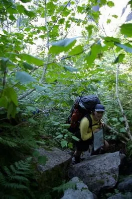
The only tricky section came right at the base of a waterfall. We had been warned about this waterfall and that we needed to stay to the right of it. Since we didn’t feel like rock-climbing with expedition packs on, we heeded that advice and took the beaten path to the right. This section involved the most sustained use of hands I have ever done on a hike – perhaps 45min of climbing up the steep hillside, hand over hand. We ascended 550m in about 2.5km and I sure felt it later.
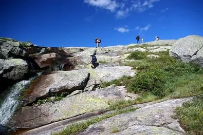
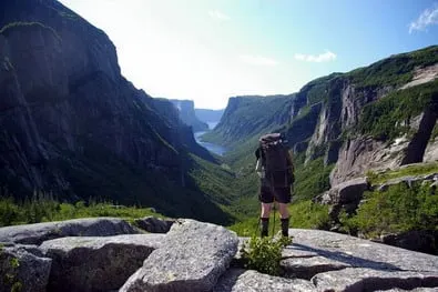
Eventually, we got to the top of the climb to the place where all the famous pictures of Gros Morne National Park are taken. After looking at tourism brochure photos of that spot it was exhilarating to actually stand there. The landscape at the top of the gorge was also drastically different from the trees, roots and rocks we had encountered on the way up. On the plateau it was all rolling hills, granite outcrops, patches of tasty berries, and little pocket ponds. There was also a beaten path to follow the few kilometres to our first campsite on Little Island Pond, which was nice since we were far too tired for route-finding.
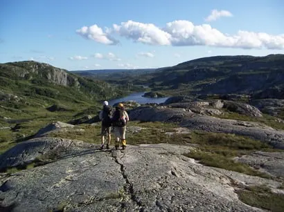
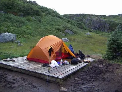
We arrived at camp and set up on the provided tent pads, which were a necessity due to the huge amount of mud. We also discovered the Gros Morne version of a backcountry outhouse. Apparently they don’t do the ‘house’ part. At each campsite there was a lovely green plastic throne with gorgeous views in all directions. It took a little getting used to. Apparently, they chopper out the thrones, with their contents, at the end of the season. (The rocky soil makes digging a pit of any depth close to impossible.)
For dinner we had the first of our yummy home-dehydrated meals. As we were cooking we were joined by a couple from Saskatchewan and their determined eight year-old son. We hiked with them on and off throughout the trip.
Day 2: Little Island Pond to Hardings Pond
The next morning started with a short and cold swim in the pond and some tent pad yoga for a few of us. Then we set out on our first major route-finding task – to make it to our next campsite on Hardings Pond. We started out following a beaten path in the direction of our first landmark, St. Mark’s Pond. We soon discovered that this trail led us off in the wrong direction and we had to backtrack. Apparently the moose are responsible for making more of the trails in this area than the people! We stopped and vowed to cease following trails blindly and start paying more attention to our map and compass. Soon we were on our way again. We did our first creek crossing and wound up at our lunch spot at the St. Mark’s Pond campground only a little behind schedule.
As we ate lunch the wind picked up despite the continuing sunshine. Throughout the rest of the day the wind made it difficult to walk on ridges or talk to each other without yelling. Concerned about getting lost, I had one of our maps in a sealed plastic map case strapped to my chest. In the wind, the map case became a madly flapping flag and sometimes even a sail, which led to much mocking from my companions.
After lunch we hiked up and over a ridge until we could see down to Hardings Pond. Even though the weather had been beautiful for days, the mud we contended with on this section was fierce. At one point I fell into a mud puddle that looked shallow but actually wasn’t since it sucked me in over the knees. That wasn’t our only adventure for the day: we also almost literally ran into a cow moose who growled at us (so fiercely I thought she was a bear at first). Later we also engaged in combat with the tuckamore. (Tuckamore is the gnarled and tightly woven vegetation that grows on the plateau.) A large stand of it stood between us and our campsite and there didn’t seem to be anyway around it, so we went through it. It was like walking underwater… against a strong current.
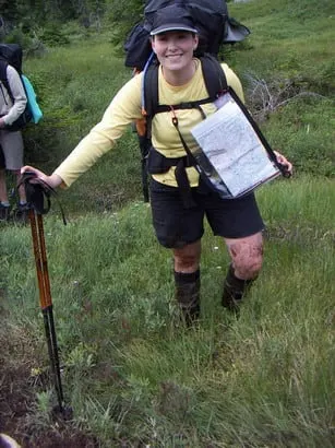
Going through the tuckamore didn’t help us get any closer to the campsite. After some detours and almost falling in the lake we finally arrived. The campsite was even more of a mucky quagmire than the last one. Soon after we got there it began to sprinkle. I was glad we used all our guy wires in securing my new Hubba Hubba to the tent platform since it was windy and rainy all night.
Day 3: Hardings Pond to Green Island Pond
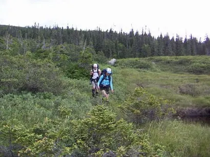
We had been told the third day would be our hardest navigation day. Waking up we were devastated to find that we had the worst weather for it. We needed to go up and over two ridge and navigate through an interconnected system of ponds. At the top of the ridges the fog was extremely thick, making navigation difficult. Despite the area being billed as a plateau all we did this day was climb up and down a series of steep and rocky slopes.
The constant rain throughout the day meant that the ground was extremely soggy. It seemed like too much work to set up a tarp and there were no trees for shelter so we couldn’t stop to get much warmer or to eat. We had to keep going. We got increasingly cold, wet, and miserable. Eventually we got within a few hundred meters of our campsite, but we became lost in the fog in a maze of little ponds. The ground was boggy, there was bear scat everywhere and we were damp and freezing. Somehow after going in circles for a while trying to get out of the pond maze, and yelling at each other in frustration, we managed to get out of there and get to our campsite.
We didn’t get into camp until 5pm that night. We were so tired that we only had energy to rehydrate some bean-dip and eat that with power bars for dinner. The family from Saskatchewan came into camp around 7:30. We were quite relieved about that since we were afraid they were lost in the same boggy mess we had been in. The sun came out for a few minutes just around sunset, which gave us a glimmer of hope after the bleakest of days. Almost everything we had was wet – Greg and I even had to sleep in our fleece jackets to attempt to dry them out a bit.
Day 4: Green Island Pond to Ferry Gulch
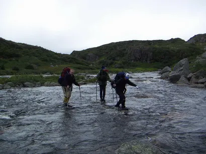
The widest river crossing on the trip was the starting point for our fourth day. Due to the heavy rain the day before the river was running fast. I wasn’t that deep, thankfully. It came to just above our knees at the highest. After the river crossing we hiked together as a group with the Saskatchewan family. We felt there was safety in numbers after fog related navigation mishaps in the never-ending rain the previous day.
Despite our apprehension, the going was quite easy on fourth day, our last real day of the traverse. All that we had to do that day was an easy walk along the plateau to a view of 10 Mile Pond and then a descent to our campsite along the Gros Morne Mountain trail. We easily found the viewpoint and stopped for lunch. The view down to 10 Mile Pond was spectacular. We could see numerous people over on the top of Gros Morne, scurrying around like little ants on an ant-hill. We also saw several caribou hanging out on an outcrop on Gros Morne, out of sight of the many day-hikers. The view was so nice that we had a long lunch to enjoy the view.
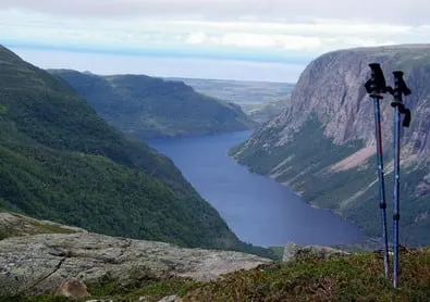
From the viewpoint it was supposed to be an easy descent to the campsite at the bottom of Ferry Gulch. The ranger had warned us that there was really only one way down that we should take, otherwise we would have to contend with bluffs that cliffed out. Apparently the ‘trail’ we were looking for was fairly easy to find. Ninety minutes of looking later, we finally found it. It was located in a different spot than the ranger had indicated on the map, and it was quite close to straight down. Descending was murder on our knees.
When we finally got down into Ferry Gulch we found the pleasant little campsite in between two small ponds. It even had an outhouse, complete with the “house” part.
After setting up camp and laying out our still wet gear in the sun to dry, we began cooking up a huge backcountry potluck feast. The rangers recommend you carry a few days of extra food when hiking the Long Range Traverse in case you get pinned down by weather and need to take extra time. Since that didn’t happen to us, we had lots of extra food. So we ate it. And ate it. And ate it some more. We went to bed on our last night extremely full and happy to be finished the off-trail portion of our trip. We planned to hike Gros Morne Mountain (which we were camped on the side of) in the morning and then head down the trail to our waiting car.
Day 5: Ferry Gulch to Gros Morne Trail Parking Lot
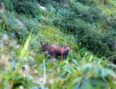
I was awoken on our last day at 6:30am by Greg yelling “Everybody get up! There’s moose chasing me!” At first I didn’t believe him, but lying in the tent I could hear the sound of hooves on gravel and some grunting and snorting. Needless to say, I didn’t want to get up! Greg did some shouting and arm waving, and then hid behind the tent while the moose charged around our campsite. Eventually the moose crashed off across the pond and started feeding on a bush. Later the ranger told us that since it was neither calving season nor rutting season, there was no explanation for the moose to chase Greg. He was wearing a big black fleece so perhaps the moose mistook him for a bear. A more likely rationalization is that the moose was an adolescent having some fun and/or protecting his territory.
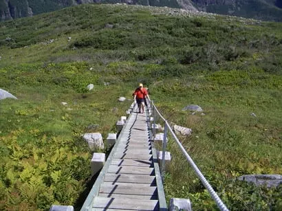
After the moose incident, we lazily had breakfast and packed up camp. We stashed our packs in some bushes and set off to climb the tourist trail up the backside of Gros Morne. After four days of muck, moose trails and tuckamore, the graded path and stairs (complete with handrails) were a welcome change, as was walking with daypacks instead of expedition packs. The hordes of daytrippers in jeans with purses and bottles of Coke were a bit of a culture shock though.
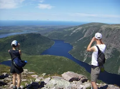
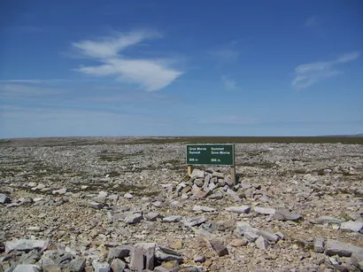
We soon reached the summit of Gros Morne, Newfoundland’s second highest peak at 807m. The top was actually quite flat and strewn with rocks. To me it looked like the surface of another planet. After posing for some summit shots, we returned to our backpacks at the lake. We had a quick lunch of whatever scraps were left in the food-bag. Reluctantly, we started on the long downhill trip to the car in the blazing sun. It was only 7km or so, but it took us quite a long time since we were tired and the trail was quite steep in places.
When we finally reached the parking lot, we checked our GPS. Apparently, the advertised 35km distance for hiking the Long Range Traverse is definitely an “as-the-crow-flies” distance. We had walked closer to 50km!
We went to the ranger station to sign in with the parks staff and return our transceiver. Next, we checked back in to Berry Hill campground, showered, and made our way into the village of Rocky Harbour. We had a late gourmet dinner of caribou lasagne and seafood vol-au-vent with lobster at Java Jack’s Restaurant. Divine!
The next morning we all went our separate ways. We dropped G and R off in Deer Lake to catch the bus back to the ferry and then on to Halifax. The Saskatchewan Family headed back to St. John’s to attend a conference. Greg and I headed off for a week-long driving and camping tour of Newfoundland. After spending 5 days hiking the Long Range Traverse, I couldn’t wait to see more of Newfoundland. As I write this, years later, I’m trying to figure out when I’ll be able to go back.
If You Go
The route is located in western Newfoundland near the town of Rocky Harbour in Gros Morne National Park. The closest airport is about an hour’s drive away in Deer Lake. You can rent a car in Deer Lake or take a bus from there to Rocky Harbour. If want to bring your own car, you can take the ferry. The ferry leaves from North Sydney, Nova Scotia and goes to Port-aux-Basques, Newfoundland. From there it’s a 4 hour drive to Rocky Harbour.
There is no trail and you must be experienced in map and compass navigation. The route is 35km long, but it is likely you will walk further due to navigational challenges. We walked 50km on our trip. Most parties take 4 or 5 days to complete the trip. The route is open from June 15 to September 15 each year.
You will need a reservation to hike the route. The national park allows just 3 parties to start each day, with a maximum of 4 people in each party. You can make reservations on the Gros Morne National Park website. A reservation fee applies and you also must pay for a wilderness camping permit when you arrive in Gros Morne.
Before you start you must attend a mandatory safety briefing and orientation session with the park rangers. The orientation session is scheduled for 2:30pm each day. At the orientation meeting your group leader will need to pass a brief map and compass test. You are required to attend orientation on the day before you start, so build that into your travel plans.
To start the route you need to take a boat to the head of Western Brook Pond. You can book your trip with the local operator, Bon Tours. You end at the Gros Morne Mountain trailhead. These two places are 30 minutes drive away from each other so you will need to arrange a shuttle. You can use local taxi operators in Rocky Harbour.
Hiking the Long Range Traverse is best multi-day route in Atlantic Canada. I would say that it’s worth travelling to Newfoundland to experience it. Have you hiked the Long Range Traverse? Do you have questions about the trip? Tell me in the comments.
Read Next: Beautiful Backpacking Trips Around the World
Trekking to Annapurna Base Camp
Backpacking the Sunshine Coast Trail Trip Report
Walk the Wildside Trail: Backpacking Trip Guide
- Lake O’Hara Packing Lists for Hikers and Campers - April 25, 2025
- BC Parks Day Passes 2025 – Everything You Need to Know - April 24, 2025
- Best Women’s Hiking Pants (Picks for Every Body Type) - April 21, 2025

Wayne Ng
Monday 27th of December 2021
Superb report, thanks for sharing. We might do this, pandemic travel being what it is.
Katie @k8tlevy
Sunday 25th of August 2019
Hi, and thanks so much for sharing all of this! My husband and I did the LRT earlier this month in 3 days/2 nights and I just finished my trip report. I stumbled on yours today, and it all sounds so wonderfully familiar. We didn't see nearly as much wildlife, but had some of the same challenges, trials, and tribulations. But what a wonderful adventure! It was fun reading about your experiences :)
Taryn Eyton
Sunday 25th of August 2019
Glad you enjoyed reading it Katie. I just read your report and it brings back a lot of memories.
Peter Andrews
Wednesday 8th of August 2018
Hi Taryn. Our group of 4 just completed the Long Range Traverse in 4 days/3 nights finishing up on Sunday August 5th. The group included my daughter in her early 30's and another couple in their mid 30's. All experienced backpackers and in excellent shape. I was the old guy in my mid 60's but in decent shape and with lots of wilderness experience. By way of background all of us did the WCT last summer. As part of our preparation i read your blog, thank you, along with everything else I could find about the trek. As you know there's not a lot of detailed info about the Long Range or Northern Traverse compared to info available on the WCT. I feel that a couple of cautionary comments are essential to those considering either the Northern Traverse or the Long Range Traverse: 1. It's very tough - lots of steep climbs and descents on relentless terrain of rock, mud, bog and lose rock (screed) and as you noted often through Tuckamore which is virtually impossible to penetrate. 2. Regardless of weather conditions, time of year and quality of boots your feet will be wet for the entire hike due to bog and water crossings. 3. There will be bugs and while less in mid to late August they're still there. We had bug shirts/hats and used them. 4. Unless you're a genius compass and map master navigator a GPS with the right (Parks Canada) map and way points loaded in is essential. The route is not at all marked and as you noted the trails are as likely to be animal trails as those made by humans. Follow the Parks Canada recommended route an not the older one loaded into some maps. 5. We were rushed at 4 days and even though the distances seem short the technical nature of the terrain and time to navigate carefully (we got off track once which cost us 4 hours and a lot of energy) makes the pace slow. Your average of 2k per hour is consistent with our overall experience. As a result of rushing we didn't really have time to enjoy the experience. 6. Weather in Gros Morne changes very quickly. Hikers must be prepared for 10 c to 15 c temperature swings and fog which without GPS can stop you dead. Add to this rain and wind and the risk of hypothermia is very real. We started our first day at 27c with sun and ended by setting up camp in a torrential cold rain with wind which had us all trembling from both cold and exhaustion by the time we got inside our damp tents. 7. The risk of getting lost or injury is very high. Probably 5 times that of the WCT. This is why they issue Personal Locator Beacons. Two groups the week before us were airlifted out, one lost and one injured and a group just ahead of us was airlifted out due to injury. In fact the rescue helicopter stopped to ask us if we'd seen the other group and/or if we were OK. 8. Like all longer wilderness hikes go as light as you possibly can. Don't be fooled by the fact that its "short" and take a little extra as we did. That extra weight nearly stopped me near the top of our first day's accent up the steep part of the gorge. 9. The terrain can only be described as spectacular in its scale, beauty and remoteness but othereise not well suited for human consumption. Overall our group decided that while we were pleased to have accomplished the hike and did enjoy the wonder of Gros Morne, unlike most other hikes we've done, this was a "never again" experience. i hate to discourage others from such a spectacular spot but do want them to go in with eyes wide open and hopefully well prepared. I enjoyed your blog and hope to write our story along with some pics to bring the experience to life shortly. In the meantime, happy hiking and wishing you lots of new adventures.
Mike
Monday 18th of December 2017
Hi Taryn. I've enjoyed a lot of your write ups and adventures in BC. Thanks very much for sharing! My GF and I have talked about the Long Range Traverse and my first reaction was "36km Is not 'Long Range' and shouldn't require 5 days." Can you fill me in on how it is that most people need 5 days? Is it just a matter of taking a leisurely pace or is the terrain that technical? Because I'd otherwise want to tack on the Northern Traverse to extend the trip another 27km.
Thanks! -Mike
Taryn Eyton
Monday 18th of December 2017
Hi Mike. It's 35km in a straight line... but it's an off trail route so most people hike a lot further. We hiked about 50km. We also tacked on a summit of Gros Morne Mountain at the end so we could have finished in 4 days without that. As well, there's a lot of micro-terrain (little cliff bands, tiny ponds, scrubby vegetation) and at times we were travelling less than 2km an hour. If you're fit and experienced with off trail navigation you could probably do the Long Range is 3 days (not including the summit of Gros Morne)... but most people still take 5.
Peter
Friday 29th of September 2017
Thanks for this great writeup. I'm looking at doing this exact trail, maybe next summer. I was a little concerned about transportation between the start and end points, but seems the taxi option is quite convenient!