

No car? No problem! There are actually lots of hikes in Vancouver that you can get to on transit. In fact, some trails are actually better on transit since parking can be a problem. There are even a few hikes that are best done as a one-way trip, which is much easier to do when you can take the bus to the start, then get another bus at the end.
So here’s my big list of Vancouver hikes you can get to on transit. While I put over 35 hikes on the list, there are even more transit-accessible hikes near Vancouver. Grab a map and a transit schedule and see what you can find!
PSST! Want to go overnight or multi-day hiking? Check out my list of the best car-free backpacking trips in BC.
But first… Be prepared
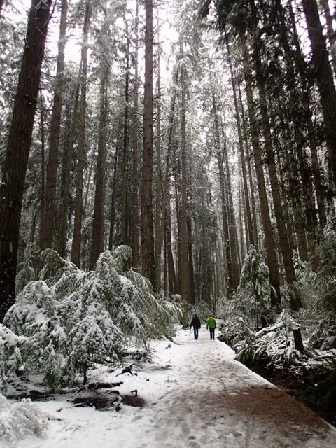
Just because you can take a bus right to the trail doesn’t mean you aren’t going to the wilderness. Many of the hikes on this list are very snowy and dangerous in winter or can have other hazards the rest of the year. Make sure you research trail conditions before you go.
Check the weather forecast too so that you know what to wear to keep you warm and dry. Bring a backpack that contains the 10 essentials – gear you should have on every hike. And leave a trip plan with a friend or family member so someone knows where you are going and when you will be back. Read more about the things you should do before every hike.
Lastly, these trails are located in sensitive wilderness areas. Learn how to Leave No Trace before you go so we can all keep the wilderness wild.
Taking Public Transit in Vancouver
Unfortunately, bus schedules change. I’ve done my best to include the most up-to-date transit info in this post, but please double check with Translink before you take transit to your hike.
Vancouver’s transit system uses a reloadable fare card called the Compass Card. You can buy one at a Skytrain station on online. Tap your card when you get on a bus. (You don’t have to tap out.) Tap in and out of the gates at Skytrain and Sea Bus stations.
If you don’t want to buy a Compass Card you can use a contactless (tap) credit cards or debit cards. You can also use mobile wallets (e.g. Apple Wallet, Samsung Pay. On the bus, you also have the option of paying with exact change.
Vancouver’s Skytrain and Sea Buses work on a zone system with fares increases the more zones you travel through. However, buses are all in the same zone. Look up info on your trip before you purchase your fare.
Bowen Island and Sunshine Coast Hikes You Can Get to on Transit
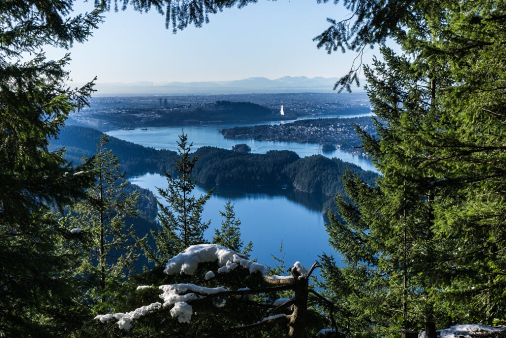
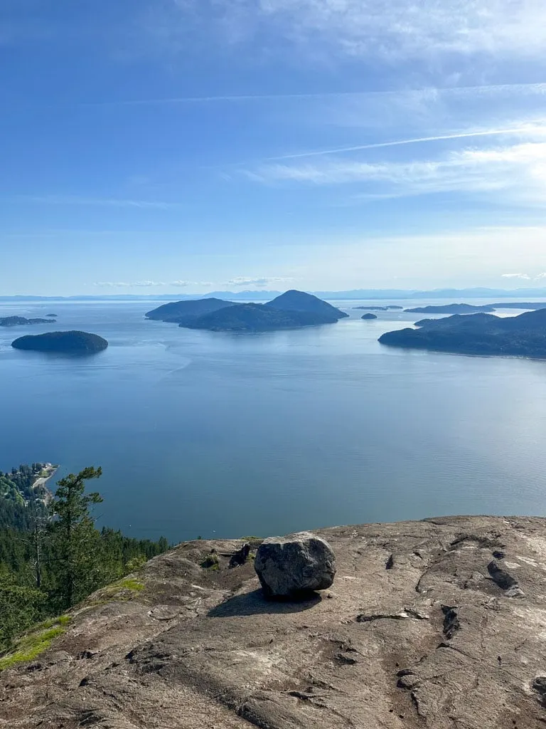
Mount Gardner
Mount Garner is the highest point on Bowen Island so it has great views. But since it’s only 719m tall, it’s rarely snowy and can be hiked almost all year.
Trail Stats: 17km round trip, 719m elevation gain, 7 hours, moderate. Getting There: From downtown Vancouver, take bus 257 or 250 to Horseshoe Bay, then walk on to the Bowen Island ferry. Parking at the ferry is difficult and expensive so taking the bus is much easier. More Info: Vancouver Trails
Killarney Lake
The easy and flat hike around Killarney Lake makes a great day trip to Bowen Island.
Trail Stats: 9km round trip, no elevation gain, 2 hours, easy. Getting There: From downtown Vancouver, take bus 257 or 250 to Horseshoe Bay, then walk on to the Bowen Island ferry. More Info: Crippen Regional Park
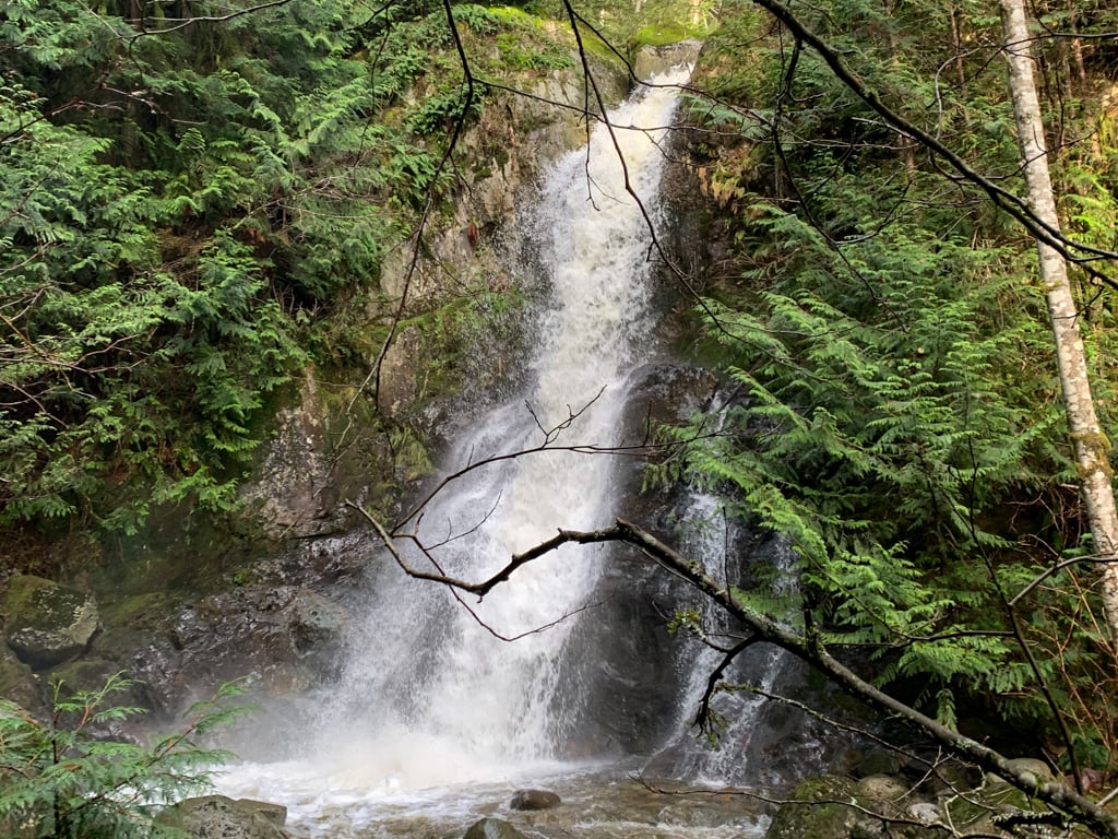
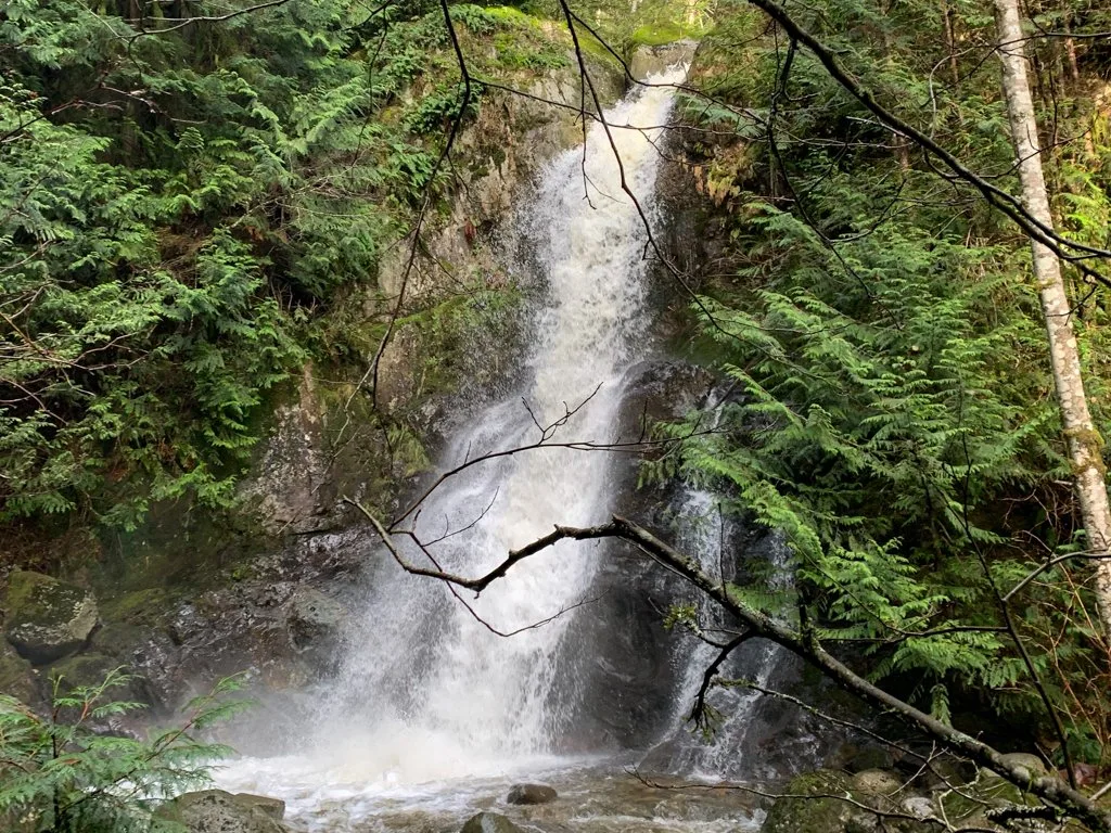
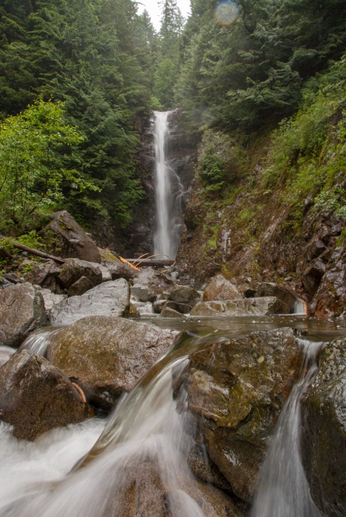
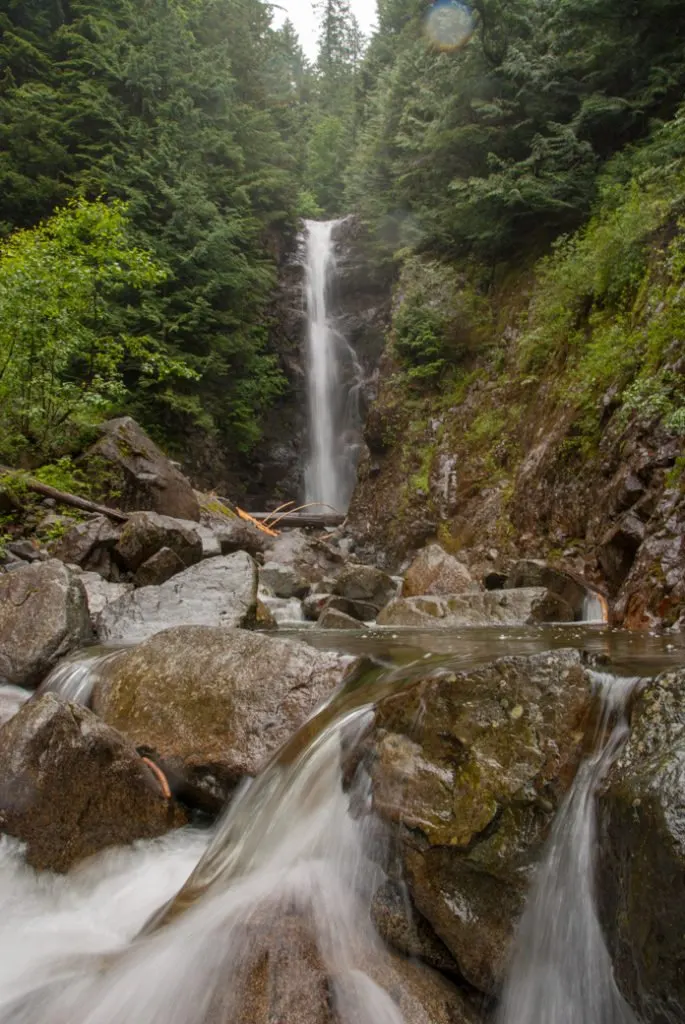
Langdale Falls
The hike to this waterfall passes through gorgeous mossy forest. It’s at a low elevation so you can hike it year-round. It’s one of the best hikes on the Sunshine Coast.
Trails Stats: 8km round trip, 280m elevation gain, 3 hours, easy. Getting There: From downtown Vancouver, take bus 257 or 250 to Horseshoe Bay, then walk on to the Sunshine Coast ferry. More Info: My Langdale Falls trail guide.
Lions Bay Hikes You Can Get to on Transit
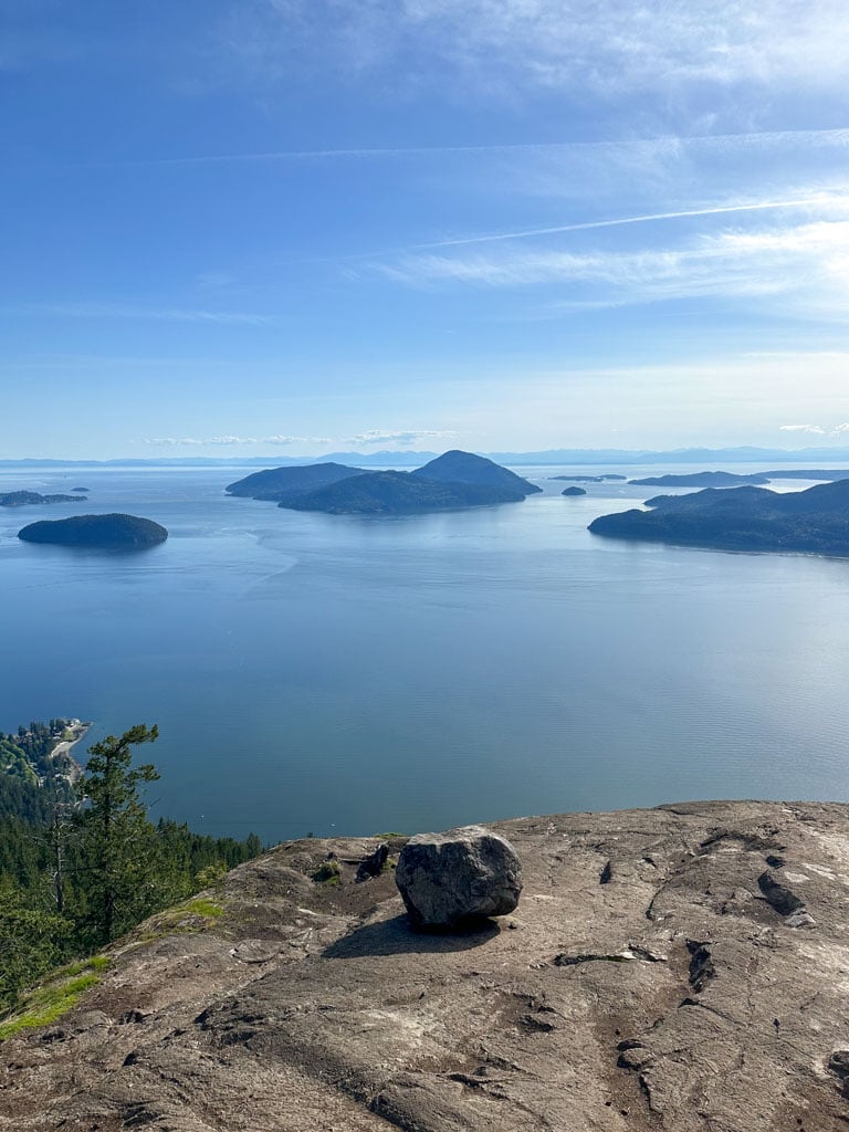
Tunnel Bluffs
The hike to Tunnel Bluffs leads to an incredible view of Howe Sound. The first half of the hike is brutally steep, but the second half is easy. And of course, the view is worth it.
Trail stats: 11 km round trip, 450 m elevation gain, 3.5-4.5 hours, moderate. Getting there: Take bus 262 to Lions Bay from Horseshoe Bay. In Lions Bay, walk up Bayview Drive, then Mountain Drive to the trailhead on Sunset Drive. More Info: My Tunnel Bluffs trail guide
The Lions
This is a tough trail, best left for experienced hikers. But it goes to a viewpoint near the summit of Vancouver’s iconic Lions – peaks that can dominate the city’s skyline. (The route to the summit is for mountaineers only.)
Trail Stats: 16 km round trip, 1280 m elevation gain, 8 hours, very challenging. Getting there: Take bus 262 to Lions Bay from Horseshoe Bay. In Lions Bay, walk up Bayview Drive, then Mountain Drive to the trailhead on Sunset Drive. More Info: Vancouver Trails
Brunswick Mountain
At 1788 m, Brunswick Mountain is the tallest mountain on Vancouver’s North Shore. The steep and challenging trail to the summit (for experienced hikers only) leads to an incredible view.
Trail stats: 14 km round trip, 1543 m elevation gain, 7-9 hours, very challenging. Getting there: Take bus 262 to Lions Bay from Horseshoe Bay. In Lions Bay, walk up Bayview Drive, then Mountain Drive to the trailhead on Sunset Drive. More Info: Outdoor Vancouver
West Vancouver Hikes You Can Get to on Transit
Cypress Falls
If you’re looking for a shorter hike on a cloudy day, Cypress Falls is a great choice. It’s an easy walk to lots of waterfalls. (It’s also one of the best waterfall hikes near Vancouver.)
Trail Stats: 3km round trip, 130m elevation gain, 1.5 hours, easy. Getting there: Take bus 253 from Park Royal. Get off on Woodgreen Drive at Woodgreen Place, then walk 1 block down Woodgreen Place to the park. More Info: Vancouver Trails
Lighthouse Park
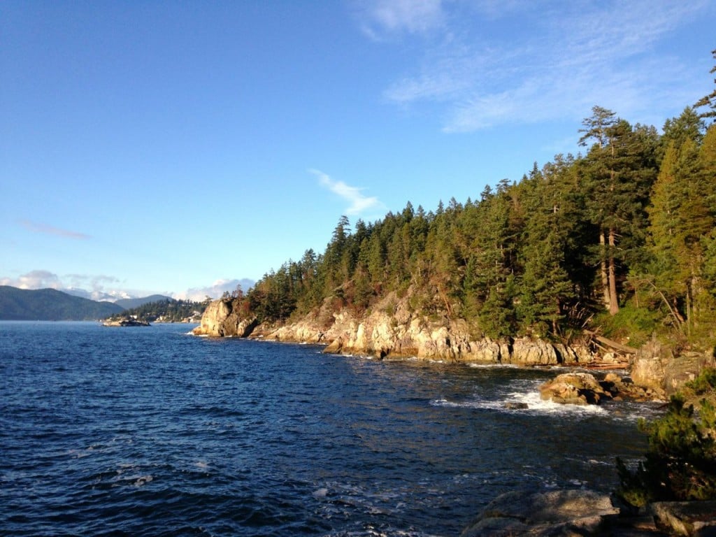
Even though it’s close to the city, the trails of Lighthouse Park are surprisingly wild. Explore the forested interior or head to the coast for great views of Howe Sound or Burrard Inlet.
Trail Stats: 6km loop, minimal elevation gain, 2 hours, easy. Getting there: Take bus 250 from downtown Vancouver. Get off at the Beacon Lane stop on Marine Drive in West Vancouver, then walk down Beacon Lane into the park. The parking lot fills up on summer weekends, so take transit instead. More Info: My favourite route in the park.
Did you you know? Lighthouse Park is actually one of the best easy hikes in Vancouver AND one of the most Instagrammed hikes in Vancouver.
Brothers Creek
There are some great trails just above the mansions of the British Properties. The Brothers Creek trail follows the creek uphill past some waterfalls and old growth trees.
Trail Stats: 7km loop, 350m elevation gain, 4 hours, moderate. Getting there: Take bus 254 from Park Royal to the stop at Eyremount Drive and Crestline Road. Walk up Crestline Road, then turn left on Henlow Road. Turn right on Millstream Road, then continue on Millstream for 100m. Turn left at the fork to reach the trailhead. Total walking distance from the bus stop: 500m. More Info: Vancouver Trails
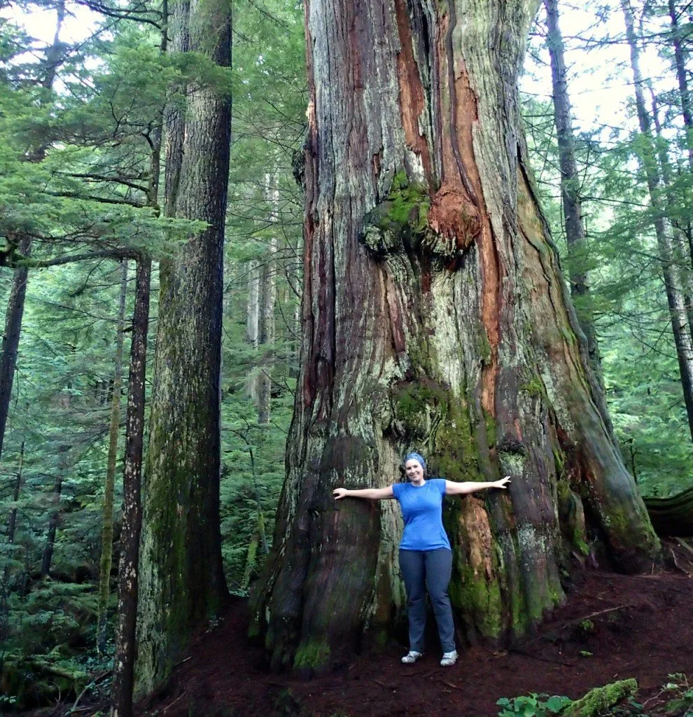
Bonus: From the Brothers Creek trail you can detour to the Hollyburn Fir. It’s over 1000 years old and is on my list of Vancouver’s most unusual hikes.
Capilano Pacific Trail
Note: There is a significant washout on this trail but there is a signed detour.
Although this trail is never far from neighbourhoods, the rushing of the Capilano River makes it sound like you are out in the wilderness. The trail follows the river upstream from the ocean to Capilano Canyon below Cleveland Dam.
Trail Stats: 15km return, 230m elevation gain, 4 hours, easy. Getting there: More Info: Capilano River Regional Park Getting there: Take bus 250 or 257 to Park Royal, then walk behind the mall to the trail near the mouth of the river. If you don’t feel up to walking back the way you came, take bus 232 then 246 to Vancouver or take bus 236 to the Seabus. More info: Capilano River Regional Park
North Vancouver Hikes You Can Get to on Transit
Capilano Canyon
There is lots to see on the trails around the Cleveland Dam in Capliano Canyon. Be sure to check out the dam spillway, fish hatchery, and deep canyon walls. Watch for whitewater kayakers too.
Trail stats: 2.5km loop, 100m elevation gain, 1 hour, easy. Getting there: Take bus 236 from the Sea Bus. Get off on Nancy Green Way at Prospect Avenue. More info: Capilano River Regional Park
Grouse Grind

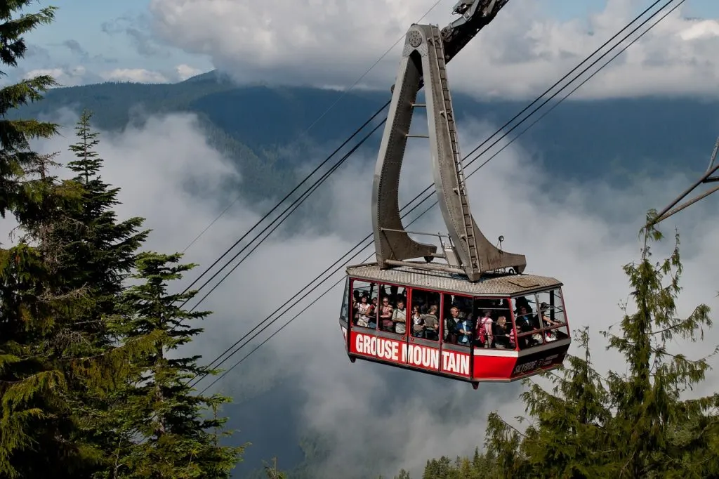
“The Grind”, as locals call it, is a Vancouver workout classic. It climbs relentlessly uphill to the top of the Grouse Gondola. There are lots of stairs (and sweat) along the way, and no views until the top.
Trail Stats: 3km, 850m elevation gain, 2 hours, difficult. Getting there: Take bus 236 from the Sea Bus to the base of Grouse Mountain. Or take bus 232 from Phibbs Exchange. More info: Grouse Mountain Regional Park
DID YOU KNOW? The Grouse Grind is one of the Most Instagrammed Hikes in Vancouver?
BCMC Trail
If the manicured stairs and personal-best-seeking runners aren’t your thing, skip the Grouse Grind and take the BCMC trail up to the top of Grouse instead. The BCMC is just east of the Grind and has a much wilder feel.
Trail stats: 3km, 850m elevation gain, 2 hours, difficult. Getting there: Take bus 236 from the Sea Bus to the base of Grouse Mountain. Or take bus 232 from Phibbs Exchange. More info: Grouse Mountain Regional Park
Thunderbird Ridge
This short hike ends at a spectacular viewpoint high above Lynn Creek. Even though you’re right next to Grouse Mountain Resort, you’ll cover some rugged terrain to get here. Of the trails on my best easy hikes in Vancouver list, Thunderbird Ridge definitely has the most wilderness feel.
Trail stats: 6km return, 190m elevation gain, 2.5 hours, easy/moderate. Getting there: Take bus 236 from the Sea Bus to the base of Grouse Mountain. Or take bus 232 from Phibbs Exchange. Take the Grouse Gondola up to the resort or hike up the Grouse Grind or BCMC. More info: Lynn Headwaters Regional Park
Little Goat Mountain and Dam Mountain
This short loop hike behind Grouse Mountain takes you to the summit of two peaks along the top of a ridge. There are peek-a-boo views of Vancouver and the surrounding mountains.
Trail stats: 5.5km loop, 250m elevation gain, 2 hours, easy/moderate. Getting there: Take bus 236 from the Sea Bus to the base of Grouse Mountain. Or take bus 232 from Phibbs Exchange. Take the Grouse Gondola up to the resort or hike up the Grouse Grind or BCMC. More info: Lynn Headwaters Regional Park
Goat Mountain
If you’re looking for a hike at Grouse Mountain that is a bit more challenging without being too extreme, head to Goat Mountain. The final section up to the summit includes a short scramble on granite rocks.
Trail stats: 8km return, 300m elevation gain, 4 hours, moderate. Getting there: Take bus 236 from the Sea Bus to the base of Grouse Mountain. Or take bus 232 from Phibbs Exchange. Take the Grouse Gondola up to the resort or hike up the Grouse Grind or BCMC. More info: Lynn Headwaters Regional Park
Crown Mountain
Crown Mountain is the most difficult trail on the North Shore. It features a brutal descent into Crown Pass, then a slabby rock scramble to the summit. Use caution and don’t go in bad weather as hikers have fallen to their death here.
Trail Stats: 10km return, 385m elevation gain, 7 hours, difficult. Getting there: Take bus 236 from the Sea Bus to the base of Grouse Mountain. Or take bus 232 from Phibbs Exchange. Take the Grouse Gondola up to the resort or hike up the Grouse Grind or BCMC. More info: Lynn Headwaters Regional Park
Mount Fromme
Next-door to Grouse Mountain is its forgotten sister, Mount Fromme. The route to the summit weaves together a patchwork of mountain bike and multi-use trails and is much quieter than its slightly taller sibling.
Trail info: 10km return, 880m elevation gain, 5 hours, moderate. Getting there: From Lonsdale Quay take bus 230 to Braemar Road at St. George’s Avenue. Walk up St. George’s for 600m to the trailhead. More info: Vancouver Trails
Kennedy Falls and the Big Cedar

This rugged trail follows an old logging road bed to a huge old cedar tree and beautiful Kennedy Falls.
Trail info: 10km return, 150m elevation gain, 5 hours, moderate. Getting there: Take bus 210 from downtown Vancouver to the top of Mountain Highway at Coleman Street. Walk 900m up Mountain highway to the trailhead and parking lot. The lot is always full and parking on the surrounding streets is very difficult, so transit is the best choice here. More info: My Kennedy Falls trail guide
Lynn Loop
This short forested trail is a great choice for a cloudy day since it stays in the trees along the banks of Lynn Creek.
Trail stats: 5km, 160m elevation gain, 2 hours, easy. Getting there: Take bus 228 from Lonsdale Quay. Get off on Lynn Valley Road at Dempsey and follow Lynn Valley road or the Varley Trail into the park. More info: Lynn Headwaters Regional Park
Norvan Falls
This waterfall hike is great in the spring when the snow is melting and the falls are gushing. It’s also nice in the summer when you can cool off under the chilly falls.
Trail stats: 14km return, 195m elevation gain, 6 hours, moderate. Getting there: Take bus 228 from Lonsdale Quay. Get off on Lynn Valley Road at Dempsey and follow Lynn Valley road or the Varley Trail into the park. More info: Lynn Headwaters Regional Park
Lynn Peak
The hike up to Lynn Peak is steep in places, but there’s a viewpoint at the top to make it worth the climb.
Trail stats: 9km return, 720m elevation gain, 4.5 hours, moderate/difficult. Getting there: Getting there: Take bus 228 from Lonsdale Quay. Get off on Lynn Valley Road at Dempsey and follow Lynn Valley road or the Varley Trail into the park. More info: Lynn Headwaters Regional Park
WANT MORE STEEP WORKOUT HIKES? Check out these Alternatives to the Grouse Grind
Coliseum Mountain
The hike to Coliseum Mountain is long and difficult, but few venture this far so you’ll escape the crowds. The views from the top are some of the best on the North Shore.
Trail stats: 22km return, 1245m elevation gain, 10+ hours, difficult. Getting there: Take bus 228 from Lonsdale Quay. Get off on Lynn Valley Road at Dempsey and follow Lynn Valley road or the Varley Trail into the park. More info: Lynn Headwaters Regional Park
Hanes Valley
The difficult Hanes Valley trail is unique since it is usually done as a one-way hike. That makes it a great one to do via public transit. You start at Lynn Headwaters parking lot and finish at Grouse Mountain. Along the way you ascend the scree slopes of rugged Hanes Valley.
Trail Stats: 15km one way, 1320m elevation gain, 8.5 hours, difficult. Getting there: To start take bus 228 from Lonsdale Quay. Get off on Lynn Valley Road at Dempsey and follow Lynn Valley road or the Varley Trail into the park. To finish take the gondola down to the base of Grouse Mountain, then take bus 236 to the Sea Bus or bus 232 to Phibbs Exchange. More info: Lynn Headwaters Regional Park
Lynn Canyon
The picturesque suspension bridge and trails in Lynn Canyon are popular with tourists and locals alike. The loop through the canyon to Twin Falls is a popular route.
Trail Stats: 1.5km loop, 65m elevation gain, 1 hour, easy. Getting there: Take bus 228 to Lynn Valley Road at Peters Road. Follow Peters road into the park. More info: Lynn Canyon Park
NEED AN EASY HIKE? Lynn Canyon is one of the best Easy Hikes in Vancouver for Beginners and Tourists
Baden Powell: Lynn Canyon to Grouse
The Baden Powell trail stretches all the way across the North Shore. This section traverses the lower slopes of Fromme and Grouse Mountain, intersecting lots of mountain bike trails.
Trail stats: 10km one way, 200m elevation gain, 5 hours, moderate. Getting there: To start, take bus 228 to Lynn Valley Road at Peters Road. Follow Peters road into Lynn Canyon Park. To finish, take bus 236 to the Sea Bus or bus 232 to Phibbs Exchange from the base of Grouse Mountain. More info: Vancouver Trails
Quarry Rock

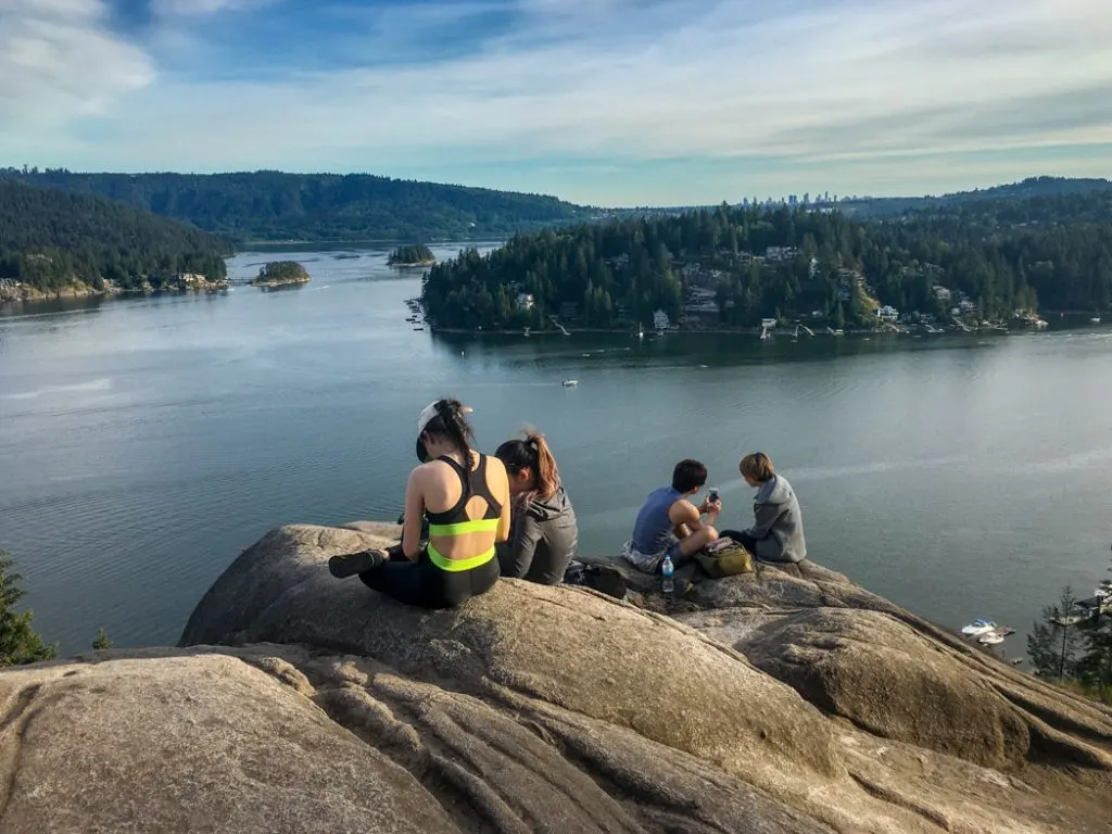
The hike to Quarry Rock is one of the most popular ones in Vancouver. (It’s one of Vancouver’s best easy hikes and it’s kind of a big deal on Instagram!) It’s not difficult, there’s a great viewpoint, and afterwards you can go to Honey’s Doughnuts in Deep Cove.
Trail stats: 4km return, 100m elevation gain, 1.5 hours, easy. Getting there: Take bus 212 from Phibbs Exchange or bus 211 from downtown Vancouver to Deep Cove. More info: Vancouver Trails
Baden Powell: Deep Cove to Lynn Canyon
This section of the Baden Powell goes through the trail network at the base of Mount Seymour. You’ll cross the Seymour River before finishing your hike at Lynn Canyon.
Trail stats: 12km one way, 420m elevation gain, 5 hours, moderate. Getting there: To start, take bus 212 from Phibbs Exchange or bus 211 from downtown Vancouver to Deep Cove. To finish, walk out of the park on Peters road. Take bus 228 from Lynn Valley Road at Peters Road. More info: Vancouver Trails
Vancouver Hikes You Can Get to on Transit
Pacific Spirit Park

Although it’s right next to the city, Pacific Spirit Park has tons of forested trails. It’s easy to look at the park map and then put together your own loop route.
Trail Stats: Up to 15km loop, up to 100m elevation gain, up to 5 hours, easy. Getting there: There are numerous trailheads for the park and tons of options for getting there. Any UBC-bound bus will work. More info: Pacific Spirit Regional Park
Stanley Park

Although most people head to Stanley Park to walk the seawall, there are actually lots of beautiful forested trails in the interior of the park. You can string a bunch of them together to form a loop. I think it’s one of the best easy hikes in Vancouver for tourists.
Trail Stats: 6km+ loop, no elevation gain, 2+ hours, easy. Getting there: Take bus 19 from downtown Vancouver. More info: Stanley Park map
Burnaby Hikes You Can Get to on Transit
Burnaby Lake
The easy hike around Burnaby Lake is an oasis of nature in the middle of the urban jungle. Keep your eyes peeled to spot lots of birds and other wildlife.
Trail stats: 10km loop, no elevation gain, 2.5 hours, easy. Getting there: Take the Skytrain to the Sperling-Burnaby Lake station on the Millenium Line. Then take the pedestrian overpass over the railway tracks into the park. More info: Burnaby Lake Regional Park
Velodrome Trail

This short, steep trail is a great choice for a workout hike. It’s so steep that it’s been nicknamed the “Burnaby Grind”. (There are actually lots of other Grouse Grind-like hikes.) And while there’s no gondola, you can catch the bus at the top so you don’t have to hike back down!
Trail stats: 3km one way, 240m elevation gain, 1 hour, moderate. Getting there: To start take bus 160 from Kootenay Loop to the Velodrome stop on Barnett Highway. To finish take the Trans Canada Trail up to the SFU bus loop, then take the 135 back to Vancouver. More info: City of Burnaby Map
Coquitlam and Tri-Cities Hikes You Can Get to on Transit
Jug Island Beach

This short hike ends at a small beach on Indian Arm. Along the way it goes through mossy, green forest.
Trail stats: 5.5km return, 100m elevation gain, 2.5 hours, moderate. Getting there: Take bus 182 from Port Moody Skytrain Station to the Belcarra Regional Park stop. More info: Belcarra Regional Park
Admiralty Point
This trail winds along the coast of Burrard Inlet, with detours to several scenic viewpoints. It ends at Admiralty Point across the water from Burnaby Mountain.
Trail stats: 5km return, no elevation gain, 1.5 hours, easy. Getting there:Take bus 182 from Port Moody Skytrain Station to the Belcarra Regional Park stop. More info: Belcarra Regional Park
Sasamat Lake
On a hot day, combine a trip the short hike around Sasamat Lake with a trip to the beach at the northern end of the lake. Note: Public transit only runs to Sasamat Lake in the summer and may only run on weekends. Check Translink schedules before you go.
Trail stats: 3km loop, no elevation gain, 1 hour, easy. Getting there: Take bus 150 from Coquitlam Skytrain Station to the White Pine Beach stop on Sasamat Lake. More info: Belcarra Regional Park
Buntzen Lake
The popular hike around Buntzen Lake has a few spots to drop down to lake level for a swim, including a great grassy picnic area at the north end. Note: Public transit only runs to Buntzen Lake in the summer and may only run on weekends. Check Translink schedules before you go.
Trail stats: 10km loop, 100m elevation gain, 3 hours, easy. Getting there: Take bus 179 from Coquitlam Skytrain Station or Inlet Skytrain Station to the Buntzen Lake stop. (Important: This bus only runs May to September.) More info: BC Hydro Buntzen Lake Trail Info
Diez Vistas
The Diez Vistas trail climbs a ridge between Buntzen Lake and Indian Arm for great views of Burrard Inlet and Indian Arm. Originally there were 10 views (“diez vistas” in Spanish), but a few of them have grown in. Note: Public transit only runs to Buntzen Lake in the summer and may only run on weekends. Check Translink schedules before you go.
Trail stats: 15km loop, 460m elevation gain, 7 hours, moderate. Getting there: Take bus 179 from Coquitlam Skytrain Station or Inlet Skytrain Station to the Buntzen Lake stop. (Important: This bus only runs May to September.) More info: BC Hydro Buntzen Lake Trail Info
Coquitlam Crunch
This steep trail climbs up underneath the powerlines in Coquitlam. Since it climbs relentlessly uphill, it’s a great workout hike. In fact, some people say it’s Coquitlam’s version of the Grouse Grind.
Trail stats: 4.5km round trip, 240m elevation gain, 1.5 hours, moderate. Getting there. From Moody Centre Skytrain station take bus 184 or 160 to Guilford Way at Falcon Drive. Walk up Falcon Drive to the elementary school. The trail starts behind the school. More info: Vancouver Trails
I hope this list has convinced you that you really don’t need a car to go hiking. There are so many Vancouver hikes you can get to on transit that you won’t even miss having a vehicle!
MORE VANCOUVER AREA HIKES:
- 30+ Places to Go Backpacking in BC Without A Car
- The Best Vancouver Hiking Books
- Waterfalls Near Vancouver You Can Hike To
- Most Instagrammed Hikes in Vancouver (Updated for 2019)
- The Worst Hikes in Vancouver (And Where to Hike Instead)
- The 10 Best Hikes in Vancouver: A Local’s Guide
- 15 Unusual Hikes Near Vancouver
- 100+ Snow-Free Hikes in Vancouver: Trails You Can Hike Year Round
- 6 Easy Hikes in Vancouver for Beginners and Tourists
- Coastal Hiking in Vancouver
- Alternatives to the Grouse Grind


- Things to Do on Newfoundland’s Great Northern Peninsula - July 29, 2026
- Best Sun Hoodies for Hiking - June 3, 2026
- Lower Stein Valley Trail Hiking and Backpacking Guide - May 27, 2026