
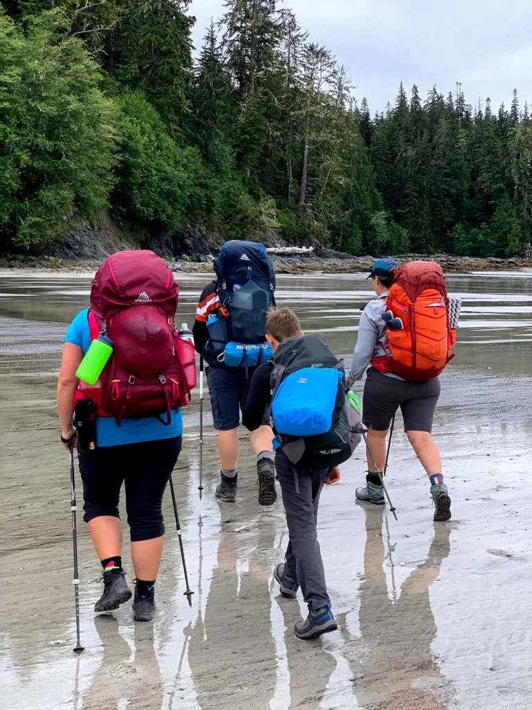
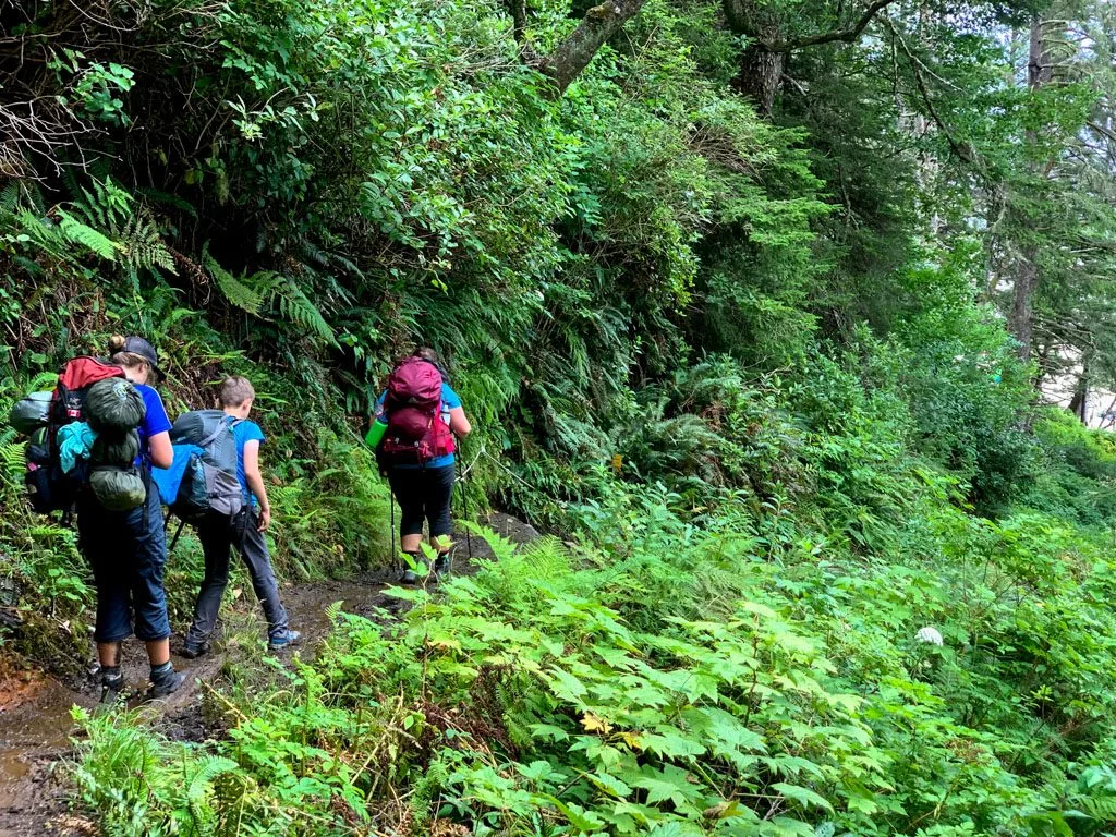
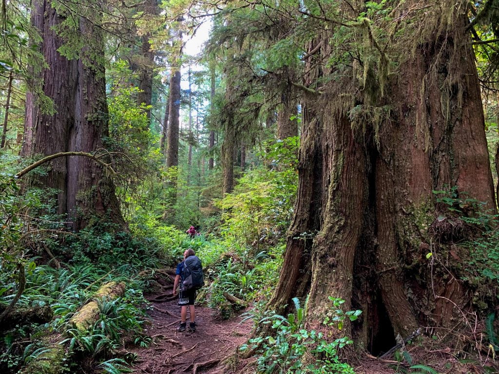
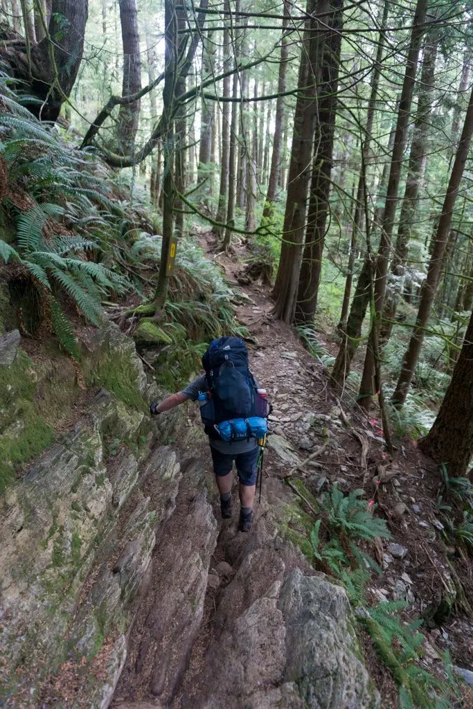
The West Coast Trail is a 75km multi-day backpacking trip along the West Coast of Vancouver Island in British Columbia. Along the way, you’ll hike through the rainforest on rough trail, boardwalks and mud bogs, walk along sandy beaches, boulders, and slippery coastal shelf, cross rivers on high bridges and cable cars, and climb in and out of gorges on towering wooden ladders. Each night you’ll camp on a beautiful beach.
I’ve hiked the West Coast Trail twice. I went south to north in June 2004 and north to south in August 2019. Both times it was gorgeous but challenging. I’ve put together a section-by-section overview of the West Coast Trail to give you a taste of the trail and help you get prepped for your trip. It’s got info on distances, difficult, hiking times and things you won’t want to miss for each section. There are also loads of photos!
WANT MORE WEST COAST TRAIL INFO? Check out these posts:
- West Coast Trail Basics
- 7-Day West Coast Trail Itinerary (Plus More Itinerary Options)
- Packing List: Everything You Need to Bring
- Complete Guide to Every Campground
- Transportation: How to Get There, Where to Stay Near the Trailheads
- Coastal Hiking Tips: Advice for Beach Backpacking
This is a sensitive wilderness area. Learn how to Leave No Trace to keep the wilderness wild. Make sure you are prepared by bringing the 10 Essentials. Get ready for adventure with this checklist of things to do before every hike.
Key Distances on the West Coast Trail
A Quick Note: I’ve chosen to layout this guide from north to south because KM0 is in the north. Also, I use the official Parks Canada kilometre markers throughout this guide. As anyone who has hiked the trail with GPS can tell you, many of Parks Canada’s kilometres are much longer than an actual kilometre! So for each West Coast Trail section below, I’ve given the “official distance”. You may find that you travel much further than the official distance!
| KM | Location |
|---|---|
| 0 | Pachena Bay Trailhead |
| 9 | Side trail to Sea Lion Rocks |
| 9.5 | Pacheena Lighthouse |
| 12 | Michigan Creek Camp |
| 13.7 | Darling River Camp |
| 15 | Orange Juice Creek Camp |
| 16.5 | Tscowis Creek Camp |
| 18 | Valencia Bluffs Viewpoint |
| 23 | Klanawa River Camp |
| 25 | Tsusiat Falls Camp |
| 29.7 | Ditidaht Luxury Tents (closed in 2022) |
| 32.2 | Nitinaht Narrows |
| 41.5 | Cribs Creek Camp |
| 44 | Carmanah Lighthouse |
| 45 | Chez Monique’s (closed) |
| 46 | Carmanah Creek Camp |
| 48 | Bonilla Point Camp |
| 53 | Walbran Camp |
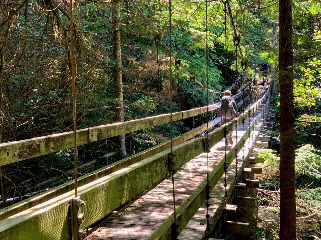
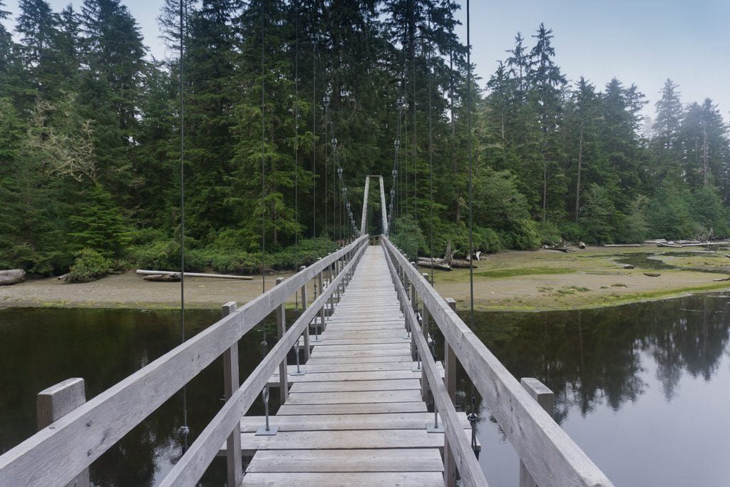
| 56 | Logan Creek Suspension Bridge |
| 57.7 | Cullite Creek Campsite via side trail |
| 62.2 | Camper Bay Camp |
| 67 | Owen Point |
| 70 | Thrasher Cove Junction |
| 75 | Gordon River ferry |
West Coast Trail Orientation Sessions
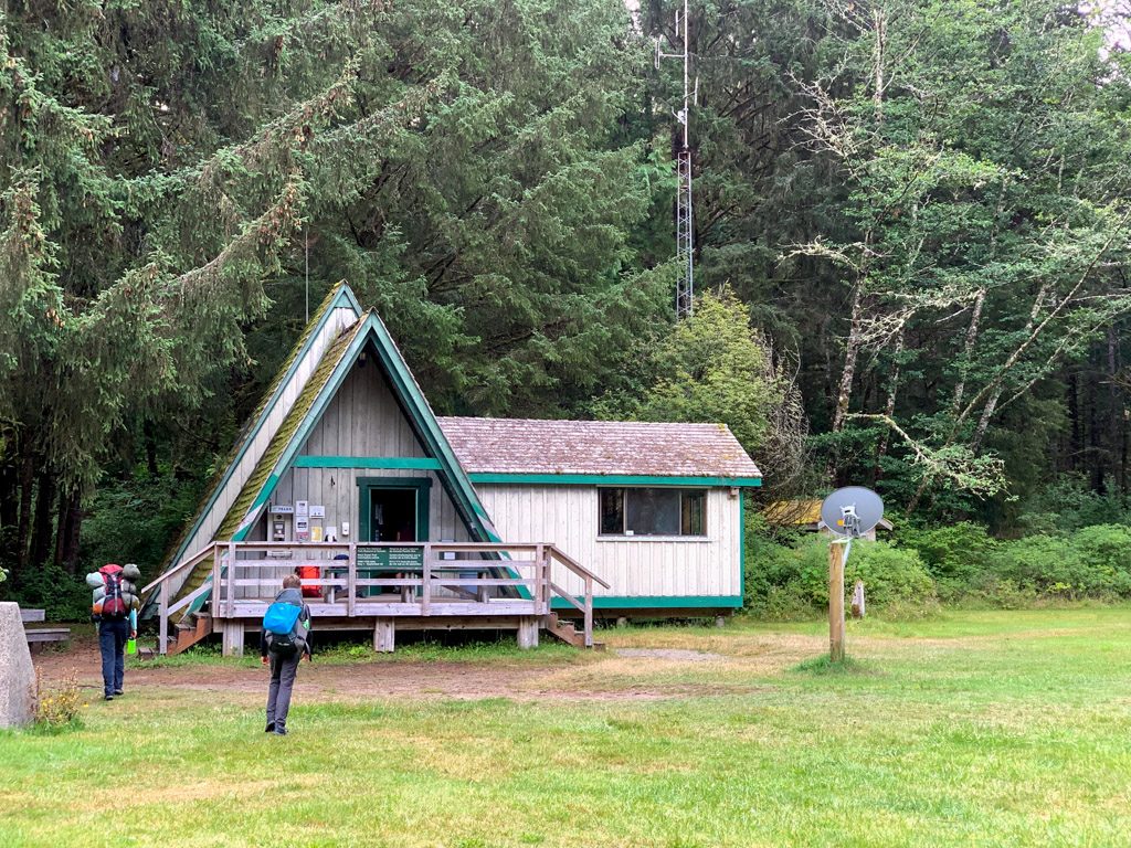
Every hiker heading out on the West Coast Trail MUST attend an orientation session. Pre-pandemic orientation sessions included a powerpoint presentation about the trail. It includes information about safety, tides, wildlife and trail etiquette. It also included a section-by-section breakdown of what the trail will be like. You’ll also learn a bit about the history of the trail and the local First Nations people who have lived in the area since time immemorial.
During the pandemic, you’ll receive a link to a video orientation a week before your trip. When you check in, they will ask you skill testing questions to check if you have watched the video. They will also give you an update on the latest trail conditions.

Check-in schedule:
Pachena Bay: 10 am and 2 pm
Gordon River: 10 am and 2 pm
Nitinaht Village: 7 am and 3:30 pm
You can attend either orientation on the day you start the trail or the afternoon of the day before. You don’t have to reserve a spot at an orientation – just show up. However, they do ask that you come 15-30 minutes early to check-in.
Bring your emailed permit confirmation to the orientation session. When you get to the orientation, the ranger will check you in and give you a copy of the waterproof trail map and tide table. You’ll also have to buy your National Parks pass (or show your annual pass if you have one.)
After the orientation you will sign a waiver and the ranger will give you your trail permit. You must carry your trail permit and parks pass at all times on the trail. They aren’t waterproof so bring a ziplock bag to carry them in.
Join the Backpacking in BC Facebook Group
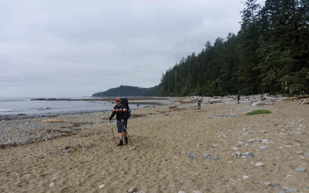
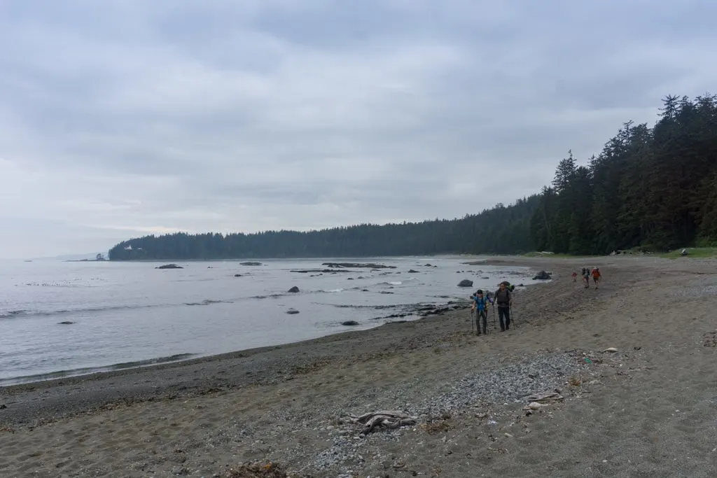
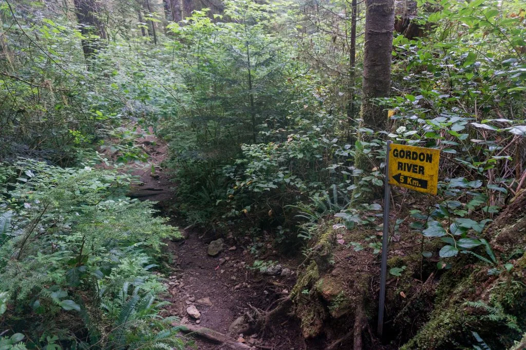
Pachena Bay to Michigan Creek (KM0 to KM12)
Official Distance: 12km Actual Distance: 13km Time: 4-5 hours Difficulty: Easy/Moderate
Highlights: Sea Lion rocks, Pachena Lighthouse
The northern-most West Coast Trail section is easier than the rest of the trail, but it’s still not that easy. The trail starts next to the ranger station at Pachena Bay. Right from the start, you have a choice between the beach route and the forest route. You can take the beach route if the tide is below 2.4m. You’ll only be on the beach for 0.5 km, but it’s worth it since the forest route involves a few ladders to go up and over a bluff. The two routes rejoin at a small bridge over Clonard Creek.

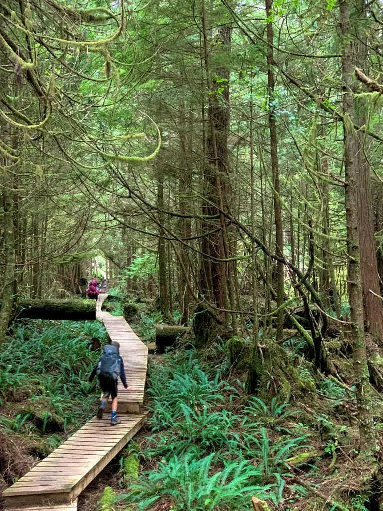
The next 12 kilometers are all in the forest. The trail is a former jeep road that was used to supply the Pachena Point Lighthouse. However, most traces of the road are long gone and it’s not entirely easy walking. There are lots of gullies to climb in and out of. There are even a few short ladders to give you a taste of what’s to come on the southern part of the trail. As well, the trail is well away from the coast and climbs up to 100m above sea level, so there is more up and down that you’d think.
At roughly the 9km mark look for a side trail heading towards the ocean. Follow the trail for about 100m to a viewpoint on a bluff high above the ocean. There are usually sea lions on the rocks just off shore. On my August 2019 visit, we didn’t see any sea lions, but we did spot grey whales feeding!

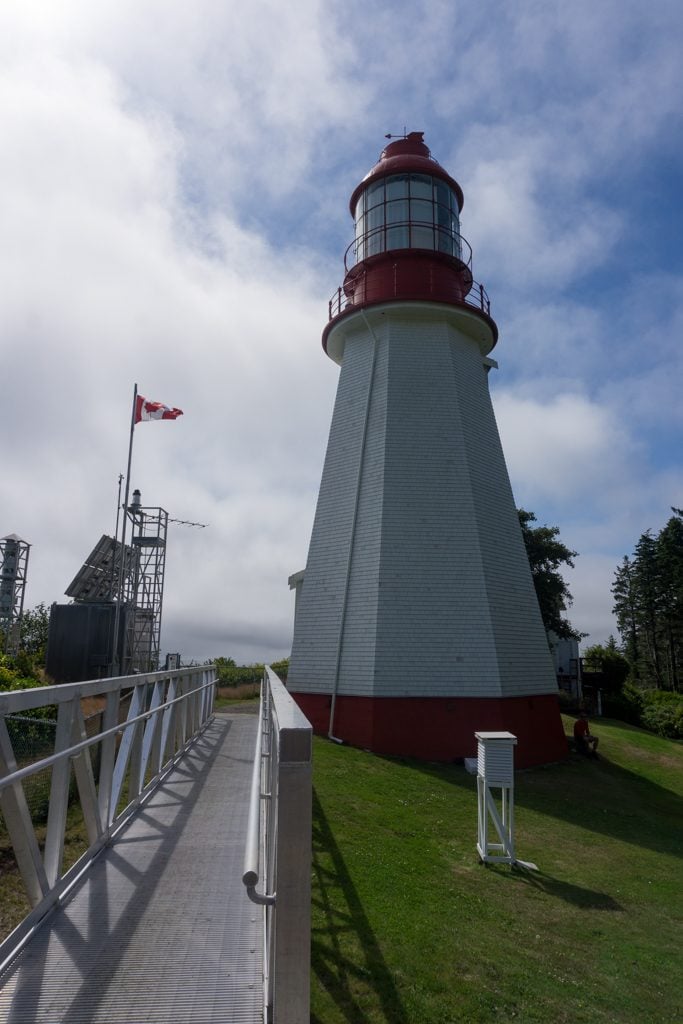
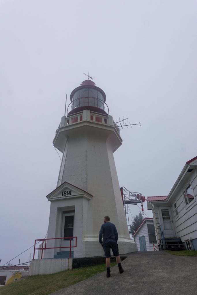
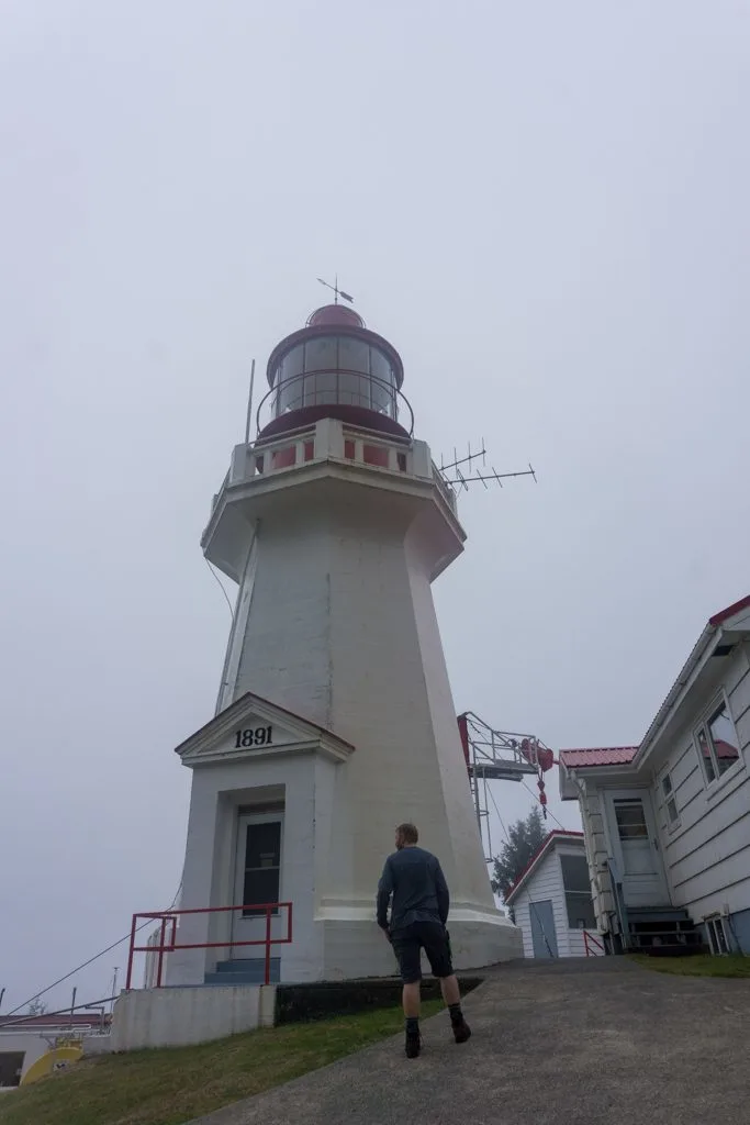
Back on the main trail, it’s another 500m of walking to reach the turnoff to Pachena Lighthouse around the 9.5km mark. The side trail emerges from the forest on the manicured lawn of the lighthouse. You are allowed to walk around the grounds and enjoy the views, but respect the privacy of the lighthouse keepers and their homes. Be sure to watch for whales below the bluff. We spotted a grey whale in the cove just below the lighthouse.
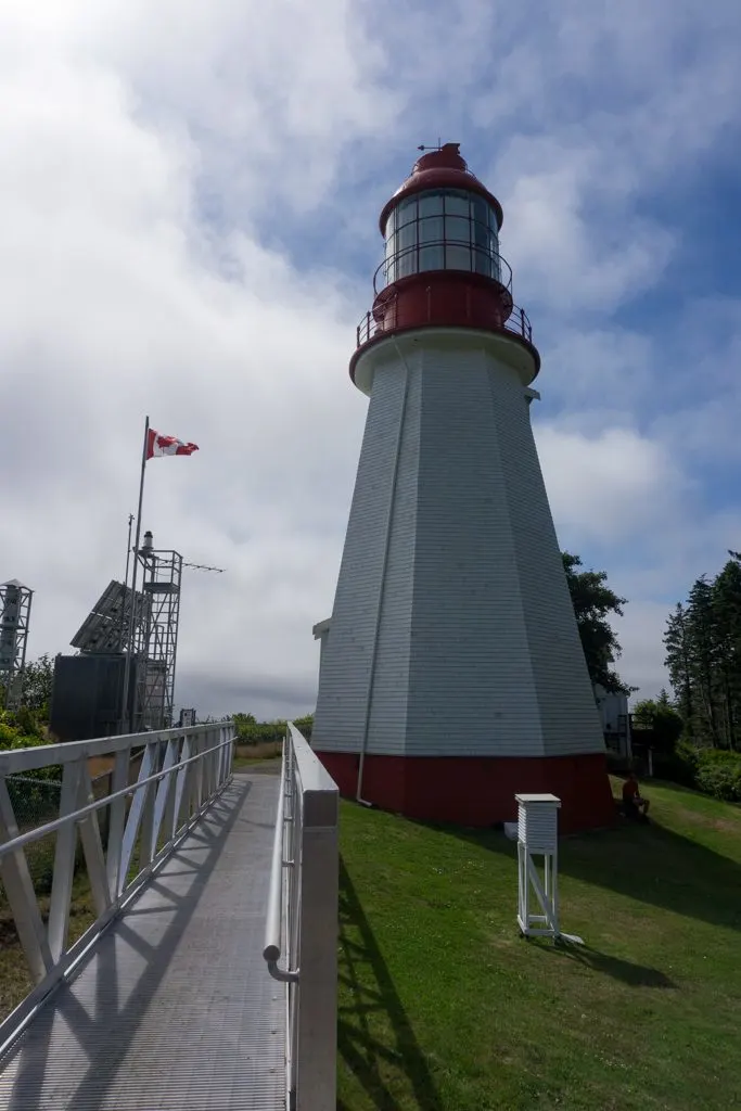
The final 2.5km of walking to Michigan Creek is also in the forest. There are a few more hills to climb before descending to the beach at Michigan Creek where there is a campsite.

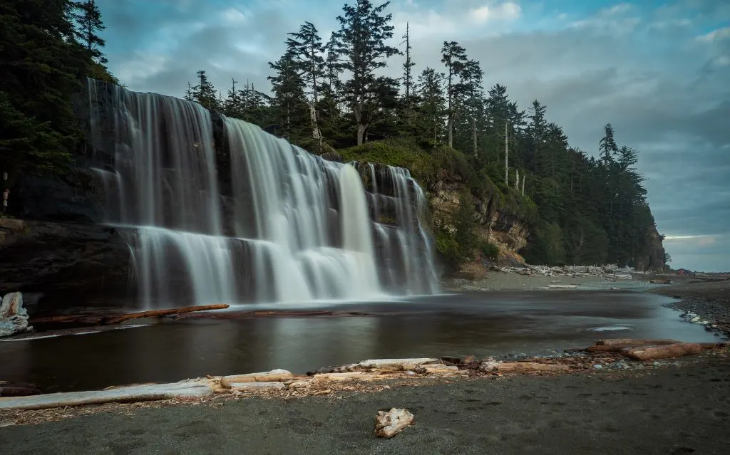
Michigan Creek to Tsusiat Falls (KM12 to KM25)
Official Distance: 13km Actual Distance: 14.5km Time: 4-6 hours Difficulty: Moderate
Highlights: beaches, sandstone shelf Valencia Bluffs viewpoint, Klanawa River cable car
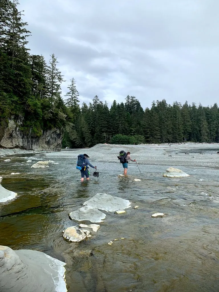
From Michigan Creek, the only route is along the beach for 2km to Darling River campground. There is no bridge at Darling River so you’ll have to ford. It’s not usually very deep, especially at lower tides. Both times I’ve been able to rock hop across without removing my boots.
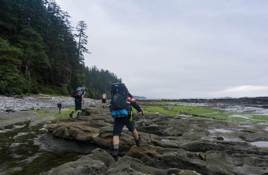
From Darling River, you can take the beach route for another 2.5km to Tscowis Creek campground at the 16.5km mark if the tides are below 2.7m. Along the way, you’ll pass Orange Juice Creek campground at the 15km mark. I’ve never taken the inland trail option, but I’ve heard it’s a bit overgrown since it doesn’t get used that often.

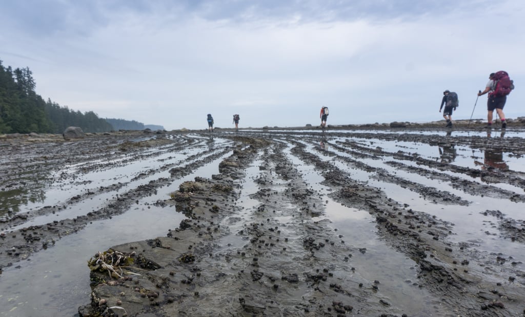
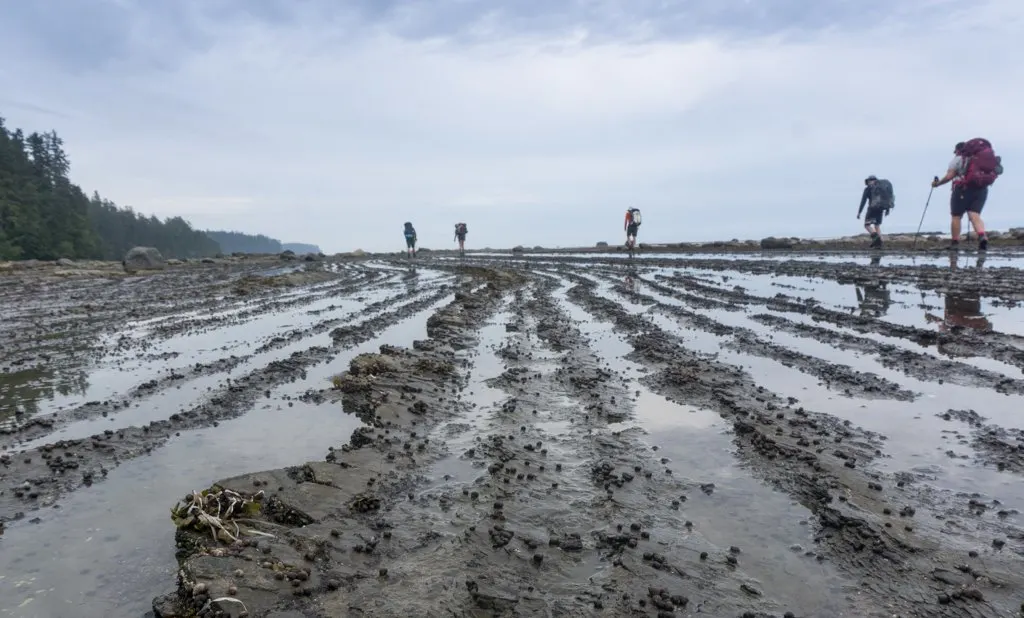
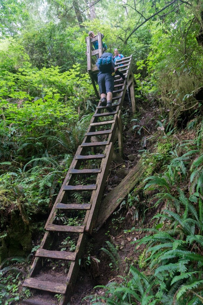
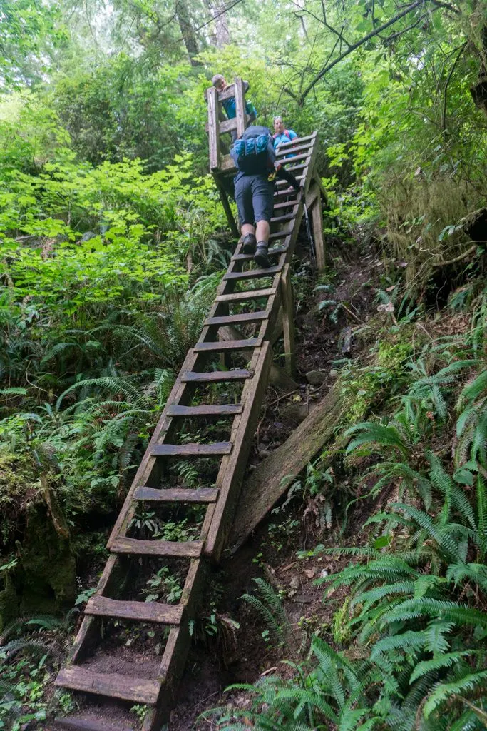
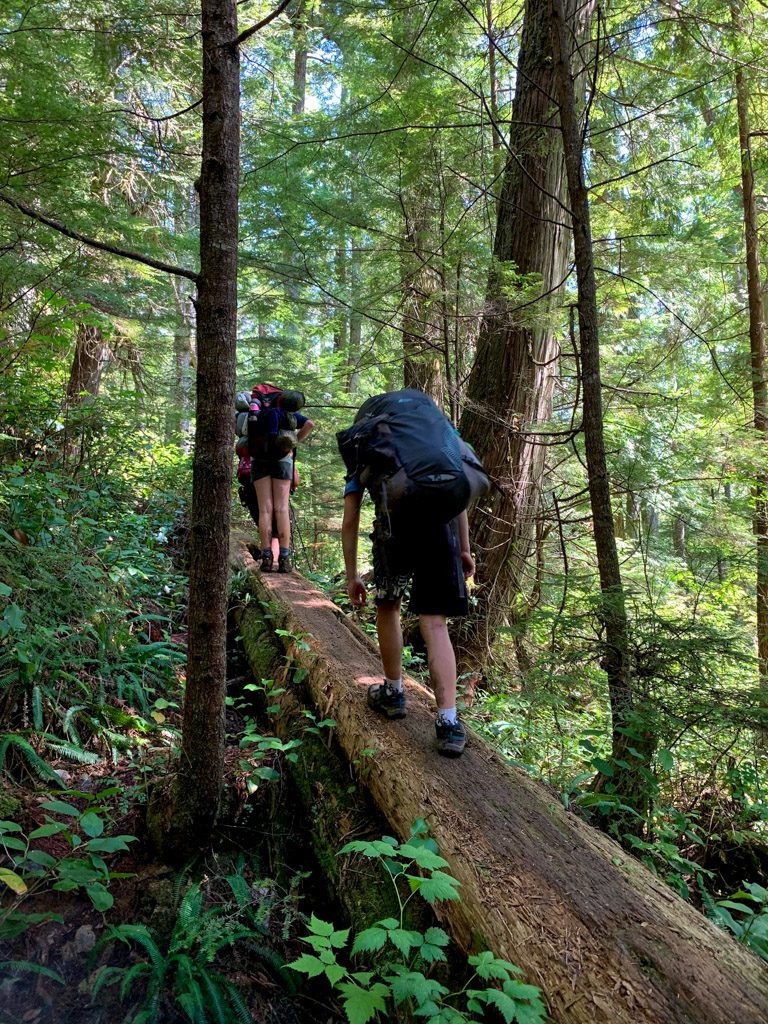
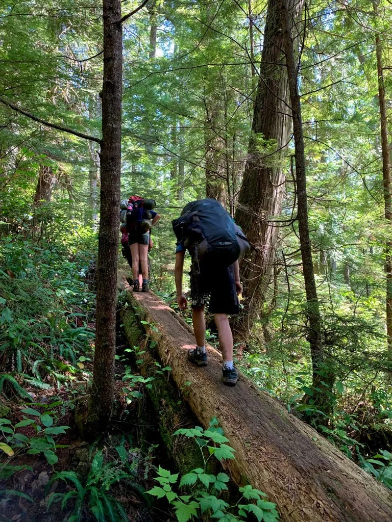
After Tscowis Creek the trail goes inland and immediately goes up a few sets of ladders and then across a short suspension bridge. For the next 3.5km, the trail runs along the top of the bluffs. The trail is near the edge of the bluffs and there are lots of good viewpoints. The best one is at Valencia Bluff where there are a pair of the iconic Parks Canada red chairs you can take a break in. After the bluff viewpoint watch for a derelict donkey engine and grader. This section of the West Coast Trail is easy walking on a good trail.

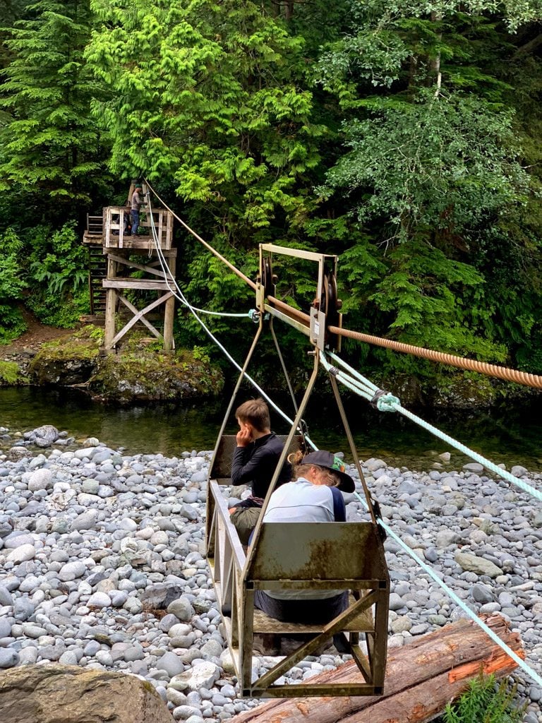
Descend back to the beach on a ladder near the 20km marker at Trestle Creek. From here you’ll be on the beach for the next 3km to Klanawa River camp. (Keep in mind that you need tides below 2.7m for this route and there is no inland alternative.) You can walk on the sandstone shelf at lower tides for MUCH faster travel. Cross the Klanawa River on the cable car. It’s too wide and deep to wade. In my opinion, this is the most difficult cable car on the West Coast Trail since it sags lower than the others and requires lots of arm strength for pulling.

After the cable car, you’ll climb up onto the bluff again via some ladders. The 2km of trail before the Tsusiat River bridge is easy walking, thanks to the boardwalks. A set of steep ladders drops you down to the beach and campground at Tsusiat Falls just after the bridge.


Tsusiat Falls to Nitinaht Narrows (KM25 to KM32.2)
Official Distance: 7.2km Actual Distance: 7.25km Time: 3-4 hours Difficulty: Moderate
Highlights: Hole in the Wall, Ditidaht Luxury Tents, Nitinaht Narrows, beaches
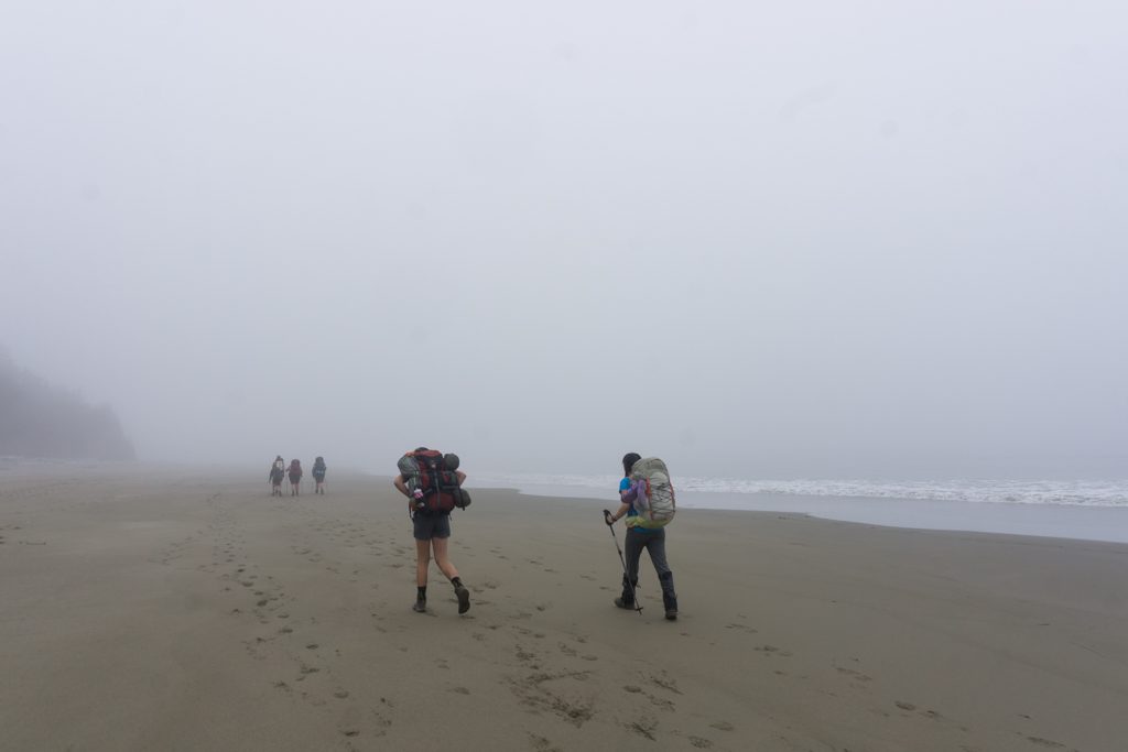
From Tsusiat Falls you have a choice between the beach route and the forest route until near the 29km marker. The beach features some deep sand that can be tough to slog through. On my most recent West Coast Trail hike we got tired in the sand and did a short section in the forest. We decided that we liked the sand better and headed back out again. I’ve heard that there’s a large cave along the inland trail, but I’ve never hiked that portion of the trail so I haven’t seen it.
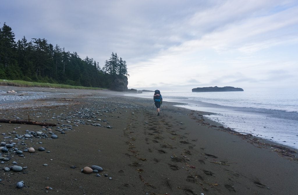

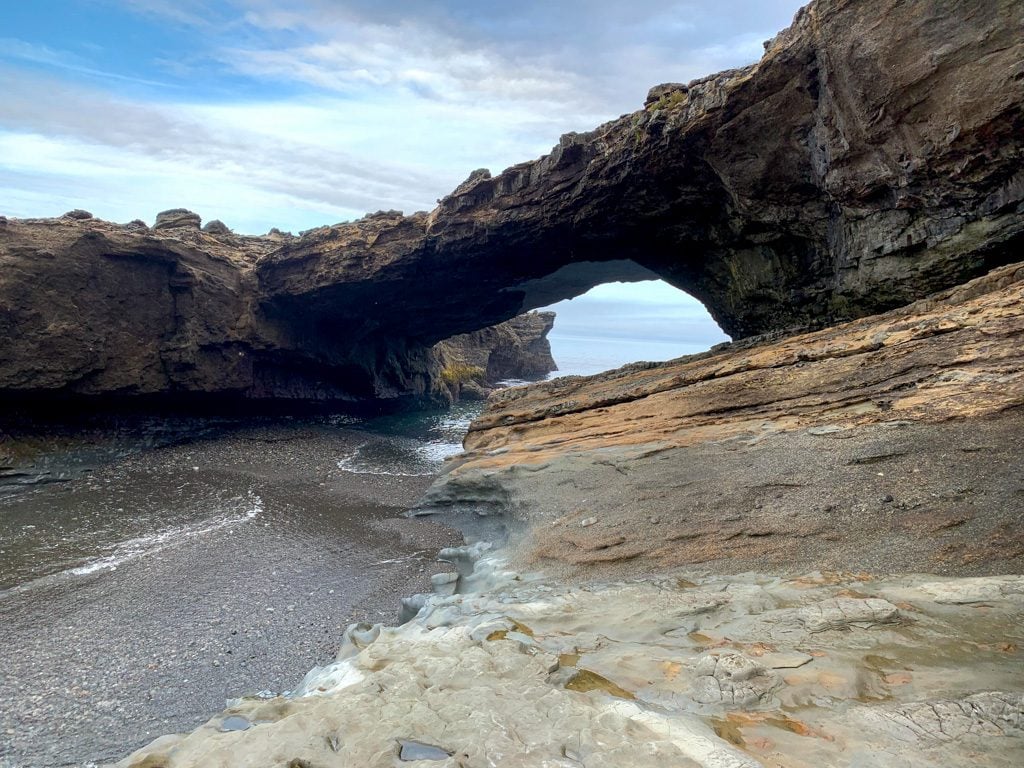
If you take the beach route you can walk through the “hole in the wall” at Tsusiat Point. It’s a natural arch. You’ll need a tide below 2.1m to do that. However, if the tide is too high to go through the hole, you can still walk the beach and take a short bypass trail around Tsusiat Point.

You’ll have to go back into the forest near the 29km marker. From there it’s a short hike to the Ditidaht luxury tents near Tsuquadra Point and km 30. (Note: they are not open for the 2022 season.)
The streams here are the last place to get water until kilometer 40 so be sure to fill up. Past the luxury tents, the trail climbs up onto the bluffs a bit, then turns inland on boardwalks towards Nitinaht Narrows. Once you reach the dock, yell across the Narrows. The ferry operator will come pick you up. The ferry runs between 9:30 am and 4:30 pm.

Join the Backpacking in BC Facebook Group
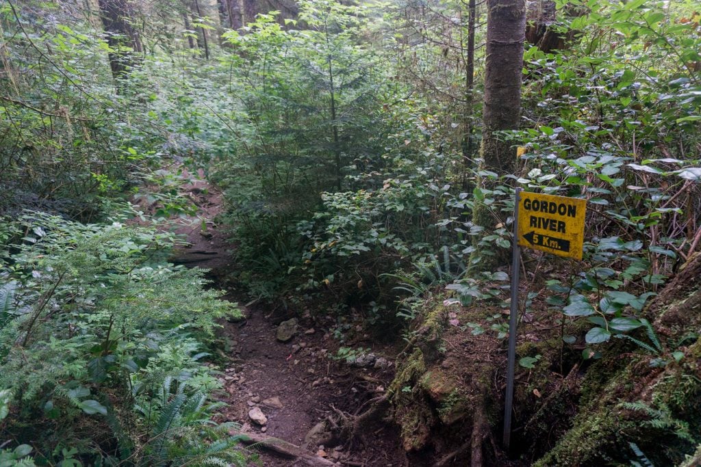
Nitinaht Narrows to Cribs Creek (KM32.2 to KM41.5)
Official Distance: 9.5km Actual Distance: 11km Time: 4-5 hours Difficulty: Easy/Moderate
Highlights: The Crab Shack, Clo-oose Village, Cheewhat River, beaches
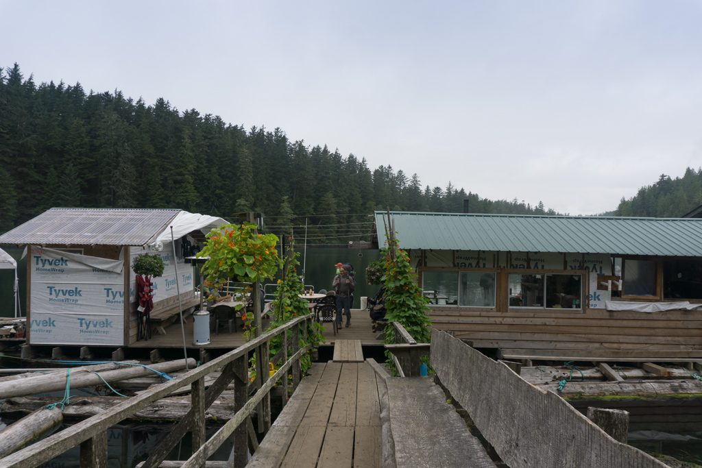
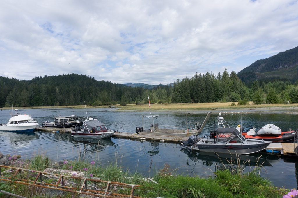
You’ll get off the ferry on the south side of Nitnaht Narrows directly on to the dock at the Crab Shack, the Edgar family’s restaurant and cabin rentals. Stop and buy some lunch, then continue up the ramp and into the forest.
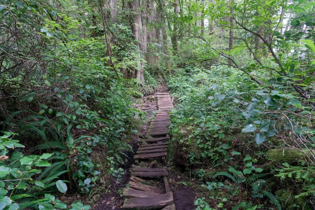
The trail is almost entirely boardwalk from here until the Cheewhat River bridge near the 36km marker. Along the way, you’ll pass through the abandoned village of Clo-oose. It’s a First Nations Reserve and is private property, so be respectful and don’t leave the trail.

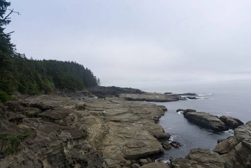
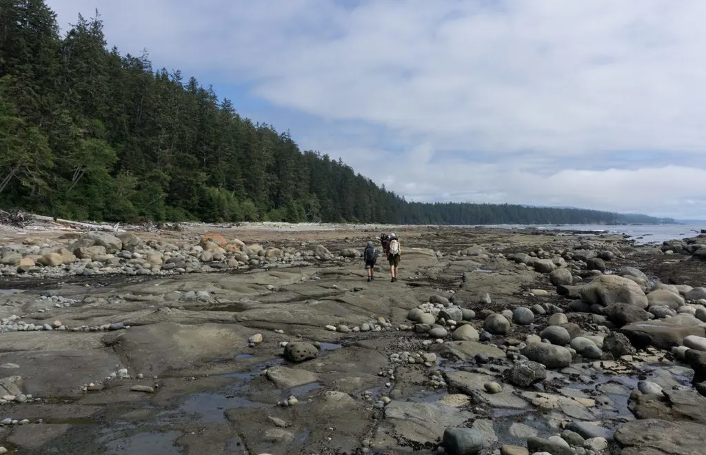
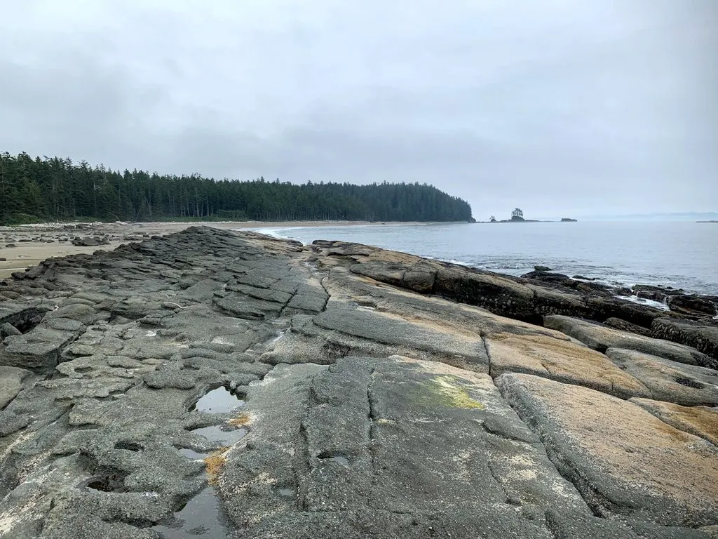
Cross the Cheewhat River on a wide suspension bridge. The river is tidal and has a high mineral content so you can’t drink it. Just past the bridge is another beach access. The beach is firm sand that makes for easy walking. I haven’t hiked the inland trail in this West Coast Trail section, but I hear it is also nice and easy to walk. Just past kilometer 38, there’s an impassable headland that forces you to take ladders to an inland trail for a few hundred meters, but you can get down onto the beach again quickly.

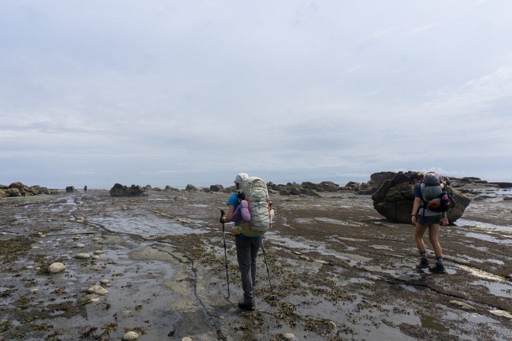
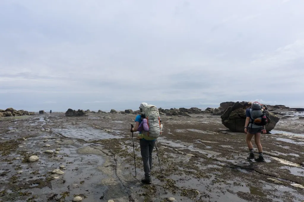
Eventually, the sand gives way to tidal shelf with some scrambly bits around the headlands. There’s a brief section around KM38 where you must take a ladder to the forest route to bypass a dangerous surge channel. Then, there’s a short section at KM39 where you must take the beach. Around the 40km mark, you’ll need to make a decision. If the tide is below 2.1m you can take the beach route around the point to Cribs Creek campground. If not, you’ll have to go up the ladder into the forest. The beach route traverses several rocky shelves before emerging on a rocky peninsula that juts out across Cribs Bay.
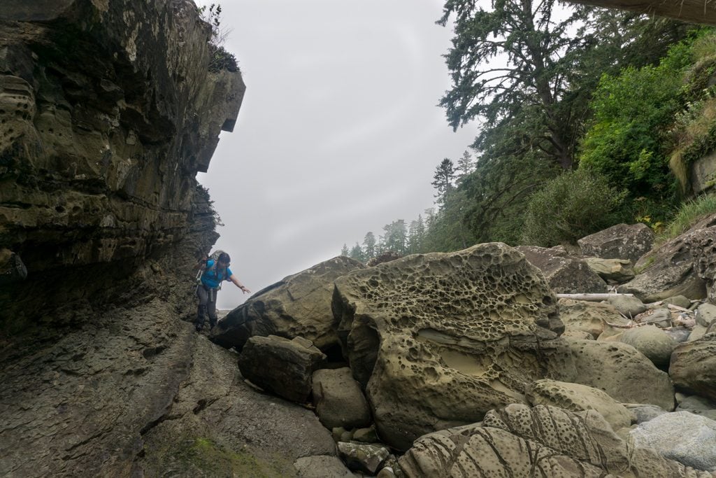
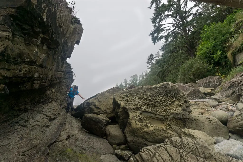

Cribs Creek to Walbran Creek (KM41.5 to KM 53)
Official Distance: 11.5km Actual Distance: 12. 1km Time: 4-6 hours Difficulty: Moderate
Highlights: Carmanah Point Lighthouse, Chez Monique’s Carmanah Creek cable car, beaches
The route south from Cribs Creek is along the beach. It’s relatively easy walking along the sand for the first kilometre or so. If the tide is below 2.1m you can continue along the coast to Carmanah Point at the 44km mark, then climb the stairs up, up, up! to the lighthouse. If you don’t have the right tides, it’s an easy walk in the forest for a few hundred meters to a junction with the side trail to the lighthouse.
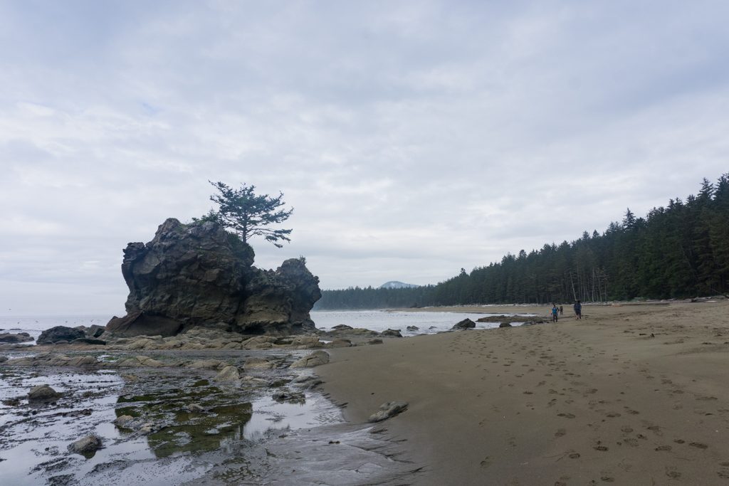

It’s worth taking the detour to Carmanah Point Lighthouse for the great views. They also have a big whale skeleton on the grass that’s pretty cool. Remember, the lighthouse buildings are private property so be respectful.
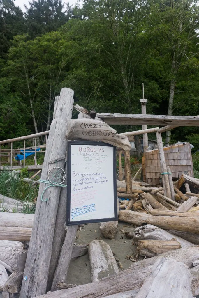
From the lighthouse, it’s a quick walk in the forest, then down some ladders back to the beach. You’ll find Chez Monique’s near the beach access. For decades this informal restaurant on a First Nations reserve was a key stopping point for West Coast Trail hikers. It’s been since 2018 since the owners have passed away, but their children are considering getting it up and running again. Stay tuned!

Past Chez Monique’s, you continue on the beach. The sand gets deeper so it’s not easy walking. You can wade across Carmanah Creek at the 46km mark or take the cable car. There’s a campground here on the north side of the creek. The next 2km to Bonilla Point campground is also on the beach, but you may be able to get on to the sandstone shelf for faster travel. The section of the West Coast Trail from Bonilla Point at km 48 to the beach access just before Vancouver Point near km 51 starts with some easy walking on the shelf but then turns into some brutally deep sand. It’s definitely a workout to walk through it!
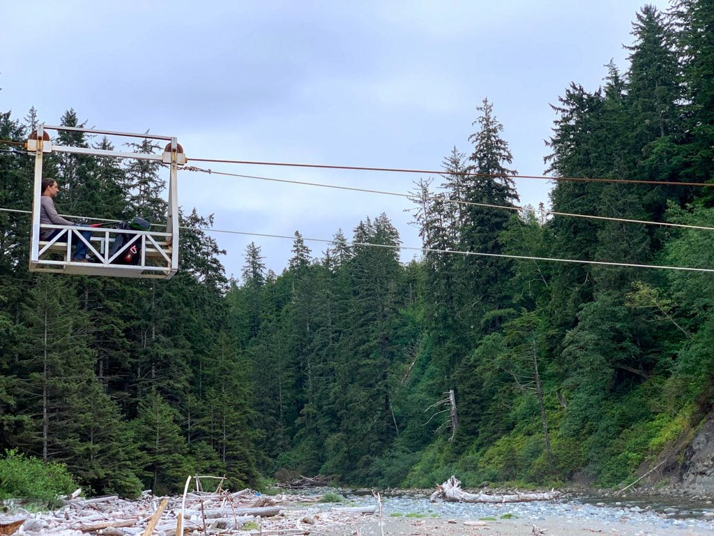


You need to make a decision at the Vancouver Point beach access. If the tide is below 2.7m and you don’t mind wading a creek, continue on the beach route. If not, take the forest route inland. I’ve never taken it, but I hear it’s a bit rough and overgrown. It ends with a ride across Walbran Creek on the longest cable car of the West Coast Trail. The beach route is mostly easy walking on the sandstone shelf. The crux is the ford of Walbran Creek. Try to cross near the mouth at low tide for the easiest crossing. The campground is near the 53km marker on the south side of the creek.

Walbran Creek to Camper Bay (KM53 to KM 62.2)
Official Distance: 9.2km Actual Distance: 11.8km Time: 4-6 hours Difficulty: Difficult
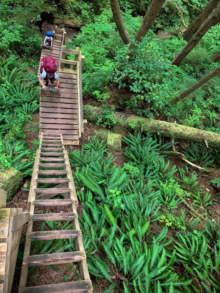
Highlights: Ladder sections at Walbran, Cullite, Sandstone, and Camper Creeks, Logan Creek suspension bridge, boardwalks through bogs, Cullite Creek cable car
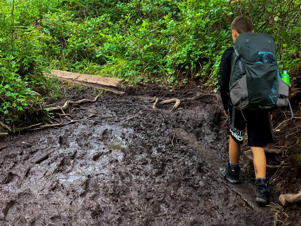
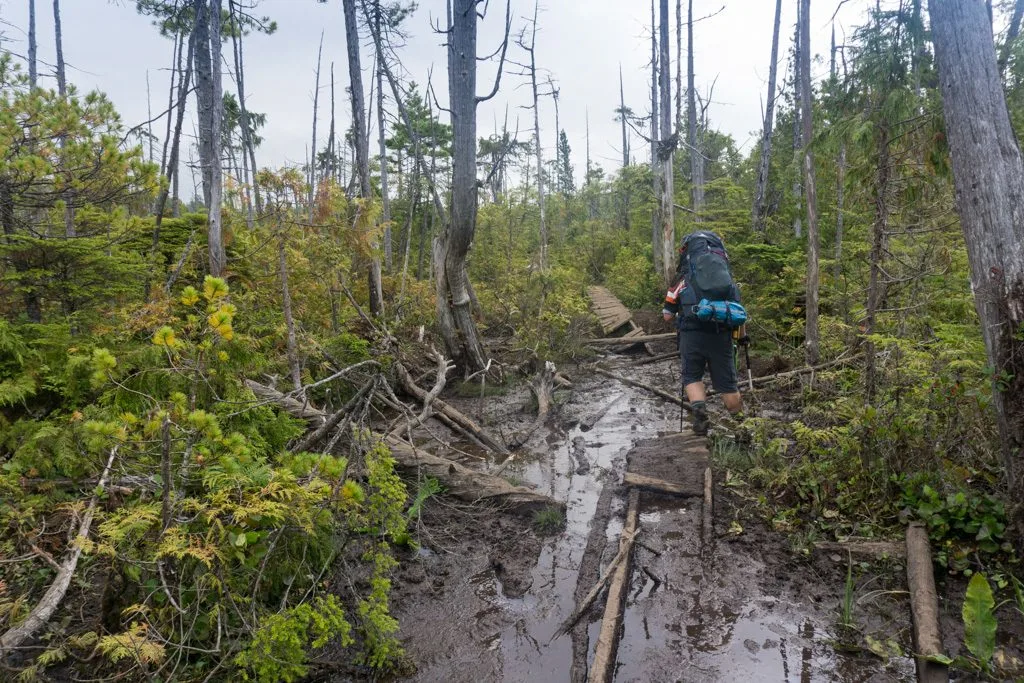
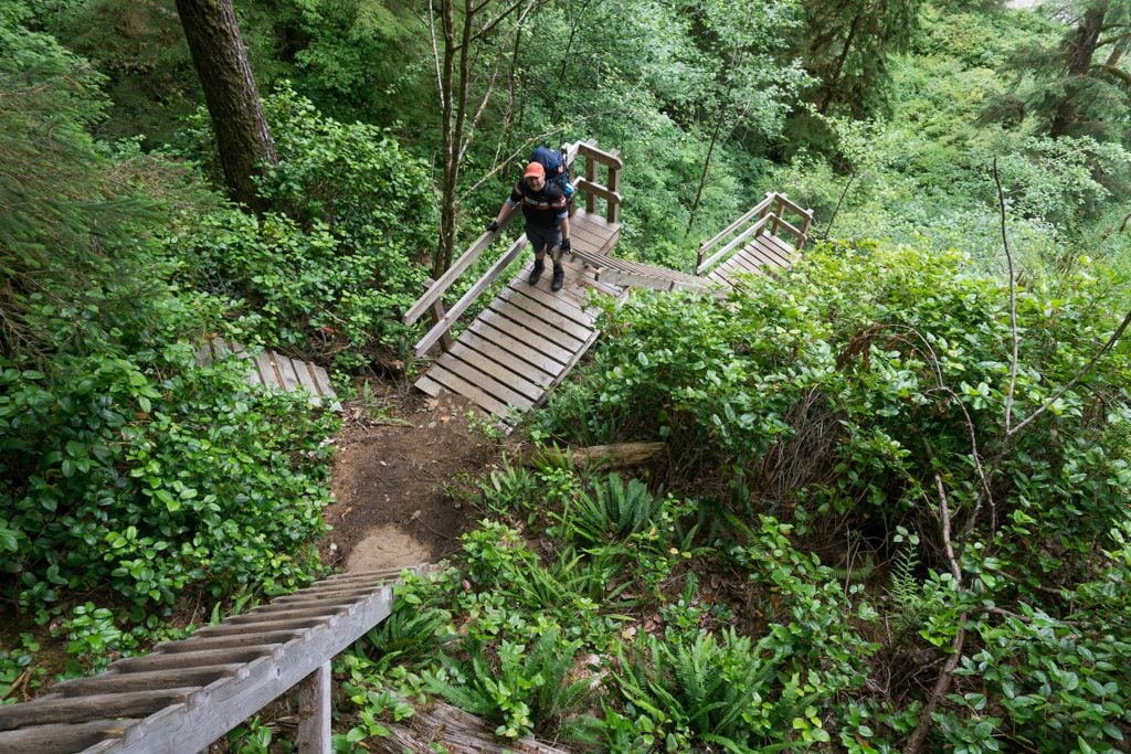
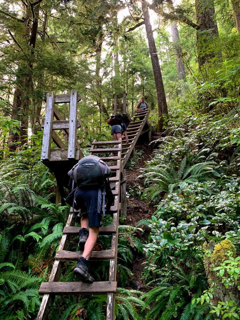
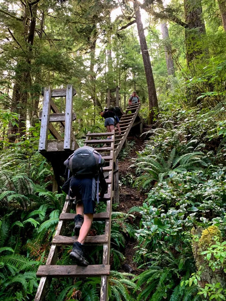
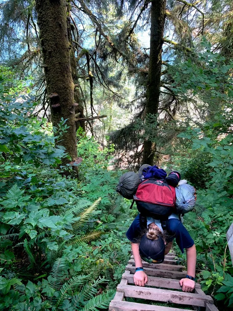
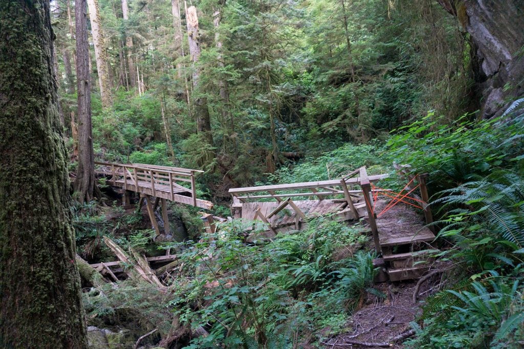
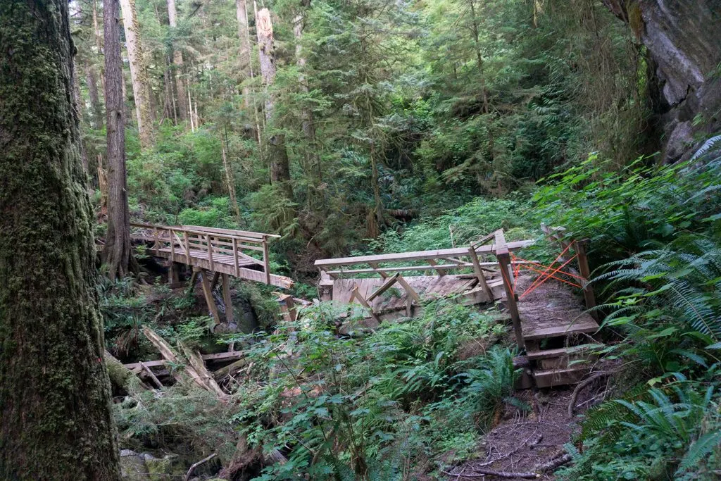
Some people find the West Coast Trail section between Walbran and Camper to be the hardest part of the trail due to all the ladders. The trail from Walbran starts with a section of ladders. At the top, you’ll go through a bog on boardwalks. When the boardwalk ends, the mud, roots, and logs begin. It’s about 3km from Walbran to Logan Creek at the 56km mark.


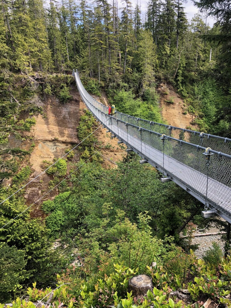
Logan Creek used to the the site of some of the scariest ladders on the West Coast Trail. But as of 2021, a new suspension bridge crosses the top of the canyon. That means you will be through this section in a few minutes when it used to take close to half an hour.
Once you reach cross Logan Creek you have another 2km of mud, tree roots, and wrecked boardwalks to contend with before reaching the Cullite Creek ladders just before the 58km mark. Cullite Creek has the most ladders on the West Coast Trail: 7 on one side of the gorge and 11 on the other. In the middle, you can wade (or rock hop) across Cullite Creek or take the cable car.


The Cullite Creek campground is a short walk downstream to the beach. The trail has been washed out in a few places so you may have to walk in the creek bed. (And that’s only possible later in the season at times of lower runoff.) Even if you aren’t camping, the beach is a nice lunch spot.
After Cullite Creek the trail heads through the forest for another 1.5km to Sandstone Creek at 59.5km. It’s not as muddy or boggy as the earlier section, but it’s also not smooth walking. At Sandstone Creek you’ll descend a few ladders to a bridge, then climb ladders right back up the other side. The route from Sandstone Creek to Camper Bay has a few sections of newer boardwalk, but there are still mud holes, broken boardwalk and tree roots to climb over most of the time.


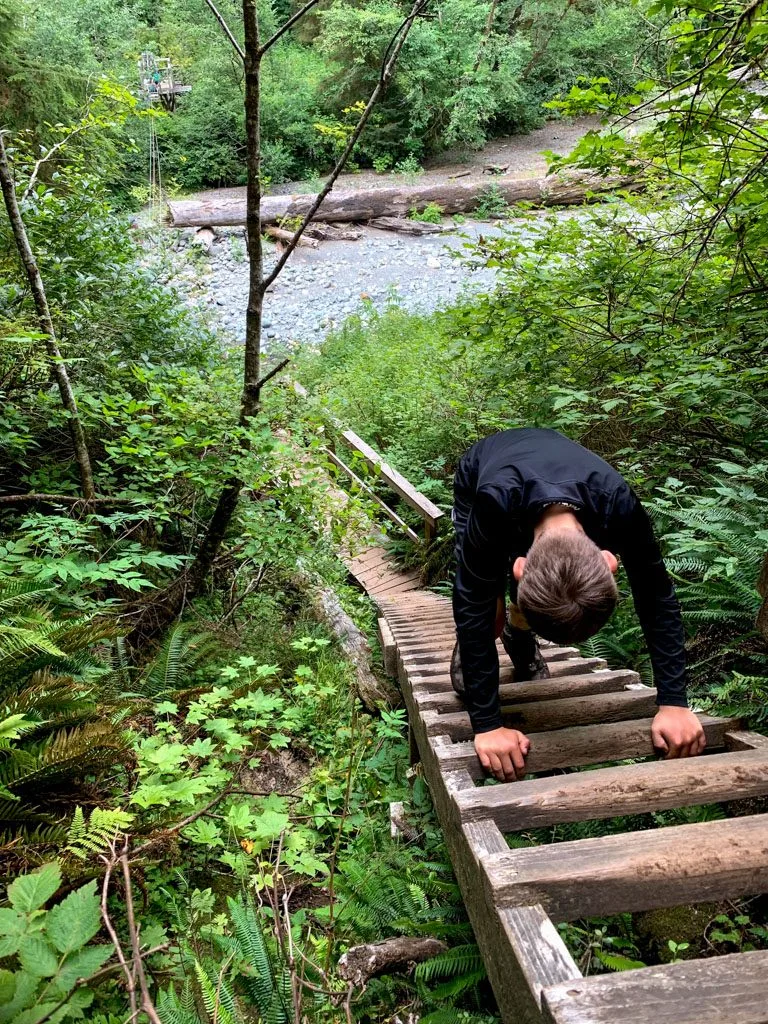
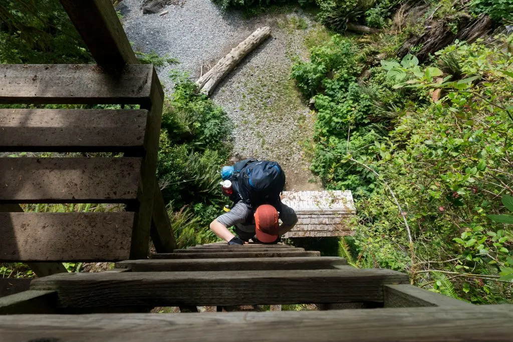
Just past the 62km marker, you’ll descend ladders and a section of steep trail to Camper Bay. The campground is just downstream on the beach.
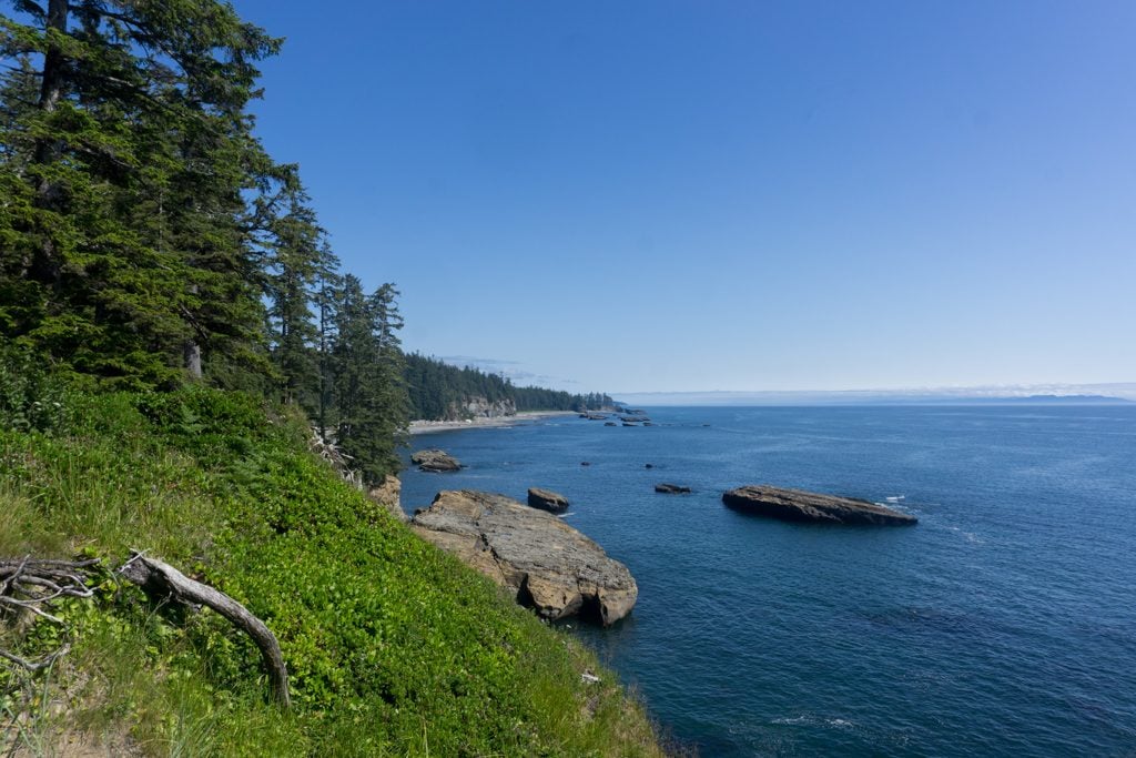
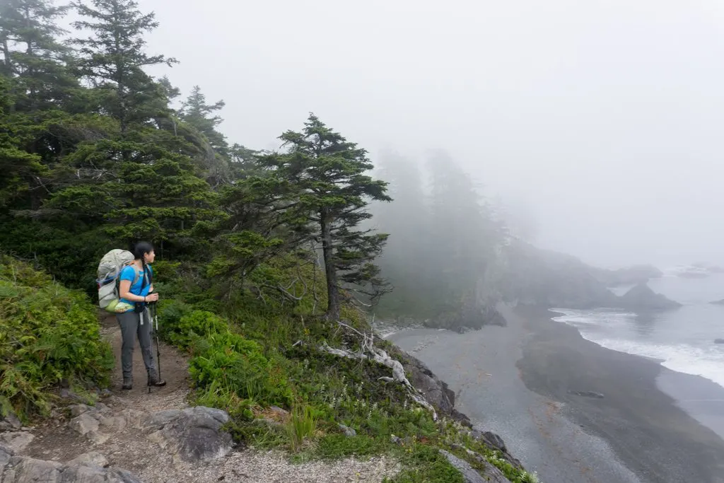
Camper Bay to Thrasher Cove(KM 62.2 to KM 70+1)
Official Distance: 8.8km Actual Distance: 9.8km Time: 4-5 hours Difficulty: Very difficult
Highlights: Ladder sections, Owen Point, challenging forest terrain
To leave the campground at Camper Bay you’ll need to take the cable car or ford the creek. Later in the season, it’s possible to rock hop across. Next, it’s time for another section of ladders. The forest trail between Camper Bay and the 65km mark has some muddy sections, but there is lots of boardwalk and it’s not too bad, as far as forest sections go.

At kilometre 65 you’ll need to make a choice: coastal route or forest route. Despite having hiked the West Coast Trail twice, I’ve never taken the coastal route. Both times the low tide we needed was in the middle of the night!
The coastal route includes some sections of easy sandstone shelf walking. But it also includes lots of boulders and logs to scramble over. You need a tide of less than 2.4m to do the coastal route, except around Owen Point where you need a tide of less than 1.8m to pass through a sea cave. Reportedly, the route is much easier at very low tides.
The forest route is one of the roughest parts of the whole trail. The 5km between the 65km beach access and the Thrasher Cover junction at 70km include lots of mud, slippery tree roots and lots of narrow log crossings. Some of the log crossings are 10 to 15 feet off the ground! Both times I’ve hiked the trail I’ve had my slowest travel speeds through here and I think it’s the hardest part of the trail.

From the 70km junction you’ll have 1km of side trail to descend to Thrasher Cove campground. The trail is rough and very steep in places. It ends with a series of ladders down to the beach. If you took the coastal route, you’ll arrive directly on the beach.

Thrasher Cove to Gordon River (KM 70+1 to KM75)
Official Distance: 6km Actual Distance: 6.6km Time: 4-5 hours Difficulty: Very difficult
Highlights: Ladder sections, highest point on the WCT, donkey engine, challenging forest terrain
This West Coast Trail section starts with an ascent out of Thrasher Cove. It begins with ladders, then heads steeply uphill on a few switchbacks. After 1km you’ll reach the 70km junction and be back on the main trail.
The trail from this point to Gordon River is rough and technical, but I thought it was slightly easier walking than the forest section between km 65 and 70. However, lots of hikers say this is the most difficult part of the trail, especially those who tackle this part on their first day with heavy packs.
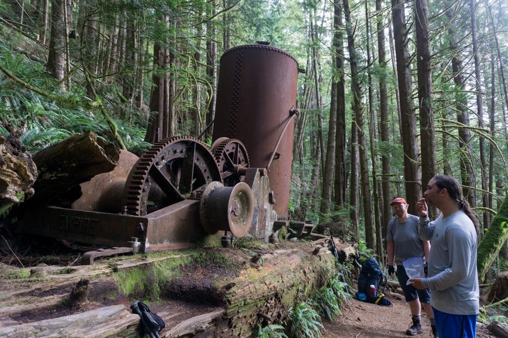
From the junction, the trail starts to climb. It crosses two creeks including one with some ladders. As of 2019, a major bridge is damaged so you have to follow the rough flagged bypass route. Just after the 71km marker, you’ll reach the high point of the trail at 213m. It’s a stiff climb to get up here! The trail undulates gently and passes by a huge derelict donkey engine and a bunch of old logging cables around km 72.

The trail descends slowly towards the ocean over the next few kilometres, although you don’t really get any views. In the last kilometre you might start to see the ocean through the trees and hear the waves.
Finally, you’ll come to the top of a very tall and VERY steep ladder. (This is the steepest ladder on the entire trail!) Head down the ladder to the beach on the Gordon River. You’re done! Use the rope next to the ladder to raise the buoy up to the top. This signals to the ferry operator that you want a pickup. The ferry comes by at 8:30 am, 11:30 am, 12:30 pm, 1:30 pm, 2:30 pm and 3:30 pm.


Join the Backpacking in BC Facebook Group
Finishing the West Coast Trail
After you take the ferry across Gordon River, you’ll arrive at Butch Jack’s ferry dock. Head up the ramp to the road, turn right and walk a few hundred metres to the Parks Canada office. Head inside to drop off your permit with the ranger and officially check-out from the trail. They have souvenir hats, t-shirts and more if you want them.

So that’s my West Coast Trail overview with a section-by-section breakdown of the trail. If you have any questions while planning your hike, let me know in the comments.
MORE WEST COAST TRAIL POSTS:
- Your Guide to the West Coast Trail in British Columbia
- 7-Day West Coast Trail Itinerary (Plus More Itinerary Options)
- West Coast Trail Packing List: Everything You Need to Bring
- West Coast Trail Camping: Your Complete Guide
- West Coast Trail Transportation: How to Get There
- Coastal Hiking Tips: Advice for Beach Backpacking
MORE VANCOUVER ISLAND POSTS:
- Juan De Fuca Trail Guide: Backpacking on Vancouver Island
- North Coast Trail Guide: Backpacking on Vancouver Island
- Cape Scott Trail Guide: Hiking and Camping on Northern Vancouver Island
- Wild Side Trail: Hiking and Camping Guide
- The Ultimate Guide to the Pacific Marine Circle Route on Vancouver Island
- How to Visit Avatar Grove, Big Lonely Doug and Other Big Trees on Vancouver Island
- Cape Scott Trail Guide: Hiking and Camping on Northern Vancouver Island
- Kayaking in the Johnstone Strait: Everything You Need to Know
- Things to do on North Vancouver Island
- 30 Best Backpacking Trips in BC


- Best Sun Hoodies for Hiking - June 3, 2026
- Lower Stein Valley Trail Hiking and Backpacking Guide - May 27, 2026
- The Best Things to Do in Vernon, BC - May 21, 2026
Carrie
Monday 27th of June 2022
Hi Taryn,
Thanks for this. It is super helpful. We are going at the end of Aug/beginning of Sept later this summer. Is Chez Monique's still closed or open? Hoping to plan for less food and eat at both restaurants if it is open.
Also, we live in WA state and are wondering if you recommend one particular travel insurance that would cover hiking the W. Coast Trail in case of accident/injury. Do you have a particular company that you like and use?
Thanks, Carrie
Carrie
Tuesday 28th of June 2022
Taryn,
Thanks so much. That is helpful for sure! Good to know Search and rescue is free. I am in research mode on insurance now.
Will there be a good place to find out the details on the Nytom eatery opening/hours as the summer moves on?
Thanks again, Carrie
Taryn Eyton
Tuesday 28th of June 2022
Hi Carrie. Chez Monique's is permanently closed. However, Monique's daughter has plans to reopen a similar business in the same location, called Nytom, which is the Indigenous version of her parents last name, Knighton. So far there isn't any info on when she will open and how often she will be open. Your best bet will be to bring some extra cash and if she's open when you hike through there, consider a meal there a happy coincidence rather than planning for it. As far as travel insurance goes, I'm Canadian so unfortunately I don't have any recommendations for insurance for Americans coming to Canada. Best to check with your insurance broker. It's worth noting that search and rescue is free in British Columbia so you don't need coverage for rescue - just medical insurance.
LISA Aho
Sunday 28th of March 2021
Hi , I just read through this! Thank you much , hoping to complete this trail in July 2021 id I can get a reservation . Do you have any suggestions for good lightweight rainproof jacket & sandals to carry to wear around camp ? Looking for any lightweight suggestions . I have quite a bit of decent gear but needing a few more thing s and as light as possible. Also for warmth at night? Merino wool sweater & leggings maybe , i tend to get really cold. I have a synthetic sleeping bag that is ok . need to buy a lighter thermarest mine is old & heavy
Taryn Eyton
Monday 29th of March 2021
Hi Lisa. You can find my recommendations for West Coast Trail gear in my West Coast Trail packing list here: https://happiestoutdoors.ca/west-coast-trail-packing-list/