

Organizing transportation to the West Coast Trail can be one of the most complicated parts of the hike. There are a few different options for getting to the start and getting back from the finish, and it can be hard to figure out which one makes the most sense for you.
I have also talked to lots of hikers who didn’t book transportation and thought they’d just figure it out a few days before. DON’T DO THAT! You definitely need to figure out how to get to the West Coast Trail and make reservations in advance.
The West Coast Express shuttle bus is definitely the most popular option for getting to the West Coast Trail, but you can also drive yourself, take a floatplane, take a boat or organize your own private shuttle van. I’ve got all the details on each West Coast Trail transportation option for you below. And since you may need to stay overnight at one of the trailheads before or after your trip, I’ve also got info on that too.
WANT MORE WEST COAST TRAIL INFO? Check out these posts:
- West Coast Trail Basics
- Section-By-Section Overview
- 7-Day West Coast Trail Itinerary (Plus More Itinerary Options)
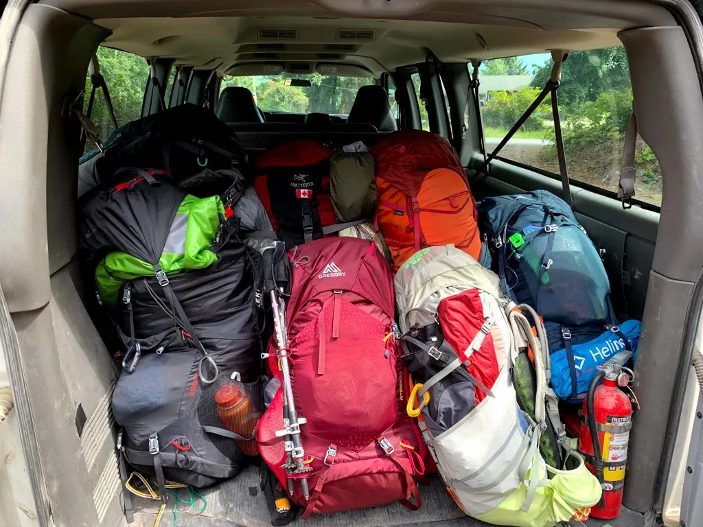
- Packing List: Everything You Need to Bring
- Complete Guide to Every Campground
- Coastal Hiking Tips: Advice for Beach Backpacking
Hey there: Some of the links in this post are affiliate links, which means I earn a small commission at no extra cost to you if you make a purchase. Thanks for your support! -Taryn
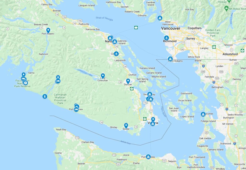
If you aren’t familiar with Southern Vancouver Island, it can be confusing to figure out where the trailheads and other transportation hubs are. I’ve made a custom google map for you that shows you every single location I mention in this guide.

Getting to Vancouver Island
The West Coast Trail is located on the West Coast of southern Vancouver Island in British Columbia. Since Vancouver Island is an island (duh!) it takes a bit of planning to get there.
You can take a ferry to Vancouver Island. BC Ferries has scheduled sailings from the Vancouver area to both Victoria and Nanaimo. If you are coming from Washington, you can take the Coho ferry from Port Angeles or the Washington State Ferry from Anacortes to the Victoria area. You can bring a car on any of these ferries.
You can also fly to Vancouver Island. Both Victoria and Nanaimo have regional airports with regular flights to Vancouver and Calgary. Victoria is also an international airport and has flights from Seattle.
Where Does the West Coast Trail Start and Finish?
The West Coast Trail has two main trailheads at the southern and northern ends of the trail. You can hike the trail in either direction. You can also start or finish the trail at the trail’s midpoint, Nitinaht Narrows. (Read my section-by-section overview of the West Coast Trail for a full description of the trail. See my West Coast Trail Itineraries for info on the pros and cons of starting at each of the three trailheads.)
Southern Trailhead: Port Renfrew/Gordon River
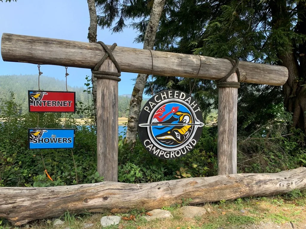
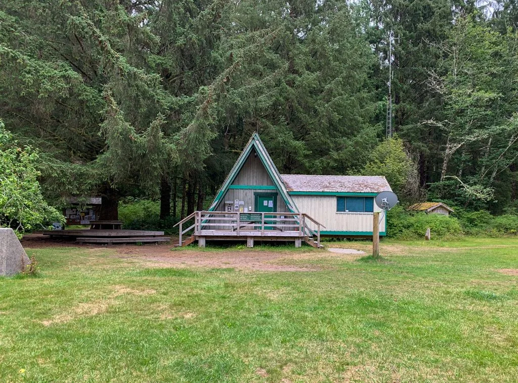
The southern trailhead is at the mouth of the Gordon River at the Pacheedaht campground near the town of Port Renfrew. Port Renfrew is on the southwest coast of Vancouver Island north of Sooke. You can drive to Port Renfrew via paved roads from the Victoria and Duncan areas. The trailhead is about 4.5km from Port Renfrew.
Unfortunately, there is no local taxi service. The Parks Canada office is located at the Pacheedaht campground. From there you walk about 100m down the road to Butch’s dock where you catch the ferry across the Gordon River to start the West Coast Trail.
Even though it is a small town with a population of just 144 people, there are lots of things to do in Port Renfrew. It is becoming a popular eco-tourism spot thanks to its location on the Pacific Marine Circle Route, a fun road trip. Some of Canada’s largest trees are also nearby including Avatar Grove and Big Lonely Doug.
Port Renfrew has a small general store, a gas station, and several restaurants. But it’s not a big place so plan to pick up all your supplies before you get there.

Northern Trailhead: Bamfield/Pachena Bay
The northern West Coast Trail trailhead is at the Pachena Bay campground near the town of Bamfield. Bamfield is on the central west coast of Vancouver Island. You can drive there on a gravel road from Port Alberni, or on logging roads from Lake Cowichan. The Pachena Bay trailhead is 5.5km from Bamfield. However, they do have a taxi service that can take you between the two.
Bamfield is slightly larger than Port Renfrew – they have 179 residents! It’s a unique place since the town is divided by an inlet and there is no road access to the western part – you have to take a water taxi across. It’s a popular place for fishing and there’s a world reknowned marine research station.
Bamfield has a small grocery store and several restaurants. But like Port Renfrew, you shouldn’t plan to do much shopping for the trail there.
Middle Trailhead: Nitinaht Narrows
The Nitinaht Narrows trailhead is located near the middle of the trail at KM32. There is no town at Nitinaht Narrows – there is a small First Nations Reserve with a restaurant called The Crab Shack. To get to Nitinaht Narrows you have to take a water taxi for 23km from Nitinaht Village at the head of Nitinaht Lake to the narrows at the outflow of the lake. The water taxi runs once a day at 9 am or you can arrange a private charter for other times of the day. Call them at 250-745-3509 to book. You can drive to Nitinat Village on gravel roads from the Lake Cowichan area.
Nitinaht Village is located on the Ditidaht First Nations Reserve and has a population of about 120. The village is on Nitinaht Lake, which is a popular place for windsurfing. It has a motel, campground, gas station, restaurant, and a small general store.
Join the Backpacking in BC Facebook Group
Public Transportation to the West Coast Trail Trailheads
Unfortunately, there is no public transportation to the West Coast Trail. You’ll have to take a private shuttle bus or drive yourself. If you want to save money, you could take public transit to Sooke or Lake Cowichan, then take the West Coast Trail Express private bus from there. See the BC Transit website for more info.
Psst! The West Coast Trail is on my list of the best car-free backpacking trips in BC.
West Coast Trail Express Private Bus Service to Trailheads
The West Coast Trail Express is a private shuttle bus company that provides scheduled bus services to all the West Coast Trail starting and ending points including Port Renfrew, Gordon River, Nitinaht Village, Pachena Bay, and Bamfield. They also pick up and drop off in Victoria, Nanaimo, Sooke, and Lake Cowichan.
A popular option is to drive yourself to one trailhead, then use the shuttle bus to get to the other trailhead. However, you can take the West Coast Trail bus from Victoria or Nanaimo to the trailhead, then back again. It’s a better deal than renting a car. Be sure to reserve your West Coast Trail bus tickets well in advance as they do book up! There’s also a slight discount if you book a return ticket.
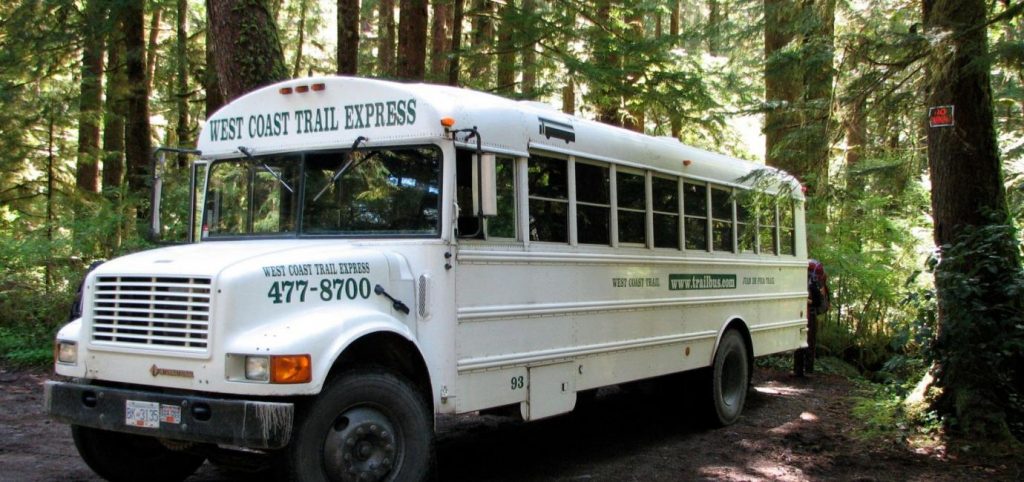

The shuttle buses are school buses and they aren’t that comfortable. The roads they travel on are very winding and bumpy. If you get car sick, plan to take anti-nausea medication.
Tip: If you are going to drive to one trailhead and take the West Coast Express bus to the other, take the bus before you start the West Coast Trail. That way you’ll finish at your car and won’t have to worry about trying to make it back to the trailhead in time for the scheduled shuttle pick up.
On my first West Coast Trail hike in 2004, we didn’t have shuttle reservations AND we chose to take the shuttle at the end of our hike. It was super stressful trying to finish the last few kilometres of trail in time to meet the bus, and then we managed to get the LAST seats available. If we hadn’t been able to get on, we would have had to wait an entire day for the next bus!
Private Charter Shuttles to the West Coast Trail Trailheads
The West Coast Trail Express schedule doesn’t work for everybody. It’s especially annoying if you are hiking from north to south. If you have a bit of extra cash to splash out, you can hire a private driver to take you wherever you want to go, at whichever time you choose. The West Coast Trail Express offers charter services and my group of 8 used it on my 2019 West Coast Trail trip. It’s definitely expensive, but if you go with a larger group of people, it can be a similar price to taking the scheduled bus.
Flying to the West Coast Trail Trailheads
It’s possible to charter a floatplane between Port Renfrew and Bamfield. You can also fly to Bamfield directly from Vancouver International Airport. It’s definitely not a cheap option, but it will save you some time. You’ll need to contact the floatplane companies directly to arrange a charter.
Taking a Boat to the West Coast Trail Trailheads
For many years there was a water taxi service between Port Renfrew and Bamfield. Many hikers would drive their car to one end, then take the water taxi to the other to start their hike. Unfortunately, the person running this service retired and it’s no longer offered.
However, you can still take a boat to Bamfield. Lady Rose Marine Services runs a freight ship a few days a week between Port Alberni and Bamfield. It takes passengers too! Once you get to Bamfield, you can take a taxi to the trailhead.
Driving to the West Coast Trailheads
For the most part, it’s not too hard to drive yourself to any of the three West Coast Trail trailheads. However, it’s really time-consuming and some of the navigation can be a bit tricky since the logging roads aren’t always easy to follow.
You can rent a car in Victoria or at the Victoria Airport. I use Discover Cars since it lets you compare prices from lots of different rental companies to make sure you are getting the best deal.
However, read the rental agreement carefully. The route from Victoria to Port Renfrew is on paved roads, so it should be no problem for a rental car. However, the route between Port Renfrew and Bamfield, and between Victoria and Bamfield involves lots of travel on unpaved roads. Some rental car companies won’t let you drive on unpaved roads.
If you are going to drive, my advice would be to drive to one trailhead, then take the West Coast Express bus to the other trailhead. You could leave a car at each trailhead, but setting up the car shuttle would take up nearly a full day of your trip. Here’s everything you need to know about driving to the West Coast Trail.
Driving to Port Renfrew/Gordon River
This is the easiest trailhead to drive to. It’s an easy 2-hour drive from Victoria on Highway 14. There are some curvy and bumpy sections, but it’s paved the whole way. It’s part of the scenic Pacific Marine Circle Route, so if you have extra time, it’s worth spending a day road-tripping it to stop at waterfalls and beaches. Get directions.
It’s also fairly straightforward to drive from Duncan to Port Renfrew in about 1.75 hours. Take highway 18 to Lake Cowichan. From Lake Cowichan take South Shore road to Mesachie Lake, then take the Pacific Marine Road to Port Renfrew. This is the other half of the Pacific Marine Circle Route and has some big trees you can stop at. It’s also paved the whole way, but it does have some bumpy sections. Get directions.
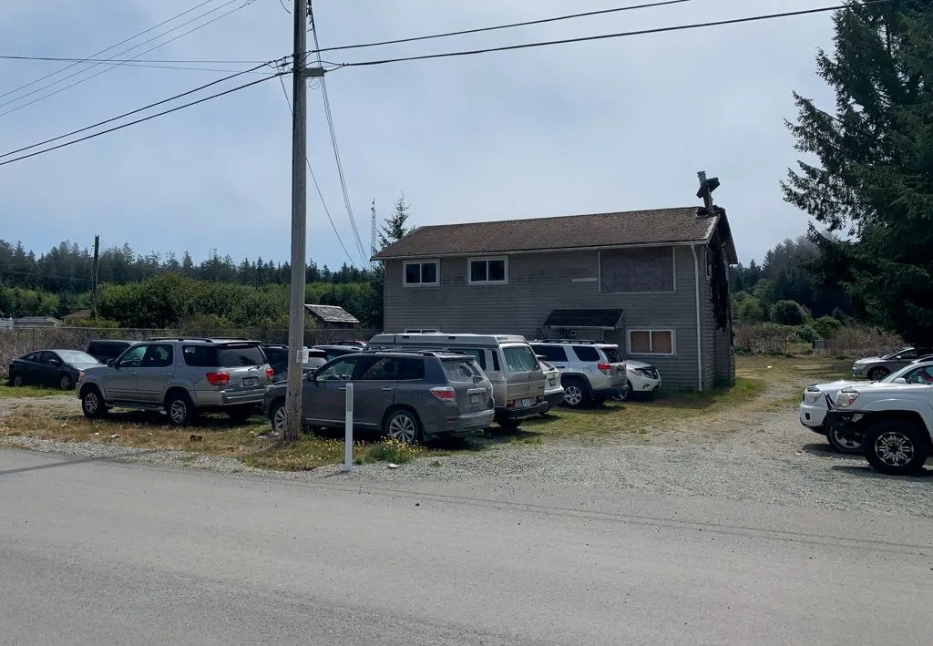
You can park on the Pacheedaht First Nations Reserve near the Gordon River trailhead. You can pay for parking inside the Pacheedaht Campground office. The parking is in the yard of an abandoned house directly across the street from Butch’s dock where you catch the ferry across the Gordon River. Parking is $5/day.

Driving to Nitinaht Village
Driving to Nitinaht Village involves driving on unpaved and sometimes poorly signed logging roads. You don’t need a 4 wheel drive, but you should carry a spare tire. You’ll be sharing the road with logging trucks which can be FAST. Pull-over whenever you see one. I recommend bringing a copy of the Vancouver Island Backroad Map Book. There’s no cell service out there, so having a map can make all the difference. Unfortunately, google maps doesn’t have detailed directions.
From Duncan drive highway 18 to Lake Cowichan, then continue to Youbou. Shortly after Youbou, the pavement ends and you’ll see an “End of Public Road” sign. Continue on the gravel road as it follows the shores of Cowichan Lake to the end of the lake and a campsite. Look for the sign for the Nitinaht Motel and turn left onto Nitinaht Main. Follow it until you reach a T-junction. Go left on the Carmanah Main to Nitinaht Village. There should be signs for the Motel at the junction. You’ll know you’ve reached the village when the road turns to pavement again.
Driving to Bamfield/Pachena Bay
Driving to Bamfield and Pachena Bay involves driving some rough logging roads. There are a LOT of confusing junctions and no cell service. And google maps doesn’t really work for this route. Definitely bring the Vancouver Island Backroad Map Book or consider taking the shuttle instead of driving.
The most straightforward way to drive to Bamfield is to start in Port Alberni. It will take about 1.5 hours. From downtown Port Alberni take 3rd Avenue south to Ship Creek Road. This will turn into Franklin River road, which is the start of the gravel logging road. Stay on this road until it forks and you go left onto Bamfield Road. Stay on Bamfield Road all the way into Bamfield.
If you’re coming from Southern Vancouver Island, you can also start from Duncan. This will take about 3 hours. From Duncan drive Highway 18 to Lake Cowichan, then continue on to Youbou. Shortly after Youbou, the pavement ends and you’ll see an “End of Public Road” sign. Continue on the gravel road as it follows the shores of Cowichan Lake to the end of the lake and a campsite. Look for the sign for the Nitinaht Motel and turn left onto Nitinaht Main.
Follow it until you reach a T-junction. Turn right at the T junction onto Carmanah Main. (Left goes to Nitinaht Village.) Stay on that road, then cross the river to turn left on Flora Main and drive 13km. Turn left onto Central Main and drive 17km. Then turn right onto Klanawa Main, left at Between the Lakes and left on to Bamfield Main. Follow the signs into Bamfield and the start of the paved road.
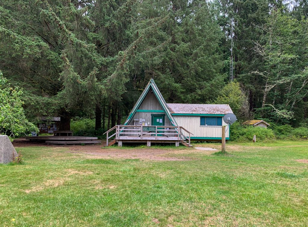
In Pachena Bay you can park in the lot near the Parks Canada Info Centre. There is no fee for parking.
Driving Between Port Renfrew/Gordon River and Bamfield/Pachena Bay and Nitinaht Village
It’s definitely a serious undertaking to drive between the Port Renfrew and Bamfield West Coast Trail trailheads. It takes about 4 hours and requires travel on some rough gravel roads that aren’t well signed. Unfortunately, google maps is useless and there’s no cell service. Definitely bring the Vancouver Island Backroad Map Book or consider taking the shuttle instead of driving.
From Port Renfrew, take the Pacific Marine Road to Lake Cowichan. It’s paved, but winding and bumpy. From Lake Cowichan turn left onto Highway 18 and head to Youbou. Shortly after Youbou, the pavement ends and you’ll see an “End of Public Road” sign. Continue on the gravel road as it follows the shores of Cowichan Lake to the end of the lake and a campsite. Look for the sign for the Nitinaht Motel and turn left onto Nitinaht Main.
Follow it until you reach a T-junction. Turn right at the T junction onto Carmanah Main. (Left goes to Nitinaht Village.) Stay on that road, then cross the river to turn left on Flora Main and drive 13km. Turn left onto Central Main and drive 17km. Then turn right onto Klanawa Main, left at Between the Lakes and left on to Bamfield Main. Follow the signs into Bamfield and the start of the paved road.
You’ll also pass by the turn-off to Nitinaht Village on the above route. To reach Nitinaht Village, go left at the T junction, then drive another 7km into the village.
Join the Backpacking in BC Facebook Group
Where to Stay Near the West Coast Trail
Since the West Coast Trail trailheads are so remote, your itinerary will likely require an overnight stay before or after you hike the trail. (Or maybe both?) With the orientation session schedule and West Coast Trail Express schedule to consider, most hikers stay at least one night before their hike. Some also like to stay a night afterward to unwind and take a shower before heading home.
Where to Stay in Port Renfrew
Pacheedaht Campground: Located right at the Gordon River trailhead. It’s got lots of forested sites, plus a few prime campsites right on the beach. I stayed here before my first West Coast Trail hike in 2004, and also in 2018 when I visited Port Renfrew to see the big trees. They have a new-ish washroom building with pay showers. Call or email them to book: 250-647-0090, [email protected]
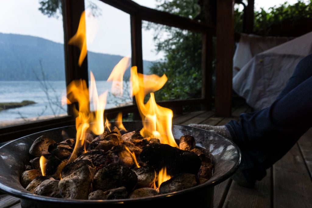
Wild Renfrew: Cabins right on the water in Port Renfrew just down the pier from the pub. I splurged on a night here during my big tree trip to Port Renfrew. They have covered porches with propane fire pits. So cozy on a rainy day! Check rates.

West Coast Trail Lodge: They have budget dorm rooms as well as regular hotel-style rooms. Located in Port Renfrew around the corner from the pub. Check rates.
Trailhead Resort: A fishing lodge with nice cabins and lodge rooms. But they also have “hiker huts” – tiny cabins designed for hikers on a budget. Check rates.
Other hotels in Port Renfrew: There are a few other hotels, motels, and lodges in Port Renfrew.
Where to Stay in Nitinaht Village
Nitinaht Lake Campground: Located just south of Nitinaht Village. Currently, they are first-come, first-served, but they plan to offer online reservations in 2020. It’s run by the Ditidaht First Nation and is really popular with kite surfers. Check rates.
Nitinaht Village Motel: This basic 9 room motel is the only place to stay in Nitinaht Village if you aren’t camping. They also have a restaurant. Call them for info: 1 888-745-3844
Where to Stay in Bamfield
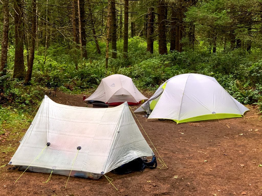
Pachena Campground: This campground is about 5.5km from Bamfield, but it’s right next to the Pachena Bay Trailhead. They have forested campsites just behind the beautiful beach at Pachena Bay. I stayed here before my August 2019 West Coast Trail hike. We booked the hiker site, which is the closest site to the trailhead and has a food cache. Book well in advance since they are very popular and get totally booked up. Check rates.

Hacas Inn: Formerly known as the Bamfield Motel, this inn is run by the Huu-ay-aht First Nation. They have backpacker rooms for hikers that are a little bit cheaper than their regular rooms. Check rates.
West Coast Magic B&B: This gorgeous looking bed and breakfast is located in the rainforest near Brady’s Beach on the east side of Bamfield. Check rates.
Other hotels in Bamfield: There are a few other hotels, motels, and lodges in Bamfield.
Join the Backpacking in BC Facebook Group
I hope you’re reading this well in advance of your trip. Now that you know how to get to the West Coast Trail, make your booking ASAP.
MORE WEST COAST TRAIL POSTS:
- Your Guide to the West Coast Trail in British Columbia
- West Coast Trail Section-By-Section Overview
- 7-Day West Coast Trail Itinerary (Plus More Itinerary Options)
- West Coast Trail Packing List: Everything You Need to Bring
- West Coast Trail Camping: Your Complete Guide
- Coastal Hiking Tips: Advice for Beach Backpacking
MORE VANCOUVER ISLAND POSTS:
- Juan De Fuca Trail Guide: Backpacking on Vancouver Island
- North Coast Trail Guide: Backpacking on Vancouver Island
- Cape Scott Trail Guide: Hiking and Camping on Northern Vancouver Island
- Wild Side Trail: Hiking and Camping Guide
- The Ultimate Guide to the Pacific Marine Circle Route on Vancouver Island
- How to Visit Avatar Grove, Big Lonely Doug and Other Big Trees on Vancouver Island
- 30 Best Backpacking Trips in BC


- Things to Do on Newfoundland’s Great Northern Peninsula - July 29, 2026
- Best Sun Hoodies for Hiking - June 3, 2026
- Lower Stein Valley Trail Hiking and Backpacking Guide - May 27, 2026
Trevor Wiebe
Monday 18th of April 2022
Hi Taryn - Thanks for all this great information. I will continue to reference this as my trip approaches. Speaking of which: my friend and I will be starting our hike at Gordon River in August. You mention driving to your exit point (i.e., Pachena Bay) and then taking a shuttle to where you will start (i.e., Gordon River). However, you also mention that the drive out to Pachena Bay is tricky. How would you plan your transportation if you were hiking from Gordon River to Pachena Bay?
Also, our booking has the following charges: Gordon River Ferry Fee for 2 People @ $24.00: $48.00 Nitinaht Village Ferry Fee for 2 People @ $24.00: $48.00
Does this mean that we don't have to book a ferry to drive over to the island? Any assistance would be greatly appreciated. Thanks!
Taryn Eyton
Tuesday 19th of April 2022
Hi Trevor Those ferry charges on your booking are for small passenger ferries on the trail to cross rivers. You still need to get yourself to Vancouver Island. If you are concerned about driving the backroads, I would just book the shuttle both ways from Victoria. If you want to drive yourself to one end I would drive to Pachena Bay (Bamfield) - driving instructions are in the post. It involves some driving on unpaved backroads but is well signed. The trickier drive is between the two trailheads, so my advice is to take a shuttle for that portion. So your itinerary would be: Drive to Pachena Bay. Catch the afternoon shuttle to Gordon River. Camp at the Pacheedaht Campground or stay at a Hotel in Port Renfrew. Start the trail the following day. If you have more questions, I do provide custom itinerary planning services and phone consultations. More info here: https://happiestoutdoors.ca/about/custom-trip-planning/
Darrell Kinas
Sunday 23rd of January 2022
Hi Taryn, We are doing the west coast trail in July, you mention that the trail head is around 4 km’s from port renfrew,how do you get to the trail head? We are thinking of taking the bus from Victoria to port renfrew does that get us to the trail head? Thanks Darrell
Taryn Eyton
Monday 24th of January 2022
Hi Darrell, If you take the bus from Victoria, it drops off both in Port Renfrew and at the trailhead (Gordon River). If you stay overnight in Port Renfrew beforehand, ask your hotel or guest house about arranging a ride to the trailhead for you. There is no official taxi service in town, but many locals give rides for cash.
Andrew
Sunday 15th of September 2019
I second your comment on taking the bus first. It's been a long time (2002) since I hiked the WCT. It's still ranks as one of the best vacations I've taken in my life...minus the 3 hour logging road ride home. Do it first for sure! Cool map feature!
Taryn Eyton
Monday 16th of September 2019
That logging road bus ride is definitely not awesome! Although after enduring 9 hour bus rides in Nepal, I'd have to say it's not the worst thing ever :)