

In Tasmania, Australia if you want to get out into the wilds and off the grid, you head over to the West Coast. One of the first things I did in Tasmania was a short road trip on the Tarkine Drive in the North West corner of the state.
The trip begins and ends at the small city of Smithton, on the Bass Highway, but the rest of the route follows sealed roads through remote wilderness down the West Coast, then inland through the temperate rain forest.
There are tons of places to stop, walk on the beach, hike through the forest and learn about aboriginal heritage. If you’re looking for a a day (or three) of outdoorsy adventure in Tasmania, you’ve got to try the Tarkine Drive.
This guide to Tasmania’s Tarkine Drive includes:
- Driving directions
- Road conditions
- Petrol, food, and services on the Tarkine Drive
- Driving times
- Where to stay
- 15 places to stop along the Tarkine Drive
Hey there: Some of the links in this post are affiliate links, which means I earn a small commission at no extra cost to you if you make a purchase. Thanks for supporting my website! -Taryn
What is the Tarkine?
The Tarkine is a region in Tasmania’s North West. (FYI: It’s pronouned “tar-kine”, rhymes with “fine”, not “tar-keen”, rhymes with “mean”.) It’s named after the Indigenous Tarkiner people who traditionally lived in the area. However, the proper Indigenous name for the area is “takayna”.
The Tarkine is known as one of the world’s largest temperate rainforests. It’s full of big old growth eucalypts, myrtle, leatherwood and pines, tree ferns and lush vegetation in every shade of green.
Some of the plants are from species that date back millennia to the age of the Gondwana supercontinent. There are also unique coastal and buttongrass plains ecosystems to explore.
The region has almost no permanent residents, but it has lots of wildlife including one of the only surviving wild populations of endangered Tasmanian Devils.
You can also find some of the richest Indigenous sites in the Tarkine, including shell middens and rock carving sites.
The Tarkine is definitely off the beaten path so it’s not overrun with tourists, but it is still easy enough to get around.
While the local tourism authorities are promoting the Tarkine Drive, and parts of the region are in the Arthur-Pieman Conservation Area, most of the Tarkine is unprotected.
This means that logging and mining are occurring in old growth habitats. Watch this excellent documentary about the Tarkine and see what you think. It definitely inspired me to visit before it’s gone.
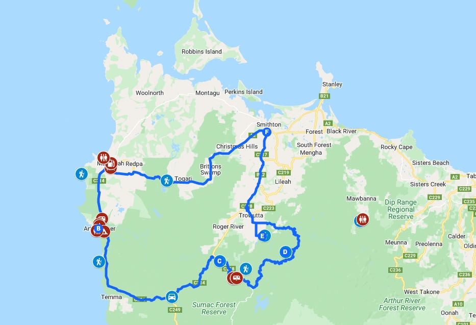
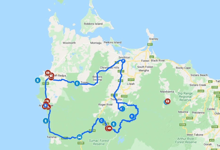
Driving Directions for the Tarkine Drive
The Tarkine Drive is a loop road trip that starts and ends in Smithton in North Western Tasmania, Australia. The route is only about 205km long and can be driven in one day, but since there is so much to see along the way, many people prefer to take a few days. Driving directions are as follows:
- From Smithton go southwest along the A2 to Marrawah
- Next, go south down the coast to Couta Rocks on the C214
- At Couta Rocks turn left to stay on the C214 and continue until the Kanunnah Bridge
- Just before the bridge turn right onto the C218
- Follow the C218 north to Edith Creek where it becomes the B22.
- Take the B22 back to Smithton.
The entire route is well signed so you won’t get lost. You can travel the loop in either direction, but I did a counter-clockwise loop so I’m describing it that way here. I also made a custom, clickable Google map for you with all the stops highlighted!
You will need your own transport to see the Tarkine Drive – there are no public buses. It’s easiest to hire a car in Devonport, Launceston, and Hobart. I use Discover Cars since it lets you compare prices from lots of different car hire companies. That way you can be sure you are getting the best deal.
Tarkine Drive Road Conditions
The entire Tarkine Drive is sealed (paved). It used to have a gravel portion on the C218, but it’s sealed (paved) now.
In general, it’s a two lane road with few opportunities for passing. There are several sections that are very twisty and despite being sealed, the road is a bit bumpy. There are also a handful of single lane bridges. Most of the route has very little traffic.
Petrol, Food and Services on the Tarkine Drive
The entire Tarkine Drive is quite remote and there are a few stretches where you’ll go quite a while without passing any services.
In particular, the only places there are any services are Marrawah and Arthur River. Marrawah has a small general store, a pub, a post office and petrol available. Arthur River has a small store with a take-away counter but no petrol.
There are very few public toilets on the drive so plan ahead. There are toilets at Green Point Beach, the Arthur River Ranger Station, the Edge of the World Viewpoint, Julius River, Milkshake Hills and Dip Falls. They may not have toilet paper so bring your own.
And if you can’t get to a toilet, be sure to go well away from camps, roads, and tracks, bury your waste and pack out your toilet paper.
READ NEXT: How to Leave No Trace (And Why it’s Important!)
There is no mobile phone coverage on parts of the route. You will likely lose service along the coast between Marrawah and Arthur River and on the inland portion through the forest. As I said, the road is well-signed, so as long as you stay on the main road, you will be fine.
Driving Times for the Tarkine Drive
You can definitely drive the Tarkine Drive in a single day. It takes about 3.5 hours to do the loop with no stops.
But many of the stops will take you an hour or more, so it’s best to split the trip up over several days. Two days is great but three is even better. I spent two days on my trip, but wished I had three.
Where to Stay on the Tarkine Drive
There are not that many accommodation options along the route.
There are a few self-contained holiday home rentals in Marrawah, but there are many more in Arthur River. I think Arthur River is a logical place to stay overnight because it’s closer to the halfway point of the trip. Unfortunately, there aren’t any places to stay on the eastern, inland portion of the loop.
In Arthur River, there are a few places to stay:
- Arthur River Spa Cottage: Cute cottage with an incredible view of the river mouth. Check prices.
- Sunset Holiday Villas: Two-bedroom suites with a full kitchen and a great view. Check prices.
- Arthur River Lodge: Beautiful five-bedroom house is great for groups. Check prices.
- Arthur River Beach House: Gorgeously updated beach house with a great patio. Check prices.

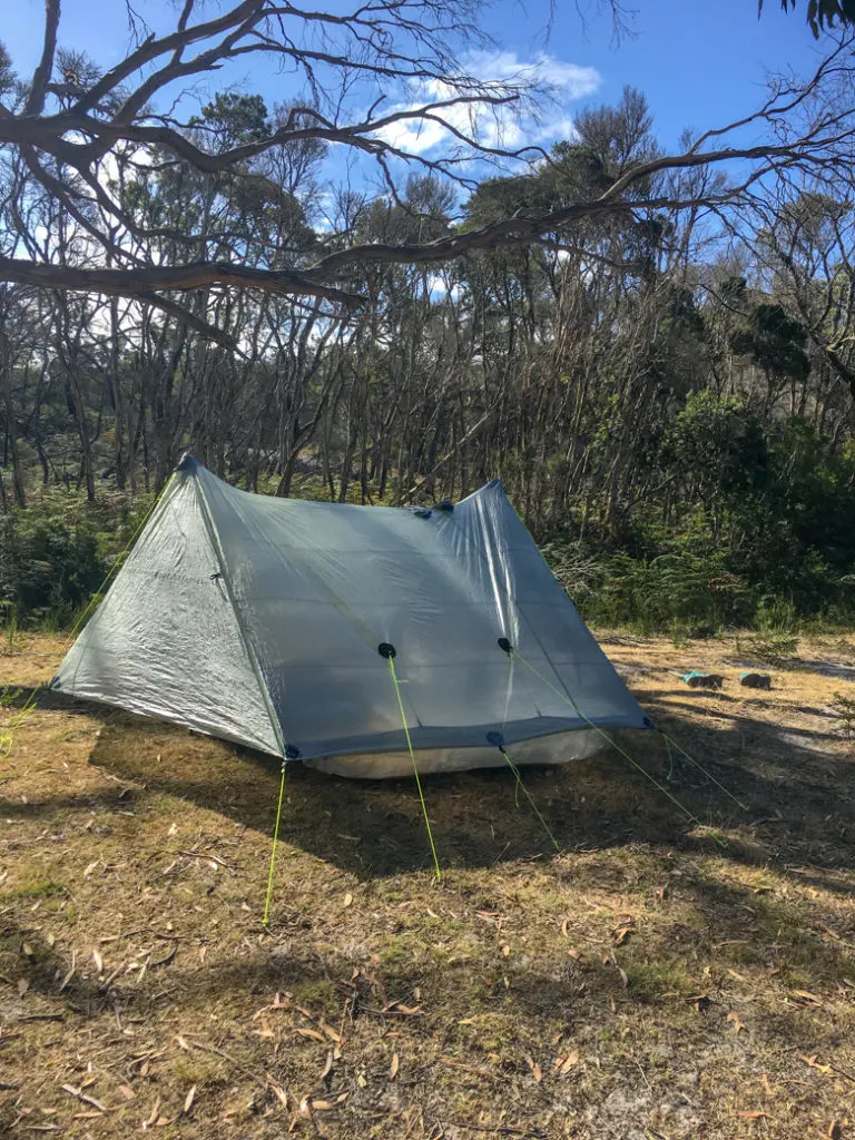
If you’re up for roughing it, there are a bunch of great places to camp along the Tarkine Drive. I stayed at the Prickly Wattle campground just south of Arthur River. It was really quiet and had some beautiful shaded sites. Plus… we glimpsed a Tasmanian devil in the wild at dusk!
Here’s my complete list of all the campsites along the Tarkine Drive:
- Green Point Campground, Marrawah (Free)
- Arthur River Cabin Park, Arthur River (Contact them for rates)
- Manuka Campground, Arthur River (Check in and pay at Arthur River Ranger Station)
- Peppermind Campground, Arthur River (Check in and pay at Arthur River Ranger Station)
- Prickly Wattle Campground, Arthur River (Check in and pay at Arthur River Ranger Station)
- Julius River Forest Reserve on highway C218 (Free, self-contained caravans only)
Places to Stop on the Tarkine Drive
Here’s my list of the best places to stop on the Tarkine Drive. It includes viewpoints, short walks, longer hikes and other places of interest. You don’t have to stop everywhere to experience the Tarkine – just pick the ones that appeal to you.
Green Point Beach
From Marrawah take Green Point Road, then Beach Road towards the coast to reach Green Point Beach. There’s a small campground here, popular with experienced surfers who make the trek out to the West Coast to brave the huge swells.
West Point Reserve

Take the gravel side road out to West Point Reserve to visit Tasmania’s westernmost point. Known as nunga in the local Indigenous language, the area boasts tons of Indigenous cultural sites. The easiest ones to find are the massive shell middens.
Arthur River

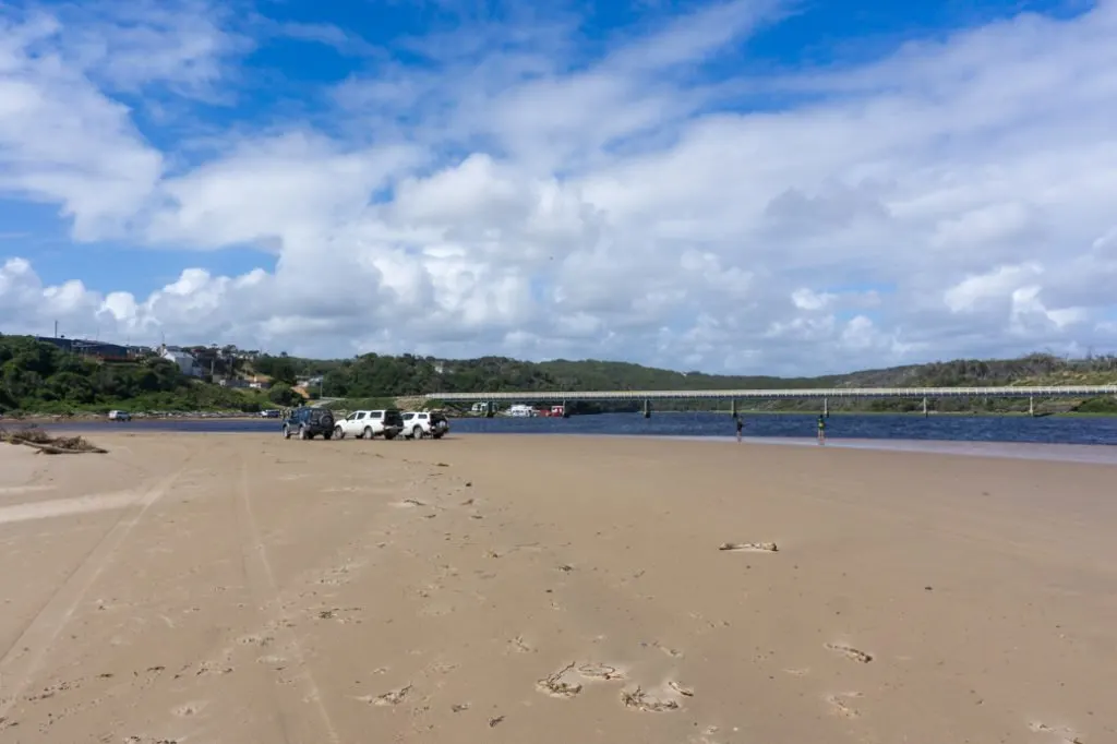
This is the largest “town” on the Tarkine Drive, but town is pretty generous a label for such a small place.
Be sure to stop at the river mouth and take a walk down to the beach.
The ranger station and visitor centre is also worth a stop to get tips on local walks, camping and wildlife.
There’s also a small store that does take-aways across from the visitor centre if you’re craving fish and chips. It was a hot day when we came through, so we stopped in for an ice cream.
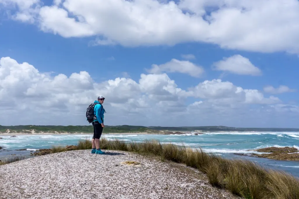
Arthur River Coastal Walk
If you are up for a longer walk, you can follow the coast north from the river along a set of beaches and walking tracks to Church Rocks.
Park your car at the lot next to the inland side of the bridge, then head down to the beach. Follow the beach around the corner, using inland tracks to bypass rocky headlands. Be sure to go at lower tides if you don’t want to get a shoe full of water and sand. (Ask me how I know….)
Arthur River Cruises
Lots of people rave about the Arthur River Cruises, but unfortunately I didn’t have time on my Tarkine Drive road trip. They do two different full-day guided cruises up the river with a couple of different stops plus lunch. Advance bookings required.
The Arthur River is one of Tasmania’s last wild rivers with no roads, industry or hydro on it, so it’s a great place to experience nature and maybe even spot some wildlife!
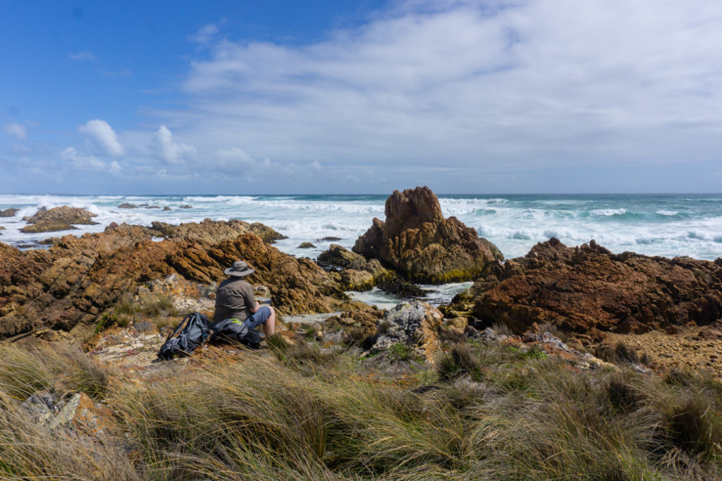
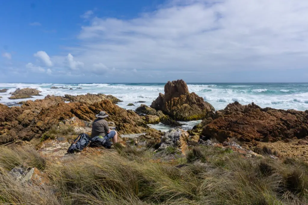
Edge of the World Viewpoint

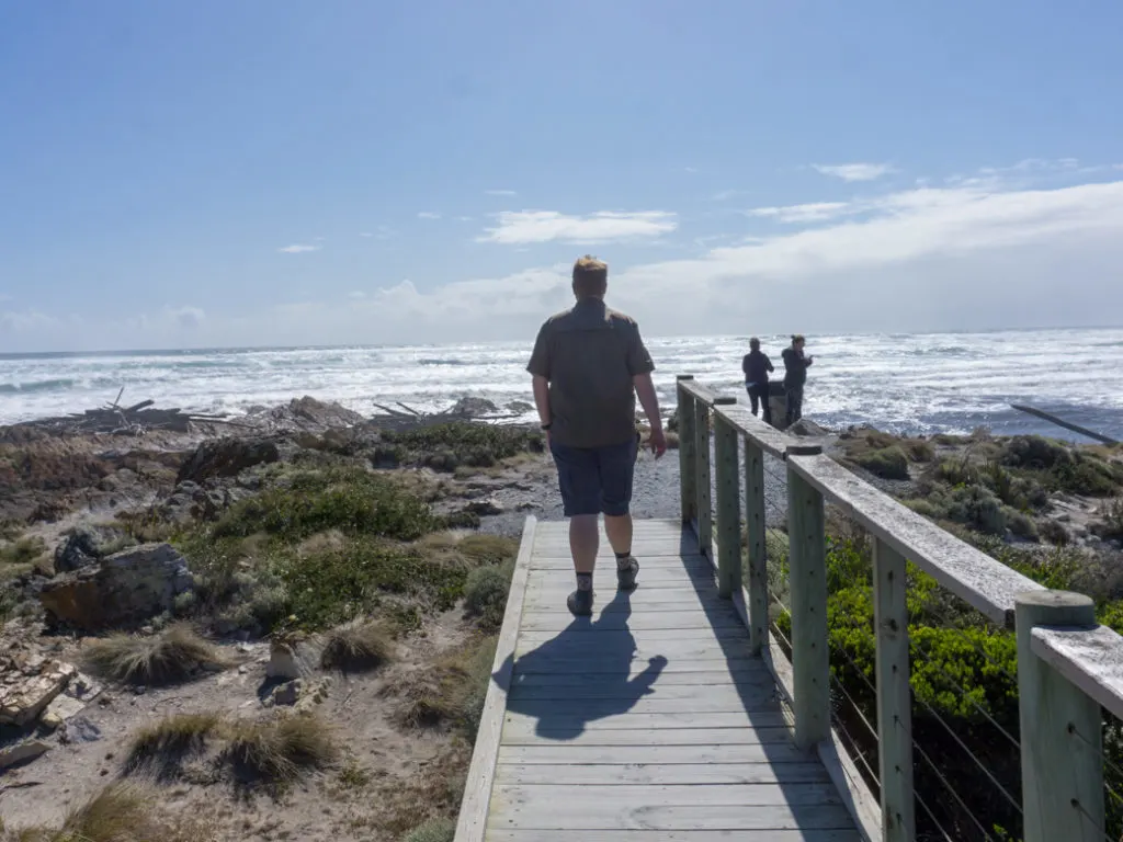
This viewpoint may not be at the actual edge of the world, but it kind of feels like it.
There’s a boardwalk path and a viewing platform leading out to a point just south of the mouth of the Arthur River. If you look due west, all you can see is the ocean stretching out before you – there’s nothing between you and South Africa!
There’s a small picnic area here, toilets and free barbecues, but it’s a pretty windy spot for a cook out. To find the viewpoint, turn west on Airey road, just up the hill from the south side of the Arthur River Bridge.
Sundown Point Reserve
Known as laraturunawn in the local Indigenous language, Sundown Point is an important Indigenous cultural site. You can walk an hour along the coast to visit some Indigenous rock carving sites.
Unfortunately I didn’t have time to make it out there on my trip and I’m sad to have missed it since Indigenous heritage in the Tarkine is so rich. To find the rock carvings, take Sundown Point Road into the coastal community of summer shacks, then follow the coast north to the mouth of Sundown Creek.
READ NEXT: How to Prevent Blisters When Hiking
Western Explorer
This road is a whole extra adventure on its own. A few kilometres after the main road turns inland, you’ll reach the junction with highway C249, better known as the Western Explorer.
This remote and unsealed road links the northern part of the West Coast to the southern part at the town of Corinna. It’s bumpy and slow-going, but safe for two-wheel drive vehicles. We drove it on a weekday and saw two other cars!
Sumac Lookout
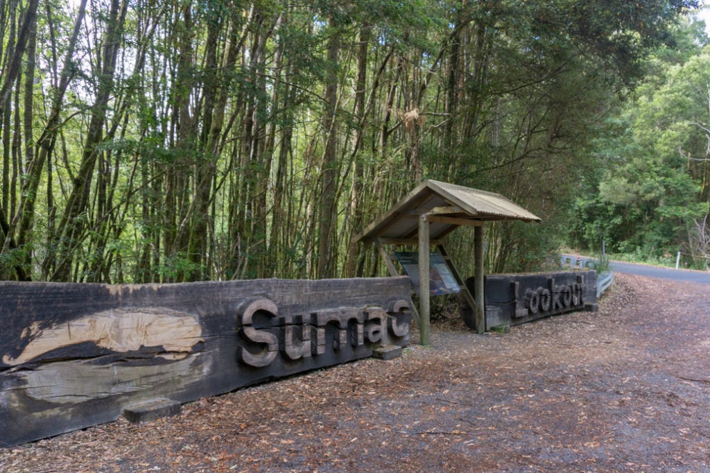
As the road winds away from the coast, it enters the temperate rain forest section of the Tarkine. One of the best places to get a good look at it is the Sumac Lookout viewpoint.
As highway 214 winds down the hill towards the Arthur River, turn right and go up the hill to the lookout. (Don’t cross the bridge.) The lookout is a 2 minute walk from the car park and has a great view of the Arthur River and surrounding forest.
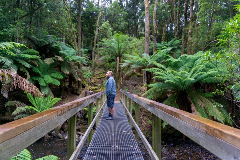
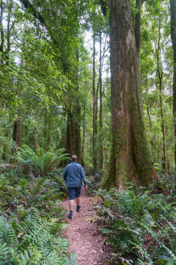
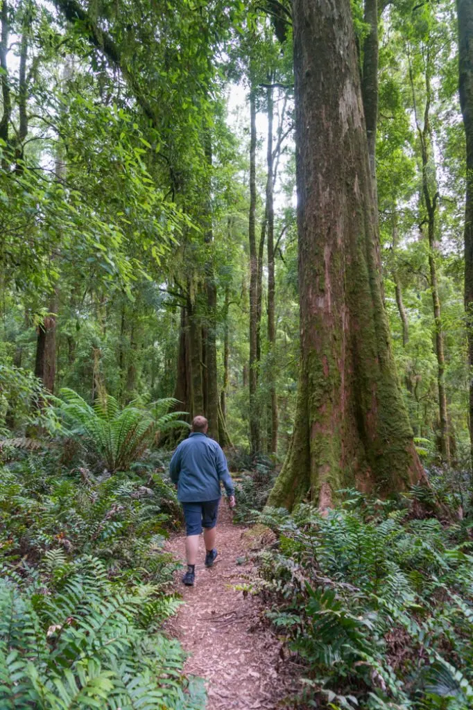
Julius River Walking Tracks
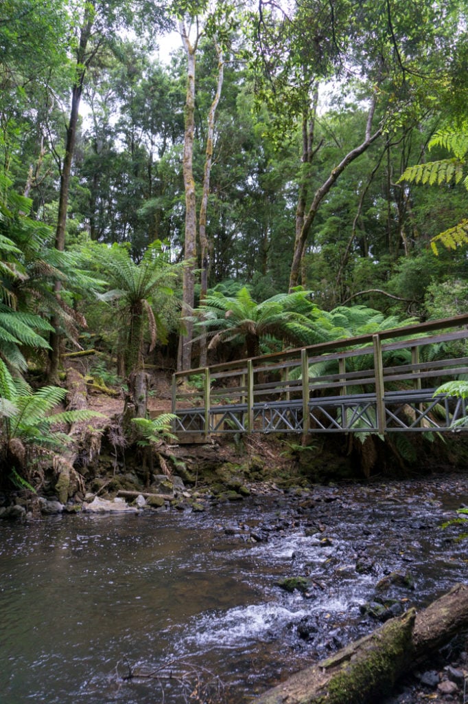

The green on green on green of the temperate rainforest at Julius River made it one of my favourite parts of the Tarkine Drive. There are two short loop walks at Julius River.
The shorter one takes about 30 minutes. It leaves from the end of the carpark and runs next to the river, over a bridge and then up a hill back to the start. The forest scenery here is primeval, with tree ferns and lots of ancient plants that date back to Gondwana, the ancient supercontinent that formed most of the modern continents.
The longer walk takes about 40 minutes and makes a loop through the forest, but I didn’t find it nearly as worthwhile.
The picnic ground at Julius river has tables, barbecues and toilets, which makes it a nice place to stop for a break. You can also camp for free here if you are in a self-contained caravan. Tents are not allowed.
Lake Chisholm
A short, paved side road takes you to the carpark for Lake Chisholm. From there, it’s a 30 minute walk down to the shores of the lake. Lake Chisholm is actually an old flooded sinkhole. Apparently you can spot platypus there, but we didn’t see any. (They are most active at dawn and dusk and we were there in the middle of the day.)
The lake itself is kind of interesting, but the huge old growth trees along the way were the real draw for me. It’s also a good spot to see wildlife. We startled a pademelon and its joey along the track.
READ NEXT: Best Places to See Wildlife in Tasmania
Milkshake Hills
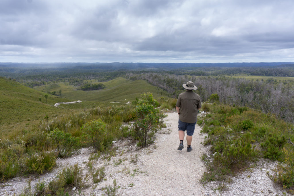

The side trip to Milkshakes Hills is worth the trip to see a completely different ecosystem. The short gravel side road to the Milkshake Hills carpark runs through open temperate forest that is recovering from a bushfire.
Once at the car park, the walking track spends a few minutes in the forest, before emerging into the open and climbing up one of the hills. From a top you get a great view of the rainforest and some of the buttongrass moorlands. It’s about a 30 minute trip up the hill and back.
Trowutta Arch

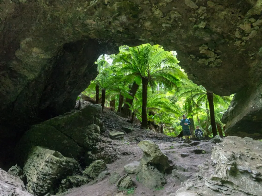
This arch is one of the most popular destinations on the Tarkine Drive, and also one of the most spectacular.
Trowutta Arch formed when two sinkholes collapsed. The near one is full of rubble but you can walk through the arch to see the far one, which is full of water. It’s a visually stunning place, covered in moss and ferns.
It’s an easy 30 minute walk to the arch but you’ll want to spend more time there taking photos.
To reach Trowutta Arch, take Reynolds Road south from highway C218 in Trowutta, then turn left onto Gun road and follow it to the carpark. Both Reynolds road and Gun Road are gravel, but they are fine for 2-wheel drive vehicles. Watch-out for active logging on the drive in.
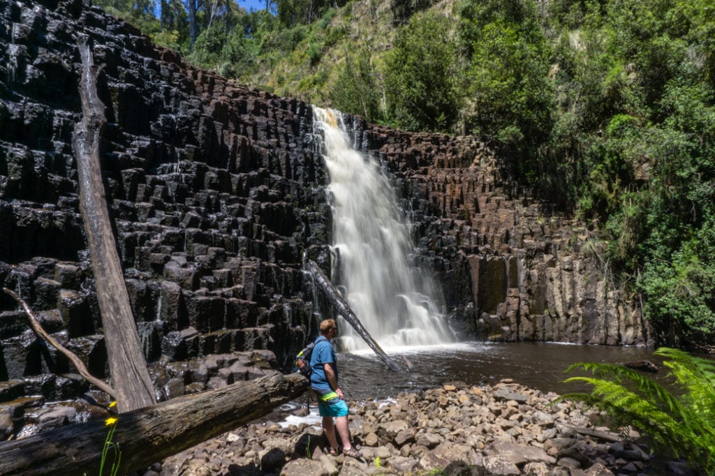
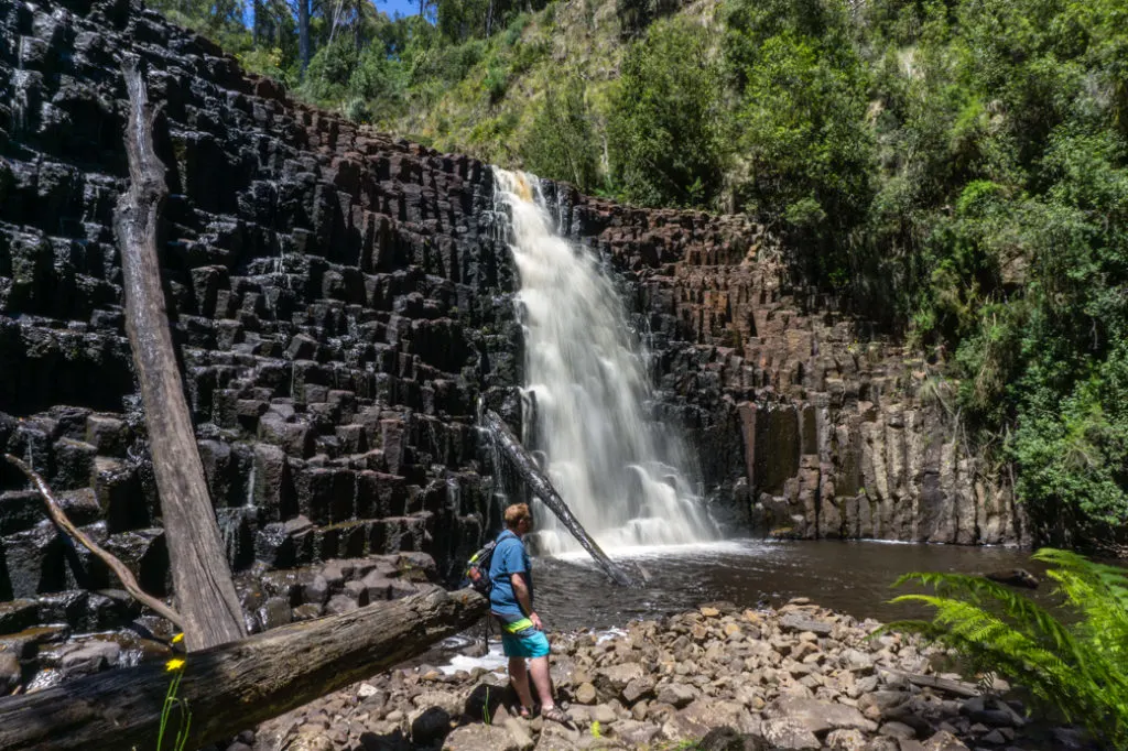
Bonus: Dip Falls and the Big Tree
While these two sights aren’t located directly on the Tarkine Drive loop trip, they are well worth a side trip from the Bass highway since they are also part of the Tarkine region.
Beautiful Dip Falls drops 30 meters down a rocky cliff face into the dip river. It flows over volcanic columns that reminded me a bit of Svartifoss in Iceland!
There’s a really well-built set of stairs and viewing platforms that takes you down into the canyon to view the falls from the bottom. You can also get a great view of the top of the falls by crossing the river on the road bridge, then taking a short track to another viewing platform.

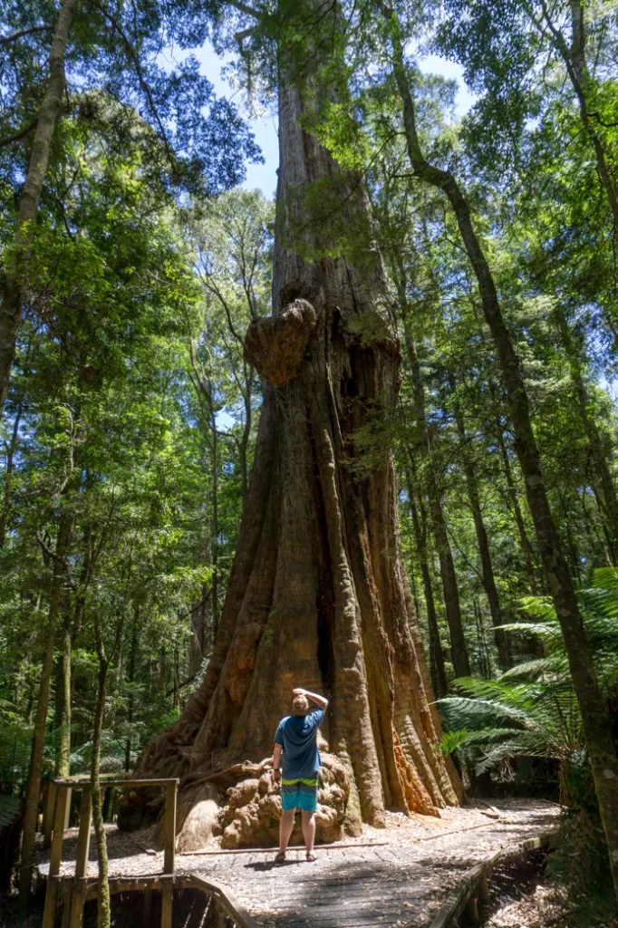
Just a kilometre up the road from the falls is a grove of giant old growth trees, including one fittingly called “The Big Tree”. You can reach the trees via a short 2 minute path. The Big Tree is believed to be over 400 years old and has a circumference of 16 meters around the base. That’s pretty big!
To reach Dip Falls and the Big Tree, take highway C225 south from the Bass highway east of Stanley. Follow the signs at each junction to stay on the C225 to the falls. The last few kilometres are on a gravel road, but it’s easy driving for 2-wheel drive vehicles. From the falls, continue on to the north for another kilometre. Look for a pull out on the right hand side and the start of the track to the Big Tree.
I wasn’t sure what to expect when planning my roadtrip on the Tarkine Drive but I’m sooo glad we went. It’s such a beautiful place and is still quite off the beaten path. I loved learning about the Indigenous culture too.
There were only a few cars at most of the places we stopped. We even had some of them all to ourselves. If you find yourself in Tasmania, make time to drive the Tarkine. I promise you’ll love it.
MORE TASMANIA POSTS:
- The Best Things to do in Strahan and Tasmania’s West Coast
- Best Places to See Wildlife in Tasmania
- 40+ Things to do in Devonport and Tasmania’s North West
- How to spend the weekend in Hobart, Tasmania: 2-day Itinerary
- 22 Things to Do on the Tasman Peninsula Near Port Arthur
- The Ultimate Guide to Visiting Maria Island, Tasmania
- The Best Things to Do on Bruny Island, Tasmania


- Things to Do on Newfoundland’s Great Northern Peninsula - July 29, 2026
- Best Sun Hoodies for Hiking - June 3, 2026
- Lower Stein Valley Trail Hiking and Backpacking Guide - May 27, 2026
Lorraine Cocks
Sunday 9th of February 2025
Hi Taryn. Thank you so much for this information. As a ‘happiest outdoors’ person myself, this info has had a huge impact on my Tassie Trip planning. I can’t tell you how grateful I am as my goal is to predominantly immerse in the forests/wilderness during my holiday, rather than the well travelled tourist trail. Hats off to ya!
Luke
Tuesday 11th of January 2022
If you ride a road bike and you have read this far then yes it's one of the best bike roads in Australia. Best ridden in full summer but the rivers and waterfalls run better in the cooler months. Fill up before you start.
Rowan Roger Schultz
Thursday 12th of August 2021
Thank you so much - I'm going!
Marta
Friday 6th of December 2019
Thanks a lot for such a detailed guide for the Tarkine Roadtrip, It helped a lot to plan my trip. Thanks :)
Taryn Eyton
Saturday 7th of December 2019
You're welcome Marta. It's such a gorgeous place. I'm glad you had a good time.