

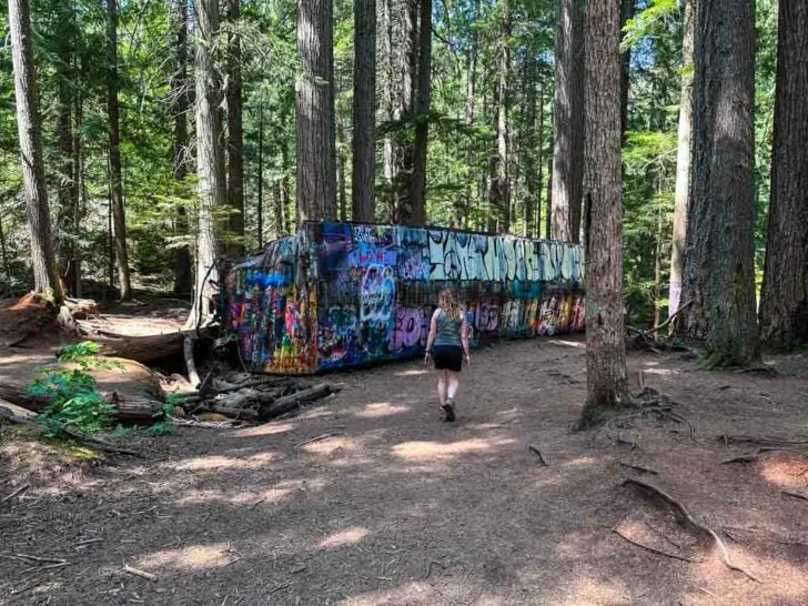
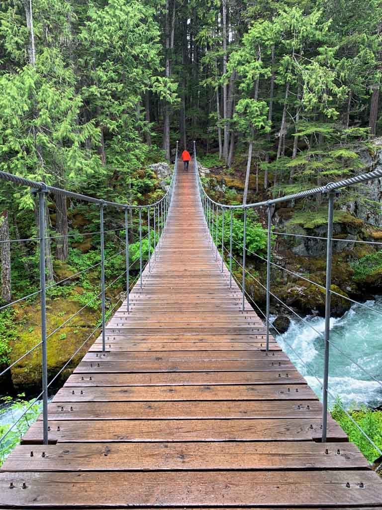
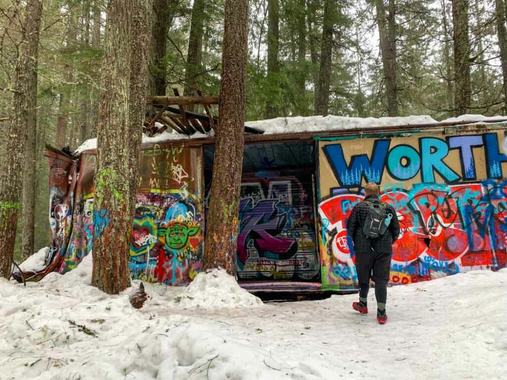
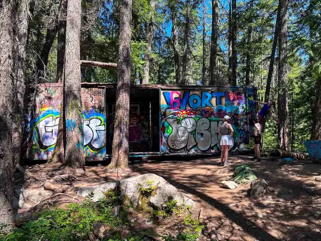
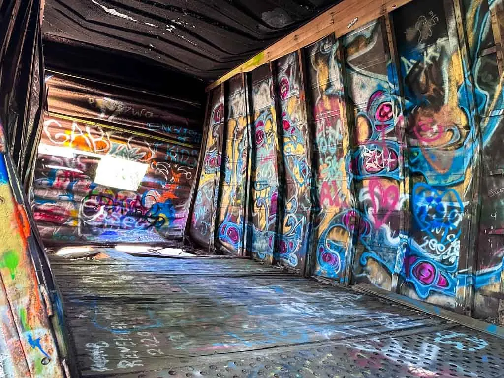
The Whistler Train Wreck hike is one of the most popular short trails in Whistler, and it’s easy to see why. The star attraction is the graffiti-covered train cars, abandoned since the 1950s. But the forest scenery and picturesque suspension bridge along the way also add to the beauty.
I live just down the road in Squamish, so I’ve hiked the Whistler Train Wreck Trail more times than I can count. (I think I’m up to about six times?) If people ask me to recommend a short and easy Whistler hike, it’s always the one I recommend. It’s one of my top picks for the best things to do in Whistler in summer.
This guide to the Whistler Train Wreck Trail includes:
- Key trail stats for the Whistler Train Wreck Hike
- A Whistler Train Wreck trail map that I made just for you
- How to get to the trailhead by car and bus
- Turn-by-turn hiking directions with lots of photos
- History of the train wreck – how did the train cars end up in the forest?
- Whistler Train Wreck Trail FAQ – all your questions answered
This is a sensitive wilderness area. Learn how to Leave No Trace to keep the wilderness wild. Make sure you are prepared by bringing the 10 Essentials. Get ready for adventure with this checklist of things to do before every hike.
Hey there: Some of the links in this post are affiliate links, which means I earn a small commission at no cost to you. Thanks for your support. -Taryn

Whistler Train Wreck Hike Basics
The Whistler Train Wreck is a short and easy hike through the forest to a cluster of abandoned train cars. The train cars are covered in graffiti and are fun to explore. Along the way, the trail crosses a spectacular suspension bridge over the turquoise glacial waters of the Cheakamus River.
The hike to the Whistler Train Wreck is my favourite short hike in Whistler since it is easy enough for almost all hikers and has great scenery. It’s also mostly in the forest, which is great for both hot days and rainy ones. Plus it is easy to get to by bus or car and has lots of parking.
I also love snowshoeing to the train wreck in winter – it’s on my list of the best snowshoe trails in Whistler.

Trail Stats
Distance: 2.5-3 km
Elevation Gain: 90 m
Duration: 1-1.5 hours
Difficulty: Easy
Season: April to November in hiking boots, November to March with snowshoes or microspikes. (Read my guide to the differences between snowshoes and microspikes.)
Toilets: The closest toilets are at Bayly Park, which is across the road and up the hill from the trailhead (about 3 minute walk).
Dogs: Allowed on-leash only under Whistler’s dog bylaws.
Caution: Some of these trails are multi-use trails which are shared with bikes. Watch for bikes and move over as they are often not able to stop as quickly as hikers.
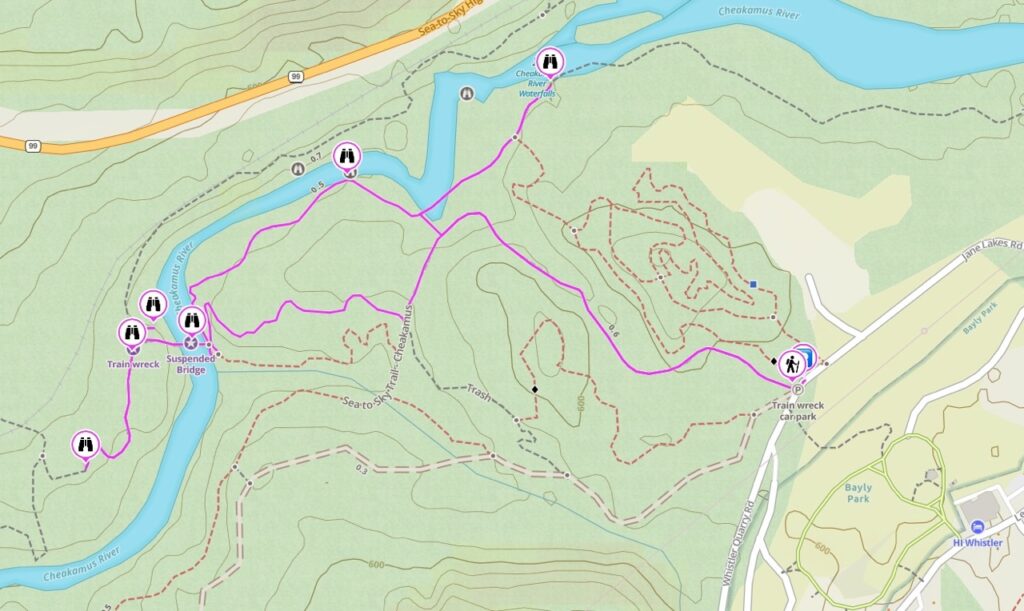
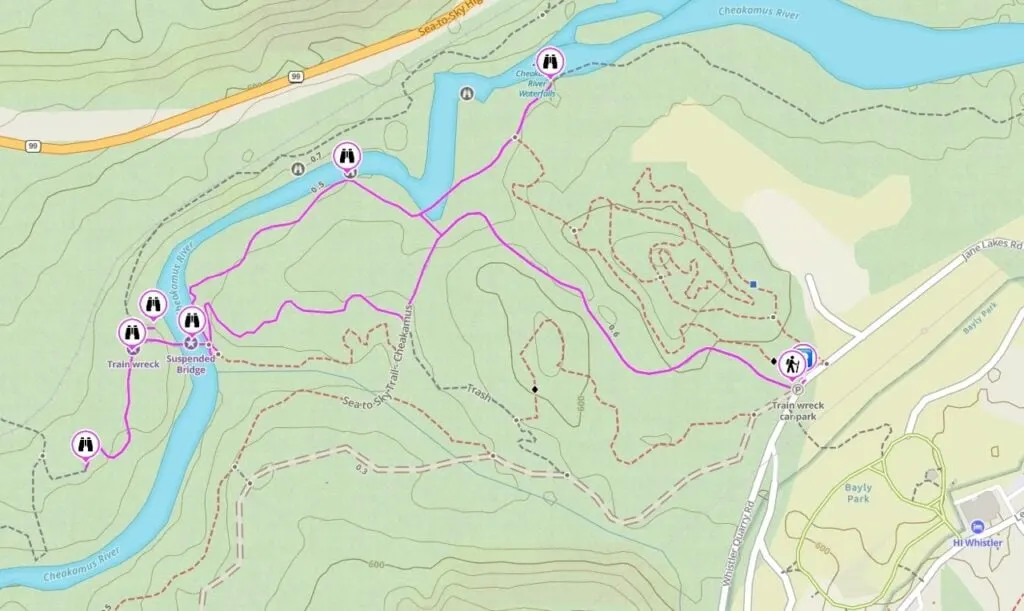
Whistler Train Wreck Trail Map
The Whistler Train Wreck Trail is easy to follow and there are signs at most intersections. However, I made you a trail map using Gaia GPS, my favourite GPS and mapping app. Click through to zoom in and explore.
How to Get to the Whistler Train Wreck Hike
Where is the Trailhead for the Whistler Train Wreck Hike?
Over the years there have been several different ways to hike to the Whistler Train Wreck. The current trailhead is on Jane Lakes Road in the Cheakamus Crossing neighbourhood.
The original route to the train wreck started in Function Junction, Whistler’s industrial park. However, that route involved walking along the railroad tracks for a few minutes, which was dangerous and illegal. If you see instructions online for accessing the Train Wreck Trail that way, they are out of date since that route is now closed.
There is also another route to the Whistler Train Wreck from a pullout on Highway 99 just south of Whistler. It uses the Lower Yer Saddle mountain bike trail to get to the train wreck quickly. However, it also involves crossing the railway tracks, so it is also illegal.
The new official route to the Whistler Train Wreck opened in 2016. It starts near Bayly Park in the Cheakamus Crossing neighbourhood. The new trail includes a suspension bridge over the Cheakamus River. That is the only legal way to access the trailhead (and it’s also the nicest trail.)
Below I’ve got both driving and public transit directions for getting to the official trailhead.
Driving Directions and Parking
From Whistler Village, go south on Highway 99. Turn left at the traffic light onto Cheakamus Lake Road. (Turning right puts you on Alpha Lake Road, which goes to the Function Junction neighbourhood.)
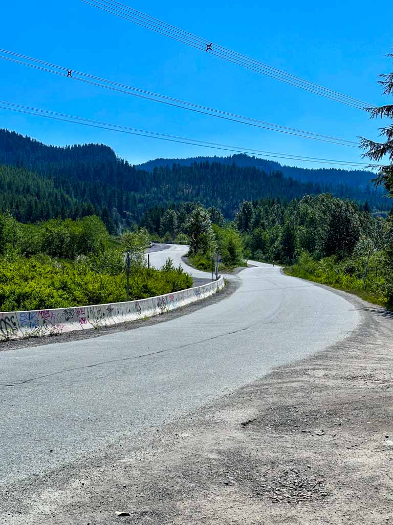
Follow Cheakamus Lake Road (which becomes Legacy Way) over a bridge, and then around the corner into the Cheakamus Crossing neighbourhood. Make your first right onto Jane Lakes Road, following signs for the Train Wreck Trail.
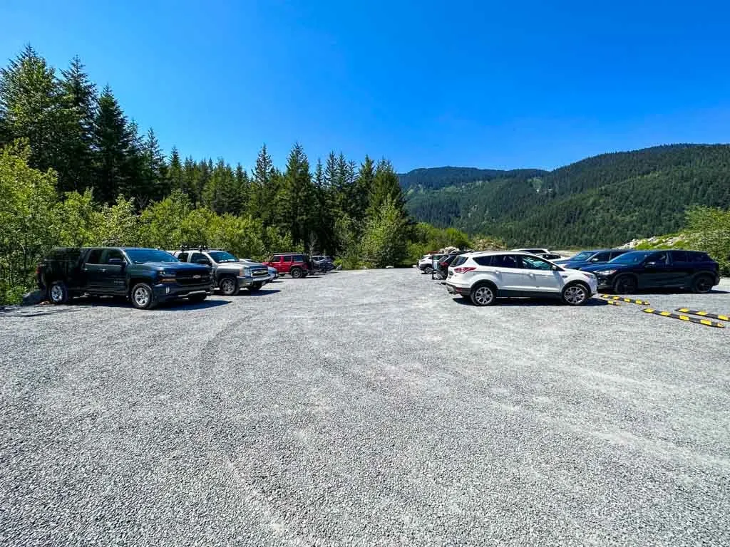
A minute later, turn right into the gravel parking lot for the Train Wreck Trail. If it is full, there is another parking area a few meters later on the left side of the road.


You can also take a taxi or Whistle (Whistler’s Uber service) to the Whistler Train Wreck trailhead from anywhere in Whistler.
Click here for Google Maps driving directions.
Bus Directions
It’s also possible to get to the Train Wreck Trail by bus. Take BC Transit bus 10 or 20 from Whistler Village to the stop on Legacy Way at the HI Whistler Hostel. From there, walk down the hill through Bayly Park to the trailhead. The walk adds about 5 minutes to your hike.
Click here for Google Maps bus directions.
Whistler Train Wreck Hiking Directions
From the main parking area, follow the gravel path beside the road for a minute to the trailhead.
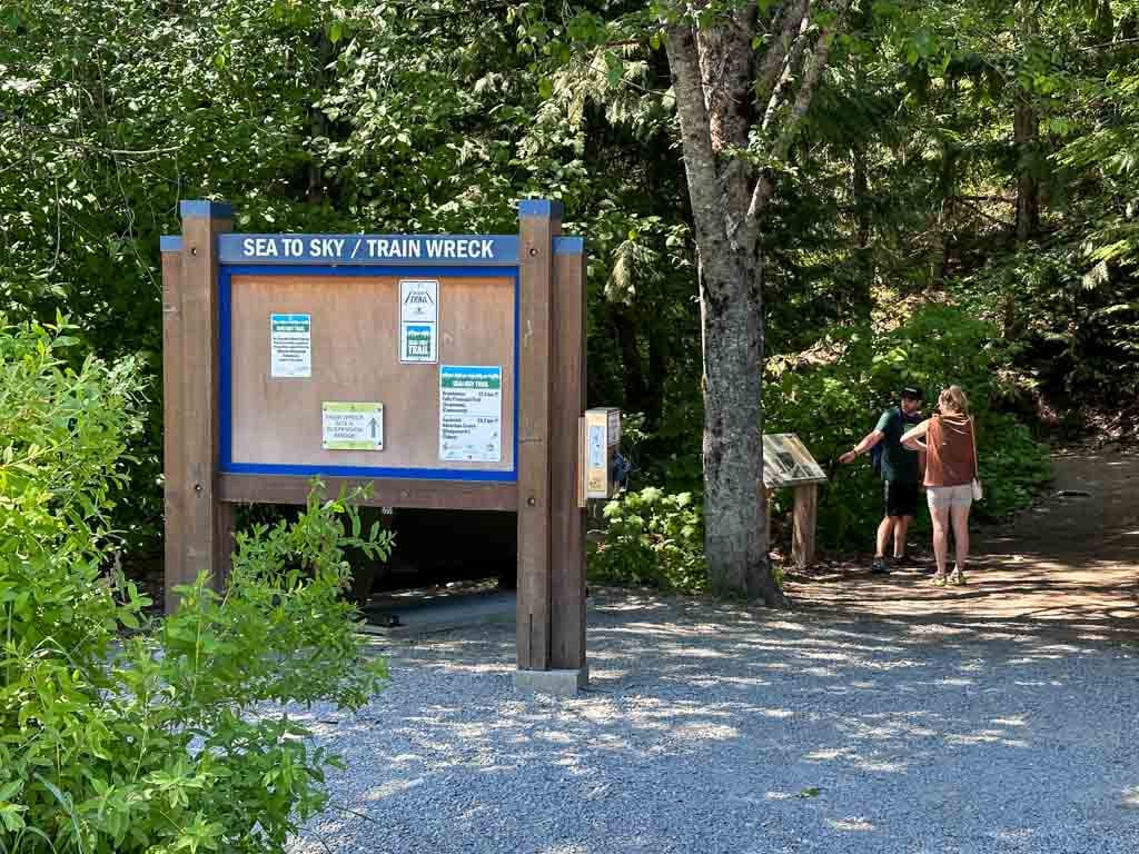

The large signboard here is labelled “Sea to Sky/Train Wreck” because, for the first part of your hike, you will be on the Sea to Sky Trail. This 180-kilometre-long multi-use trail stretches from Squamish past Pemberton.
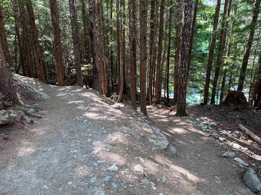
From the trailhead, follow the wide gravel trail into the forest. The trail heads slightly downhill for the first few minutes.

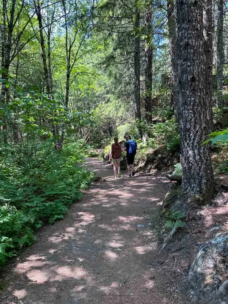
Stay on the main trail until you reach a signed junction. Turn right onto the Train Wreck Express Trail.

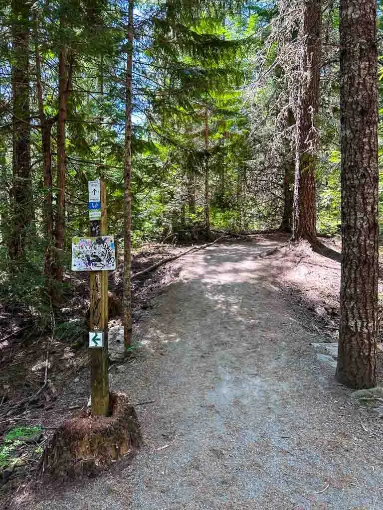
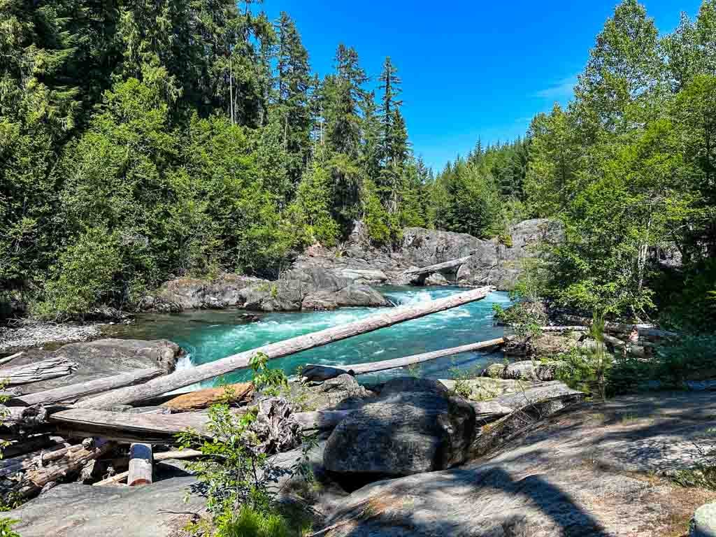
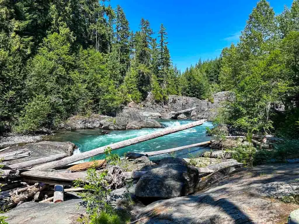
Follow this trail downhill on a long switchback to arrive at the suspension bridge. Less travelled trails follow the river to the right and left of you, but ignore them for now and cross the bridge.

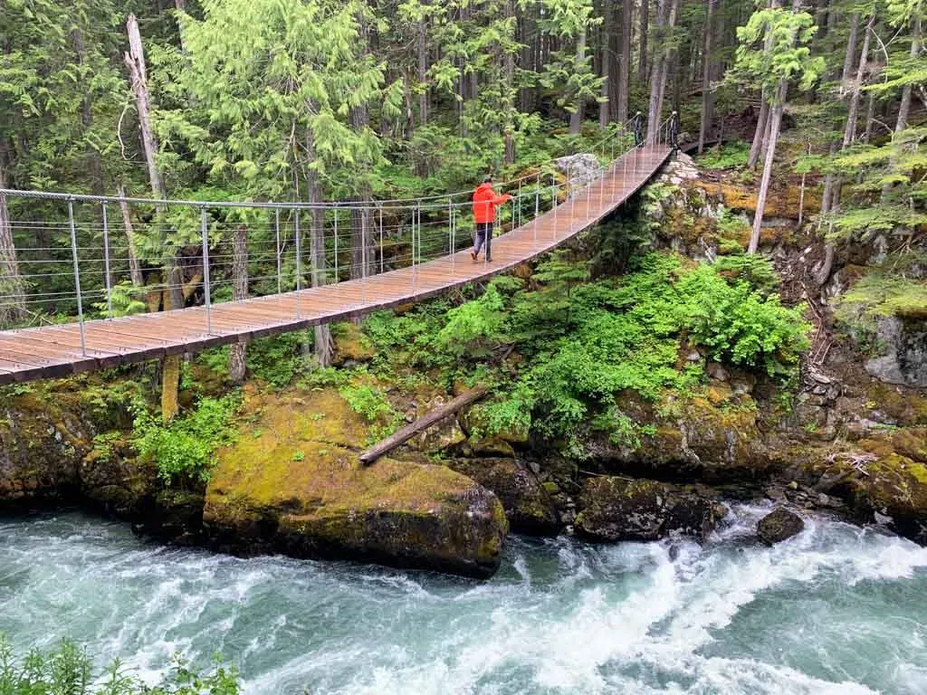
On the other side of the bridge, follow the trail slightly uphill into the forest to an open area where you will see the first of the abandoned train cars. Follow the path to the right and then down towards the river to spot two train cars, one of which is partially dangling into the canyon.

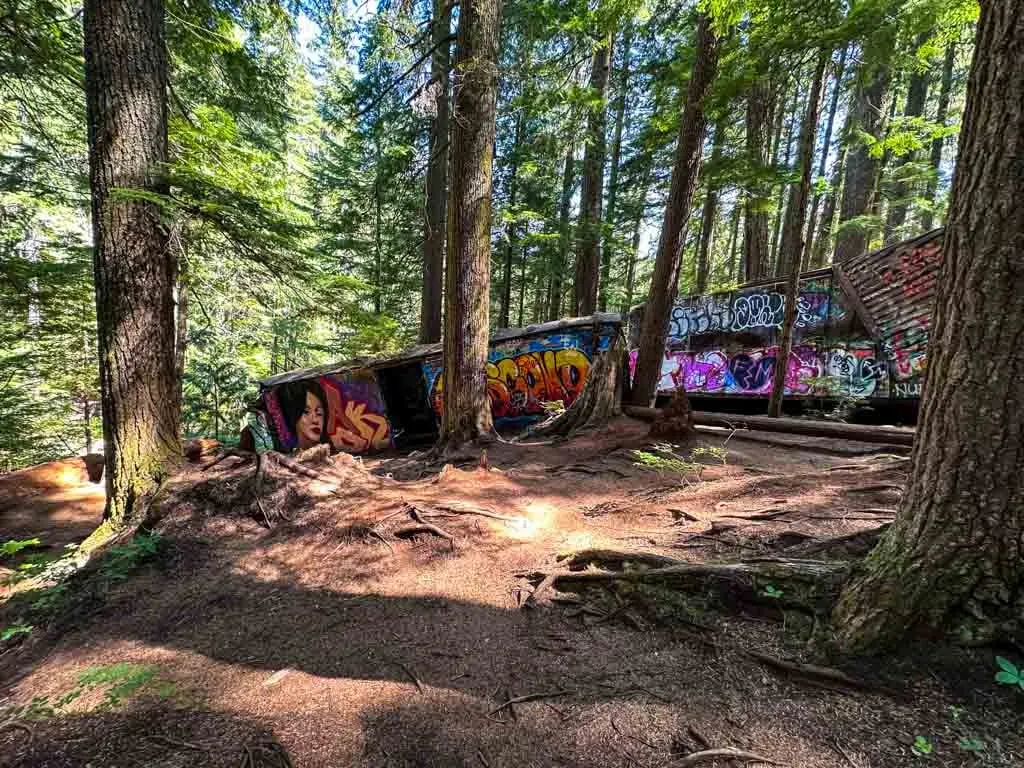
Retrace your steps and go left along the trail to see three more train cars spread out in clearings in the forest.

Many people turn around here since they don’t realize there are two more train cars to see. Continue following the trail around a few corners to see the other train cars. The trails in this area are very braided and there are lots of paths. Stick to the most well-trodden trail to find your way. Or use All Trails+ or Gaia GPS app to stay on track.
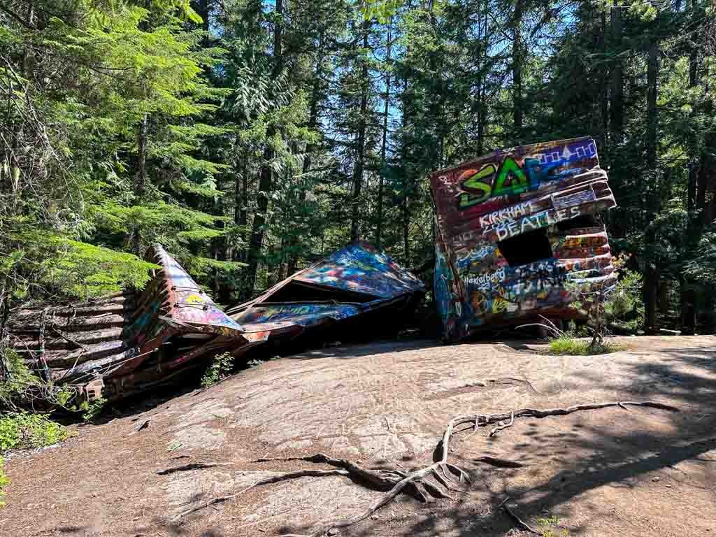
Once you have visited the last two train cars (there are seven in total), turn around and retrace your steps to the suspension bridge. When you get across the suspension bridge, you have a choice.
Most guides to the Whistler Train Wreck Hike tell you to just go back to the parking lot. But then you would miss out on a gorgeous waterfall and some canyon views. Below I’ve got a description for a 0.5 km add-on to the hike.
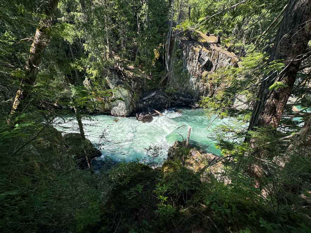
If you want to do the canyon and waterfall add-on, turn left immediately after crossing the suspension bridge and follow the trail along the edge of the river. You will see the main trail off to your right, but continue on the fainter riverside trail.
The trail weaves through the forest and then comes close to the edge of the cliff. There is a good view down into the water, but be careful near the edge.

Continue along the trail as it passes a wide bend in the river. Ignore a trail heading right that joins up with the Sea to Sky Trail – that is your return route.
Continue along the trail beside the river. Spur trails out to the left lead to more canyon views. Pass a junction with a mountain bike trail called Just Another Bike Trail then arrive at the waterfall. If you’re lucky, you might see whitewater kayakers playing in it.
When you’re ready to leave the waterfall, retrace your steps back to the bend in the river, then head left on a trail through the trees that joins up with the Sea to Sky Trail almost right away. Follow the Sea to Sky Trail back uphill to the trailhead and parking lot to finish your hike.

If you want to explore even more, use the Gaia GPS app to follow the Trash trail further along the river. It ends up Legacy Way, and you can walk back along Jane Lakes Road to the trailhead from there.
Whistler Train Wreck History
The abandoned train cars on the Whistler Train Wreck Trail are the result of a train that derailed in 1956.
A freight train heading south from Lillooet was going about 35 miles per hour (56 km/hr) in an area where it should have been going 15 miles per hour (24 km/hr). One of the engines came off the rails, causing the wreck.
Several of the cars were damaged, but they were blocking the train tracks. So a local logging company was hired to use their heavy-duty machinery to drag the cars out of the way, then roll them down the hill into the forest.
The train cars remained in the forest, mostly undisturbed for decades. In the 1990s and early 2000s, mountain bikers built trails around them, incorporating the cars into elaborate ramps and jumps. But those trails fell into disrepair.
In 2013, hikers popularized the Train Wreck trail on Instagram. To give people a legal way to get to the Whistler Train Wreck Hike without walking on the train tracks, the town of Whistler built the suspension bridge and new trail in 2016.
You can read more about the history of the train wreck on the Whistler Museum website. And I definitely recommend visiting the Whistler Museum – it’s one of my picks for the best cheap things to do in Whistler.

Whistler Train Wreck FAQ
The Whistler train wreck hike is about 2.5 km long and takes 1 to 1.5 hours.
Yes! The Whistler Train Wreck is one of the best easy snowshoe trails in Whistler. You will need microspikes in November, December, and March. In December, January, and February you may also need snowshoes.
The train wreck is at the south end of the town of Whistler. It is a 10-minute drive from Whistler Village. See the Getting There section above for directions.
Yes, but I don’t recommend it. You can walk to the train wreck from Whistler Village via the Valley Trail. But the route is about 10 km long and will take about 2 hours. Driving or taking the bus is a much better option. See the Getting There section above for more info.
In 1956, a freight train was speeding and derailed. Seven damaged train cars were dragged off the tracks and abandoned in the forest. See the History section above for more details.
The train wreck happened in 1956. But the trail to the wreck wasn’t popularized until 2013. See the History section above for more details.
So that’s everything you need to know to hike the Whistler Train Wreck Trail. If you have questions about the hike, leave them in the comments so I can help you out.
MORE WHISTLER OUTDOOR ADVENTURES:
- The Best Hikes in Whistler: A Guide to All the Trails
- Joffre Lakes Hike (By a Local)
- High Note Trail in Whistler
- Hike to Parkhurst Ghost Town in Whistler
- Rainbow Falls Loop Trail in Whistler
- How to Paddle the River of Golden Dreams in Whistler, BC
- Where to Go Snowshoeing in Whistler
MORE WHISTLER INFO:
- 80+ Things to Do in Whistler (By a Local)
- Visiting Whistler, BC in Summer (By a Local)
- 42 Cheap and Free Things to Do in Whistler
- Camping in Whistler, BC: 18 Places to Camp Near Whistler
- Lost Lake in Whistler: Hiking, Swimming, Biking and More
- Sea to Sky Highway Road Trip Guide: Driving from Vancouver to Whistler


- Best Sun Hoodies for Hiking - June 3, 2026
- Lower Stein Valley Trail Hiking and Backpacking Guide - May 27, 2026
- The Best Things to Do in Vernon, BC - May 21, 2026
K. Knittle
Thursday 11th of July 2024
Thank you for this post.
We used this today and it was very helpful.
We also showed about 8 others where the trail started as there is a tendency for everyone to mistakenly head up the gravel road at the back of the first parking lot.
Jamie
Sunday 31st of March 2024
Just wanted to say thank you for writing this! I was in the area and decided to give this a shot. Your directions were so helpful and that extra trek is so worth it for the waterfall views!