

With tons of hikes in Whistler to choose from, the Rainbow Falls Loop is a bit under-the-radar. It’s a short and easy trail to a charming little waterfall that includes several different viewpoints. I love this trail for a quick walk in the woods mostly just locals enjoy.
This guide to the Rainbow Falls Loop Trail includes:
- Key trail stats for the Rainbow Falls Loop Trail
- A Rainbow Falls trail map that I made just for you
- How to get to the trailhead by car, bus, and bike
- Turn-by-turn hiking directions with lots of photos
- Rainbow Falls FAQ – all your questions answered
This is a sensitive wilderness area. Learn how to Leave No Trace to keep the wilderness wild. Make sure you are prepared by bringing the 10 Essentials. Get ready for adventure with this checklist of things to do before every hike.
Hey there: Some of the links in this post are affiliate links, which means I earn a small commission at no cost to you. Thanks for your support. -Taryn
Rainbow Falls Hike Basics
While it isn’t the most spectacular hike in Whistler, Rainbow Falls is a great option if you are short on time or stamina. Since it isn’t that popular, it won’t be crowded like many other Whistler hikes. And it’s mostly in the trees, which is great for hot days or rainy ones.
While you can enjoy Rainbow Falls at any time of year, visit in May and early June to see it at maximum flow. In late July, August, and September, the water slows to a trickle and you can explore more of the canyon. If you visit in winter, you might catch it frozen.
A quick note: The Rainbow Falls Trail leaves from the same trailhead as the hike to Rainbow Lake. It’s easy to confuse the two, especially since Rainbow Lake is much more well-known. While Rainbow Lake is a 6-hour hike up into the mountains for experienced hikers, Rainbow Falls is an easier short loop trail close to town.
It’s also easy to confuse this hike with Rainbow Park, a popular lakeside beach in Whistler. While Rainbow Park is just a few minutes away, the Rainbow Falls Loop Trail is not at Rainbow Park
Trail Stats
Distance: 2.3 km
Elevation Gain: 130 m
Duration: 1-1.5 hours
Difficulty: Easy/Moderate
Season: April to November without snowshoes, November to March with snowshoes
Toilets: At the trailhead
Dogs: Allowed on-leash on the Rainbow Falls Loop Trail but not allowed on other trails in the area.
Caution: The Rainbow Falls Loop is a multi-use trail and is shared with bikes. Watch for bikes and move over as they are often not able to stop as quickly as hikers.
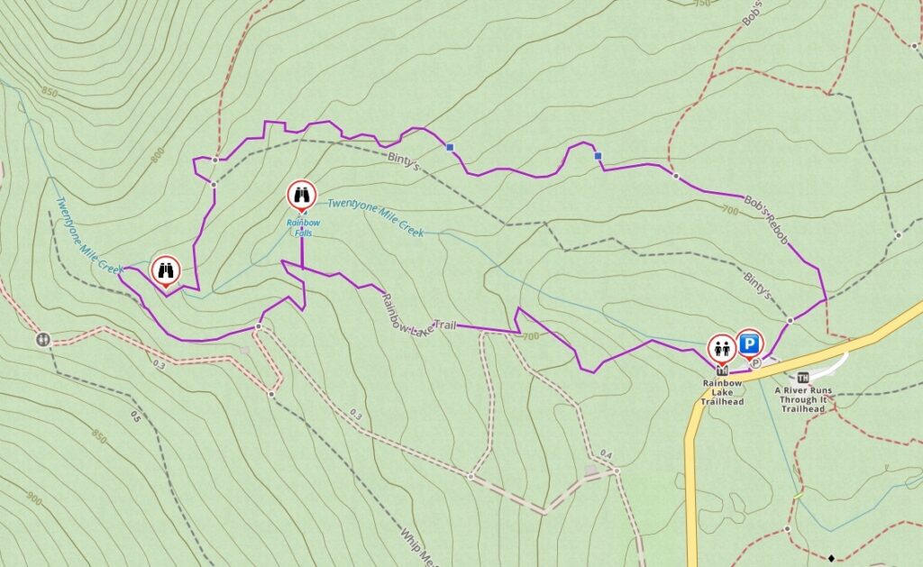
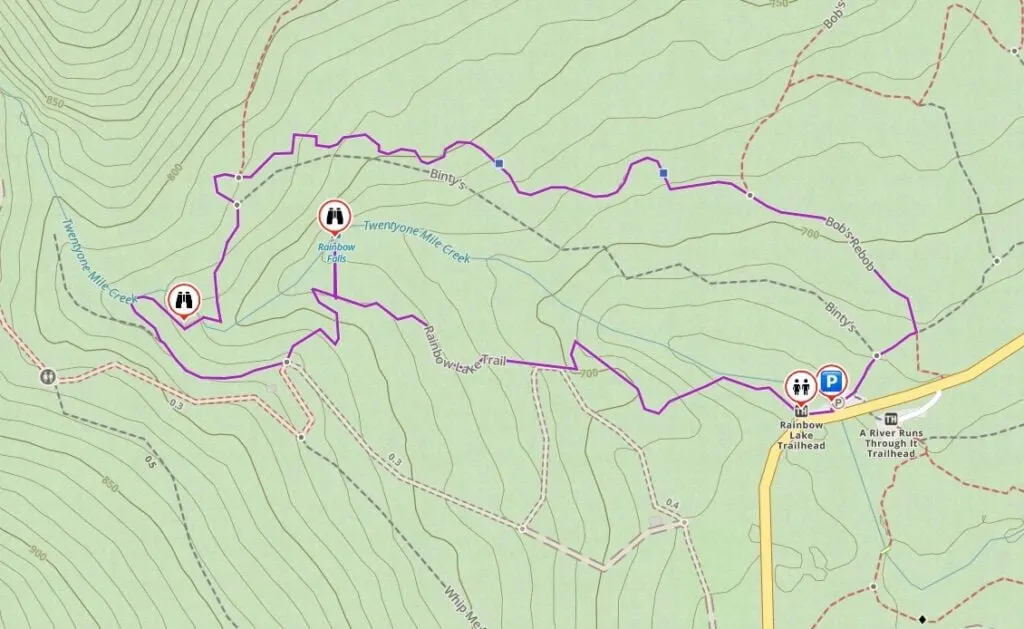
Rainbow Falls Trail Map
The Rainbow Falls Loop is easy to follow and there are signs at most intersections. However, I made you a trail map using Gaia GPS, my favourite GPS and mapping app. Click through to zoom in and explore.
How to Get to the Rainbow Falls Trail
The Rainbow Falls Trail is just a few minutes from Whistler. It’s easy to get there by car, bike, bus, or taxi.
Driving Directions and Parking
From Whistler Village, take the Sea to Sky Highway north. Turn left at the traffic light onto Alpine Way. Go left at the three-way stop onto Rainbow Drive, following signs for Rainbow Park. After a few minutes, Rainbow Drive becomes Alta Lake Road and leaves the residential neighbourhood behind.
Keep driving along Alta Lake Road through the woods. A few minutes later, look for the parking area just after a crosswalk. There are 17 parking spots in the paved lot on the right and more in a gravel overflow lot on the right. As of 2023, parking is free.
Click here for Google Maps driving directions.

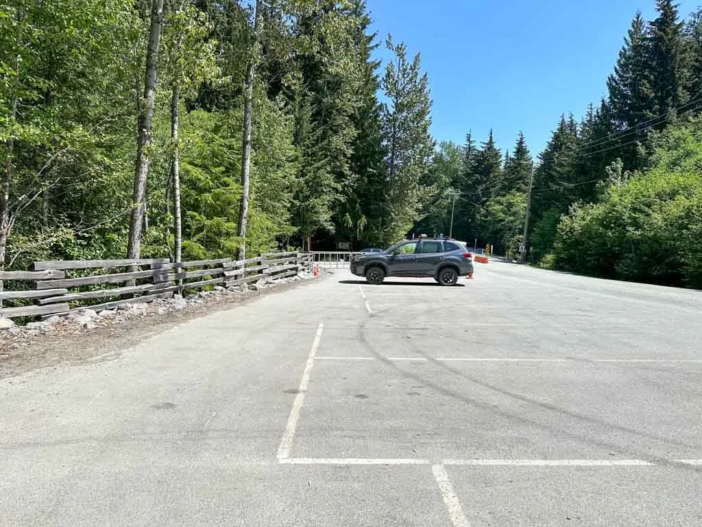
Besides these two lots, there is no other parking. If you park on the roadside you risk getting towed. On summer weekends, the lots fill up so go early or plan to bike, bus, or taxi.
If you don’t have your own car, any of Whistler’s taxi companies will take you to the trailhead. It’s a 10-minute trip from the Village.
Bus Directions
It’s also possible to get to the Rainbow Falls Trail by bus. Take BC Transit bus 6 from Whistler Village to the stop on Crabapple Drive at Cedar Grove. From there, walk north then west on the Valley Trail to Rainbow Park. Then walk north on Alta Lake Road to the trailhead. The extra walking will add about 40 minutes each way, but it’s fairly flat.
Click here for Google Maps bus directions.
Biking Directions
From Whistler Village, take the Valley Trail north along Lorimer Road. At a T-junction on Crabapple Drive, turn right to follow the Valley Trail beside the River of Golden Dreams to Rainbow Park. Turn right and continue along Alta Lake Road for a few minutes. There is a bike rack at the trailhead. The entire ride should take about 20 minutes. This map of the Valley Trail is helpful for navigating.
Click here for Google Maps biking directions.
Rainbow Falls Hiking Directions
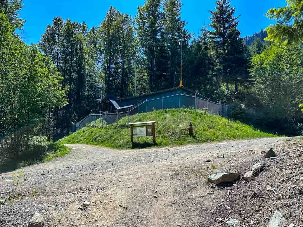
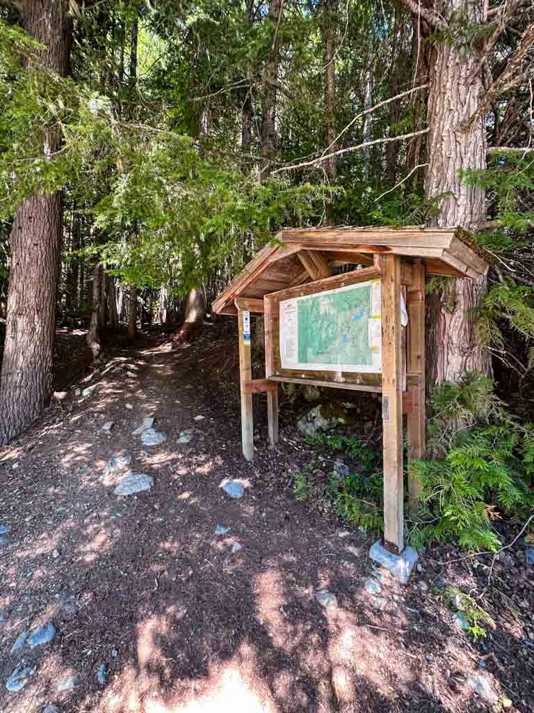
The trailhead is on the left (west side) of the paved parking area. There are several large info signs as well as a bike rack and outhouse. (The trail leaving from the right side of the parking area is your return route.) This is also the trailhead for the hike to Rainbow Lake and a lot of mountain bike trails.
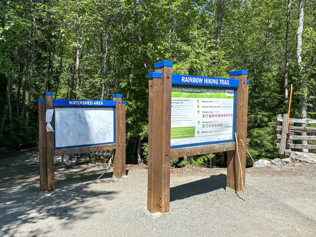

This area is crisscrossed by bike trails and is the start of the popular (and much longer) hiking trail to Rainbow Lake. (I’ve got full details on the Rainbow Lake hike in my book, Backpacking in Southwestern British Columbia.) Since there are so many trails, you need to pay attention at each junction.
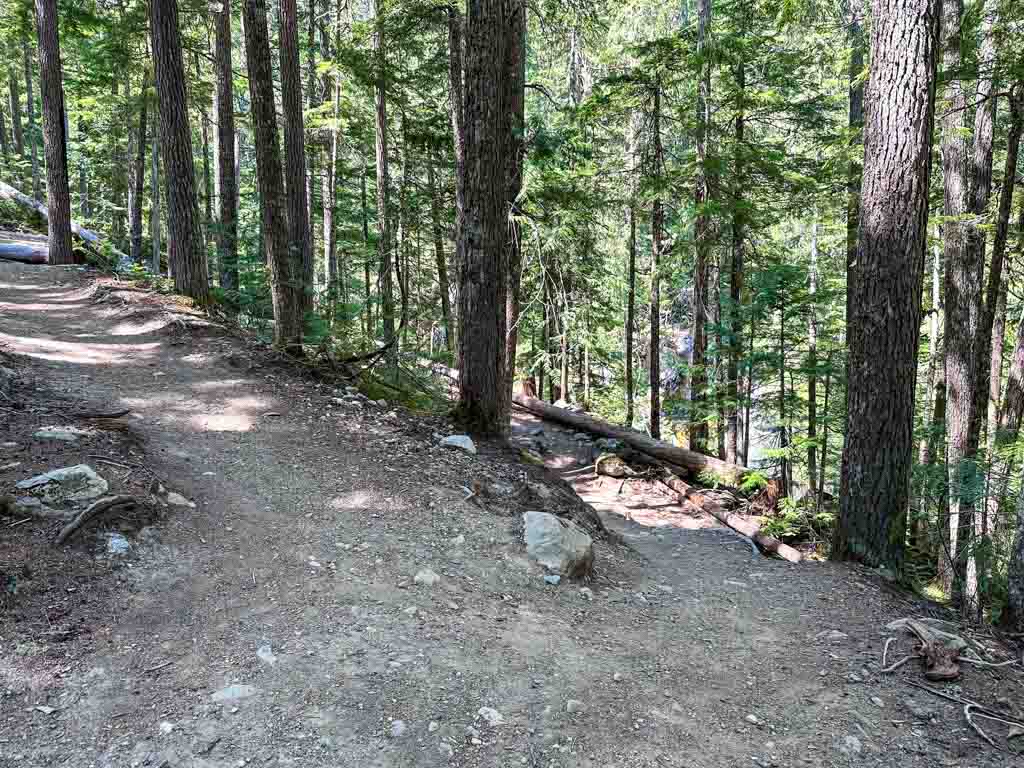
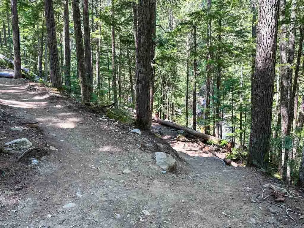
The trail starts by heading steadily uphill through the forest on a well-maintained trail. You will be able to hear Twentyone Mile Creek rushing off to your right, but you won’t be able to see it.
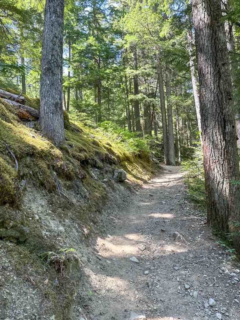

After a few minutes, the trail approaches an old road on the left. Stick with the orange markers to stay on the trail as it swings away from the road to the right. The trail branches a few times through this section – stay with the orange markers and the most obvious path.
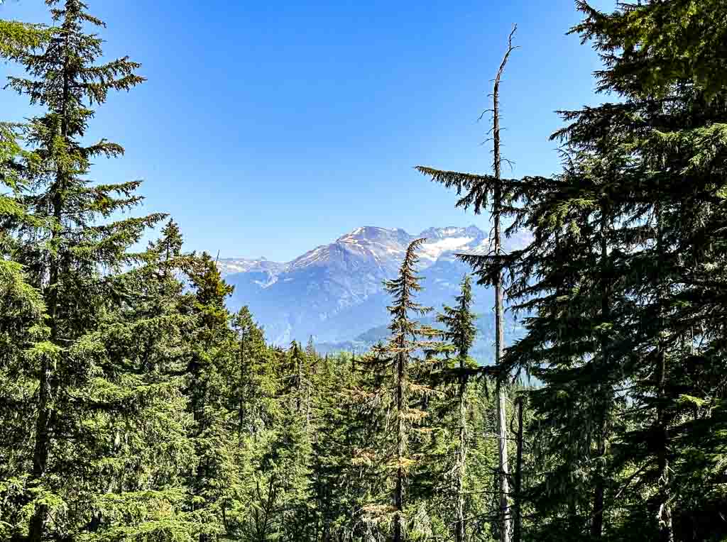
Don’t forget to look behind you for a good view of Blackcomb Peak. The forest here was thinned in 2017 to remove dead trees and reduce the wildfire risk, so the forest feels a bit more open than in other areas.

About 0.6 km from the trailhead, reach a junction where a side trail descends diagonally to the right. You don’t want to miss this intersection because this is where you get to see the falls!
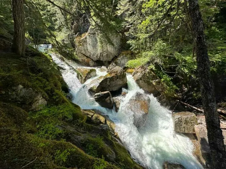
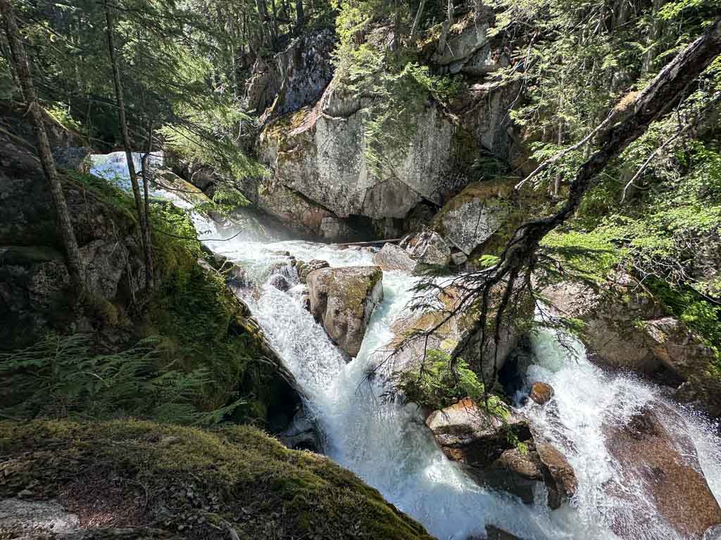
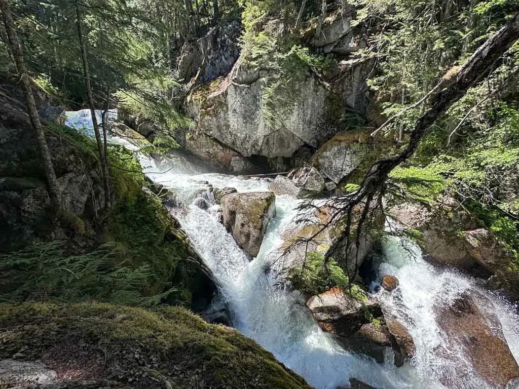
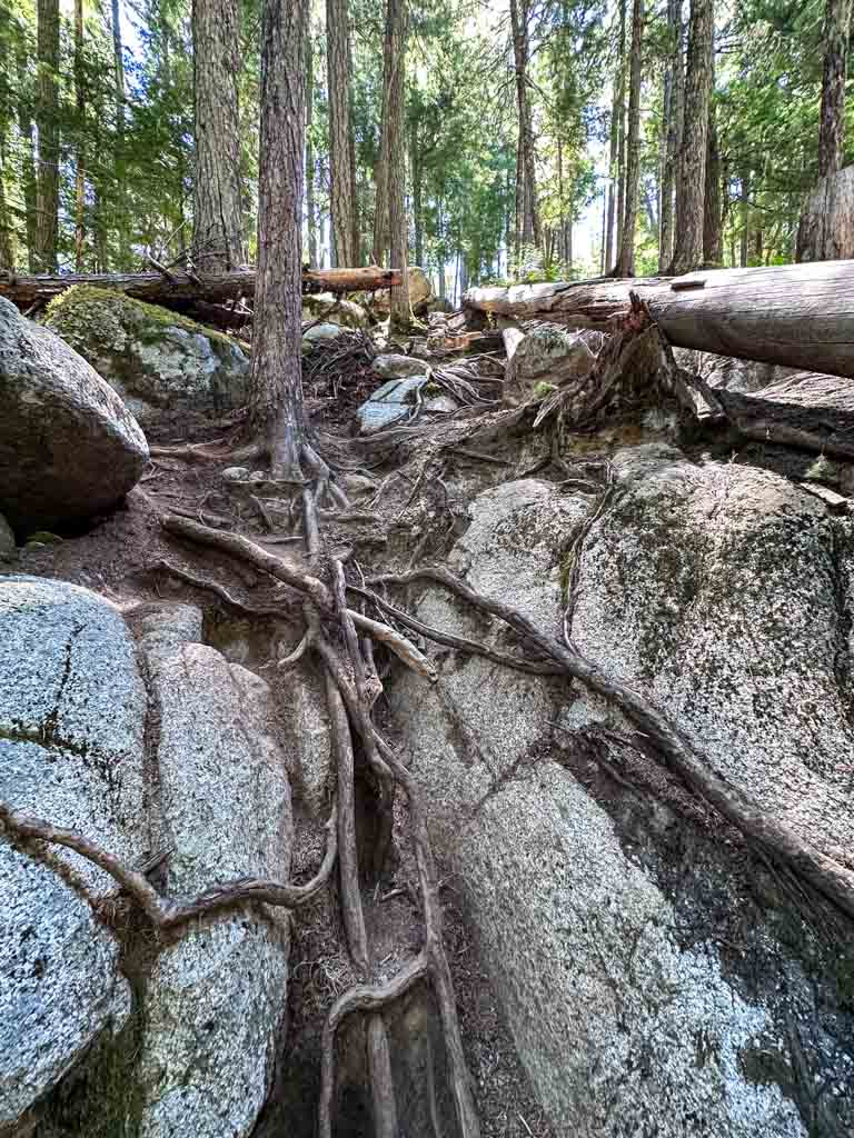
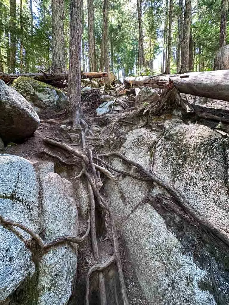
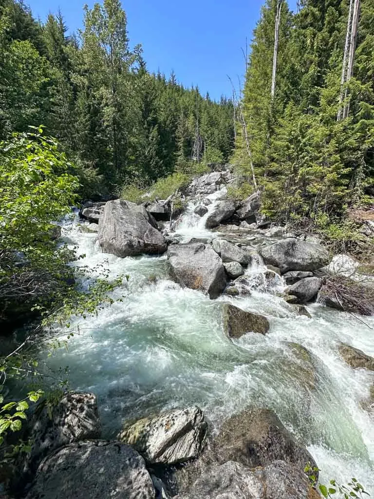
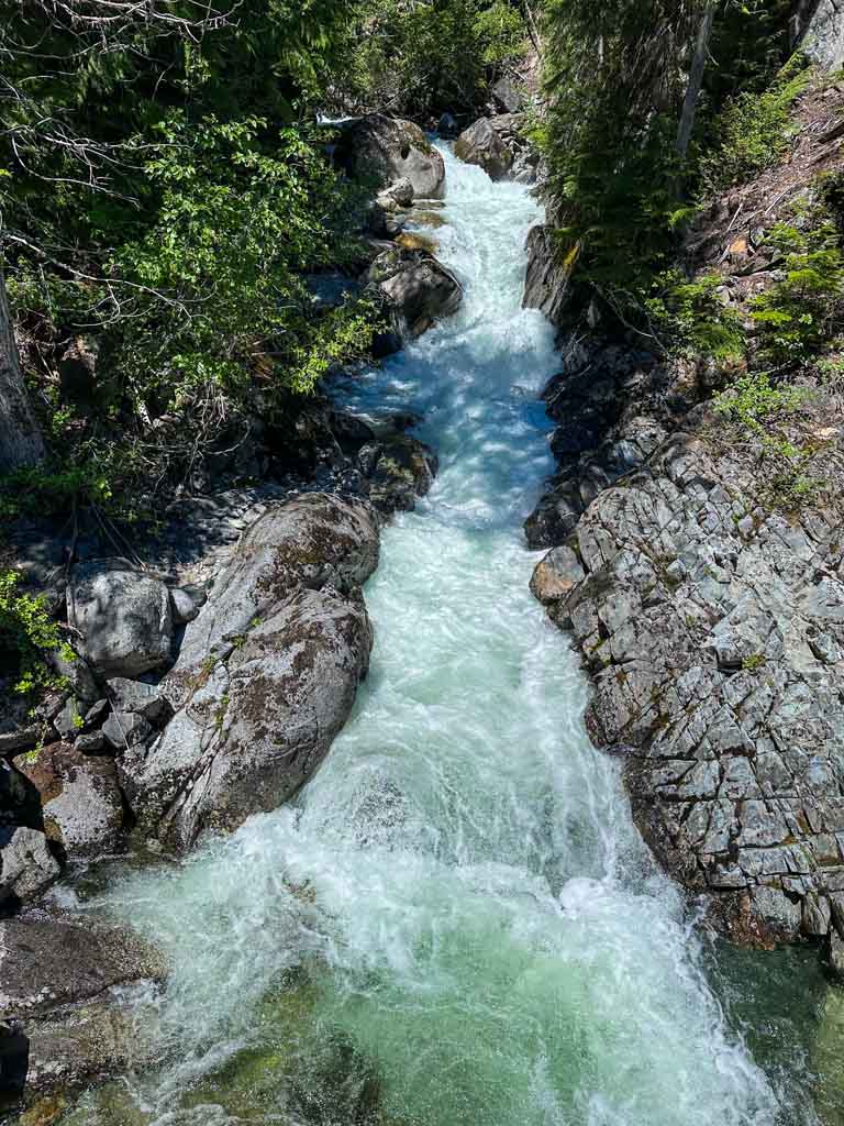
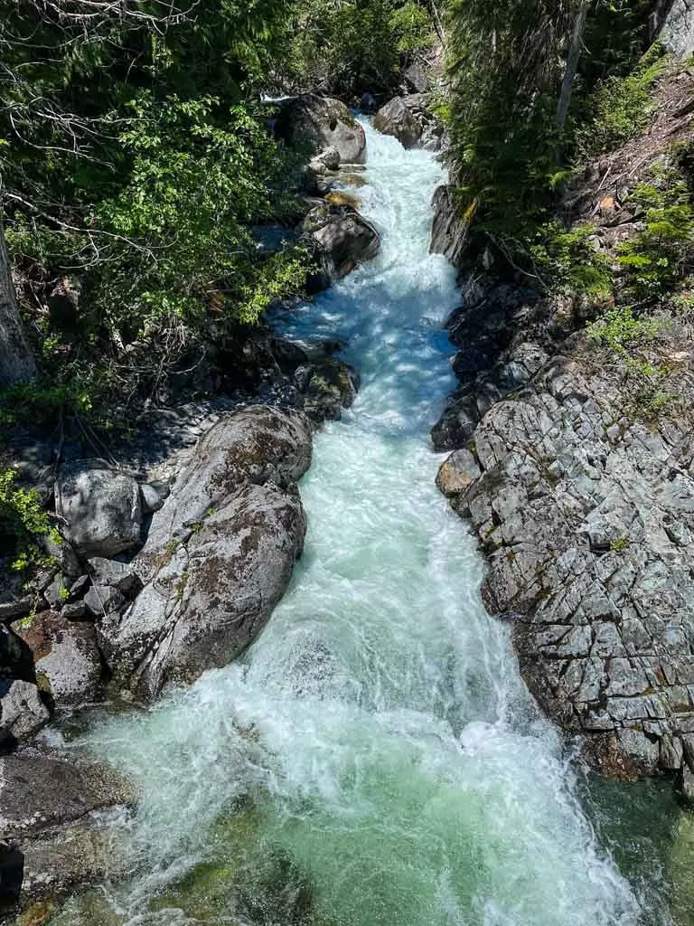
Follow the side trail to a fallen log. Scramble over the log and follow a rough trail down to the creek to see several smaller waterfalls. Note: While the rest of the hike is easy, this scramble down to the falls is moderate and may require you to use your hands on some tree roots.
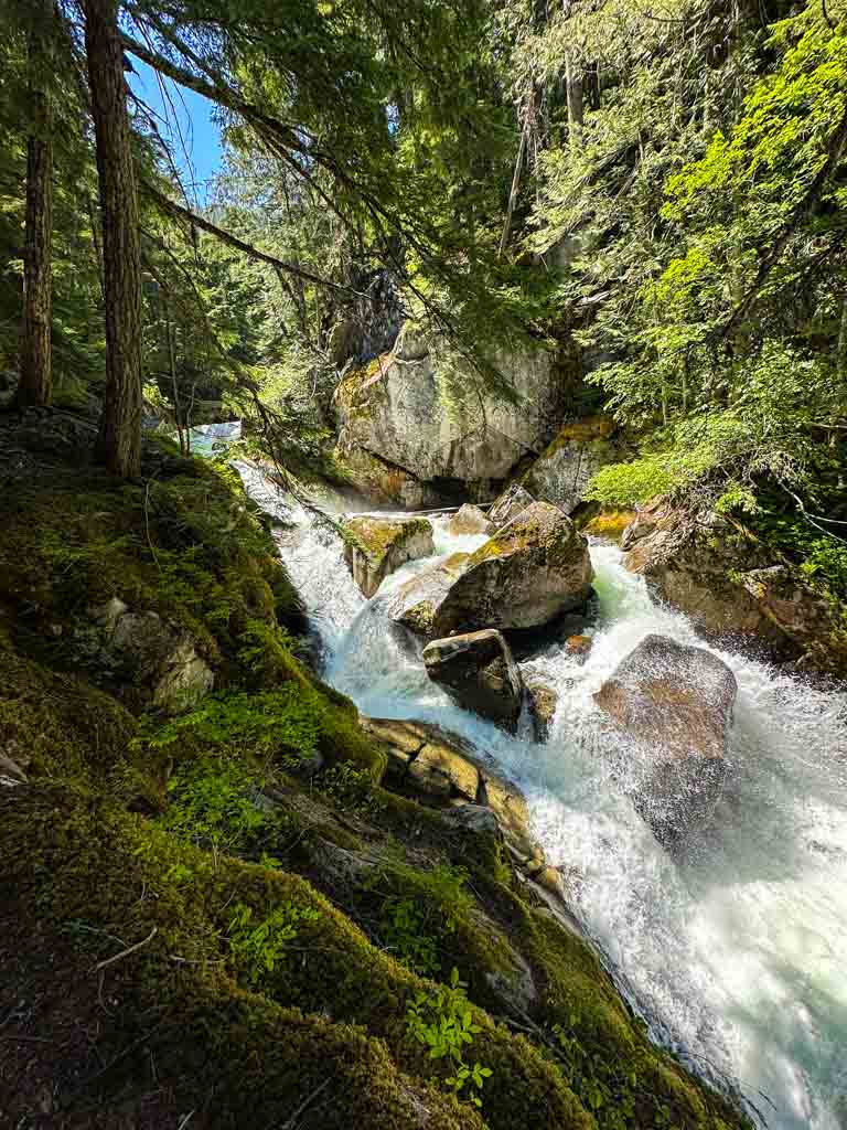
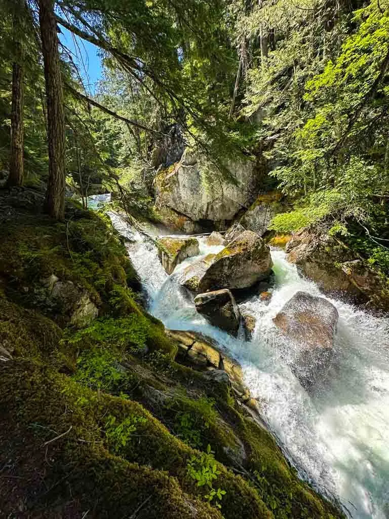
When you are done, head back up to the main trail and continue uphill. There are peek-a-boo views of the main Rainbow Falls through here. It is actually two falls that converge right beside each other. However, it’s hard to see the falls through the trees.
Some people may choose to turn around here since they have already seen the falls. However, I think it’s worth continuing through the whole loop as you get more views of the falls and Twentyone Mile Creek
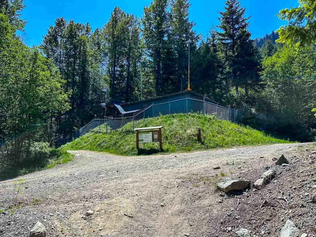
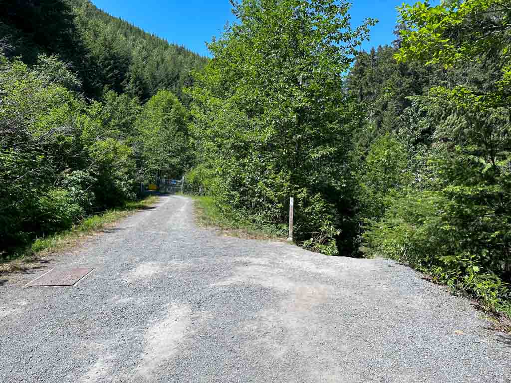
A few minutes after the falls, the trail joins a gravel road in a clearing. The building here is part of the Whistler water supply system. Follow the right-hand road to continue the Rainbow Falls Loop. (The road to the left goes to Rainbow Lake.)
Watch for a trail leaving the road on the right side. The road ends at a gate in a few meters anyway. Hike down the trail towards the creek.

You can look upstream and see water spilling over a small dam in Twentyone Mile Creek, another part of Whistler’s water supply infrastructure.

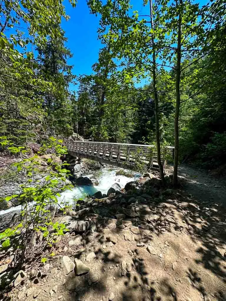
The trail descends to the creek and crosses it on a long wooden bridge. Be sure to look down into the creek bed at the rushing water below. On the other side of the bridge, there is another peek-a-boo view of the main falls through the trees.

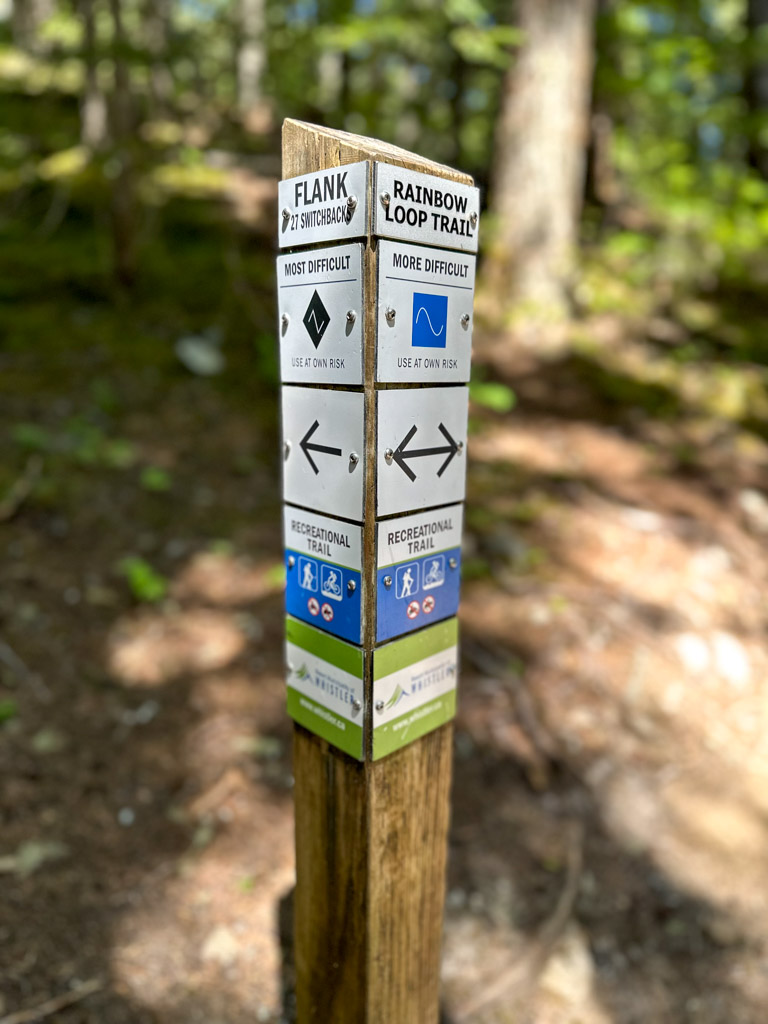
The trail heads slightly uphill to a junction with several mountain bike trails. Stay on the Rainbow Lake Loop Trail, avoiding 27 Switchbacks (part of the longer Flank Trail), which goes uphill. There’s also another un-signed trail called, Binty’s which parallels your trail but is closer to the creek and much steeper. The path you want is the most well-travelled one, so it is easy to stay on track.

Follow the trail as it loops and curves downhill. This is a multi-use mountain bike trail so it is much smoother than many hiking trails.
As you approach the bottom of the hill, your route joins the much wider Bob’s Robob Trail. Follow it down through the forest to the trailhead and map board at the right side of the parking area to finish the loop.

Rainbow Falls FAQ
The Rainbow Falls Loop Trail is 2.2 km long and takes 1 to 1.5 hours.
No. The falls are part of the drinking water source for Whistler’s residents and visitors, so swimming is not allowed. As well, most of the year the falls see some pretty high water so swimming would be very dangerous.
Yes. Dogs are allowed on-leash on the Rainbow Falls Trail. However, they are not allowed on other trails in the area since this is the drinking water resource for Whistler and it needs to be kept clean.
Yes! Rainbow Falls is one of the best easy snowshoe trails in Whistler. You will need microspikes in November, December, and March. In December, January, and February you may also need snowshoes.
So that’s everything you need to know to hike the Rainbow Falls Loop Trail in Whistler. If you have questions about the hike, leave them in the comments so I can help you out.
MORE WHISTLER OUTDOOR ADVENTURES:
- The Best Hikes in Whistler: A Guide to All the Trails
- Joffre Lakes Hike (By a Local)
- Hike to Parkhurst Ghost Town in Whistler
- Whistler Train Wreck Hike
- How to Paddle the River of Golden Dreams in Whistler, BC
- Where to Go Snowshoeing in Whistler
MORE WHISTLER INFO:
- 80+ Things to Do in Whistler (By a Local)
- 42 Cheap and Free Things to Do in Whistler
- Camping in Whistler, BC: 18 Places to Camp Near Whistler
- Lost Lake in Whistler: Hiking, Swimming, Biking and More
- Sea to Sky Highway Road Trip Guide: Driving from Vancouver to Whistler


- Things to Do on Newfoundland’s Great Northern Peninsula - July 29, 2026
- Best Sun Hoodies for Hiking - June 3, 2026
- Lower Stein Valley Trail Hiking and Backpacking Guide - May 27, 2026