
If you live in Vancouver’s Fraser Valley, you probably don’t want to drive all the way to the North Shore to go snowshoeing. There are lots of places to go snowshoeing in the Fraser Valley from Agassiz to Chilliwack to the Coquihalla to Manning Park.
This guide covers seven snowshoe trails on in the Fraser Valley. They are all trails that are high enough for consistent snow AND are also safe to snowshoe.
This guide to snowshoeing in the Fraser Valley includes:
- Quick reference guide: An easy overview of the stats for all the trails
- Snowshoeing safety: key info to help get you prepared to snowshoe in Vancouver
- Where to rent snowshoes in the Fraser Valley including which shops have the best price
- Snowshoe trails in the Fraser Valley: details for 7 places to go snowshoeing
- No-go trails: summer trails that aren’t safe for snowshoeing
If you’re looking for even more places to go snowshoeing in in the Vancouver area, don’t worry, I got you! Check out these other guides to snowshoeing trails near Vancouver:
- Snowshoeing in Vancouver
- Snowshoeing in Whistler
- Snowshoeing in Squamish
- Snowshoeing in Manning Park
- Snowshoeing at Dakota Ridge on the Sunshine Coast
Hey there: Some of the links in this post are affiliate links, which means I earn a small commission at no cost to you. Thanks for your support. -Taryn
Snowshoeing in the Fraser Valley Quick Reference Guide
| Trail | Rating | Time | Cost |
|---|---|---|---|
| Sasquatch Mountain | Easy/ Moderate | 1.5-3.5 hours | $15 |
| Elk Mountain | Challenging | 5-6 hours | FREE |
| Needle Peak | Challenging | 4-5 hours | FREE |
| Falls Lake | Easy | 1.5-2 hours | FREE |
| Zoa Peak | Challenging | 5-6 hours | FREE |
| Artist Point | Moderate | 2.5-3.5 hours | FREE |
| Manning Provincial Park | Super Easy to Challenging | 30 min-8 hours | FREE/$10 |
But First… Be Prepared
- Make a trip plan: While these trails may be steps from busy ski areas, they access serious wilderness. Tell someone where you are going and when you expect to be back. Use the great trip planning tools from Adventure Smart.
- Check the weather, trail conditions, and avalanche forecast: If the weather and trail conditions don’t look good, don’t go. Use my list of the best weather apps for hiking. Check the avalanche forecast for the South Coast Inland zone. Unless you have taken an avalanche safety course, you probably shouldn’t go out unless the forecast is rated “Low”.
- Wear winter clothing and pack the essentials: Prepare for emergencies by packing the 10 essentials. Read my recommendations for what to wear snowshoeing and tips for winter hiking and snowshoeing.
- Use safe snowshoeing techniques: Snowshoes keep you from sinking into deep snow, but they aren’t great for walking sideways or downhill – it’s easy to slip and injure yourself. Read up on snowshoeing safety and check out my guide to choosing snowshoes.) They also have crampons and other traction aids underfoot to help grip icy snow.
- Take an avalanche safety course: If you plan to stray from flat terrain, you need avalanche safety training. great FREE online beginner tutorial on Avalanche.ca. You should also take a 2.5 day AST1 course with avalanche Canada.
READ NEXT: Snowshoeing Safety: 14 Ways to Get into Trouble and How to Prevent Them
Join: Snowshoeing in Vancouver Facebook Group
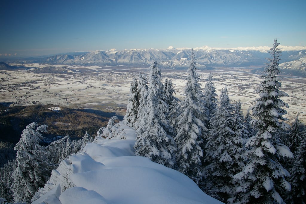
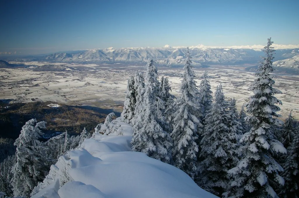
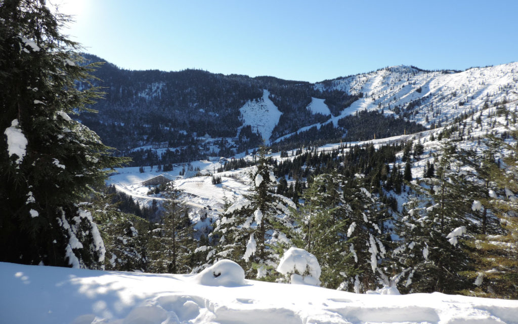
Snowshoe Trails at Sasquatch Mountain

Distance: 3-8km
Time Needed: 1.5-3-5 hours
Elevation Gain: Up to 300m
Rating: Easy-moderate
The Trail: Formerly called Hemlock Valley Resort, this ski resort near Harrison Hot Springs has a network of snowshoe trails. The short and flat Village Loop trail is great for beginners. More adventurous snowshoers can tackled the intermediat Ridge Run or Old Yeller Trails. For advanced snowshoeing, head to the peaks of Mount Klaudt or Mount Cartmel.
Avalanche Danger and Hazards: The Mount Klaudt and Mount Cartmel trails climb some steep slopes, but there is no significant avalanche danger or other hazards. Check the avalanche forecast before you go.
Trail Map/Guide: There’s a trail map on the Sasquatch Mountain website.
Permits/Fees: Trail passes are $15/day.
Dogs: Not allowed
Getting There: It’s a 45min drive from Agassiz to Sasquatch Mountain Resort. The last 7km of the road are gravel, steep and winding but it is plowed and sanded regularly. Provincial law requires you to carry chains (and you’ll probably want them).
Snowshoeing to Elk Mountain, Chilliwack
Distance: 7km return
Time Needed: 5-6 hours
Elevation Gain: 800m
Rating: Challenging
The Trail: This steep trail is sometimes referred to as Chilliwack’s version of the Grouse Grind. (Although it’s not quite as steep!) Once you break out of the trees on to the ridge it’s flatter you’ll get great views of Chilliwack and of the Chilliwack River Valley. If you want to extend your trip, you can continue along the ridge for another kilometer or so.
The Elk Mountain trail is by far the most popular place to go snowshoeing in the Fraser Valley, so the trail is often so packed down that you can get by with just microspikes and only use snowshoes once you are on the ridge. (Read my guide to differences between microspikes, crampons, and snowshoes.)
Avalanche Danger and Hazards: The last section of the trail before you reach the ridge top can be very slippery. It may be worth bringing microspikes or crampons and poles for this section (especially going downhill). There are very steep slopes and drop offs once you reach the open ridge top. Stay in the center of the ridge and well back from steep drops and slopes. Check the avalanche forecast before you go.
Trail Map/Guide: There’s a good trail guide on Vancouver Trails.
Permits/Fees: None.
Dogs: Allowed.
Getting There: It’s a 25min drive from Chilliwack City Hall to the trailhead. The last 2km are on a gravel road that is not plowed and can be very icy. Bring chains or be prepared to walk the extra 2km on the road to the trailhead. There is a gravel pullout for parking at the trailhead.
Snowshoeing to Needle Peak on the Coquihalla
Distance: 8km return
Time Needed: 4-5 hours
Elevation Gain: 650m
Rating: Challenging
The Trail: The Coquihalla is a great destination for Fraser Valley snowshoers since the road reaches high into the mountains to access lots of fresh snow. This challenging trail climbs through the trees on to the ridge of Needle Peak. It isn’t safe to go all the way to the summit in the winter unless you have mountaineering skills and equipment, so turn around somewhere on the ridge and retrace your steps back to the car.
Avalanche Danger and Hazards: This is a true backcountry trail and is only appropriate for experienced snowshoers. As long as you stay on the ridge you can avoid the worst of the avalanche terrain, but you’re never totally safe from avalanches on this trail. Check the avalanche forecast before you go and don’t go unless the forecast is low. After the trail gets above the treeline, the trail gets harder to follow, but just stay in the center of the ridge.
Trail Map/Guide: There’s trail info on the Coquihalla Summit Recreation Area website.
Permits/Fees: None.
Dogs: Allowed on leash.
Getting There: From Hope, it’s a 35 min drive on the Coquihalla. Take exit 217 to the Zopkios Rest Area on the south side of the highway. You will need winter tires or chains to drive the Coquihalla. See this parking map for instructions on legal places to park.
Snowshoeing to Falls Lake on the Coquihalla
Distance: 4km return
Time Needed: 1.5-2 hours
Elevation Gain: 100m
Rating: Easy
The Trail: The trail to Falls Lake is the only easy snowshoe trail on the Coquihalla. The first half of the trail follows a road. After reaching a summer parking lot, it heads into the trees before emerging on the shores of Falls Lake. This lake is surrounded by tall peaks and feels much more remote than the short 2km walk from the road.
Avalanche Danger and Hazards: Be prepared to share the initial road section of the trail with snowmobiles. There is no significant avalanche danger on this trail, but once you reach the lake stay away from the west bank as the steep slopes there can send avalanches down. Check the avalanche forecast before you go.
Trail Map/Guide: There’s trail info on the Coquihalla Summit Recreation Area website.
Permits/Fees: None.
Dogs: Allowed on leash.
Driving Directions: From Hope, it’s a 40 min drive on the Coquihalla. You will need winter tires or chains to drive the Coquihalla. Take exit 221 and follow the tunnel under the highway and turn left. You will immediately see a snowed-in road heading uphill. This is the trailhead. See this parking map for instructions on legal places to park.
Join: Snowshoeing in Vancouver Facebook Group
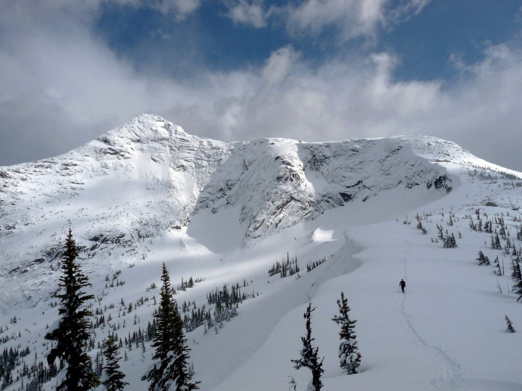
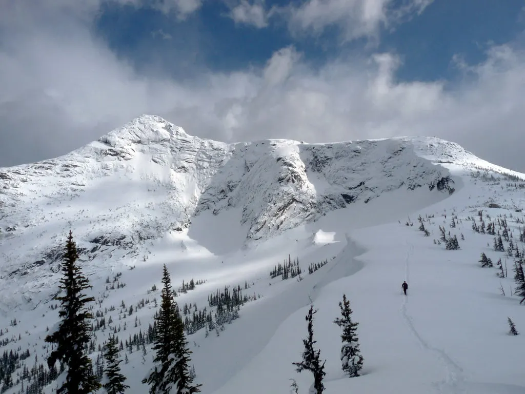
Snowshoeing to Zoa Peak on the Coquihalla
Distance: 11km return
Time Needed: 5-6 hours
Elevation Gain: 635m
Rating: Challenging
The Trail: The trail to Zoa Peak starts at the same trailhead as the trail to Falls Lake. But unlike the snowshoe to Falls Lake, the trip to Zoa Peak is not easy. The trail climbs a steep hill on an access road, before turning left into the forest.
Soon you’ll reach the treeline and stroll along the ridge looking waaay down towards Falls Lake. While the summer trail goes all the way to the true summit, in winter it’s much safer to be content with the views from the sub-summit since there’s a steep gully between the two.
Avalanche Danger and Hazards: Be prepared to share the initial road section of the trail with snowmobiles. There is no significant avalanche danger on this trail, but once you reach the ridge stay away from edges, especially on the west side, as the steep slopes there can avalanche. Check the avalanche forecast before you go. The trail can be hard to find, especially if it has snowed recently.
Trail Map/Guide: There’s trail info on the Coquihalla Summit Recreation Area website. There’s also a good write up on Vancouver Trails.
Permits/Fees: None.
Dogs: Allowed on leash.
Driving Directions: From Hope, it’s a 40 min drive on the Coquihalla. You will need winter tires or chains to drive the Coquihalla. Take exit 221 and follow the tunnel under the highway and turn left. You will immediately see a snowed-in road heading uphill. This is the trailhead. See this parking map for instructions on legal places to park.
Snowshoeing to Artist Point at Mount Baker, Washington

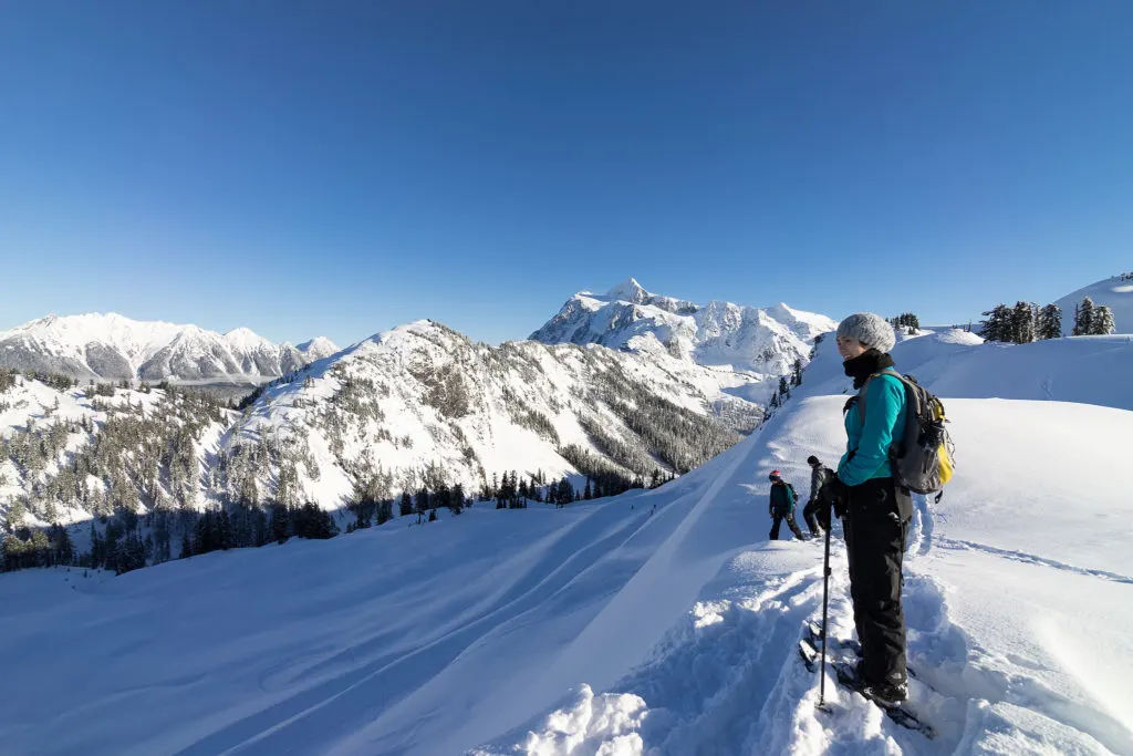
Distance: 6.5km/4 miles return
Time Needed: 2.5-3.5 hours
Elevation Gain: 300m/1000 feet
Rating: Moderate
The Trail: If have a passport, Washington’s Mount Baker makes a great cross-border trip for Fraser Valley snowshoers. In the summer Artist Point is a gorgeous viewpoint that you can drive right up to. In the winter meters of snow blanket the region and you have to park further down and hike up… which means it’s way less busy… and possibly way more beautiful.
After a moderate 300m of elevation gain, you’ll be treated to great views of Mount Baker and Mount Shuksan wearing their winter coats – in fact the Washington Trails Association calls it one of best viewpoints in the state!
Avalanche Danger and Hazards: This route crosses avalanche terrain in several areas. Check the avalanche forecast for the West Slopes North region before you go and don’t go if the hazard is above low unless you have avalanche training. The route is not marked but it is a popular trail so there should be tracks to follow. The slope is mostly un-treed so bring a map and compass in case the clouds roll in and make navigation difficult.
Trail Map/Guide: There’s a great guide on the Washington Trails Association website.
Permits/Fees: None.
Dogs: Allowed on leash.
Getting There: From Abbotsford, drive 1.5 hours across the border to the Mount Baker Ski Area. Drive past the ski area to the very end of the plowed road. Don’t forget your passport for the border crossing and bring chains for your car. This is a very a high elevation mountain road. There is a designated and plowed parking area at the end of the road.
Snowshoeing at Manning Provincial Park
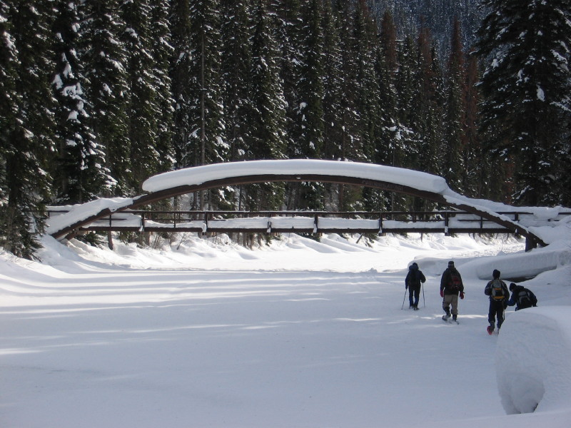
Distance: You can go out for as little as 1km or as much as 16km!
Time Needed: 30 min-8 hours
Elevation Gain: Trails range from flat to gains of up to 700m
Rating: Super-easy to Challenging
The Trails: In my opinion, Manning Park is the best place to snowshoe in Southwestern BC… and it’s not too far from the Fraser Valley. There are tons of trails to snowshoe in Manning Park… in fact there are so many that I had to put them all in a separate Snowshoeing in Manning Park post! There are flat easy strolls for beginners, more adventurous backcountry trails and lots in between.
Avalanche Danger and Hazards: Most trails are fairly free of avalanche danger and other hazards, but there is avalanche terrain in the park. Check the avalanche forecast before you go. Some trails are unmarked and require backcountry route finding.
Trail Map/Guide: The best source of info is my post all about Snowshoeing in Manning Park.
Permits/Fees: Most trails are free, but there are paid trails for $10/day.
Dogs: Allowed on leash on all trails except Poland Lake.
Getting There: Manning Park is roughly 50 minutes from Hope. Provincial law requires you to have winter tires or chains to drive highway 3 east of Hope. There are plowed parking areas at all trailheads in the park.
Join: Snowshoeing in Vancouver Facebook Group
No-Go Trails for Snowshoeing in the Fraser Valley
There are lots of summer hiking trails in the Fraser Valley that may sound like a fun snowshoe adventure in winter. However, many of them have significant avalanche danger, are closed in winter, or just don’t have enough consistent snow for good snowshoeing.
- Lindeman Lake: The trail is too low elevation to get much snow and the trail is steep so microspikes are a safer choice than snowshoes.
- Flora Peak: This trail has significant avalanche danger so it is best for experienced snowshoers with avalanche training.
- Radium Lake: This trail has significant avalanche danger so it is best for experienced snowshoers with avalanche training.
- Pierce Lake and Mount MacFarlane: This trail has significant avalanche danger and requires a lot of route finding in winter. It is best for experienced snowshoers with avalanche training and experience with off-trail navigation.
- Mount Slesse: The logging road to the trailhead is not plowed, making this trail inaccessible. It also has substantial avalanche danger.
- Golden Ears Provincial Park: The road into the park is closed when there is snow on the ground making all of the trails in the park inaccessible.
- Cheam Peak: The road to the trailhead is not plowed in winter, making this trail inaccessible.
Final Thoughts
Which of these trails is your favourite? Do you have more suggestions for snowshoeing in the Fraser Valley? Tell me in the comments.
READ NEXT:
More Snowshoeing Guides:
- Where to Go Snowshoeing in Manning Park
- Where to Go Snowshoeing in Vancouver
- Where to Go Snowshoeing in Squamish
- Where to Go Snowshoeing in Whistler
Snowshoeing and Winter Hiking Advice
- How to Choose Snowshoes: A Complete Guide
- The Best Boots For Snowshoeing
- Best Gifts for Snowshoers (20+ Ideas)
- Snowshoeing Safety: 14 Ways to Get into Trouble and How to Prevent Them
- What to Wear Winter Hiking and Snowshoeing
- 9 Tips for Winter Hiking (You Don’t Have to Freeze!)
- Winter Camping For Beginners
- 100+ Snow-Free Hikes in Vancouver: Trails You Can Hike Year Round


- Best Sun Hoodies for Hiking - June 3, 2026
- Lower Stein Valley Trail Hiking and Backpacking Guide - May 27, 2026
- The Best Things to Do in Vernon, BC - May 21, 2026