

Just because it’s winter, doesn’t mean you need to stop hiking. Since it can be tough to find trails without snow, I’ve put together the an absolutely enormous list of snow-free hikes in Vancouver for you. These are trails in Vancouver that you can hike year-round… and there’s over 50 of them! I’ve got snow-free hikes for every part of the Lower Mainland.
I’ve lived in the Vancouver area my whole life and have been hiking here since I was a child. These days I’m a hiking guidebook author and a full-time outdoor writer so I know lots about Vancouver’s trails. I’m also a four-season and all-weather hiker so I get out on the trails regularly in the winter.
This is a sensitive wilderness area. Learn how to Leave No Trace to keep the wilderness wild. Make sure you are prepared by bringing the 10 Essentials. Get ready for adventure with this checklist of things to do before every hike.
Hey there: Some of the links in this post are affiliate links, which means I earn a small commission at no cost to you. Thanks for your support. -Taryn
8 Best Snow-Free Hikes in Vancouver
This post has dozens of options for Vancouver area hikes that are snow-free all year. Many of the hikes are short and easy nature walks, but there are a few gems.
Here are my picks for the 8 best snow-free hikes in Vancouver:
- Lynn Loop/Cedar Mills Trail
- Whyte Lake
- Lighthouse Park
- Jug Island
- Buntzen Lake
- East and West Canyon Loop
- Steelhead Falls
- Mount Crumpit
Vancouver Winter Hiking Safety Tips
Winter hiking requires more preparation than summer hiking: the weather is cold, the trails are often in poor condition and there are less people on the trails to help you if you get into trouble.
- Make sure you leave a trip plan with a friend or family member before you go.
- Always bring the 10 essentials and check out my tips for winter hiking to make sure you keep warm and stay safe.
- Check the weather before you go and bring appropriate clothing and gear. Use my picks for the Best Weather Apps for Hiking.
- Some of these trails might get a dusting of snow a few times of year (especially if it snows down at sea level), but none of them will get enough snow to require snowshoes. They can still be icy though, so microspikes are a good idea. (Read my guide to the difference between microspikes and snowshoes.) Check trail conditions ahead of time so you know what to expect.
Snow-Free Hikes in Vancouver
Stanley Park
Stanley Park is an urban park that has a beautiful forested interior with one of the best short and easy hikes in Vancouver. I recommend using the park map to plan a route. My personal highlights include Beaver Lake, the Siwash Rock Trail, and the big trees along Tatlow Walk.
Distance: 1 to 15 km
Time: 30 minutes to 4 hours
Difficulty: Easy
Pacific Spirit Park
Pacific Spirit Park is a great patch of wilderness almost right in the city with tons of trail options. I used to trail run here a lot when I lived closer. My favourite trails are Lily of the Valley and Sword Fern because they feel a bit more wild than the multi-use trails.
Distance: 1 to 20 km
Time: 30 minutes to 6 hours
Difficulty: Easy
Point Grey Foreshore Trail
This beautiful walk goes along the coast past several out-of-the-way beaches in Pacific Spirit Regional Park. You’ll need a low tide to complete this trail. Check the tide table before you go.
Note: This trail passes through Wreck Beach, a nudist beach. While there are far fewer nude sunbathers in the winter than the summer, be prepared to see naked people any day of the year.
Distance: Up to 12 km round-trip
Time: 3 to 4 hours
Difficulty: Moderate

Snow-Free Hikes in North Vancouver
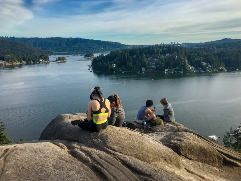
Quarry Rock
A short forest walk to a beautiful viewpoint on Quarry Rock over Deep Cove. This is a great hike to do in the winter. In the summer the trail is REALLY busy since Quarry Rock is pretty Instagram-famous.
Distance: 4 km round-trip
Time: 1.5 hours
Difficulty: Easy

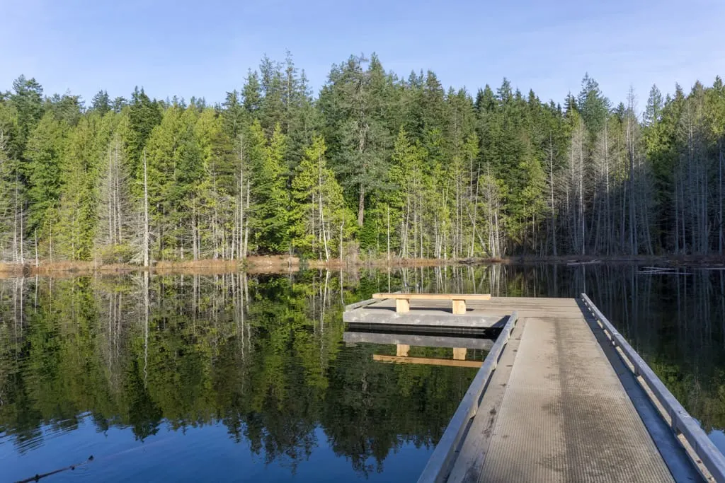
Rice Lake
The easy walk around tiny Rice Lake in the Lower Seymour Conservation Reserve is popular with families and fishers. I love it on a calm day since you get great reflections in the lake’s surface. Keep your eye out for side trails that take you to hidden viewpoints along the shoreline.
Distance: 3 km loop
Time: 1 hour
Difficulty: Easy
Fisherman’s Trail
The Fisherman’s Trail is easy walk on a gravel trail along the banks of the Seymour River. Start the hike from the Rice Lake parking lot. Watch for the hidden tunnel part way along.
Distance: 16 km round-trip
Time: 3 to 4 hours
Difficulty: Easy
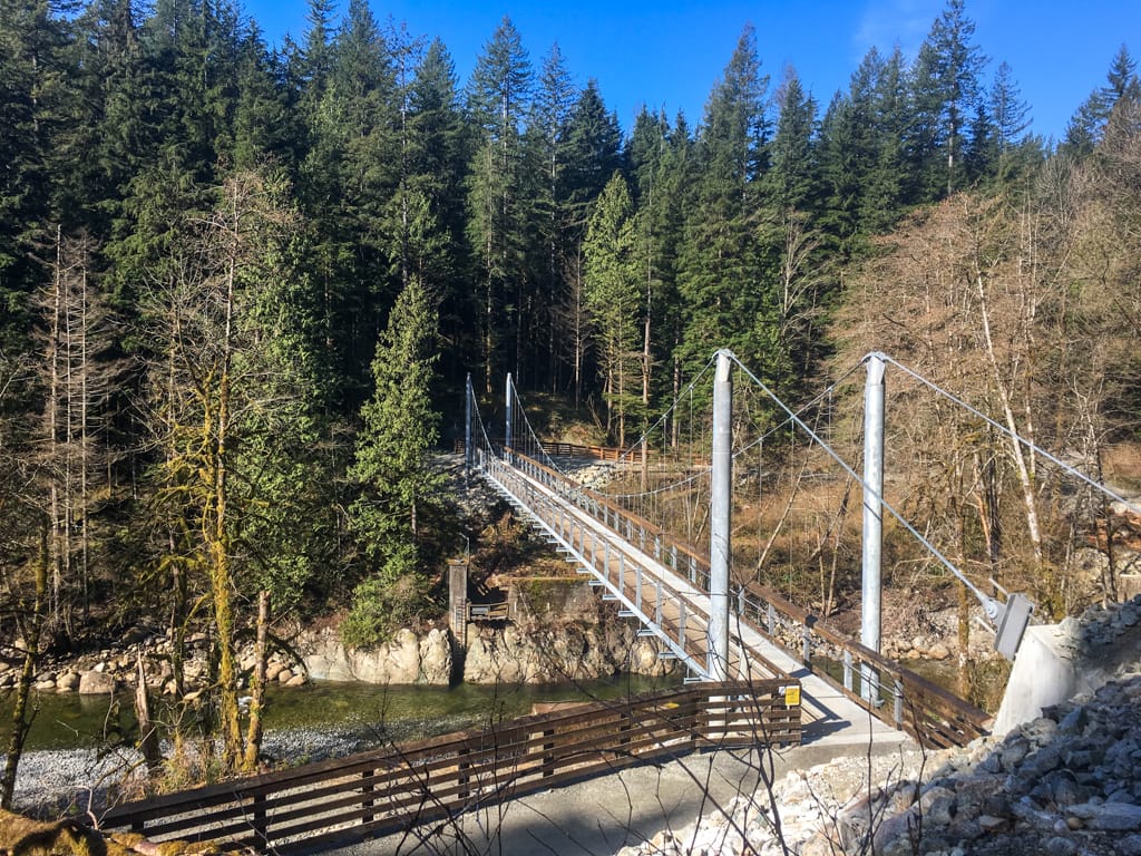
Homestead/Twin Bridges Loop
The Homestead/Twin Bridges Loop is a short hike to the Seymour River from the Lower Seymour Conservation Reserve parking lot near Rice Lake. Start downhill on the Twin Bridges Trail to the river and a suspension bridge, then turn left to follow Fisherman’s Trail upstream. Head back uphill to the parking lot on the Homestead Trail.
Distance: 4.7 km
Time: 1.5 hours
Difficulty: Easy

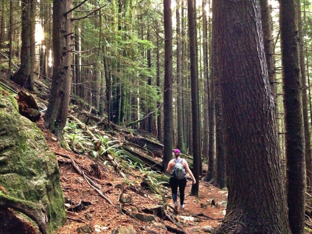
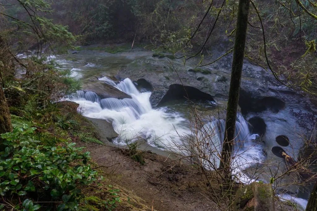
Seymour and Lynn Canyons
The hike around the best parts of the Seymour and Lynn Canyons is one of my favourite winter hikes. It’s low enough to avoid snow but it has lots of waterfalls, bridges, rainforest, and canyon viewpoints. You can start from a few different places, but it’s easiest to get parking at the Rice Lake Parking Lot.
Distance: 8 km loop
Time: 2.5 to 3 hours
Difficulty: Moderate
Baden Powell Trail from Deep Cove To Lynn Valley
The Baden Powell Trail stretches across the width of the North Shore. In the winter, I think the section between Deep Cove and Lynn Valley makes a great hike. You can do it as an out-and-back or use the bus or an Uber to do it one way. Or extend it all the way to the base of Grouse Mountain (see below).
Distance: 12 km round-trip
Time: 4 to 5 hours
Difficulty: Moderate
Baden Powell from Lynn Valley to Grouse Mountain
I think the section of the Baden Powell between Deep Cove and Lynn Valley is a little nicer than the one between Lynn Valley and the base of Grouse Mountain. But it’s still worth doing if you want a snow-free winter hike in Vancouver.
The trail stays in the trees and has tons of small ups and downs. It also crosses countless mountain bike trails – watch for signs and use an app like AllTrails or Gaia GPS to stay on track. You can do it as an out-and back from either end. Or take the bus, a taxi, or an Uber to do it as a one-way.
Distance: 15.1 km round-trip
Time: 6 hours
Difficulty: Challenging

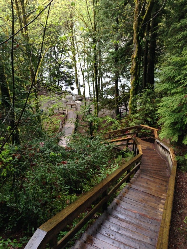
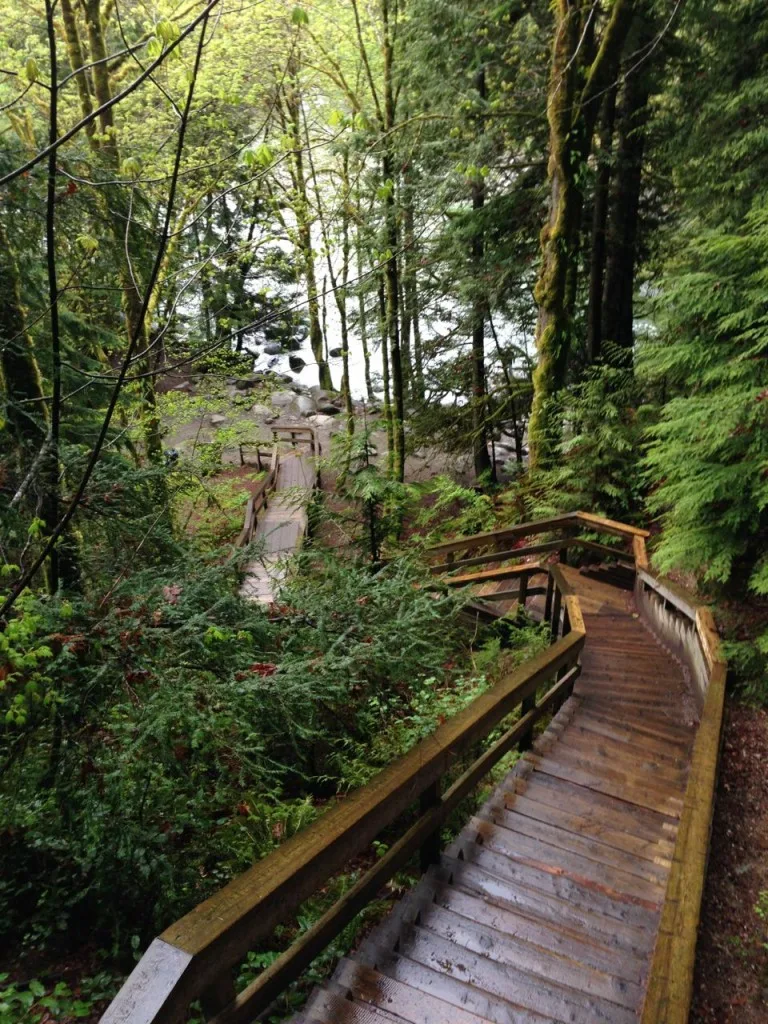
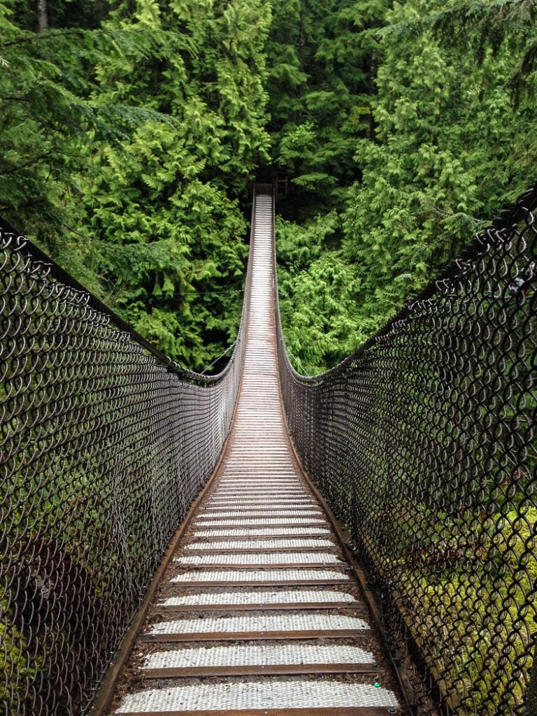
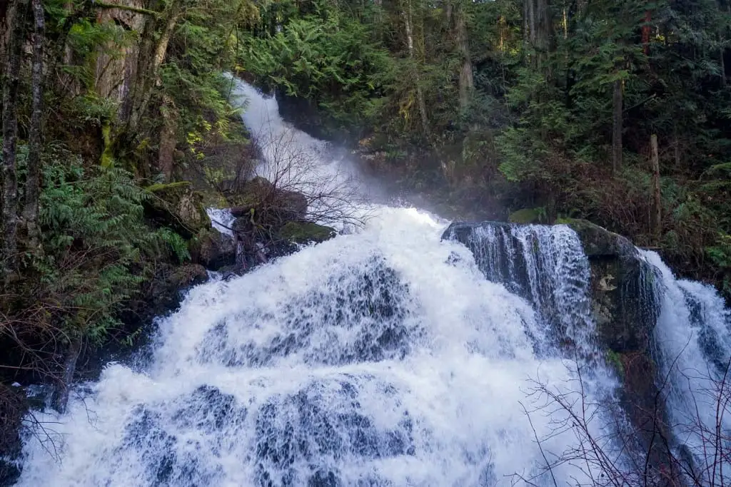
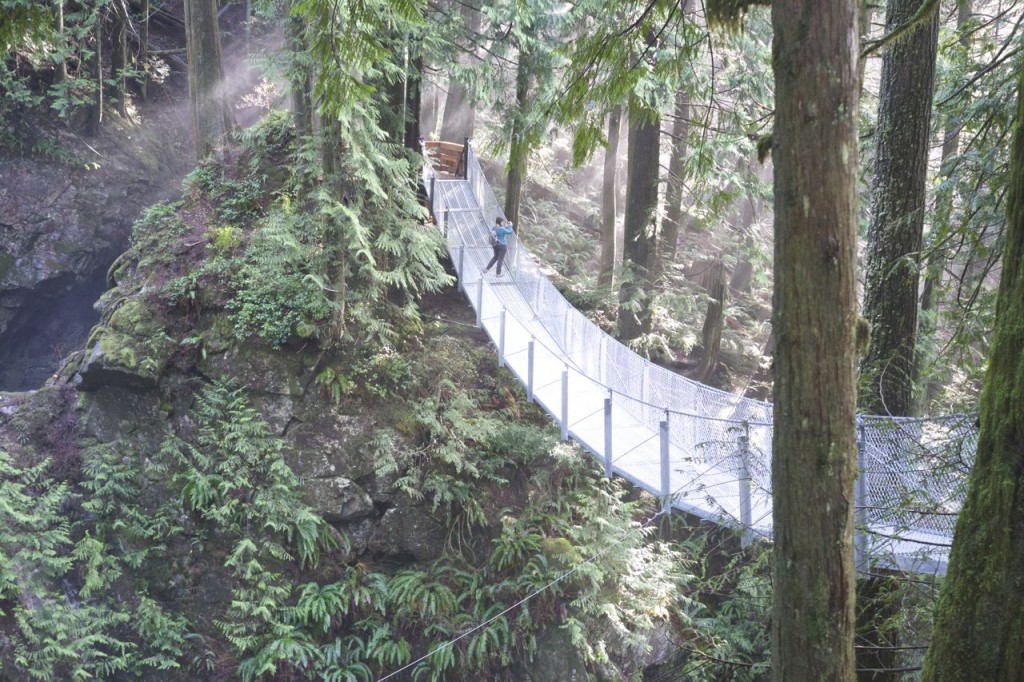
Lynn Canyon Suspension Bridge and Twin Falls
The hike to Lynn Canyon Suspension Bridge and Twin Falls is a tourist hot-spot in the summer (it’s one o the best easy hikes in Vancouver), but in the winter it’s much less crowded and usually snow-free. This short loop includes the suspension bridge, Twin Falls and Twin Falls bridge, and 30 foot pool – all the highlights in the area.
Distance: 2.3 km loop
Time: 1 hour
Difficulty: Easy

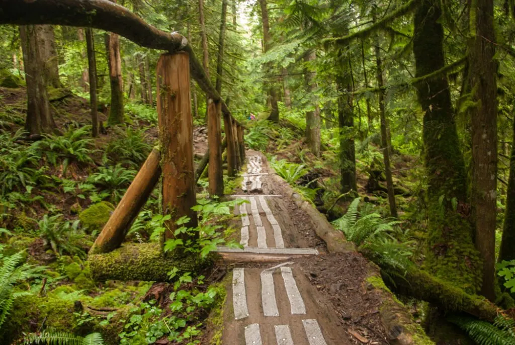
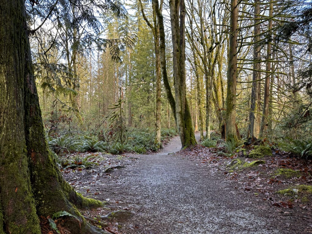
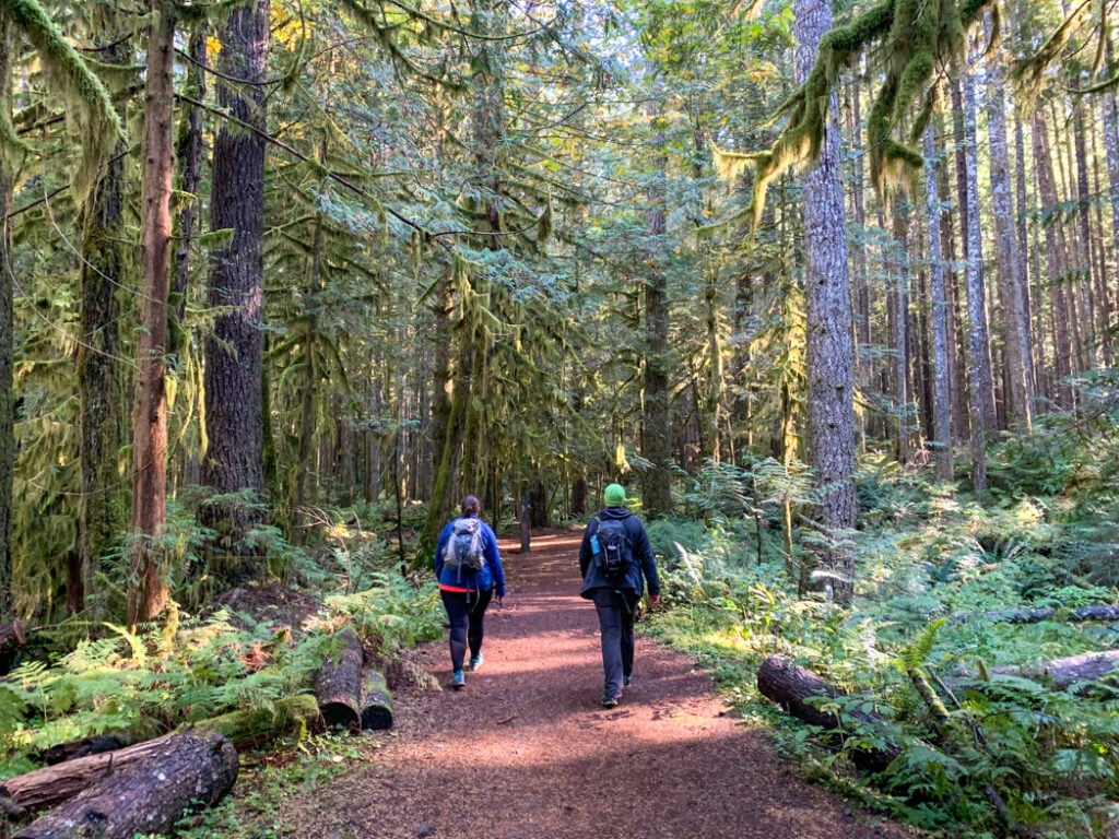
Lynn Loop
This short Lynn Loop in Lynn Headwaters Regional Park is usually snow-free in the winter. It heads through the forest and the loops back along Lynn Creek. You can also extend the hike along the Headwaters Trail towards Norvan Falls, but you will likely encounter snow as you head upstream.
Distance: 5.5 km
Time: 1.5 to 2 hours
Difficulty: Moderate
Snow-Free Hikes in West Vancouver
Capilano Canyon Trails
The Capilano Canyon Trails are fun to explore in the winter since they don’t get snow. The huge network of trails leads to views from the top of the Cleveland Dam, bridges over the Capilano River, views of the canyon, and lots of rainforest.
Distance: 6 km (but you can add on more trails)
Time: 2 hours
Difficulty: Easy/Moderate
Mountain Path and Cypress Trestle Bridge
The Mountain Path and Cypress Trestle Bridge trail is a new trail on the lower slopes of Cypress Mountain. It starts at Cypress Village, which is a great viewpoint and has a coffee shop and pizza truck. (It’s actually a real estate sales office, but it’s worth a visit for the views.) From there, it heads uphill through the forest to a beautiful trestle bridge with great views of Vancouver.
Distance: 6.5 km round-trip
Time: 2 to 2.5 hours
Difficulty: Easy/Moderate
Cypress Falls
The short hike to Cypress Falls is perfect in the winter since the waterfalls really get flowing when it rains. But stay back from the edge – there have been accidents here! The trail heads uphill through the canyon to visit several waterfall viewpoints.
Distance: 3 km round-trip
Time: 1 to 1.5 hours
Difficulty: Easy/Moderate
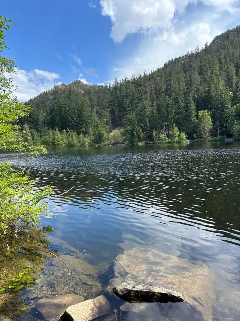
Whyte Lake
I’ve done the hike to Whyte Lake at least a dozen times. It’s beautiful in all seasons and it doesn’t have snow in the winter. It’s an easy hike uphill through the forest next to a beautiful little canyon. It ends at a picturesque lake that often has good reflections and is home to Vancouver’s nicest outhouse.
Distance: 5 km round-trip
Time: 1.5 to 2 hours
Difficulty: Easy/Moderate

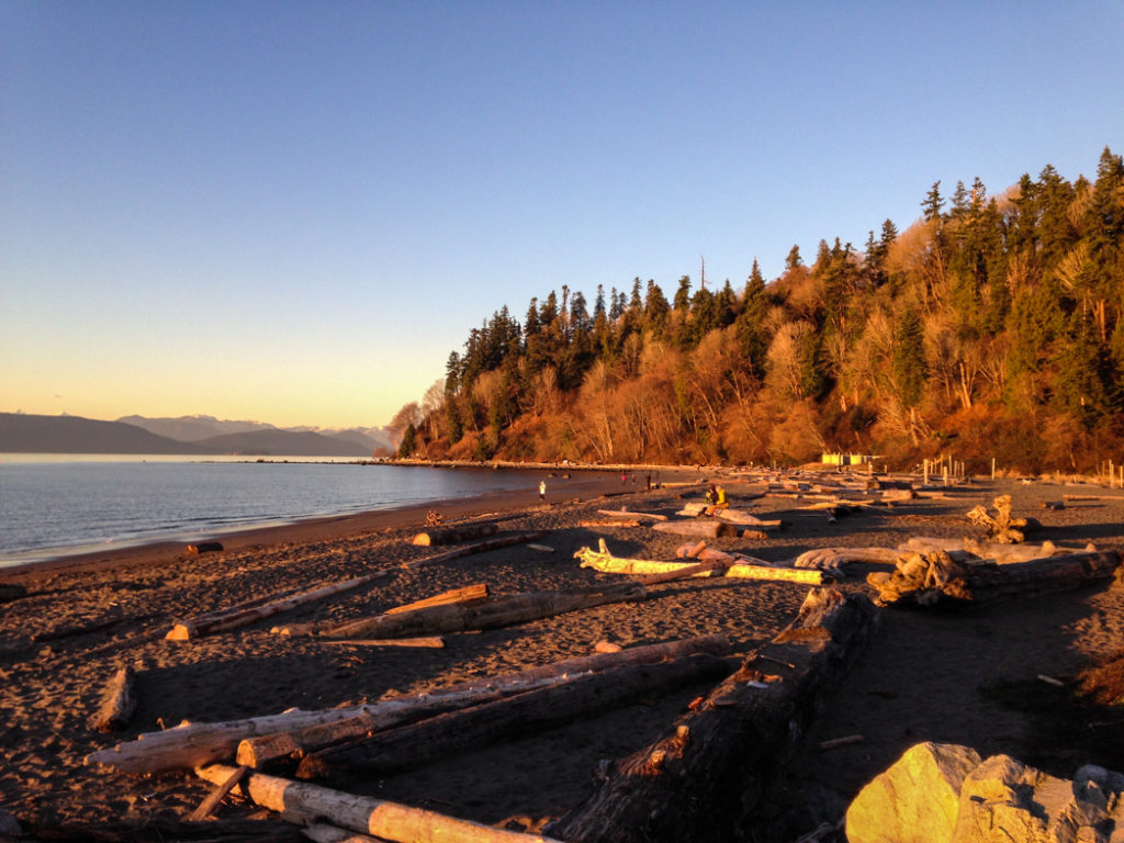
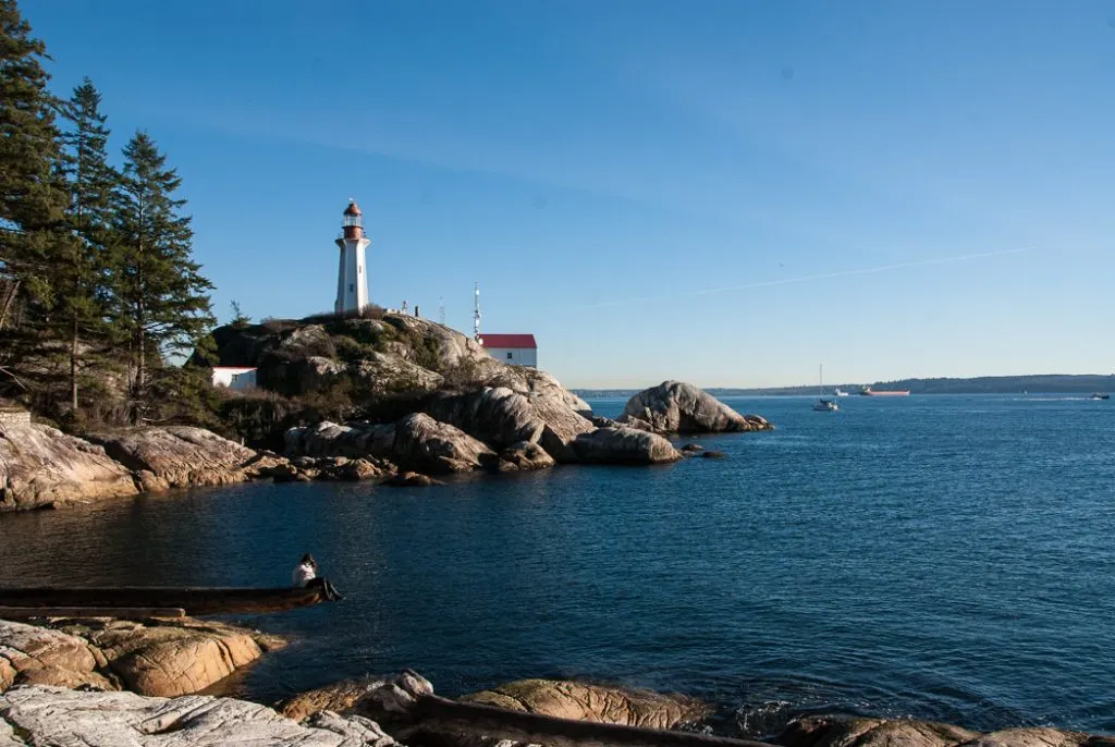
Lighthouse Park
The trails in Lighthouse Park are so scenic: rainforest, bluffs with ocean views, a tiny beach, and great views of Vancouver. It’s on my list of Vancouver best easy hikes.
With tons of trails, you can make your own route. However, the loop around the park’s perimeter takes you to all the best viewpoints.
Distance: 5.3 km loop
Time: 1.5 to 2 hours
Difficulty: Moderate

Snow-Free Hikes in Burnaby
Velodrome Trail
There are lots of snow-free hiking options on Burnaby Mountain. One of my favourites is the Velodrome Trail, which climbs steeply up the north side. Some people call it the Burnaby Grind. You can extend your hike by incorporating some of the other trails on the west side of the mountain.
Distance: 3 km round-trip
Time: 1 to 1.5 hours
Difficulty: Moderate

Burnaby Lake
Even though this trail is in the middle of an urban area, it feels wild enough to call it a hike. The Burnaby Lake Trail makes a big loop around Burnaby Lake through forests and along well-built trails through the bog. You can barely tell you are close to Metrotown!
Distance: 10.5 km loop
Time: 2 to 2.5 hours
Difficulty: Easy
Snow-Free Hikes in Richmond and Delta
Iona Beach
Most people heading to Iona Beach stick to the paved and gravel walkway on top of the Iona Jetty. It’s a nice walk, but I wouldn’t describe it as hike. Instead, head further along the road to Iona Beach. You can follow a trail behind the beach and then come back along the sand (as long as it is low tide). It has good views of the river and you might spot seals on the log booms.
Distance: 4.5 km loop
Time: 1 hour
Difficulty: Easy
Deas Island
The hike on Deas Island is another gem of a trail hidden in the middle of the city. The trail actually goes right over to top of the Highway 99 tunnel. But for most of the hike, you’ll just enjoy a sandy trail and views of the Fraser River.
Distance: 4.7 km loop
Time: 1 hour
Difficulty: Easy

Delta Watershed Park
The Delta Watershed Park has a maze of trails sandwiched between Highway 91 and residential neighbourhoods. Many of the trails are mountain bike trails, so expect to share the trail. It’s a fun place to explore, but it’s easy to get turned around. The best option is a loop around the perimeter.
Distance: 6.3 km loop
Time: 1.5 to 2 hours
Difficulty: Easy
Snow-Free Hikes in Belcarra
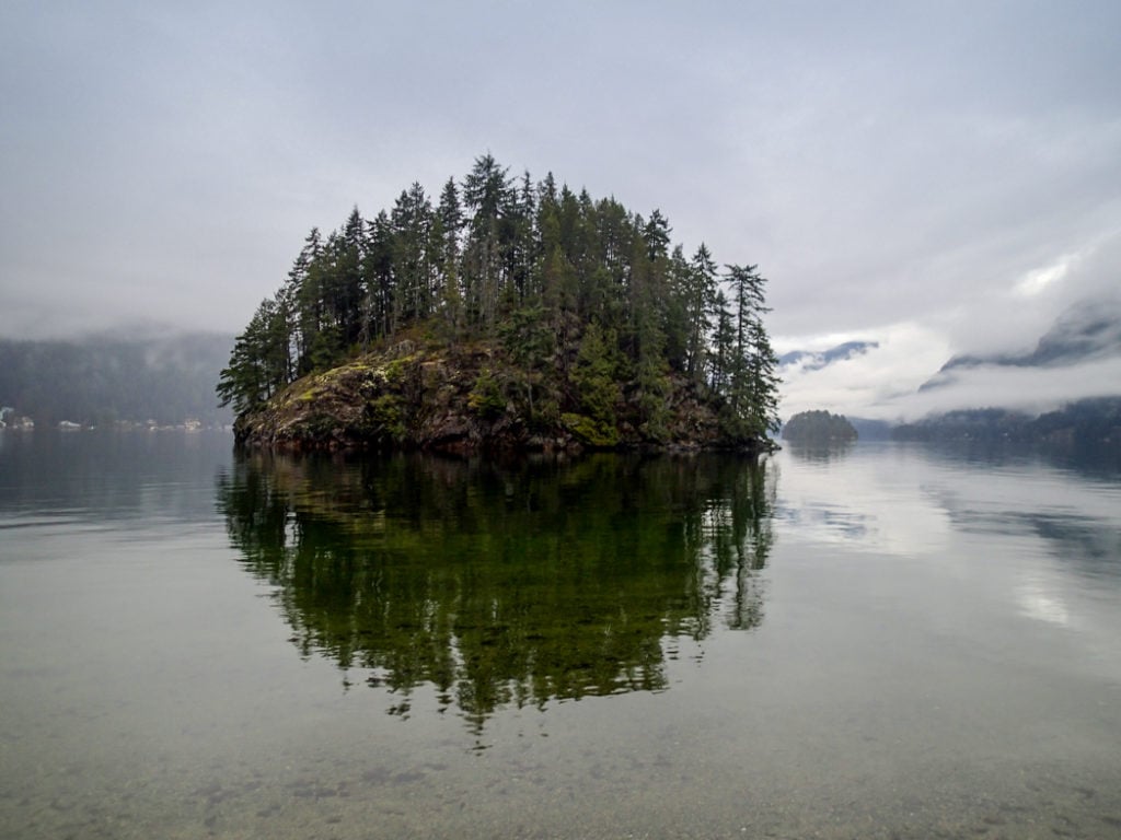
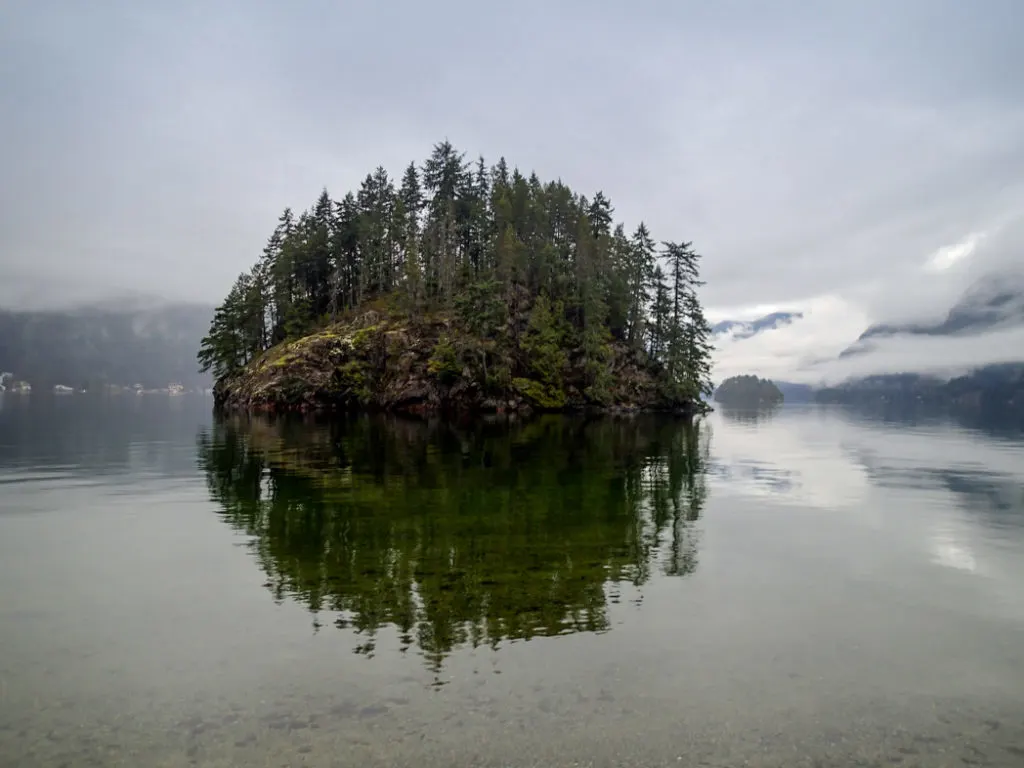
Jug Island Beach
I love the quiet Jug Island Beach trail through the forest in təmtəmíxʷtən/Belcarra Regional Park. Along the way it has some good views of Bedwell Bay It ends at tiny Jug Island Beach on Indian Arm.
Distance: 5.5 km round-trip
Time: 1.5 to 2 hours
Difficulty: Easy/moderate
Admiralty Point
The Admiralty Point trail is another great hike in təmtəmíxʷtən/Belcarra Regional Park – it starts from the same parking lot as the Jug Island Beach Trail so you can do them back to back if you want more distance. The hike to Admiralty Point follows the coast to lots of little pocket beaches and viewpoints of Indian Arm.
Distance: 5.5 km
Time: 1.5 hours
Difficulty: Easy
Sasamat Lake
In the summer Sasamat Lake is so popular that the parking lot is usually totally full, but you won’t have to fight crowds in the winter. It’s a short and easy walk around the lake, including walking over a floating bridge. If you want to extend your hike, you can add on a trip to Woodhaven Swamp or Sugar Mountain.
Distance: 3.2 km loop
Time: 1 hour
Difficulty: Easy
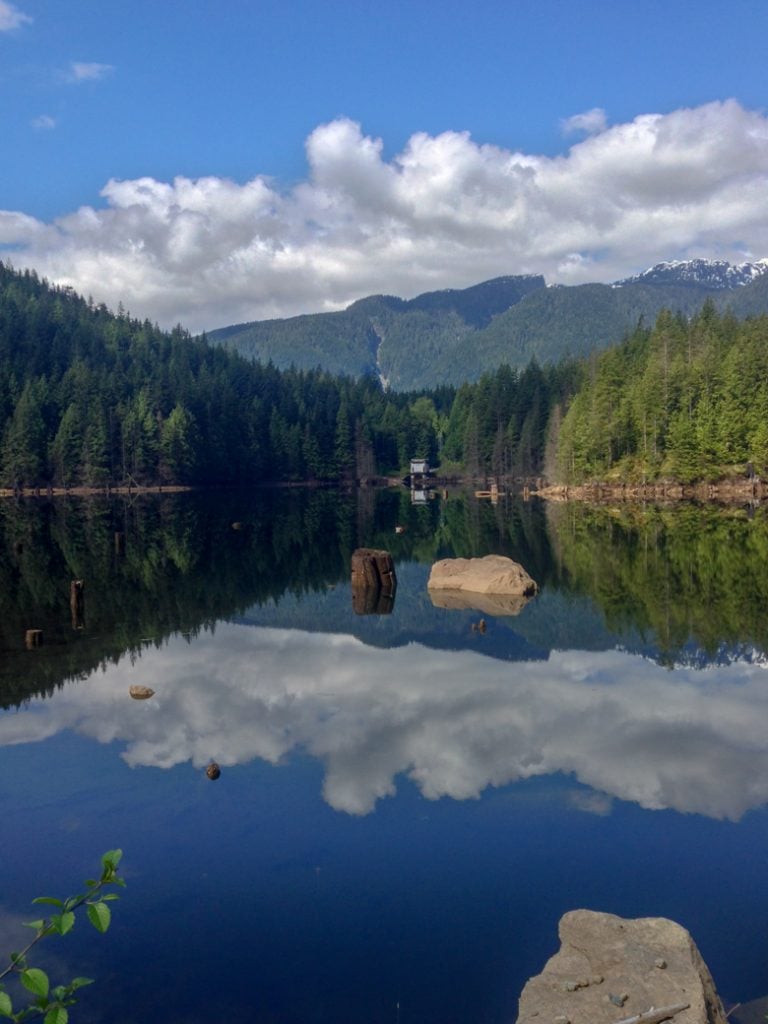
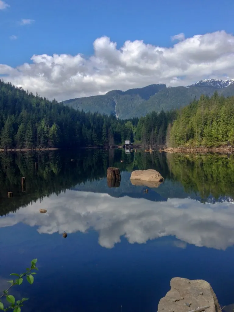
Buntzen Lake
The loop around Buntzen Lake is a Vancouver classic. It goes through rolling forest with lots of viewpoints of the lake. It has both a suspension bridge and a floating brige, which is why its one of my favourite snow-free hikes. You can add on some of the other trails in the area, but many of them will have snow in the winter.
Distance: 10 km
Time: 2.5 to 3 hours
Difficulty: Moderate
Snow-Free Hikes in Coquitlam and Port Coquitlam
Coquitlam Crunch
The Coquitlam Crunch is Coquitlam’s answer to the Grouse Grind, this steep trail is great for a workout and stays snow-free all year. It heads steadily uphill under the powerlines with lots of stairs.
Distance: 5.8 km round-trip
Time: 2 to 2.5 hours
Difficulty: Moderate
Coquitlam River Trails
The Coquitlam River Trails are hidden behind houses in Coquitlam. The network of trails stretches along both sides of the river. In the fall, you can spot salmon in the river and the side channels. My sister lives nearby and this is one of her favourite winter hikes in Vancouver.
If you want to extend your hike, this trail is part of the 23.5 km Taboulay Poco Trail that makes a loop around Port Coquitlam.
Distance: 5.8 km loop
Time: 1.5 hours
Difficulty: Easy

Minnekhada Regional Park
Minnekhada Regional Park has a wonderful network of trails that goes through forest and past marshes. The highlight is the climb up to a viewpoint over the Pitt River.
Distance: 6.8 km loop
Time: 2 to 2.5 hours
Difficulty: Moderate
Snow-Free Hikes in Maple Ridge
UBC Malcolm Knapp Research Forest
The UBC Malcolm Knapp Research Forest near Golden Ears Provincial Park has a huge network of trails in a working forest. The most popular option is an 8 km loop that includes a lookout and a little log cabin shelter.
Distance: 7.9 km
Time: 2.5 to 3 hours
Difficulty: Moderate
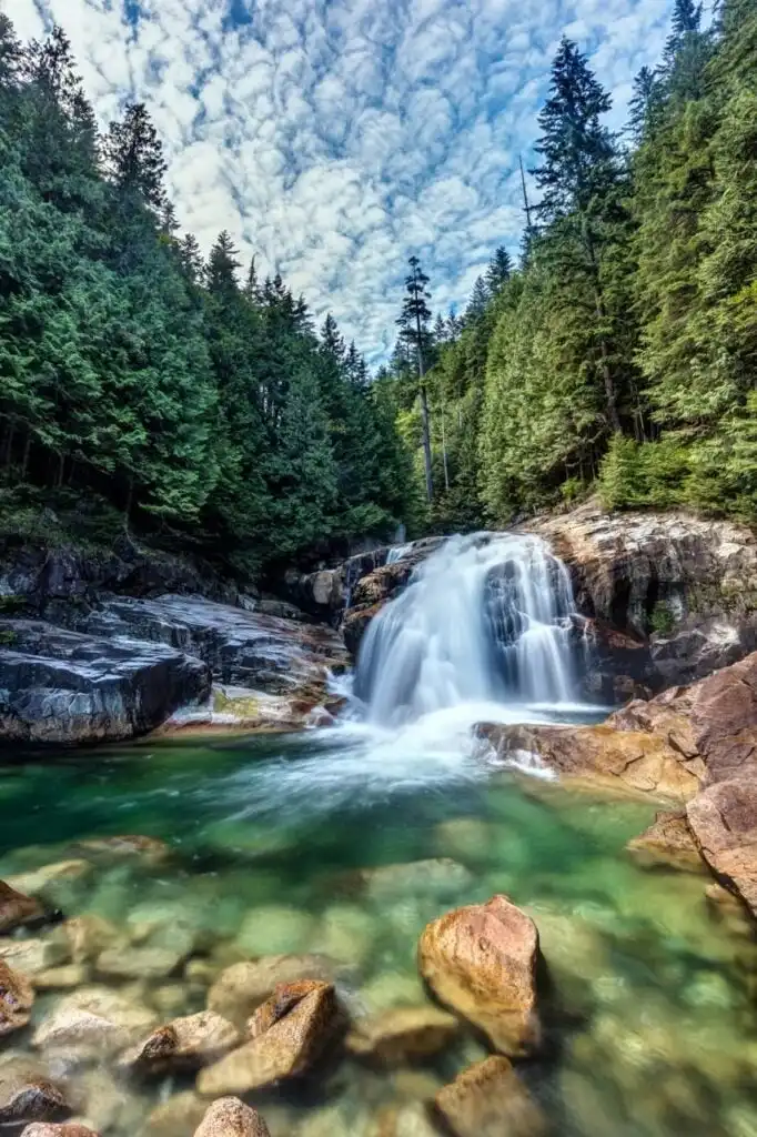
Lower Falls/Gold Creek Falls
The walk to Lower Falls (also called Gold Creek Falls) is probably the most popular hike in Golden Ears Provincial Park. Thankfully, it is at low elevation so it is usually snow-free all year. It’s an easy hike beside Gold Creek to a great waterfall viewpoint.
Distance: 5.3 km
Time: 1 to 1.5 hours
Difficulty: Easy

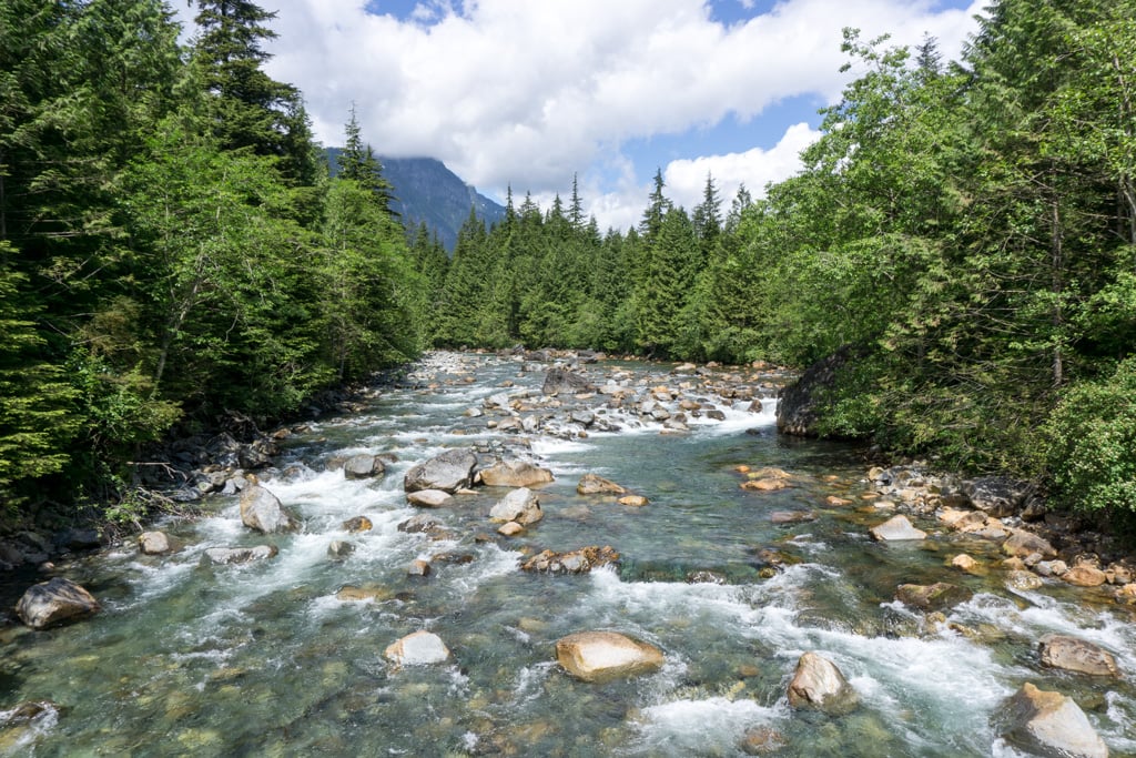
East and West Canyon Loop
This loop heads up the east side of Gold Creek, crosses a bridge, then heads back down the west side. Parts of the trail are old logging roads, but you can barely tell since the mossy forest and grown so much over the decades.
These East and West Canyon Trails didn’t used to connect, but BC Parks built a bridge here about 10 years ago, making a loop possible. If you want to extend your hike, you can take a rough side trail to Upper Gold Creek Falls. (This trip is also in my book, Backpacking in Southwestern British Columbia.)
Distance: 10.3 km
Time: 3 to 3.5 hours
Difficulty: Moderate

Kanaka Creek Cliff Falls
The highlight of the short hike to Kanaka Creek Cliff Falls is the waterfall. It cascades over a set of sandstone ledges that form curved pools. If possible, visit during cold and dry weather to see the pools at low water.
Distance: 2.3 km
Time: 30 minutes to 1 hour
Difficulty: Easy
Kanaka Creek/Cliff Falls: A short walk to a picturesque waterfall with curved pools.
Snow-Free Hikes in Langley
Campbell Valley Regional Park
There are lots of trails to explore in Campbell Valley Regional Park. The best ones are on boardwalks next to the tiny river. It’s a great spot for bird watching.
Distance: 7.6 km loop
Time: 2 hours
Difficulty: Easy
Brae Island Regional Park
The Tavistock Trail at Brae Island Regional Park is a great short hike in Fort Langley. The trail heads through the forest alongside the Bedford Channel. There are a few side trails leading down to the water and a great view of the Fraser River at Tavistock Point.
Distance: 4.7 km
Time: 1 to 1.5 hours
Difficulty: Easy
Aldergrove Regional Park
Aldergrove Regional Park has a huge network of trails through wetlands beside Pepin Brook. There are also great views of Mount Baker.
Distance: 10.8 km loop
Time: 2.5 to 3 hours
Difficulty: Easy
Snow-Free Hikes in Mission and Harrison
Rolley Lake and Rolley Falls
There is a popular campground at Rolley Lake, but it’s closed in winter so you might have the area to yourself. (And you’ll have to walk an extra kilometre into the park from the gate. But your reward is a lovely easy hike around the lake along with a steeper hike to a waterfall.
Distance: 4.8 km loop
Time: 1.5 to 2 hours
Difficulty: Easy/moderate
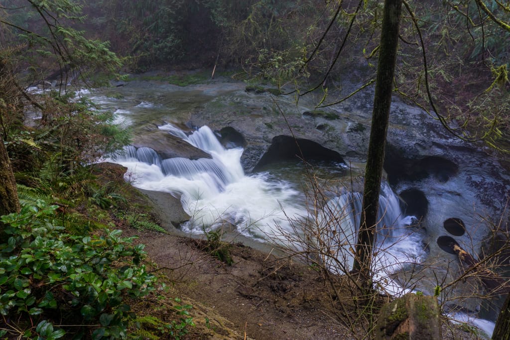
Hayward Lake and Steelhead Falls
This trail follows the shoreline of Hayward Lake, which is actually a hydro power reservoir. You can continue along the entire eastern shoreline. But don’t miss the side trip to Steelhead Falls, just a one kilometre from the parking lot.
Distance: 9.7 km round-trip
Time: 2.5 to 3.5 hours
Difficulty: Moderate

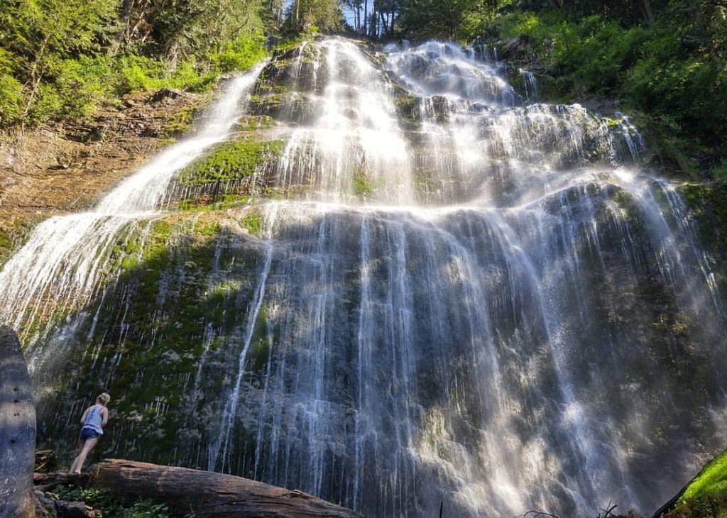
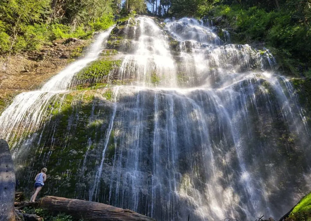
Cascade Falls
The hike to Cascade Falls is very short, but the scenery is worth it. The steep trail leads to a suspension bridge in front of a spectacular waterfall.
Distance: 0.6 km round trip
Time: 30 minutes
Difficulty: Easy
Whippoorwill Point
The hike to Whippoorwill Point starts in Harrison Hot Springs and follows the shoreline of Harrison Lake. It then heads up over a ridge before descending to a tiny sandy beach.
Distance: 3.7 km round-trip
Time: 1 to 1.5 hours
Difficulty: Easy/moderate
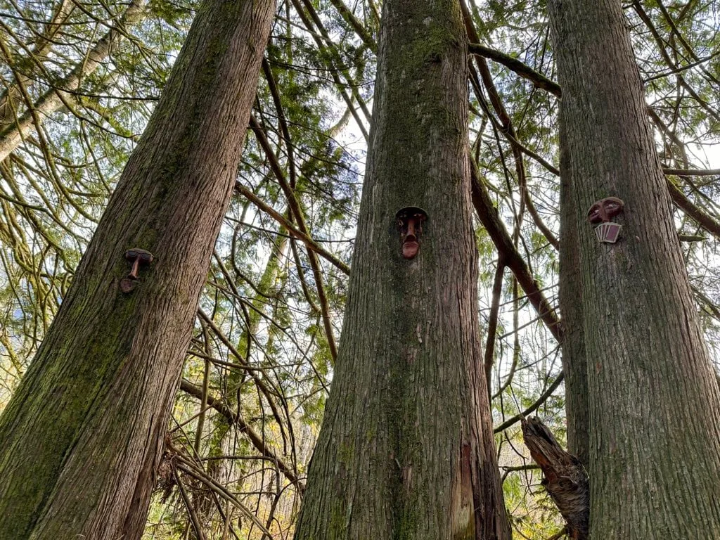
Spirit Trail
If you’re in Harrison Hot Springs in winter, don’t miss the Spirit Trail. It’s a shot hike, but it features dozens of hand carved masks mounted on trees. It’s kinda creepy and kinda cool at the same time.
Distance: 1 km loop
Time: 30 minutes
Difficulty: Easy

Snow-Free Hikes in Abbotsford
Abby Grind
The steep Abby Grind is also known as the Glen Ryder Trail. It climbs up to Taggart Peak and is a well-known alternative to the Grouse Grind.
Distance: 3.4 km round-trip
Time: 2 to 2.5 hours
Difficulty: Moderate/Challenging
Downes Bowl
Downes Bowl in Abbotsford has a great trail system through a marsh with lots of boardwalks. It is a bit of a maze, but you can make a loop that uses most of the trails.
Distance: 4.3 km loop
Time: 1 to 1.5 hours
Difficulty: Easy
Snow-Free Hikes in Chilliwack and Hope
Tea Pot Hill
The hike up Tea Pot Hill in Cultus Lake Provincial Park is one of the most unique hikes in Vancouver thanks to the literal teapots along the sides of the trail. Even though the trail goes up a small hill, it’s low enough to be snow-free most winters.
Distance: 4.8 km round-trip
Time: 1.5 to 2 hours
Difficulty: Moderate
Seven Sisters Trail
The Seven Sisters Trail is another great short hike in Cultus Lake Provincial Park. It goes to a beautiful grove of old growth trees known as the Seven Sisters.
Distance: 3.2 km
Time: 1 to 1.5 hours
Difficulty: Easy/Moderate
Chilliwack Community Forest
The new volunteer-created trail network in the Chilliwack Community Forest includes several short loops through the forest. You can string a few of them together to make various loops.
Distance: 4 km loop
Time: 1.5 to 2 hours
Difficulty: Easy/Moderate
Cheam Lake Wetlands
Cheam Lake Wetlands Regional Park is hidden in farm land in between Chilliwack and Hope. It’s a great place to go birding. The trails along the lake and through the marsh are my favourite – some of them feature floating walkways.
Distance: 4.5 km round-trip
Time: 1 hour
Difficulty: Easy

Bridal Veil Falls
The gate to Bridal Veil Falls is closed in winter, but you can still hike it if you park outside the gate and walk a few minutes along the road. It’s a short hike, but the falls are incredible. Be sure to stay away from the base – in the past visitors have been seriously injured when rocks fell on them.
Distance: 1.3 km loop
Time: 30 minutes
Difficulty: Easy
Flood Falls
The hike to Flood Falls is a good leg-stretcher if you’re driving along Highway 1. The falls is really spectacular after heavy rains.
Distance: 1 km round-trip
Time: 30 minutes
Difficulty: Easy
Snow-Free Hikes in Squamish
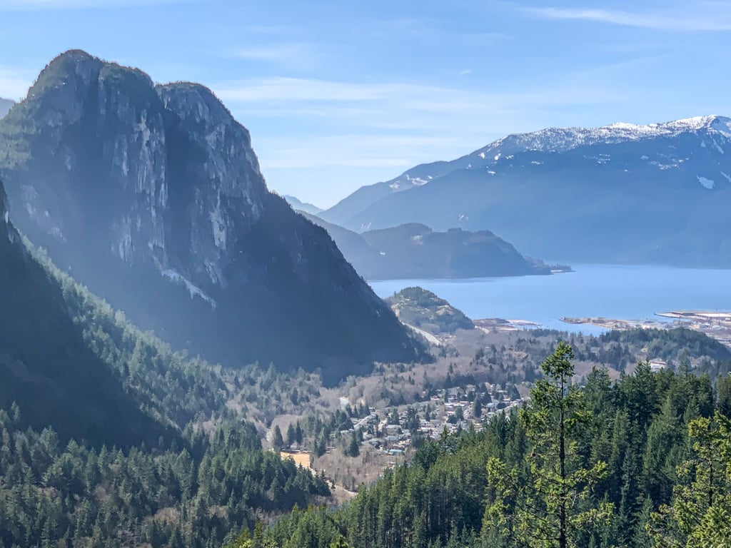
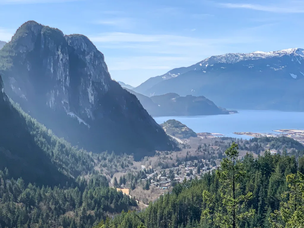
Mount Crumpit
The hike to Mount Crumpit is one of my favourite local hikes in Squamish. It’s low enough to avoid snow but it’s high enough to have incredible views of the Stawamus Chief and downtown Squamish. The hike is steep in places!
Distance: 7.9 km round-trip
Time: 2.5 to 3.5 hours
Difficulty: Moderate.
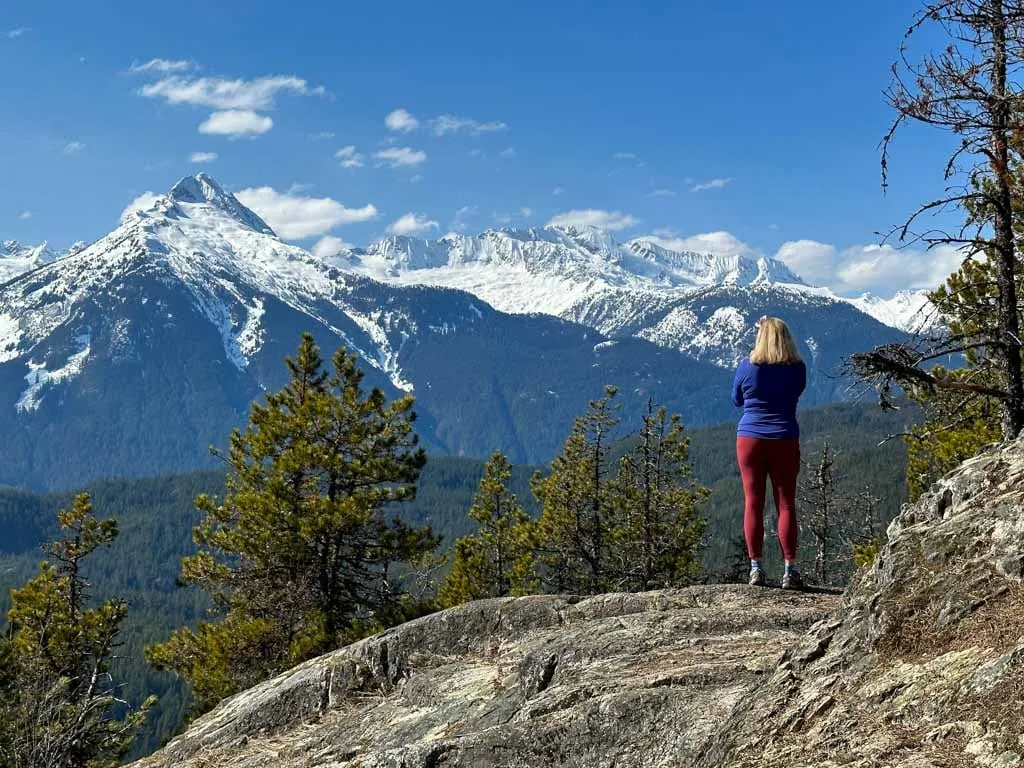
Four Lakes Trail at Alice Lake
As a Squamish local, the Four Lakes Trail at Alice Lake Provincial Park is one of my go-to winter hikes. It’s relatively easy, but the forest is gorgeous and there are four lakes to check out along the way.
Distance: 6.3 km loop
Time: 1.5 to 2 hours
Difficulty: Easy

Brohm Lake
I love the trails at Brohm Lake. You can do the easy 4 km loop around the lake or add on a great viewpoint. I also love the off-the-beaten path trails in the southern part of park. My recommended loop takes in the best spots in the park.
Distance: 8 km loop
Time: 2.5 to 3 hours
Difficulty: Moderate

Starvation Lake on the Sea to Sky Trail
The Sea to Sky Trail stretches from Squamish to Whistler. Most of it is too snowy in the winter. But you can hike the short section from the end of Paradise Valley Road to Starvation Lake.
Distance: 6.4 km round-trip
Time: 1.5 to 2 hours
Difficulty: Moderate

Snow-Free Backpacking Trips Near Vancouver
With snow in the mountains between November and June, you’ll have to look to low elevation trails to go backpacking in Vancouver in the off-season. See my list of the best spring backpacking trips in British Columbia for recommendations on where to for a snow-free backpacking trip in March, April, and May.
Final Thoughts
How many of these snow-free hikes in Vancouver have you done? Do you have even more to add to my list? Let me know in the comments?
MORE VANCOUVER HIKES:
- 15 Unusual Hikes Near Vancouver
- Most Instagrammed Hikes in Vancouver
- Alternatives to the Grouse Grind: Steep Workout Hikes Near Vancouver
- 35+ Vancouver Hikes You Can Get to on Transit
- 40+ Waterfall Hikes Near Vancouver
WINTER TIPS:
- What to Wear Winter Hiking and Snowshoeing
- 9 Tips for Winter Hiking (You Don’t Have to Freeze!)
- Where to Go Snowshoeing in Vancouver


- 10 Best Things to Do in Nanaimo - April 16, 2026
- 25+ Women’s Adventure Books That Will Inspire You - April 13, 2026
- 10 Best Things to Do in Saskatchewan - March 22, 2026
Andrew
Tuesday 23rd of January 2018
This is such an awesome list of fun! Thank you for giving me some more ideas of awesome hikes with no snow.