Vancouver is blessed with tons of gorgeous trails a short drive from downtown. There are a lot of articles online claiming to list the best hikes in Vancouver or the top 10 hikes near Vancouver. I’ve looked at them all and realized that often… I just don’t agree with all of their picks. I’ve lived in the Vancouver area almost my whole life and have hiked here pretty steadily for the last decade. That means I’ve been on countless trails and have formed some pretty clear opinions about which trails are worthwhile and which ones just… aren’t. I actually agonized over which Vancouver hikes to include on this list and which ones to leave out. Everyone has a preference about which kinds of trails they like. I favour ones with good views and access that isn’t a pain in the ass. (No endless 4wd roads please!) I’ve hiked all of the trails on this list, most of them multiple times. So here’s my list of the 10 best hikes in Vancouver, in my local’s opinion. I know not everyone will agree with my picks… but that’s awesome since Vancouver has so many great trails to choose from.
Hey there: Some of the links in this post are affiliate links, which means I earn a small commission at no extra cost to you if you make a purchase. Thanks for supporting my website! -Taryn
This is a sensitive wilderness area. Learn how to Leave No Trace to keep the wilderness wild. Make sure you are prepared by bringing the 10 Essentials. Get ready for adventure with this checklist of things to do before every hike.
Al’s Habrich Ridge
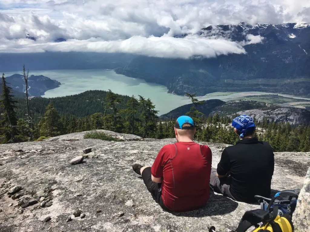
This Vancouver area hike is one of my favourites since it’s a bit of a hidden gem. You have to take the Sea to Sky gondola to get to the trailhead, so the trail is never busy. It starts off with a little bit of road walking in the forest, but before too long you are ascending a gorgeous granite ridge with great views of Howe Sound. After leaving the ridge you’ll explore a little bit of alpine meadow, then follow a rough loop trail to rugged Neverland Falls. It’s a beautiful area with a great variety of terrain.
Distance: 7km round trip, Elevation gain: 440m, Time Needed: 5 hours, Difficulty: Moderate, Best Time to Go: July-October, Trail Info: See my Al’s Habrich Ridget Trail guide. How to get there: From Vancouver drive 45 minutes north to the Sea to Sky gondola in Squamish. Buy a ticket to take the gondola up. (You can also walk up via the Sea to Summit Trail but that adds another 3.5 hours and 900m of elevation gain to your day.)
Heather Trail to Three Brothers
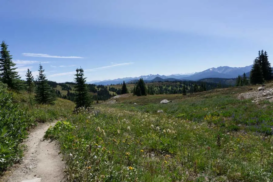
This alpine trail in Manning park is a bit of a drive from Vancouver, but it’s well worth it, especially when the wildflowers are blooming. The hike starts at the end of Blackwall Peak road, high in the alpine. You’ll walk through seemingly endless meadows before climbing gradually up towards Three Brothers Mountain. The last kilometer to the peak is a steep and rocky scramble, but the summit at an elevation of 2272m is well worth it. The hike is doable in a day, but if you have more time, consider backcountry camping at one of the sites along the way and extending your trip to beautiful Nicomen Lake.
Distance: 21.5km round trip, Elevation gain: 480m, Time Needed: 7-8 hours, Difficulty: Difficult, Best Time to Go: July-September, Trail Info: See Manning Provincial Park, hike #79 in Stephen Hui’s 105 Hikes book, and Vancouver Trails. How to get there: Drive 2.5 hours from Vancouver to Manning Park via highway 1, then highway 3. Take Blackwall Peak Road to the parking lot.
READ NEXT: Most Instagrammed Hikes in Vancouver
High Note Trail
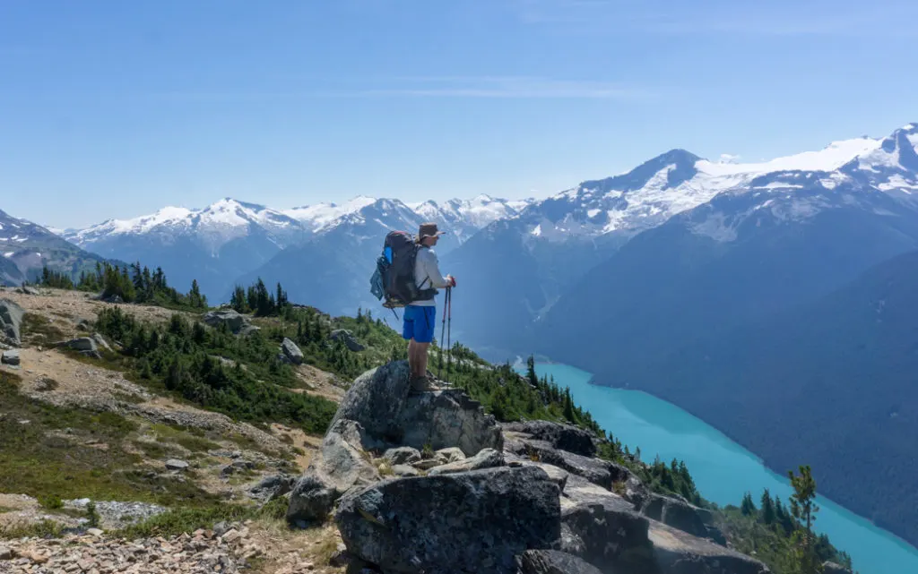
This trail has one of the best effort to reward ratios amongst hikes near Vancouver: the trail is never too steep or too technical and there are spectacular views the entire time. The only catch is the price. You’ll have to pay to take the Whistler gondola up to the peak to hike it. The trail drops down off Whistler peak and contours along the side of ridge with great views of Cheakamus Lake and Black Tusk. At a junction, it turns downhill to go past a couple of pretty alpine lakes and meadows to finish at the gondola roundhouse. If you have the energy, add a few extra kilometers to your trip by going right at the junction and doing an out and back section to Flute Summit or Oboe Summit on the Musical Bumps trail. The views are incredible and you’ll far fewer hikers up there. (This trail is so good it also made my list of the best hikes in Whistler.)
Distance: 9.5+km loop, Elevation gain: 300+m, Time Needed: 4+ hours, Difficulty: Moderate, Best Time to Go: July-September, Trail Info: See my High Note Trail hiking guide. How to get there: Drive 1.5 hours from Vancouver to Whistler. In Whistler, purchase an alpine pass then take the Whistler gondola and the peak chair to the summit.
Psst! If you’re driving to Whistler from Vancouver, check out my complete guide to the Sea to Sky Highway. It includes all the best places to stop along the way.
Mount Seymour
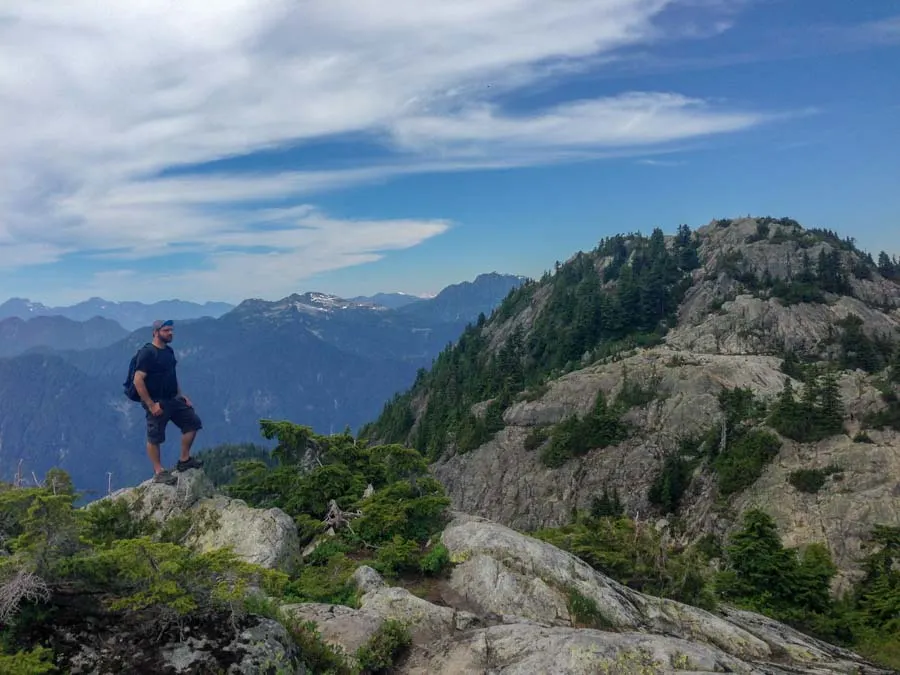
Mount Seymour is my favourite hike on Vancouver’s North Shore. The trail to the summit starts out alongside the gravel ski runs before climbing up a rooty and rocky trail. Seymour has three different peaks, each with their own charms. In particular I love the slabby granite playground around First Peak. You can spend hours exploring the various outcrops, finding different viewpoints of the city and the surrounding mountains. After you’ve finished poking around First Peak (also called Pump Peak) be sure to hike the extra couple hundred meters to Tim Jones Peak (a.k.a. Second Peak) and the true summit (Third Peak) since the views from there are also great.
Distance: 9km round trip, Elevation gain: 450m, Time Needed: 5 hours, Difficulty: Moderate/Difficult, Best Time to Go: July-October, Trail Info: See Mount Seymour Provincial Park map, hike #1 in Stephen Hui’s 105 Hikes book, Vancouver Trails, and Outdoor Vancouver. How to get there: It’s a 45 minute drive from Vancouver.
READ NEXT: 15 Unusual Hikes Near Vancouver
Panorama Ridge and Garibaldi Lake
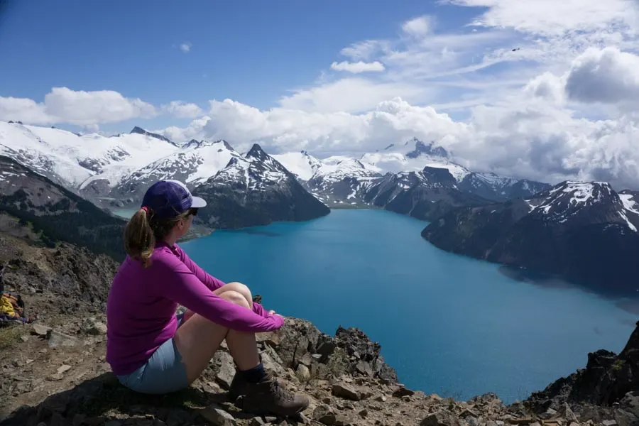
Heads up: Day passes are required at Garibaldi Lake in summer 2023. Learn more in my guide to BC Parks day passes.
This is one of Vancouver’s most popular and well known hikes. And it deserves the reputation – it’s spectacular. The first 6km of the trail consists of long switchbacks in the forest. Eventually you top out in the alpine at Taylor Meadows. The trail follows the meadows gradually uphill until the base of Panorama Ridge. From the junction, it’s a steep and rocky climb up to the top of the ridge. The views up here are insane: you can see Garibaldi Lake in front of you and Black Tusk behind you. Be sure to walk along the ridge a little bit to escape the crowds. On the way back, take the trail from the outhouse junction down to Garibaldi Lake. Go for a quick (and cold!) swim before descending the switchbacks to your car. This is a really long and difficult day hike with a lot of elevation gain. Most hikers will need to build up to this one. If you aren’t ready to tackle it in a day, consider booking a backcountry campsite at Taylor Meadows or Garibaldi Lake so you can tackle the trip over a couple of days.
Distance: 30km round trip, Elevation gain: 1500m, Time Needed: 11-12 hours, Difficulty: Very Difficult, Best Time to Go: July-October, Trail Info: See hike #30 in Stephen Hui’s 105 Hikes book, Vancouver Trails, and Outdoor Vancouver How to get there: From Vancouver, drive 1 hour, 15 minutes to the trailhead just off highway 99 north of Squamish.
Eagle Bluff
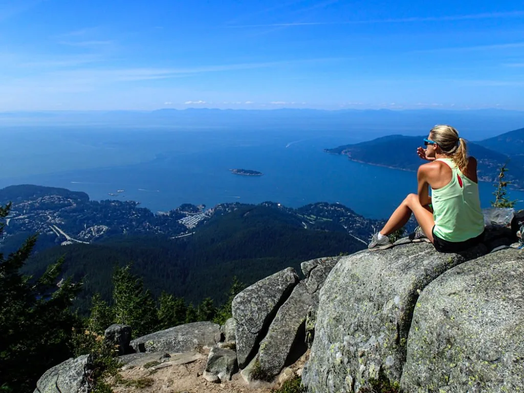
I think this is one of the best hikes in Vancouver because I think it has everything you need in a North Shore hike: great viewpoints and beautiful little alpine lakes. The trail starts with a steep climb up towards Black Mountain plateau. At the top of the climb you can go left for a loop through the lakes or right to summit Black Mountain. The two trails meet up again and head slightly down hill to Eagle Bluff. It’s an open rocky area with killer views of West Vancouver. On the way back, stop by Cabin Lake for a quick dip.
Distance: 8km round trip, Elevation Gain: 350m, Time Needed: 4 Hours, Difficulty: Moderate, Best Time to Go: July-October, Trail Info: See Cypress Provincial Park map, hike #15 in Stephen Hui’s 105 Hikes book, Vancouver Trails, and Outdoor Vancouver How to get there: The trail starts at the Cypress Mountain ski hill parking lot. It’s a 30 minute drive from Vancouver.
READ NEXT: Alternatives to the Grouse Grind: Steep Workout Hikes Near Vancouver
Lighthouse Park
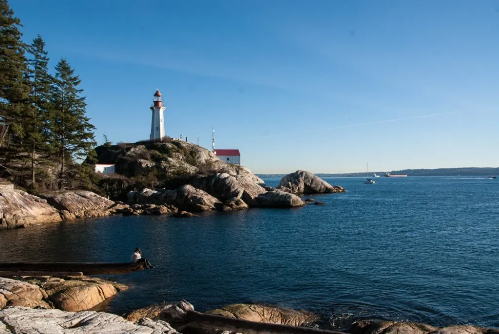
Not every hike needs to be an epic trek up a mountain. I love the trails in Lighthouse Park for a more relaxed hike. (It’s a great one for out of town visitors too.) While most people make a bee-line for the lighthouse, there are actually lots of quiet trails leading to viewpoints, giant trees and hidden beaches. My favourite hike combines a bunch of trails into a loop around the park.
Distance: 6km loop, Elevation Gain: 50m, Time Needed: 2 hours, Difficulty: Easy, Best Time to Go: Year-Round, Trail Info: See my recommended route including a map. Outdoor Vancouver also has a good guide. Bring a copy of the trail map since there are a lot of trail junctions and it can get confusing. How to get there: Drive 40 minutes from Vancouver to the park entrance off Marine Drive in West Vancouver. You can also get there via bus 250 or 253.
St. Mark’s Summit
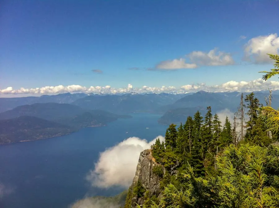
The hike to St. Mark’s summit has a bit of a split personality. The first half is on a wide gravel trail that makes for easy walking, even on the steep parts. But suddenly, part way up some steep switchbacks, the gravel ends and a true rooty and rocky North Shore trail begins. But it’s the finale that you’re really here for – the panoramic view over Howe Sound up at St. Mark’s Summit. The granite outcroppings seem to hang directly over the Sea to Sky highway far below. Be sure to go on a clear day. If you want to extend your trip, continue along the trail to Unnecessary Mountain. The descent down from St. Mark’s, then the climb back up might seem, umm, unnecessary, but the close-up views of the Lions are pretty incredible.
Distance: 11km round trip, Elevation Gain: 460m, Time Needed: 5 hours, Difficulty: Moderate, Best Time to Go: July-October, Trail Info: See my St. Mark’s Summit hiking guide. How to get there: The trail starts at the Cypress Mountain ski hill parking lot in West Vancouver. It’s a 30 minute drive from Vancouver.
READ NEXT: Snow-Free Hikes in Vancouver: 100+ Year-round Trails
Elk Mountain
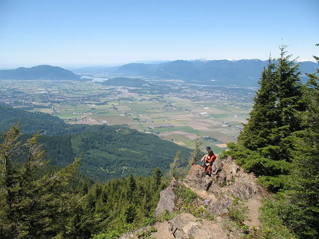
Elk Mountain is probably the most popular trail in Vancouver’s Fraser Valley… but for a good reason. It’s a short and steep hike through the forest up to the summit. (In fact Chilliwack locals hike it instead of the Grouse Grind.) At the top you’ll find incredible views of the Chilliwack area and the mountains to the south. A gorgeous ridge-top trail extends a few kilometers further to the summit Mount Thurston as well. Be sure to head this way in the summer to see the alpine flowers blooming.
Distance: 7+km round trip, Elevation gain: 800m, Time Needed: 4-5 hours, Difficulty: Moderate/Difficult, Best Time To Go: June-October, Trail Info: See hike #64 in Stephen Hui’s 105 Hikes book, Vancouver Trails, and Outdoor Vancouver How to get there: It takes 1.5 hours to drive to the trailhead in Chilliwack.
Lynn Canyon
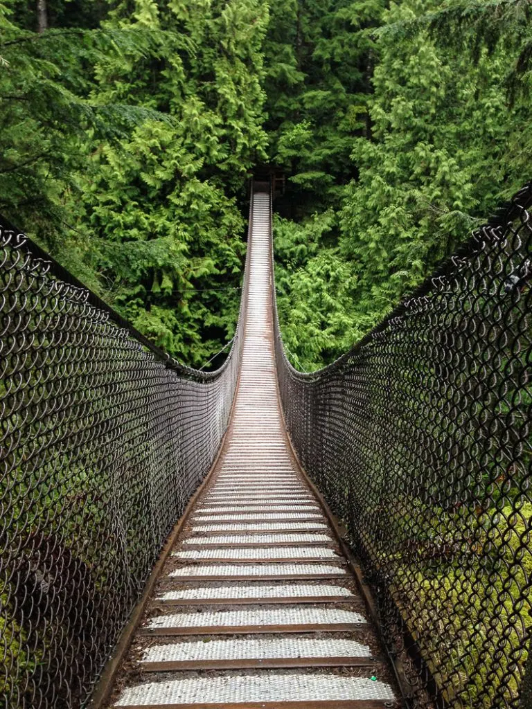
Lynn Canyon is my pick for the best hike in Vancouver to take visitors from out of town since it’s short and easy. There’s tons to see including a suspension bridge, waterfalls, rainforest, boardwalk, a deep canyon and a gorgeously clear pool. It’s also a great place for a short hike on a rainy day or after work when all the tourists stay away. Be sure to explore upstream of the suspension bridge to see 30 foot pool and downstream to see Twin Falls. Lots of DIY loops are possible.
Distance: 1.5+km round trip Elevation gain: 70m Time needed: 1-1.5 hours Difficulty: easy. Best time to go: All year. Trail Info: See Vancouver Trails, and Outdoor Vancouver. Bring a copy of the trail map so you can plan your route. How to get there: It’s a 30 minute drive from Vancouver or accessible by bus 227 or 228.
So there’s my list for the 10 best hikes near Vancouver. Which ones do you agree with? Which Vancouver hikes would be on your list? Tell me in the comments.
More Vancouver Hikes:
- Most Instagrammed Hikes in Vancouver
- The Worst Hikes in Vancouver (And Where to Hike Instead)
- The Best Vancouver Hiking Books
- Where to Go Snowshoeing in Vancouver
- Alternatives to the Grouse Grind: Steep Workout Hikes Near Vancouver
- 35 Vancouver Hikes You Can Get to on Transit
- Waterfalls Near Vancouver You Can Hike To
- 15 Unusual Hikes Near Vancouver
- The Best Hikes in Whistler: A Guide to All the Trails
- The Best (and Worst) Backpacking Meals Reviewed - December 16, 2025
- My Favourite Hiking Gear of 2025 - December 9, 2025
- Best Insulated Skirts For Hiking and Snowshoeing in 2026 - December 5, 2025

Ben
Sunday 9th of July 2023
Thanks!! Are these still the top ten five years later?!?!
Taryn Eyton
Sunday 9th of July 2023
I haven't revisited this post in awhile, but perhaps its time for an update. Stay tuned!
Pansy
Saturday 27th of October 2018
Thank you for the list! These hikes look amazing and I have bookmarked this page for future reference! My husband is actually from Vancouver and we've gone back to visit several times, but I've only done Lynn Canyon!
nicky
Saturday 27th of October 2018
Awesome! i moved to Van recently and always looking for hiking inspo. Thanks for sharing!
the Curious Pixie
Saturday 27th of October 2018
So many beautiful hikes. I love getting out in the outdoors and surrounded by nature. Canada is on our list of destinations next year. Will definitely bear these in mind.
Josy A
Friday 26th of October 2018
I mentioned this on twitter already, but this is a fantastic list Taryn! I really wish I had found your blog when we first arrived in Vancouver! I could have done all the best hikes first! :D