

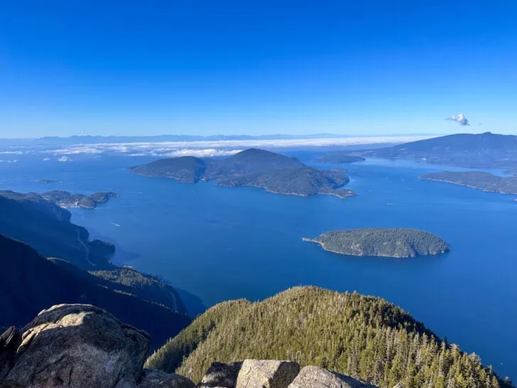
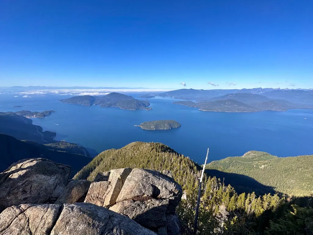
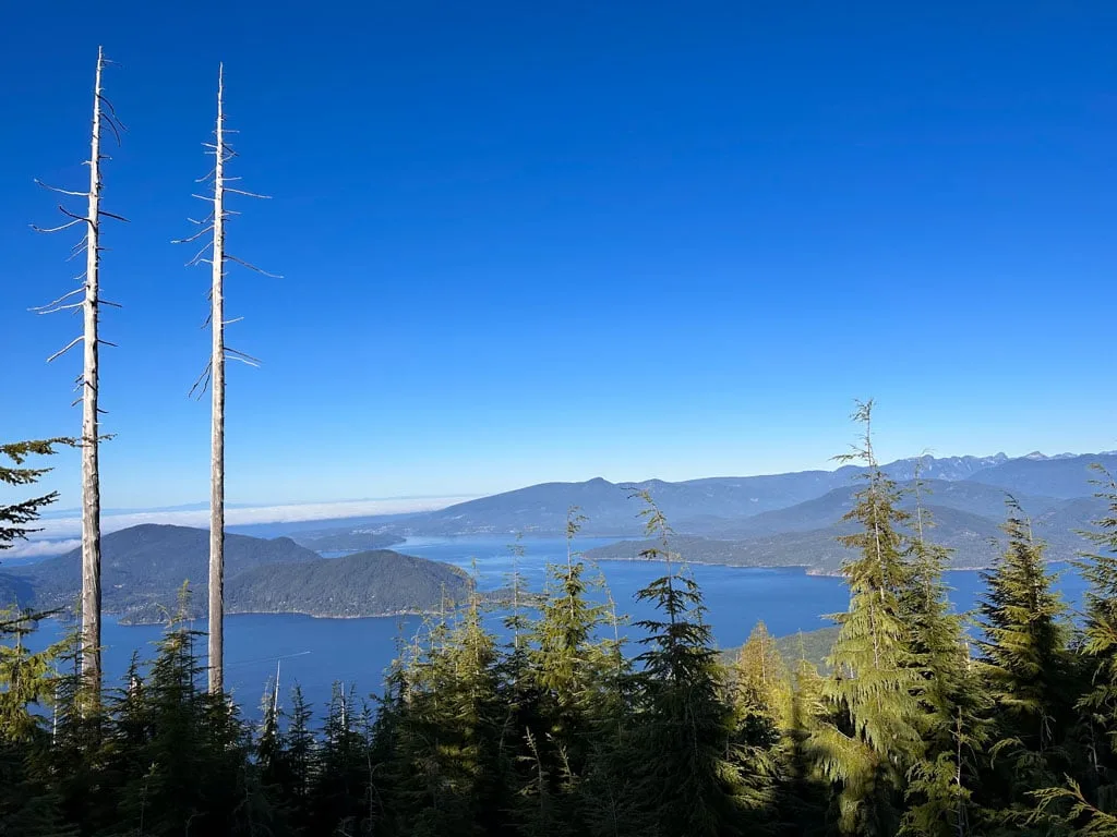
With incredible panoramic views of the waters of Howe Sound dotted with small islands, the St. Mark’s Summit trail is one of Vancouver’s best hikes. I also love the gorgeous forest on the way to the peak.
I’ve hiked this trail countless times and the view at the end always amazes me. While the first half of the trail is fairly straightforward, the second half is rough and if you aren’t paying attention, you might get off track.
Since I’ve hiked this trail so many times (and it’s in my book, Backpacking in Southwestern British Columbia), I can help you plan the best route to St. Mark’s Summit and give some tips on how to find all the viewpoints.
In this guide, I’ve got everything you need to know to hike to St. Mark’s Summit. It includes:
- Trail stats including how long it takes, difficulty, best time to go, and more
- Tips for hiking to St. Mark’s Summit including what to pack and how to prep
- Trail map that shows all the key locations I mention in this post
- How to get to St. Mark’s Summit – detailed driving directions
- Step-by-step hiking directions so you know what to expect
- Winter hiking and snowshoeing tips for St. Mark’s Summit
This is a sensitive wilderness area. Learn how to Leave No Trace to keep the wilderness wild. Make sure you are prepared by bringing the 10 Essentials. Get ready for adventure with this checklist of things to do before every hike.
Hey there: Some of the links in this post are affiliate links, which means I earn a small commission at no cost to you. Thanks for your support. -Taryn

St Marks Summit Trail Stats
Here are the basic stats that you need to know about hiking the St. Mark’s Summit Trail:
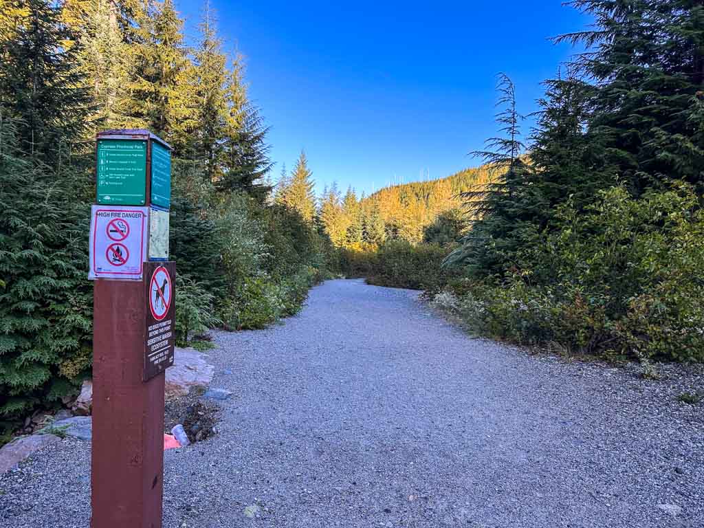
Location: The St Marks Summit Trail is located on the southern part of the Howe Sound Crest Trail in Cypress Provincial Park in West Vancouver. It starts next to the lodge at Cypress Mountain Ski Resort.
Duration: 3.5 to 4.5 hours
Distance: 11.5 km
Difficulty: Moderate
Elevation Change: ~600 m of elevation gain
Best Time to Go: Mid-June to early November when the trail is snow-free. Pick a clear day to enjoy the views. The trail has significant avalanche danger in the winter (see the snowshoeing section below.)
Day Passes: As of 2024, you do NOT need a BC Parks day pass to hike to St. Mark’s Summit. A few years ago, you did need a day pass for Cypress Provincial Park, but that hasn’t been the case since 2021. Read my guide to BC Parks day passes for more info.
Toilets: There are toilets in the Black Mountain Lodge and Cypress Creek Lodge next to the parking lot. There are no toilets on the trail.
Dogs: Dogs are allowed on this trail but BC Parks rules require them to be on a leash. Use caution near the viewpoints – a dog nearly died here a few years ago when it slipped out of its harness and went over the edge of the cliff.
Bears: This area has black bears. Hike in a group, make noise, and carry bear spray.
Indigenous Context: The St Marks Summit Trail is in the traditional territory of the Skwxwu7mesh (Squamish), xʷməθkʷəy̓əm (Musqueam), and səl̓ilwətaɁɬ təməxʷ (Tsleil-Waututh) Nations.
What’s with the name? Sometimes spelled “Saint Mark’s Summit”, the peak got its name because for many years St. Mark’s Anglican Church operated a summer camp in Lions Bay below the mountain.

Tips for the St Marks Hike
- Check the weather before you go. City weather forecasts are useless in the backcountry. Use an algorithmic spot forecast for Saint Mark’s Summit like Spotwx. (Read my guide to weather apps for hikers for more tips.)
- Check trail conditions online using AllTrails or Instagram. This is especially important in the spring or fall when the trail can be icy or snowy.
- Bring a rain jacket and warm clothing just in case. It can be much colder, windier, and rainier in the mountains than in the city.
- Wear trail running shoes or hiking boots. The trail is very rocky and rooty in places. It can also be muddy. Regular running shoes don’t have enough grip or ankle support.
- Bring water and snacks. It is not safe to drink the water from the creeks without boiling, filtering, or treating it because you never know if people or animals have pooped or died upstream. Gross! (I use a Katadyn BeFree to filter water.)
- Bring the 10 Essentials. These are key safety items you should have on every hike.
- Pack out all your garbage. There are no garbage cans here so you must take your garbage home with you. Leaving it on the trails attracts animals.
- Bring a camera – it’s gorgeous and you will want tons of pics! But leave the drone at home. Drones aren’t allowed in BC Parks without a commercial filming permit.
- Be Bear aware: There are black bears in this area. Hike in a group, make noise, and carry bear spray. Read my bear safety tips for more info.
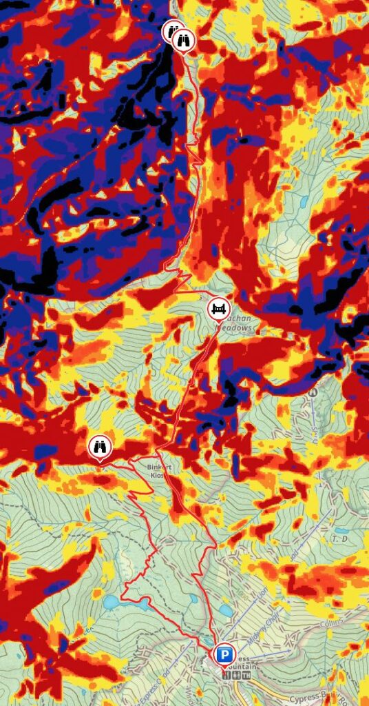
St Marks Summit Trail Map
While the first half of the trail is easy to follow, the second half is rough and can get confusing. Pay close attention to trail markers, especially on the switchbacks. There have been lots of Search and Rescue call-outs for hikers who accidentally went off-trail. I recommend using a GPS mapping app like All Trails+ Gaia GPS to stay on track.
I made a map of the St Mark’s Summit Trail for you using Gaia GPS. Click through to zoom in (and download the GPX track).
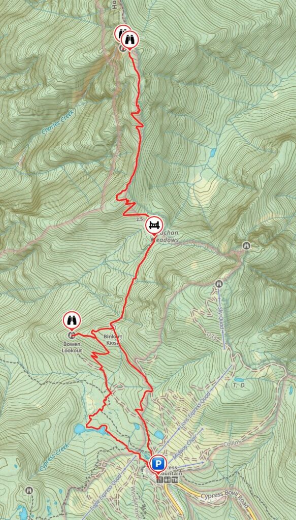
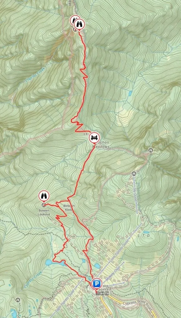
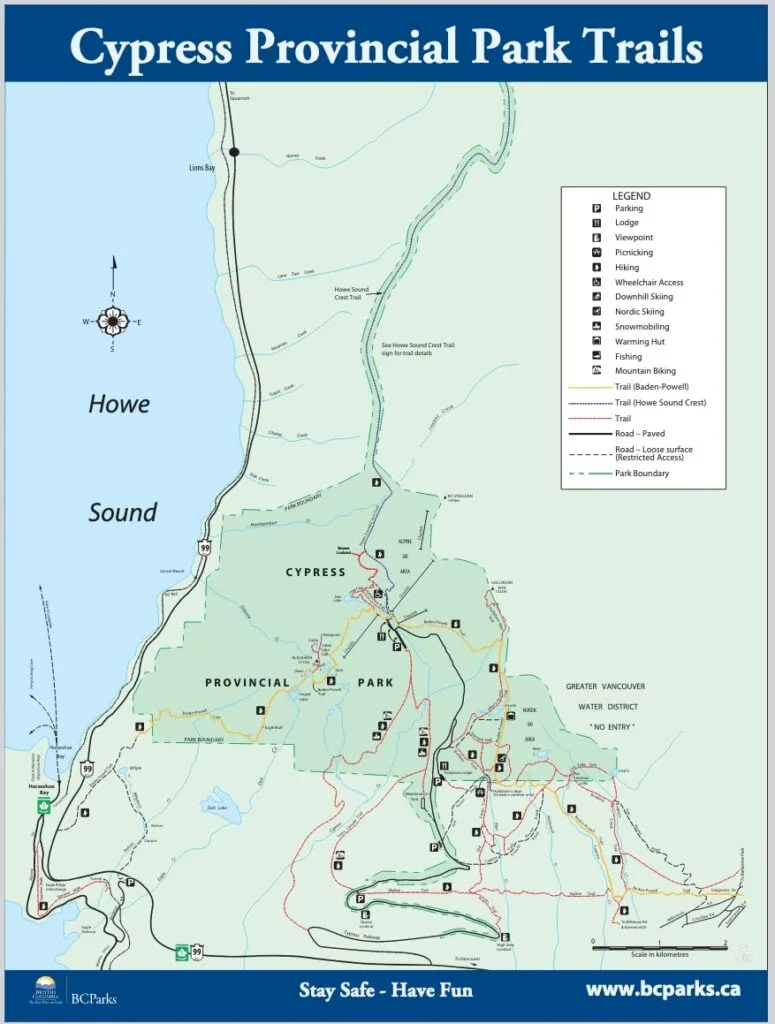
You can also use the Cypress Provincial Park map, but it isn’t very detailed so I don’t find it very helpful.

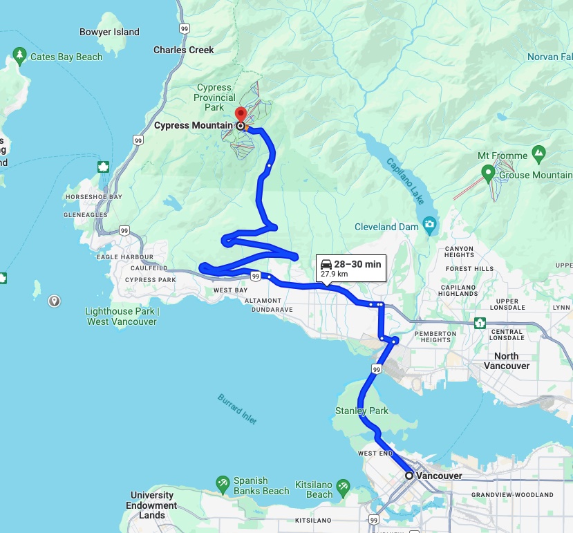
St Marks Summit Driving Directions
The trailhead is about 45 minutes from Vancouver. There is no public transportation to the trailhead so you will need to drive yourself. You can also take a taxi or an Uber, but it can be expensive and sometimes drivers won’t want to come pick you up afterwards.
Here are step-by-step driving directions to the St Mark’s Summit trailhead:
- From Vancouver, go north over the Lions Gate Bridge.
- Follow signs along Marine Drive and Taylor Way to get onto Highway 1 westbound.
- Take Exit 8 onto Cypress Bowl Road.
- Follow Cypress Bowl Road up the mountain to its end at the Cypress Creek Lodge. There is lots of parking in the huge lot.
Here are Google Maps driving directions.
St. Marks Summit Hiking Directions
The route to Saint Mark’s Summit is mostly on the Howe Sound Crest Trail. However, there are a few different options for starting the hike.
My recommended route below adds about 0.5 km more distance than the most direct route. But it includes a walk through a unique subalpine meadow and a great viewpoint. On the way back, my route takes the most direct way to the parking lot.
To help keep you on track, here is a brief overview of the key distances on the hike to St. Mark’s Summit:
| Location | Distance | Elevation |
|---|---|---|
| Parking Lot | 0 km | 920 m |
| Lodge/Start of Yew Lake Loop Trail | 0.2 km | 925 m |
| Junction with Black Mountain Trail | 0.5 km | 935 m |
| Junction with Old Growth Trail | 1.2 km | 940 m |
| Junction with gravel road | 1.4 km | 955 m |
| Junction with HSCT West | 1.7 km | 950 m |
| Junction with Bowen Lookout Trail | 2.3 km | 1040 m |
| Bowen Lookout | 2.5 km | 1005 m |
| Junction with Bowen Lookout Trail | 2.7 km | 1040 m |
| HSCT East/West Junction and Info Kiosk | 3 km | 1080 m |
| Strachan Meadows Bridge | 3.9 km | 1080 m |
| Start of ridge top section | 4.8 km | 1195 m |
| St Mark’s Summit Main Viewpoint | 6.3 km | 1345 m |
| St Mark’s Summit Lower Viewpoint | 6.4 km | 1325 m |
| St Mark’s Summit Main Viewpoint | 6.5 km | 1345 m |
| End of ridge top section | 8.1 km | 1195 m |
| Strachan Meadows Bridge | 9 km | 1080 m |
| HSCT East/West Junction and Info Kiosk | 9.9 km | 1080 m |
| Trail leaves gravel road | 10.6 km | 1030 m |
| Trail joins gravel road | 11 km | 975 m |
| Trail leaves gravel road | 11.2 km | 945 m |
| Bottom of ski hill/lodge | 11.4 km | 920 m |
| Parking lot | 11.6 km | 920 m |
Trailhead to the HSCT Junction Info Kiosk
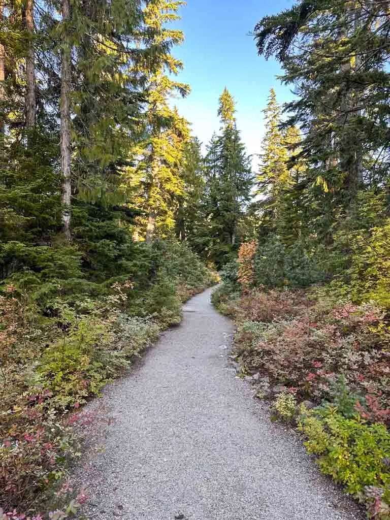
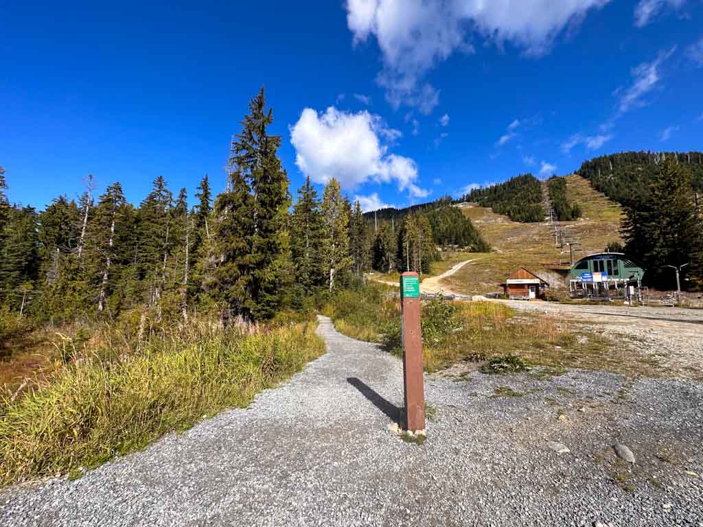
To start the hike, walk through the parking lot and past the lodge. Depending on when you visit, the restaurant and cafe here may be open. Just past the end of the lodge, go straight onto the Yew Lake Trail leading into the trees. A minute later, follow the trail as it goes around the bottom of the ski lift and continues into the forest.
Ignore a trail heading left a few minutes later. It goes uphill to Black Mountain, Cabin Lake, and Eagle Bluffs. Continue straight. The trail here is part of wheelchair accessible loop so it is wide and flat. The babbling waters of Cypress Creek are to your left.

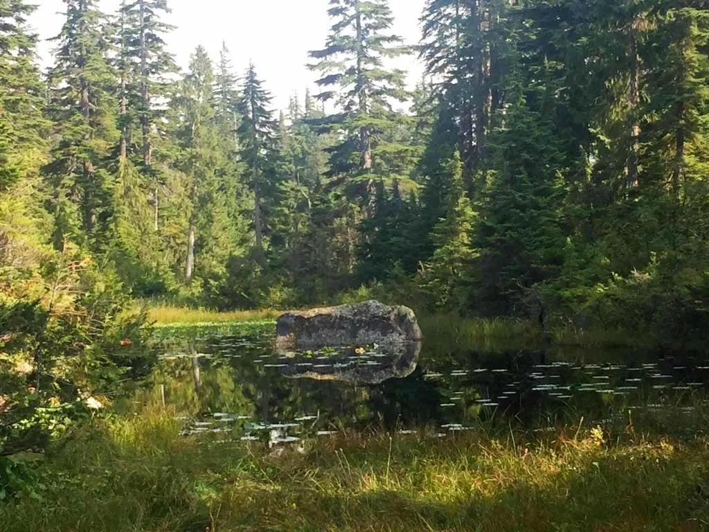
A few minutes later, arrive on the shores of marshy Yew Lake, which is more of a pond. Stay on the trail as it goes around the lake and then curls right into a swampy meadow with some small ponds. Ignore a trail going right – this is the other half of the Yew Lake Trail.


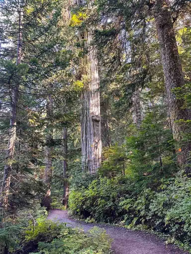
Instead, to straight onto the Old Growth Trail. Walk back into the forest, which includes some huge Old Growth trees. At a fork, you can go either right or left – they meet up again less than 100 m later. A minute after the two trails meet up, emerge onto an old gravel road. This road is also known as the Howe Sound Crest Trail West (HSCT West).

Turn left and follow the road for a few minutes until the road ends and a trail goes right. Head uphill on switchbacks. This is the first real climb of the hike and it is steep in places. About 0.6 km later after gaining about 90 m, reach another junction.
Turn left and follow the trail gently downhill to Bowen Lookout. There is a great view down to Howe Sound, Bowen Island, and the Sunshine Coast. The trees are growing up a little bit and starting to block the view, but it’s still a great place to take a break.

When you are ready to continue, retrace your steps back to the HSCT West. Turn left and follow it uphill for a few minutes to a junction. There is a large info kiosk sign here with a trail map. The HSCT East heads downhill to the right.

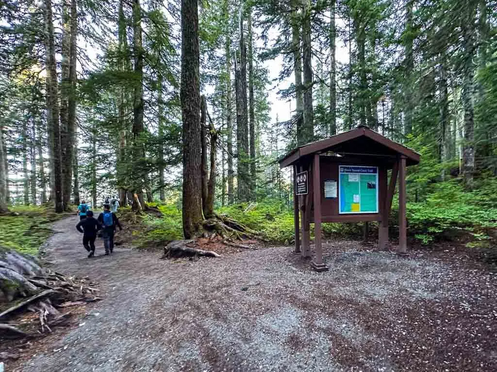
HSCT Junction Info Kiosk to Strachan Meadows
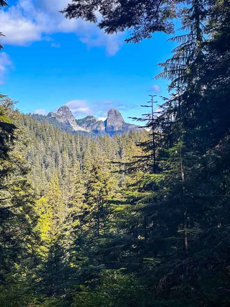
From the info kiosk, turn left onto the main Howe Sound Crest Trail. There is a brief gap in the trees here with a distant view of the Lions.

Follow the trail down a small hill. The trail curls north and stays fairly flat for the next kilometre. Keep an eye out for some huge trees through here.

You’ll cross two creek gullies. In the early season, these will be wet, but they mostly dry up by the end of summer. When you pass through these gullies notice how there are bushes here instead of trees. That’s because avalanches roar through here every winter and spring.
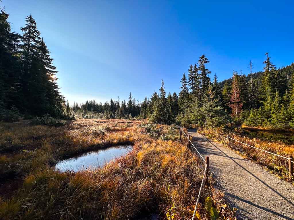
About 3.9 km from the start, reach a bridge in an open area known as Strachan Meadows. If you need water, this is the only reliable place on the hike to get it. But be sure to filter or treat it first as it is not safe to drink.
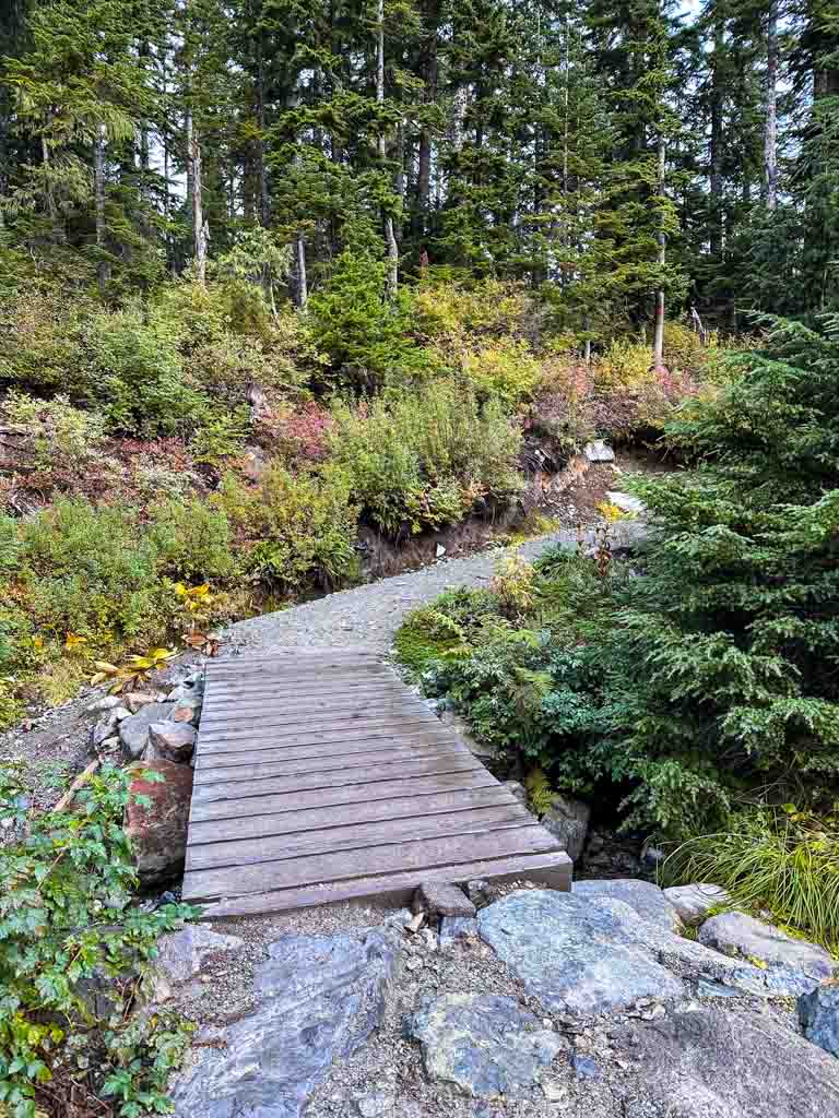
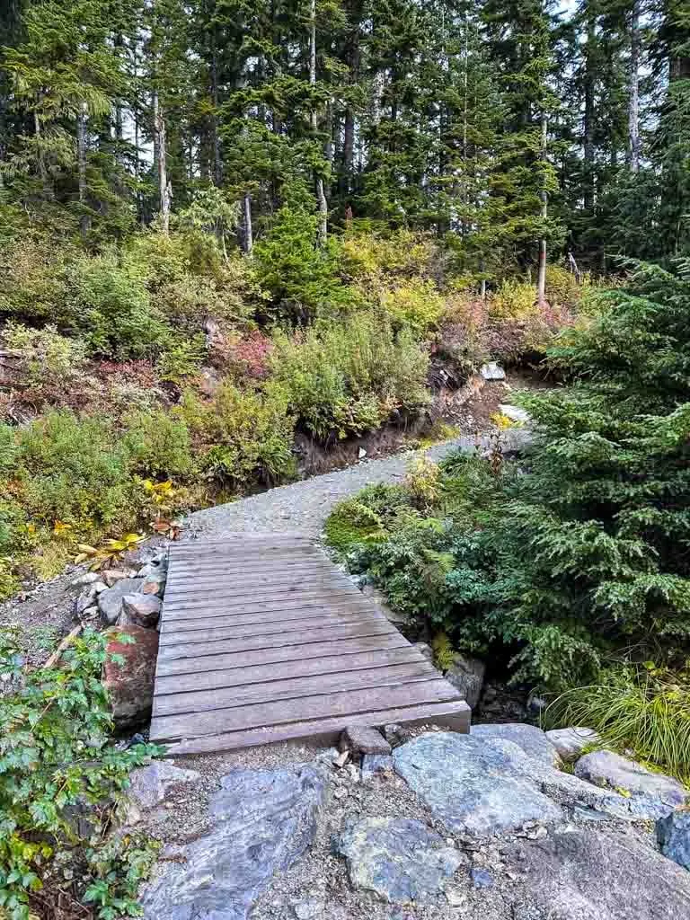
Strachan Meadows to the Summit
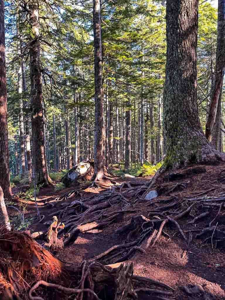
The first few minutes after the bridge continue along on the same wide and well-maintained gravel trail you have been following since the beginning. The trail heads up a few switchbacks and eventually, the smooth gravel disappears and the trail becomes very rough, rooty, rocky, and eroded.

BC Parks has slowly been working on upgrading this trail for over 10 years, but due to chronic underfunding, they are only able to fix a few dozen meters of trail per year. And the remaining trail keeps getting more and more eroded. If you want to help make a change, write to your MLA to ask them to increase the BC Parks budget and focus on trail maintenance projects.
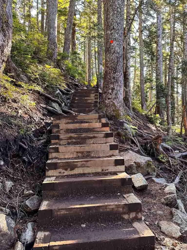
Pay close attention to trail markers as you work your way up the deteriorating trail. Many hikers have gotten lost in this section when they accidentally went off-trail. About 4.8 km from the trailhead, the trail reaches the top of a ridge.
The next few minutes are almost flat as you walk through the forest on a broad ridge top. But about half a kilometre later the trail starts to climb again, sometimes with the help of wooden stairs.

About 6 km from the start the trail starts to flatten out and you go through some mucky areas and past some tiny ponds. There are some sections of boardwalk to keep you out of the mud, but in other places, its unavoidable.

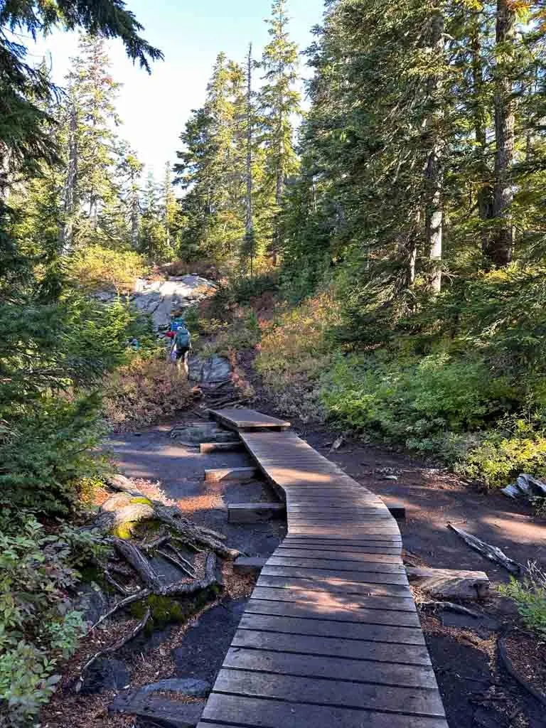
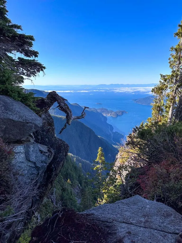
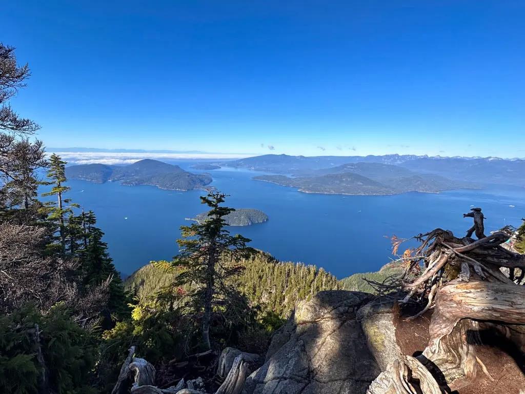
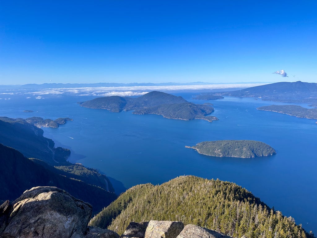
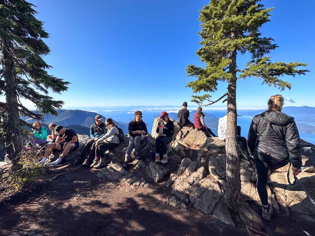
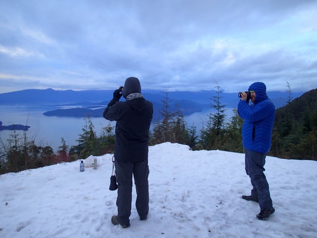
Reach the main viewpoint 6.3 km from the trailhead. You can scramble up onto the rock outcropping to the left of the trail to get a great view of Howe Sound and its islands. You can also look across to a clifftop perch jutting out to the north and slightly lower. That’s the lower viewpoint.

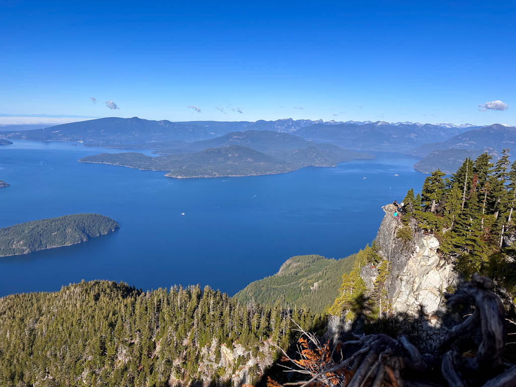

To get to the lower viewpoint, continue on the main trail for a few more minutes, then follow a faint trail to the left. This trail is not officially maintained and in a couple of places is very steep. Be careful as you follow it down to the viewpoint. There are actually several trails here so choose the most travelled and safest options.

You’ll get a panoramic view from the lower viewpoint, but be careful as the drop-offs are deadly. A dog nearly died here a few years ago when it slipped out of its harness. And please make room for others at the viewpoint. It might seem like a great place to chat and have lunch, but you’ll be preventing other people from enjoying the view if you sit down here.

When you are done, make your way back to the main trail. Some trails from the lower viewpoint go north to connect with the HSCT on its way to Unnecessary Mountain and beyond to the Lions and eventually Porteau Cove. Make sure you are going south if you want to get back to the parking lot!
Note: None of the viewpoints are at the true peak of St. Mark’s Summit. It’s about 20 minutes higher in the trees to the east of the trail. There are a few faint boot paths through the trees to get there, but the summit itself is in the forest with no views, so few people bother.
Summit Back to the Trailhead
To get back to the trailhead, retrace your steps past the main viewpoint, down past the mucky ponds, across the ridge, and down the switchbacks. Continue on the smoother trail over the bridge in Strachan Meadows, and then through the gullies in the flat section.
Arrive back at the Info Kiosk Junction 9.9 km into your hike. You can follow your earlier route back to the parking lot, but instead, I recommend a more direct route.
From the kiosk, go straight on the HSCT East (don’t turn right onto the HSCT West towards Bowen Lookout). Follow the trail downhill. Within a few minutes, it turns into a gravel road. A few hundred metres later, look for a sign pointing to a trail going right. You can stay on the gravel road and follow it onto a ski run, but the trail is much nicer.
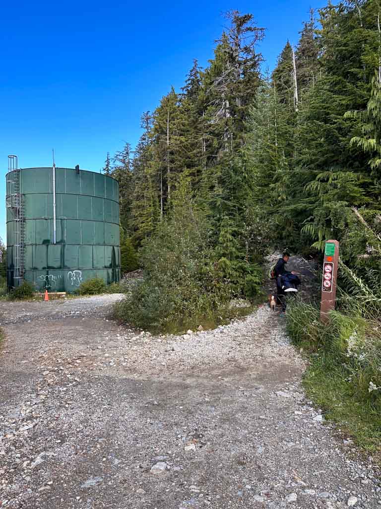
Turn right onto the trail and take it downhill into a beautiful forest. The trail emerges onto another gravel road next to a huge green water tower a few minutes later. Follow the road (which is actually a ski run) downhill. At an open area on your right about 200 m later, you can choose to stay on the ski or go right onto a forest trail one last time.
The ski run route and the forest trail route meet up in front of the lodge within a few minutes. Follow the path along the side of the lodge to head back to the parking lot and finish the hike.

Winter Hiking and Snowshoeing to St Mark’s Summit
With plowed road access to the trailhead thanks to its location at Cypress Mountain ski area, it can be tempting to think that St Mark’s Summit makes a great snowshoeing destination.
However, it is a much more challenging and potentially dangerous trip in winter. The trail markers are harder to see, so it is easy to get off track. You will need to be comfortable with navigation. I use All Trails+ or Gaia GPS.
Each winter there are several Search and Rescue call-outs for lost skiers and snowshoers in this area. It has lots of steep cliffs and terrain traps. Several people have died when they got lost in the snow and then either succumbed to hypothermia or fell off cliffs looking for a way back to the trail.
The trail also has dangerous avalanche terrain, especially between the junction of the two branches of the HSCT and the bridge in Strachan Meadows. Right after the junction, the trail passes through several avalanche chutes. Each winter, avalanches come roaring down these chutes, right across the trail. One year a friend of mine was crossing one of these chutes in the spring and was knocked down by a small avalanche. Thankfully the outcome wasn’t worse!
The first part of the trail up to Bowen Lookout makes a great snowshoe trip since it isn’t in avalanche terrain (and it’s on my list of the best places to snowshoe near Vancouver).

But you should not attempt the trail to St Mark’s Summit past Bowen Lookout in winter unless you have winter navigation experience and avalanche training. Check the avalanche forecast before your trip.
The trail to Saint Mark’s Summit is one of the most popular trails in Vancouver, which isn’t surprising since it has such an amazing view. If you have questions about the trail, ask them in the comments. I’d love to help.
READ NEXT:
- The 10 Best Hikes in Vancouver – A Local’s Guide
- BC Parks Day Passes 2024 – Everything You Need to Know
- Where to Go Snowshoeing in Vancouver
- Get my book: Backpacking in Southwestern British Columbia
- The Best Hikes in Squamish, BC (From a Local)
- The Best Hikes in Whistler: A Guide to All the Trails


- Best Sun Hoodies for Hiking - June 3, 2026
- Lower Stein Valley Trail Hiking and Backpacking Guide - May 27, 2026
- The Best Things to Do in Vernon, BC - May 21, 2026