
One of my favourite places to snowshoe in Whistler is a loop along the banks of the Cheakamus River using the Farside and Riverside Trails. You’ll snowshoe through the gorgeous snowy forest, get views of the river canyon, and cross a spectacular suspension bridge. The Cheakamus River snowshoe trail is rated easy to moderate, so it’s good for beginners.
As a local, the Cheakamus River snowshoe trails are one of my picks for the best places to snowshoe in Whistler. They usually aren’t very busy, so you might even get the trails yourself.
In this post you’ll find:
- A hiking map of the Whistler Interpretive Forest showing the Cheakamus River snowshoe trails
- Detailed driving and transit directions to the trailhead
- Turn-by-turn snowshoeing directions for my recommended loop along the Cheakamus River
Psst: Looking for a full list of Whistler activities? Check out my list of the best things to do in Whistler in winter for non-skiers.
This is a sensitive wilderness area. Learn how to Leave No Trace to keep the wilderness wild. Make sure you are prepared by bringing the 10 Essentials. Get ready for adventure with this checklist of things to do before every hike.
Hey there: Some of the links in this post are affiliate links, which means I earn a small commission at no cost to you. Thanks for your support. -Taryn
Cheakamus River Snowshoe Trail Basics
The Cheakamus River area in Whistler’s Cheakamus Crossing neighbourhood has lots of great trails. It’s a good place to go snowshoeing in Whistler since it has easily accessible parking (or you can get there by bus). The trails have low avalanche risk too.
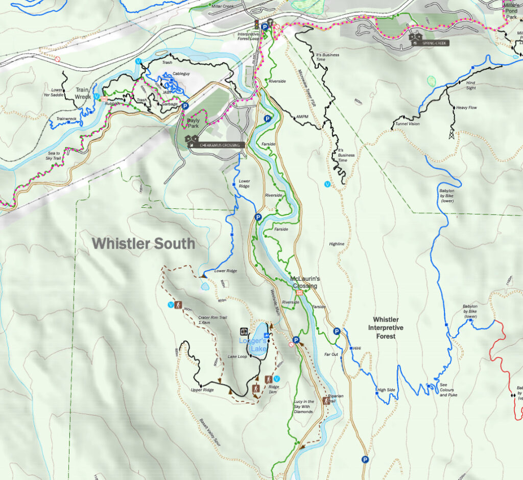
There is a huge network of trails in the area, which is part of the Whistler Interpretive Forest. But I’ve put together a great loop route for you that follows the banks of the Cheakamus River on the Farside and Riverside Trails. In the middle, you’ll cross a beautiful suspension bridge.
Distance: 6.5 km
Duration: 2-3 hours
Avalanche Hazard: Low – the trail does not pass across or below any steep slopes
Elevation Gain: 250 m
Difficulty: easy/moderate
Dogs: Allowed, leash optional
The Cheakamus River Snowshoe Trails are located on the traditional territory of the Squamish, Lil’wat, and St’at’mic Indigenous peoples. In Squamish, Cheakamus Lake (upstream from these trails) is called Tseearkamisht, which means “people who use the cedar rope fishing net”. The Squamish Nation has identified the Cheakamus watershed as a Wild Spirit Place for its cultural, spiritual and ecological significance.
To learn more about the Indigenous context of the area, visit the Squamish Lil’wat Cultural Centre in Whistler.
READ NEXT: Snowshoeing Safety: 14 Ways to Get into Trouble and How to Prevent Them
Cheakamus River Trail Map
In the summer, hiking and biking along the Cheakamus River are easy. However, in the winter there are few trail markers so watch carefully to make sure you stay on the trail.
I recommend using the Gaia GPS app. The premium version has detailed maps of this area that make it really easy to stay on track.
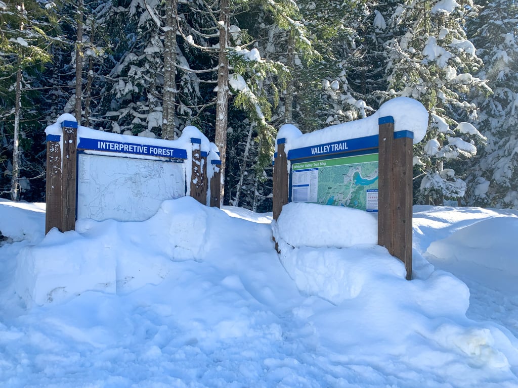
It’s also a good idea to bring a copy of the Whistler Interpretive Forest Trail Map. It shows all of the trails in this part of Whistler. Keep in mind that the map is intended for summer hiking and biking so winter navigation may be a bit trickier.

How to Get to the Cheakamus River Snowshoe Trails
Click here for Google Maps driving directions to the Cheakamus River snowshoe trailhead.
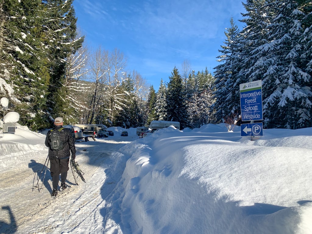
From Squamish: Head north on Highway 99 (Sea to Sky Highway). In Whistler, turn right at the first traffic light onto Cheakamus Lake Road. Make your first left into the Whistler Interpretive Forest parking lot.
From Whistler: Head south on Highway 99 (Sea to Sky Highway). Just before leaving Whistler, turn left at the traffic light onto Cheakamus Lake Road. Make your first left into the Whistler Interpretive Forest parking lot.
Parking: Parking is free, but the parking lot may not be well-plowed so bring a shovel in case you have to dig yourself a parking spot. There is an outhouse here.
By bus: From Whistler village, take the 10 or 20 bus to the first stop on Cheakamus Lake Road in the Cheakamus Crossing neighbourhood. The trailhead and parking lot are across the street.

Join: Snowshoeing in Vancouver Facebook Group
Cheakamus River Trail Snowshoeing Directions
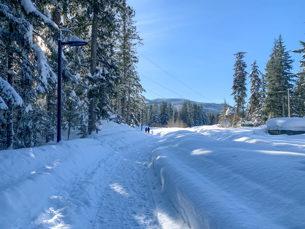
Your snowshoe hike starts on the Valley Trail, a paved walkway that may be plowed, so it’s best to carry your snowshoes for the first few minutes.
Find the start of the Valley Trail at the edge of the parking lot close to Cheakamus Lake Road. There is a large cluster of trail maps and info signs here. Go south on the Valley Trail, paralleling Cheakamus Lake Road.


After a few minutes, arrive at an unplowed road heading left. This is the Cheakamus Lake Forest Service Road. Put on your snowshoes and follow the road to the left (ignoring a branch of the road going right to a bridge). Just after the branch, look for the Farside Trail descending to the right towards the river.

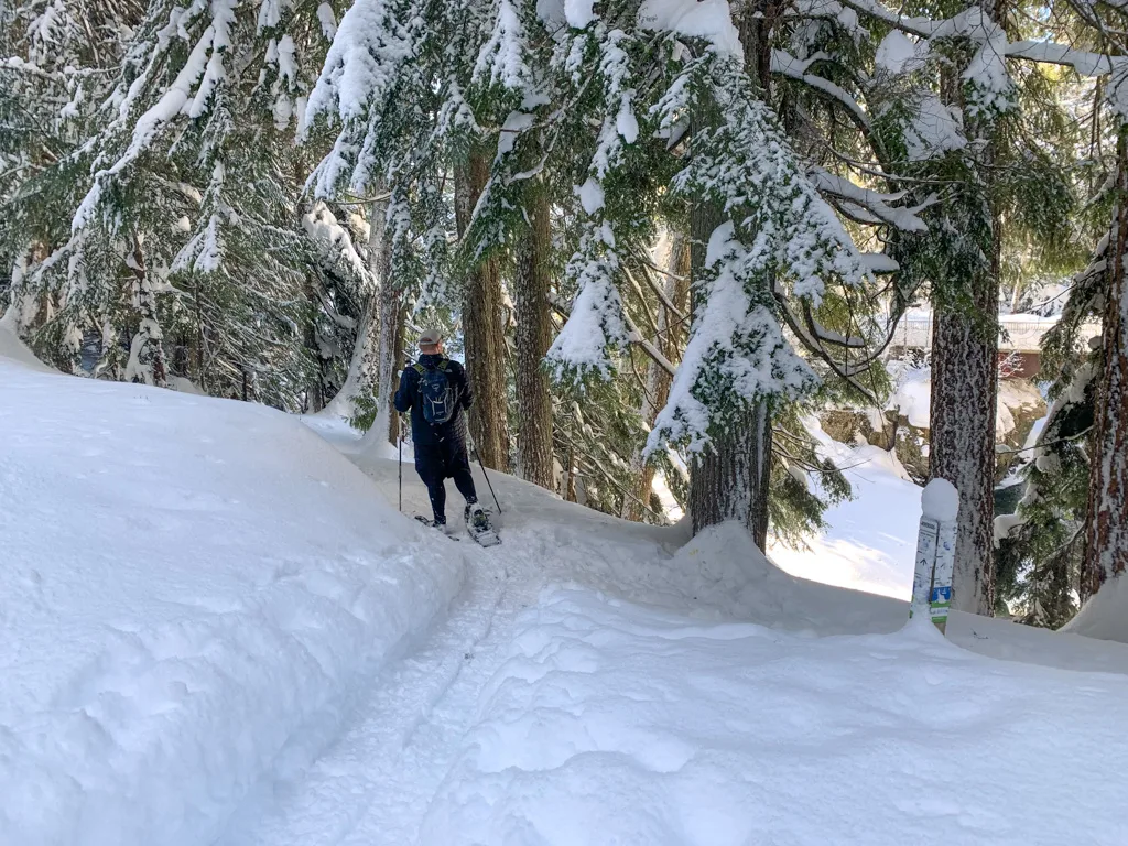
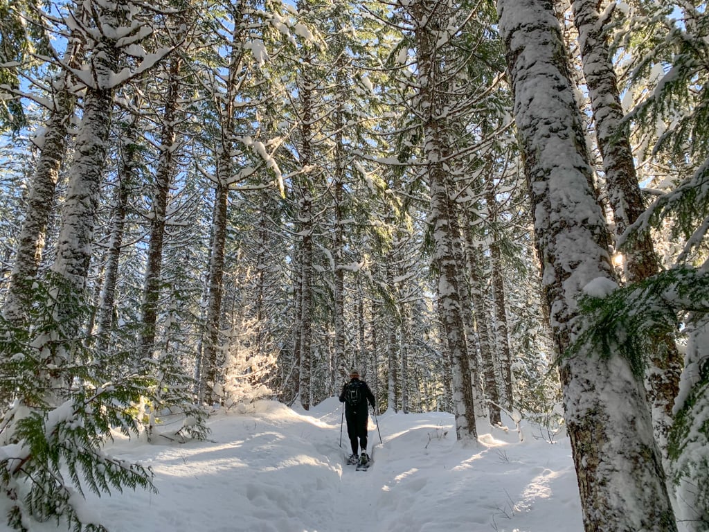

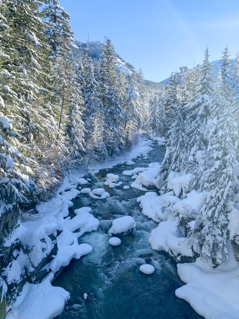
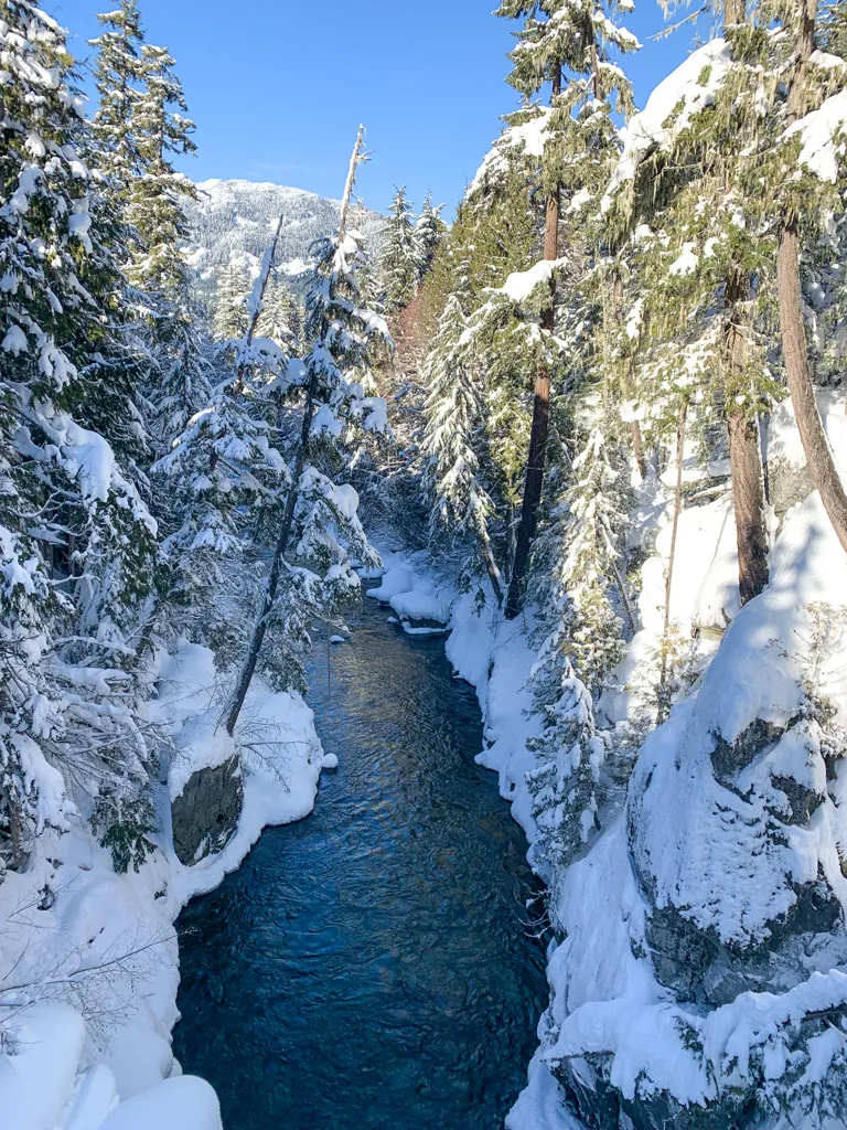
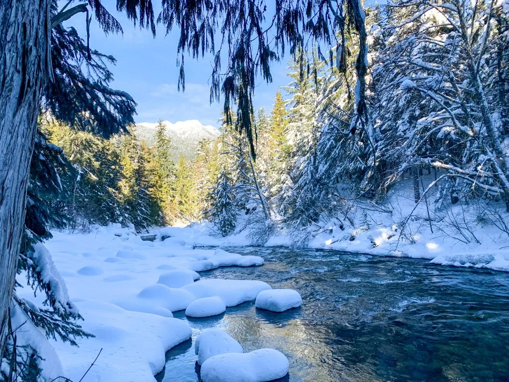
Snowshoe along the Farside Trail as it follows the river bank. The trail undulates through the forest, with lots of small hills. There are no markers on the trees, but for the most part, the trail is easy to follow.
There are a few peek-a-boo views of the river canyon, but be careful near the edge as the slope is steep. In a few places, trails to your left lead back to the Cheakamus Lake Forest Service Road.
READ NEXT: Where to Go Snowshoeing in Whistler
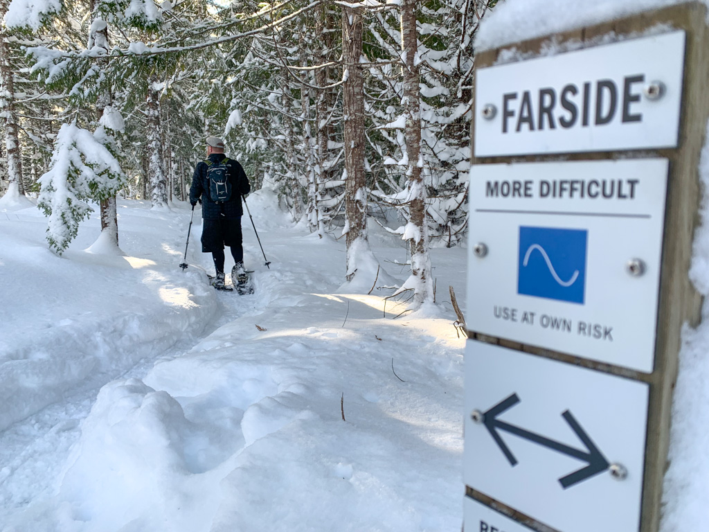
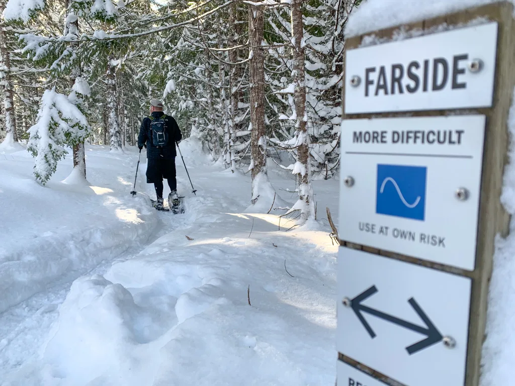
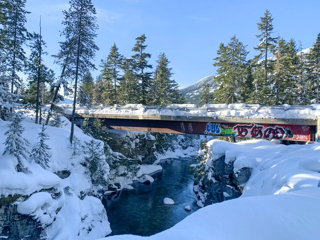
Stay on the Farside Trail until you reach McLaurin’s crossing, about 3 km from the start. The fabulous suspension bridge here is named after long-time Whisterlite Don McLaurin who helped develop many trails in Whistler, including the ones you will snowshoe today.

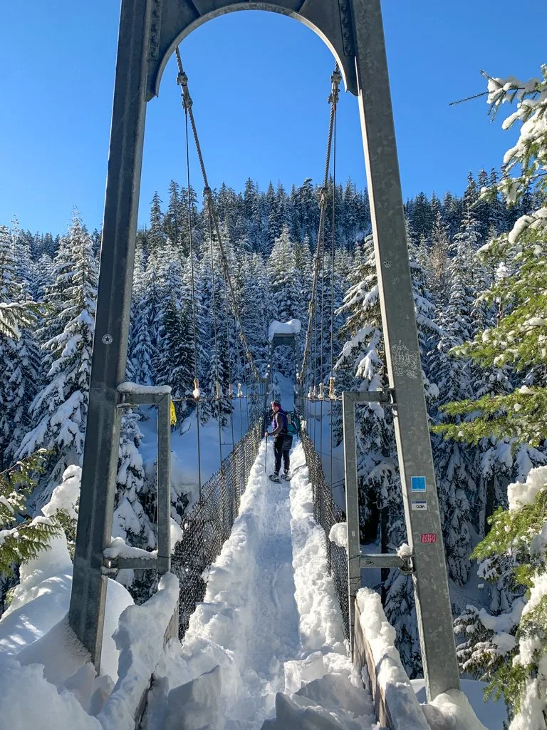
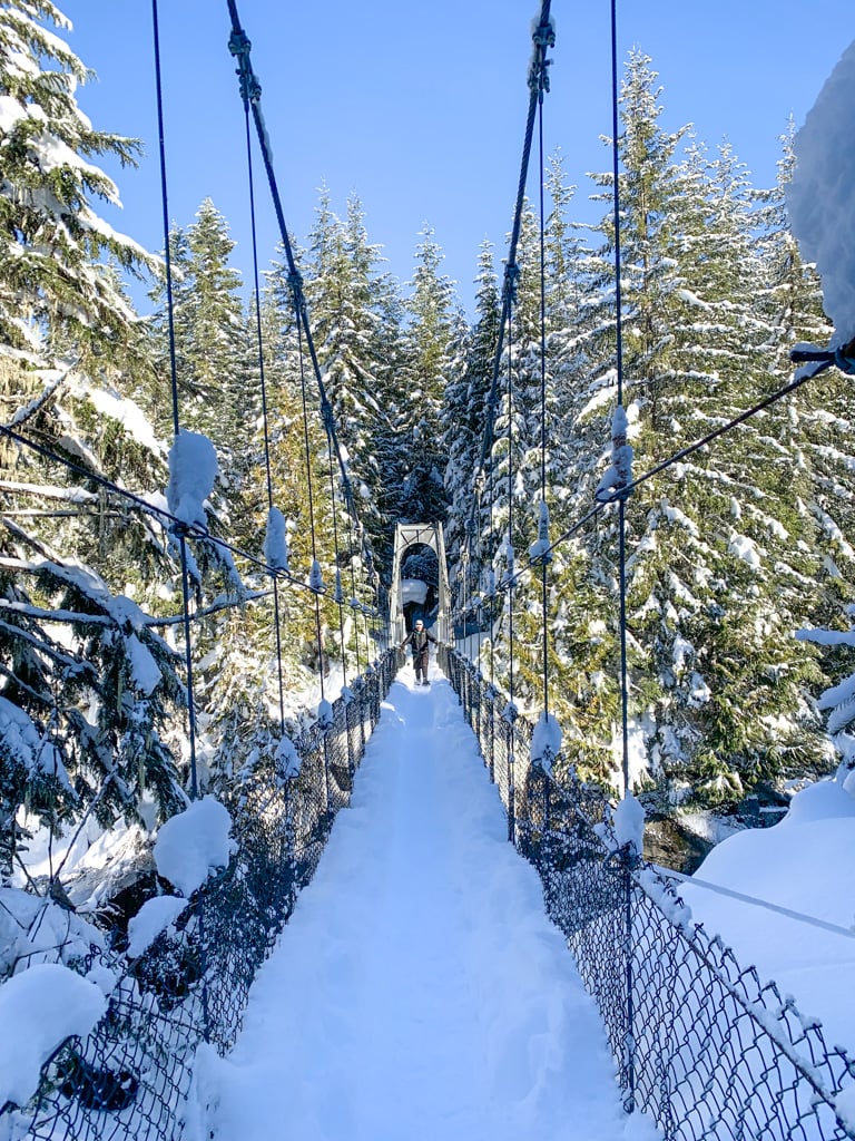
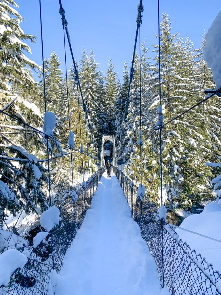
Carefully cross the suspension bridge. It can get heavily loaded with snow, which means the railings won’t be as high as usual.


Reach a junction on the other side of the bridge. Turn right to follow the Riverside Trail.
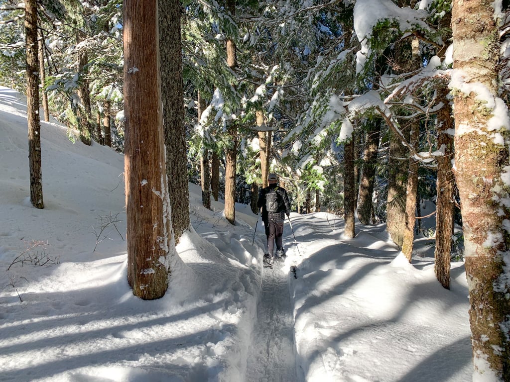
Leaving the bridge, you’ll tackle the biggest hill on your snowshoe hike of the Cheakamus River trails. Once you reach the top, the trail snakes downhill steeply on a set of switchbacks as it heads towards river level. The trail goes up and over several small hills but stays near the Cheakamus River.
Ignore a few side trails to the left – they lead to the Cheakamus West Forest Service Road. When in doubt, choose the right-hand branch closest to the river. In some cases, this will take you on short dead-end trails to canyon bottom viewpoints.


About 4.5 km into your snowshoe hike you’ll start to see signage warning you to stay on the trail and away from construction on the nearby road. A few minutes later, arrive at the road and immediately turn right to head down the hill onto a continuation of the Riverside Trail.
Continue alongside the river. Around 5.5 km, your route will join the unplowed Cheakamus West Forest Service Road. Snowshoe along the road for about one hundred meters, then turn right to get back onto the Riverside Trail.
A few minutes later, the trail goes through an unplowed parking lot. Keep snowshoeing along the Riverside Trail as it heads back into the forest by the river.
At the 6 km mark, the trail meets the Cheakamus West Forest Service Road again. Turn right and walk along the road as it crosses a bridge over the Cheakamus River (next to the bridge on the paved road). On the other side, turn left onto the Cheakamus Lake Forest Service Road, then right on the Valley Trail to retrace your steps back to the parking lot.

Join: Snowshoeing in Vancouver Facebook Group
So that’s everything you need to know to complete the Cheakamus River snowshoe trail in Whistler. Do you have questions about snowshoeing in the Whistler Interpretive Forest? Let me know in the comments. I’m always happy to help.
MORE WHISTLER POSTS:
- Where to Go Snowshoeing in Whistler
- Lost Lake Snowshoe Trails in Whistler – another great easy snowshoe trail
- The Best Things to Do in Whistler (Over 80 Ideas)
- 40+ Things to do in Whistler in Winter
- Cheap and Free Things To Do in Whistler
MORE SNOWSHOEING POSTS:
- Snowshoeing Safety: 14 Ways to Get into Trouble and How to Prevent Them
- How to Choose Snowshoes: A Complete Guide
- The Best Boots For Snowshoeing
- What to Wear Winter Hiking and Snowshoeing
- Where to Go Snowshoeing in Squamish
- Where to Go Snowshoeing in Vancouver


- Best Sun Hoodies for Hiking - June 3, 2026
- Lower Stein Valley Trail Hiking and Backpacking Guide - May 27, 2026
- The Best Things to Do in Vernon, BC - May 21, 2026
Kay
Friday 2nd of December 2022
The directions in this write up were spot on and SO helpful for us navigating the trail! We were coming from out of town and unsure of the area or which trail to do, and this write up worked perfectly for us. The trail was beautiful, and we loved walking alongside the river the whole way. Thank you for your recommendations and time spent on this post.