

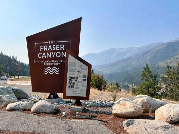
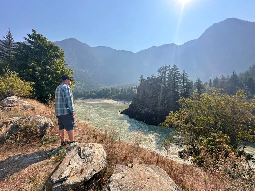
The Fraser River is the lifeblood of BC, slicing through the heart of the province. But the best part is the Fraser Canyon, along Highway 1 between Hope and Lytton. This sparsely populated section has churning rapids, high cliffs, and towering peaks.
For decades, the Fraser Canyon was the main travel corridor through BC for Indigenous people and then the fur trade, Gold Rush, railways, and the Trans Canada Highway. But that changed in the 1980s when a new, shorter highway was built through the Coquihalla Mountains.
Since then, the Fraser Canyon has quieted down and sees a fraction of the cars it used to. That means it makes an incredible road trip through tiny towns that used to be huge centres, to historic sites that let you step into the past, and to incredible viewpoints.
If you’re driving through southwestern BC, take a bit of extra time, skip the Coquihalla, and take a road trip through the Fraser Canyon instead. I have driven this stretch of highway countless times over the years, but I recently made time to slow down and take it in.
I’ve put together a complete Fraser Canyon road trip guide for you. It includes:
- A map of the Fraser Canyon that shows all the places I mention in this post.
- 10 Best things to do in the Fraser Canyon: small towns, historic sites, viewpoints, outdoor activities, and more
- Extending your trip: tips for road tripping further afield from the Fraser Canyon
- Where to eat in the Fraser Canyon: My picks for the best restaurants and cafes
- Where to stay in the Fraser Canyon: The places I stayed and recommend.
- Fraser Canyon road trip basics: How to get there? How long to spend? What’s the weather like? And lots more.
Hey there: Thanks so much to Destination BC: Vancouver, Coast, and Mountains for hosting some of my experiences on my recent trip. My previous trips were at my own expense. All opinions in this post are my own. Some of the links in this post are affiliate links, which means I earn a small commission at no cost to you. Thanks for your support. -Taryn
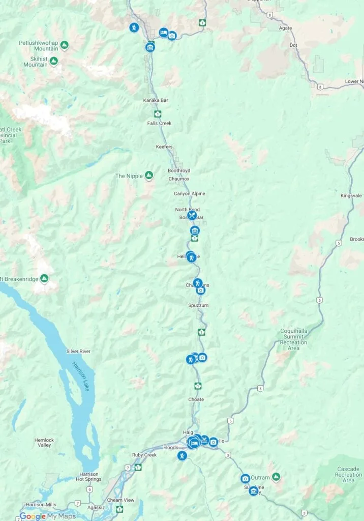
Fraser Canyon Map
To help you plan your trip and find your way around, I created a custom Google Map of the Fraser Canyon for you. It includes every place I mention in this post.

10 Best Things to Do on a Fraser Canyon Road Trip
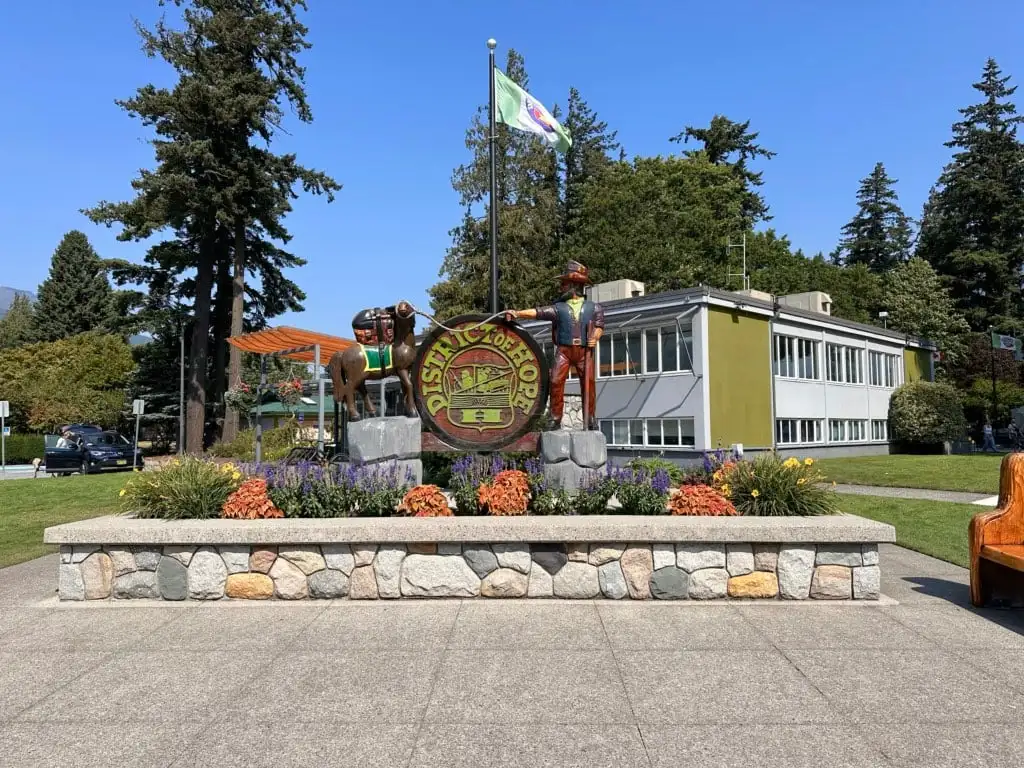
Explore Downtown Hope
Hope is one of those towns where people stop for gas and fast food on the outskirts but miss the quaint downtown. I should know: I was one of those people.
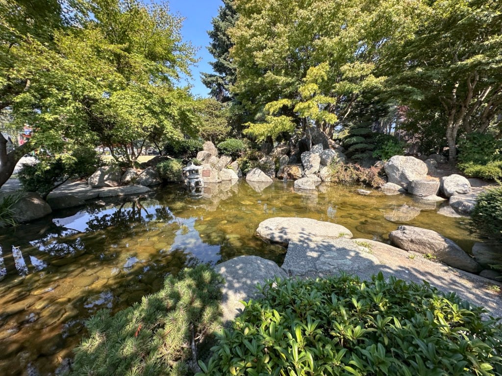
But a few years ago, I started heading into downtown Hope to get coffee at Blue Moose Coffee on Wallace Street. I’d get my drink, then stroll through the towering conifers at Memorial Park. The tranquil Japanese-style Hope Friendship Garden in a corner of the park is a great place to take a break from hours in the car.
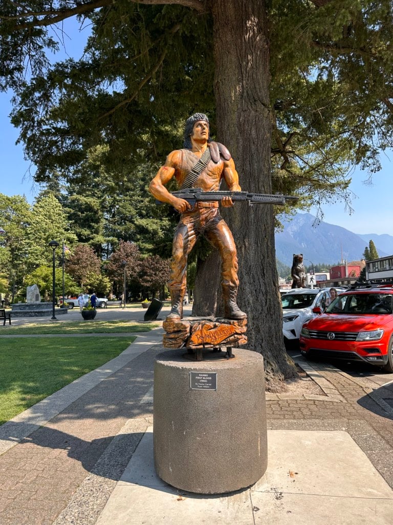
As I visited more often, I started to notice the chainsaw carvings dotted around town – apparently, there are over 80 of them! It became a fun game to find new ones on each visit.
I was also intrigued by the Rambo chainsaw sculpture outside City Hall. On my last visit to Hope, we actually spent the evening watching First Blood in our hotel room. Not only is the movie shot in Hope, but many of the locations in downtown Hope are still easily recognizable. The town even has a self-guided Rambo-themed walking tour you can take!
If you’re looking to shop, there are a few gift shops and second-hand shops worth a rummage. My favourite is Baker’s Books. They have tons of used books, and almost everything in the store costs just $2. I haven’t had time to visit, but I’ve also heard great things about the local and affordable art at Hope Arts Gallery.


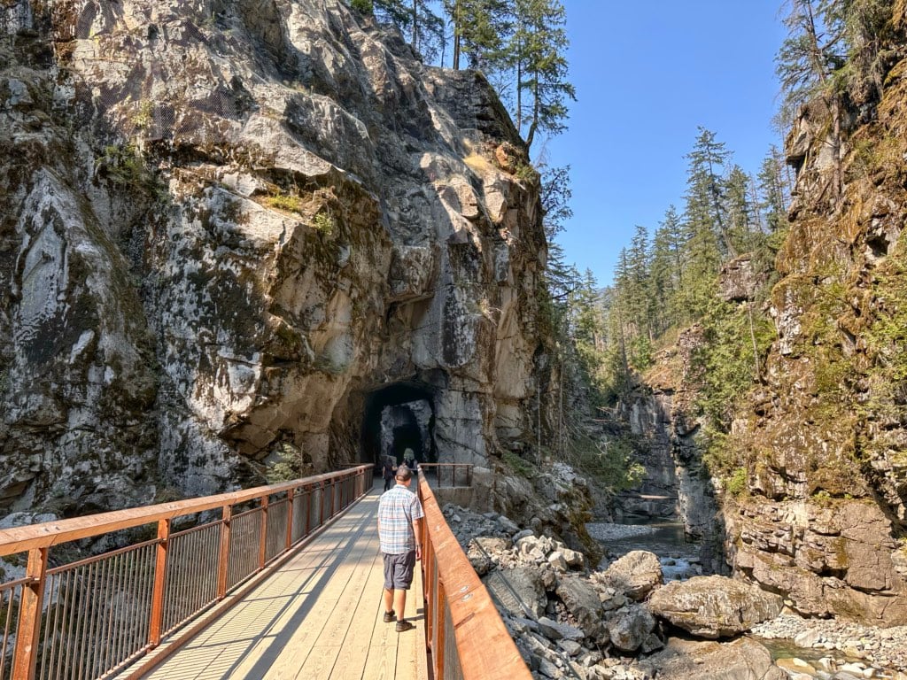
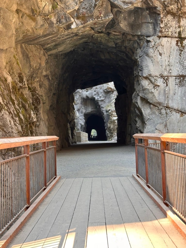
Wander Through the Othello Tunnels
The Othello Tunnels are one of the most picturesque historical sites in BC. The tunnels were built in 1914 for the Kettle Valley Railway, which used to connect the Kootenays with the BC coast via a route that went through the Okanagan and what is now the Coquihalla Highway.
There are four tunnels connected by bridges inside the tight, granite canyon. It’s a flat and easy 10-minute walk to the tunnels along a path beside the Coquihalla River. The gravel path is smooth enough for wheelchairs and strollers. Plan to spend 30 minutes to an hour wandering through the tunnels and taking photos.
In 2021, huge floods damaged the site, and it was closed for a few years. The site finally reopened after major repairs in June 2025. Right now, the first two tunnels and the beginning of the third have reopened with plans to open the fourth tunnel and the rest of the third once more repairs are complete.
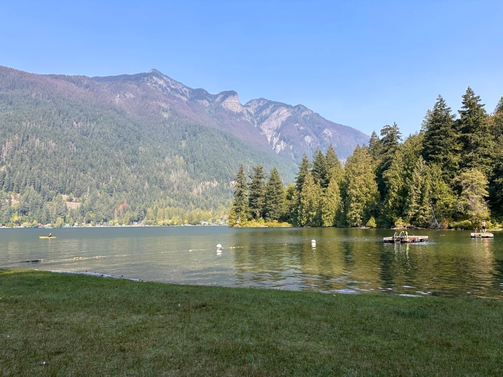
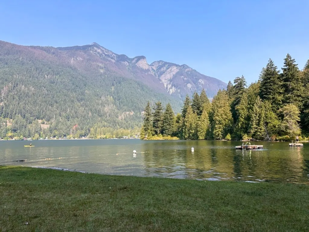
If it’s a warm day, don’t miss stopping at Kawkawa Lake on the way back from the tunnels. There is a small beach on Lakeview Crescent with a roped-off swimming area and rafts to jump off. We loved cooling down there on a super hot late summer day.


Go Back in Time at Yale Historic Site
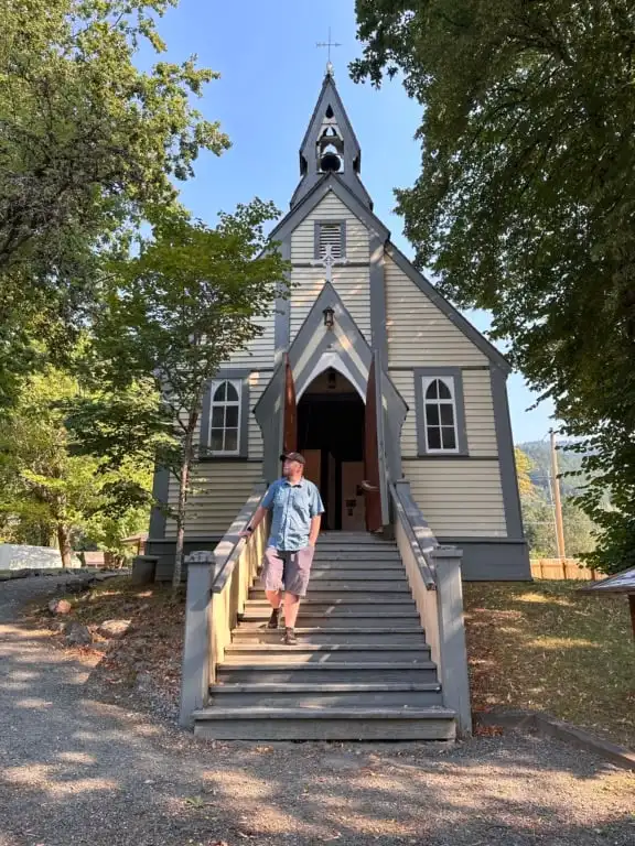
As a kid growing up in BC, we spent a lot of time learning about the Gold Rush, so it was pretty cool to visit Yale Historic Site.
The site is a museum that includes a historic house, BC’s second-oldest church (built in 1863), and an outdoor tent city that replicates what life was like in Yale during the Gold Rush. There are exhibits and artifacts that explain the local history. I especially liked the first-hand stories about the old piano.
They also have a free gold panning station where I unearthed a microscopic flake of gold! (I was excited to find it, but didn’t know what I would do with it, so I put it back for others to find.)
While the town of Yale was home to about 15,000 people at the height of the Gold Rush, now it is quite sleepy with only about 160 residents. It’s worth taking a walk around the town and down to the riverbank.
You can also drive out to the end of Toll Road, just north of town, for great views of Lady Franklin Rock, a huge rock island in the middle of the river.

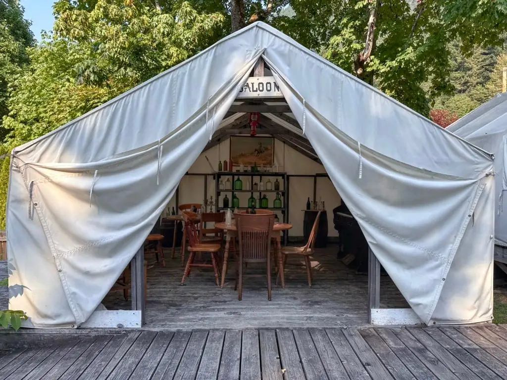
One of the outdoor tent exhibits.


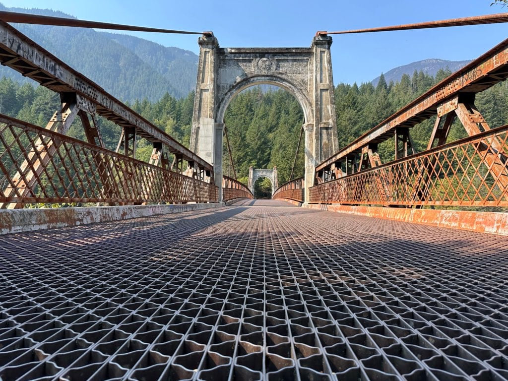
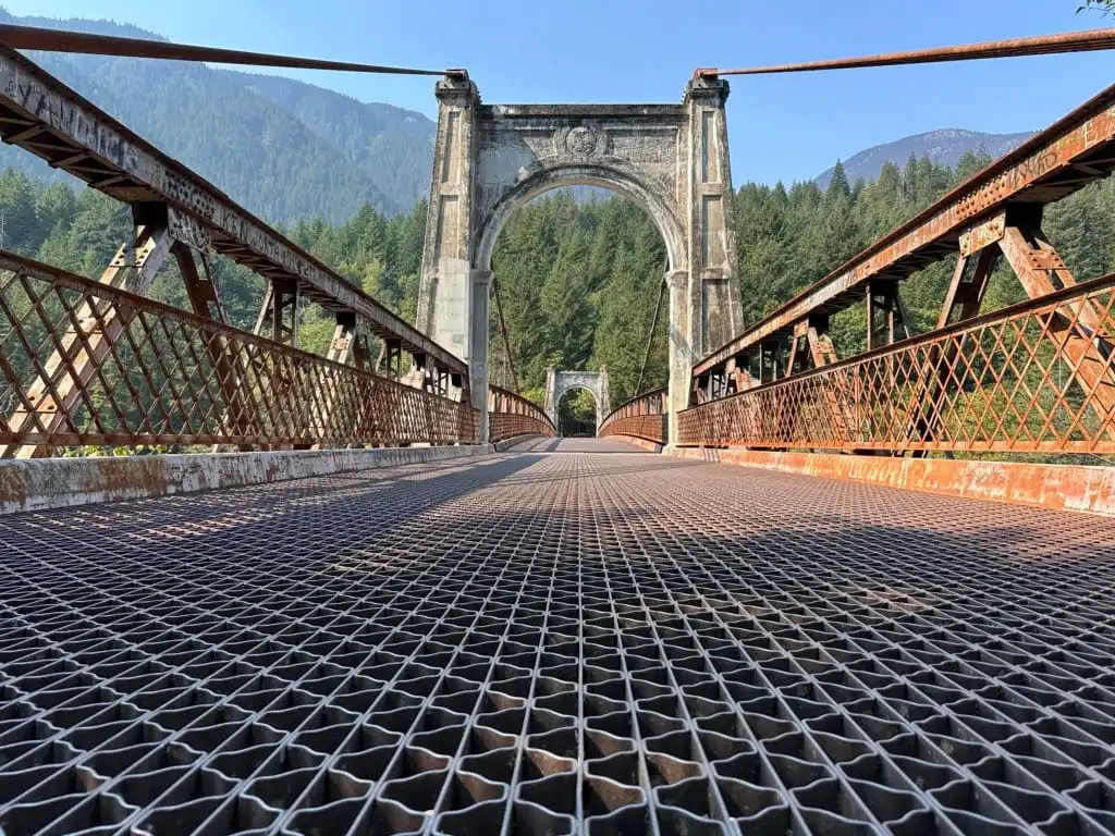
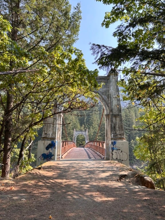
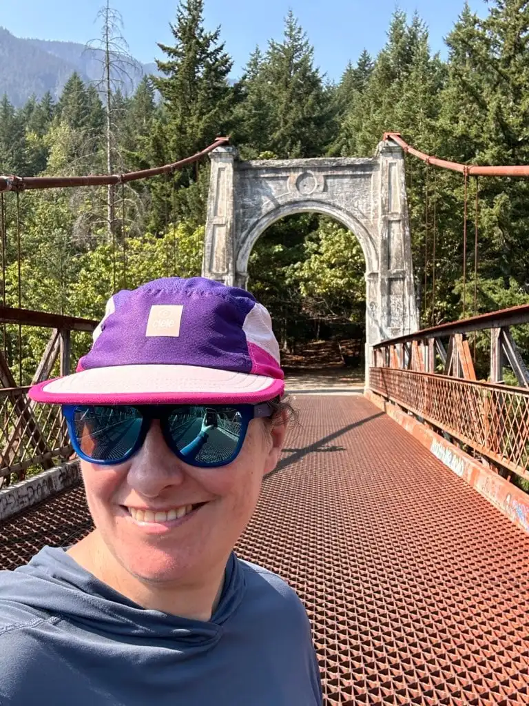
Walk Across Historic Alexandra Bridge
Alexandra Bridge has been on my to-do list for a long time. I first saw this historic bridge on Instagram about ten years ago, but it took until this summer for me to finally visit.
These days, Highway 1 crosses the Fraser River on a recently updated arch and span steel bridge high above the water. But the historic suspension bridge lower in the canyon dates back to 1926 and is now part of a provincial park.
You can walk downhill on the former Highway, now a gravel road, to the bridge. Walking across the honeycomb steel bridge deck is a bit daunting since you can see the rushing waters of the Fraser River below your feet.
Allow about 10 minutes each way for the walk down to the bridge.

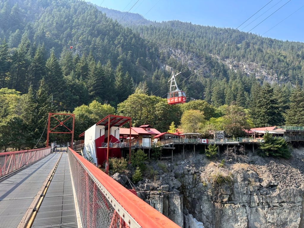
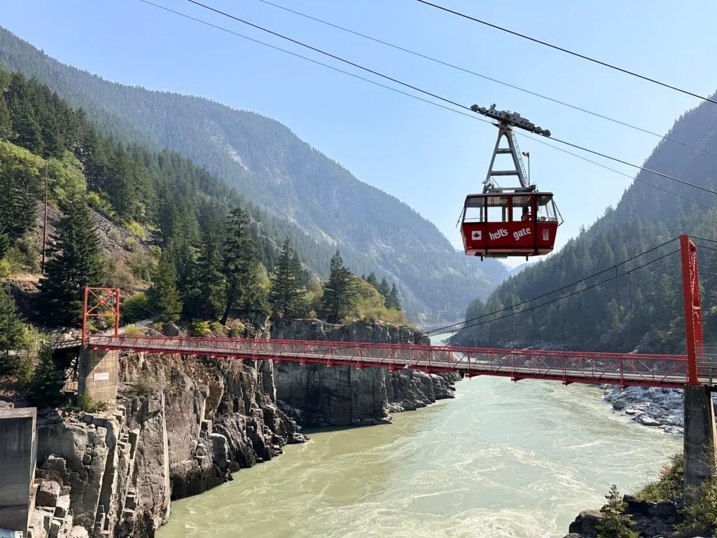
Ride the Hell’s Gate Airtram
I have been driving past Hell’s Gate Airtram since I was a kid. I remember whining to my parents that I wanted to stop, but we didn’t have time on our way to Kamloops to visit family. Recently, I finally made it happen!
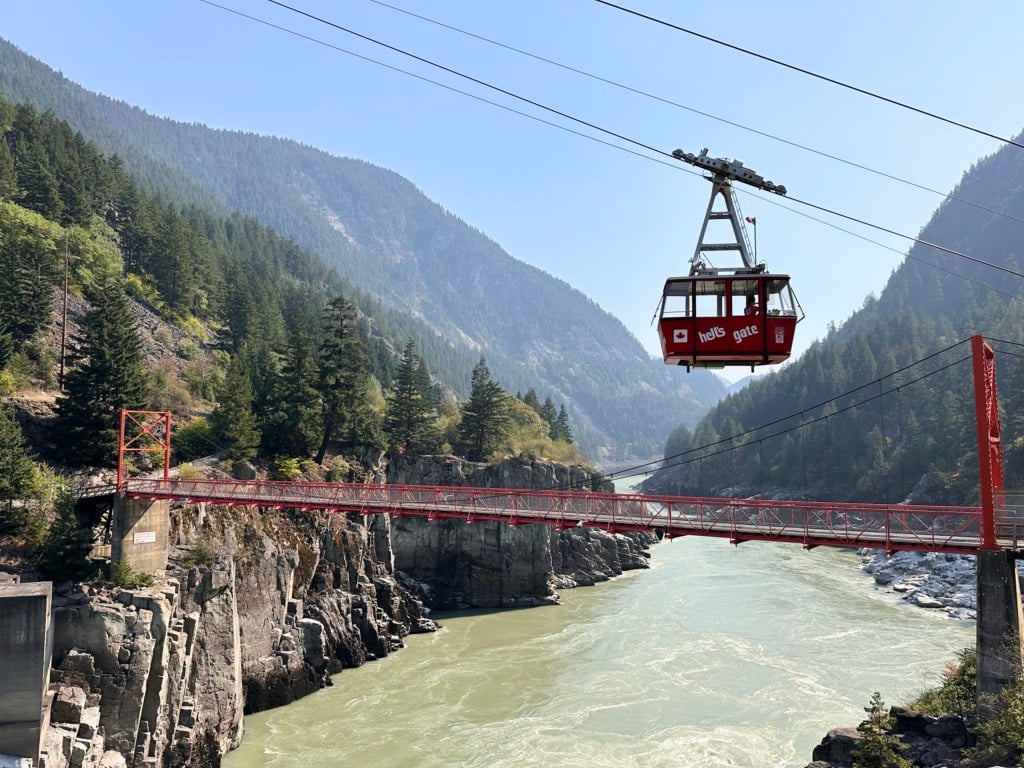
Hell’s Gate is the narrowest part of the Fraser Canyon with the wildest rapids. This section posed the most problems for early road and rail builders, so there were many landslides. Today, the canyon is home to a series of fishways that provide a less strenuous path for migrating salmon. A suspension bridge, built in 1948, also stretches across the river.
The Hell’s Gate Airtram opened in 1970. It drops 157 metres (515 feet) into the canyon – that’s the steepest non-supported tram in North America. The ride down gives you a great view of the narrow gorge. At the bottom, there are viewing platforms, a restaurant, gift shops, and exhibits about the history of the fishways. You can also walk out onto the suspension bridge.
The view from the Airtram, viewing platforms, and suspension bridge is great. You really get a sense of what it was like to be an Indigenous fisher, perched on the rocks with a dip net, or a railway worker trying to build a track on the edge of a cliff.
However, the entire attraction is a bit dated. I can imagine it bustling in the heyday of Fraser Canyon travel in the 1970s and ’80s. If visit with the mindset that you are visiting a quirky tourist attraction from another era, it’s kind of fun. But if you expect a shiny, modern experience, you’ll be disappointed.
I should also note that you don’t have to pay for the Hell’s Gate Airtram to visit the bottom of the canyon. You can hike down a gated gravel road from a highway pullout just south of the Airtram. The road is 1.5 kilometres each way with a drop of 190 m. Allow 30 to 45 minutes round-trip for the hike.
Once you get to the bottom, you can access the suspension bridge, viewing platform, exhibits, shops, etc., for free.

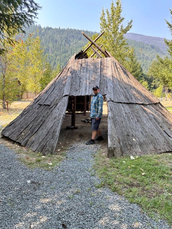
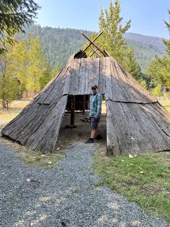
Immerse Yourself in Indigenous Culture at Tuckkwiowhum Village
If you’re interested in learning more about Indigenous culture, visit Tuckkwiowhum Village near Boston Bar. Pronounced “Tuck-we-ohm”, the village’s name means “great berry picking place”.
The village includes lots of outdoor exhibits that explore what pre-contact Nlaka’pamux life was like. You can see a summer lodge, a winter pit-house, a smoke house, food caches, and more.
I found it interesting to see how the Nlaka’pamux culture compared with other nearby Indigenous cultures. For example, the pit house was similar to ones I had seen at the Squamish Lil’wat Cultural Centre in Whistler and the Nk’Mip Desert Cultural Centre in Osoyoos, but each pit house was differently adapted to the local climate and culture.
Guided tours and other cultural events are sometimes available, but if there isn’t anything scheduled, you can walk around on your own on a self-guided tour. Just check in at the gas station before you head into the village.
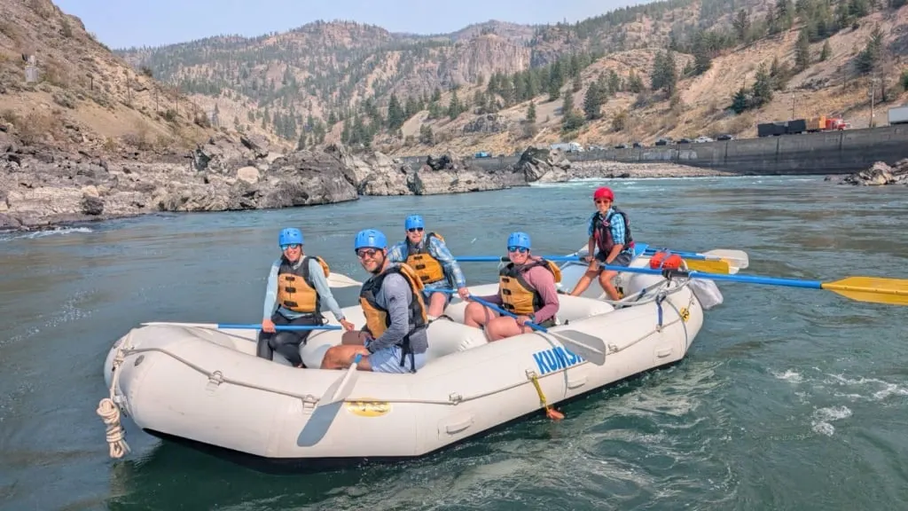
Get an Adrenaline Rush at Kumsheen Rafting
Until fairly recently, I was terrified of whitewater. I’m a tentative kayaker, and the moving water portion of the Bowron Lakes canoe circuit had me a little scared. But I went whitewater rafting in Squamish a few years ago and had a great time.
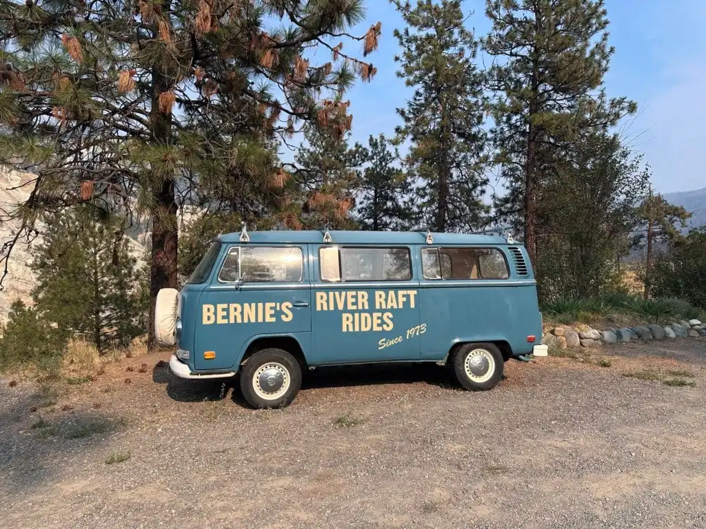
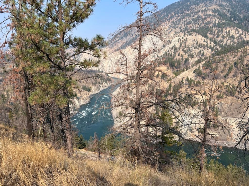
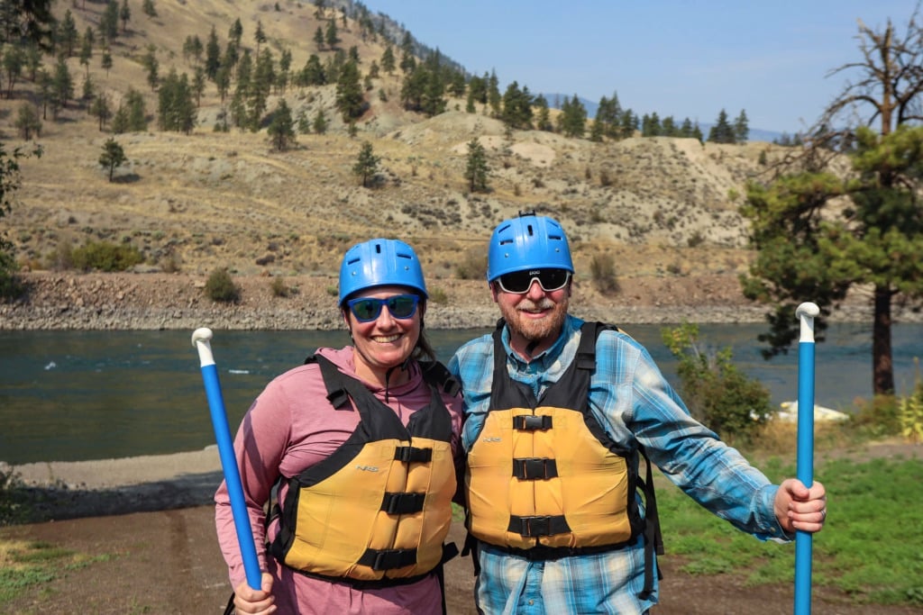
I was excited to go whitewater rafting on the Thompson River just outside of Lytton. The Thompson flows into the Fraser at Lytton, which is known as Kumsheen in the Nlaka’pamux language since it means “rivers meeting”. Many people consider the Thompson River Canyon a continuation of the Fraser Canyon since Highway 1 runs through it too.
I had driven through the Thompson Canyon lots of times, gazing down at its churning waters, so I knew rafting it would be fun… and a little terrifying. I booked a trip with Kumsheen Rafting, who have been running trips on this river for over 50 years. They are a family-owned business, with founder Bernie Fandrich still at the helm.
Our guide, Jasmine, is a Lytton local, and told us about her journey from a power-rafting guide to a paddle-rafting guide. I had no idea that the Thompson and Fraser Rivers (along with the Grand Canyon) were some of the only places to offer motorized whitewater rafting since the rapids are so big.
We opted for the paddle raft experience, which was exhilarating as we plunged into whirlpools and got slammed by big waves. We got soaked, but I welcomed the water since it was 38C!
Since we went in early September, we also got to paddle through thousands of salmon working their way upriver. It was one of the most unique ways to experience the salmon run – I really understood how hard they have to work to get to their spawning grounds!


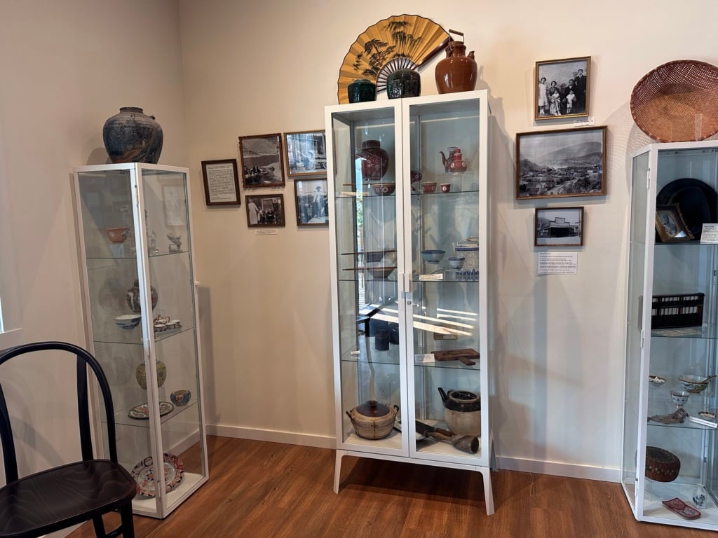
Learn About the Past at the Lytton Chinese History Museum
Sadly, 90% of the town of Lytton burned in a devastating wildfire in June 2021. Today, the town is rebuilding. One of the first places to rebuild is the Lytton Chinese History Museum. Lorna Fandrich, wife of Kumsheen Rafting’s founder, runs the museum, which reopened in May 2025.
The little building sits on the site of an 1880s Chinese temple, built to serve Chinese railway workers. The museum uses historical artifacts, photographs, and quotes to tell the story of the everyday life of Chinese Canadians in Lytton and the Fraser Canyon from the 1850s to 1940.
The Lytton wildfire destroyed the museum’s entire collection in 2021. Thanks to donations, Lorna has rebuilt a great collection of artifacts that are now on display. The museum is open Thursdays through Mondays in the spring, summer, and fall.

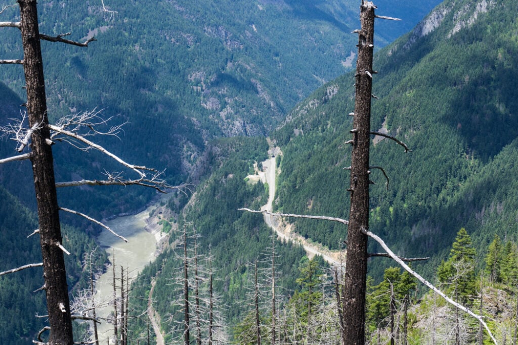
Enjoy the Scenic Drive to Lillooet
Many people miss the upper part of the Fraser Canyon since they keep going east on Highway 1 along the Thompson River towards Kamloops. However, if you have the time, drive Highway 12 to Lillooet. It takes about 1 hour from Lytton.
It’s a beautiful drive high above the canyon, looking down to isolated ranches across the river. The road is very winding, and in one section, it narrows to one lane as it crosses a slide above a cliff.
Once you arrive in Lillooet, I recommend checking out the Fort Berens Estate Winery. Their tasting room has a great location overlooking the Fraser River and the town. My husband belongs to their wine club and enjoys their award-winning reds.
Lillooet has interesting geography since it sits at the intersection of the desert interior and the coastal rainforest. The views from town are quite desert-like, but if you drive 10 minutes out of town to Seton Lake Recreation Area, you’ll start to get into more coastal forest. The huge glacier-fed lake is also spectacular.
Go Hiking
As a hiker, most of my past trips to the Fraser Canyon have involved hiking. If you can spare the time, it’s worth devoting a day or two to hiking here. The scenery is spectacular, and the trails are never crowded.
This is a sensitive wilderness area. Learn how to Leave No Trace to keep the wilderness wild. Make sure you are prepared by bringing the 10 Essentials. Get ready for adventure with this checklist of things to do before every hike.
Here are a few of my fave hikes in the area (and a few that are still on my to-do list):
Serpent’s Back
Volunteers from the Hope Mountain Centre built the Serpent’s Back Trail in 2020. Located just west of Hope, the trail climbs to several viewpoints along a ridge. From the summit, you can see the town of Hope, the Fraser River, and many surrounding mountains.
The 5.5 km moderate trail has 435 m of elevation gain and takes about 2.5 hours to complete. As of September 2025, the trail is closed due to a nearby wildfire, but it should reopen soon.
Hope Lookout
The steep and moderately challenging Hope Lookout Trail is Hope’s answer to the Grouse Grind. The viewpoint at the top has interpretive signs and an incredible view of the town below.
It climbs 470 metres over 2.25 km (for a 4.5 km round trip) from the trailhead next to Highway 1 at the entrance to Hope. Plan to spend about 2.5 hours on this trail.
Thacker Mountain
If you’re looking for views of Hope with a bit less effort, try out the Thacker Mountain Loop on the north side of Hope. The first part of the trail is a climb to the top of the mountain. But after that, the terrain mellows out as you complete a loop around the peak, visiting several viewpoints.
The moderate trail is 4.3 km round-trip with 200 m of elevation. It takes about 1.5 hours to do this hike.
Spirit Caves
This Spirit Caves hike in Yale leads to an incredible viewpoint over the Fraser River. You can also visit some small hollows amongst large boulders, which is how it got its name. The trail is very steep with loose rocks and creek crossings, so it is best for experienced hikers.
The 7 km round-trip trail has 600 m of elevation gain and takes about 3.5 hours.
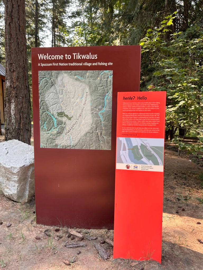
Tikwalus Heritage Trail
The Tikwalus Heritage Trail follows historic Indigenous and fur trade routes high into the mountains above the canyon near Alexandra Bridge. There are several viewpoints along the way and a backcountry campground at the end of the trail.
It’s 12.6 km round trip with 968 m of elevation gain, so it takes about 5 hours. This trail is featured in my book, Backpacking in Southwestern British Columbia.

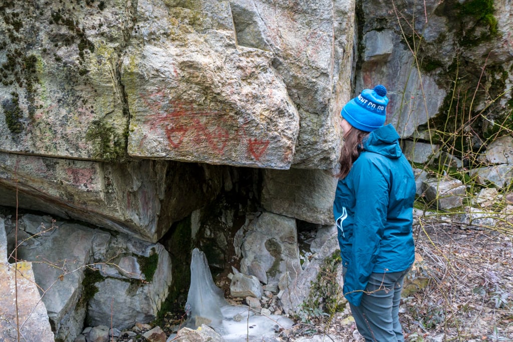
Stein River Trail
The Stein River Valley near Lytton is one of my favourite places in BC. It’s one of southwestern BC’s only intact watersheds and is an important spiritual place for the Nlaka’pamux Nation. To get to the trail, you need to take the free 2-car Lytton Reaction Ferry across the Fraser River.
From the trailhead in Stein Valley Nlaka’pamux Heritage Park, you can follow the path 10.5 km upriver to Earl’s Cabin Campground. (Beyond there, the trail is closed due to wildfire damage.) The trail passes the rushing river, goes through groves of ponderosa pine and cedar, and crosses clifftops.
There are also several opportunities to view Indigenous pictographs that are over 1000 years old. The easiest place to see them is at the Asking Rock, just 0.3 km from the trailhead. But there are several other sites where you can spot pictographs on cliffsides and boulders. Do not touch them because the oils from your skin can damage them. And of course, be respectful in this special place.
You can make your hike in the valley as long or as short as you want. For a short hike, I recommend the flat walk to the Asking Rock – it’s 0.6 km round trip. For a longer hike, head to Devi’s Staircase Camp, an 8 km round trip with about 150 m of elevation gain. You can find more info about this trail in my book, Backpacking in Southwestern British Columbia.

Extending Your Fraser Canyon Road Trip
Most people will visit the Fraser Canyon as part of a longer road trip. Since the area sits at the intersection of several travel corridors, I’ve got a few options for extending your trip in various directions.
Highway 3 and Manning Park
Extend your trip by heading towards the Okanagan on Highway 3 through Manning Park. The core of the park is only 45 minutes from Hope, and there are a few things to see along the way.
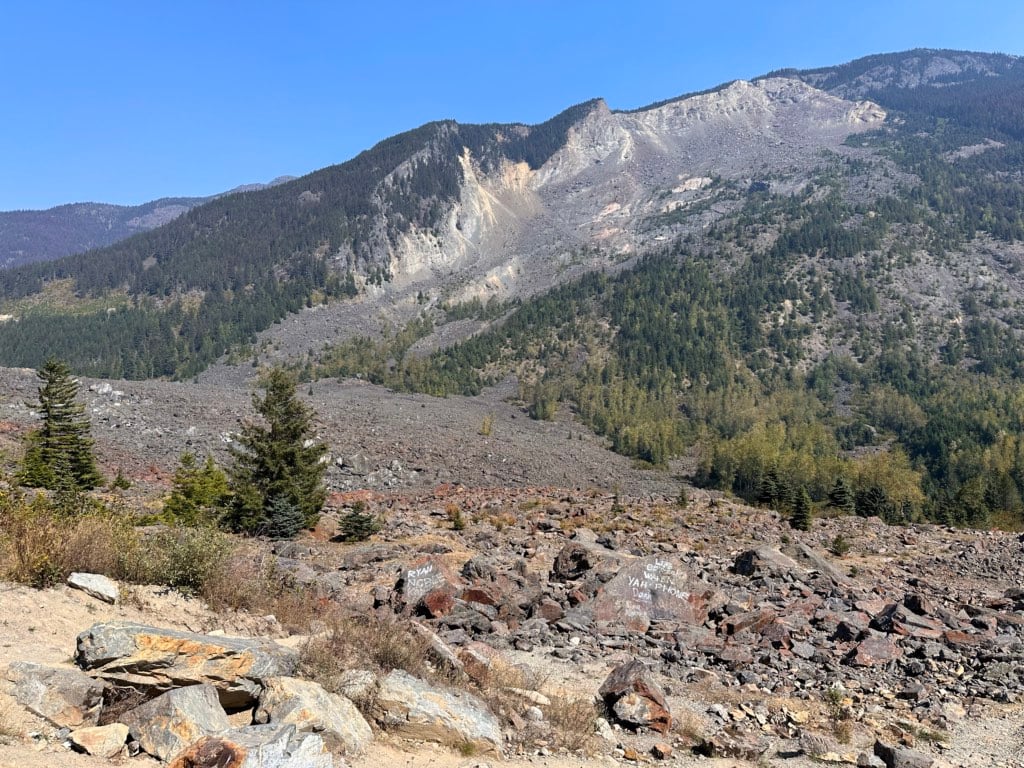
The Hope Slide viewpoint is only 15 minutes east of Hope. From the highway, it’s hard to see much, but from the viewpoint, the scale of the devastation is mind-boggling. In January 1965, one of Canada’s largest landslides tumbled down the mountain, covering the highway, displacing a lake, and spewing rocks up the far side of the valley. Today, you can see the huge debris field of boulders.
The history of the Japanese internment during WWII is one of the most shameful parts of BC’s modern history. Until recently, I had no idea there was an internment camp along Highway 3 that once held over 2,600 people. I also hadn’t heard of the Tashme Museum, which has exhibits about the camp. It has limited opening hours, so I haven’t visited yet, but it’s on my list.
E.C. Manning Provincial Park is one of the best places for hiking in BC. Over the years, I’ve visited countless times to hike. If you’re visiting for a quick day trip, I recommend the Lightning Lake day use area for picnics, swimming, and views or the drive to the top of Blackwall Peak for alpine flowers and a great viewpoint.
If you want to hike, you’re spoiled for choice. For wildflowers, the Heather Trail is great. And in the fall, you have to see the larches turn gold on the Frosty Mountain Trail. If you’re looking for something flat with scenery, the Lightning Lake Loop is a great family hike. I’ve got tons of details on hikes in Manning in my book, Backpacking in Southwestern British Columbia.


Highway 1 to Kamloops
Continuing northeast on Highway 1 into the Thompson Canyon feels like the natural continuation of a Fraser Canyon road trip. It takes about 2 hours to drive to Kamloops from Lytton, but you can also just drive the first hour to Cache Creek.
If you’re looking for good views of the canyon, stop at the Skihist Provincial Park day use area. It’s just past Kumsheen Rafting and is a great place to look down at the river and the railway on the other side.
Stop in the tiny town of Spence’s Bridge to grab something to eat at the historic Packing House restaurant.
In Cache Creek, don’t miss Horstings Farm Market just north of town on Highway 97. The sprawling complex has lots of fresh fruit and veggies as well as local meat, eggs, jams, and pickles. Their on-site bakery is amazing – we always pick up a pie to take home.
I also keep meaning to visit the Historic Hat Creek Ranch just outside of Cache Creek. The local Bonaparte First Nation are now managing the site. Along with historic buildings and exhibits from the Gold Rush era, the ranch now offers more Indigenous exhibits.

Highway 99 to Whistler
The route from Lillooet south to Whistler via Pemberton on Highway 99 is one of my favourite drives. It’s a high mountain route with lots of steep hills and curves. But the scenery is incredible. It takes about 2.5 hours to drive from Lillooet to Whistler.
The first part of the is along the steep Duffey Lake Road. There are lots of pullouts where you can enjoy views of the mountains and Duffey Lake.
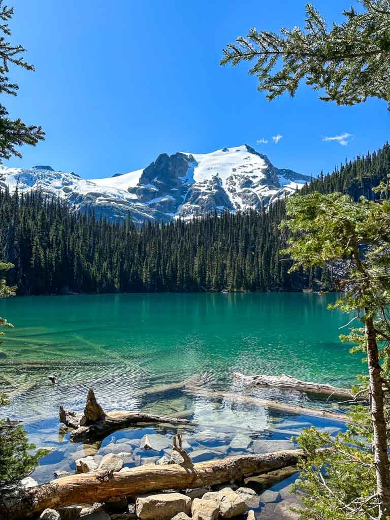
If you want to go for a beautiful hike, stop at Joffre Lakes Provincial Park. The three turquoise glacier lakes make this the most popular hike in BC, so you need to get a free day-use pass online to hike here. I’ve got more details about passes and the hike in my Joffre Lakes guide.
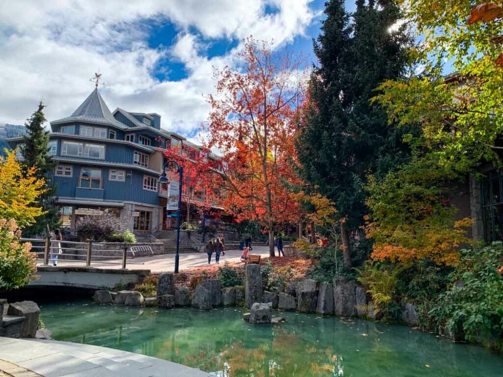
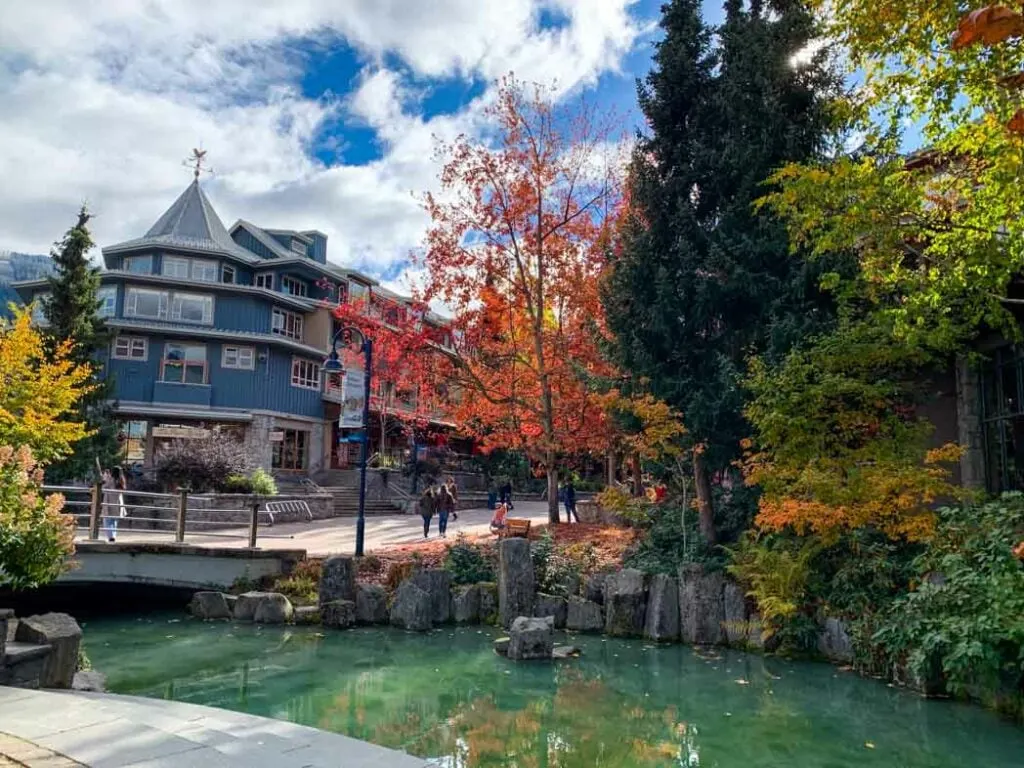
Past Joffre Lakes, you’ll go through Pemberton. The town itself is small, but cute, and the surrounding farmlands are gorgeous. I recommend stopping at North Arm Farm for produce and One Mile Lake for a walk or a swim. If you’re hungry, I recommend Mount Currie Coffee or The Pony.
Whistler is about 30 minutes past Pemberton. There are tons of things to do in Whistler, from hiking to sightseeing and shopping. I live nearby, so I’ve got a huge guide to Whistler.
If you want to continue on to Vancouver from Whistler, it’s another 2 hours via the gorgeous Sea to Sky Highway. Be sure to stop in Squamish along the way. It has great hiking, sightseeing, and a cute downtown. (But I’m a bit biased because I live here.)

Where to Eat in the Fraser Canyon
If you’re looking for fine dining in the Fraser Canyon, you will be disappointed. However, there are lots of great casual restaurants run by enterprising locals. Hope has the most (and best) restaurants, but there are a few other places in the canyon also worth checking out.
Hope
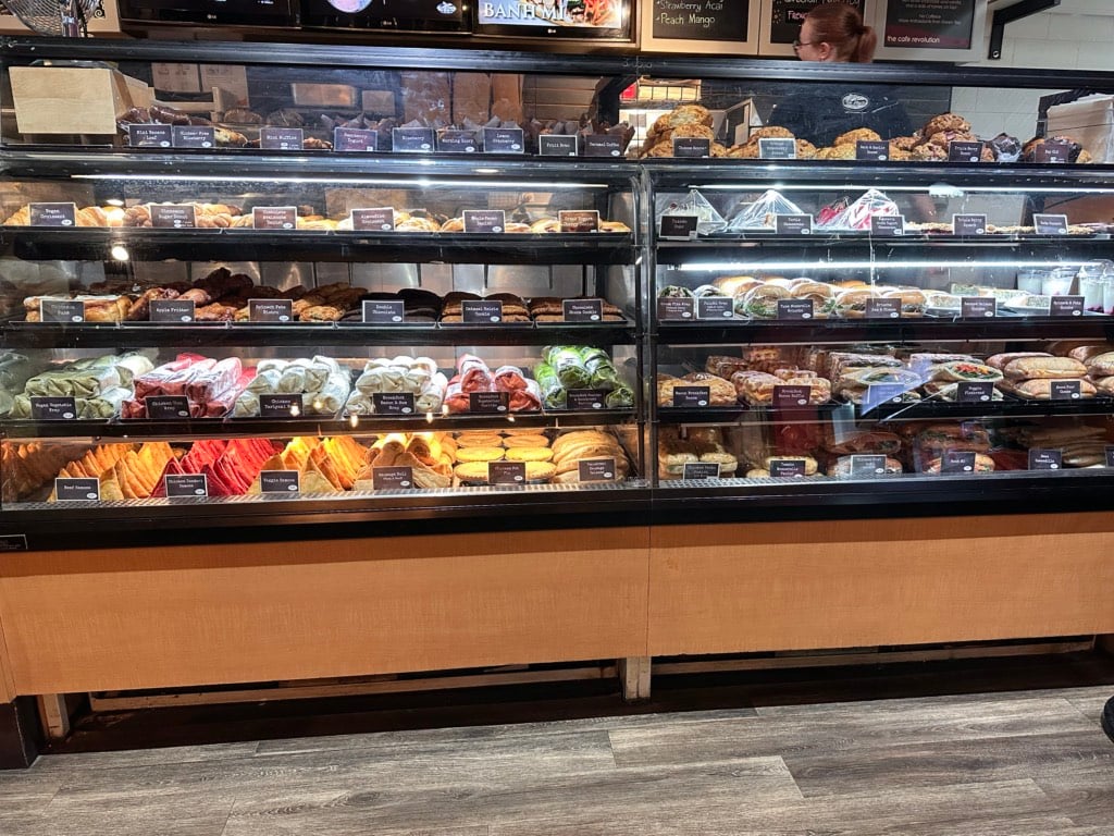
I’ve been stopping at the Blue Moose on Wallace Street in downtown Hope for years. They are open early for breakfast, make great coffee and pastries, and have lots of sandwich options for lunch. Their paninis are great, and while their banh mi isn’t authentic, it’s pretty good.
Another perennial favourite for us is Home Restaurant. This is the ultimate diner with a big pie case at the entrance. They serve breakfast all day, and their dinner menu includes diner classics like meatloaf, liver, and schnitzel. I usually get the triple-decker clubhouse sandwich.
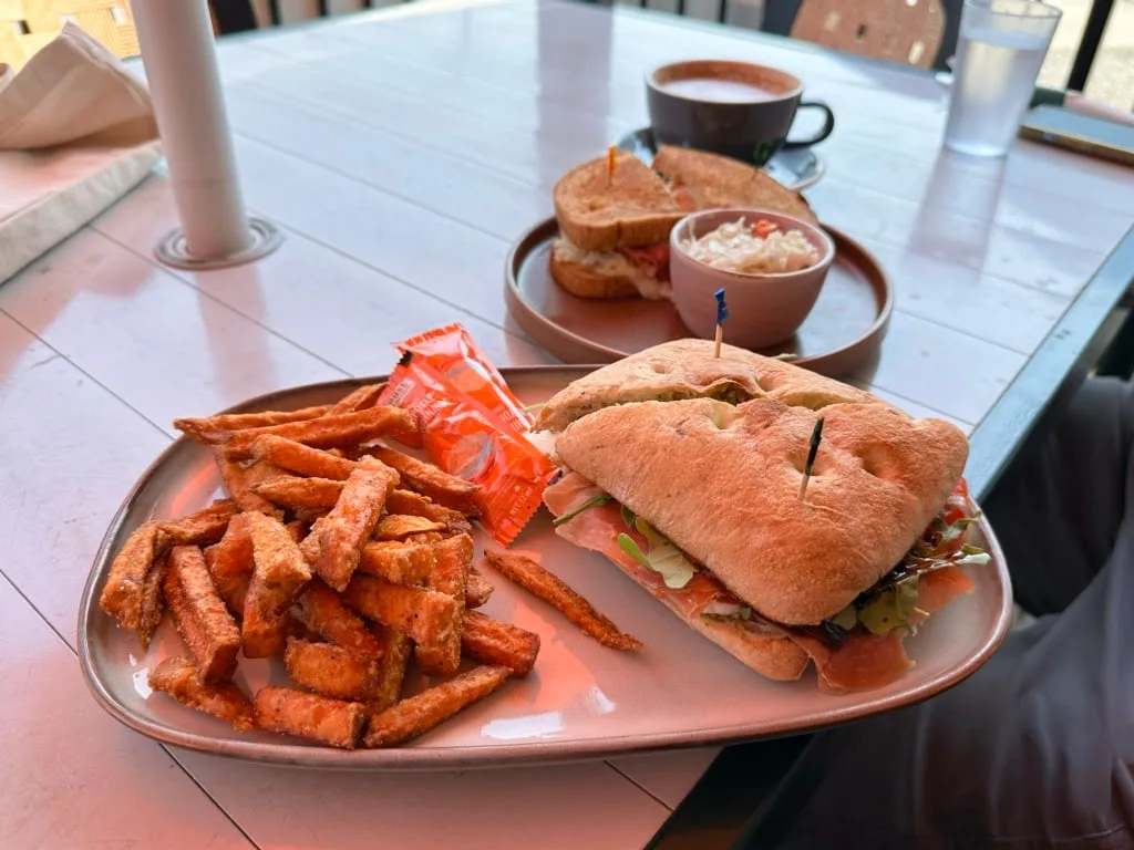
On my most recent trip, we discovered Hope Mountain Cafe, kitty corner to Blue Moose. Their breakfast sandwich is great. We also had lunch there. The prosciutto, mozza, and tomato sandwich had an amazing balsamic glaze.
We also discovered Nomad So.cial Eatery recently. It’s a bit more upscale without being fussy. I had hoped to order their salmon wellington, but they were sold out! Instead, I had a great steak salad.
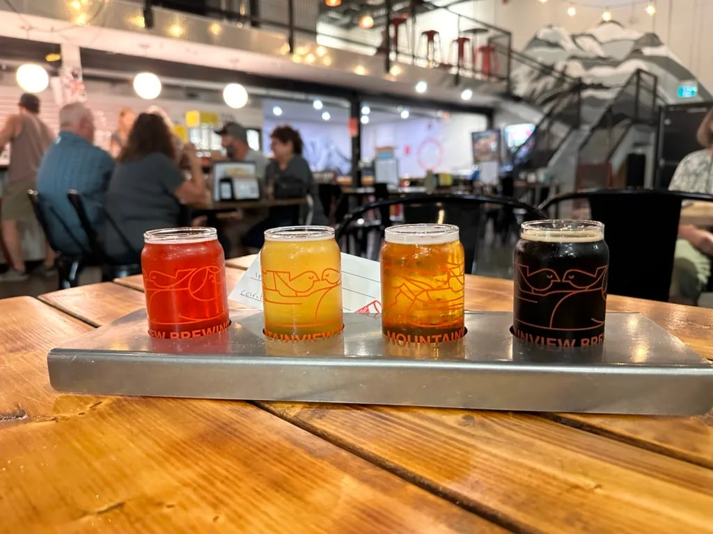
If you’re into craft beer, you need to go to Mountainview Brewing Co. Their tasting room has a big glass wall so you can look into the brewery while you eat. In addition to flights of housemade craft beer, they also make some of the best smash burgers I’ve had.


Boston Bar
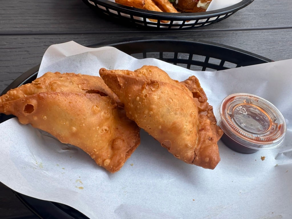
There aren’t that many restaurants in the heart of the Fraser Canyon, but we were pleasantly surprised by JB’s Drive-In in Boston Bar. It’s a pretty basic diner on the side of the highway, but the food was fast and pretty good. Since the owners are Indian, I had to try the samosas. They were really good with a wonderful crispy exterior.

Lytton
While Lytton rebuilds, there aren’t any restaurants in town. However, if you’re in the area, it’s worth stopping at Kumsheen Rafting just outside of town. The coffee bar inside their office is open from April to September and has cold drinks, baked goods, coffee, and great homemade sandwiches.
Lillooet
If you’re in Lillooet, you have to stop at Abundance Artisan Bakery. They are open for breakfast and lunch. I love their sandwiches and baked goods. It’s also worth picking up a loaf of their organic sourdough to take home.
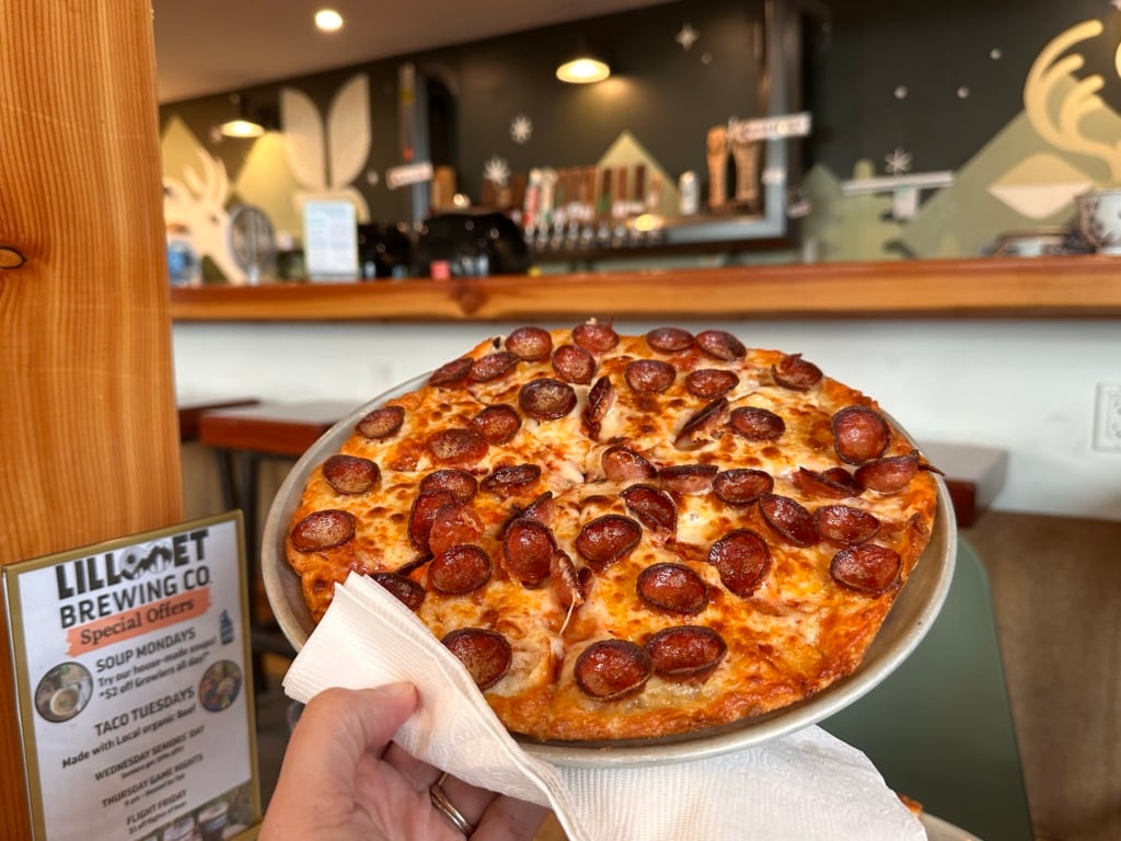
On my last trip, we had dinner at Lillooet Brewing Company. They are tucked away at the north end of town, so I didn’t even know they were there – apparently they’ve been open since 2022! Their tasting room and picnic area have incredible views of the Fraser River. Their pizza and beer are also pretty tasty, and there is a vegan food truck outside too.

Where to Stay in the Fraser Canyon
Thanks to its legacy as the main travel route from the BC Interior to Vancouver, there are tons of older hotels in the Fraser Canyon. Many of them are showing their age, but there are a few gems.
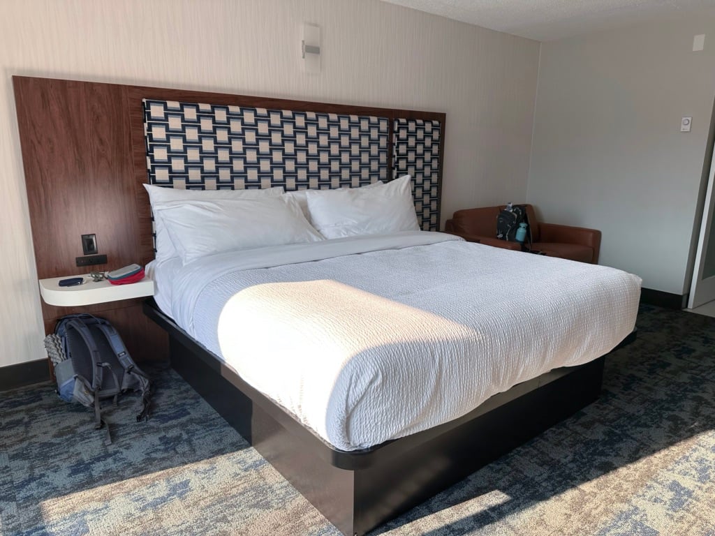
Windsor Motel: I spent two nights at this recently renovated hotel in Hope. It is basic, but super clean and affordable. The location in downtown Hope made it easy to walk to shopping and dinner. Plus, it was quiet at night. Check prices.
Evergreen Bed & Breakfast: I’ve heard great things about this cute family-run B&B in Hope. People rave about their breakfast. Check prices.
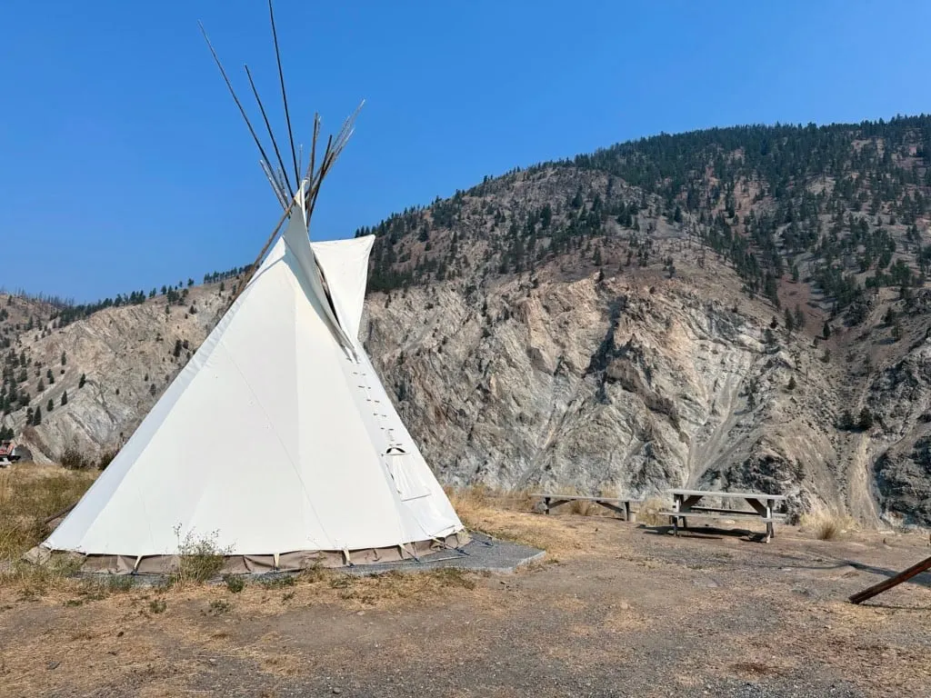
Kumsheen Rafting Resort: I arrived early for my river rafting trip, so I walked around their campground just outside of Lytton. They have really cute teepees and glamping tents with real beds and amazing Fraser River views. I would definitely stay here next time I’m in the area. Check prices.


Fraser Canyon Basics
In this section, I’ve got practicalities for taking a road trip through the Fraser Canyon. It includes getting there, the best time to go, weather, what to pack, and more.
How to Get to the Fraser Canyon
If you’re in Vancouver, getting to the bottom of the Fraser Canyon at Hope is easy: you just drive east on Highway 1 for about 1.5 hours.
You can also get to the Lytton side of the Fraser Canyon by driving west on Highway 1 from Kamloops for about 2 hours.
There is no public transportation in the Fraser Canyon, so you will need to drive yourself if you want to explore this area. The easiest places nearby to rent a car are Vancouver and Kamloops. I like to use DiscoverCars to book car rentals since the site lets you compare prices across different rental companies.
Keep in mind that legally, your car must have winter tires or chains to drive the Fraser Canyon between October 1 and March 31.
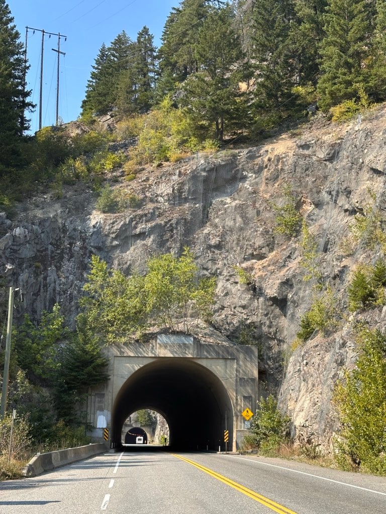
Driving the Fraser Canyon is fairly straightforward. The road has a few steep hills and lots of curves, but is otherwise pretty easy to navigate. Keep in mind that there are few passing lanes, so if you are driving slowly to enjoy the views, move over when you can to let others pass. Driving through the tunnels is a real highlight too!

Best Time to Go
The Fraser Canyon is at a relatively low elevation and doesn’t get that much snow, so you can visit year-round. However, some businesses may be closed or have reduced hours in the winter, and when it does snow, the roads can be terrible.
The best time to go is May through September. You could also visit anytime between mid-March and the end of October to avoid snow.
Unless you are visiting in the middle of the summer, avoid going mid-week as some businesses are only open on weekends. Check opening hours of all attractions you want to visit ahead of time.
If you visit in the fall, you can witness the spectacular salmon run as spawning salmon fight their way upstream through the rapids of the Fraser River to their natal streams.
How Long to Spend
The drive from Hope to Lytton is only 1.5 hours, and you can add on another hour if you want to continue up the canyon to Lillooet. It’s fairly easy to explore the highlights of the Fraser Canyon in just one day.
However, I recommend spending at least one night in the area so you can see everything without feeling rushed. On my most recent visit, we spent two nights in Hope to really slow down our pace.

Fraser Canyon Weather
The weather really varies in the Fraser Canyon as you work your way from the rainforests of Hope in the south to the deserts of Lytton and Lillooet in the north.
The Fraser Canyon is one of the hottest and driest parts of BC, so expect higher temperatures than the surrounding regions. Lytton regularly sets BC records as the hottest town in the province.
In the summer months of June, July, and August, the average temperature in Hope is 13°C to 24°C. In the spring and fall, it drops to 5°C to 18°C. July and August are the driest months in Hope. October through May can be very wet.
By contrast, Lytton is much hotter and drier than Hope. The average summer temperature is 15°C to 28°C, but many days see temps up to the high 30s. (It was 38°C when I went river rafting in Lytton!) Spring and fall in Lytton are a bit warmer than Hope, with temps between 4°C and 23°C. It’s also much drier, with about half as many rainy days as Hope gets and far less overall precipitation.

What to Pack For the Fraser Canyon
The towns of the Fraser Canyon are VERY laid back, so you don’t need to bring anything fancy. Casual wear is fine everywhere.
The summer heat here is no joke. Bring sunscreen and a sun hat. You should also pack a water bottle since it is easy to get dehydrated in the heat. I use a Hydro Flask bottle because it is insulated, so it keeps my water cold.
If you plan to hike, bring a small backpack, hiking shoes, and quick-dry clothing. I like to wear a long-sleeved sun hoodie since it means I don’t have to constantly reapply sunscreen. I’ve got a list of my favourite sun hoodies, but my top pick is the Mountain Hardwear Crater Lake.
If you want to go swimming or whitewater rafting, bring all your beach stuff: swimsuit, towel, sandals, sun hat, etc.
If you are travelling in the canyon in hot summer weather, bring a cooler for water and snacks. Anything left in your car will get incredibly hot.
There are small stores and restaurants in Yale, Boston Bar, and a few other spots, but you may want to stock up on supplies in Hope, which has larger stores and more variety.

Cell Phone Service
It’s worth noting that while there is cell phone signal in most of the Fraser Canyon, there are a few places with dead spots. Download offline maps and other info before you leave so you can find your way.
There is good 5G service in Hope, Boston Bar, Lytton, and Lillooet. You’ll get ok LTE service in Yale and near Hell’s Gate Airtram. There are big dead zones with no service near Alexandra Bridge and on Highway 12 between Lytton and Lillooet.
Indigenous Context in the Fraser Canyon
The Fraser Canyon is the traditional territory of the Stó:lō, Nlaka’pamux, Stz’uminus, and St’at’imc Nations.
The Fraser Canyon was an important historical trade route for Indigenous people. As well, Indigenous people played an important role in guiding Europeans through the canyon during the Gold Rush of the 1850s and 1860s. Routes that the Indigenous people pioneered during that time went on to form today’s Highway 1 and adjacent railroads.
Today, these nations continue to live in the Fraser Canyon and practice their traditions and culture. It is important to be respectful of Indigenous lands, culture, and traditions when you visit and to respect private property on the many Reserves sprinkled up and down the canyon.
If you want to learn more about Indigenous culture, visit Tuckkwiowhum Heritage Village near Boston Bar. It’s run by the Nlaka’pamux Nation and has lots of self-guided outdoor exhibits.

Final Thoughts
Even though it is longer than the Coquihalla, I’ve always loved driving through the Fraser Canyon instead. It’s a slower, less frenetic pace, and the scenery is great. However, after my most recent trip, I regret not spending more time there sooner.
I knew that the area was long past its prime since its lustre had faded since the Gold Rush and certainly since the Coquihalla Highway opened in the 1980s. But now that I’ve really explored, I think that is part of its charm. It’s old and gritty and authentic. It’s not tarted up to be shiny and happy for tourists. And there’s something special about that.
I’m sure I’ll be taking a Fraser Canyon road trip again soon. There are still a few hikes I haven’t done yet!
Do you have questions about the Fraser Canyon? Ask in the comments and I’ll help you out.
MORE BC ROAD TRIPS:
- Sea to Sky Highway Road Trip Guide: Driving from Vancouver to Whistler
- Pacific Marine Circle Route Road Trip Guide
- How to Take an Epic Canadian National Parks Road Trip


- The Best Things to Do in Saskatoon - March 17, 2026
- Grasslands National Park Travel Guide - February 4, 2026
- The Best (and Worst) Backpacking Meals Reviewed - December 16, 2025