

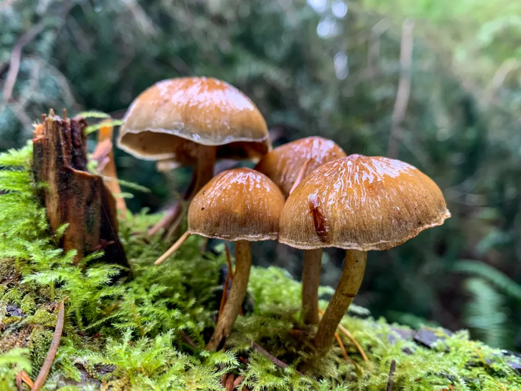
Cliff Gilker Park near Roberts Creek on the Sunshine Coast is a great place for a short and easy hike. It has a network of forested trails that lead to lots of waterfalls and cascades. If you love moss, ferns, mushrooms, and tall Douglas firs, this hike is for you.
I lived in Gibsons for five months in the winter of 2020/21. The easy trails of Cliff Gilker Park were a short drive away in Roberts Creek. I found myself heading there often for a short nature break. The forest is especially gorgeous on cloudy or drizzly days. (I think it’s one of the most beautiful hikes on the Sunshine Coast.)
I’ve explored all the trails in the park and each of the waterfall viewpoints. That means that I’m able to give you a local’s insider info on everything you need to know to hike in Cliff Gilker Park.
In this post you’ll find:
- A hiking map of Cliff Gilker Park showing all the trails
- Detailed driving directions to the trailhead
- Turn-by-turn hiking directions for my recommended loop around the park
This is a sensitive wilderness area. Learn how to Leave No Trace to keep the wilderness wild. Make sure you are prepared by bringing the 10 Essentials. Get ready for adventure with this checklist of things to do before every hike.


Basics
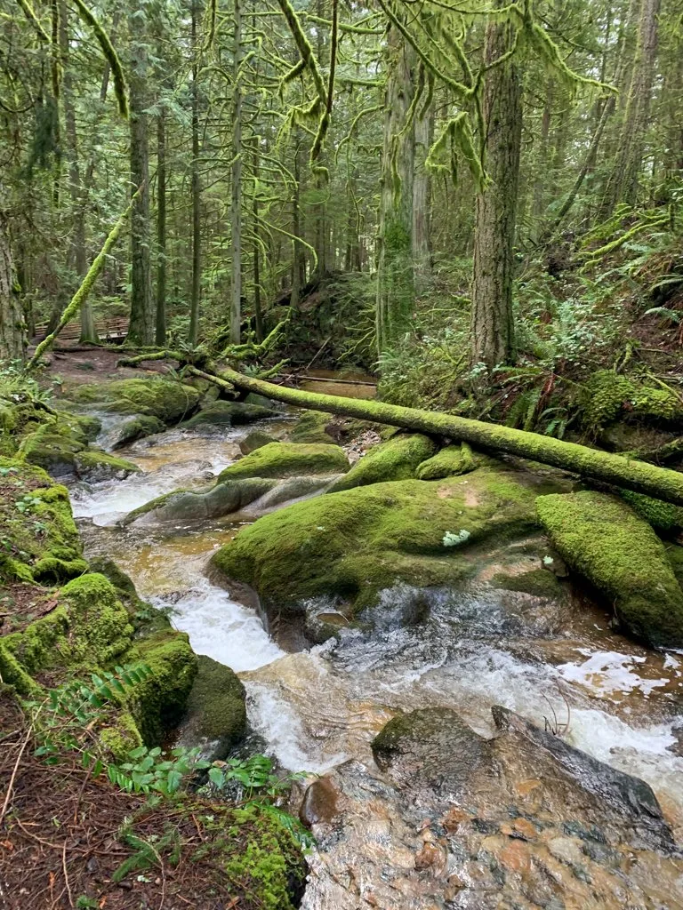
Cliff Gilker Park is a small forested park with a network of trails. Roberts Creek and Clack Creek run through the park and both have some beautiful waterfalls, cascades, and sections of gorgeous mossy canyon.
You can use the park map (below) to plan your own trip. But I’ve put together a loop hike for you that visits all the best spots. Stats for my recommended loop are below.
Distance: 3 km
Elevation Gain: 50m
Time: 1 hour
Difficulty: Easy
Season: Year-Round
Toilets: Washroom building with toilets at the main parking lot.
Dogs: Allowed on leash
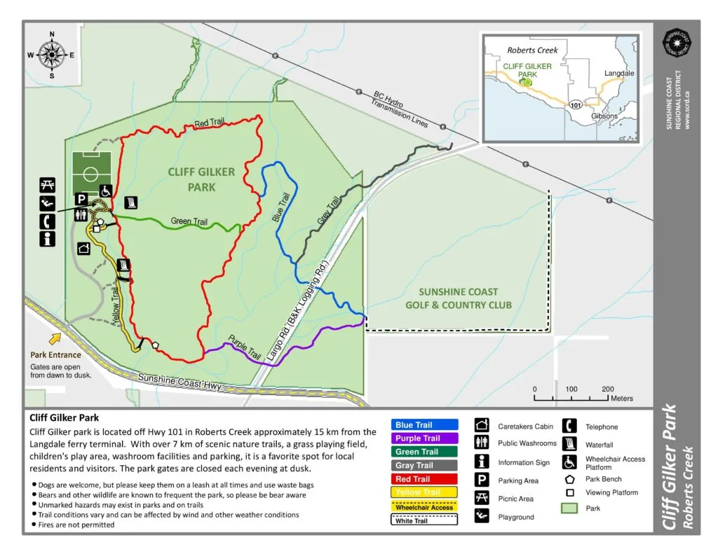
Cliff Gilker Park Hiking Map
Navigating the trails in Cliff Gilker Park is easy with frequent colour coded markers to show which trail you are on and mini maps at major junctions.

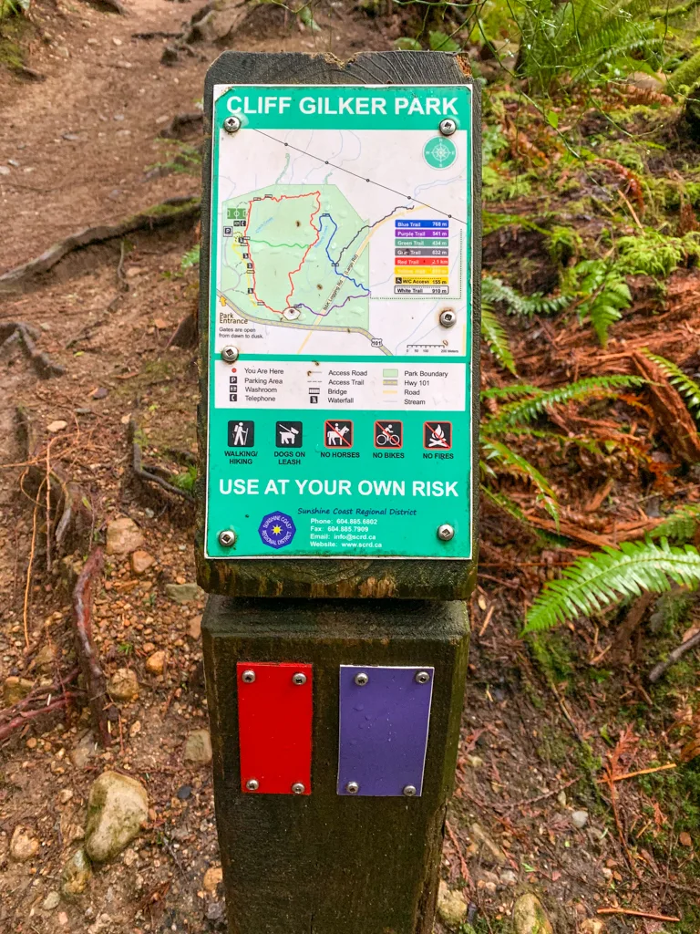
But having a map with you is a good plan to keep you oriented and to help you plan your route.
Here is the official Sunshine Coast Regional District map of Cliff Gilker Park. It shows all the hiking trails, waterfalls, parking, and washrooms.

How to Get to Cliff Gilker Park
Cliff Gilker Park is located along the Sunshine Coast Highway near the village of Roberts Creek. The entrance to the park is just east of the Sunshine Coast Golf & Country Club.
From Gibsons, take the Sunshine Coast Highway west for 9 kilometres. Just after the intersection with Largo Road, watch for the Cliff Gilker Park sign on your right. Turn right into the park and drive to the large parking lot at the end of the gravel road. Click here for Google Maps driving directions.
From Sechelt, take the Sunshine Coast Highway east for 11 kilometres. Just after the intersection with Roberts Creek Road, pass the golf course, then watch for the Cliff Gilker Park sign on your left. Turn left into the park and drive to the parking lot at the end of the gravel road. Click here for Google Maps driving directions.
You can also get to Cliff Gilker Park by bus. Take Bus 1 or 90 from Sechelt or Gibsons to the stop on the Sunshine Coast Highway at Largo Road. Walk west on the highway for a few minutes to the park entrance. Click here for Google Maps public transit directions.

Cliff Gilker Park Hiking Directions
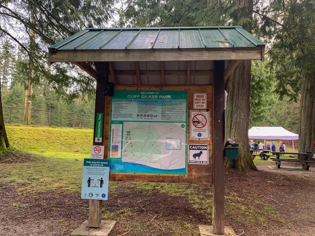
Start your hike on the trail directly behind the washroom building. Turn right and follow the Yellow Trail slightly downhill on the west bank of Clack Creek. Don’t cross the bridge over the waterfall – that is your return route.
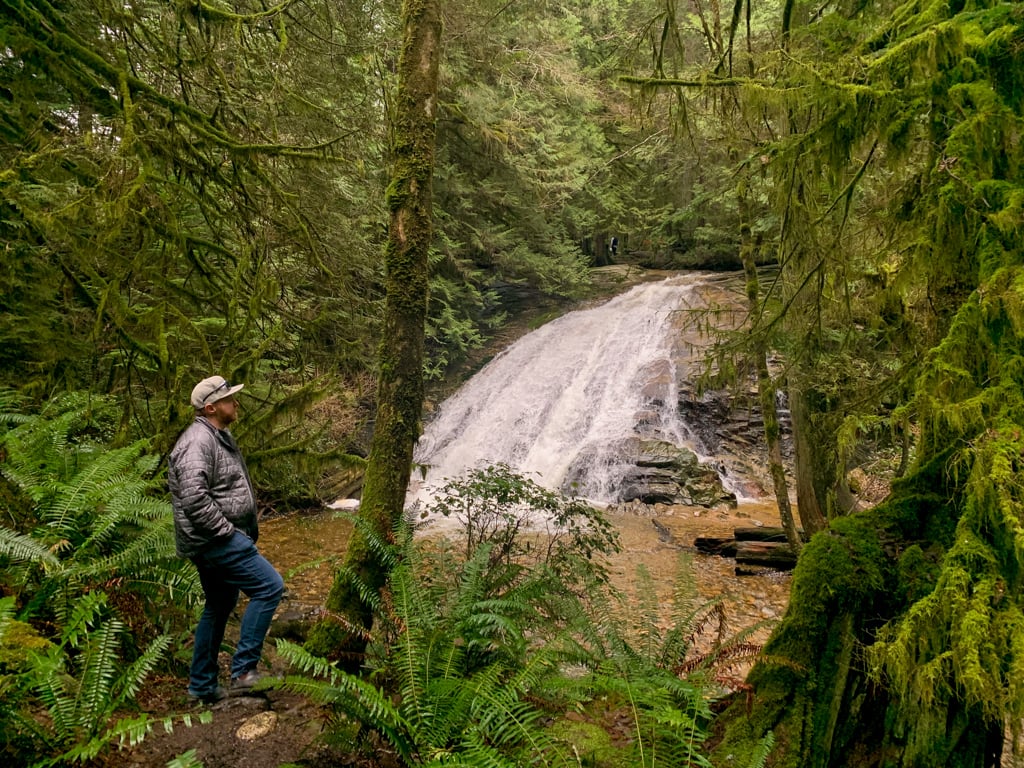
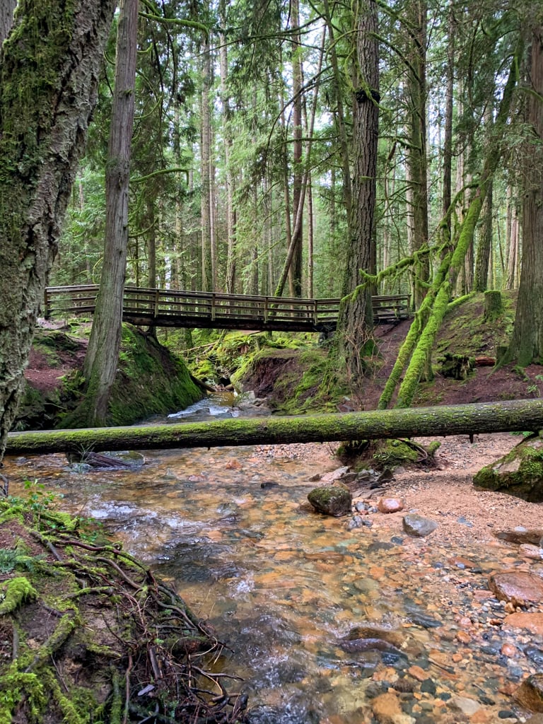
Almost immediately you will reach a viewing platform which is a great vantage point to see the upper waterfall. Continue along the trail for a few more metres, then follow a side trail down the hill towards the creek.
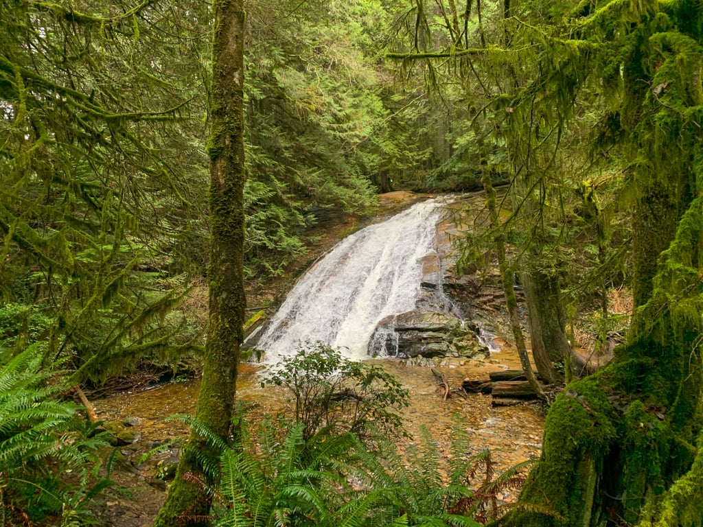

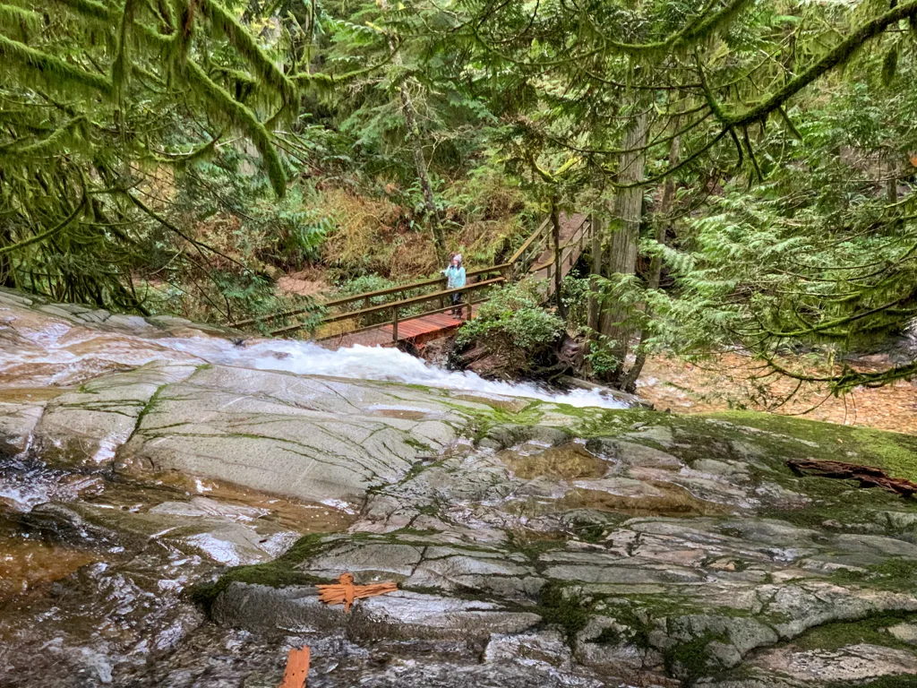
There’s a great view of the falls at the bottom of the hill near a bench. Cross the creek on a long bridge with more great views of the waterfall. On the other side, turn right and follow the Red Trail downhill along the east bank of the creek.
There are a few pretty cascades in this section, but they are often difficult to see as there are so many fallen trees in the creek. Ignore another bridge across the creek to the right, and continue downhill on the Red Trail, watching for more cascades.


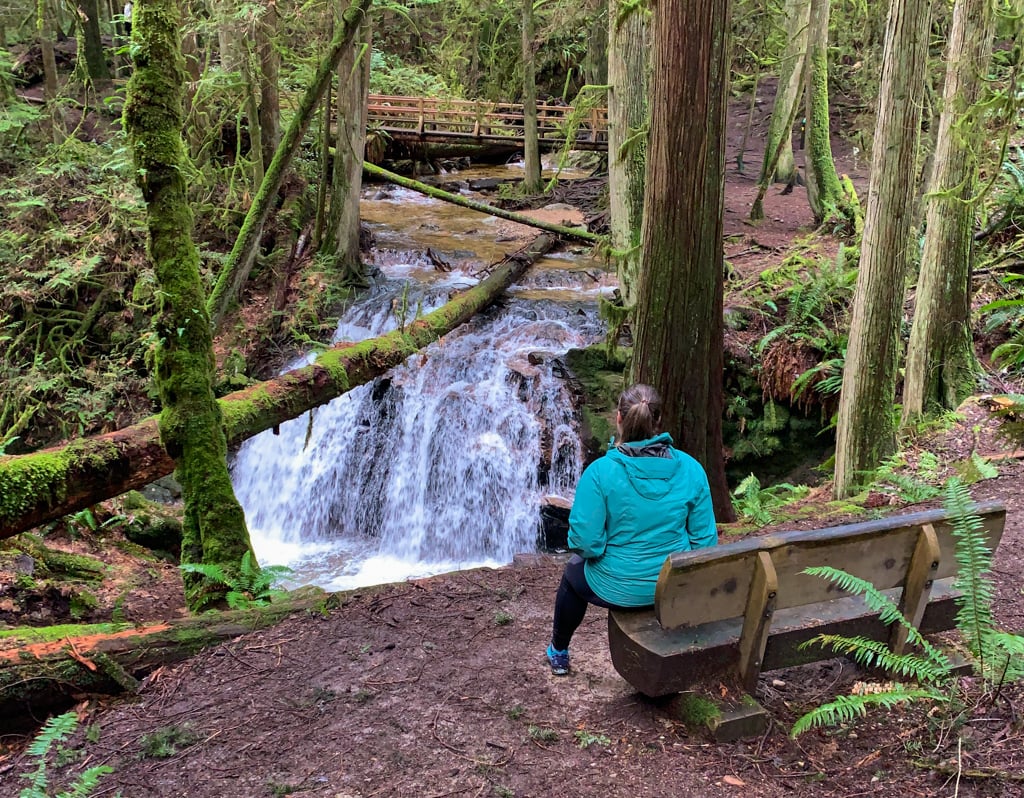
As you approach another bridge, you’ll begin to hear the roar of the lower falls. It plummets over a drop, then makes a sharp turn to the right. The best place to view it is from a nearby bench.

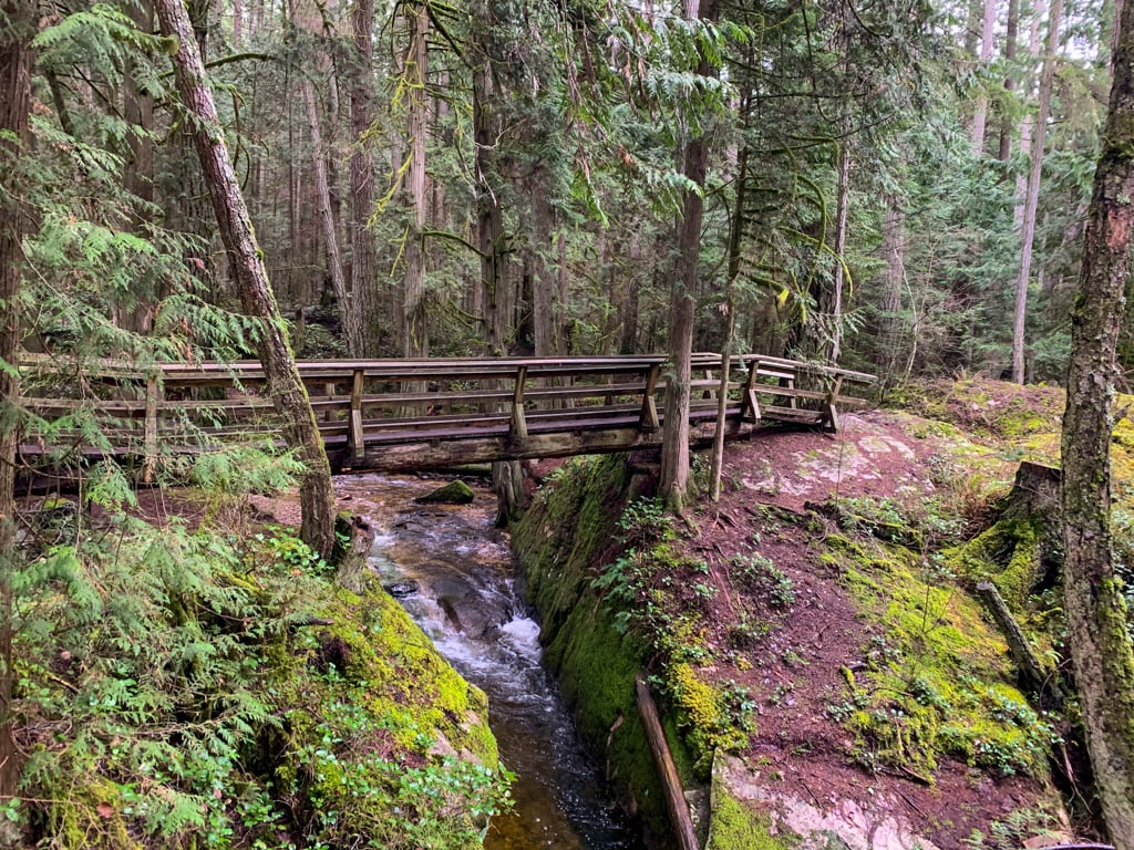
Continue along the Red Trail (ignoring the bridge) as it heads downhill, then meets up with the Purple Trail. Turn right onto the Purple trail and follow it downhill to a large bridge over Roberts Creek.

Climb up the stairs on the other side and continue along the trail until it emerges on a gravel road. Cross the road and follow the trail on the other side for a few hundred metres to a junction with the Blue Trail, crossing a small bridge along the way.
Turn left onto the Blue Trail walk a few minutes to another small bridge, then emerge onto the gravel road. Pick up the trail on the other side of the road and head downhill to cross a branch of Roberts Creek on yet another bridge.
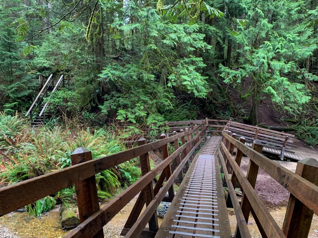
Ignore the Grey Trail heading right and stay on the Blue Trail. It traverses a wet area and the other branch of Roberts Creek on a long set of bridges and elevated boardwalks.
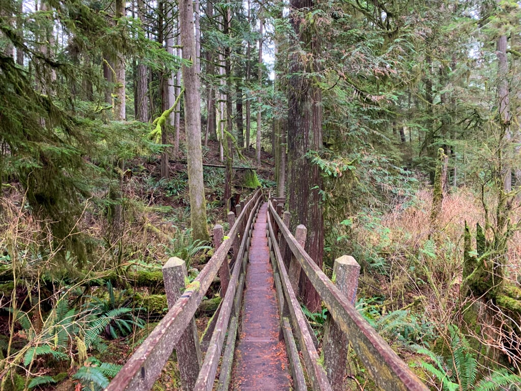

After the bridges, the trail curves uphill and arrives at a junction with the Red Trail. Turn right and follow it through the forest and across boardwalks to a bridge, this time over Clack Creek.


Stay left at the next junction and continue on the Red Trail as it traces the edge of the soccer field.
Reach a final junction in the forest. The parking lot is a few metres away to the right. But before you finish your hike, turn left and walk out onto the bridge for a final view of the waterfall from above.

So that’s everything you need to know to plan a hike in Cliff Gilker Park in Roberts Creek on BC’s Sunshine Coast. Do you have questions about the trail? Let me know in the comments. I’m always happy to help.
READ NEXT:
- 21 Best Hikes on the Sunshine Coast, BC
- The Best Things to do on the Sunshine Coast, BC
- Soames Hill Hike on the Sunshine Coast, BC
- Langdale Falls Hike on the Sunshine Coast, BC
- Skookumchuck Narrows Hike on the Sunshine Coast, BC
- How to Snowshoe and Ski at Dakota Ridge on the Sunshine Coast, BC
- Backpacking Manzanita Bluff and Rievely’s Pond on the Sunshine Coast Trail
- 100+ Snow-Free Hikes in Vancouver: Trails You Can Hike Year Round
- 20+ Beautiful Weekend Getaways from Vancouver


- Best Sun Hoodies for Hiking - June 3, 2026
- Lower Stein Valley Trail Hiking and Backpacking Guide - May 27, 2026
- The Best Things to Do in Vernon, BC - May 21, 2026