
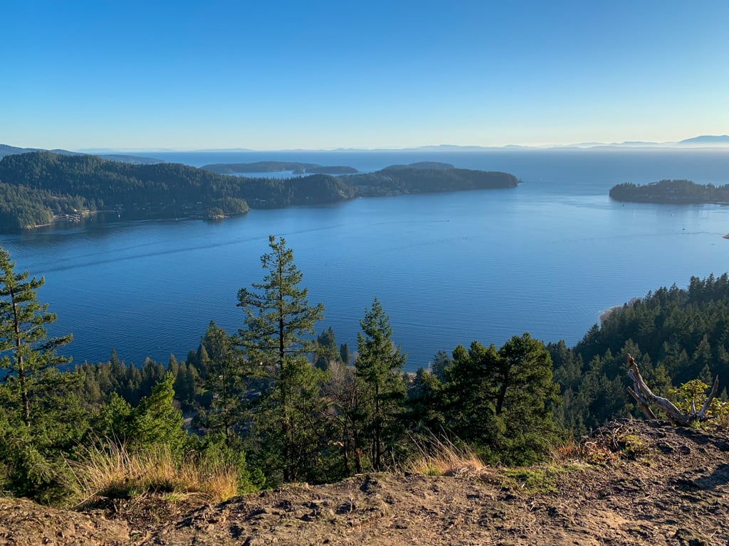
Soames Hill is not a lofty summit: It stands only 250m tall. But the views from the peak are incredible and it’s a beautiful short hike through the forest, then up a well-built staircase to the top. The Soames Hill hike is a must-do for anyone visiting Gibsons on BC’s Sunshine Coast.
A few years ago, I spent five months living in Gibsons. Soames Hill was one of the closest hikes to my house, so I went often. It was a great place to head for an after-work walk to catch the sunset. I even went up on Christmas Eve with a string of battery-powered festive lights decorating my backpack. I think it has one of the best views among hikes on the Sunshine Coast.
I’ve explored all the trails in the park and each of the viewpoints. That means that I’m able to give you a local’s insider info on everything you need to know to hike to Soames Hill.
In this post you’ll find:
- Two maps of the Soames Hill hike showing all the trail and parking options
- Detailed driving directions to the trailhead
- Turn-by-turn hiking directions for two different ways to get to the summit
This is a sensitive wilderness area. Learn how to Leave No Trace to keep the wilderness wild. Make sure you are prepared by bringing the 10 Essentials. Get ready for adventure with this checklist of things to do before every hike.
Soames Hill Basics
The Soames Hill hike is pretty short, but the view is incredible. Even though the second half of the trail is really steep, I’d say that it has a great effort to reward ratio. The stats below are for the direct route to the summit, but the loop route at the bottom of this hike also has nearly identical stats.
Distance: 2 km
Elevation Gain: 100 m
Time: 1 hour
Difficulty: Easy
Season: Year-Round
Toilets: None
Dogs: Allowed on leash
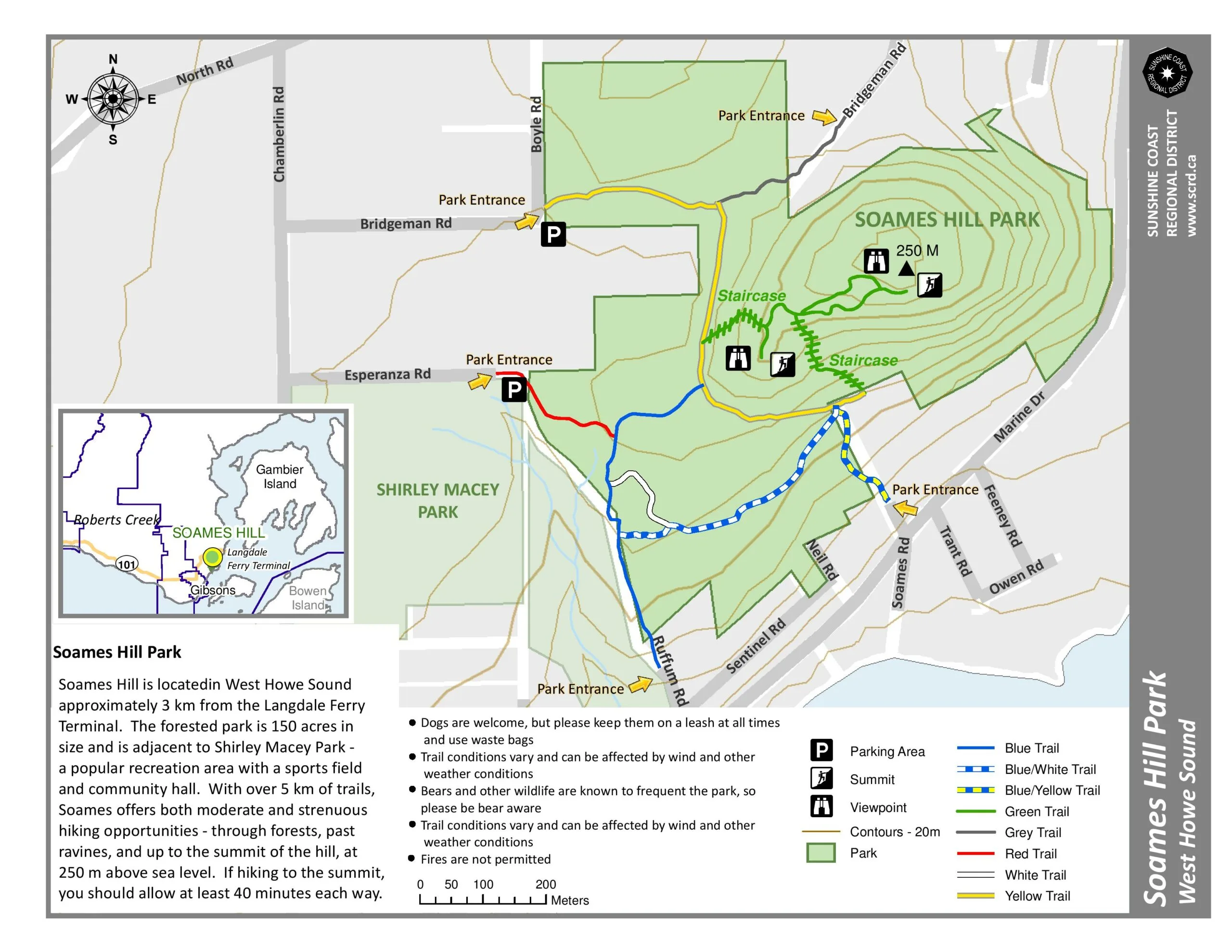
Soames Hill Hiking Maps
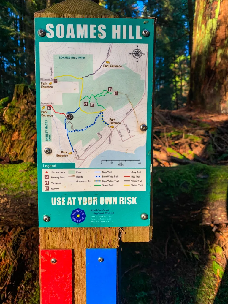
The Soames Hill trails are easy to navigate. All of the junctions are marked and some even have little maps of the trail. But having a map of the trails can be really helpful to plan your trip.
Here’s the official Soames Hill Park map from the Sunshine Coast Regional District.

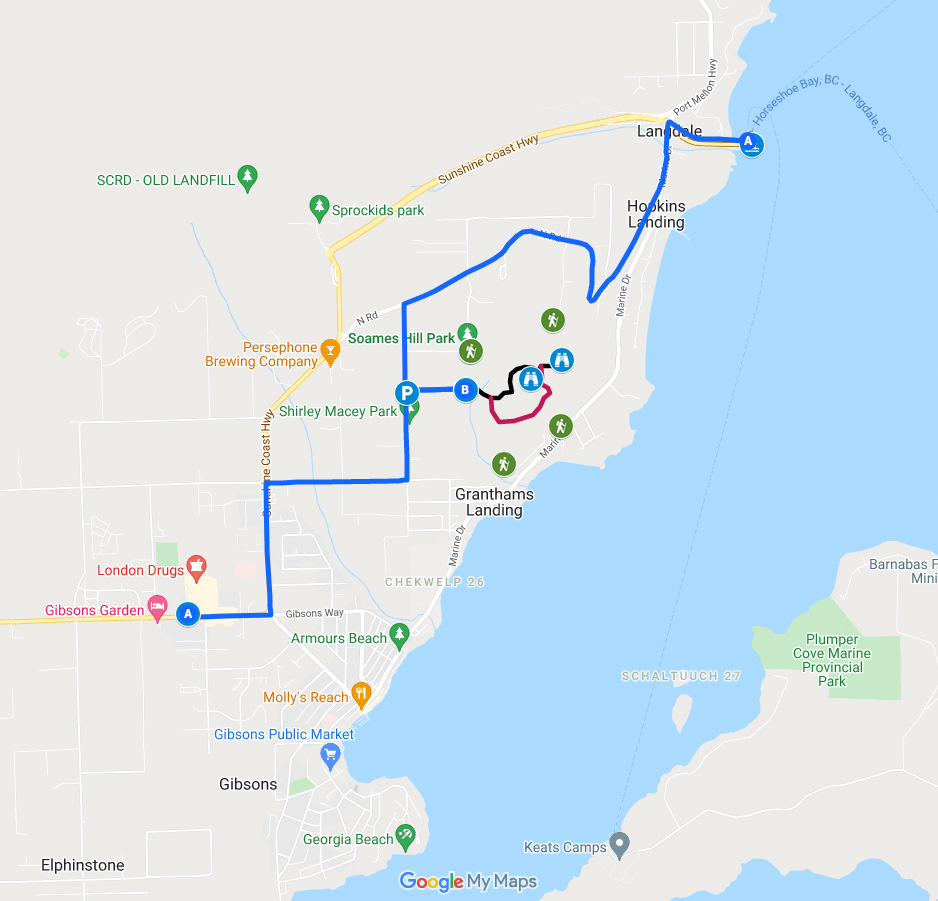
I also made you a custom Google map. It shows all the trailheads, parking areas, and driving directions. It also has a rough overview of the two trails I describe in this guide: the direct route to the summit of Soames Hill and a loop option.

How to Get to the Soames Hill Trailhead
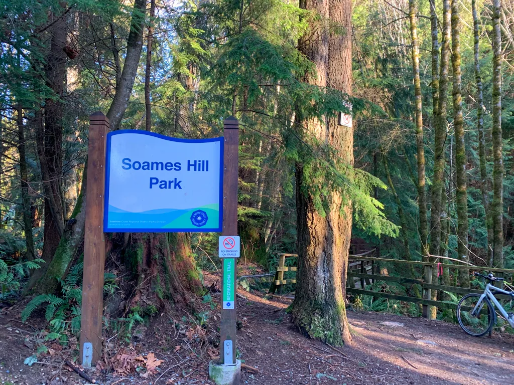
There are several trailheads for the Soames Hill hike. In my opinion, the best trailhead is the one on Esperanza Road because it has the most parking and it accesses several trails, so it’s easier to make a loop.
You can see the other trailheads on the Soames Hill hiking maps (above). The west Bridgeman Road Trailhead is also a good option and has room for three or four cars. The east Bridgeman Road Trailhead has no parking, so it’s really for locals only.
The trailheads on Soames Road and Ruffum Road also have no parking and are mostly used by locals. They are also located down at sea level, so it’s a steeeeep walk if you start down there.
Esperanza Road Trailhead Directions
Driving Directions from the Langdale Ferry Terminal
Drive off the ferry and turn left at the traffic light onto Marine Drive. About 400m later, take the right fork and head uphill on North Road. Follow North Road for about 2.5km, then turn left on Chamberlain Road.
About 500m down Chamberlain Road, turn left onto Esperanza Road at a sign for Soames Hill Park. Ignore an earlier left onto Bridgeman Road since that goes to the other trailhead.
Esperanza is a bumpy gravel road with some big potholes, but it is fine for all cars if you go slow. Drive to the end of the road and park.
The parking lot has room for about eight cars. If the lot is full, you can park on the gravel shoulder on Chamberlain Road (just outside the dog park) and walk down Esperanza Road to the trailhead.
Here are Google Maps directions.

Driving Directions from Gibsons
From Upper Gibsons, follow the Sunshine Coast Highway east (towards the Langdale Ferry Terminal). Turn right onto Reed Road at the traffic light. Follow it for about 1.5km downhill, then turn left onto Chamberlain Road.
Continue on Chamberlain for about 500m, going past Shirley Macy Park, then turn right down Esperanza Road at a sign for Soames Hill Park.
Here are Google Maps directions.
Soames Hill Hiking Directions
Direct Route to the Summit
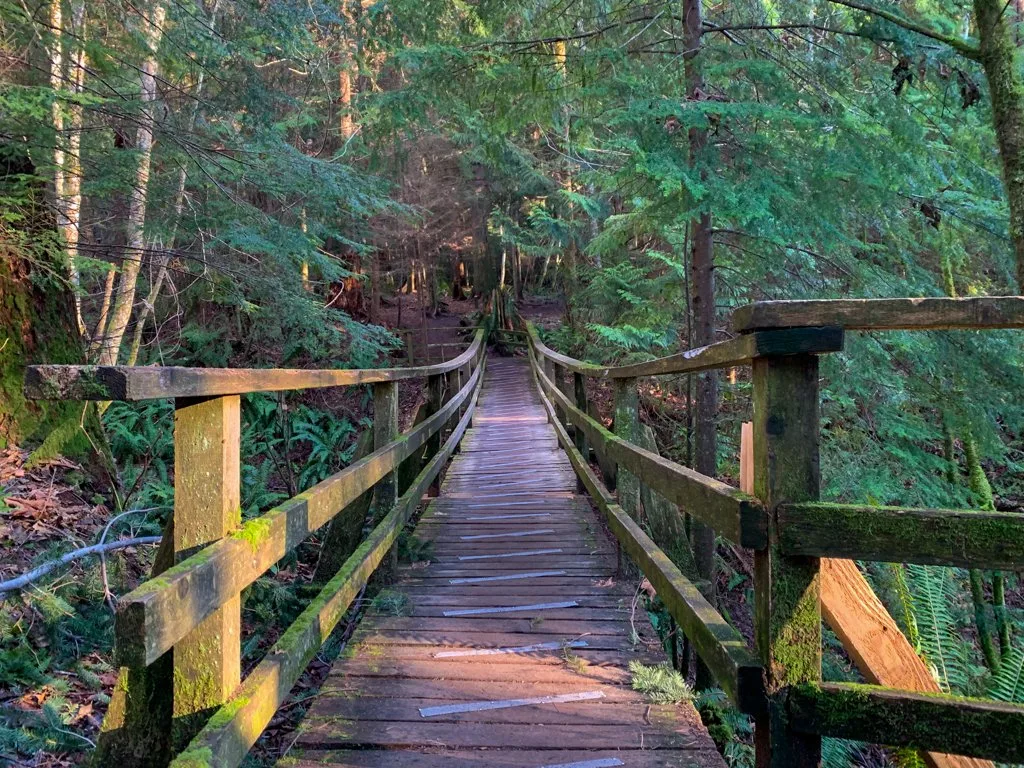
This is the most direct route to the Soames Hill summit from the Esperanza Road Trailhead. It takes you right to the peak and includes a short detour to the lower West Summit. From the parking lot, cross a long bridge over a moss and fern covered canyon.

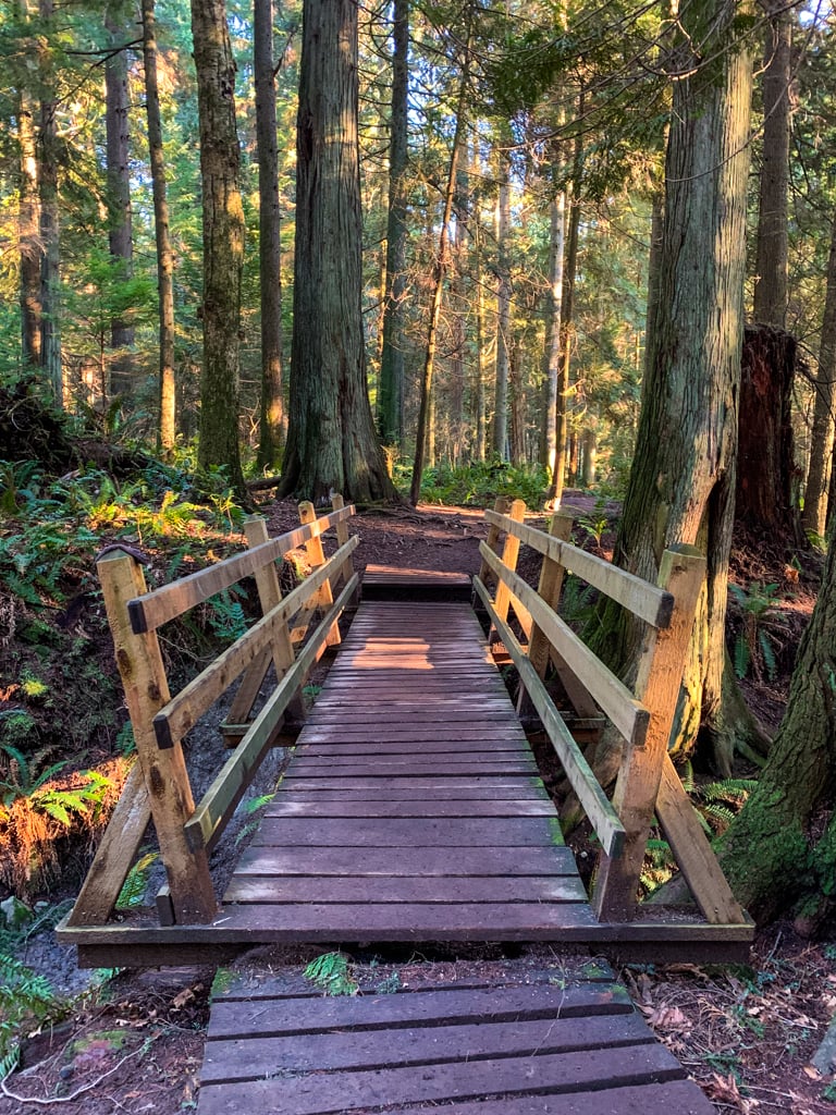
You are now on the Red Trail. Follow it through the forest and across a smaller bridge to a junction with the Blue Trail.


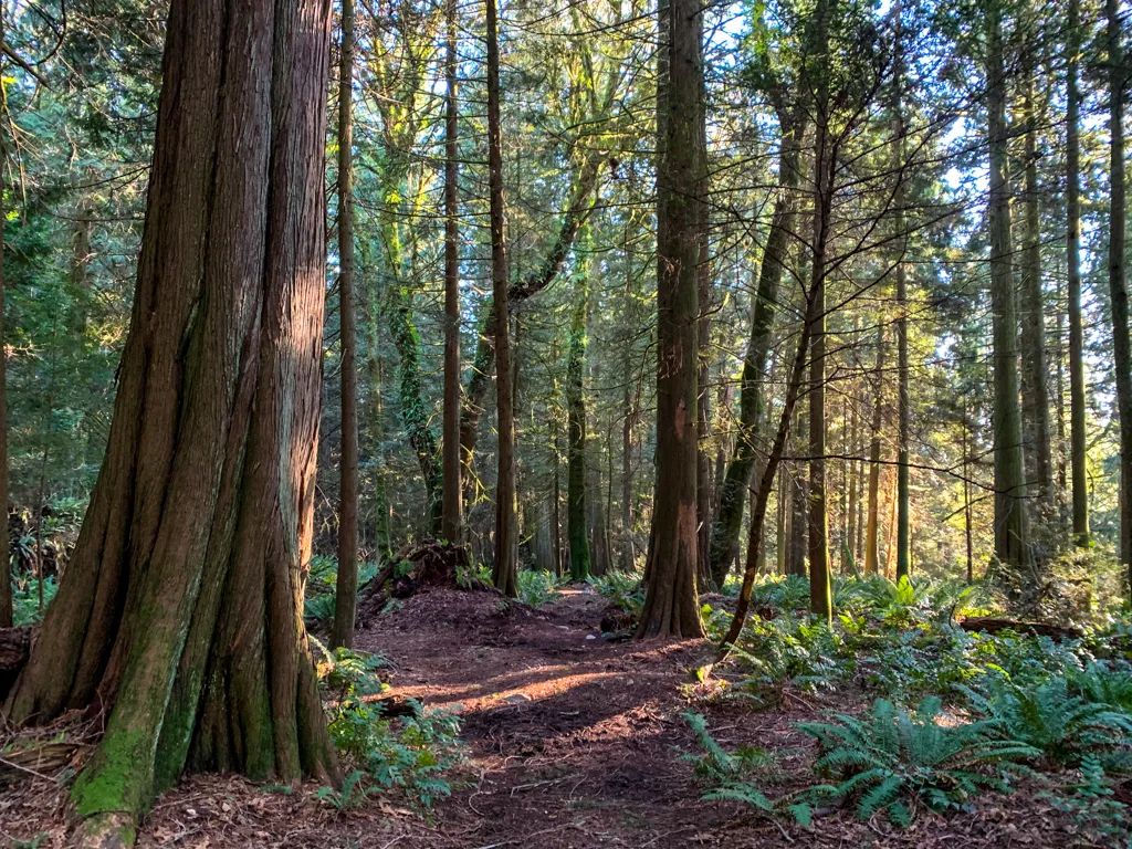
Turn left onto the Blue Trail and head through open forest. The trail is wide and somewhat indistinct in this area with some mud puddles. But just follow the most trampled path to stay on track.
In a few minutes reach another junction, this time with the Yellow Trail. Turn left and follow the wide Yellow Trail as it curves around a hill into a more open area. About 100m after the junction turn right onto the Green Trail as it heads steeply uphill.
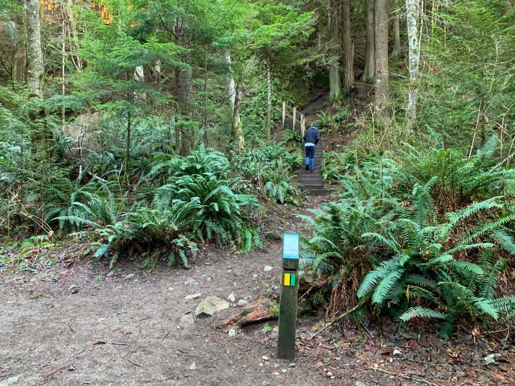

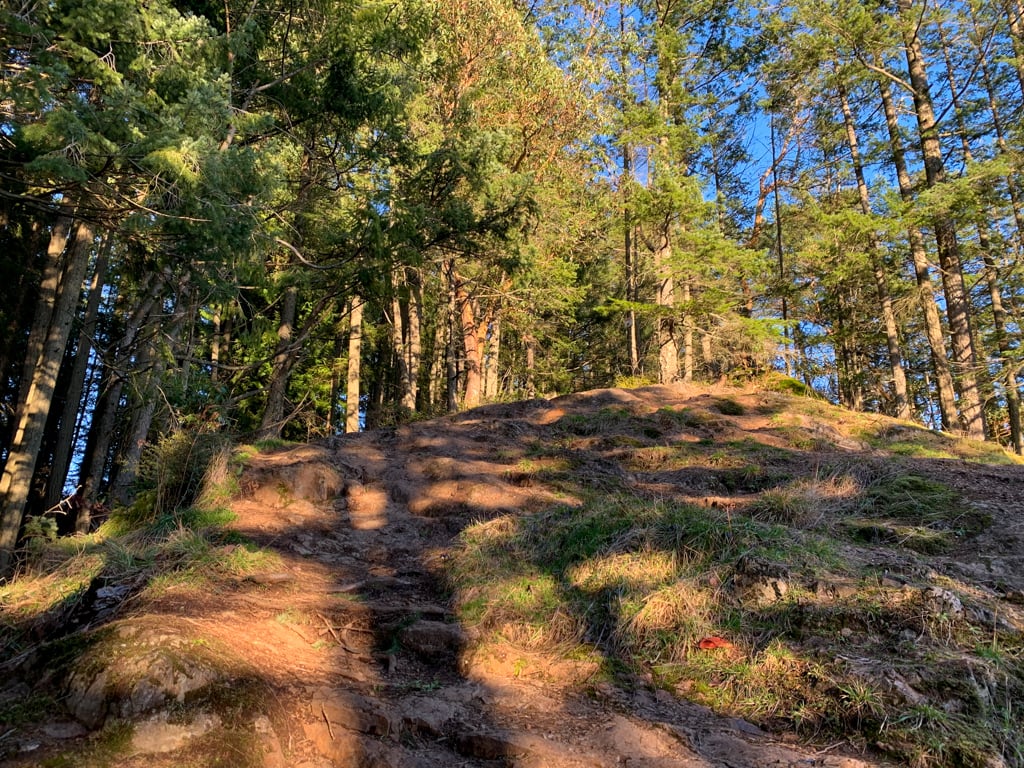
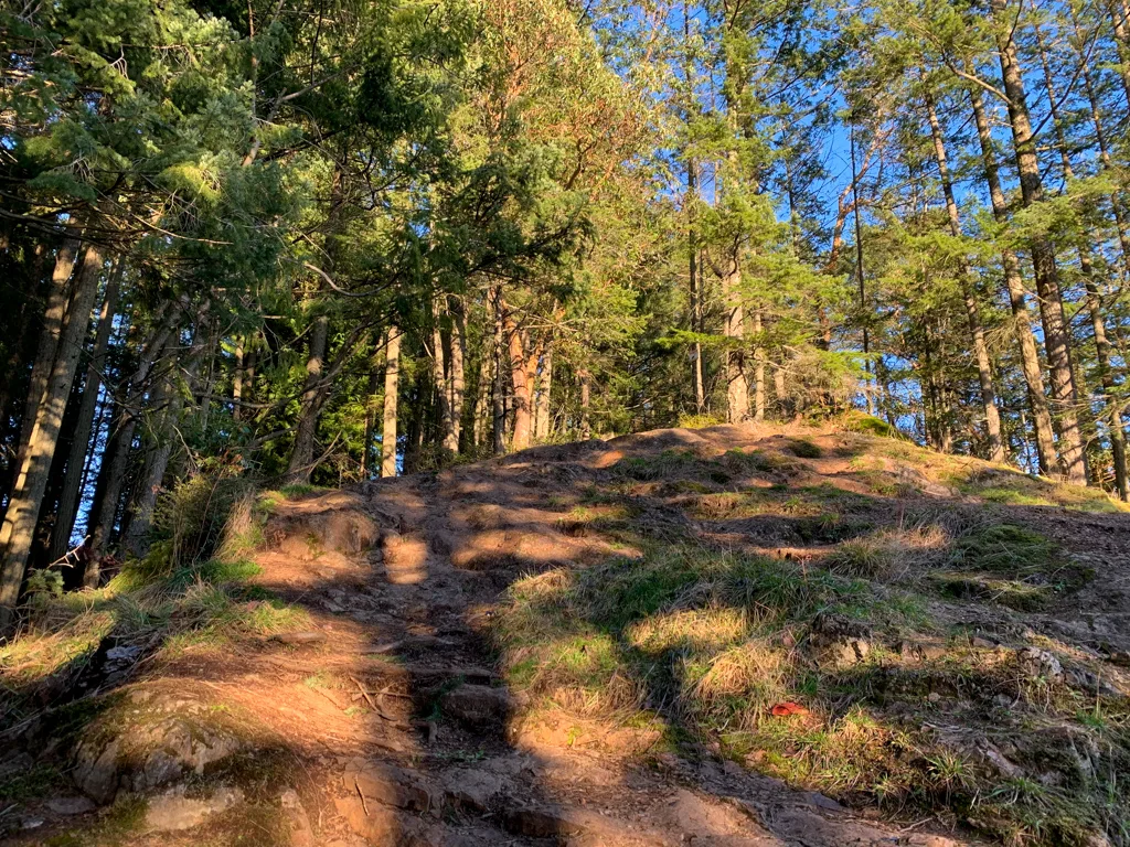
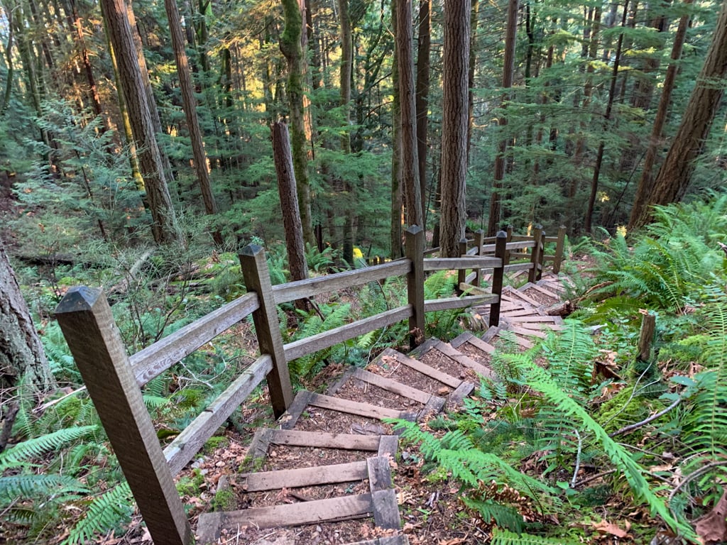
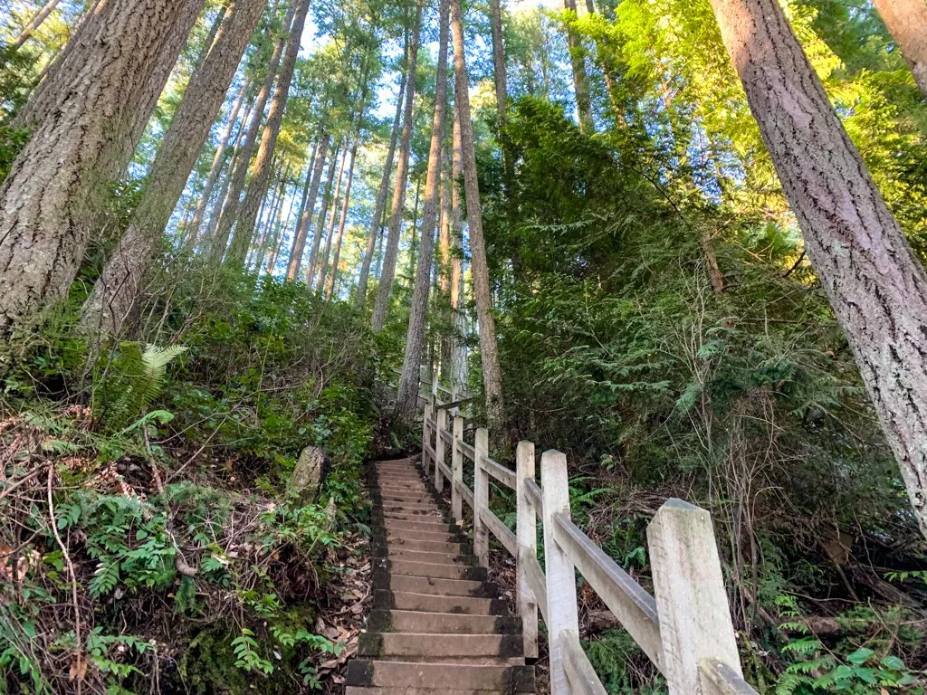
While the route has been mellow up until this point, the steep climbing starts now. You’ll climb steadily uphill on sets of wooden stairs.

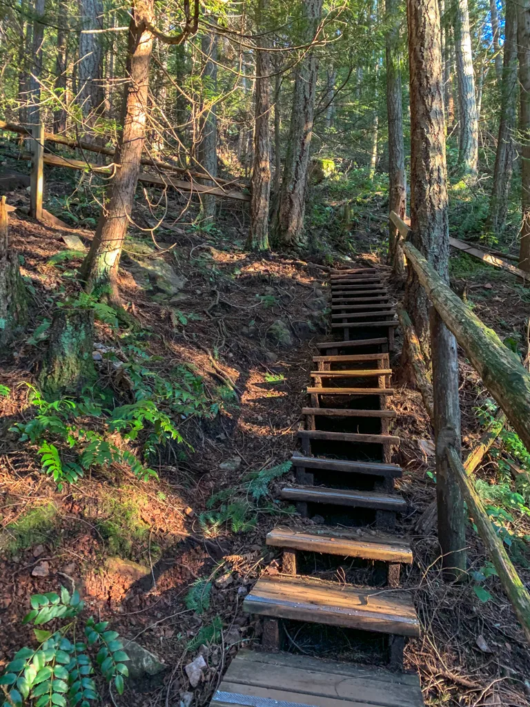
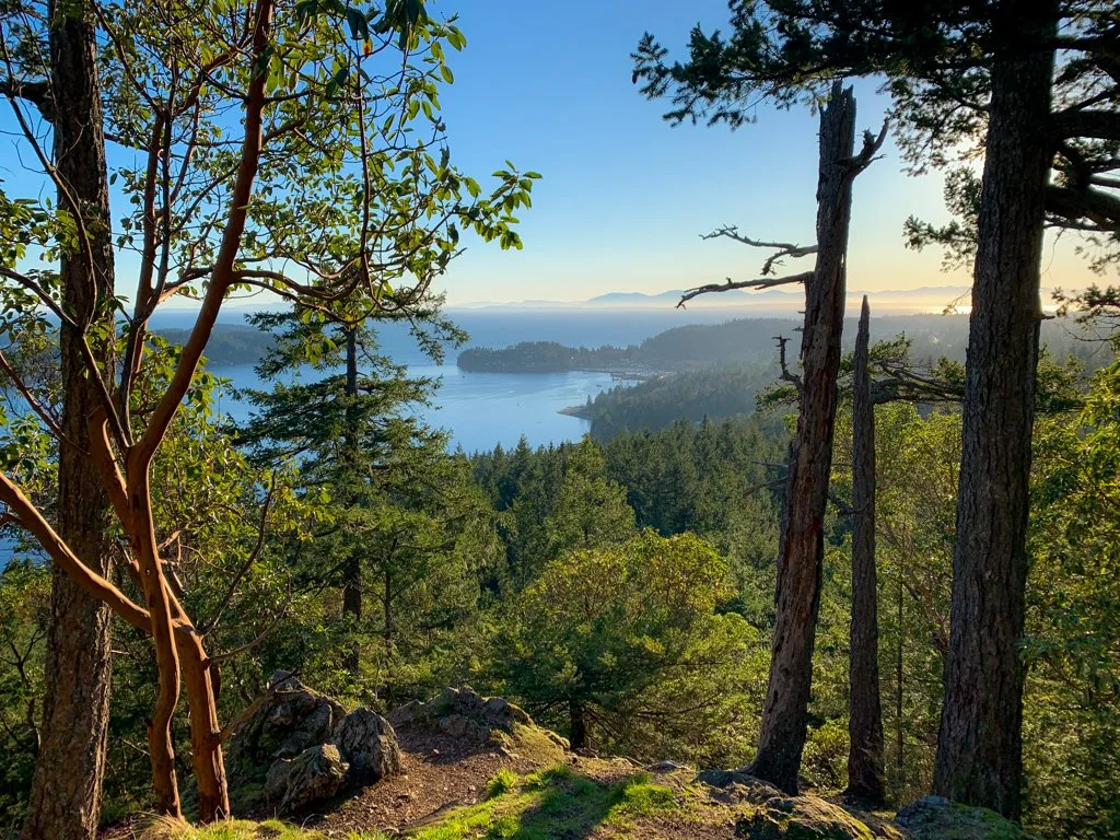
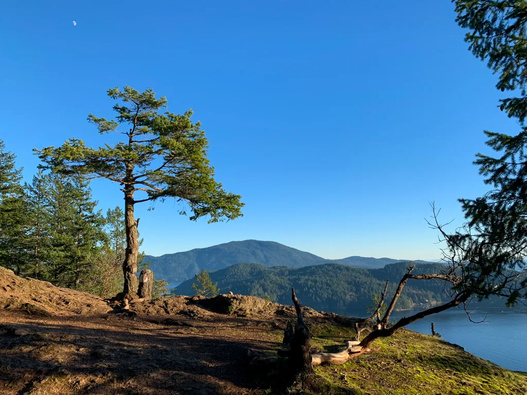
Pause to catch your breath at the top of the staircase, then follow a trail to the right to the West Summit of Soames Hill. This summit is about 50m lower than the true summit, but it has great views of Gibsons Landing through the trees.

After you’ve enjoyed the view at the West Summit, return to the main trail and take the other fork. It goes up and over a rocky knob that can be slippery, then arrives at another junction.
Your route to the summit heads uphill to the left. The trail to the right goes downhill on more stairs to meet up with the rest of the trail system. (This route is described in the Soames Hill Loop section below.)
Head uphill through the trees to the first viewpoint. It’s mostly brushed in, so continue following the trail upwards. Be careful on a steep rocky and grassy section – it can be very slippery when it’s wet.

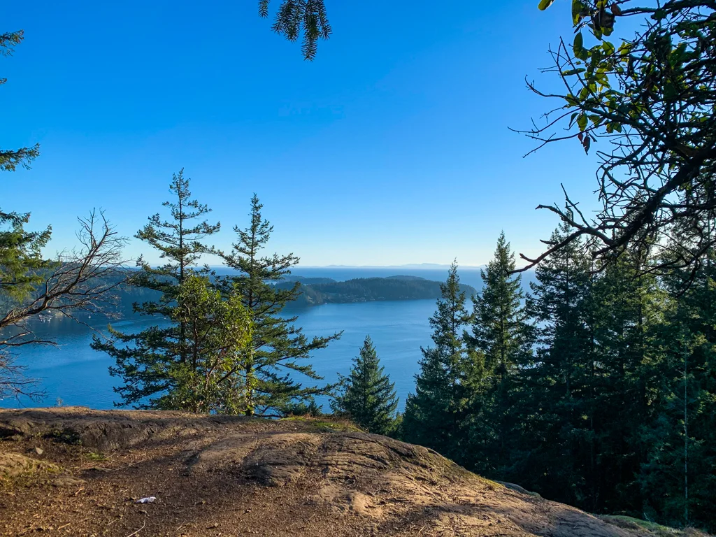
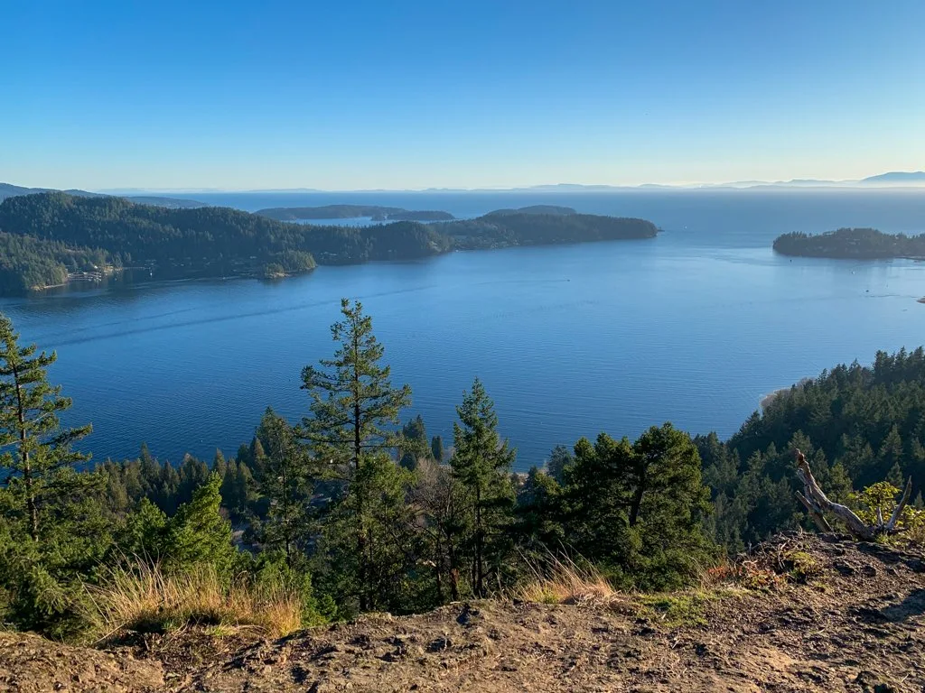
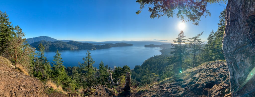
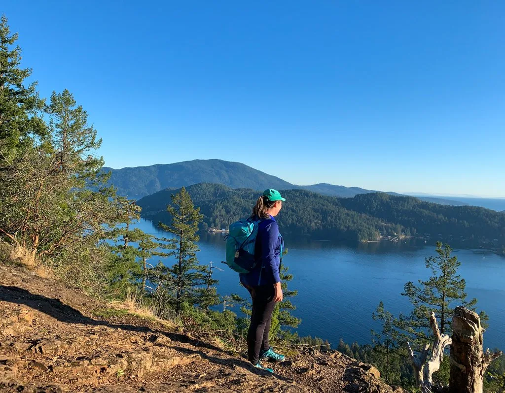
Soon you will reach the main viewpoint on a granite outcrop at the peak of Soames Hill. The views from here are spectacular. To the southeast, you can see Keats Island with Bowen Island behind it. Look southwest to see the Lower Gibsons below you and Vancouver Island across the Strait of Georgia.


When you are finished soaking up the views, retrace your steps to your car.
Soames Hill Loop
Instead of making a beeline for the summit, vary your hike by exploring some of the other trails in the park. They lead through a beautiful coastal forest with pockets of Douglas fir, cedar, and arbutus with lots of salal and Oregon grape in the understory.
Like the direct route to the summit, this loop hike around Soames Hill is about 2km. It also has about the same amount of elevation gain. However, on this route, you’ll be climbing a longer set of stairs up the southeast side of the hill, which can make it feel a bit more difficult.
To start the Soames Hill Loop hike, take the Red Trail from the Esperanza Road Trailhead. At the first junction with the Blue Trail, turn right and follow it slightly downhill. Ignore a junction with the White Trail and continue on the Blue Trail until you reach the intersection with the Blue/White Trail.

Turn left and follow the Blue/White Trail through the dense forest as it sidehills along. Reach a major junction where the Blue/Yellow Trail heads downhill and the Yellow Trail heads off to the left.
Your route is straight uphill on the stairs of the Green Trail. Climb up the stairs as they snake up the hill. At the top, turn right and follow the trail to the summit


Your return route follows the direct route to the summit, as described above. Follow the Green Trail down the southwest side of the hill (detouring over to the West Summit), then take the Yellow, Blue, and Red Trails back to the Esperanza Road Trailhead.
Final Thoughts
So that’s everything you need to know to plan a hike to Soames Hill in Gibsons on BC’s Sunshine Coast. Do you have questions about the trail? Let me know in the comments. I’m always happy to help.
READ NEXT:
- 21 Best Hikes on the Sunshine Coast, BC
- The Best Things to do on the Sunshine Coast, BC
- Langdale Falls Hike on the Sunshine Coast, BC
- Cliff Gilker Park Hike on the Sunshine Coast, BC
- Skookumchuck Narrows Hike on the Sunshine Coast, BC
- How to Snowshoe and Ski at Dakota Ridge on the Sunshine Coast, BC


- Best Sun Hoodies for Hiking - June 3, 2026
- Lower Stein Valley Trail Hiking and Backpacking Guide - May 27, 2026
- The Best Things to Do in Vernon, BC - May 21, 2026
Tobi Haywood
Sunday 27th of March 2022
Hi Taryn, Do you know if there are any trails to get to this hike from the ferry for foot passengers? Might be a nice little day trip from Horseshoe Bay. Thank you!
Taryn Eyton
Sunday 27th of March 2022
The trailhead is about 5km from the ferry terminal and unfortunately is all on roads and up a big hill. If you're looking for a trail you can do right from the ferry terminal, Langdale Falls is a better better and my guide for that trail includes directions for walking off the ferry right to the trail: https://happiestoutdoors.ca/langdale-falls/
JAra
Sunday 20th of March 2022
Very informative. I find the details, tips, and images so helpful. Thank you!
Q: If someone were to take the direct route to summit, is it comparable to the stairs in Lynn Valley and/or Wrech beach? I'm wondering if this can be possible for my mom-in-law who is senior and experiences knee pain at difficult times but with break in between and not scrambling up the stairs, can it be doable?
Thanks.
Taryn Eyton
Monday 21st of March 2022
If your mom can do the Wreck beach stairs, she can definitely do Soames Hill. It's comparable. The only difference is that there aren't as many places to rest on the Soames Hill stairs - people may have to squeeze past you if you take breaks.