

The hike to Skookumchuck Narrows is one of the most popular things to do on British Columbia’s Sunshine Coast. It’s an easy trail through a beautiful rainforest to an ocean viewpoint where you can watch the tide rush into and out of a narrow inlet, creating huge whirlpools and rapids.
I spent five months in the winter of 2020/21 living in Gibsons on the Sunshine Coast. So I was able to time my visit to Skookumchuck Narrows to make sure I hit a time with some of the biggest whirlpools. It was so crazy to watch. And the roar of the water was so loud!
If you are visiting the Sunshine Coast, don’t miss the hike to Skookumchuck Narrows near Egmont. It’s one of the most popular hikes on the Sunshine Coast (for good reason!) I’ve got everything you need to know to visit.
In this post you’ll find:
- Info on the best times to view the whirlpools and rapids at Skookumchuck Narrows
- A detailed map of the Skookumchuck Narrows hike
- The meaning of the word “Skookumchuck”
- Detailed hiking directions for the Skookumchuck Narrows Trail
This is a sensitive wilderness area. Learn how to Leave No Trace to keep the wilderness wild. Make sure you are prepared by bringing the 10 Essentials. Get ready for adventure with this checklist of things to do before every hike.
Skookumchuck Narrows Basics
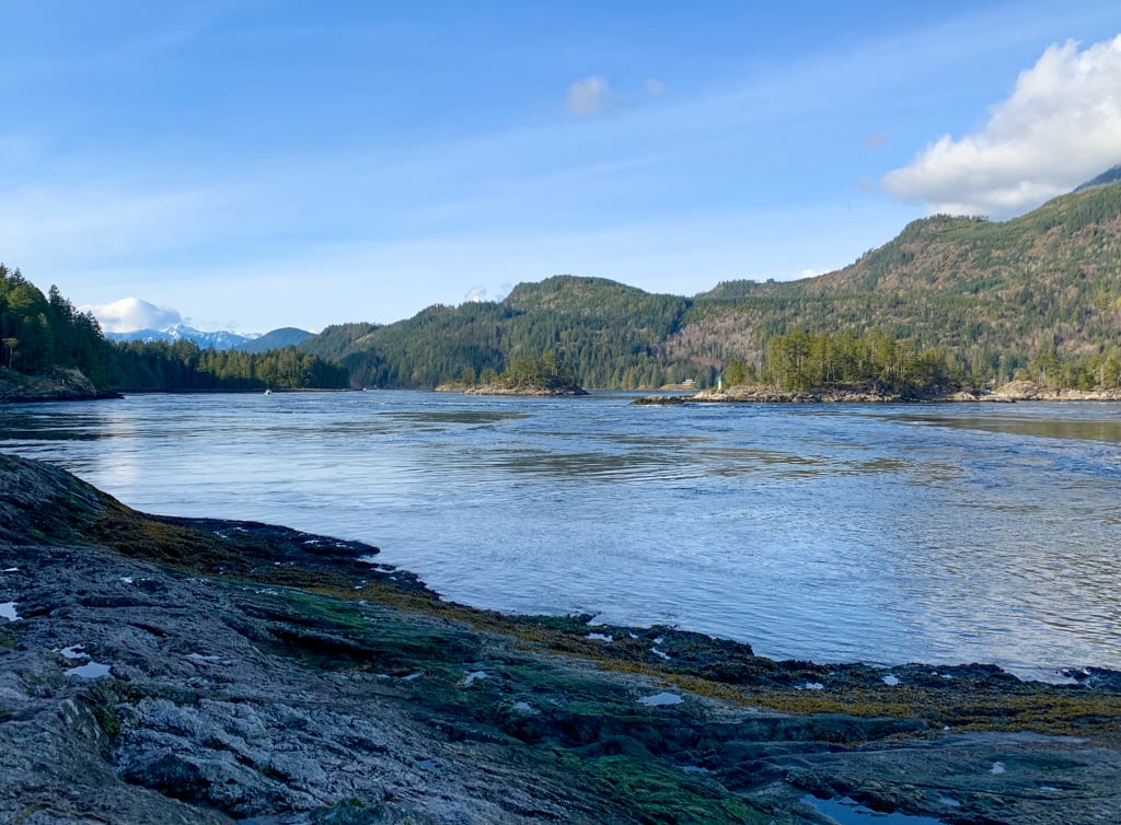
Skookumchuck Narrows sits at the entrance to Sechelt Inlet. The narrows and hiking trail are in Skookumchuck Narrows Provincial Park.
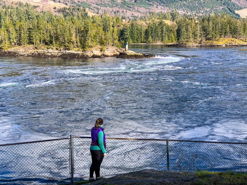
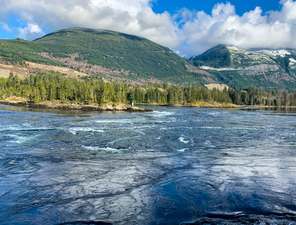
Since the opening to the inlet is so narrow, and the inlet is so big, when the tide changes, a huge volume of water rushes through the narrows, forming whirlpools and rapids.
The water is so powerful that it can flow as fast as 33 kilometres per hour (20mph)! The water level can be up to 2 meters (6’7″) higher on one side of the rapids than the other!
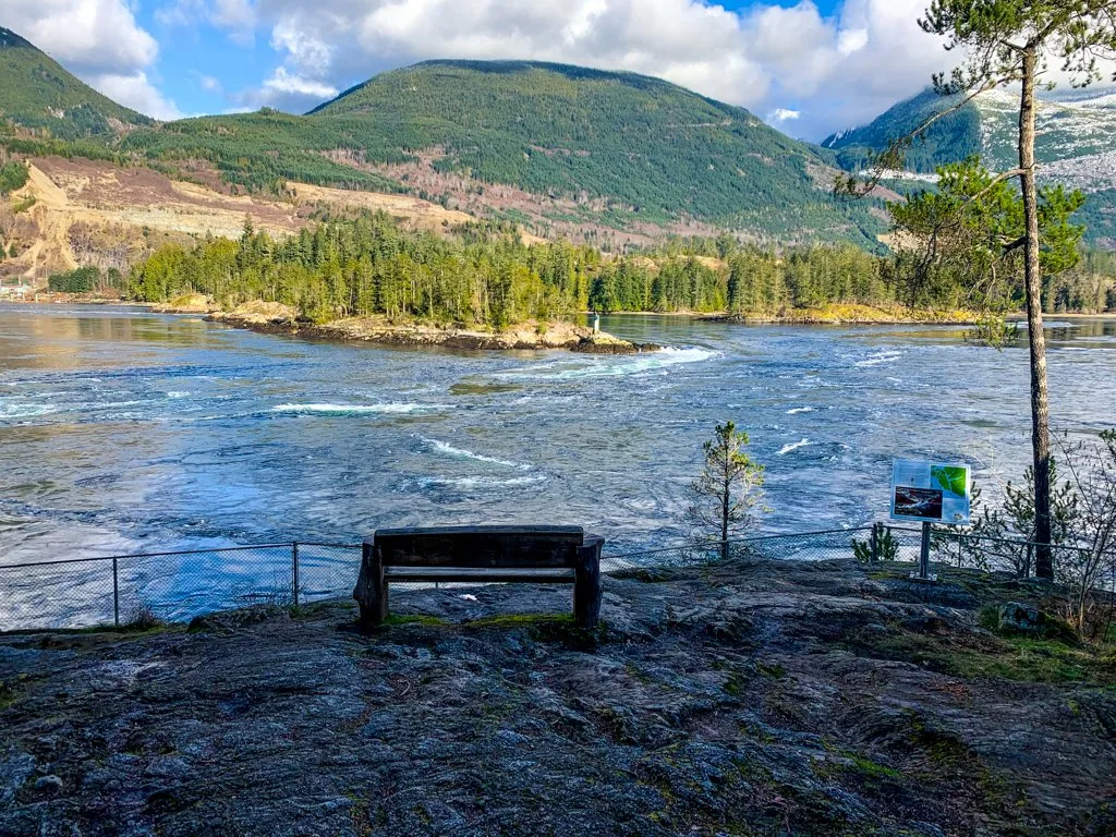
The viewpoints at North Point and Roland Point are popular places for hikers to watch the rapids. But whitewater kayakers and surfers love to play in the rapids during flood tides too. Check out this video of kayaking and surfing at Skookumchuck.
Bring binoculars for close-ups of the whirlpools and rapids. You can also spot lots of wildlife here including eagles, surf scoters, cormorants, and seals. Binos are also helpful for watching the kayakers surf the rapids.
Skookumchcuk Narrows Trail Info
Distance: 8 km return
Elevation Gain: 90 m
Time: 2-2.5 hours
Difficulty: Easy
Season: Year-round
Toilets: There’s an outhouse at the trailhead and another one near the North Point viewpoint.
Dogs: Allowed on-leash
Rules: Since this is a provincial park, alcohol, smoking, vaping, and cannabis are not allowed. While the trail is wide and flat, bikes aren’t allowed.
What Does “Skookumchuck” Mean?
Skookumchuck Narrows is on the traditional territory of the Shíshálh. The word “Skookumchuck” comes from Chinook Jargon, a pidgin indigenous language used as a trade language between indigenous groups and sometimes with European settlers. The language was used on the Pacific Coast from Alaska to Oregon during the 1800s. In Chinook Jargon skookum means strong or powerful, and chuck means water.

Best Times to Hike to Skookumchuck Narrows
The best time to see rapids and whirlpools at Skookumchuck Narrows is when the tide changes and the flow of water switches directions. You can use a tide table to calculate the time in between high and low tides and aim to visit then.
But the easiest way to figure out the best time to hike to Skookumchuck Narrows is to use this handy Skookumchuck Narrows calendar from Sunshine Coast Tourism. It lists the best viewing time(s) for each day along with a prediction on how “big” the whirlpools or rapids will be.
If you want to see whirlpools, hike to Skookumchuck Narrows on an ebb/outgoing/”-” tide. They are best viewed from North Point. If you want to see rapids at Skookumchuck, go on a flood/incoming/”+” tide.
The best times to see the Skookumchuck rapids are often early or late in the day, so don’t forget to bring a flashlight or headlamp in case you are on the trail in the dark!
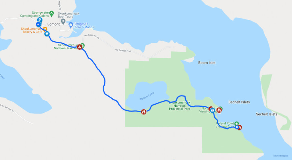
Skookumchuck Narrows Map
The Skookumchuck Narrows hike is pretty straightforward, with signs at all the major intersections. But I also made you a custom Google map that shows you the key points along the hike.

How to Get to Skookumchuck Narrows
Driving to the Skookumchuck Narrows trailhead is pretty easy. From Sechelt head north on the Sunshine Coast Highway for about 53km.
Turn right onto Egmont Road and follow it for 5km. Look for the Skookumchuck Narrows Provincial Park sign on the right-hand side near the intersection with Doriston Highway. Total driving time from Sechelt is about 1 hour.
There is lots of angle parking on the gravel shoulder here. You can also park in the Egmont Heritage Centre Museum parking lot across the road. There’s an EV charge station there too!
Click here for Google Maps driving directions.
Skookumchuck Narrows Hiking Directions
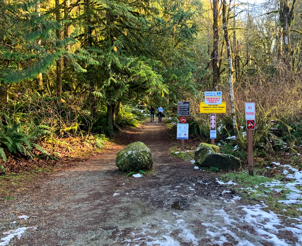
The trailhead is located a few meters down Doriston Highway. There’s an outhouse here along with an info kiosk. The first 10 minutes of your hike will be along this gravel road.
There is no public parking or public access to the road, so you have to park in the designated parking area on Egmont Road and walk along Doriston Highway.
From the trailhead, walk along the gravel Doriston Highway to a bridge. On the other side of the bridge, you’ll find the Skookumchuck Bakery and Cafe. It’s open from spring through fall, and I hiked the trail in the winter, so unfortunately I didn’t get to visit.

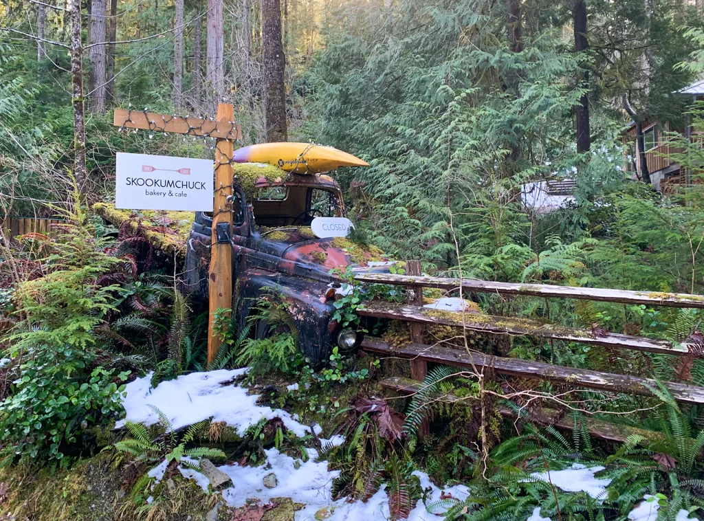
From what I’ve heard, it’s a super-cute little cafe. They have coffee, baked goods, and sandwiches, and everything is made on-site. Plan to stop here on your way back from the hike!
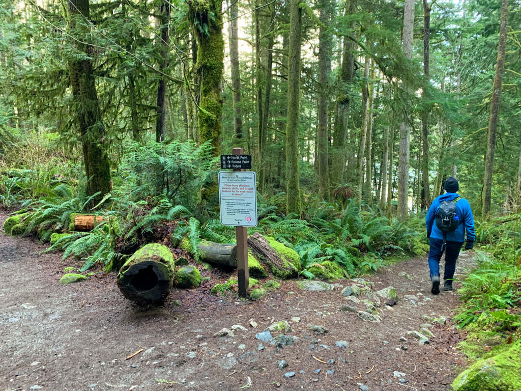
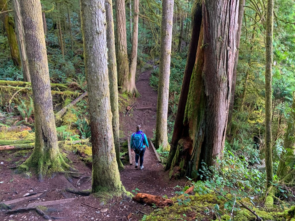
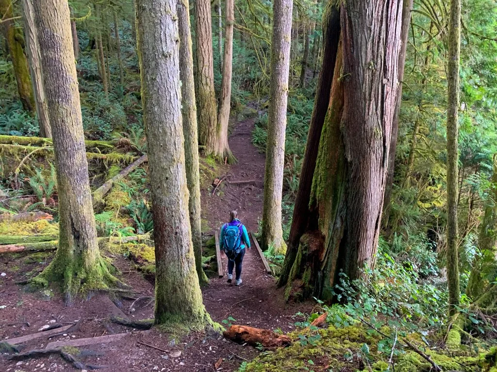
Continue along the gravel road, passing several private residences. The road ends at a large turn-around area with lots of no parking signs. A wide trail heads into the forest straight in front of you. The trail is a former logging road, so it’s quite flat. (In fact, it’s flat enough to push a stroller all the way to North Point.)

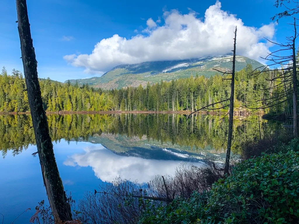
Follow the trail through a beautiful forest with lots of sword ferns, moss, and big cedar trees. About 2km from the trailhead, the forest opens up as you approach the shores of Brown Lake. This quiet lake has great reflections on calm days.
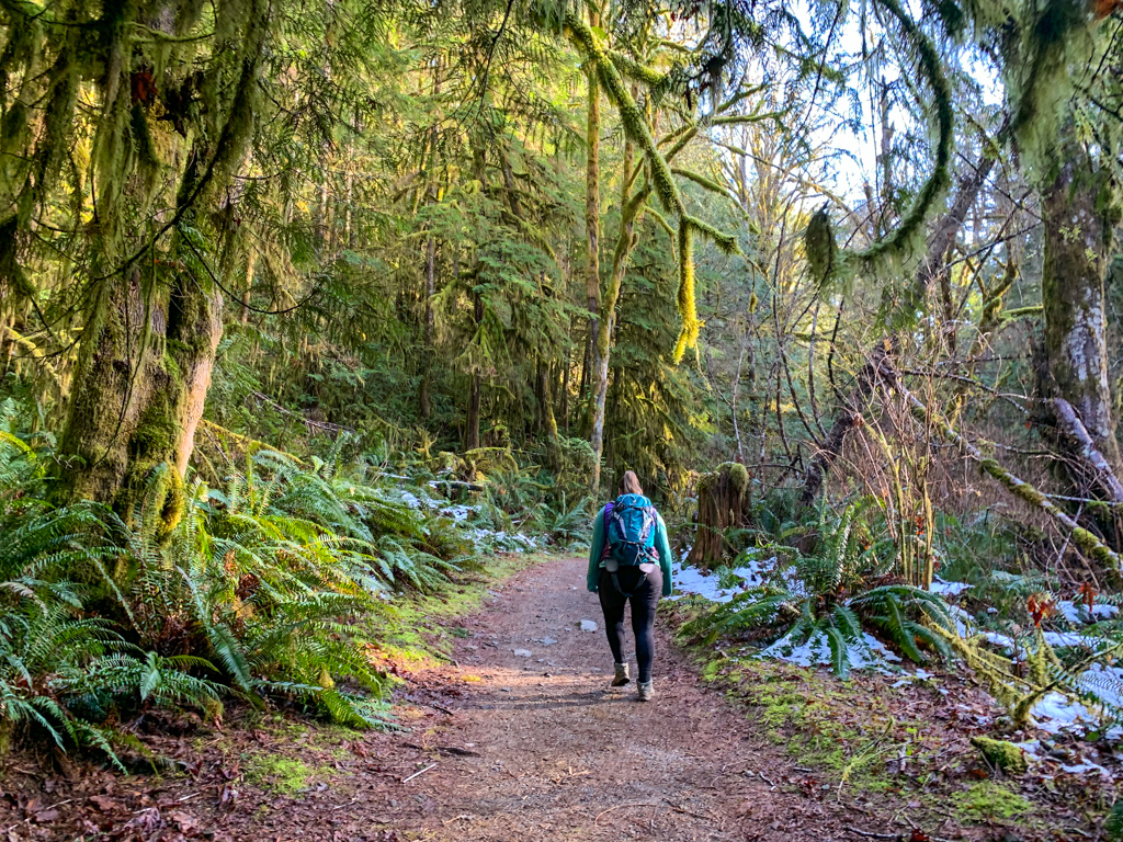


Stay on the trail as it curves around the lake and heads back into the forest. The next section has a few ups and downs as the path makes it’s way closer to the coast. You may even be able to hear the roar of the rapids through the trees.
Arrive at a junction about 3.5km from the parking area. Turn left if you want to head to North Point, which is best for whirlpools on an ebb tide.
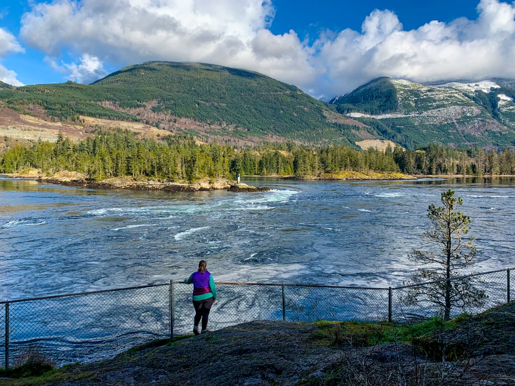
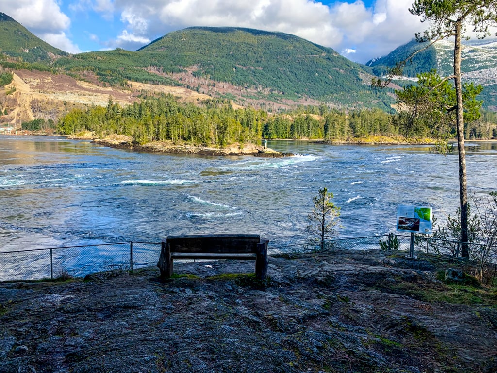
It’s just another minute to the North Point viewpoint from here. It is on a wide rocky bluff and has two benches. There’s a chainlink fence along the cliff edge for safety. The view of the tiny islands in Skookumchuck Narrows is fabulous. However, you will also get a great view of the gravel mine on the other side of the inlet, and it’s not so pretty.

If you want to reach Roland Point, which is best for rapids on a flood tide, go straight at the intersection. If you need to use the toilet, there is an outhouse on the left side of the trail just a few steps past the junction.
The trail from the junction to Roland Point is much rougher, with lots of roots, rocks, and uneven sections. Follow the trail as it descends close to sea level and crosses a small creek, then continues along the coastline above some small cliffs.
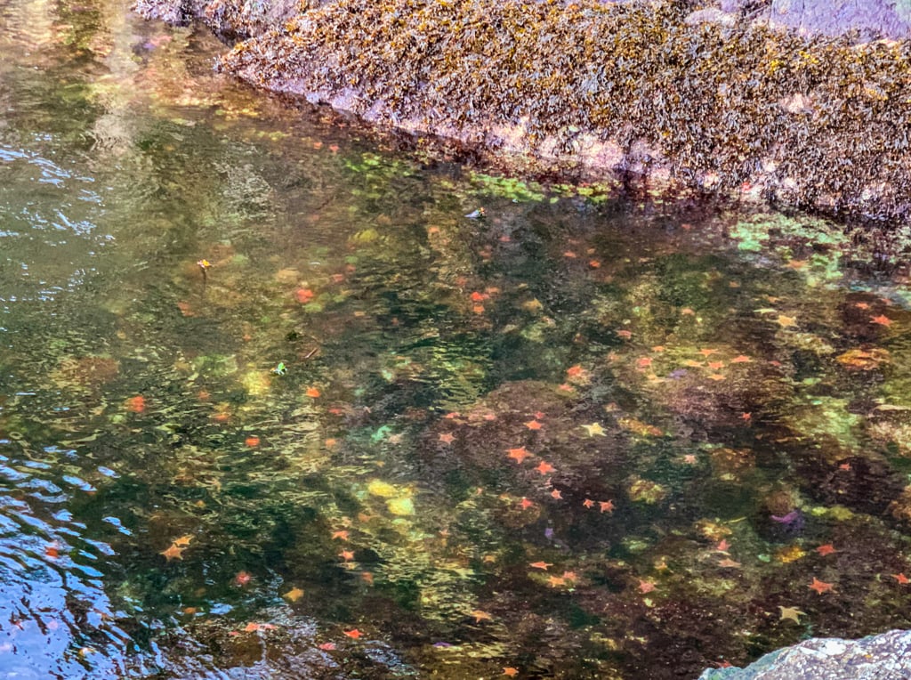
The trail ends at Roland Point, a rock outcropping jutting out into Skookumchuck Narrows. You are right at the water level here, so be careful near the edge. The water here is really clear – look for tons of sea stars and anemones below the surface.


When you have finished enjoying the Skookumchuck rapids and whirlpools at the narrows, retrace your steps back to your car.
So that’s everything you need to know to plan a hike to Skookumchuck Narrows near Egmont on BC’s Sunshine Coast. Do you have questions about the trail or the Skookumchuck Rapids? Let me know in the comments. I’m always happy to help.
READ NEXT:
- 21 Best Hikes on the Sunshine Coast, BC
- The Best Things to do on the Sunshine Coast, BC
- Langdale Falls Hike on the Sunshine Coast, BC
- Cliff Gilker Park Hike on the Sunshine Coast, BC
- Soames Hill Hike on the Sunshine Coast, BC
- How to Snowshoe and Ski at Dakota Ridge on the Sunshine Coast, BC
- 20+ Beautiful Weekend Getaways from Vancouver
- Backpacking Manzanita Bluff and Rievely’s Pond on the Sunshine Coast Trail


- Best Sun Hoodies for Hiking - June 3, 2026
- Lower Stein Valley Trail Hiking and Backpacking Guide - May 27, 2026
- The Best Things to Do in Vernon, BC - May 21, 2026
John Passas
Saturday 15th of October 2022
My wife and just did (October 13, 2022) the hike to see an +XL tide at the Skookumchuck and although the hike in was not difficult but it was a lot different than the description in your article. The first thing is that route isn't flat in changes vertical direction quite a bit and people should be prepare for some steep sections on rocky terrain. There are a number of sections with tree roots that cover the trail path and caution is required so as not to trip. Also there is no way I would even think of taking a child stroller on that route especial if you wanted to go to Roland Point. The tide we saw was at 8:13am meaning we started our hike around 7:00am in the dark as the sun had not quite come up, luckily we carried a flashlight that made the hike more comfortable. The hike in to see an XL tide is more than worth the effort but people with any mobility issues should be aware of the terrain and give themselves extra time to enjoy the Skookumchuck.
Taryn Eyton
Monday 17th of October 2022
Hi John. I'm glad you and your wife enjoyed seeing the rapids at an XL tide. I apologize if you found my description of the hike lacking. I do note in the stats at the beginning that it gains and loses 90 m, so it does have some elevation gain. As well, my comment about it being flat enough for a stroller only applies to the section up to North Point - on my trip we actually saw someone pushing a stroller, which they left just before the viewpoint. As I note in my description, the trail is considerably rougher between North Point and Roland Point. My hike descriptions are written for seasoned hikers, so in comparison to the other hikes on my site, this trail is very easy and flat.