
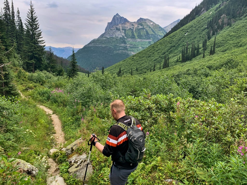
Revelstoke is my favourite mountain town in BC. And one of the big reasons for that is the amazing hiking. Last summer I took a week-long trip to Revelstoke just to hike. After spending lots of time in the area, I’ve put together a list of the best Revelstoke hikes for you. No matter what kind of trail you’re looking for, there’s a hike for you: waterfalls, wildflowers, mountain views, meadows, lakes, and rainforests. With all the huge mountains around, lots of the Revelstoke trails are steep and challenging… but there are tons of easier trails too. Use my list of the best hikes in Revelstoke to choose where to go.
Hey there: Thanks so much to Tourism Revelstoke for hosting me in Revelstoke. All opinions in this post are my own. Some of the links in this post may be affiliate links, which means I earn a small commission at no extra cost to you if you make a purchase. Thanks for supporting my website! -Taryn
Revelstoke Hiking Basics
Where is Revelstoke?
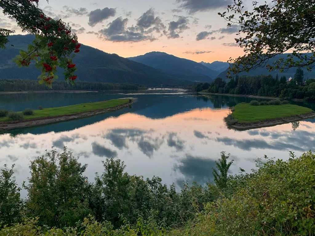
The town of Revelstoke is in eastern British Columbia, Canada. It’s on the banks of the Columbia River at 480m above sea level. Revelstoke is in a river valley between the Monashee and Selkirk Mountain ranges. The Rocky Mountains are about 100km to the east. Mount Revelstoke National Park is just outside town and Glacier National Park is a 40-minute drive to the east. Revelstoke is in the traditional territory of the Ktunaxa, Secwepemc, Sinixt, and Okanagan First Nations.
Getting to Revelstoke
Revelstoke is on highway 1. It’s a 6-hour drive from Vancouver in the west or 4.5 hours from Calgary in the east. Revelstoke has an airport, but it only has charter flights. The closest major airport is in Kelowna where you can get a shuttle van to Revelstoke that takes about 2.5 hours. Revelstoke also makes a great stop on a road trip across Canada.
Hiking season in Revelstoke
Revelstoke sits deep in the mountains. That means it has a short summer hiking season from May to September. Generally, the valley bottom trails start to be snow-free in April or May with higher elevation trails staying snowy into late July. By late September, it has started to snow again in the mountains. No matter what time of year you hike, check the weather forecast before you head out. Checking the weather is just one of the things you should do before every hike.
Revelstoke Weather
Revelstoke has a mountain climate. Summer temperatures are typically highs of 23-25C and lows of 11C. July and August are the driest months, but Revelstoke has a wetter climate than the nearby Rocky Mountains so it can still have some rainy days in summer.
READ NEXT: The Best Weather Apps for Hiking
What to bring hiking in Revelstoke
Even if you are just going for a short hike near Revelstoke, you need to be prepared for the weather and conditions. Don’t forget the 10 essentials. (Rain gear and warm clothing are especially important.)
Bear Safety
Revelstoke is home to both black bears and grizzly bears. Carry bear spray and make noise while you hike to reduce your risk of a negative bear encounter. On some trails in Glacier National Park, you must hike in groups of at least four people. (Full details on that hike below.) For more info about hiking in bear country, read my post about bear safety for hikers.
Leave No Trace
The area around Revelstoke is sensitive wilderness. Learn about Leave No Trace principles to help keep the wilderness wild.
Other Things to Do in Revelstoke
Hiking is my favourite thing to do in Revelstoke, but this cute mountain town has so much more to offer including amazing food, paddling, mountain biking, paragliding, and more. Read my guide to the best things to do in Revelstoke in the summer for all the details.
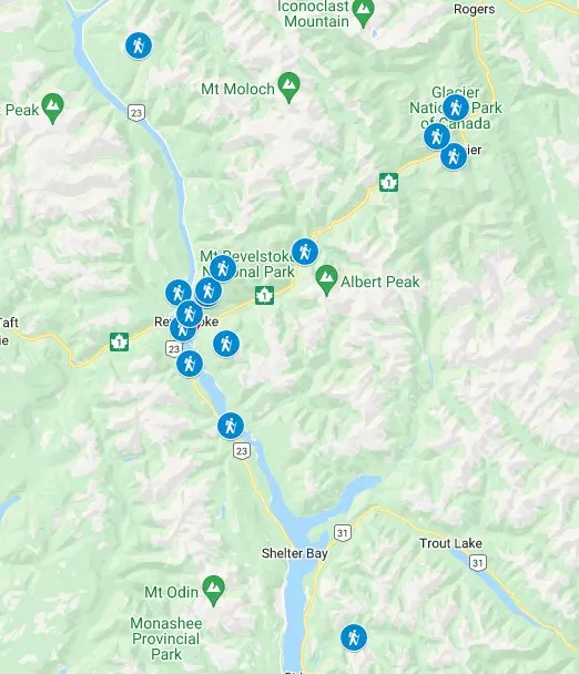
Revelstoke Trails Map

Best Hikes in Revelstoke
Greenbelt Trail
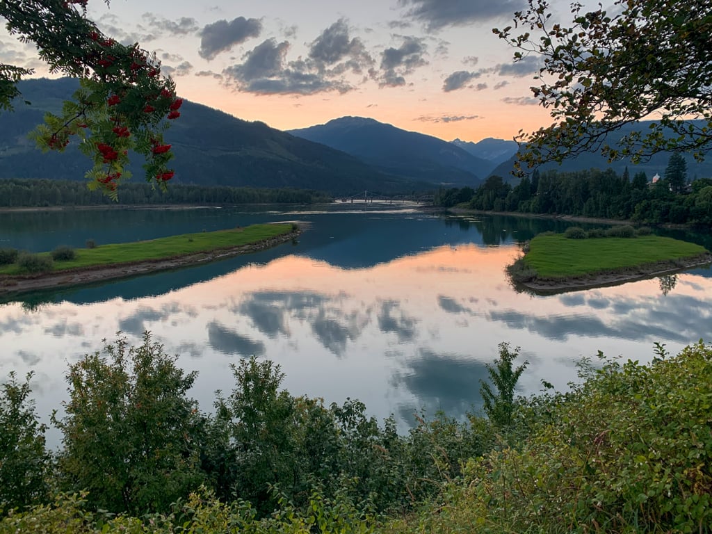
You don’t need to leave town to go for a hike in Revelstoke. The easy Greenbelt Trail along the Columbia and Illecillewaet Rivers is flat and has great views. You can walk the entire length from the Aquatic Centre along the Columbia River, up the Illecillewaet River to Powerhouse Road. Or just go for a stroll along a short section. I like to go for a walk along the river in the evening to watch the sunset over the mountains.
Difficulty: Easy | Distance: Up to 10km round trip | Elevation gain: none | Time Needed: Up to 3 hours |Best Time to Go: April to October | How to get there: Walk from pretty much anywhere in town. The start and endpoints of the Greenbelt are at the Aquatic Centre and on Powerhouse Road.
Mount Mackenzie
The easiest way to get high up into Revelstoke’s mountains is to ride the gondola at the Revelstoke Mountain Resort. In just 20 minutes you’ll ascend to 1700m above sea level. To get to the top of the mountain, follow the Stoke Climb trail uphill. It’s a mountain bike ascent trail, so even though it gains a lot of elevation, the slope is gentle. Stop to admire the views and meadows along the way. At the top of the Stoke Climb, watch the bikers start their long descent, and if you’re lucky, paragliders taking off too. (I can’t believe I jumped off the mountain here in 2019!) To continue to the sub-peak of Mount Mackenzie, follow the loop trail uphill.
Difficulty: Challenging | Distance: 15.8 km round trip | Elevation gain: 650m | Time Needed: 6 hours |Best Time to Go: mid-July to September | Trail Info: Revelstoke Mountain Resort | How to get there: Follow signs east through town along Fourth Street, Airport Way, Nichol Road, and Camozzi Road to Revelstoke Mountain Resort 7km from town. Then, ride the Revelation Gondola to the top station.

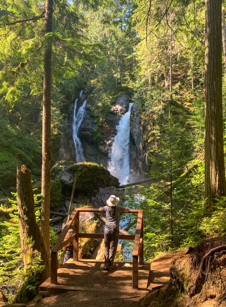
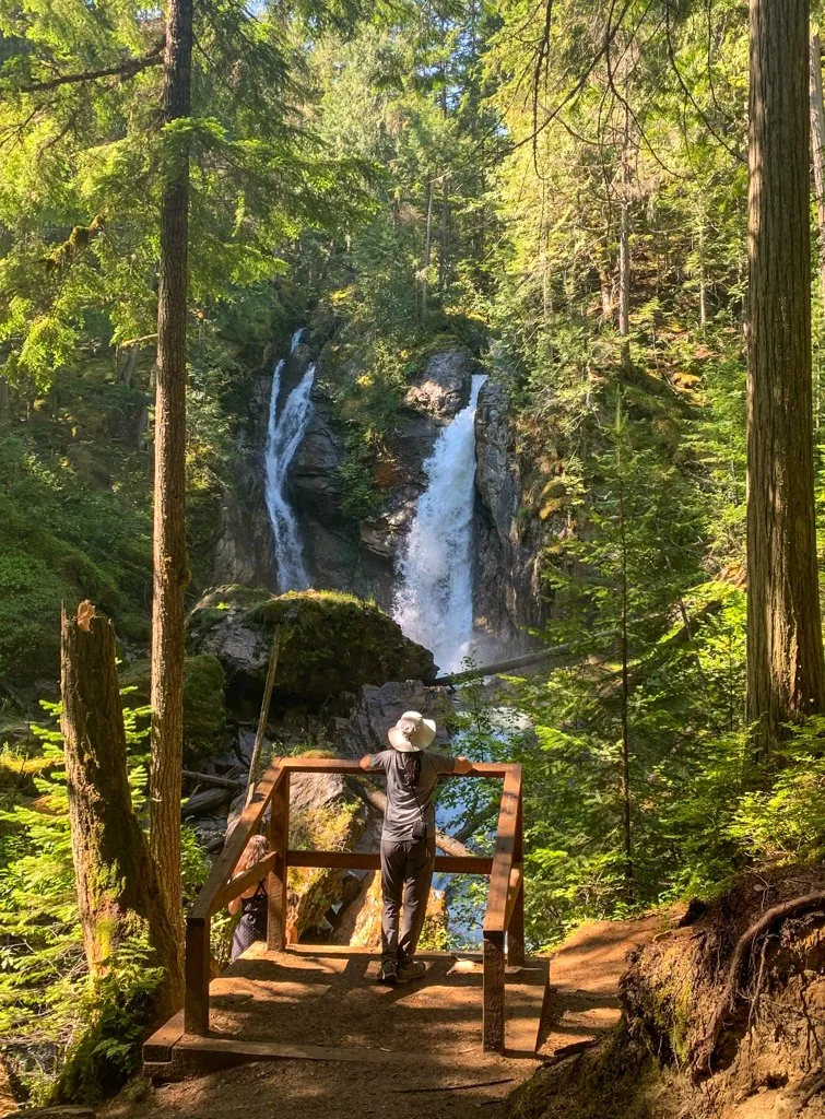
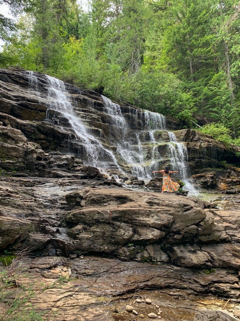
Begbie Falls
Begbie Falls is a split waterfall, with two tongues of water cascading down the slope. It’s set deep in a gulley, surrounded by beautiful forest. There are two ways to get to Begbie Falls: a short way from the lower trailhead and a long way from the upper trailhead. But they are both easy! From the lower trailhead, it’s a quick but steep walk down some switchbacks to the falls. If you start at the upper trailhead, you’ll follow the Bluff Trail through the forest, passing several side trails that lead to rock climbing crags or mountain bike trails. The junctions are all signed, so you won’t get lost. When the Bluff Trail meets a gravel road, turn right to get to the lower trailhead and then go downhill to the falls.
Difficulty: Easy | Distance: 1 or 6km round trip | Elevation gain: 40 or 160m | Time Needed: 20 minutes or 2 hours | Best Time to Go: May to September | Trail Info: Begbie Falls Recreation Site | How to get there: Head south on Highway 23 from Revelstoke. To get to the lower trailhead, turn left after 7km onto Clough Road. After a few minutes, turn right onto Mount Begbie Road and follow it past the campground to the parking lot at the end, 4km from the highway. It’s a gravel road and can be bumpy but should be fine for most cars. For the upper trailhead, turn left off Highway 23 into a gravel parking lot after about 9km.
Moses Falls
Unlike the other waterfalls in Revelstoke, Moses Falls is broad and the water spreads out over several ledges instead of roaring downhill in a single torrent. The trail to the falls is very short, but it is steep, rooty, and muddy so watch your step. The trail starts by heading downhill from the parking lot through the grass, crosses a gravel road, then descends steeply beside the falls before reaching the base. From there a trail heads downhill for another few minutes to the Columbia River and another parking area, accessed by a steep gravel road.
Difficulty: Easy | Distance: 0.5km round trip | Elevation gain: 40m | Time Needed: 30 minutes | Best Time to Go: May to September | How to get there: Head north from Highway 1 on Westside Road for 6km. Look for a gravel parking lot on the right. Park here for the upper trailhead. If you have an AWD car, turn right on the dirt road just past the parking lot and follow it for a few minutes down the steep hill to the riverbank.

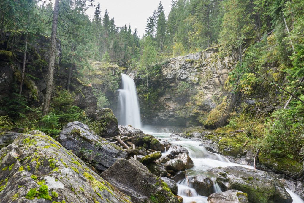
Sutherland Falls
I think Sutherland Falls in nearby Blanket Creek Provincial Park is the most beautiful of the three waterfalls near Revelstoke. It’s also the easiest hike. From the parking area, it’s an easy stroll along the gently sloped trail to the 12 m-high falls. You can get a great view of the falls from the viewing area, or scramble (carefully) down into the creek to get a bit closer. If you visit in the autumn, watch for spawning salmon in the creek.
Difficulty: Easy | Distance: 0.5km round trip | Elevation gain: 20m | Time Needed: 10 minutes |Best Time to Go: May to September | Trail Info: Blanket Creek Provincial Park | How to get there: Head south on Highway 23 from Revelstoke. Look for the signed turn-off for Blanket Creek Provincial Park after 24 km.

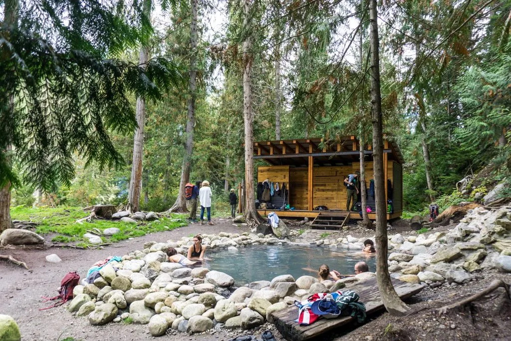
Halfway River Hot Springs
Some might argue hiking is about the journey, not the destination. But that’s not true at Halfway River Hot Springs. The short trail winds downhill through the forest to the springs. It’s a nice enough hike… but really it’s the hot springs you are here for! The natural springs here are one of my favourite hot springs in Canada and one of the best things to do in Revelstoke. While it the hike downhill to the springs might seem easy, save your energy for the climb back up. It’s steep!
Difficulty: Easy | Distance: 1km round trip | Elevation gain: 50m | Time Needed: 10 minutes | Best Time to Go: April to October | Trail Info: Halfway River Hot Springs Recreation Site | How to get there: From Revelstoke, drive Highway 23 south for 79km to the Halfway River Forest Service road on the south side of the Halfway River bridge. (The drive includes a ride on the free Arrows Lakes ferry.) From the turnoff, it’s 11km of gravel road driving to the parking lot. The road is fine for 2wd vehicles as long as you go slow and avoid the potholes.

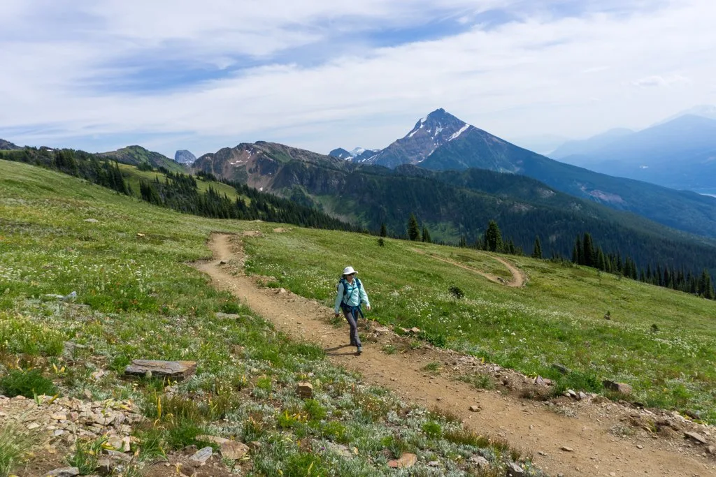
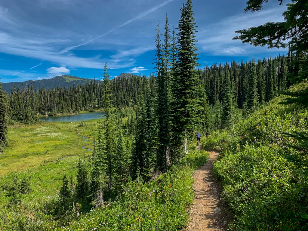
Keystone Standard Basin
This challenging trail is popular with both hikers and mountain bikers. I haven’t hiked it yet, but my husband Greg and my Dad biked it last summer. Greg said it was a challenge on bikes but would make an amazing backpacking trip or long day hike: “Since you do most of the elevation gain in the car, the trail is almost entirely in alpine meadows with incredible views of mountains in every direction.” It’s 11km each way to the log cabin at a pond, but Greg says you could turn around at the high point about 1km earlier if you are low on energy.
Difficulty: Challenging | Distance: 22 km round trip | Elevation gain: 400m | Time Needed: 7 hours | Best Time to Go: Mid-July to September | Trail Info: Keystone Standard Basin Recreation Trail | How to get there: Drive Highway 23 north for 50km, then turn right onto Keystone Forest Service Road. Continue up this 4WD-only road for 18km to the parking lot.

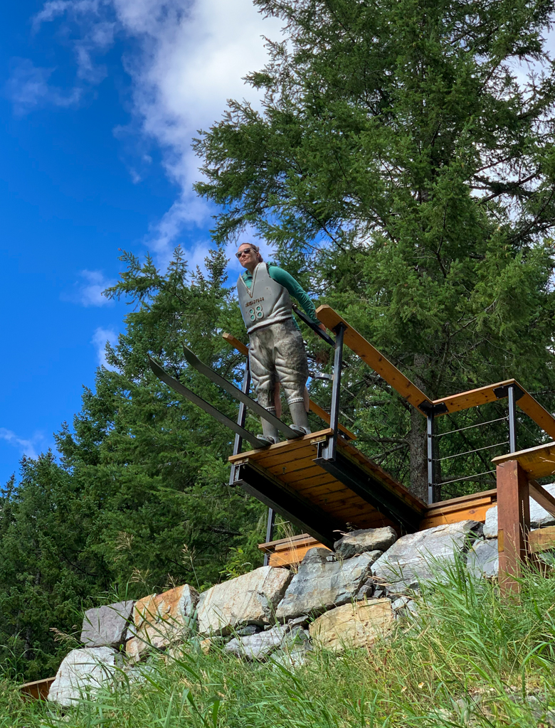
Nels Knickers
Step back in time on the Nels Knickers Trail in Mount Revelstoke National Park. Up until the 1960s, Revelstoke was the ski jumping capital of Canada. Norwegian-born Nels Nelson is credited with popularizing the sport in Revelstoke… and setting world records for distance. Parks Canada has done an amazing job of turning the old ski jump into an outdoor exhibit with info plaques, old newspaper clippings, and replica signage. But the best part is the Nels Knickers sculpture that lets you experience what it’s like to stand at the top of the hill, ready to ski jump. It’s an easy walk to the top on the Nels Knickers Trail. But if you want a longer (and steeper!) hike, park at the Nels Nelson Historic Area lower down the mountain, then follow the Nels Nelson Ski Jump trail from the bottom of the jump to the top.
Difficulty: Easy | Distance: 0.5km round trip | Elevation gain: 20m | Time Needed: 15 minutes | Best Time to Go: May to September | Trail Info: Mount Revelstoke National Park | How to get there: Take the Meadows in the Sky Parkway exit from Highway 1 just outside of Revelstoke. Drive up the Parkway for 4km to a pullout at a sharp hairpin turn. Park here next to the Nels Nelson sign. | Note: National Park Pass required. Dogs must be on leash.

Balsam Lake
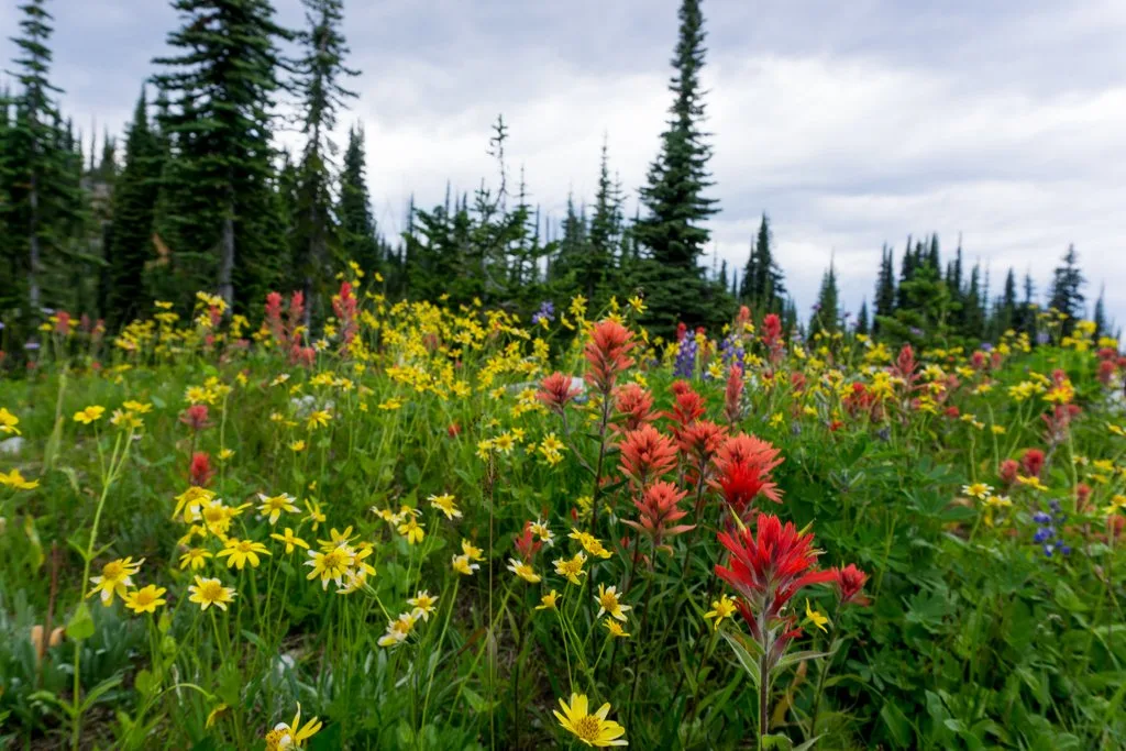
The flat hike around Balsam Lake is a great choice if you need to stretch your legs after driving the Meadows in the Sky Parkway at Mount Revelstoke National Park. The trail starts right beside the parking lot and loops around the tiny lake. In August, the meadows around the lake are carpeted in wildflowers. Look for bright red paintbrush, indigo arctic lupine, yellow mountain arnica, mauve subalpine daisy, and lots more. We brought my mom and she loved taking photos of all the flowers.
Difficulty: Easy | Distance: 0.5km loop | Elevation gain: none | Time Needed: 10 minutes | Best Time to Go: July to September | Trail Info: Mount Revelstoke National Park | How to get there: Take the Meadows in the Sky Parkway exit from Highway 1 just outside of Revelstoke. Drive up the Parkway to its end 26km later. | Note: National Park Pass required. No dogs allowed.

Upper Summit Trail
The Meadows in the Sky Parkway at Mount Revelstoke National Park ends at a parking lot, but a gated service road with a shuttle bus service continues up the mountain towards the summit. Instead of taking the bus, hike the Upper Summit Trail. It climbs steadily, but never steeply through the forest. Look for wildflowers along the way and Columbia ground squirrels scurrying around. Return the way you came, take the shuttle down, or walk down the road to make a loop.
Difficulty: Easy | Distance: 2km round trip | Elevation gain: 90 m | Time Needed: 1 hour | Best Time to Go: July to September | Trail Info: Mount Revelstoke National Park | How to get there: Take the Meadows in the Sky Parkway exit from Highway 1 just outside of Revelstoke. Drive up the Parkway to its end 26km later. | Note: National Park Pass required. No dogs allowed.

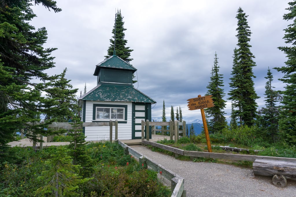
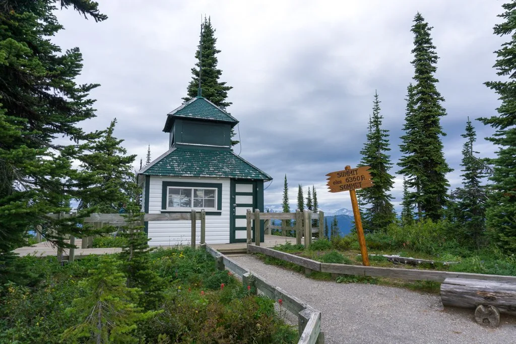
Fire Lookout
If you visit Mount Revelstoke National Park, don’t miss a trip to the fire lookout. Built in 1927, this historic structure sits at the peak of Mount Revelstoke. Until the 1980s, a tower person was stationed here to watch for fires in the surrounding mountains. There are incredible views from the lookout, as well as from a few spur trails nearby. You can look all the way down to Lake Revelstoke and across to the Monashee Mountains.
Difficulty: Easy | Distance: 1km round trip | Elevation gain: 10 m | Time Needed: 20 minutes | Best Time to Go: July to September | Trail Info: Mount Revelstoke National Park | How to get there: Take the Meadows in the Sky Parkway exit from Highway 1 just outside of Revelstoke. Drive up the Parkway to its end 26km later. From there, walk up the Upper Summit Trail or take the shuttle bus to the Heather Lake stop. | Note: National Park Pass required. No dogs allowed.
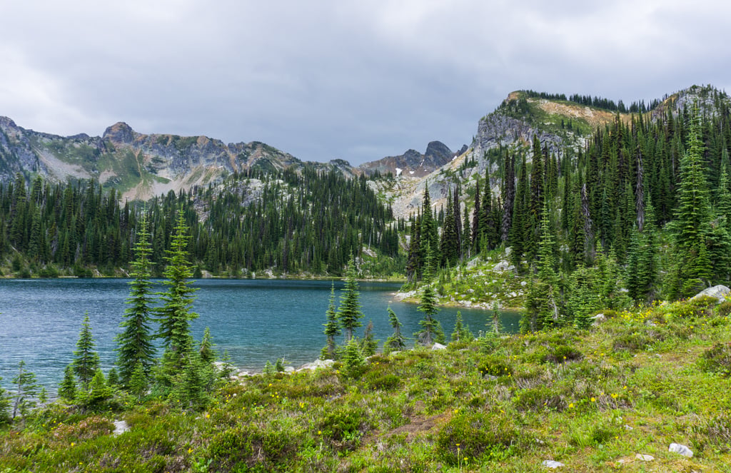
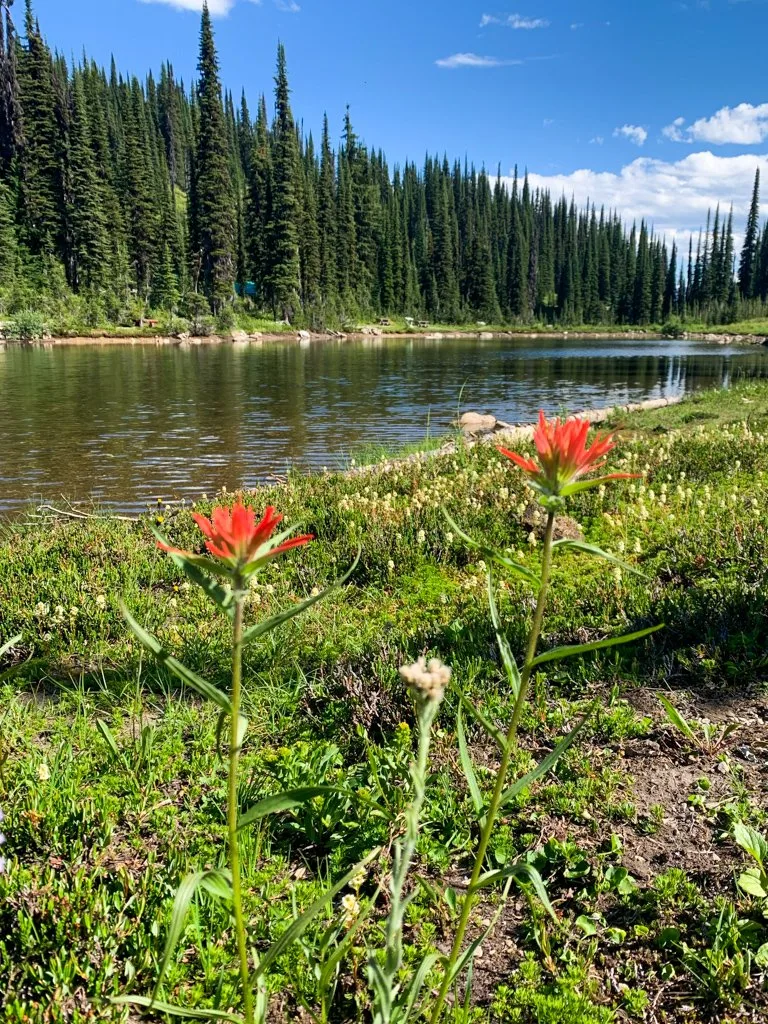
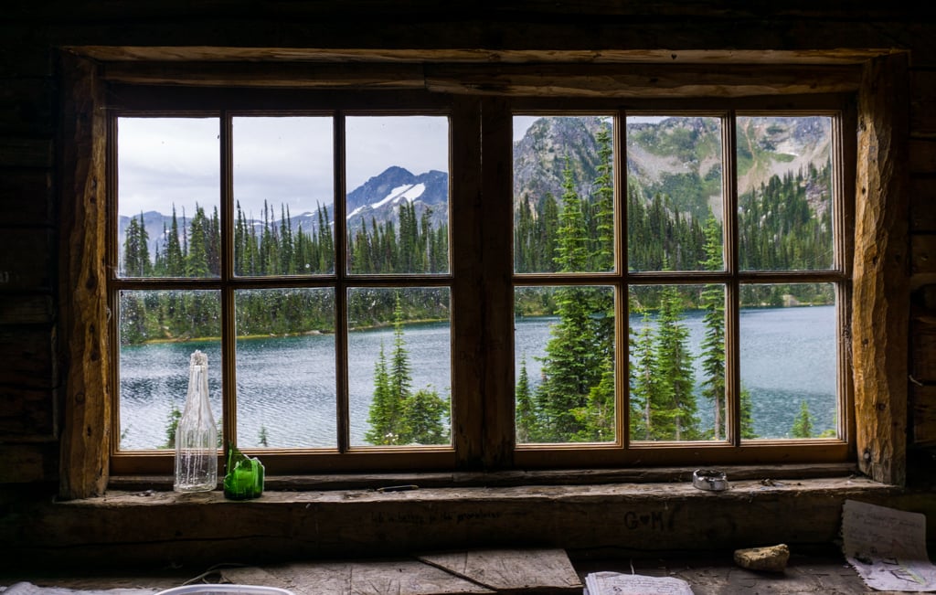
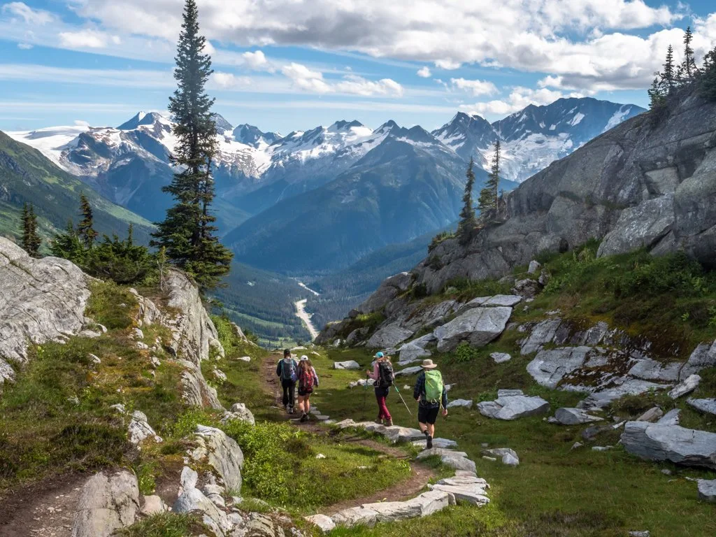
Eva Lake
The hike to Eva Lake takes you deep into the backcountry of Mount Revelstoke National Park. It’s probably my favourite hike in Revelstoke. The trail ambles through wildflower meadows, crosses rocky slopes, and ends at a beautiful sub-alpine lake. Since it starts so high up, the mountain views are incredible from pretty much everywhere along the trail and Eva Lake is particularly spectacular. If you have more time and energy, you can continue onwards to Miller and Jade Lakes. On the day I hiked this trail, we were trying to outrun a thunderstorm so we turned around at Eva Lake. Next time I go to Revelstoke I’d love to spend a night at Eva or Jade Lake – they both have backcountry campsites.
Difficulty: Moderate | Distance: 12km round trip | Elevation gain: 210 m | Time Needed: 6 hours | Best Time to Go: mid-July to September | Trail Info: Mount Revelstoke National Park | How to get there: Take the Meadows in the Sky Parkway exit from Highway 1 just outside of Revelstoke. Drive up the Parkway to its end 26km later. From there, walk up the Upper Summit Trail or take the shuttle bus to the Heather Lake stop. | Note: National Park Pass required. No dogs allowed.

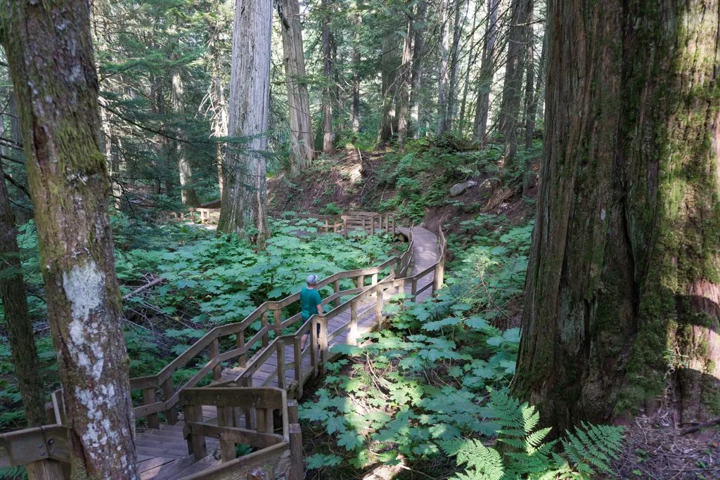
Giant Cedars Boardwalk
The base of Mount Revelstoke is home to a rare inland temperate rainforest with giant cedar and hemlock trees. I was shocked to see trees that I associate with BC’s coast so far inland! This easy trail in Mount Revelstoke National Park uses a beautiful boardwalk to make a loop through the forest. Interpretive signs along the way help you learn fun facts about the giant trees and the creatures that live in them. There are lots of great spots for photos too.
Difficulty: Easy | Distance: 0.5km loop | Elevation gain: 30m | Time Needed: 15 minutes | Best Time to Go: April to October | Trail Info: Mount Revelstoke National Park | How to get there: Head east on Highway 1 for 30km. Turn left into the signed parking lot. | Note: National Park Pass required. Dogs must be on leash.

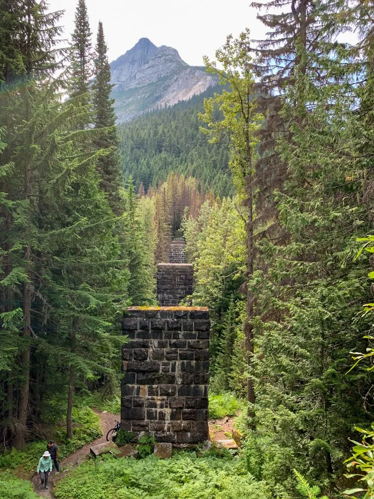
Loop Brook Trail
This short hike in Glacier National Park takes you along a former railway route. While the hike is short and easy, there are a few short, steep hills. Before a tunnel was blasted through a nearby mountain, trains needed to make a looping route through this valley to slowly gain elevation. Giant stone pillars supported the tracks, high above the creek. Today the bridges and tracks are long gone, but the pillars remain. Interpretive signs along the route give insight into the railway history.
Difficulty: Easy | Distance: 1.7 km loop | Elevation gain: 40 m | Time Needed: 45 minutes | Best Time to Go: June to September | Trail Info: Glacier National Park | How to get there: Head east from Revelstoke on Highway 1 for 60km. Turn right into the Loop Brook Campground and drive to the parking area at the end of the road. You can also park in the highway pullout just after the campground entrance. | Note: National Park Pass required. Dogs must be on leash.

Balu Pass
Hike up towards the towering peaks of Glacier National Park on the Balu Pass trail. The steep path travels up the Connaught Creek valley, crossing numerous avalanche slopes before ending at Balu Pass. The views of Mount MacDonald across the highway and numerous other glaciated peaks makes the climb worthwhile. The pass gets its name from the Hindi word bhalu, meaning bear. The mountains to the north of the trail are called Grizzly Mountain, Ursus Major, and Ursus Minor. (Ursus is Latin for bear.) The area is prime bear habitat. Make lots of noise, travel in groups, and always carry bear spray.
Difficulty: Moderate | Distance: 12.8 km round trip | Elevation gain: 779 m | Time Needed: 4-5 hours | Best Time to Go: mid-July to September | Trail Info: Glacier National Park | How to get there: Head east from Revelstoke on Highway 1 for 67km to the Rogers Pass Visitor Centre. The trailhead is at the back of the parking lot. | Note: National Park Pass required. No dogs allowed. Hikers must travel in groups of four or more people.

Hermit Meadows Trail
There are tons of amazing (and steep) hikes in Glacier National Park, and unfortunately, I haven’t had time to do many of them… yet! I asked Robyn from Tourism Revelstoke which trail she recommends in Glacier. She says the Hermit Meadows trail is one of her favourites: “The trail is steep and relentless but fairly short… It provides access to beautiful alpine meadows surrounded by the majestic Swiss Peaks. There is a [backcountry] campground at Hermit Meadows, and you couldn’t ask for better campsite views.” It sounds about as steep as Vancouver’s Grouse Grind… but with waaaay better views. I’m definitely adding it to my list!
Difficulty: Challenging | Distance: 6.4 km round trip | Elevation gain: 819 m | Time Needed: 4-5 hours | Best Time to Go: mid-July to September | Trail Info: Glacier National Park | How to get there: Head east from Revelstoke on Highway 1 for 69km. A few minutes past the Rogers Pass Visitor Centre, turn left into the signed parking lot. | Note: National Park Pass required. Dogs must be on leash.

Other Hikes Near Revelstoke
Although I’ve hiked a LOT in Revelstoke, I haven’t walked all the trails. There are a few more trails in Mount Revelstoke National Park and lots in Glacier National Park that I haven’t done yet. There are also a few epic-sounding hikes to huge peaks like Mount Cartier and Mount Begbie that I’d love to tackle. If you need more hiking ideas, download the Revelstoke Hiking Map.
With 15 trails on this list, I’m sure you’ll find a Revelstoke hike that you’ll love. (Actually… you’ll probably find a few!) Have questions about hikes in Revelstoke? Ask me in the comments as I’m always happy to help.
READ NEXT:
- 15 Things to do in Revelstoke in the Summer
- Things to do in Mount Revelstoke National Park, Canada
- How to Take an Epic Canadian National Parks Road Trip
- Your Guide to the Best Hot Springs in Canada
- 30+ Things to Do in Vernon, BC
- Your Guide to Camping and Hiking at Lake O’Hara in Yoho National Park
- The Ultimate Guide to Hiking the Berg Lake Trail
- 20+ Beautiful Weekend Getaways from Vancouver


- Best Sun Hoodies for Hiking - June 3, 2026
- Lower Stein Valley Trail Hiking and Backpacking Guide - May 27, 2026
- The Best Things to Do in Vernon, BC - May 21, 2026