
The Overland Track is a 65-80km multi-day trek over Tasmania’s high mountain plateau. Along the way you’ll pass through many different ecosystems, climb up a few mountain passes, get some amazing views and stay in rustic huts and campgrounds.
I hiked the trail in February 2019 and had an amazing time. I’ve put together a section-by-section overview of the Overland Track to give you a taste of the trail and help you get prepped for your trip.
It’s got info on distances and hiking times for each day, difficulty and things you won’t want to miss. There are also lots of photos! Use this Overland Track overview to help you plan your trip.
I’ve updated all the info for the 2022/23 season. This post includes:
- Key distances on the Overland Track
- Staring the Overland Track: Checking in and getting to trailhead from the visitor center
- Ronny Creek to Waterfall Valley: 10.7 km plus side trips
- Waterfall Valley to Windermere: 7.8 km plus side trips
- Windermere to Pelion: 16.8 km plus side trips
- Pelion to Kia Ora: 8.6 km plus side trips
- Kia Ora to Windy Ridge: 9.6 km plus side trips
- Windy Ridge to Narcissus: 9 km plus side trips
- Narcissus to Cynthia Bay: 17.5 km (bonus final day)
- Finishing the Overland Track: Sign-in to formally finish, where to eat, and arranging transport
Want more info about the Overland Track? Check out my other Overland Track posts:
- Overland Track Basics: Everything you need to know including how to book, what the weather is like, when to go, and how to stay safe.
- Overland Track Itineraries. Trips from 4 to 12 days for beginners, fast hikers, peak baggers and more. Be sure to consider which
- Side trips to take from the Overland Track. You can climb Tasmania’s highest peak, swim in a lake, visit a waterfall and more.
- Camping and huts on the Overland Track: Details on what to find at each site.
- How to get to the Overland Track: shuttle buses, water taxis, self-driving, and more.
- What to pack for the Overland Track: A super detailed packing list.
Key Distances on the Overland Track
| KM | Elevation | Location |
|---|---|---|
| 0km | 870 m | Overland Track Start – Ronny Creek, Cradle Mountain |
| 5.4km | 1240 m | Historic Kitchen Hut |
| 5.5km | 1260 m | Junction with Cradle Mountain Track |
| 9km | 1200 m | Junction with Barn Bluff Track |
| 10.7km | 1040 m | Waterfall Valley hut and campground |
| 14.5km | 1080 m | Junction with Lake Will Track |
| 18.5km | 1000 m | Windermere hut and campground |
| 31km | 730 m | Frog Flats |
| 34.9km | 880 m | Junction with Old Pelion hut track |
| 35.3km | 870 m | New Pelion Hut and campground, junction with Mt Oakleigh track |
| 39.7km | 1130 m | Pelion Gap: Junction with Pelion East and Mount Ossa tracks |
| 43.9km | 860 m | Kia Ora hut and campground |
| 46km | 930 m | Historic Du Cane Hut |
| 48km | 880 m | Junction with Fergusson Falls and Dalton Falls tracks |
| 48.4km | 910 m | Junction with Hartnett Falls Track |
| 51.8km | 1050 m | Du Cane Gap |
| 53.5km | 890 m | Bert Nichols hut/ Windy Ridge campground |
| 58.7km | 790 m | Junction with Pine Valley Track |
| 62.5km | 750 m | Narcissus Hut and campground, junction with Lake St. Clair ferry track |
| 68.8km | 750 m | Echo Point hut and campground |
| 80km | 750 m | Overland Track End – Lake St Clair Visitor Centre |
Starting the Overland Track
To start the Overland Track you’ll need to go the Overland Track check-in desk at the Cradle Mountain Visitor Centre. (Need info on getting to Cradle Mountain? Check out my Overland Track transport guide.)
The visitor centre is next to the large visitor car park just outside the main entrance to the park. Bring a copy of the email with your booking confirmation. You will also need to complete a walker safety checklist to confirm that you have the right gear and are prepared for the trek.
After you check-in, the ranger will give you a small, waterproof Overland Track permit on a string. You need to keep the permit attached to your pack while you are walking and to your tent when you camp.
Before you leave the visitor centre use the toilet and fill up your water bottle since this is the last place to do that.
The start of the track is actually seven kilometres into the park. You can walk there in a couple hours on the Cradle Valley boardwalk.
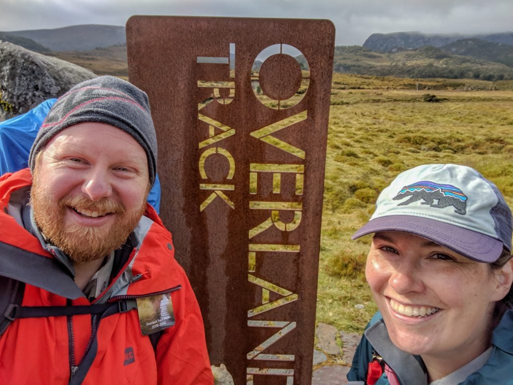
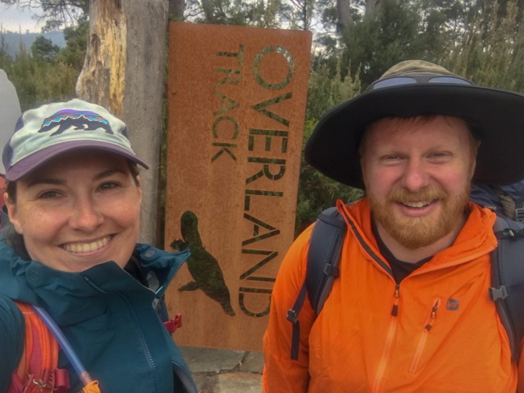
But most people opt to take the free park shuttle bus. Get on the bus just outside the Visitor Centre, then get off at the Ronny Creek stop. At Ronny Creek, be sure to sign your name in the walkers log book and take a photo with the Overland Track sign.

Ronny Creek to Waterfall Valley
Distance: 10.7km
Elevation Change: 390m ascent, 220m descent
Time: 4-6 hours
Difficulty: Challenging
Side Trip Options: Cradle Mountain, Barn Bluff
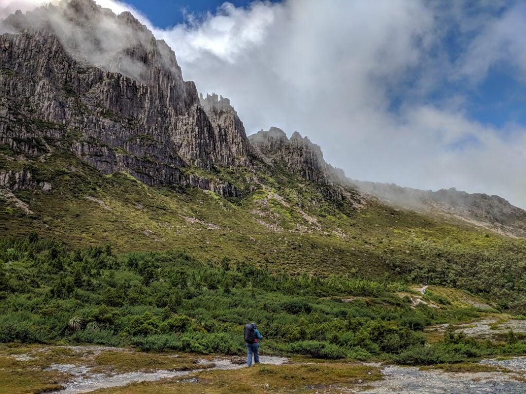
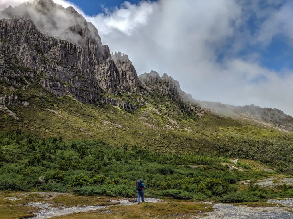
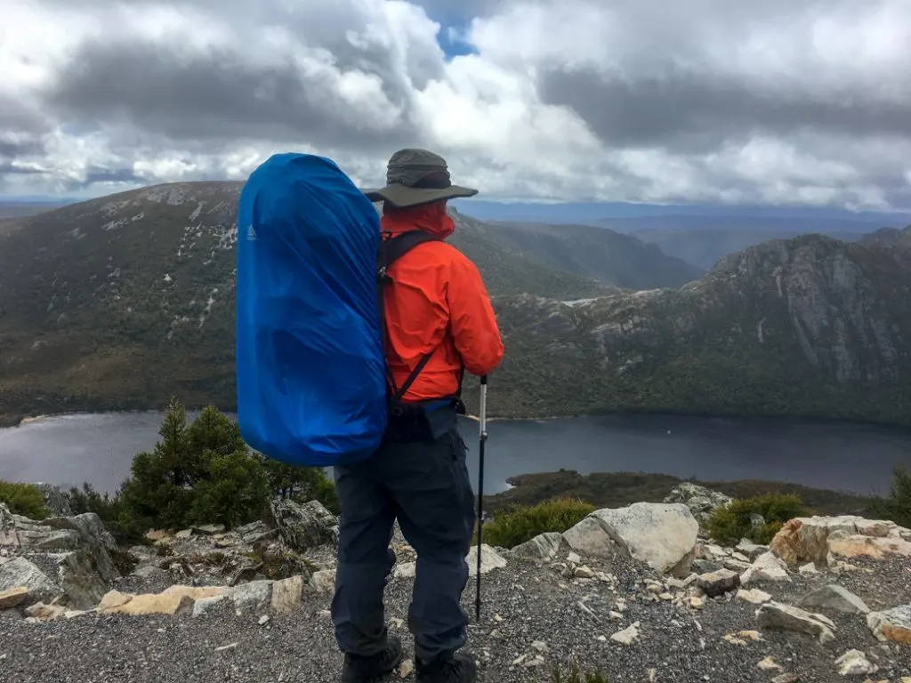
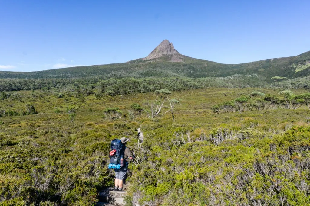
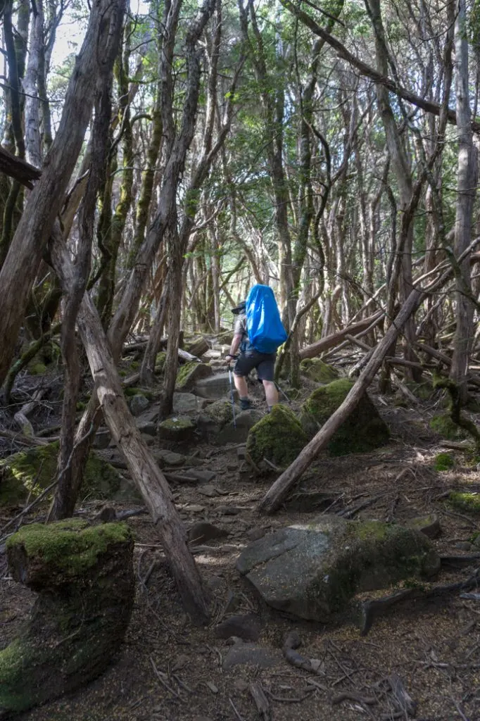
Unfortunately, the most difficult section on the Overland Track is the first day, and you’ll have to tackle it with a heavy backpack. As well, most of this day’s walk is out of the trees where you are very exposed to wind and rain. Be sure to keep rain gear and warm clothing easily accessible just in case.
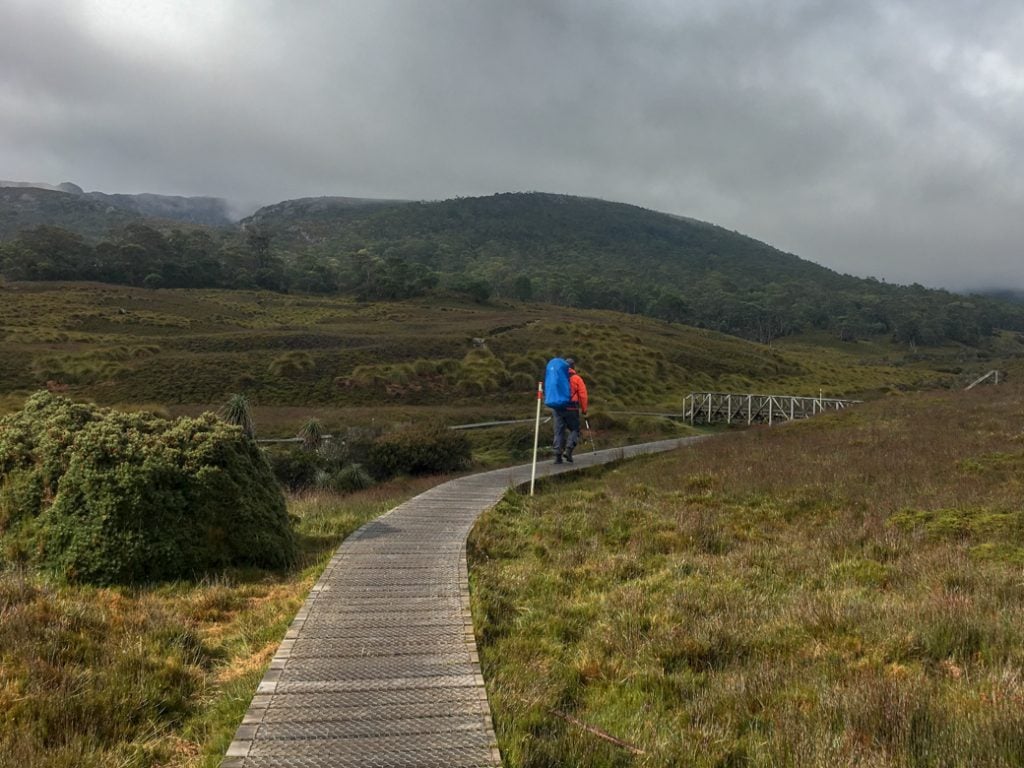
The track starts on wide duckboard from the Ronny Creek car park. You’ll pass lots of wombat burrows in buttongrass. After about 700m turn left to cross a bridge and reach a junction. Go up the stairs to the right to stay on the Overland Track through more buttongrass. After another 700m and a few stairs, go left at the junction to stay on the Overland Track.

The next section follows a creek through thick forest with a few sets of wooden stairs. Eventually you’ll emerge on the shores of Crater Lake next to an old boat house. If it’s raining and the lake level is low, head into the boat house to take a break.
From Crater Lake you’ll start to climb out of the trees towards Marions Lookout, passing two tracks coming in from the left. The trail up to Marion’s Lookout is steep in places, with lots of stairs and even a short scramble section with a chain to hang on to. This is the steepest and hardest climb on the Overland Track.
Take a break at the top to admire the great views of Dove Lake and Cradle Mountain.

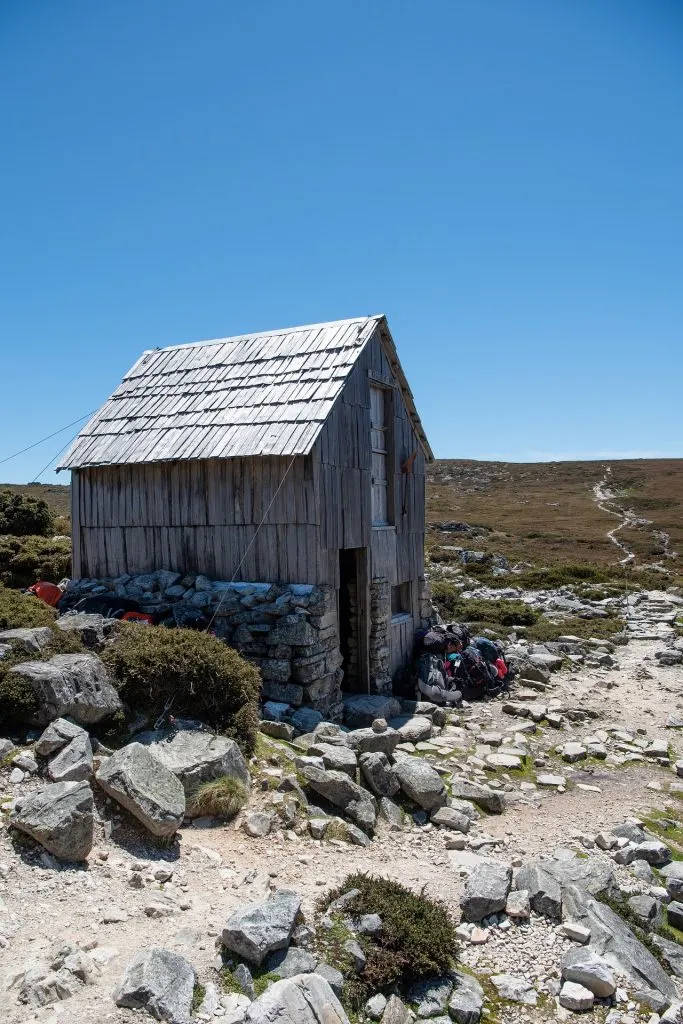
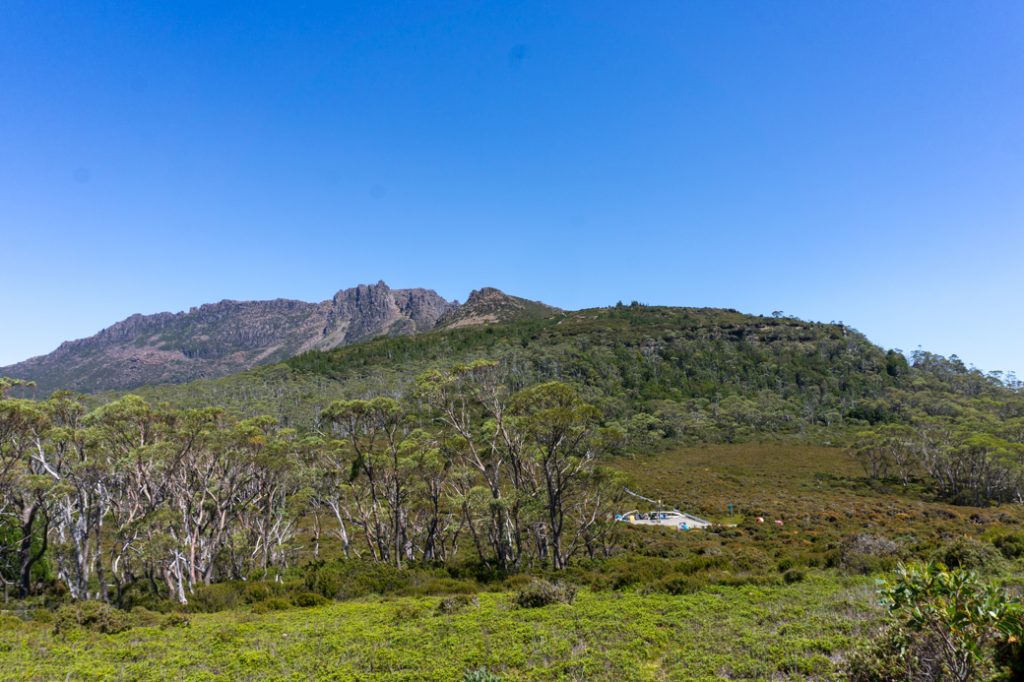
From Marion’s Lookout the track undulates over open buttongrass for another 2 kilometres before reaching Kitchen Hut. This historic hut was built in 1939 as a traditional lunch stop. It’s a small hut with a few benches and it can get crowded inside on rainy and cold days. The hut is for emergency use only so don’t plan to sleep there. There’s a toilet a few meters further along the trail from the hut.

About 100m from Kitchen Hut is the turn off for the track to the summit of Cradle Mountain. From here, the Overland Track contours around the side of Cradle Mountain through buttongrass and a few clumps of trees for another 3 kilometres.
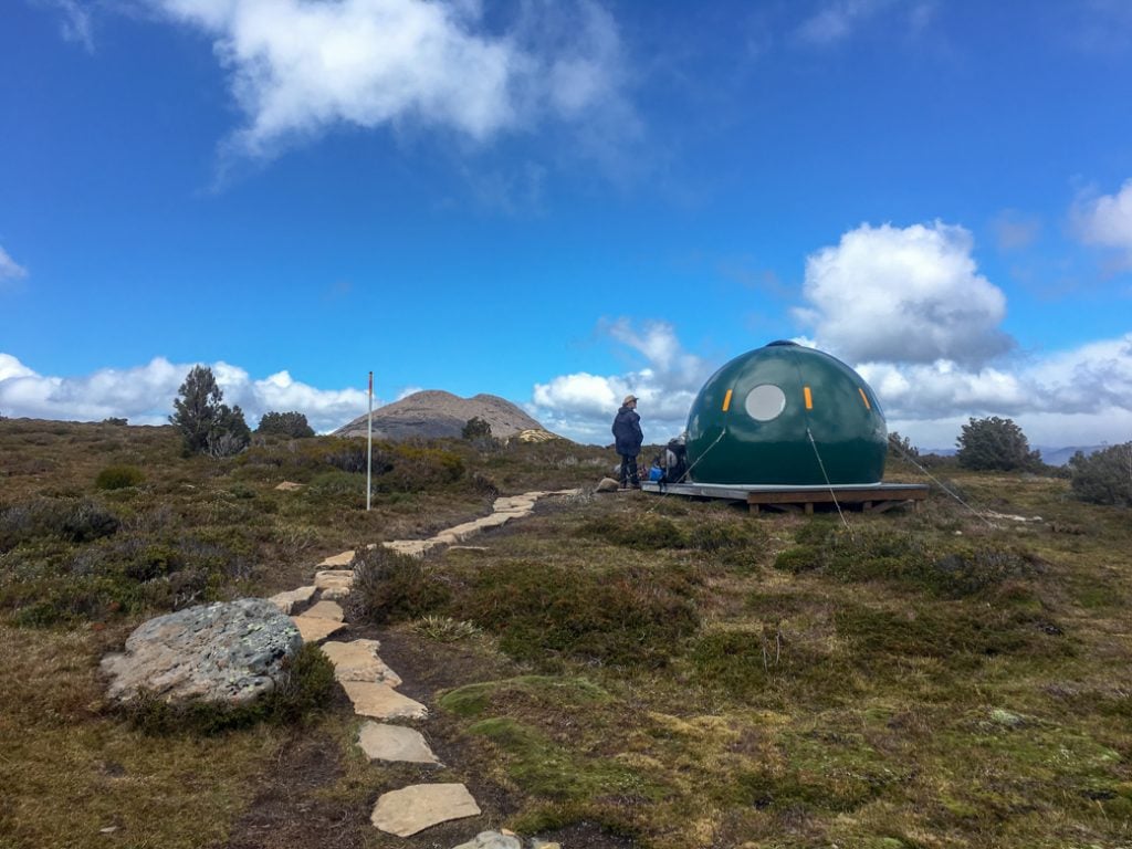
Just past the Lake Rodway Track junction on the main track is a small, green, plastic dome-shaped emergency hut. The next section of track is some of the most exposed so you may want to take a break here out of the weather.
From the emergency hut, the track traces the rim of the Cradle Cirque. The terrain drops steeply to your left. After about 700m, you’ll reach the intersection with the Barn Bluff Track. The Overland Track stays on top of the cirque for another 500m before starting the descent down to the Waterfall Valley.
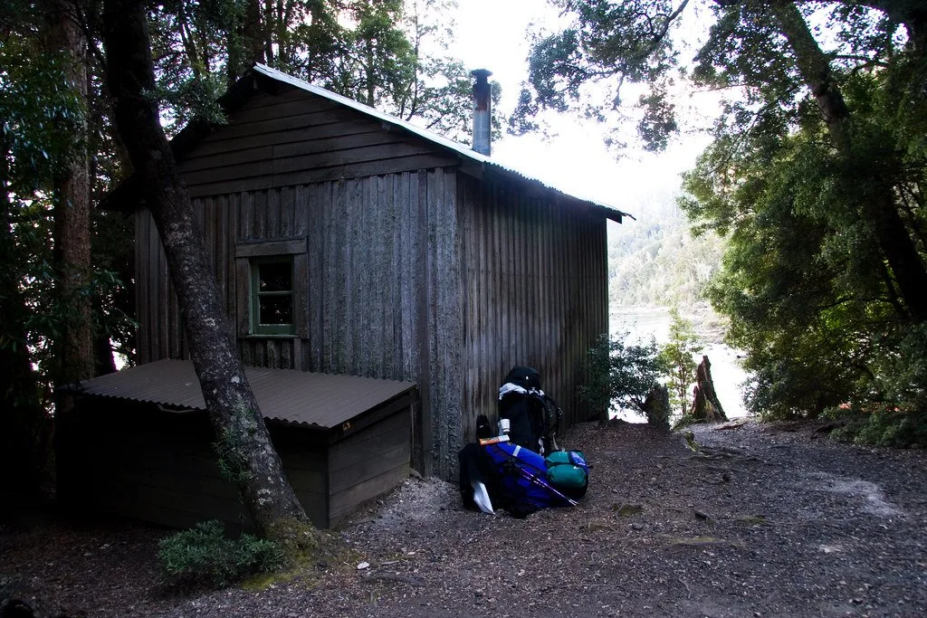
The track heads into the trees, which can be a welcome respite from high winds and rain up on the cirque. Watch for the right turn towards the Waterfall Valley Hut and campground.
Waterfall Valley to Windermere
Distance: 7.8km
Elevation Change: 50m ascent, 50m descent
Time: 2.5-3.5 hours
Difficulty: Easy
Side Trip Options: Barn Bluff, Lake Will
After starting with the hardest bit, you can follow it up with the easiest Overland Track section from Waterfall Valley to Windermere. The track starts by descending to cross a couple of creeks. It stays mostly flat, with some ups and downs through open forest and button grass.

After 3.5km you’ll reach a the turn off to Lake Will. There’s a large wooden platform here to leave your pack if you decide to make the side trip.
From Lake Will, the track climbs gently up a ridge, with views of lakes all around you. About 1.5km from Lake Will you’ll reach the top of the ridge and a great viewpoint. You can see your destination for the night, Lake Windermere, below you.
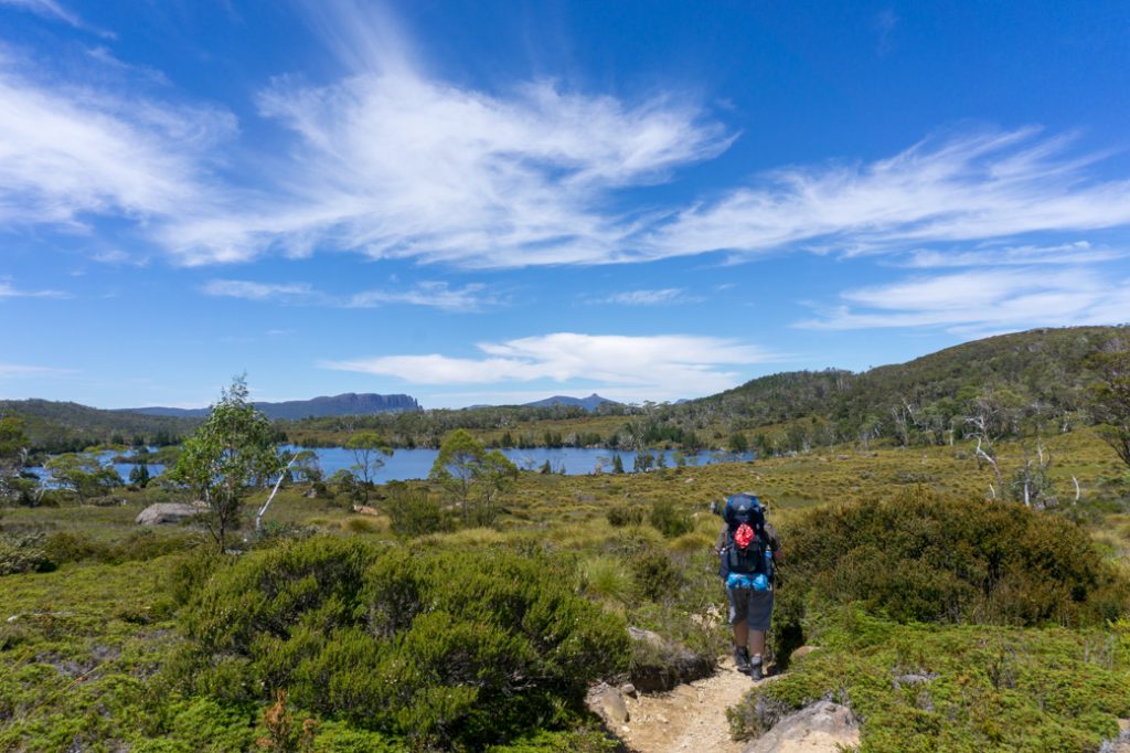
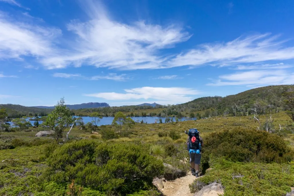
Descend steeply off the ridge, then walk across grassy plains to the shores of Lake Windermere. There’s a small open area next to the lake with rock steps heading into the water. It makes a great place to have a swim. The Windermere Hut and campground are a 10 minute walk slightly uphill from the lake.
Windermere to Pelion
Distance: 16.8km
Elevation Change: 270m descent, 150m ascent
Time: 5-7 hours
Difficulty: Moderate
Side Trip Options: Old Pelion Hut, Mount Oakleigh
This is the longest Overland Track section, but thankfully none of it is too difficult.
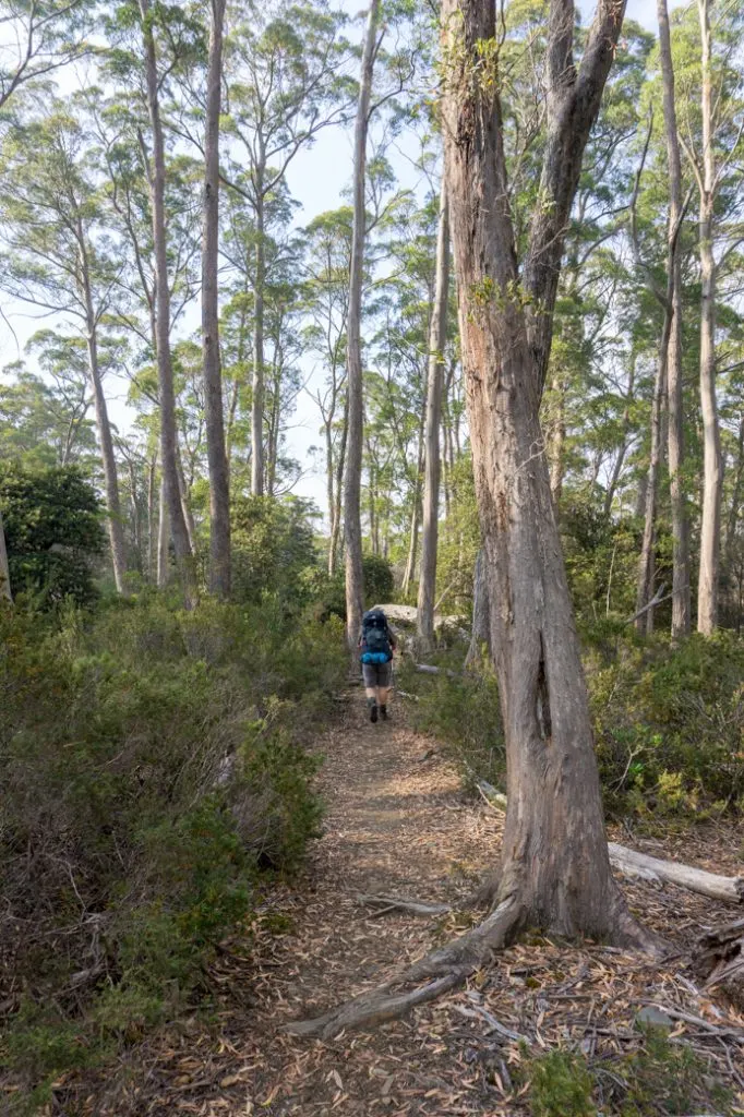
The track starts out fairly flat with a few short climbs. For the most part you’ll be walking on open plains with a few patches of forest.

After about 4km you’ll reach the junction for the short spur trail to the River Forth Lookout. There’s open area for you to leave your packs, but the track is only 50m long so you may choose to keep your pack with you. There’s a great viewpoint at the edge of cliff where you can see the River Forth far below.
From the lookout the Overland Track heads into tight forest. The track here is has lots of roots and rocks, so it’s slow going. About 1km later, the track emerges from the trees and heads across the plains. If you look across the valley here you can see Old Pelion hut. Unfortunately your route to get there is not very direct.

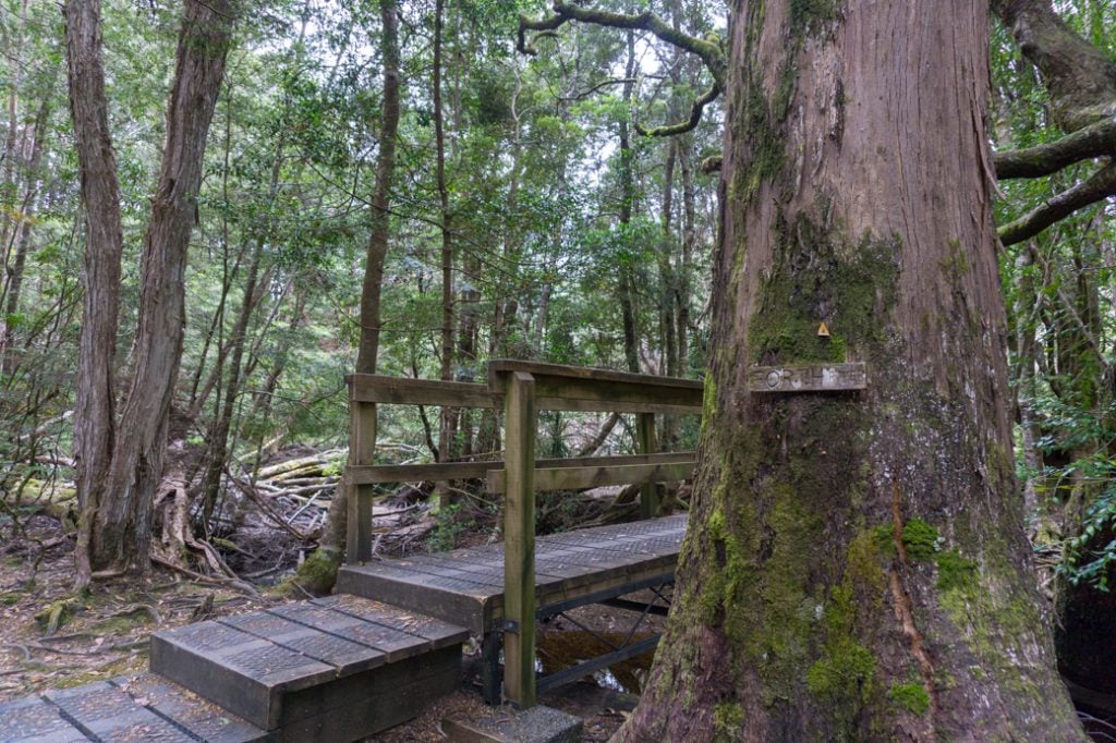
The track heads back into the trees and descends to cross Pelion Creek. There’s a wooden platform here with a bench that makes a good place to rest. It’s also a good spot to collect water.
After leaving the creek, the Overland Track heads into dense forest and gradually trends downhill for he next 2.5km to Frog Flats. This is the lowest point on the track at 720m elevation.

From the bridge over the River Forth at Frog Flats, the trail climbs in the forest for the next 1.5km before levelling out a little bit. About 2km later you’ll see the turn off to Old Pelion Hut on your left. Walk 400m more meters to New Pelion Hut and campground. Just past the hut is the start of the Mount Oakleigh track.
Pelion to Kia Ora
Distance: 8.6km
Elevation Change: 260m ascent, 270m descent
Time: 3-4 hours
Difficulty: Moderate
Side Trip Options: Mount Oakleigh, Mount Ossa, Mount Pelion East
The fourth Overland Track section is fairly short, but it includes a steep climb. As well, most walkers take a side trip up either Mount Ossa or Mount Pelion, making this day much more challenging.
The first 1.5 kilometres of the day is fairly flat walking through tight forest. Then the climbing begins.
You’ll ascend 200m of elevation over the next 2.5km to Pelion Gap. If the weather is bad, Pelion Gap is very exposed. If it is raining, windy or snowing, put on your extra clothes in the forest before you emerge into the gap.

At Pelion Gap there’s a large wooden platform to take a break and great views in all directions. You can also leave your pack here if you want to take a side trip to either Mount Ossa or Mount Pelion East. The march flies can be bad here though.
From Pelion Gap, the track drops through open terrain for about 1.5km into a wet area, then crosses Pinestone Creek. Then it’s another 2.5km of walking on a rocky track through a mix of forest and scrub to Kia Ora Hut and campground.
Kira Ora to Windy Ridge
Distance: 9.6km
Elevation Change: 190m ascent, 160m descent
Time: 3.5-4.5 hours
Difficulty: Moderate
Side Trip Options: D’Alton and Fergusson Falls, Hartnett Falls
The fifth Overland Track section isn’t especially difficult, but does include a climb up to Du Cane Gap, plus two waterfall side trips that can make your hike more time consuming.
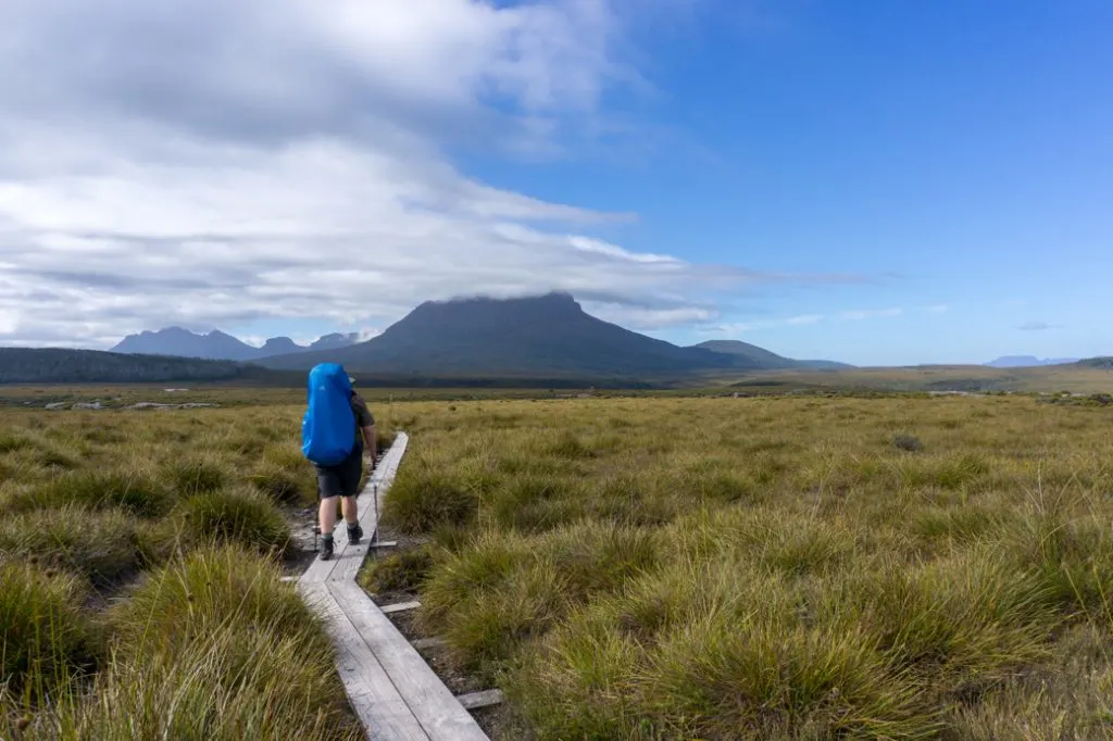
The first 2.5km of the track is a straightforward walk first through buttongrass plains, then through flattish, open forest to the historic Du Cane Hut.
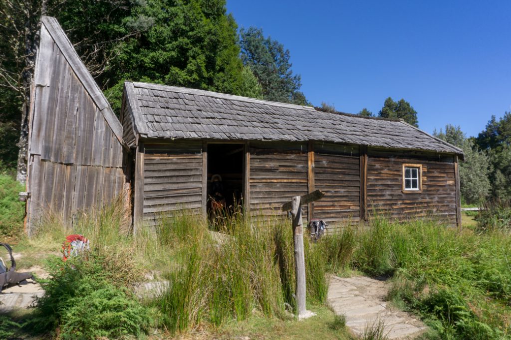
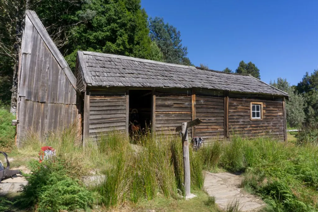
Built in 1910, the hut is the oldest one in the park and was originally used as a trappers hut. As a historical building, it’s not very structurally sound anymore, so you can’t sleep in it. However, be sure to go inside and read some of the informational signs about the history of the hut and the park.
After Du Cane Hut it’s another 2.5km through flat forest to the junction for D’Alton and Fergusson Falls. Just 500m past the turn off to the first falls is the junction with the Hartnett Falls track.
After the Hartnett Falls intersection the track starts to climb up towards Du Cane Gap. You had been walking in dense forest for most of the morning, but as you climb up to the gap beside Castle Crag Mountain, the forest becomes a bit more open.
From Du Cane Gap the track descends through myrtle forest for 1.5km to the Bert Nichols Hut and Windy Ridge campground.
Windy Ridge to Narcissus
Distance: 9km
Elevation Change: 140m descent
Time: 3-4 hours
Difficulty: Easy
Side Trip Option: Pine Valley
This is an easy Overland Track section since it’s all downhill! The first 5km of the track wind through flat eucalpyt forest that is a bit more open that the forest around Windy Ridge. Watch for snakes sunning themselves in this area – we saw three!

Around the 5km mark you’ll arrive at the junction with the Pine Valley Track. There is a clearing here with some fallen logs to sit on if you want a break.
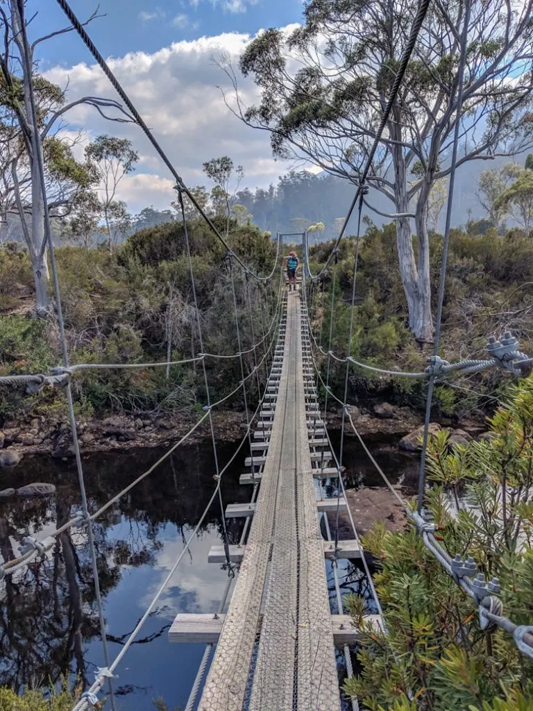
Past the junction, it’s another 3km through forest, then across boardwalk in buttongrass to the banks of the Narcissus River. Cross the river on a long suspension bridge, the only one on the trail.

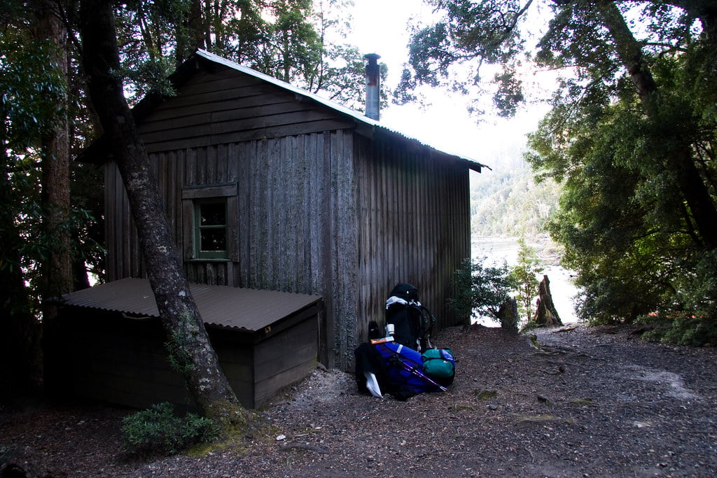
After the bridge, continue along the boardwalk through more open vegetation with great views of Mount Olympus across Lake St Clair. After about 1 kilometre, you’ll reach the Narcissus Hut and campground.
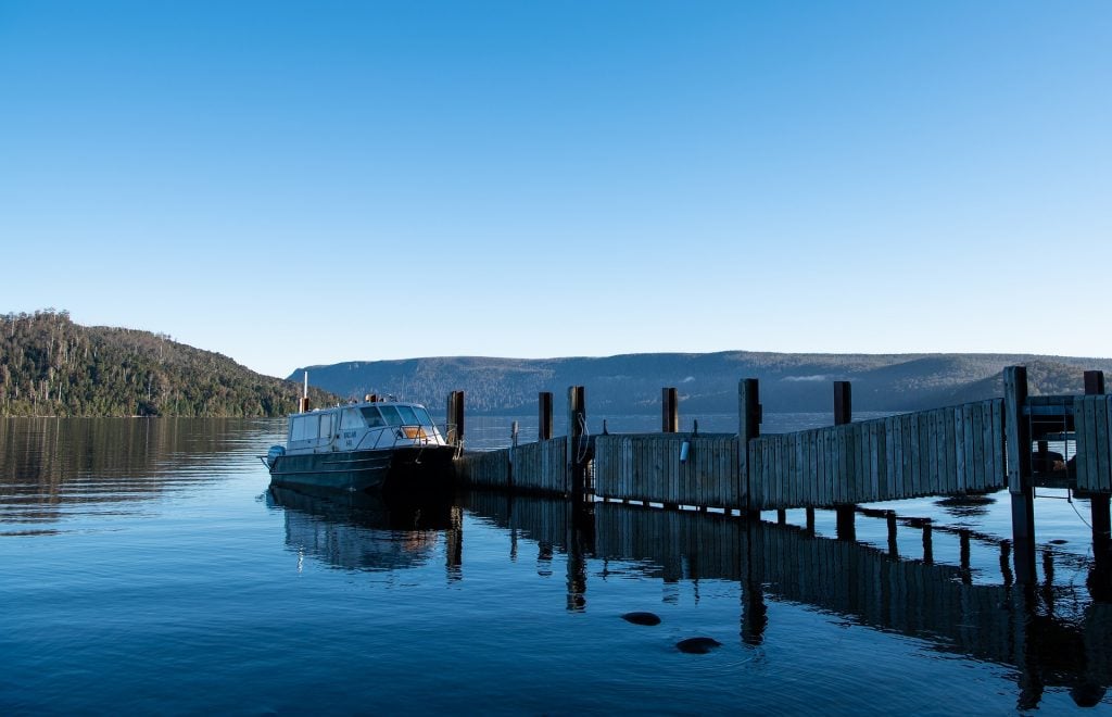
If you’re taking the Lake St Clair Ferry, head inside the hut to use the radio to confirm your booking. Then head straight past the hut and take the boardwalk 300m to the jetty.
Narcissus to Cynthia Bay
Distance: 17.5km
Elevation Change: none
Time: 5-6 hours
Difficulty: Moderate
Most hikers opt for the boat across Lake St Clair so they technically don’t complete the Overland Track.
However you can add an extra section to your walk (and save some money) by continuing all the way around Lake St Clair on a flat trail through the forest. I opted for the boat so I haven’t actually walked this section of the Overland Track.
The Overland Track heads to the right at the Narcissus Hut. Almost immediately you’ll pass the Lake Marion Track and then 1.5km later the junction with the Cuvier Valley Track. Shortly afterwards, the Overland Track heads closer to the shores of Lake St Clair where it stays for most of the remainder of the walk. Unfortunately, there are few views of the lake.
It should take you about 2.5 hours to walk the 6.3km after from Narcissus Hut to Echo Point Hut. There’s a jetty on the lake in front of the hut that is a good place for a swim.
After Echo Point, the track continues in the forest along the lake for another 11.2km. As you approach the end of the Overland Track you will encounter many junctions. Stay on the Overland Track and go over the bridge at Watersmeet.
The track turns into a dirt road. Look for the junction to Fergy’s Paddock campground about 700m after the bridge. Another 700m of walking past there brings you to the Lake St. Clair Visitor’s Centre at Cynthia Bay and the official end of the Overland Track.

Finishing the Overland Track
If you took the ferry across Lake St. Clair it will drop you off on the jetty at Cynthia Bay. Follow the signs up the jetty to the right along a dirt road. Walk along the road for 150m to the Lake St. Clair visitor Centre.
Once you arrive at the visitor centre be sure to take some photos at the Overland Track sign to commemorate your trip. Afterwards, head to the ranger’s desk in the west wing of the centre (on your right) to sign in and confirm you have completed the track safely.
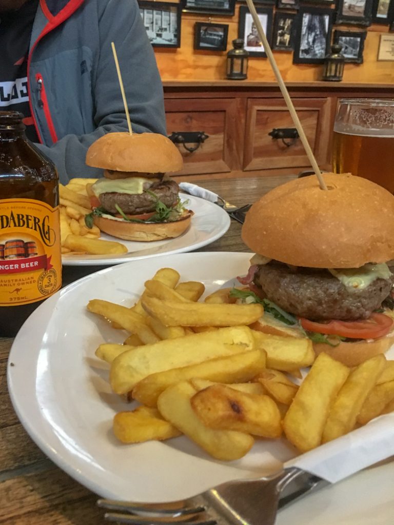
There are public toilets and a cafe in the east wing of the visitor centre. The Overland Burger is a popular choice. The car park is behind the visitor centre.
If you booked a shuttle bus, head back there to meet it. (Find out more about shuttle buses in my Overland Track transport guide.)

So that’s my Overland Track overview with a section-by-section breakdown of the trail. If you have any questions while planning your trek, let me know in the comments.
MORE OVERLAND TRACK INFO:
- The Ultimate Guide to the Overland Track in Tasmania
- 6-Day Overland Track Itinerary (Plus More Itinerary Options)
- The Complete Guide to Overland Track Huts and Camping
- Your Guide to All the Overland Track Side Trips
- Overland Track Transport: How to Get There
- Overland Track Packing List: Everything You Need to Bring


- 25+ Women’s Adventure Books That Will Inspire You - April 2, 2024
- Dehydrated Mushroom Risotto For Backpacking - March 31, 2024
- Dehydrating Food For Backpacking: A Beginner’s Guide - March 15, 2024
Luke
Monday 12th of September 2022
You've done an excellent job with this write up! Just wondering how you worked out your distances? I'm doing the overland track next week. I have been up to Ossa twice, and the distance from New Pelion hut to Pelion gap is around 4km, but the distance here shows 1.6km?
Taryn Eyton
Tuesday 13th of September 2022
Thanks for the catch Luke - it's been awhile since I wrote this guide so I'm not sure how that error snuck in there. I just calculated it again and it is 4.4 km from New Pelion Hut to Pelion Gap. I've updated the distance chart at the beginning of the post to reflect that.
Mickee Davies.
Wednesday 2nd of February 2022
A most detailed information guide for the Overland Trail. Most helpful.
Garyh
Tuesday 25th of May 2021
Oh my... an absolutely fantastic, very comprehensive and floss-free walk-through of the Overland Track — very much appreciated from a prospective walker of the OT in the next southern Spring (2021) — COVID-permitting!!
Becky
Saturday 24th of October 2020
Thank you for providing daily elevation changes! I'll be walking with my son who has type 1 diabetes, and it's really helpful to be able to plan for big changes in elevation (when he is most likely to get a hypo). We can then be sure to give him extra juice before that section. Hugely helpful!
Taryn Eyton
Saturday 24th of October 2020
So glad you found it helpful Becky! Have a great walk.
Sophie
Friday 15th of November 2019
Hi again!
Next week we will be on the Overlander track so I am still exploring your blogs. I have a little bit my concerns because my partner has no high hiking shoes, however he did 5 days jungle hiking with these shoes in Maleisia I read in you blog that they have to be high? Is this really a standard? Was this checked on arrival (we did not book a tour but will walk by ourselfs) Is it a little late now to buy new shoes right?
Also.. the map from the Overlander Tracm is sold out on the website, are there other places we can purchase them?
Also, do you suggest to already pick the whole track with side ways or do you choose your way when you are on the track depending on the weather, energy level etc?
Hope to hear from you soon! Greets Sophie
Taryn Eyton
Saturday 16th of November 2019
You absolutely don't need to wear high hiking shoes. There is no formal requirement from Parks or anything. It's just a recommendation since many people like the support they provide. You will get a map from Parks when you check in to start the walk. If you want to buy other maps, the visitor centre in Cradle Mountain has them. I'd recommend having an idea of which side trips you want to do before you start, but being flexible along the way to take side trips based on the weather or how tired you are feeling.