

One of the best parts of the Overland Track is the opportunity to take a side trip to a lake, waterfall, or peak. It’s a chance to drop your heavy backpack and strike out into the bush for a few hours (or days!). Here’s my guide to 10 different Overland Track side trips.
This guide to side trips from the Overland Track includes:
- How to prepare for a side trip
- Cradle Mountain
- Barn Bluff
- Lake Will
- Old Pelion Hut
- Mount Oakleigh
- Mount Ossa
- Mount Pelion East
- D’Alton and Fergusson Falls
- Hartnett Falls
- Pine Valley (The Acropolis and the Labyrinth)
FYI: Most walkers won’t be able to complete all of the Overland Track side trips. Have a look at my section-by-section Overland Track overview and suggested Overland Track itineraries to see how much time you can allow for side trips.
Want more info about the Overland Track? Check out my Ultimate Guide to the Overland Track. It has a great overview of everything you need to know including how to book, what the weather is like, when to go, and how to stay safe.
Preparing for a Side Trip from the Overland Track
It’s you’re taking an Overland Track side trip it’s important to be prepared.
You will not want to take your big heavy pack on the side trips so leave it at the junction. Many of the junctions have wooden platforms to leave your pack on. Be sure to put a rain cover on your pack or tie the zippers shut to protect your pack from marauding currawongs. They have learned to undo zips!
Take a small day pack with some essentials inside on your hike. You should bring food, water, rain gear, warm clothing, a first aid kit, your map and your PLB if you are carrying one. Read my recommendations for day packs, plus other essentials gear in my Overland Track packing list.

Check the weather before you head out on your side trip from the Overland Track. If the weather looks bad, don’t go up a peak. Hikers have slipped and fallen to their deaths on the trail in wet, icy and snowy conditions.
If you can see the top of a peak, climb it! Don’t wait until later in the trip to climb a peak since the weather might be bad then. Adjust your schedule to climb the peak you are near. (Check out my section-by-section Overland Track overview to see which days are best for which side trips)
Cradle Mountain
Distance: 2km return
Elevation Change: 395m ascent
Time: 2-3 hours
Difficulty: Challenging
Location: Start at Kitchen Hut, 5.4 km from Ronny Creek
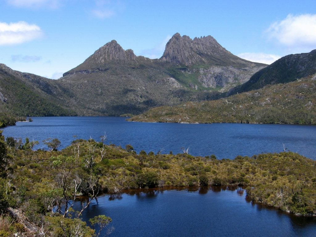

If the weather is nice, you shouldn’t skip climbing Cradle Mountain. It’s a steep scramble up rocks to the summit, but the views are incredible. Cradle Mountain towers over Dove Lake, making it the only high peak in the park that most casual visitors see. At 1545m tall its the 6th tallest mountain in Tasmania.
The track starts at Kitchen Hut. Just 100m later, turn left on to the Cradle Mountain Face Track. Then in 50m, turn right on to the Cradle Mountain Summit Track.
The beginning of the track is across grassland, but it soon turns to rocky scree with some climbing across boulders. The route is marked with cairns, red paint and posts. At the summit there is a big bronze plaque that points out the surrounding mountains.
Barn Bluff
Distance: 7km return
Elevation Change: 359m ascent
Time: 3-4hours
Difficulty: Challenging
Location: Track starts 9km from Ronny Creek; 1.7km from Waterfall Valley

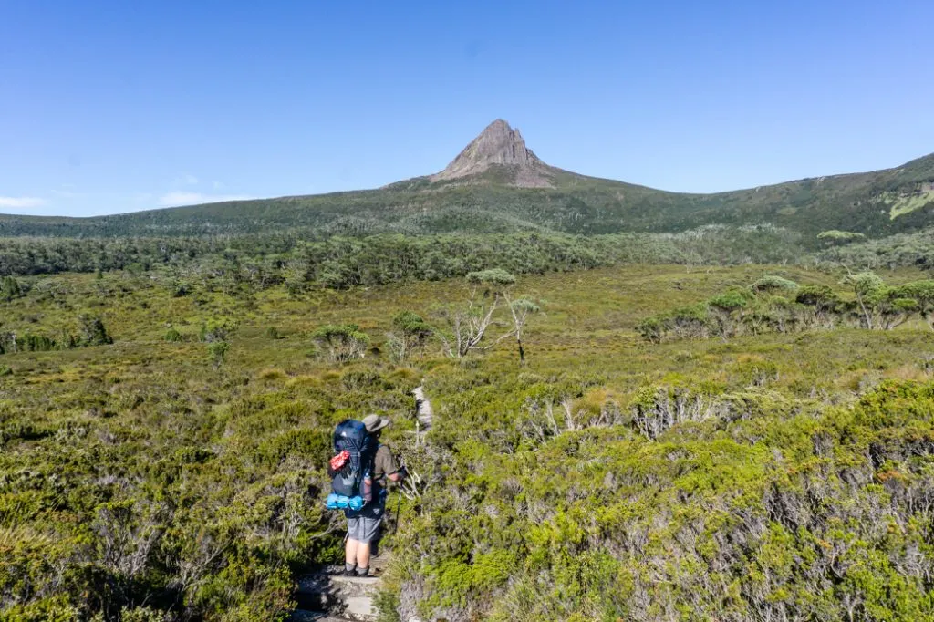
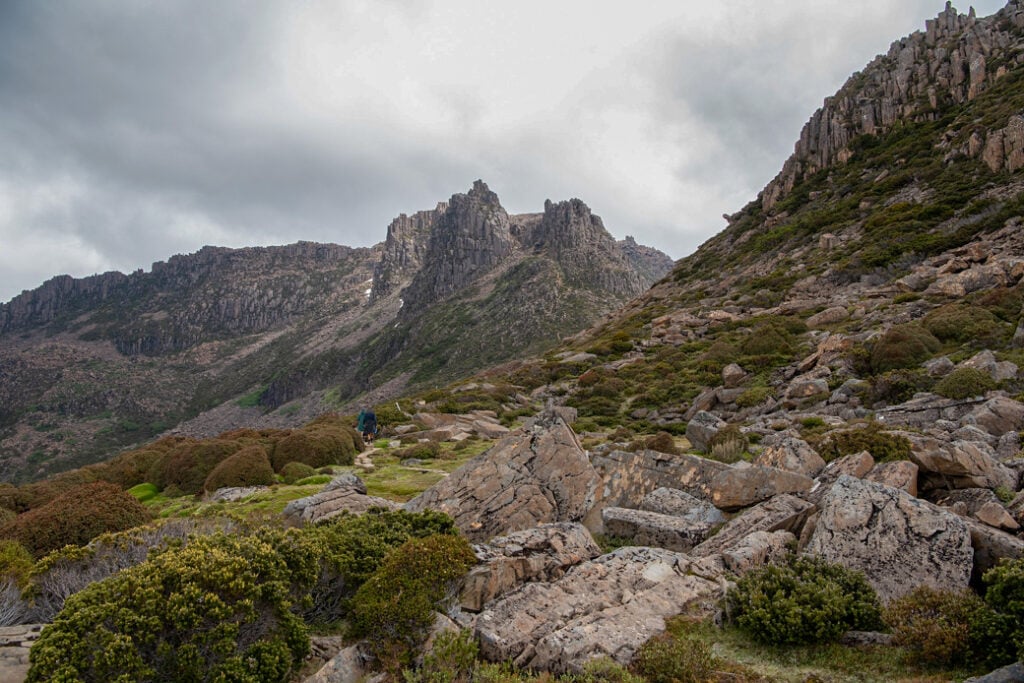
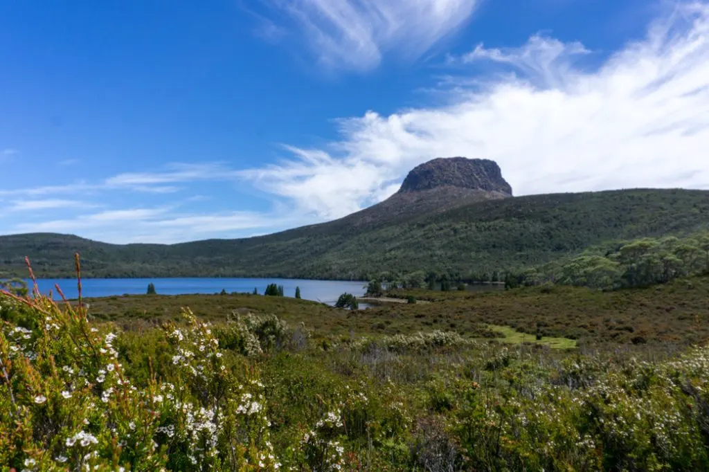
Barn Bluff is Tasmania’s 4th highest mountain at 1559m. Views of this peak dominate the first few days of the Overland Track. And from some angles, it does look like a barn.
You can summit Barn Bluff en route to Waterfall Valley on your first day on the Overland Track. However, many people choose to summit Cradle Mountain that day, or run into bad weather. In that case, you can also head up Barn Bluff from the Waterfall Valley Hut and campsite. This will add an extra 1.7km each way with 160m of elevation change.
From the junction with the Overland track, the route to Barn Bluff climbs gradually through buttongrass along the side of Bluff Cirque for the first 2.5km. The final kilometre to the summit is over rough scree with lots of boulders. There are steep scrambling moves. Watch for cairns to ensure you stay on the correct track.
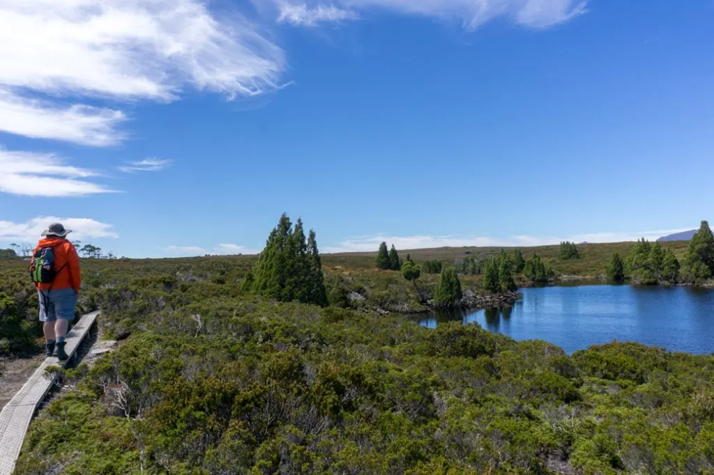
Lake Will
Distance: 3km return
Elevation Change: none
Time: 1 hour
Difficulty: Easy
Location: Track starts 3.8 km from Waterfall Valley

The track to Lake Will is one of the easiest Overland Track side trips. It makes a great lunch stop on the short walk between Waterfall Valley and Windermere. On a warm day you may even want to go for a swim. There are great views of Barn Bluff from the lake.
From the junction follow the narrow duckboard track for 1.5km to the shores of the lake. You’ll pass some pretty ponds around the 1km mark. Once you are at the lake you can stop for lunch at a small sandy bay.
The track continues to the left along the lake shore but it is very brushy. If you want to extend your walk, head to Innes Falls just beyond the lake outlet. This will add another 2km to your trip.
Old Pelion Hut
Distance: 1km return
Elevation Change: 30m descent
Time: 30 minutes
Difficulty: Easy
Location: Track starts 400m from New Pelion Hut and Campground.

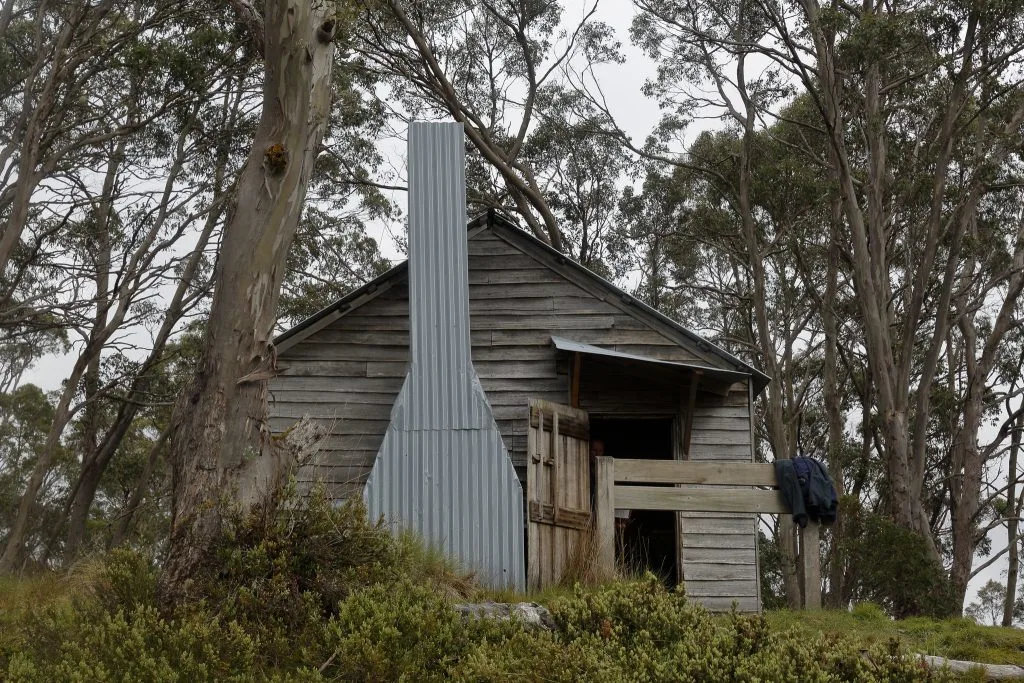
Pelion Hut is the oldest of the historic huts in the park, built in 1916. It originally housed copper miners and if you look carefully, you can see evidence of long-ago mining nearby. It’s a historic hut so you are not allowed to sleep in it.
You can take the side trip to Old Pelion Hut on your way past in on the hike from Windermere to New Pelion Hut. Or you can head to New Pelion, have dinner, then make a quick evening trip over. The track is an easy walk on duckboard.
A short path behind the hut leads down to a swimming hole on Douglas Creek.
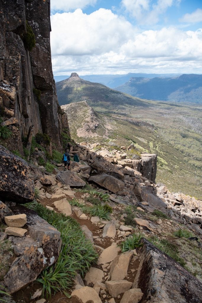
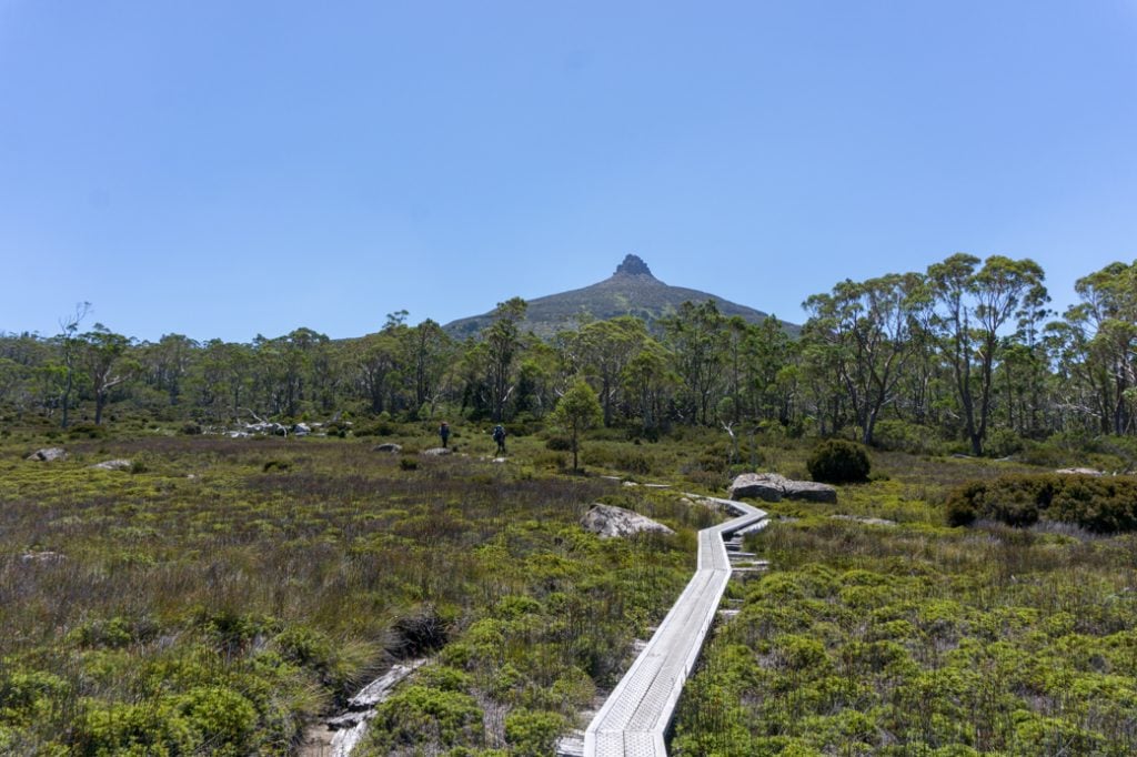
Mount Oakleigh
Distance: 8km return
Elevation Change: 516m ascent
Time: 4-6 hours
Difficulty: moderate
Location: Track starts at New Pelion Hut and Campground
The dolerite spires of 1386m high Mount Oakleigh dominate the view from the veranda of the New Pelion Hut. If you choose to take a rest day there (or you’re a super-fast hiker), this hike makes a great day trip. From the top you can see most of the Overland Track.
The track starts on the far side of New Pelion Hut. Follow the track along the side of Pelion plains for 500m to a small suspension bridge across Douglas Creek. After the bridge, turn left at the wooden sign post on to the Mount Oakleigh track. The next kilometre across the moorland can be very muddy.
The trails climbs gently through eucalyptus forest until the 2.5km mark when things get steep and the track turns west. It’s another 1.3km to a high rocky knoll with great views.
You can turn around here or carry on down into a shallow valley then up onto another high point above the rocky pinnacles. Most people will be content to turn around here, but the true summit is 700m further away to the north.
Mount Ossa
Distance: 5.2 km return
Elevation Change: 487m ascent
Time: 4-6 hours
Difficulty: Challenging
Location: Track starts at Pelion Gap, 1.6km from New Pelion Hut

As the tallest mountain in Tasmania at 1617m, Mount Ossa is on most Overland Track hikers’ tick list. It’s a long and challenging hike to the summit, but it’s worth it. Recently the national park has done a lot of work on the track to add stairs, making it a bit less arduous.
From Pelion Gap, the track climbs up the side of Mount Doris. Then it flattens out a bit as it contours around into a saddle at the 1.5km mark. There are great views from here and hikers without time or energy should enjoy them, and then turn around.
After the saddle the real climbing begins. Head up a scree-filled gully, being careful to follow the marked track.
The next kilometre features lots of steep and rocky terrain that will require a little bit of scrambling over boulders. This can be treacherous when it is wet, icy or snowy. After passing a small tarn, turn right to reach the boulder-covered summit.
Mount Pelion East
Distance: 2.4 km return
Elevation Change: 331m ascent
Time: 2 hours
Difficulty: moderate/challenging
Location: Track starts at Pelion Gap, 1.6km from New Pelion Hut
If you’re looking for a less crowds than Mount Ossa, or just want a shorter hike, head to Mount Pelion East, just across Pelion Gap. At 1461m tall it’s still a worthy objective. Plus its shorter height means it’s less likely to get clouded in.
The trip to the summit is a gradual climb through gum trees and along grassy slopes that can be wet and muddy. The final few hundred meters to the summit involve following cairns through the rocks, climbing up a a scree-filled gully, and then scrambling up to the top of the summit tower.
D’Alton and Fergusson Falls
Distance: 1 km return
Elevation Change: 70m descent
Time: 1 hour
Difficulty: easy
Location: Track starts 4.1km from Kia Ora Hut
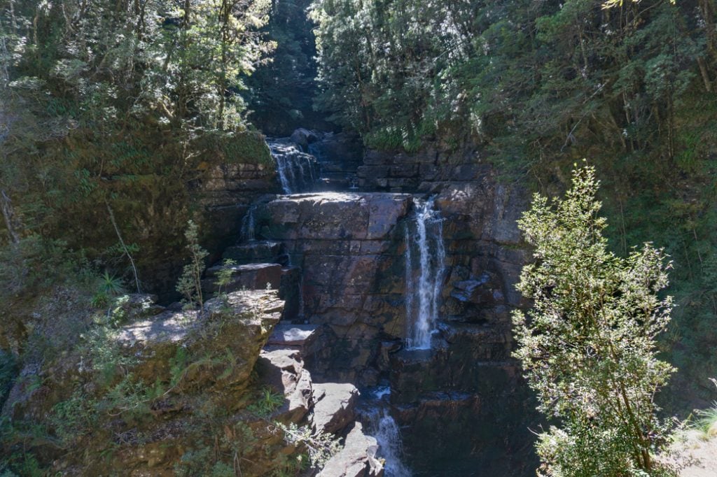

If you have time for lots of side trips on the Oveland Track, head down to D’Alton and Fergusson Falls. (But if you’re short on time, skip these and go to Hartnett Falls instead.) D’Alton and Fergusson Falls sit in a deep gorge along the Mersey River. They can be a bit of a trickle in the late summer and fall, but in the spring they rage with water.
From the Overland Track, descend on a zig zag track for about 300m to a junction. Turn right to contour around the side of a hill towards Fergusson Falls. There’s a fixed chain to use as a handhold. Be careful on the sheer ledges at the viewpoint.
Retrace your steps to the junction, then go steeply downhill to the left towards D’Alton Falls. The track is very close to the cliff edge at some points and there is no railing, so be careful.
Hartnett Falls
Distance: 1.5 km return
Elevation Change: 60m descent
Time: 1 hour
Difficulty: easy
Location: Track starts 4.5km from Kia Ora Hut
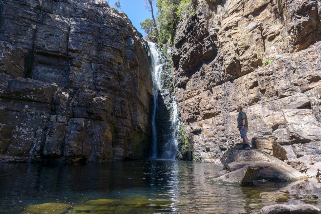

Hartnett Falls is the most beautiful waterfall on the Overland Track and is an easy side trip that you shouldn’t miss. It sits deep inside a fern-covered canyon.
From the Overland Track follow the track through the forest as it gradually descends to the Mersey River. After about 700m you will arrive at the top of the falls.
If you take a rough track to the right you’ll emerge on the river’s edge above the falls. At times of low water flow, there’s a great swimming hole.
If you head left, you can follow a newly refurbished track along the canyon rim, then down a set of stairs to the bottom. Head back up stream towards the falls, hopping across rocks to stay out of the stream. Although the water is icy cold, the pool below the falls is popular for swimming.
Pine Valley
Distance: 4.7km one way
Elevation Change: 60m ascent
Time: 1.5-2 hours one way
Difficulty: easy
Location: Track starts 5.2 km from Bert Nichols Hut/Windy Ridge campground or 3.8 km from Narcissus Hut

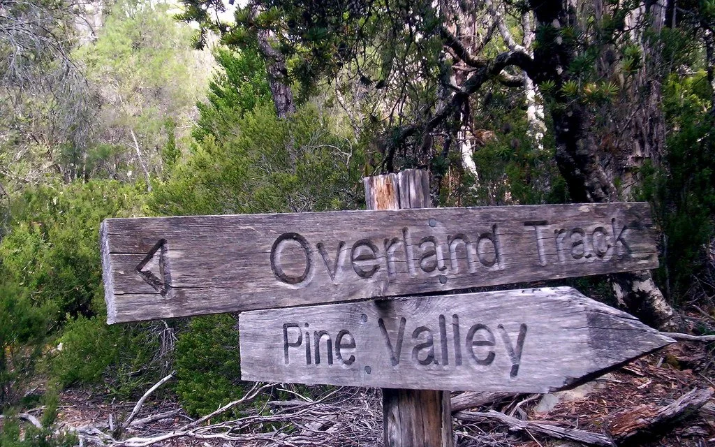
If you have an extra couple of days on the Overland Track, its worth heading into Pine Valley. There’s a hut and campground, plus more trails that lead deeper into some spectacular wilderness.
From the Overland Track descend to the Narcissus River and cross it on a suspension bridge. The track continues through flat forest on a mix of boardwalk, slippery tree roots and mud.
Cross the first bridge over Cephissus Creek at the 1km mark and then the second bridge back to the north side after another 1.5km. The track continues alongside the creek for another 2.2km before crossing Cephissus Creek for the third time (back to the south side), and arriving at the Pine Valley Hut.
The Acropolis
Distance: 6.4km return
Elevation Change: 640m ascent
Time: 4 hours return
Difficulty: moderate/challenging
Location: Track starts at Pine Valley Hut
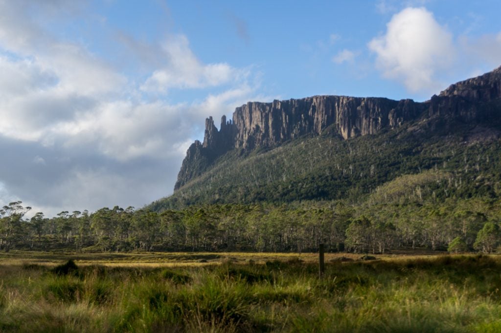
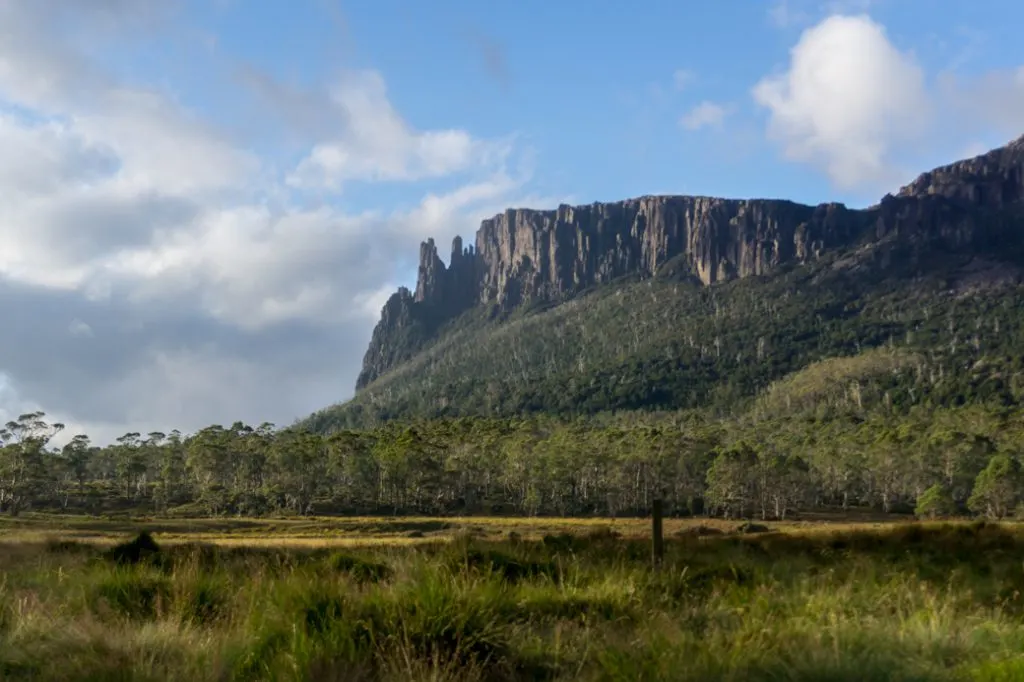
The imposing rock spires of the Acropolis look like you’d need ropes and technical climbing skills to get up them. But there’s actually a fairly straightforward route to the summit for hikers from the Pine Valley Hut. It does involve lots of boulder-scrambling and route-finding.
From the Pine Valley Hut, follow the track north. Then, turn turn right 40m later at a junction on to the Acropolis Track. In the first kilometre you will pass by Cephissus Falls and then cross Cephissus Creek.
After the creek crossing the track begins to climb up through the forest and reaches a ridge-top around the 2km mark. There are good views from here.
On the ridge the track turns left and follows the ridge crest for another kilometre. The track crosses rocky scree slopes as it follows cairns up a gully and scrambles up some short cliffs to the summit.
The Labyrinth
Distance: 6km return
Elevation Change: 430m ascent
Time: 4.5 hours return
Difficulty: moderate
Location: Track starts at Pine Valley Hut
The Labyrinth is a high alpine plateau dotted with small lakes that reflect craggy mountain peaks. Photographers love it here. You can climb up to the Labyrinth Lookout as a day trip from the Pine Valley Hut.
From the Pine Valley Hut, follow the track north then turn turn left 40m later at a junction on to the Labyrinth Track. The trail meanders through the forest before climbing up to a saddle below the Parthenon.
Next the track flanks east around the Parthenon before arriving at a junction at Lake Cyane about 2.8km from Pine Valley. Take the right hand track and climb up to a rocky lookout. This is the Labyrinth lookout. From here you get a panoramic view of all the lakes, plus Mount Geryon and the Acropolis to the north west.
If you want to walk further, return to the junction and go left past several small lakes to Lake Elysia, considered the prettiest spot in the Labyrinth. The trip will add another 2km each way to your hike.
Most hikers will do only a handful of these Overland Track side trips. You will have to let the weather, your fitness and time limits decide which ones you pick. (Tip: Check out my Overland Track itineraries to see which ones I recommend, depending on your schedule!)
Have you done and of these Overland Track side trips? Which ones would you recommend? Tell me in the comments.
MORE OVERLAND TRACK POSTS:
- The Ultimate Guide to the Overland Track in Tasmania
- Overland Track Section-by-Section Overview
- 6-Day Overland Track Itinerary (Plus More Itinerary Options)
- The Complete Guide to Overland Track Huts and Camping
- Overland Track Transport: How to Get There
- Overland Track Packing List: Everything You Need to Bring


- Best Sun Hoodies for Hiking - June 3, 2026
- Lower Stein Valley Trail Hiking and Backpacking Guide - May 27, 2026
- The Best Things to Do in Vernon, BC - May 21, 2026