

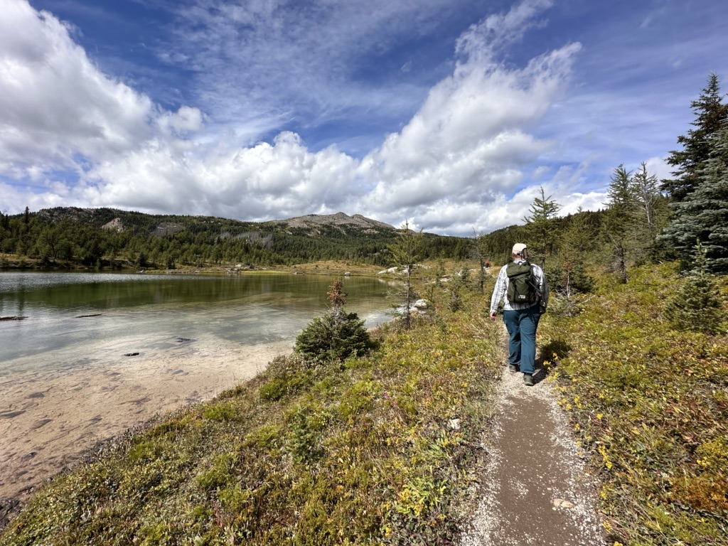
I’ve done a lot of hiking around Banff and in the Canadian Rockies… and the trails at Sunshine Meadows have by far the best effort-to-reward ratio. There is literally nowhere else where you can wander through wildflower meadows, hike past alpine lakes, and enjoy mountain views while barely breaking a sweat.
In the winter this area is known as the Sunshine Village Ski Resort, one of the three ski areas in Banff. But in the summer the wildflowers bloom and it turns into an epic hiking destination.
On my last trip to Banff, I spent a day hiking high in the mountains at Sunshine Meadows. I’m a hiking guidebook author, so I’m always thinking about the optimal way to do each hike. So I’ve put together a custom route for you plus lots of tips for enjoying your time in this special place.
This Sunshine Meadows hiking guide includes:
- Is hiking at Sunshine Meadows worth it? Spoiler: my answer is definitely yes.
- Tips for hiking at Sunshine Meadows: What to bring, how to prep, and how to protect this gorgeous but fragile ecosystem
- Sunshine Meadows hiking basics: How far, how much, how difficult, etc.
- Sunshine Meadows hiking map – I made a custom hiking map for you
- How to get there – driving, bus, and gondola info
- My recommended Sunshine Meadows hiking route – it hits all the highlights
- Other hikes at Sunshine Meadows in case you want to extend your hike
- How to hike at Sunshine Meadows for free (without taking the gondola)
- Other things to do at Sunshine Meadows – restaurants, the Interpretive Centre, and more
This is a sensitive wilderness area. Learn how to Leave No Trace to keep the wilderness wild. Make sure you are prepared by bringing the 10 Essentials. Get ready for adventure with this checklist of things to do before every hike.
Hey there: Thanks to Sunshine Meadows for hosting me on my visit. All opinions in this post are my own and I would happily pay out of my own pocket to hike here again. Some of the links in this post are affiliate links, which means I earn a small commission at no cost to you. Thanks for your support. -Taryn
Is Hiking at Sunshine Meadows Worth It?
You might be wondering if it’s worth spending money to ride the gondola up to Sunshine Meadows to go hiking. The short answer: YES!
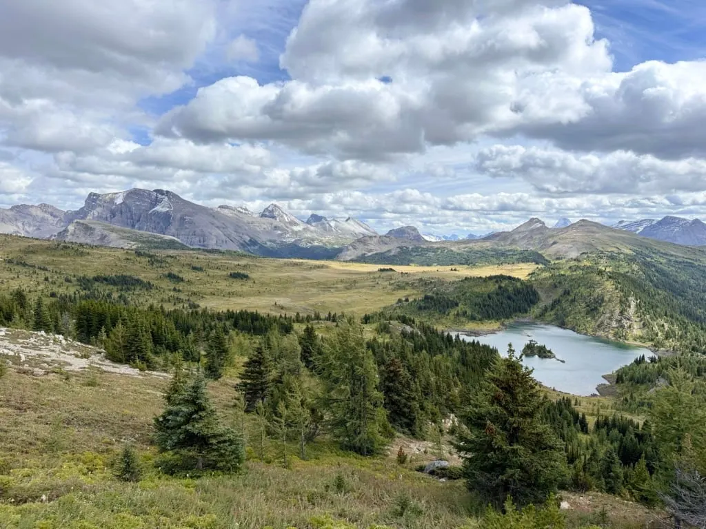
The gondola takes you high up into the mountains, above the treeline and in the alpine with gorgeous mountain lakes. That means there are views in every direction and wildflowers everywhere.
Sunshine Meadows is the only accessible place near Banff to go for an easy or moderate hike in the mountains. All of the other easy and moderate hikes are in the valley bottom.
The only other way to get to that kind of terrain is to hike steeply uphill for literally hours. Other hikes that take you to this type of terrain are rated difficult.

Sunshine Meadows vs. Banff Gondola and Lake Louise Gondola
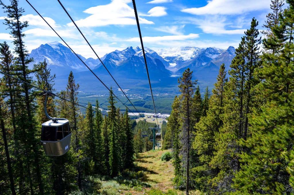
With three summer sightseeing gondolas near Banff, you might wonder how Sunshine Meadows stacks up compared to the Banff Gondola and the Lake Louise Gondola.
The Banff Gondola is the closest to the town of Banff. It goes up Sulphur Mountain, which is tree-covered (unlike the alpine landscape at Sunshine). It has great views of Banff and the Bow Valley. There is a short boardwalk through the trees, but no hiking trails or wildflower meadows. It’s a bit more expensive than Sunshine.

The Lake Louise Gondola takes you up through the Lake Louise ski resort so you get views of ski runs, although sometimes people do spot bears from the gondola. There is a small viewing platform at the top where you can look across the valley to Lake Louise and the surrounding mountains. There are no hiking trails. Tickets are slightly cheaper than Sunshine Meadows.

Tips for Hiking at Sunshine Meadows
Tips for Planning Your Trip
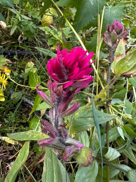
- The best time to go to Sunshine Meadows is between mid-July and early September when the trails are snow-free. For peak wildflowers, go in late July or early August. Plan to go on a clear day so you can enjoy the views. (I visited in late August and most of the flowers were done but it was still pretty.)
- Check the weather before you go. City weather forecasts are useless in the mountains. Use an algorithmic spot forecast for Sunshine like Spotwx. (Read my guide to weather apps for hikers for more tips.) It’s also worth checking current conditions at Sunshine and the Rock Isle webcam.
- Check gondola hours and trail status. Make sure the trails are open and the gondola and chairlifts are running by the Sunshine trail report.
- Arrive in the morning: That gives you lots of time to hike and explore. As well, it’s more likely to be cloudy in the afternoon. Don’t go any later than 2 or 3 pm because you won’t have enough time before they close.

What to Pack
- Bring a rain jacket and warm clothing just in case. It can be much colder and rainier in the mountains than in the valley.
- Wear sunscreen. The sun is bright up here and there isn’t much shade.
- Bring water and snacks. You can fill up your water bottles at the Centennial Lodge at the top of the gondola and grab snacks at the cafe.
- Bring the 10 Essentials. These are key safety items you should have on every hike.
- Bring a camera – it’s gorgeous and you will want tons of pics! But leave the drone at home. Drones aren’t allowed at Sunshine or in Banff National Park without a commercial filming permit.
- Bring bear spray. Black bears and grizzly bears live here and are sometimes sighted on the trails. The staff are great about closing trails and warning hikers if there is a bear around. Bring bear spray just in case because bears go where they want, when they want.
How to Respect This Fragile Ecosystem
- Pack out all your garbage. There are garbage cans at Centennial Lodge – please pack out your trash.
- Use the toilets. There are toilets at the Centennial Lodge and outhouses near Rock Isle junction and Grizzly/Laryx junction, but there are no other toilets on the trails.
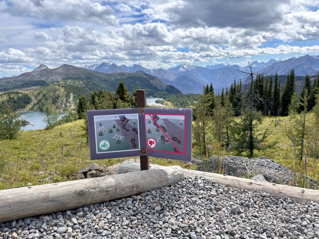
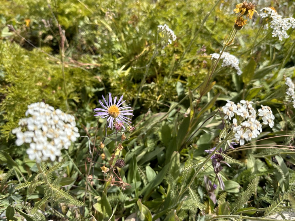
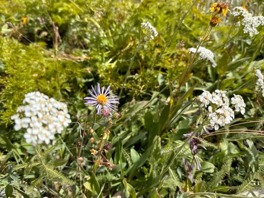
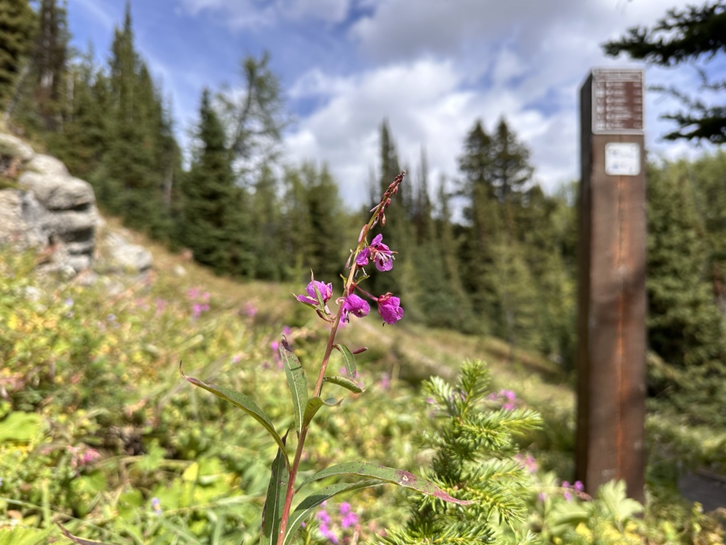
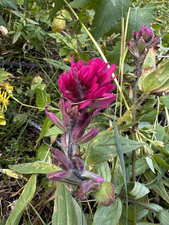
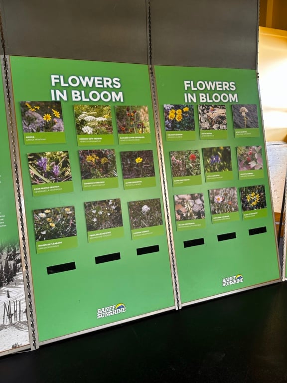
- Don’t pick the wildflowers. It can take years for each plant to produce a single flower. Leave the flowers for everyone to enjoy. Take photos instead. Visit the Interpretive Centre near the gondola for help identifying all the wildflower species you spot.
- Stay out of the lakes. While you might be tempted to take a dip on a sunny day, swimming isn’t allowed. The lakes are very shallow and sensitive ecosystems.
- Dogs aren’t allowed on the gondola or chairlift. You can hike up the access road with your dog on leash, but it’s 5.5 km each way with 510 m of elevation gain. Dogs are allowed on the Sunshine trails on leash.
- Respect Indigenous traditional territory. The Sunshine Meadows area is in the traditional territory of the Tsuut’ina, Michif Piyii (Mestis), Niitsítpiis-stahkoii (Blackfoot / Niitsítapi), Ĩyãħé Nakón mąkóce (Stoney) and Ktunaxa ɁamakɁis. The government forced Indigenous people to leave soon after Banff National Park was created in 1885 and prohibited them from accessing their traditional territory to hunt, fish, gather, and conduct cultural practices.
Sunshine Meadows Hiking Basics
Sunshine Meadows has 6 hiking trails that you can combine to make various loops. The must-do is the Standish Viewing Deck Loop. But I’ve got a recommended route at the bottom of this post that hits all the highlights.
Here are some stats for the hikes at Sunshine Meadows:
Duration: 30 minutes to four hours
Distance: 0.8 km to 9.8 km
Difficulty: Very easy to moderate
Elevation Change: Up 300 m
Cost: As of 2025, it’s $68/person for adults (kids and seniors are cheaper). This includes rides on both the gondola and chairlift.
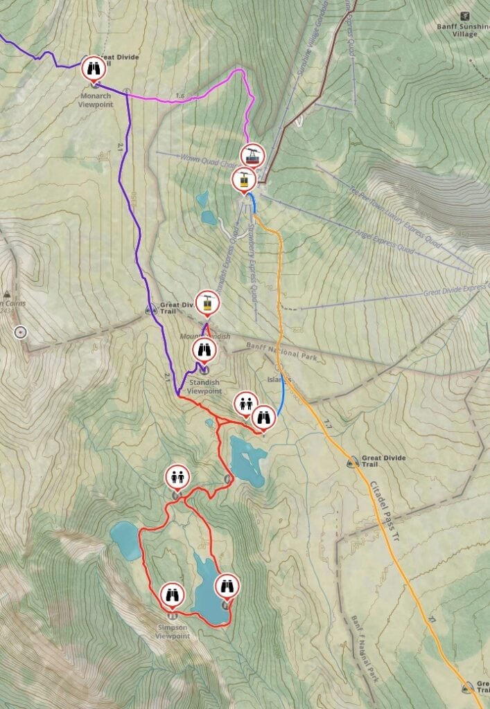
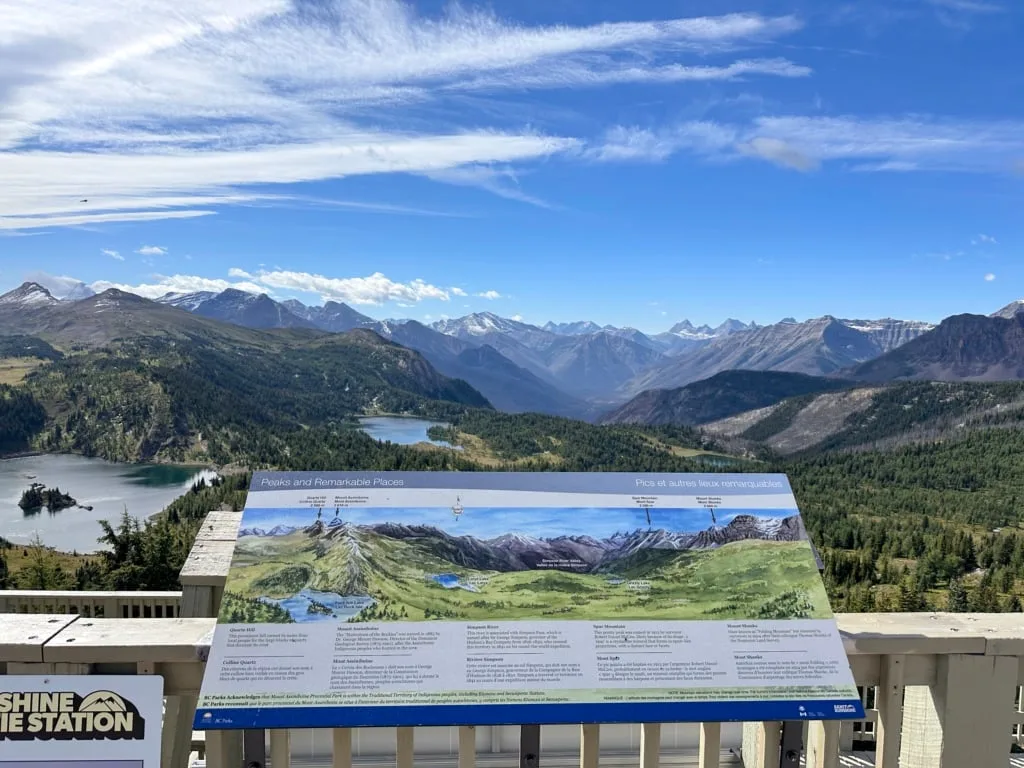
Sunshine Meadows Hiking Trails Map
The Sunshine Meadows trails are easy to follow with lots of signs and maps at every junction. When you buy your gondola tickets, they will give you a paper map.


The map is pretty, but it doesn’t show a lot of the small ups and downs the way a topographic map does. I made you a custom trail map using Gaia GPS, my favourite mapping app. It shows all the locations I mention in this post. Click through to zoom in and explore (and to download the GPX file).

PS: Want to save 10% on a premium subscription to Gaia GPS (the app I use for all my hikes)? Use my link – the discount appears in cart.
How to Get to Sunshine Meadows
Sunshine Meadows is located at the Sunshine Village ski area 15 minutes west of Banff. It’s easy to drive yourself and there is lots of free parking. Here are Google Maps driving directions.
If you don’t have a car, Sunshine also runs a free shuttle bus several times a day.
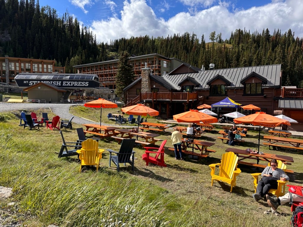
Once you arrive at the parking lot and gondola base, head inside and buy your gondola tickets. From there board the high-speed eight-passenger gondola and enjoy mountain scenery on the 25-minute ride up into the mountains. The gondola tops out at 2,159 meters.
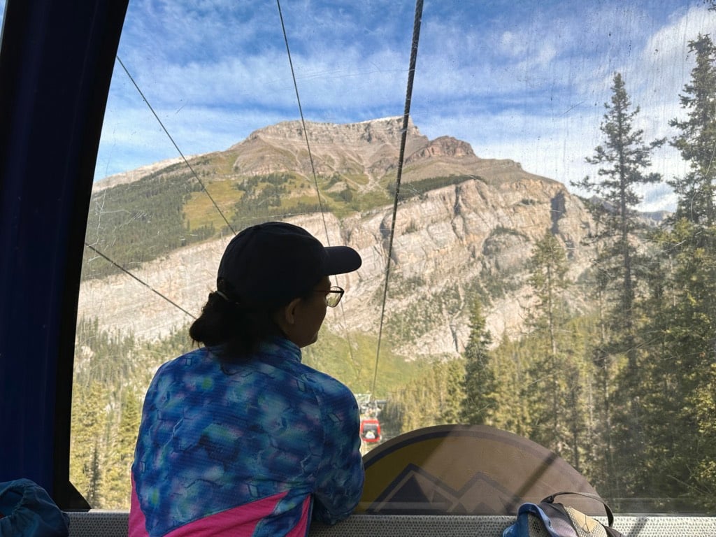

When you get off the gondola staff will greet you to give you a brief overview of the area and explain how to respect this beautiful place by staying on trail, not picking flowers etc. They will also give you some bear safety tips.
I recommend going inside the Centennial Lodge to use the bathroom before you hit the trails. It’s also worth visiting the Interpretive Centre inside the lodge to check out the wildflower displays. That way you can try to recognize some of the flowers you will be seeing on your hike.
Sunshine Meadows Hiking Directions (My Recommended Route)
There are six trails at Sunshine Meadows, but if you just want the highlights, follow my recommended route (below). It has step-by-step directions to ensure you see the highlights.
Here are the stats for this route:
Duration: 3 to 4 hours
Distance: 6.9 km
Difficulty: Moderate
Elevation Change: 312 m
Below are step-by-step directions for each part of the hike.
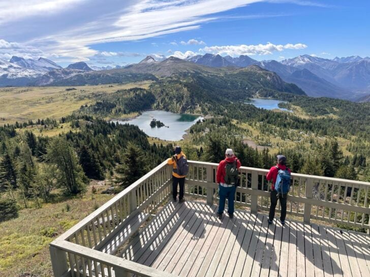
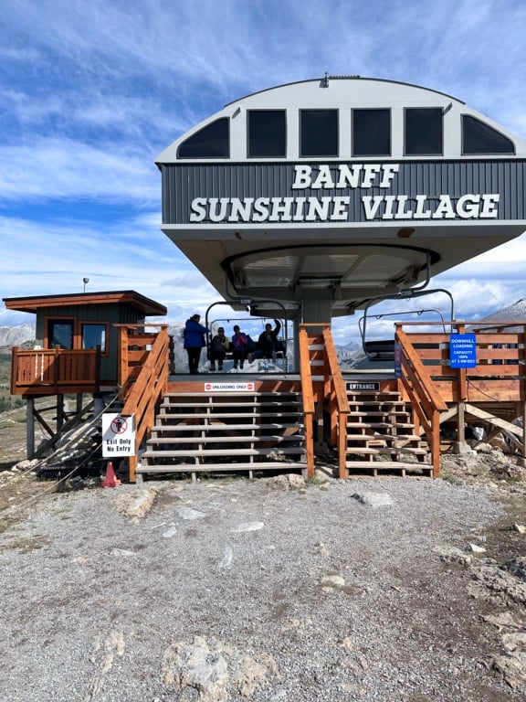
Standish Express Chairlift and Standish Viewing Deck
To start the hike, walk from the gondola over to the Standish Express Chairlift. This is an open chairlift where your feet dangle, so some people may find it unnerving to ride compared to the gondola. However, it’s not that steep and it doesn’t take long so I think you’ll be fine. You’ll also have beautiful scenery to distract you.
The chairlift will bring you to the top of Mount Standish, also called Standish Hump. This is the highest point of your hike so enjoy the 360-degree views.
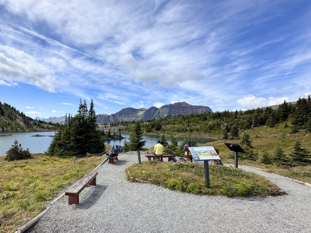
When you are ready to start hiking, you can take either the left or right path – they meet up in a few minutes at the Standish Viewing Deck 300 m from the chairlift.

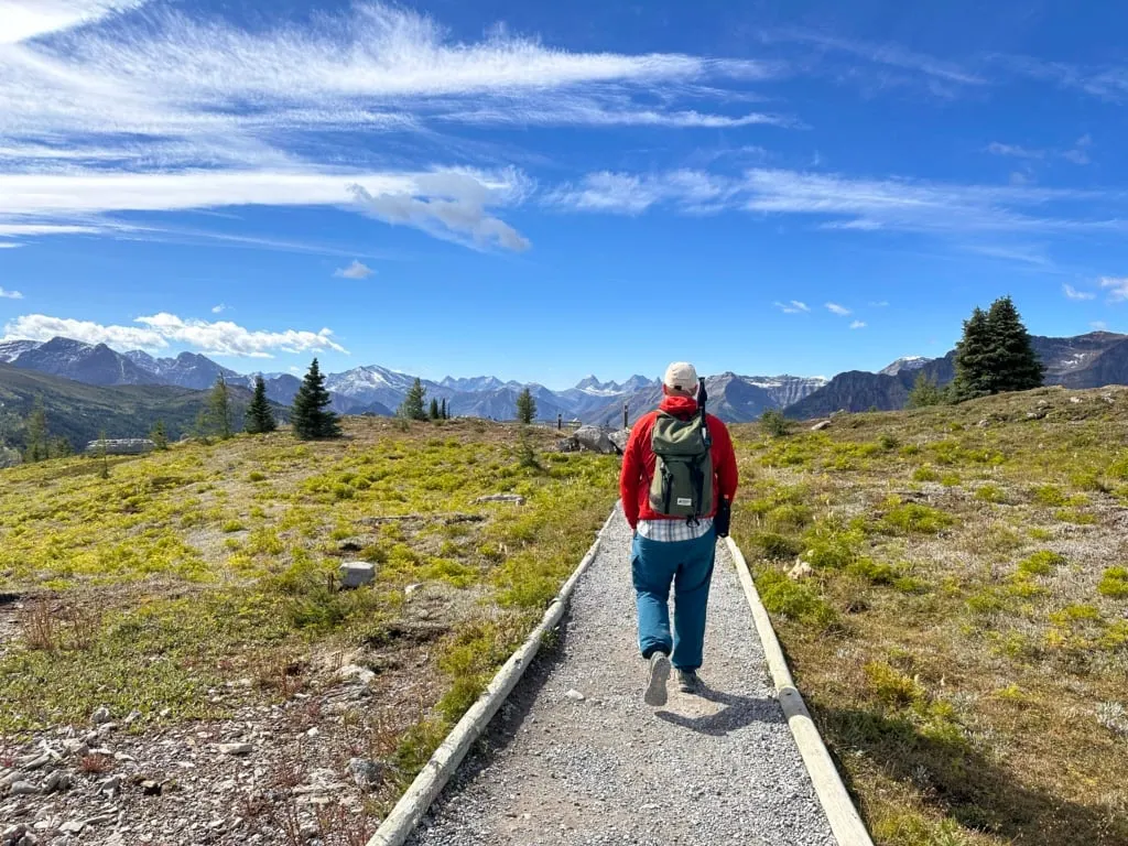
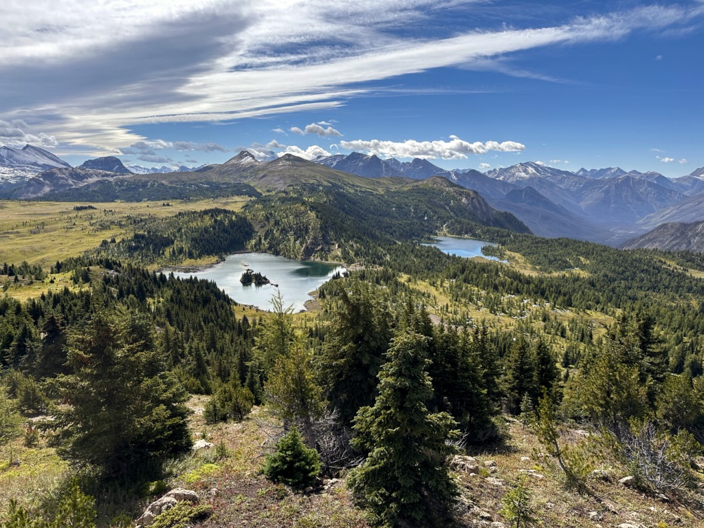
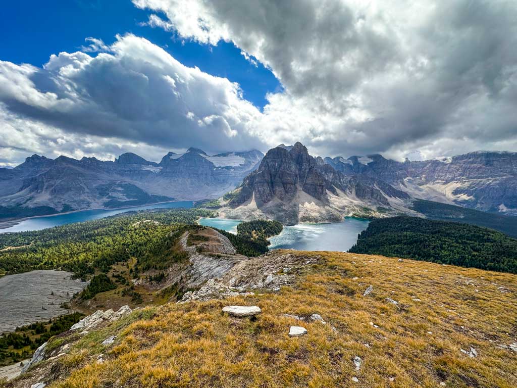
The Standish Viewing Deck has the best views at Sunshine Meadows. In my opinion, this is one of the best viewpoints anywhere in the Banff area. Don’t miss it!
From the two-level deck, you can look south to Rock Isle, Grizzly, and Laryx Lakes. On a clear day, you can also see the pointy top of Mount Assiniboine, nicknamed Canada’s Matterhorn. To the east you can spot the ski runs on Brewster Rock and Mount Howard Douglas. And to the west, you can see the rocky peaks of Two Cairns.


Standish Viewing Deck to Rock Isle Viewpoint
From the viewing deck, follow the trail down the stairs and then down the hill through a few clumps of trees. Arrive at Two Cairns junction about 400 m from the viewing deck.

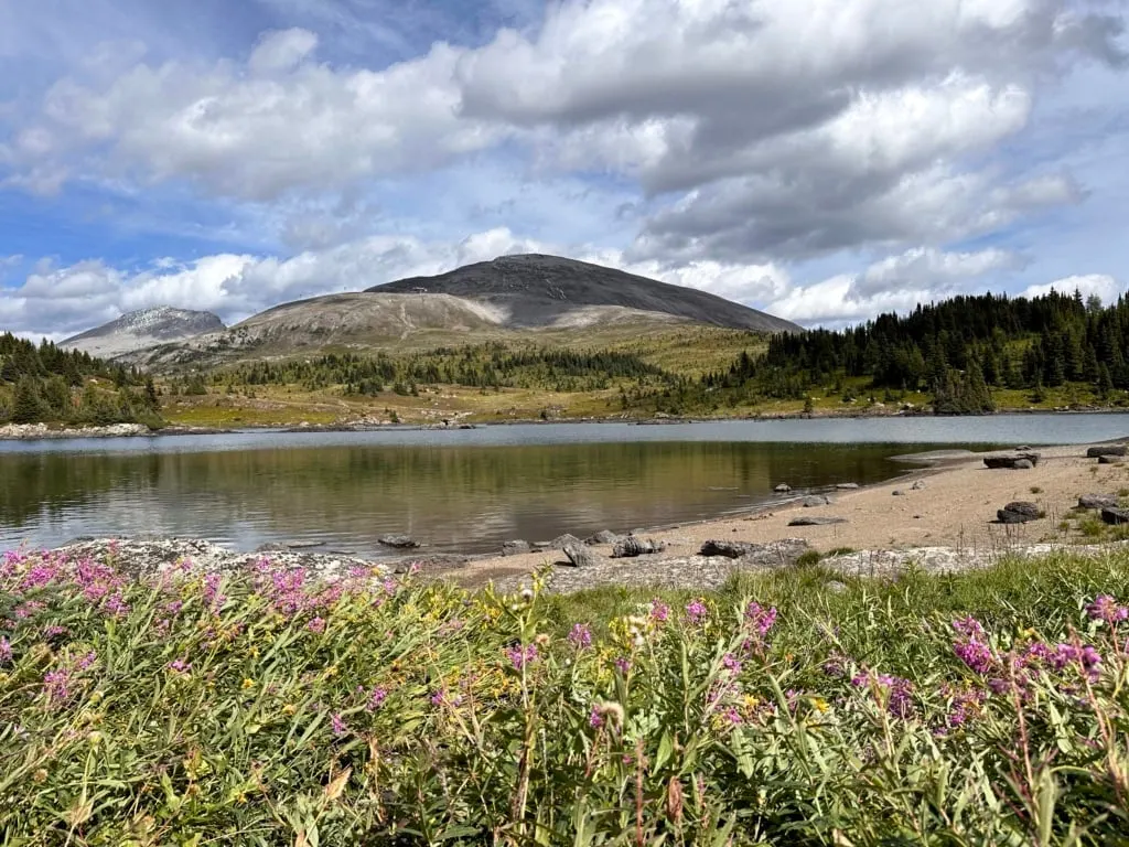
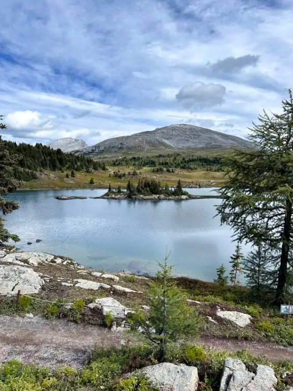
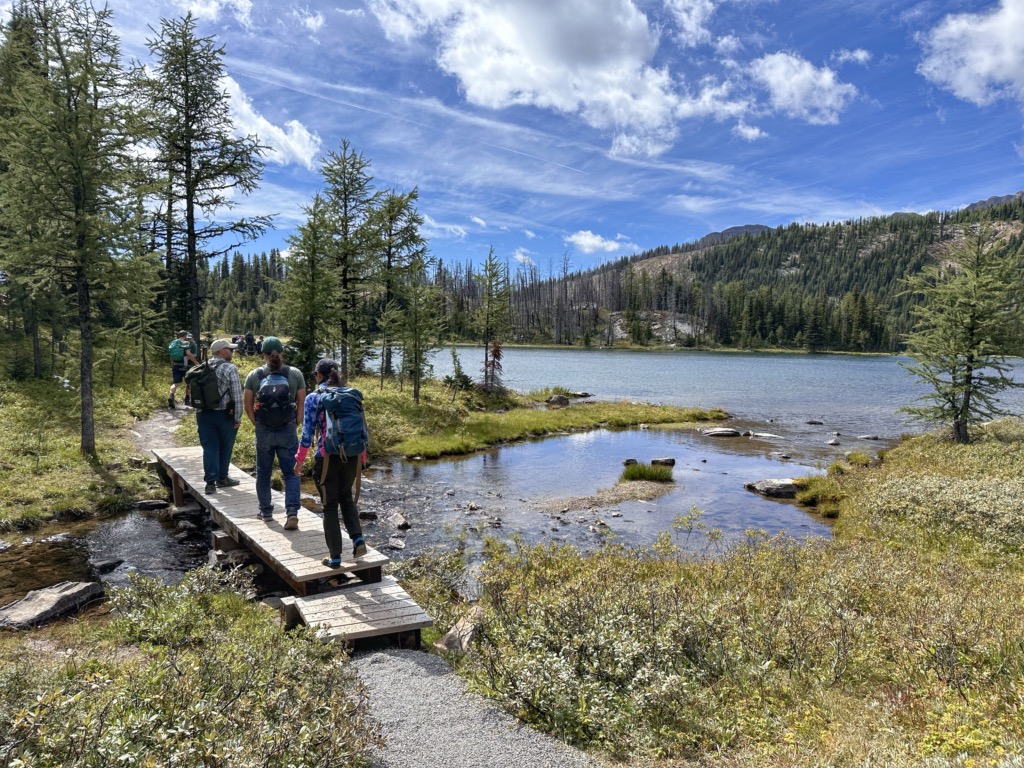
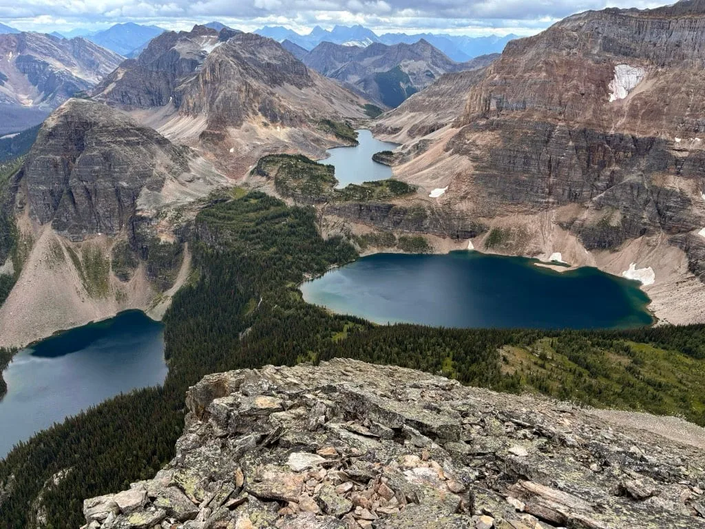
Turn left and follow the trail towards Rock Isle Junction. The trail continues downhill, although not as steeply as before. About 300 m from Two Cairns Junction, arrive at Rock Isle Junction. There are views of Rock Isle Lake here, but continue straight for even better views.
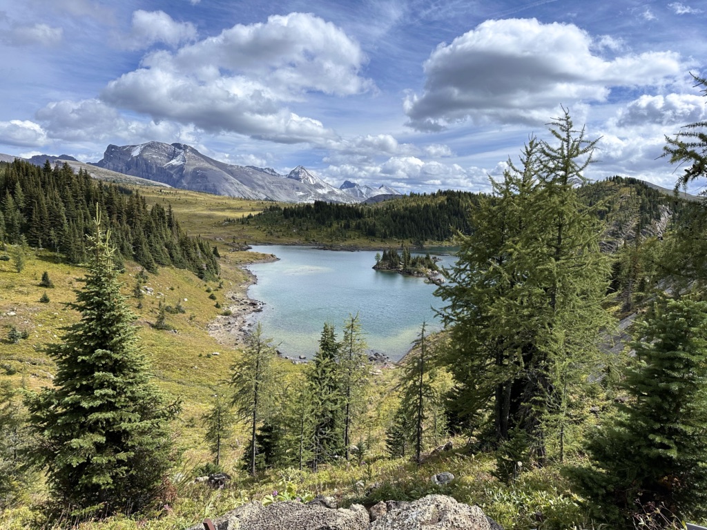

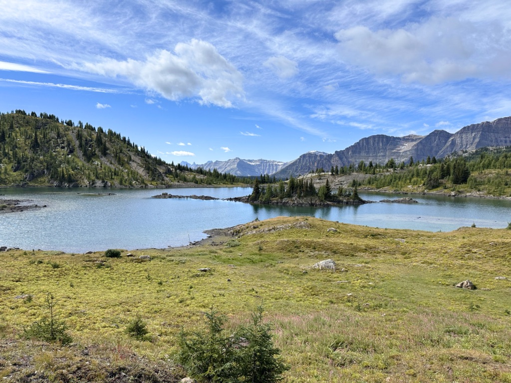
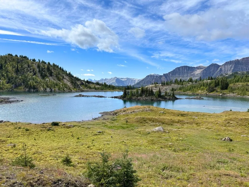
Pass a spur trail on your left leading to an outhouse, and arrive at Rock Isle Viewpoint about 400 m from Rock Isle Junction. The benches here have an incredible view of Rock Isle Lake so it’s a great spot for a snack break. It should be pretty obvious to you how the lake got its name – the island in the lake is a big rock!

Rock Isle Viewpoint to Grizzly/Laryx Junction
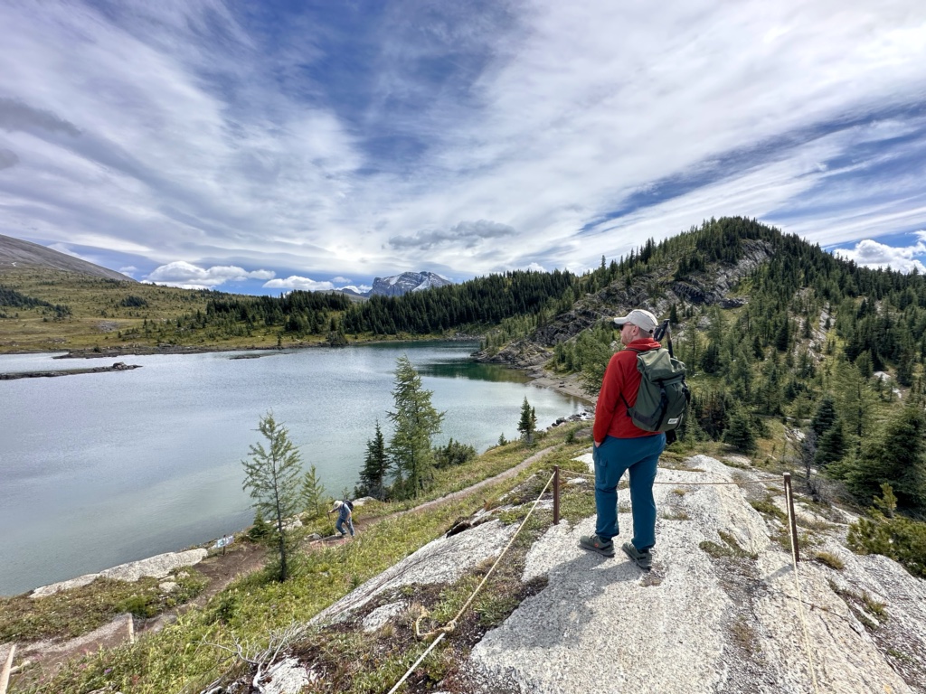
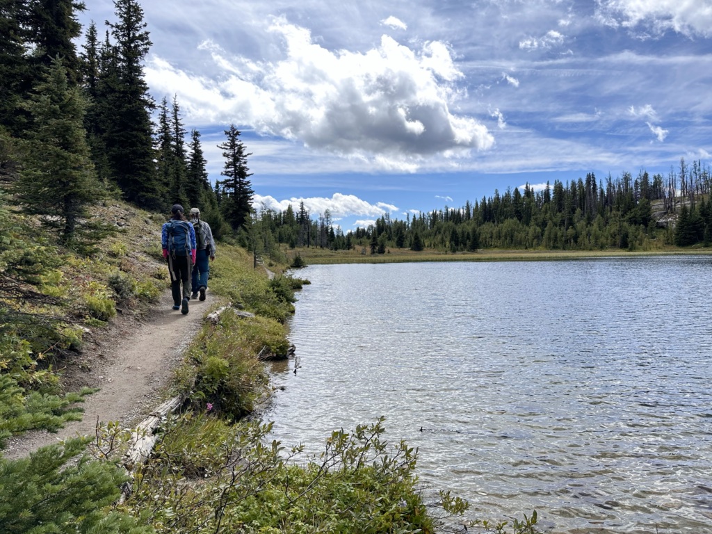
When you are finished at the viewpoint, retrace your steps back to Rock Isle Junction and turn left. Follow the trail along a ridge beside Rock Isle Lake. There are more photo opportunities here too including a short spur trail to the right that takes you to a bluff top viewpoint.

At the end of the lake, the trail drops downhill on a staircase and winds through patches of trees and meadow. Arrive at Grizzly/Laryx Junction about 900 m from Rock Isle Junction.

Grizzly/Laryx Loop
At Grizzly/Laryx junction turn right to start the loop. There is an outhouse just past the junction in the trees. (FYI Laryx is the Latin name for the larch tree – there are lots of them in this area.)
Continue along the trail as it heads gently downhill through a meadow to Grizzly Lake, about 500 m from the junction. The trail follows the east shore of the lake, then heads through an open meadow which is a great place to see wildflowers.


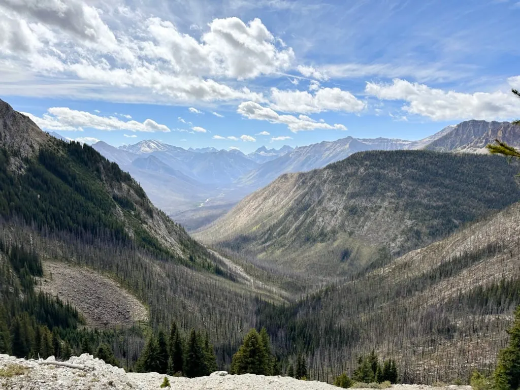
After a few minutes in the forest, watch for the Simpson Viewpoint on your left, about 500 m after leaving Grizzly Lake. The viewpoint sits on the edge of a deep canyon. You can see the Simpson River basin, which burned in forest fires in 2017.

From the viewpoint, continue along the trail to Laryx Lake, 100 m away. The trail loops around the south and east sides of the lake. A bench on the peninsula partway along makes a good break spot.

Past the end of the lake, the trail heads through another wildflower meadow and then an open forest to arrive back at the Grizzly/Laryx junction.


Grizzly/Laryx Junction Back to Standish Chairlift
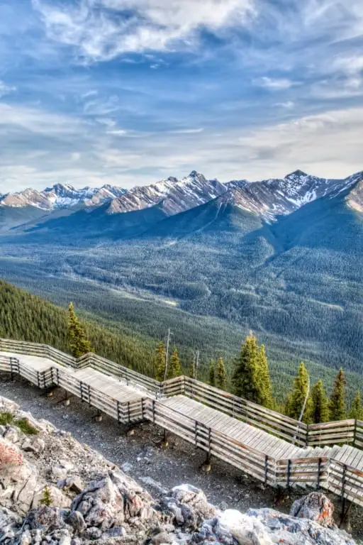
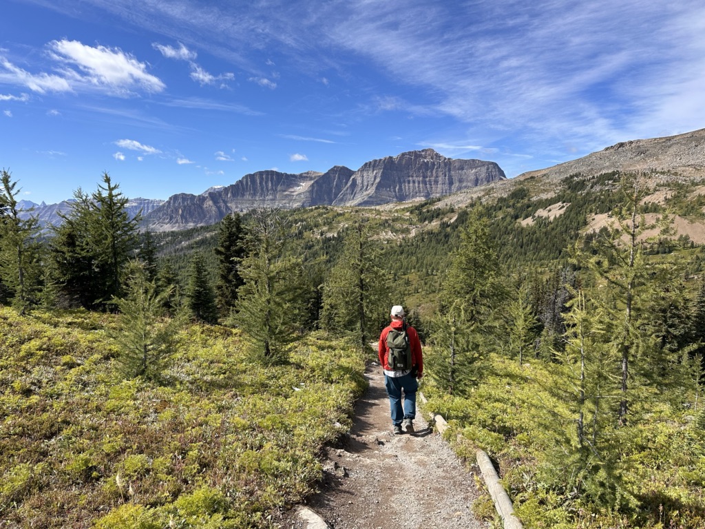
From the Grizzly/Laryx Junction, you’ll be retracing your steps back to the Standish Chairlift. Unfortunately, this section is all uphill. You’ll hike another 1.9 km and gain 180 meters. Thankfully the views are great – just remember to turn around to look at them!
Starting from Grizzly/Laryx Junction, hike back uphill through the forest and up the stairs to the shores of Rock Isle Lake. From there, turn left at Rock Isle Junction. Head uphill to Two Cairns junction, then turn right and go uphill again to the Standish Viewing Deck and the Standish Chairlift just past that. Ride the chairlift back down to Sunshine Village.
Other Hikes at Sunshine Meadows (Extending Your Trip)
The route above hits all the highlights and has the best views. However, if you want to try some of the other trails or extend your trip, here are some options I recommend:
Twin Cairns Trail and Monarch Viewpoint
This option adds 4.2 km to your hike and takes 1 to 1.5 hours. Follow the instructions in the recommended route above, but when you reach Twin Cairns junction the second time, don’t go up the hill to Standish Viewing Deck.
Instead, go left down the hill on the Twin Cairns Trail. This route works its way through a rocky valley between Twin Cairns Peak and Mount Standish. About 2 km from the start, arrive at a junction.
Go left for a few minutes to the Monarch Viewpoint. From the viewpoint, look west down the Healy Creek Valley to Healy Pass and the Monarch Ramparts. Picturesque Egypt Lake lies behind them along with pointy Pharaoh Peak.
Retrace your steps back to the junction and go left, following the Meadow Park Trail down the hill into the forest. Continue along the trail as it winds downhill and finishes at the gondola.
Rock Isle Road
If you don’t feel like climbing back up to Mount Standish to ride the gondola down, you can walk down via the Rock Isle Road. The road is 1.75 km long and loses 60 m of elevation.
The Rock Isle Road starts near Rock Isle Viewpoint and makes its way through the ski resort to the bottom of Standish Chairlift. It’s wide and dusty and not very scenic, so I don’t recommend it unless you don’t want to climb the hill back to Standish Chairlift.
Citadel Pass and Mount Assiniboine
If you want to venture further into the backcountry, follow the Citadel Pass Trail southeast from near Rock Isle Junction. It leads all the way to Mount Assiniboine, one of the most popular (and gorgeous) backpacking trips in the Canadian Rockies. It’s also one of my favourite trips.

It’s 27.5 km one way to the campgrounds at Mount Assiniboine, but you don’t have to hike the entire way to get good scenery. Citadel Pass, 7.8 km from Sunshine Meadows makes an excellent day trip destination.
The route goes into Banff National Park and has great views as you go up and over Quartz Ridge. Stop at Howard Douglas Lake just off the trail for a break, then continue on the pass for beautiful views of Mount Assiniboine.
READ NEXT: Mount Assiniboine Hiking Guide

Healy Pass and Egypt Lake
Another long day hike or backpacking trip option is the trip over Simpson Pass to Healy Pass and then Egypt Lake.
This hike starts from the Monarch Viewpoint. From there, it’s 10.4 km to Healy Pass. The route goes over Simpson Pass and then skirts below the Monarch Ramparts. Healy Pass has incredible views of Pharaoh Peak and beautiful golden larch trees in the fall.
If you want to camp overnight, Egypt Lake is a further 3 km downhill from Healy Pass. I loved the Egypt Lake area – there are so many beautiful little lakes nearby you can hike to from the campground.
READ NEXT: Egypt Lake in Banff Hiking and Backpacking Guide

How to Hike at Sunshine Meadows For Free (Without Taking the Gondola)
I get it – the Sunshine Meadows gondola is expensive. It’s possible to here without taking the gondola, but it’s a very steep and boring hike so I don’t recommend it.
But if you really want to hike at Sunshine Meadows without taking the gondola, I’ll help you do it. You can hike via the gravel access road from the parking area to the top of the gondola. This is also the only way to hike at Sunshine Meadows with a dog.
Here are the key stats:
- Duration: 2.5 hours up, 1.5 hours down
- Distance: 5.6 km each way
- Difficulty: Very Challenging
- Elevation Gain: 511 m
The gravel access road starts behind the gondola buildings in the parking lot. It is free to hike but biking is not allowed. It is not open to the public, but you may encounter resort vehicles on the road, so be prepared to step to the side and let them pass.
The road climbs steadily and steeply in between the gondola and Sunshine Creek. The first 4 km are at a steady grade, but the last part isn’t as steep. The road is wide and dusty. As you get higher you’ll pass several ski runs and ski resort buildings.
Other Things to Do at Sunshine Meadows
I think the number one thing you should do at Sunshine Meadows is follow my recommended hiking route, above. And if you don’t do that, you should at least visit the Standish Viewing Deck via the Standish Chairlift to enjoy the views.
But if you’re looking to maximize your time at Sunshine Meadows, here are a few other activities I think are worthwhile.
Guided Hikes
If you want to learn more about the local flowers and mountain scenery, book a Hosted Trail Walk. There are one- and two-hour options. These are fairly short hikes so they are great for beginners or those with less stamina. These hikes are also a great way to work on your wildflower ID skills.
Both walks take in the scenery between the Standish Chairlift and the Standish Viewing Platform. The two-hour version also passes by Rock Isle Lake Viewpoint. Neither hike goes to Grizzly and Laryx Lakes.
Interpretive Centre
If you have time, I recommend visiting the Interpretive Centre both before and after your hike. It has displays about the local wildflowers, animals, and other parts of the ecosystem.
If you visit before your hike you can get an idea of which flowers are in bloom and tips for identifying them. And if you visit after, you can check to see if you identified the flowers correctly.

Restaurants and Cafes
You can bring your own food and drinks to Sunshine Meadows, but they also have several restaurants and cafes. On my visit, it was lovely to grab a coffee from the Java Lift cafe inside Sunshine Mountain Lodge and then enjoy it in the sunshine after our hike.
We ate lunch out on the trails, but I was a bit envious of people sitting on the patio outside the log-cabin-style Old Sunshine Lodge at Mad Trappers Grill. The menu includes pub staples like burgers, wings, and poutine.
There’s also a sit-down restaurant called The Chimney Corner in the Sunshine Mountain Lodge that mostly caters to overnight guests, as well as a coffee shop at the base station at the bottom of the gondola.
Stay Overnight
Did you know you can stay overnight at Sunshine Meadows? The Sunshine Mountain Lodge is right next to the gondola, so you can hike right from your hotel room. (Guests at the lodge get there via the gondola.)
Prices for winter ski season are insane (rightly so!) but summer rates are pretty reasonable considering you are staying at the only mountain-top hotel in Banff! All of the rooms have mountain views.
Final Thoughts
Most visitors to Banff stay down in the valley, looking up at the mountains. I think they are really missing out – you need to get up close to the alpine scenery to really appreciate it. If it’s in your budget, I really recommend hiking at Sunshine Meadows.
I’ve done all kinds of tough backcountry hikes around Banff, and the scenery at Sunshine is just as spectacular, except that I didn’t have to spend hours (or even days) hiking uphill through the forest to get there!
If you’ve got questions about planning a trip to Sunshine, hit me up in the comments. I’m happy to help.
READ NEXT:
- Egypt Lake in Banff Hiking and Backpacking Guide
- Mount Assiniboine Hiking Guide
- Things to Do in Yoho National Park
- Lake O’Hara Alpine Circuit Hiking Guide


- Grasslands National Park Travel Guide - February 4, 2026
- The Best (and Worst) Backpacking Meals Reviewed - December 16, 2025
- My Favourite Hiking Gear of 2025 - December 9, 2025