

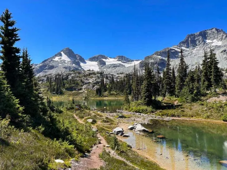
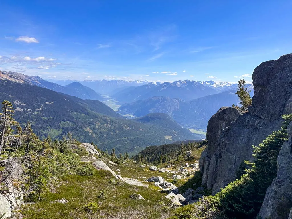
Semaphore Lakes near Pemberton is a special place. It’s a short and easy hike to three gorgeous alpine lakes with incredible glacier views. And the logging road to get there is 2WD accessible (most of the time).
I first hiked to Semaphore Lakes back in 2014. (In fact, an earlier version of this trail guide was the very first post on this blog!) I’ve returned a few more times over the years to enjoy the incredible scenery and easily accessible backcountry camping.
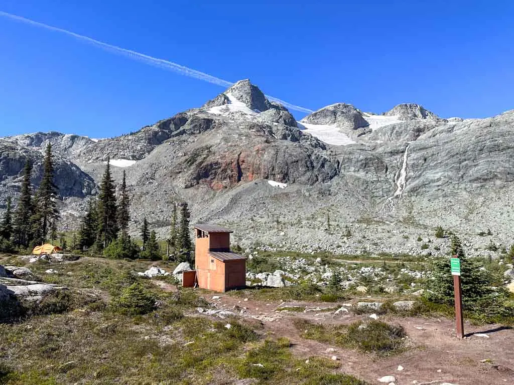
For years the area was in danger of being loved to death since it didn’t have any facilities, but that changed a few years ago. Now the area is an official BC Recreation Area and has outhouses, food caches, designated camping areas, and trail signs to protect the fragile ecosystem.
If you visit Semaphore Lakes, please tread lightly and treat this beautiful place with respect.
In this guide, I’ve got everything you need to know to visit Semaphore Lakes. It includes:
- Trail stats including how long it takes, difficulty, best time to go, and more
- Tips for hiking to Semaphore Lakes including what to pack and how to prep
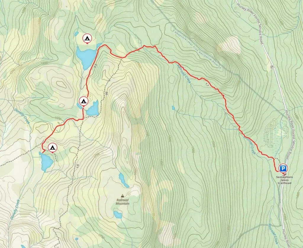
- Trail map that shows all the key locations I mention in this post
- How to get to the Semaphore Lakes trail – detailed logging road driving directions
- Step-by-step hiking directions so you know what to expect
- Extending your trip – my picks for hikes you can do from Semaphore Lakes
- Backcountry camping – info on where to camp and what to expect at each campground
This is a sensitive wilderness area. Learn how to Leave No Trace to keep the wilderness wild. Make sure you are prepared by bringing the 10 Essentials. Get ready for adventure with this checklist of things to do before every hike.
Hey there: Some of the links in this post are affiliate links, which means I earn a small commission at no cost to you. Thanks for your support. -Taryn
Semaphore Lakes Trail Stats
Here are the basic stats that you need to know about hiking the Semaphore Lakes Trail near Pemberton, BC:
Location: The Semaphore Lakes Trail is located off the Hurley Forest Service Road northwest of Pemberton.
Duration: 2 to 3.5 hours
Distance: 6 km round-trip
Difficulty: Moderate
Elevation Change: 385 m of elevation gain
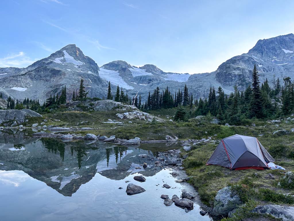
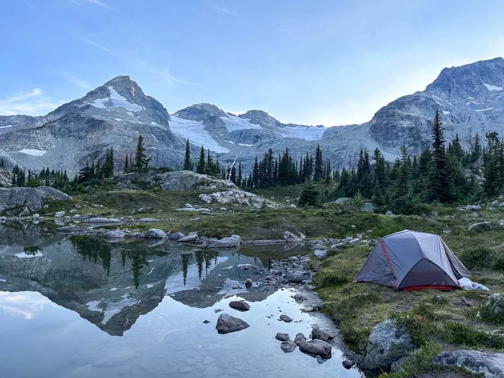
Backcountry Camping: There is free first-come, first-served camping at each of the three lakes. (See the Backcountry Camping section below for more info.)
Best Time to Go: July to late September when the lakes and approach road are snow-free.
Toilets: There are toilets at all three lakes.
Drinking Water: You can fill your bottles at the creek on the hike up, at all three Semaphore Lakes, or at the creek near the third lake. Since people swim in the lakes, and you don’t know if humans or animals have pooped or died upstream, you need to filter or treat all water before you drink it. (I use a Katadyn BeFree.)
Dogs: Allowed on leash.
Fires: Not permitted. Please do not light campfires in this fragile alpine ecosystem.
Bears: This area has both black bears and grizzly bears. Hike in a group, make noise, and carry bear spray. If you camp, cook well away from your tent and store all food and toiletries in the food caches.
Indigenous Context: The Semaphore Lakes are in the traditional territory of the Lil’wat Nation and the Bridge River Indian Band (Xwísten), both of which are members of the St’át’imc Nation. To learn more about local Indigenous culture and history, visit the Squamish Lil’wat Cultural Centre in Whistler.
What’s With the Name? The nearby pass is called Railroad Pass because according to local legend, it was once surveyed to see if the railroad between Pemberton and Lillooet should go through this pass. (The route that was built goes through D’Arcy instead.) In the 1970s, mountaineers named several geographic features near the pass using railroad theme: Locomotive, Tender, and Caboose Mountains, and the Train Glacier rise above Semaphore Lake. (If you didn’t know, railway semaphore signals were coloured and patterned metal arms that were raised and lowered along railway lines to give instructions to train drivers.)
Tips for Hiking Semaphore Lakes
- Check the weather before you go. City weather forecasts are useless in the mountains. Use an algorithmic spot forecast for Semaphore Lakes like Spotwx. (Read my guide to weather apps for hikers for more tips.)
- Check trail conditions online using AllTrails or Instagram. This is especially important in the spring or fall when the trail can be icy or snowy.
- Check road conditions at I Survived the Hurley to make sure the Hurley Forest Service Road is open and in 2WD condition. The road is usually closed due to snow (it is not plowed) between November and late May/early June. It is usually fine for 2WD vehicles unless it has recently washed out in a storm or is being graded.
- Bring a rain jacket and warm clothing just in case. It can be much colder, windier, and rainier in the mountains than in the city.
- Wear trail running shoes or hiking boots. The trail is rocky and loose in places. It can also be quite muddy early in the summer. Regular running shoes don’t have enough grip or ankle support.
- Pack bug spray or a head net. The mosquitos and black flies can be bad when the wind dies down, especially in early July.
- Bring water and snacks. It is not safe to drink the water from the lakes or streams without boiling, filtering, or treating it as you never know if people or animals have pooped or died upstream. Gross! (And people definitely swim in the lakes – I don’t want to drink that unfiltered.) (I use a Katadyn BeFree.)
- Bring the 10 Essentials. These are key safety items you should have on every hike.
- Pack out all your garbage. There are no garbage cans here so you must take your garbage home with you. Leaving it on the trails attracts animals.
- Be Bear aware: There are black bears and grizzly bears in this area, especially in late summer and fall. Hike in a group, make noise, and carry bear spray. If you camp, cook well away from your tent and store all food and toiletries in the food cache. Read my bear safety tips for more info.
- Learn Leave No Trace skills: This is a fragile alpine ecosystem. While it is protected now, years of irresponsible use have scarred the area. Stick to trails, use the outhouses, and don’t light fires. Try your best to keep this area beautiful.
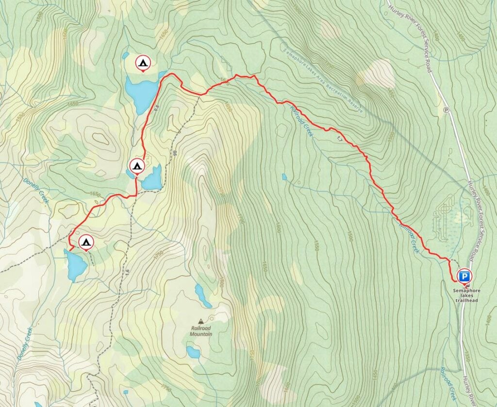
Semaphore Lakes Trail Map
I made a map of the Semaphore Lakes Trail for you using Gaia GPS, my favourite GPS and mapping app. Click through to zoom in (and download the GPX track).
Semaphore Lakes Driving Directions
The trailhead is about 3.5 hours from Vancouver and about 1 hour from Pemberton. There is no public transportation to the trailhead so you will need to drive yourself.
The last section of the drive is on a gravel road that is steep and bumpy, but usually suitable for all vehicles. I recommend an AWD or 4WD vehicle, but I think 2WD vehicles will be fine most of the time if you go slow. (I once went up in a Toyota Matrix.) Check road conditions on I Survived the Hurley before your trip.
Here are step-by-step driving directions to Semaphore Lakes: From Vancouver, take Highway 1 West and then Highway 99 north to Pemberton. Turn left off Highway 99 onto Pemberton Portage Road at the traffic light in Pemberton (at the intersection with the Petrocan and the McDonald’s).
Follow Pemberton Portage Road for a few minutes to a roundabout, then go left across the train tracks. Two blocks later, go right at the T-junction onto Pemberton Meadows Road. Stay on this road for 23.5 km as it winds through farmland.
Turn right onto Lillooet Forest Service Road and reset your odometer. The road quickly turns to gravel and crosses the river. About 9 km later, veer right at the fork (uphill) onto the signed Hurley Forest Service Road and reset your odometer again. Stay on the Hurley FSR for 14.3 km, ignoring all side branches.
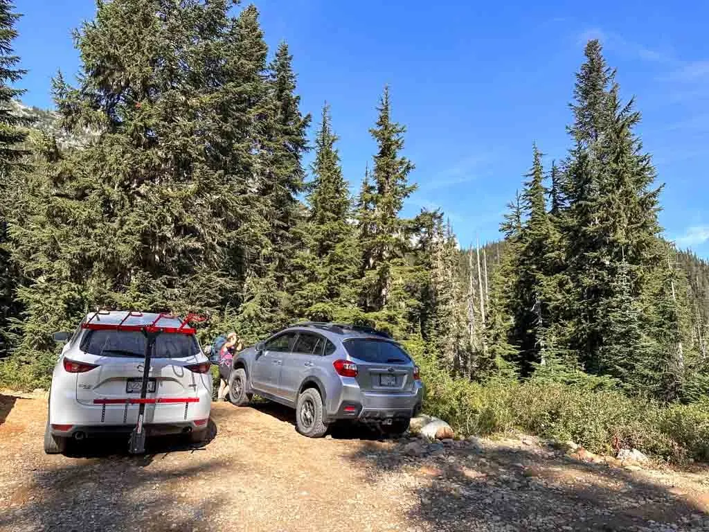
Look for a small parking area on your left 14.3 km after you begin the Hurley. This is the trailhead. There is room for 4 or 5 cars here and room for another 2 or 3 a pull-out just to the south. If they are both full, parallel park, being careful to get as far off the road as possible.

Here are Google Maps driving directions. However, you will lose cell service in the farmlands outside Pemberton. I recommend using All Trails+ or Gaia GPS for navigation.
Semaphore Lakes Hiking Directions
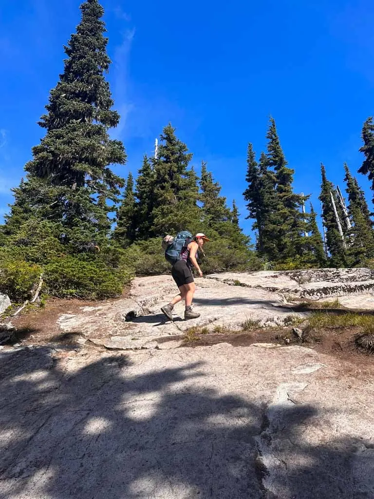
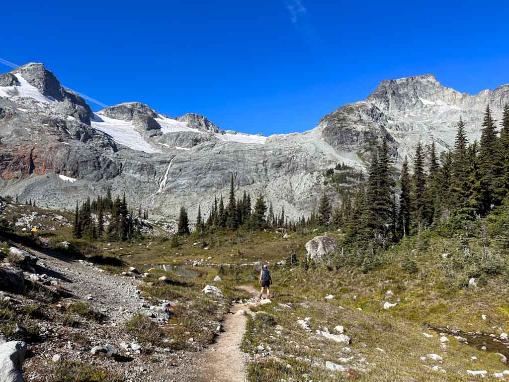
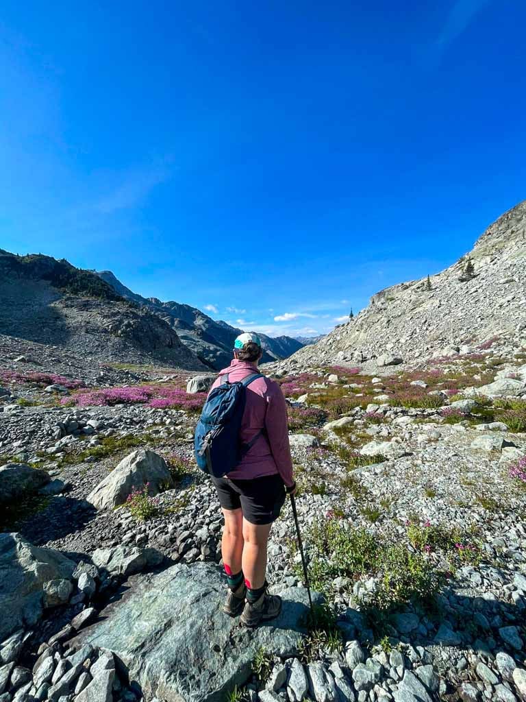
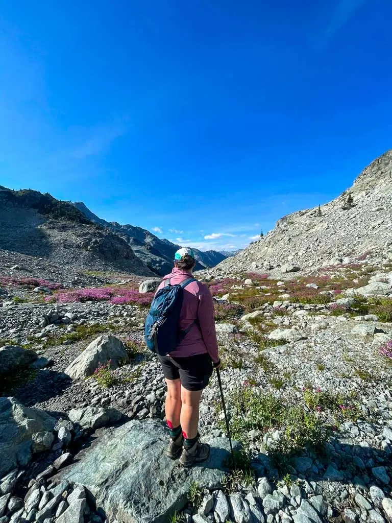
The trailhead is near the parking area on Hurley FSR. There is no sign at the start of the trail, but the footbed is wide and obvious. The first minute of the trail is downhill to a bridge over a small creek. From there the path climbs steeply in the forest.

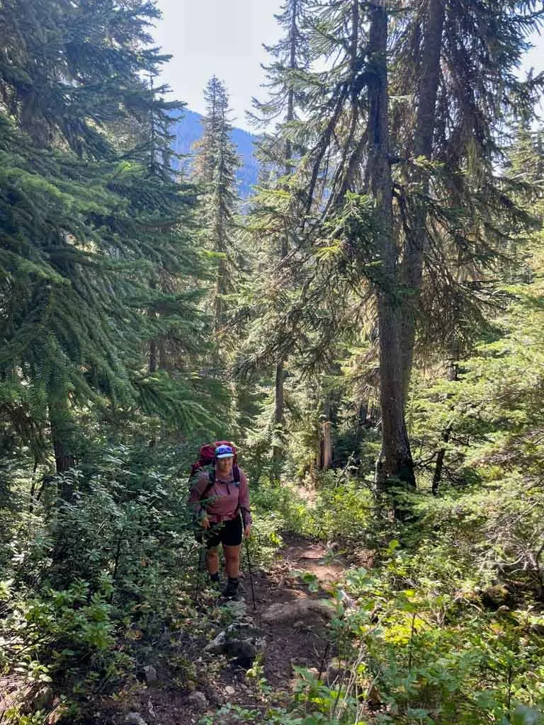
In a few places, you’ll have to scramble up over tree roots and rock slabs. The trail is often muddy and is sometimes slightly overgrown. You can hear the creek downhill to your left, but you are usually far above it.
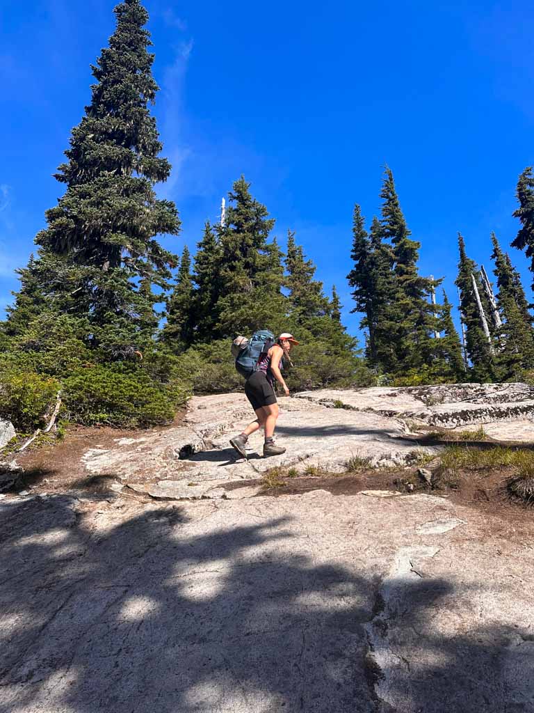
About 1.2 km from the trailhead the grade eases a bit and the trail comes down beside the creek. The forest starts to thin out here as the vegetation begins to transition to sub-alpine meadows. A few minutes later about 1.7 km from the trailhead, cross the creek on rocks and a log.

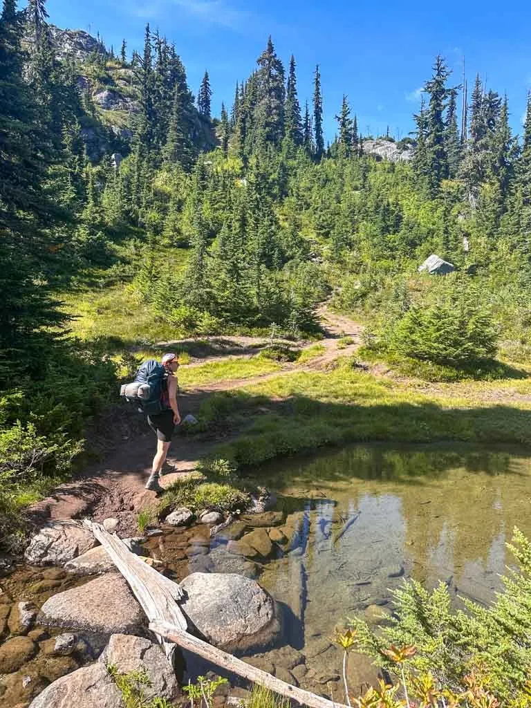
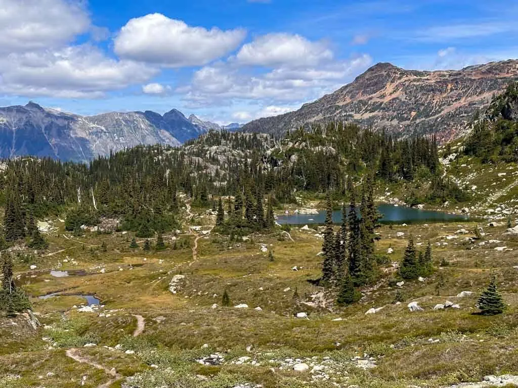
On the other side, follow the trail as it climbs up a steep slope and you leave the forest behind. Reach a junction about 200 m after the creek crossing. The trail forks here. Going straight ahead is the most direct route to the second and third lakes, but is a bit steeper since it goes up and over a little knoll.
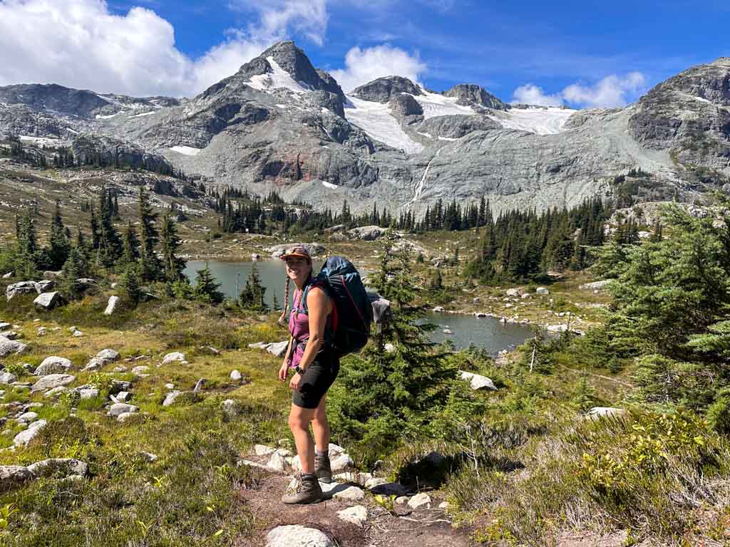
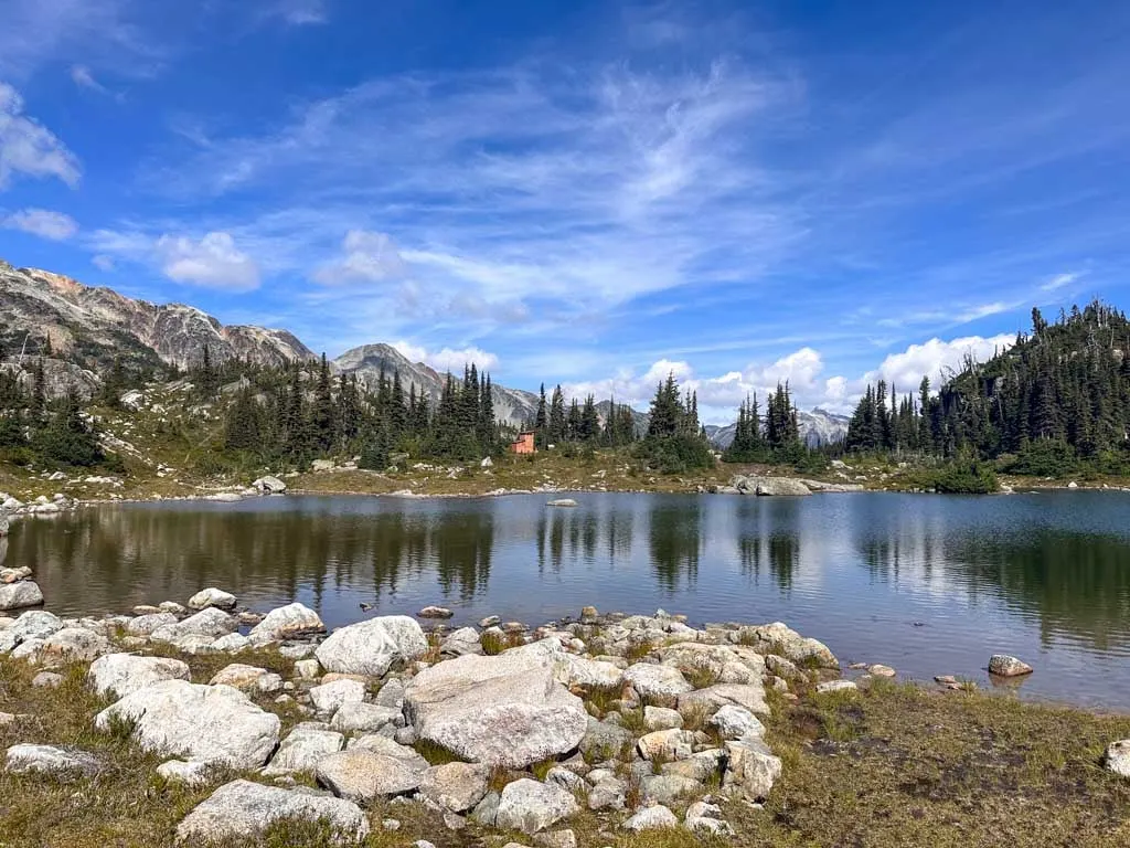
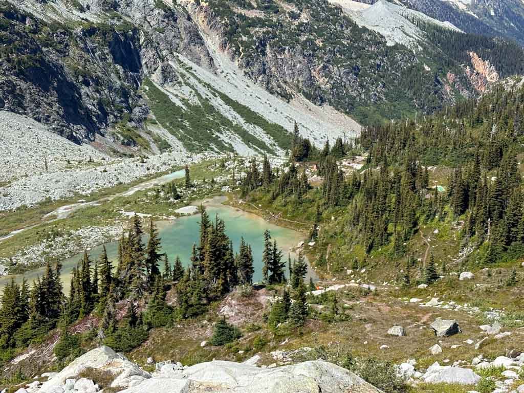
I prefer to go right to contour around the knoll. This route also takes you to the first lake (2 km from the trailhead). The camping area on the other side of the pond at the end of the lake. Turn left once you reach the first lake and follow the trail along the eastern shore. From the end of the first lake, follow the trail south and slightly uphill to the second lake (2.5 km from the trailhead).
There are tons of small social trails amongst the lakes. Some are roped off to allow the sensitive ecosystem to revegetate. Please stick to official trails and avoid less travelled trails as it just leads to more erosion. If you are in doubt about which trail to take, pick the wider one. Or consult a trail app like All Trails+ or Gaia GPS to see if you are on the official trail.

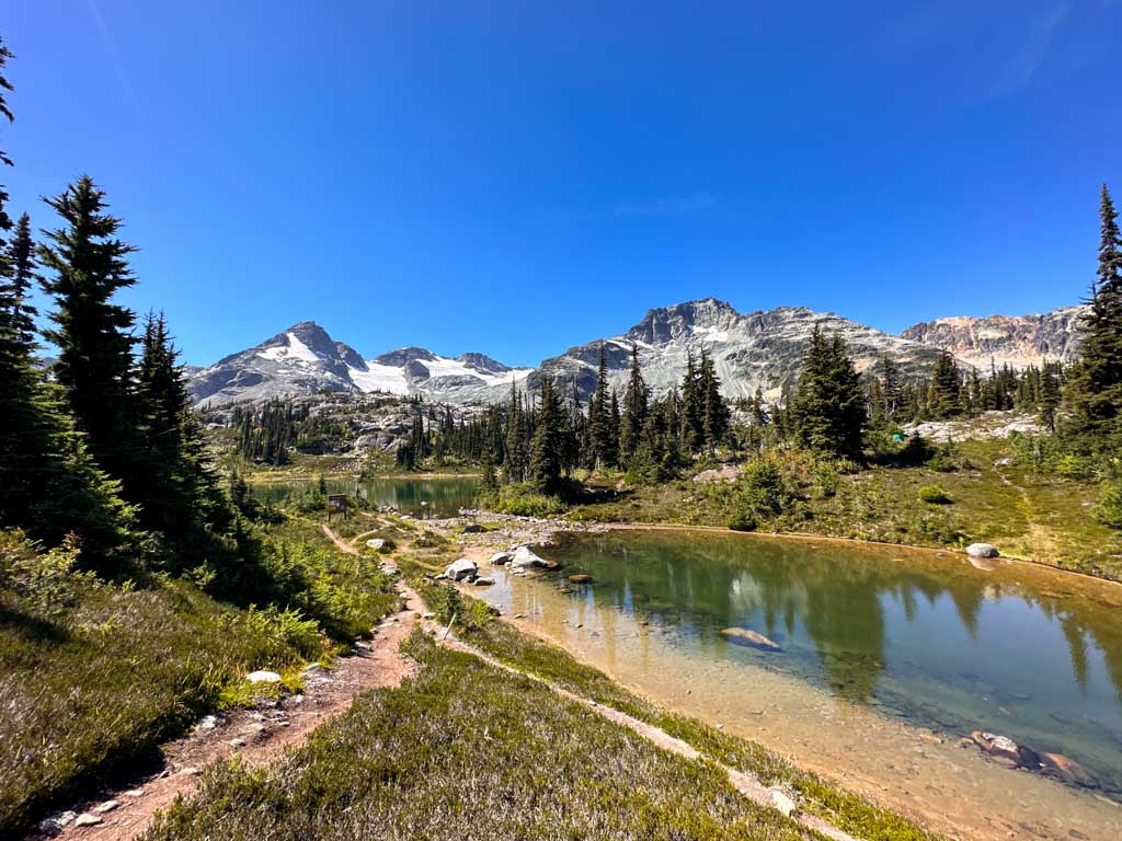
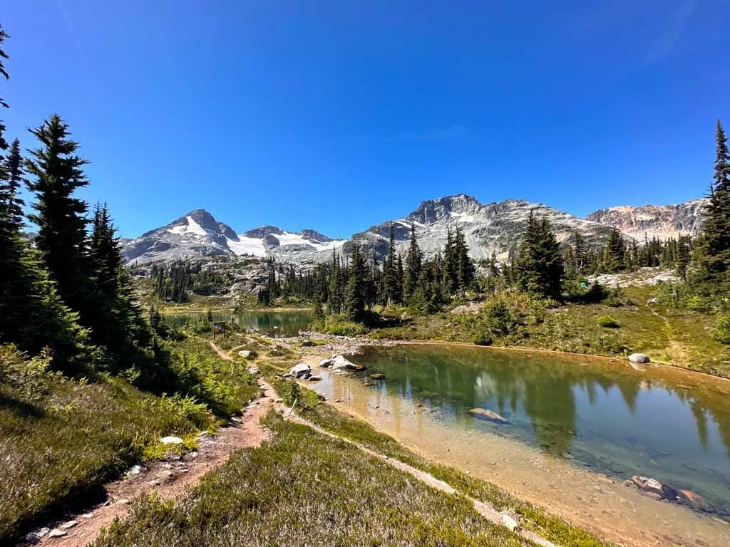
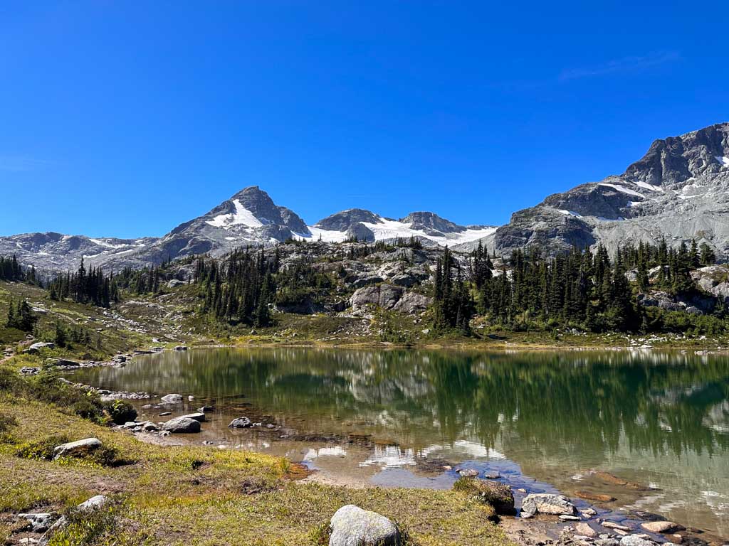
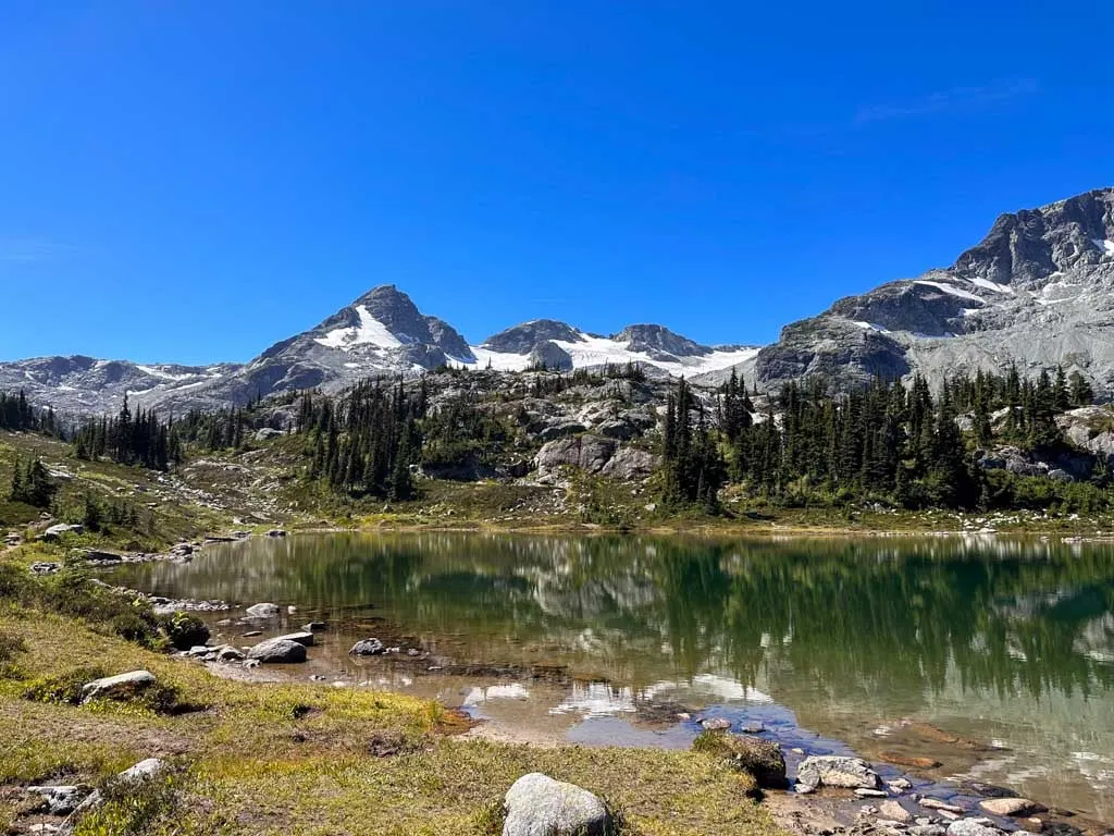
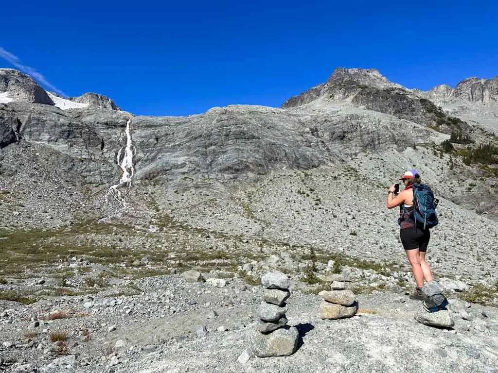
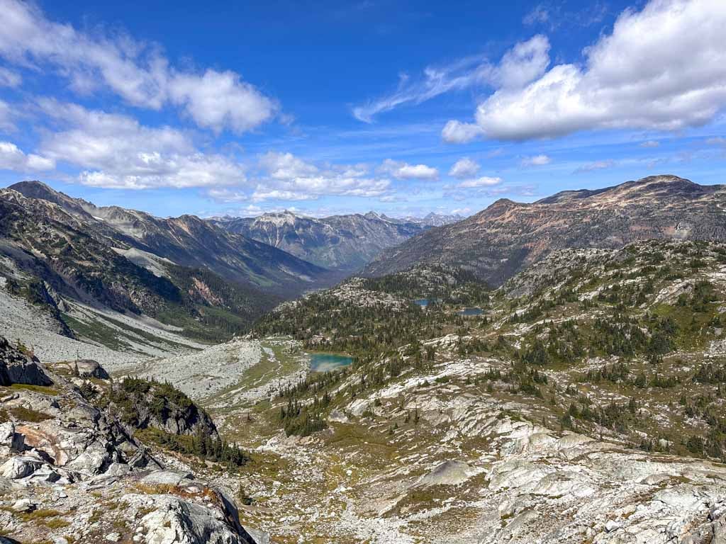
You will start to get views of the Train Glacier and waterfalls spilling down from the melting ice. Locomotive Mountain, Tender Mountain, Caboose Peak, Faceless Mountain, and Face Mountain dominate the skyline. (More details on those peaks in the Extending Your Trip section below.)
At the far end of the second lake near the camping area there is another junction. The route straight ahead leads to Locomotive Mountain. Instead, go right and slightly downhill. Follow the trail past lots of small ponds, most of which dry up by mid-summer.


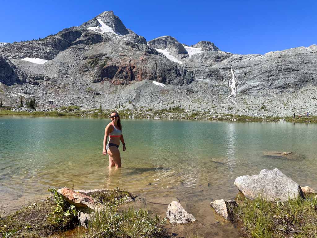
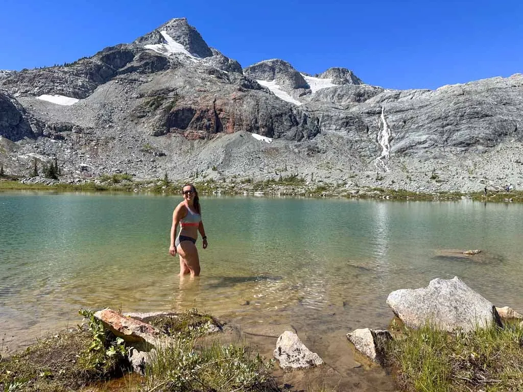
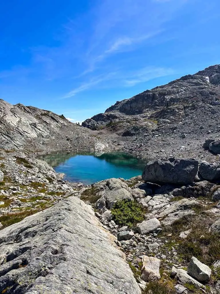
Reach the third lake 3 km from the trailhead. There are several routes down to the shoreline and the camping area. This is the official end of the trail. The third lake is fed by the train glacier, so it has the classic turquoise glacial lake colour. Gorgeous!

Find a spot on the shoreline of any of the three lakes to sit and have lunch. You may even want to go for a swim in the chilly water. But please wipe off any sunscreen or bug spray first as these tiny lakes are an important drinking water source for campers!
When you are done admiring the scenery, retrace your steps back to the trailhead. Or see the Extending Your Trip section below for more hiking options.
Extending Your Trip
Since the hike to Semaphore Lakes is so short, many visitors backcountry camp and use it as a base for longer trips. A few trails lead away from the lakes but they all disappear into nothing quite quickly. While they are shown on some maps as trails, they are actually just informal routes – not real trails. Sometimes there are cairns (stacks of rocks) to show you the way, but not always.
You need good off-trail navigation skills to follow any of the routes I mention below. That means that you will need to know both how to use a GPS to follow the route and how to read landmarks to find the best way through micro-terrain.
I met a lot of hikers on the lower slopes of Locomotive Mountain who were unprepared for off-trail navigation. They thought that since the route was shown on All Trails, it would be an easy-to-follow trail. That’s definitely not the case.
Locomotive Mountain
The Scramble to Locomotive Mountain is the most common objective from Semaphore Lakes. It’s about 7 or 8 km round trip from the third lake with about 700 m of elevation gain over very rough terrain.
There are several routes to get there. The route on All Trails starting from the third lake is the most direct, but it is not the easiest or the fastest. Instead, I recommend taking the eastern route starting from the second lake (which is shown as a discontinuous trail on All Trails and Gaia GPS). The first part is a trail through meadows that is easier to walk than the other route, which is very rocky.
The trail disappears and reappears. In between, look for cairns to find the route. It passes several pretty tarns and scrambles over lots of rocks and short cliffs on the way up Locomotive Mountain.

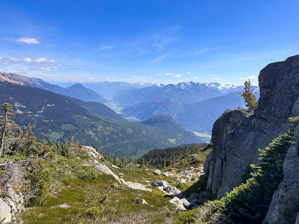
From the shoulder of Locomotive Mountain, you get great views down to the Pemberton Valley below. For some people, this is a worthy objective. You may wish to turn around here.
If you want to continue, it’s another 1.5 km to the summit across rocks and lots of micro-terrain to the 2340 meter-tall summit.
Train Glacier Waterfall
If you want to get a close-up look at the waterfall, there is a rough cairned route across the gravel flats to the waterfall base. It’s about 1 km each way and starts by crossing the creek near the third lake. You can scramble up beside the waterfall for a closer look, but the terrain gets really steep and scrambly fairly quickly.

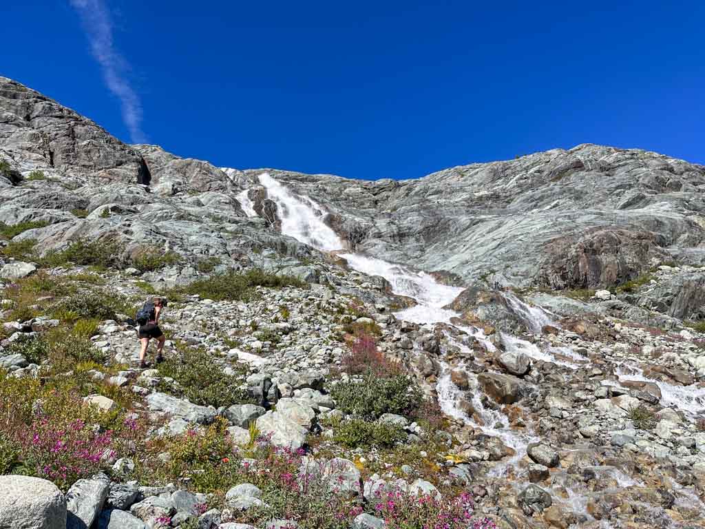

On your way back from the waterfall you can also explore the Donnelly Creek basin between the waterfall and the third Semaphore Lake. There are lots of beautiful wildflowers in the wet spots. Patches of bright magenta dwarf fireweed, also known as river beauty are the most prominent.
Other Scrambles
Experienced scramblers and mountaineers come to Semaphore Lakes to climb Face Mountain or to complete the Train Glacier Traverse. This route makes a loop from Face Mountain, around to the summits of Faceless, Caboose, and Tender, finishing with Locomotive Mountain and then descending back to the lakes.
These are very challenging routes with lots of navigation, some exposure, and a little bit of glacier travel.
Backcountry Camping at Semaphore Lakes
While it is a short hike from the highway, Semaphore Lakes is a popular backcountry camping location since it has great views and makes a good base camp for scrambles to Locomotive Mountain and other peaks.
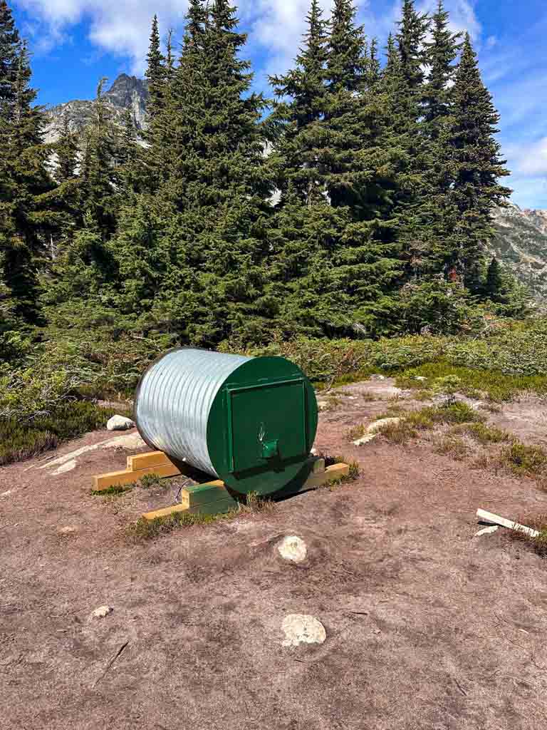
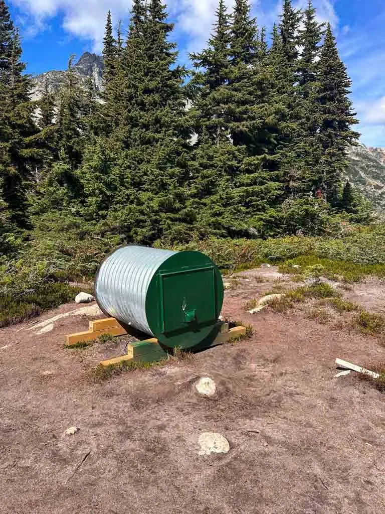
Historically, this area had no protection and no facilities. Unfortunately, that meant that people camped and pooped all over the place. Recently, the site became a formal BC Recreation area managed in partnership with Tourism Pemberton.
They created designated camping areas at each of the three lakes. They also installed urine-diversion outhouses and food caches at each camping area. The third lake seems to be the most popular place to camp, mostly because it is at the end of the trail. But the second lake has better views since its a bit more uphill.
All camping is first-come, first-served and there are no fees. It’s free!
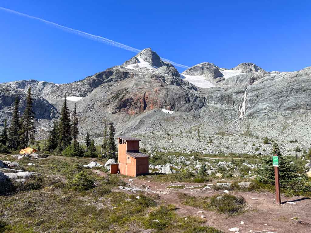
The food caches are a little strange – they are homemade using road culverts. Each one has a front and a back compartment. Your stuff will get jumbled with other people’s stuff inside, so I recommend using a lightweight dry bag or stuff sack to keep your food contained and organized.
While the maps on the trail signs make it look like there are individual campsites, in reality, there are no campsites. Perhaps they plan to install tent platforms or clear areas for tents in the future. But right now, you just need to find a flat spot to put your tent. Try to put your tent on gravel or bare dirt – avoid camping on the fragile alpine vegetation.
Please don’t have a campfire here – fires are not allowed. The trees here may look small but they are very old since the growing season is so short. Using them for firewood depletes a rare resource. And the soil here is also fragile since it is a sensitive alpine ecosystem. Fire scars will take decades to revegetate.


Fingers crossed you get nice weather for your hike to Semaphore Lakes. It’s such a special place! If you have questions about the trail, ask them in the comments. I’d love to help.
READ NEXT:
- The Best Hikes in Whistler: A Guide to All the Trails
- 32 Best Backpacking Trips in BC
- Joffre Lakes Hike (By a Local)


- Best Sun Hoodies for Hiking - June 3, 2026
- Lower Stein Valley Trail Hiking and Backpacking Guide - May 27, 2026
- The Best Things to Do in Vernon, BC - May 21, 2026
Isobel
Thursday 28th of May 2026
Do you have more info on where the waterfall is? Pretty new to backpacking and want to try this hike this summer, but the lake route is so short!
Taryn Eyton
Friday 29th of May 2026
You can see the waterfall from the third lake. You just cross the creek and hike across gravel slopes to get there. There is no real trail but there are a few cairns.
Lauren
Friday 16th of August 2024
Really appreciate your post, Taryn! I camped overnight a couple of weekends ago, so thought I would add a few notes, in case they're helpful for others/to update your post: there is an outhouse at the trailhead, but we did not see any outhouse or food cache at the 1st lake.
Rachel
Thursday 7th of March 2024
Thank you for this informative post! Love this trail but haven't been for a few years, nice to hear there are outhouses now!
Heather
Thursday 11th of March 2021
I read this post a few years ago and we finally did this trip this summer. We loved it. Thanks!!