
I’ve been to Newfoundland three times, and the main reason for all of my trips has been hiking. It’s such a gorgeous place with so many incredible trails, most with beautiful coastal views. In this post, I’ve got my picks for the 16 best hikes in Newfoundland.
I’ve hiked all over the province. While I haven’t been everywhere in Newfoundland (yet!), I have been to most places. And on my most recent two trips, I hiked every day, sometimes on two or three different trails a day! (Honesty check: I didn’t hike a few of the days I was attending a conference in St. John’s, but that was out of my control.)
Most of the hikes in this post are easy or moderate, but there are a few tough options, especially in Western Newfoundland. I’ve also got tips for hiking in Newfoundland at the end of the post. This list of the best hikes in Newfoundland includes:
- Quick picks: My top 5 best hikes in Newfoundland
- Newfoundland hiking map that shows the location of every trailhead
- Hikes on the Avalon Peninsula near St. John’s
- Hikes in Eastern Newfoundland near Bonavista and Trinity
- Hikes in Central Newfoundland in Terra Nova National Park and near Twillingate
- Hikes in Western Newfoundland in Gros Morne National Park and near Corner Brook
- Newfoundland hiking tips including fees, weather, gear, and more
Planning a trip to Newfoundland? I’ve got a big list of the best things to do Newfoundland plus lots of travel tips for the province.
This is a sensitive wilderness area. Learn how to Leave No Trace to keep the wilderness wild. Make sure you are prepared by bringing the 10 Essentials. Get ready for adventure with this checklist of things to do before every hike.
Hey there: Thanks so much to Go Western Newfoundland for hosting me during part of my trip to Newfoundland. All opinions in this post are my own. Some of the links in this post are affiliate links, which means I earn a small commission at no cost to you. Thanks for your support. -Taryn
Best Hikes in Newfoundland Quick Picks

Best Easy Hike: French Head, Twillingate
Best Moderate Hike: Green Gardens, Gros Morne National Park

Best Challenging Hike: Tablelands, Gros Morne National Park

Best Hike Close to St. John’s: North Head (Signal Hill)

Best Hike Close to Corner Brook: South Head Lighthouse
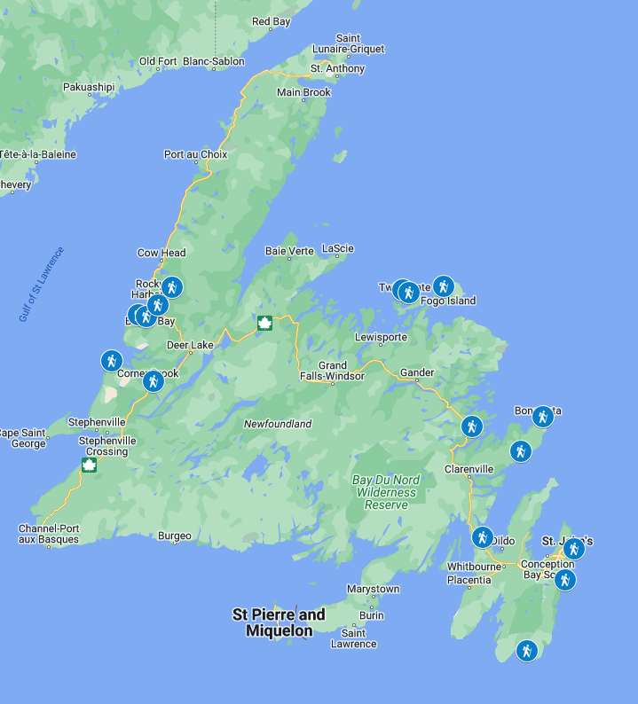
Newfoundland Hiking Map
Most of the hikes on this list are easy to follow. But sometimes the trailheads can be hard to find or there are lots of confusing unmarked trails that can lead you astray. As well, cell service can be spotty. I recommend using a hiking app like AllTrails+ to stay on track.
I also made a custom Google Map for you that shows you the locations of the trailheads for all of my picks for the best hikes in Newfoundland. But DON’T use Google Maps once you are on the trails. There is often no cell service and Google doesn’t show the trails correctly (or at all in some cases).

Best Hikes on the Avalon Peninsula
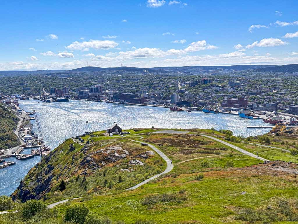
North Head Trail (Signal Hill), St. John’s
Difficulty: Moderate
Time Needed: 1 to 1.5 hours
Distance: 3.5 km loop
Elevation Gain: 160 m
You can hike to the top of Signal Hill right from downtown St. John’s. It’s one of the best urban hikes I’ve ever done and is on my list of the best things to do in St. John’s. I actually started my hike right from the front door of my hotel – I dipped out for a sneaky hike between sessions at a conference!
The loop is 3.5 km long, but if you hike from downtown, that adds another 1 to 2 km. You can start the loop hike from Battery Road, from the Signal Hill Visitor Centre part way up, or from the top of the hill. I went counter-clockwise, but either direction is fine.
Since I started from downtown, I walked through the colourful cliffside houses in The Battery neighbourhood first. (It’s pronounced batt-ree in Newfinese, not batt-er-ee.) The trail begins at the end of North Battery Road and curls around North Head. There is one narrow section with a chain, but it’s not really needed.
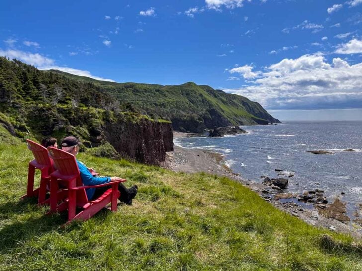
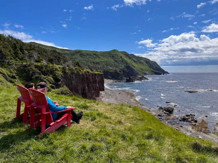
From there, you’ll arrive at a set of Parks Canada red chairs, since this is a National Historic Site. Enjoy the view and take a rest before beginning the big climb up lots of stairs to the top of Signal Hill. The view of downtown St. John’s from the top is incredible.
There are a few ways to descend. I followed the Queen’s Battery Trail downhill, then took an informal trail towards Deadman’s Pond. I used an informal trail back down to Battery Road to close the loop.
If you’re walking back to downtown St. John’s, stop at The Battery Cafe on your way back. Their iced coffee really hit the spot at the end of my hike!
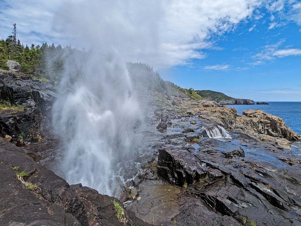
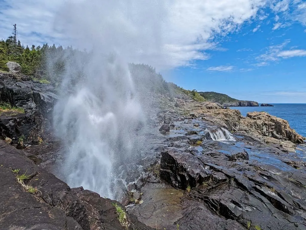
Bay Bulls Lighthouse/Spout Path, Bay Bulls
Difficulty: Moderate or Challenging
Time Needed: 3 or 8 to 10 hours
Distance: 7.2 or 22 km round-trip
Elevation Gain: 320 or 1040 m
While I have hiked the West Coast Trail and North Coast Trail on Vancouver Island, I haven’t hiked Newfoundland’s iconic East Coast Trail yet. It follows the rugged Atlantic Coast for 270 km on the Avalon Peninsula. (The North Head Trail, above, is actually part of the ECT!)
If you’re looking to get a taste of the ECT on a day hike, try the Spout Path in Bay Bulls. My friend Gemma hiked this section as part of her multi-day trip along the East Coast Trail.
She hiked the Spouth Path from end to end (16.2 km total), but she says “most day hikers start at the Bay Bulls trailhead and turn around at the Spout (11km one way). It makes for a long but rewarding day for experienced hikers.” The Spout is the highlight of the trip. It’s an impressive wave and river-powered geyser.
If you don’t have time to go all the way to the Spout, Gemma recommends stopping at Bay Bulls Lighthouse about 3.6 km from the trailhead. “The exposed trail offers sweeping views of the ocean and intricate coves,” Gemma explains. She also says that people often see whales!
If you are in Bay Bulls, don’t miss taking a puffin and whale watch trip. I did this tour on my first trip to Newfoundland and it was so fun. You’ll cruise through the Witless Bay Ecological Reserve. For me, the highlight was spotting puffins and lots of other seabirds. But whales are also common, and sometimes you can see icebergs too!
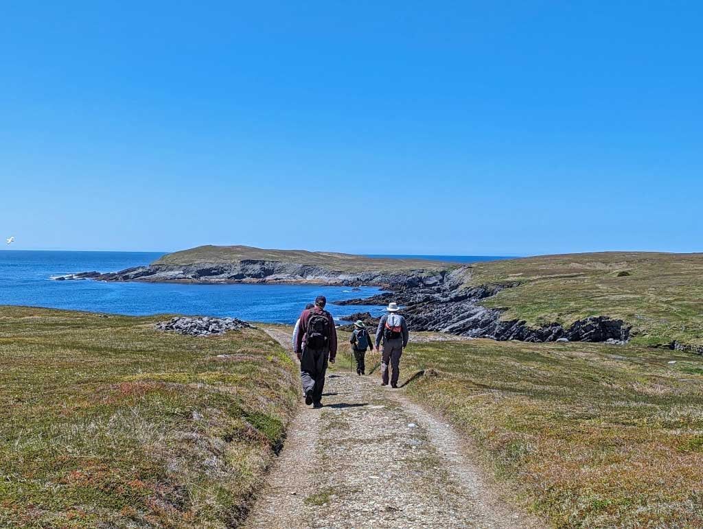
Mistaken Point, Portugal Cove South
Difficulty: Easy
Time Needed: 4 hours
Distance: 6 km round-trip
Elevation Gain: 65 m
Mistaken Point UNESCO World Heritage Site is a special place. Located at the southern end of the Avalon Peninsula, it protects a huge collection of ancient marine fossils, preserved in the prehistoric ocean floor for over 565 million years.
Since the fossils are so important, the only way to see them is on a guided hike, which is fairly easy but lasts for four hours since you make so many stops to look at fossils. I haven’t made it out to Mistaken Point yet, but my friend Stephanie who runs The World as I See It just came back from a visit.
“I highly recommend booking the guided hike,” Stephanie says. “The knowledgeable guide shared interesting details about this unique environment as we hiked along the scenic coastline. At Mistaken Point we took our shoes off to walk out on the rocks that hold the fossils which made this hike a truly unique experience.” Sounds super cool! I can’t wait to see the fossils on my next trip to Newfoundland.
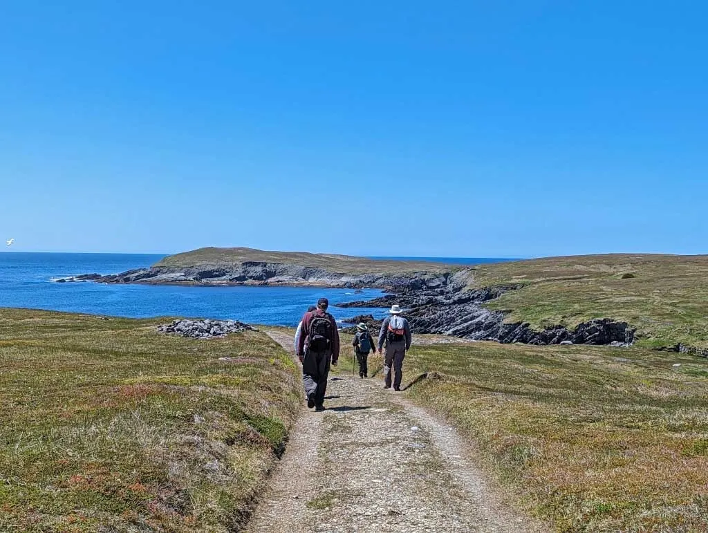
Chance Cove Coastal Trail, Chance Cove
Difficulty: Moderate
Time Needed: 1.5 to 2 hours
Distance: 4 km loop
Elevation Gain: 150 m
This gorgeous coastal trail is located on the edge of the Avalon Peninsula and has incredible views of some sea stacks and islets. It starts in the small community of Chance Cove and immediately heads up a big hill into the forest. The path can be muddy, so wear waterproof boots.
About 15 minutes from the start, the path heads back down to sea level to a viewpoint on the edge of Chance Cove Point. Next the trail forks. Take the left path which follows the coast out to a headland. There are several cliffside viewpoints along the way.
Once you round the headland, a stairway leads down to a small beach. Back on the main trail, you can follow two spur trails to more viewpoints atop Green Head. Just past the spur trails a steep trail with a rope leads down to another beach if you are up for a challenging scramble. After the rope, the trail goes inland and up and over a small hill to rejoin the main trail. Turn left and follow the trail back to the start.
Best Hikes in Eastern Newfoundland
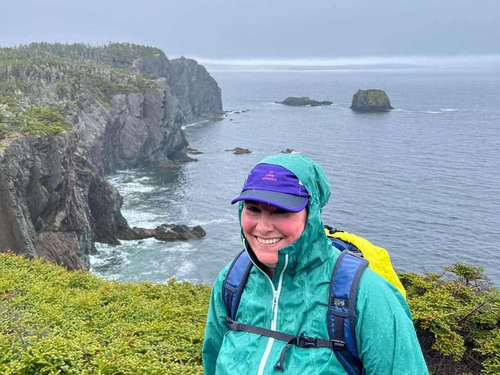
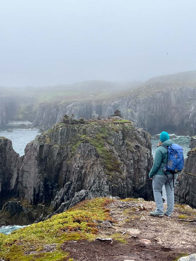
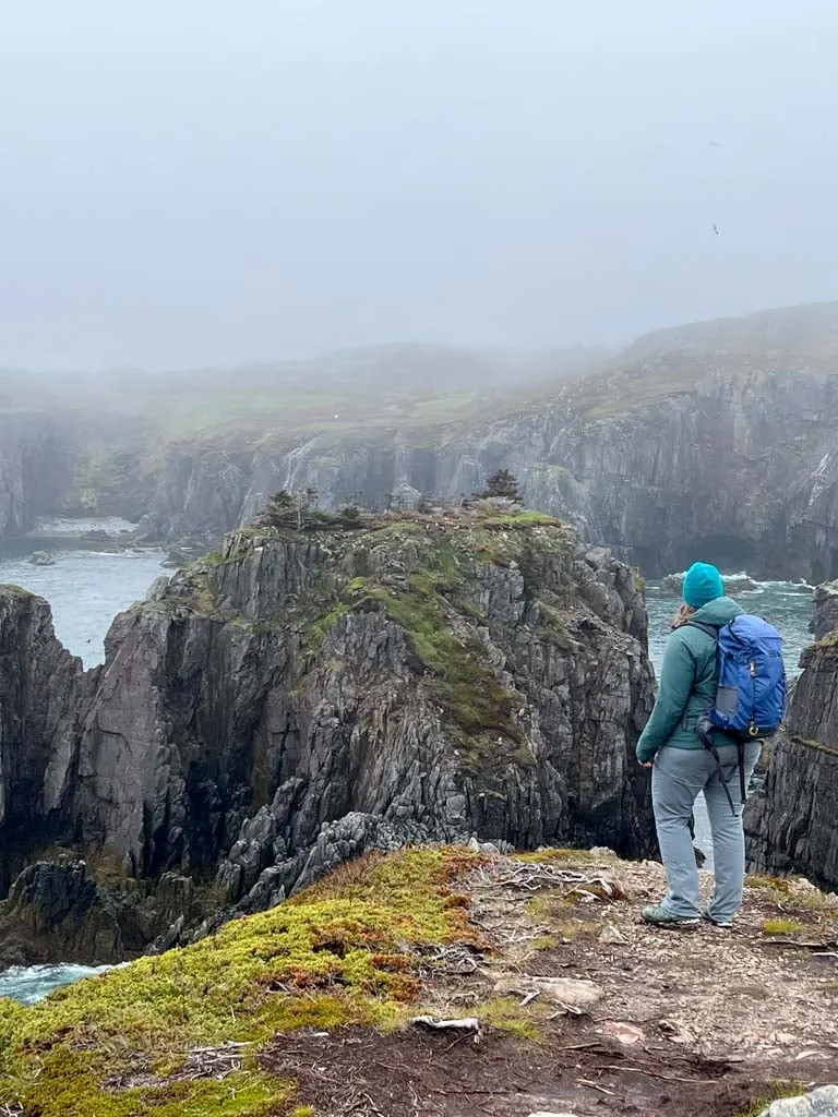
Skerwink Trail, Port Rexton
Difficulty: Moderate
Time Needed: 1.5 to 2 hours
Distance: 5 km loop
Elevation Gain: 150 m
Several online sources call the Skerwink Trail the best hike in Newfoundland. The day I hiked it was foggy with sideways rain, so I can’t say I agree. But despite the weather, it was pretty spectacular. The trail starts in Port Rexton near Trinity and makes a loop around Skerwink Head.
In places, the trail sticks close to the cliff edge with lots of views of the coastline and Trinity Harbour. But in other places it heads inland through thick forest and bog, using boardwalks and stairs to carry you over the more challenging terrain. The two ends of the loop are on old gravel roads, which make for easier walking than the rest of the trail.
After your hike, get beers at Port Rexton Brewing. Or grab coffee and a sandwich at Two Whales Coffee Shop. I was happy for their delicious veggie soup to warm me up after our soggy Skerwink experience. If you want to support the organization that maintains the trail, you can buy Hike Discovery merch and trail maps online or at local shops.
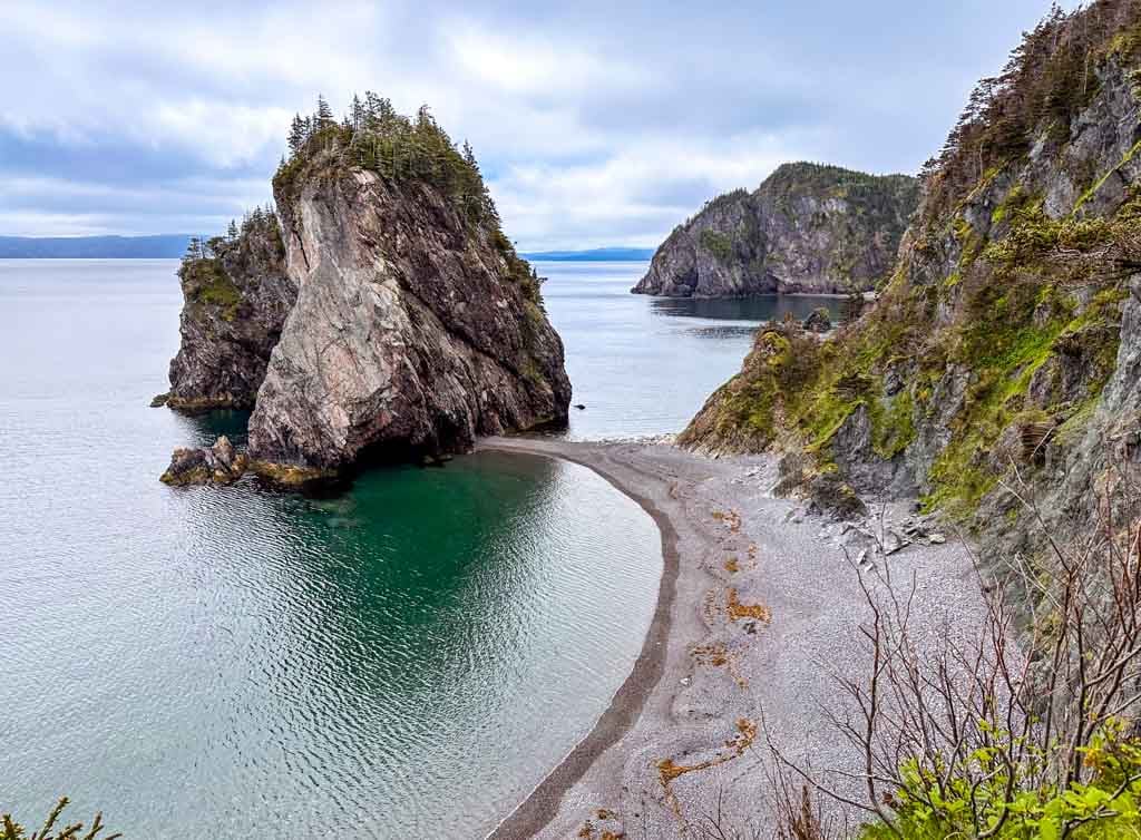
The Chimney/Klondike Trail, Bonavista

Difficulty: Easy
Time Needed: 45 min to 2 hours
Distance: 2 to 6.5 km round-trip
Elevation Gain: Up to 100 m
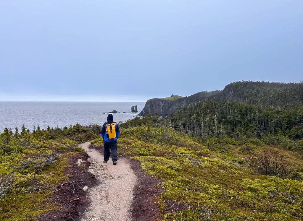
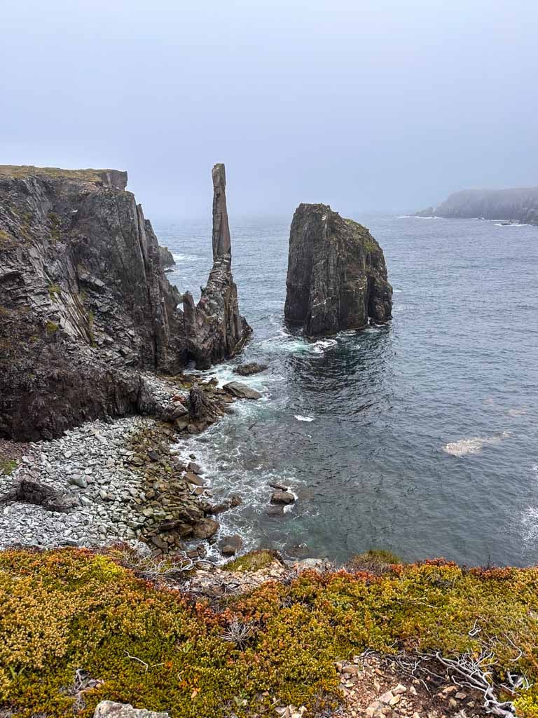
Maintained by Hike Discovery, this trail near Bonavista is actually an old horse and cart route between the communities of Spillar’s Cove and Elliston. You can walk the entire route through the forest and wetlands between the two towns. But if you’re short on time, I think the section from Spillar’s Cove to The Chimney is the best part. We hiked it on a foggy day and it was still gorgeous.
It’s an easy walk on an old gravel road out to the coast. From there, you’ll have a great view of The Chimney, an incredible sea stack off to the left. You can follow faint paths off to the left to get closer to the sea stack, but the view doesn’t get any better.
There is also a small islet in the centre of the cove with a puffin colony! The views of puffins aren’t quite as good as at the nearby Elliston Puffin Viewing site, but it’s still pretty awesome to watch them hopping and flapping about.
After your hike, head to Ragged Rocks Gastropub in Bonavista. I had the best seafood chowder of my life there. Such huge scallops! It’s on my list of the best things to do in Bonavista.
Best Hikes in Central Newfoundland
Coastal Trail, Terra Nova National Park

Difficulty: Easy
Time Needed: 3 to 4 hours
Distance: 9.5 km round-trip
Elevation Gain: 80 m
This trail leads along the shoreline of Newman Sound in Terra Nova National Park. There are trailheads at the visitor centre and at the day-use area in the Newman Sound Campground so you can start at either end. We were staying at the campground so we started from that end.
The trail parallels the coastline, periodically dipping down to small beaches or viewpoints between the trees. It’s a great place to watch for birds in the mud flats or eagles overhead. You might even see moose along the trail… although might only spot their tracks and poop. About halfway along a side trail leads to Pissamere Falls.
Don’t miss the displays at the Visitor Centre either before or after your hike. They have great displays about the flora and fauna of the park, including touch tanks where you can interact with marine life. But my favourite part was the huge bale of sticks that was a great visual representation of how many twigs moose eat every day – about 40 to 60 pounds worth!
Nanny’s Hole, Twillingate

Difficulty: Easy/Moderate
Time Needed: 1 to 1.5 hours
Distance: 2.5 km round-trip
Elevation Gain: 100 m
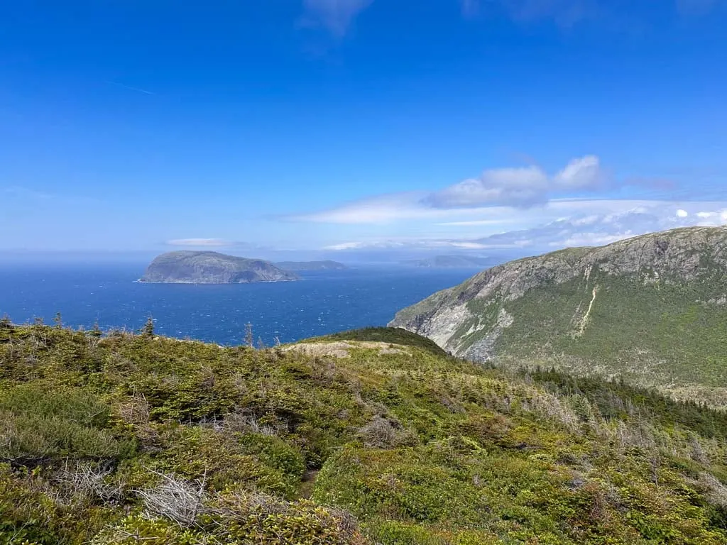
This short trail starts at the Long Point Lighthouse near Twillingate. From the viewing platform near the parking lot, you can look down to a rugged and rocky peninsula sticking out into the ocean. If you look carefully, you’ll see tiny hikers walking along an undulating trail – that’s the Nanny’s Hole Trail.
To start the hike, follow the path downhill from the parking area. There are a couple great viewpoints from the top of the bluff, but soon you begin descending on sets of wooden stairs. At the bottom, follow the trail across the grassy meadow to the coast. Then, turn right and hike along the path out to Nanny’s Hole. The trail ends at a great viewpoint on the edge of the headland.
When you are done, retrace your steps back up the stairs to the parking lot. If you hike here, consider donating to the Rockcut Twillingate Trails, which maintains the paths in this area.
After our hike, we went for dinner at Annie’s in Twillingate. They have a great view of the harbour and lots of great seafood on the menu. Try the cod tongues as an appetizer. They are a bit chewy, kind of like calamari, but really tasty.
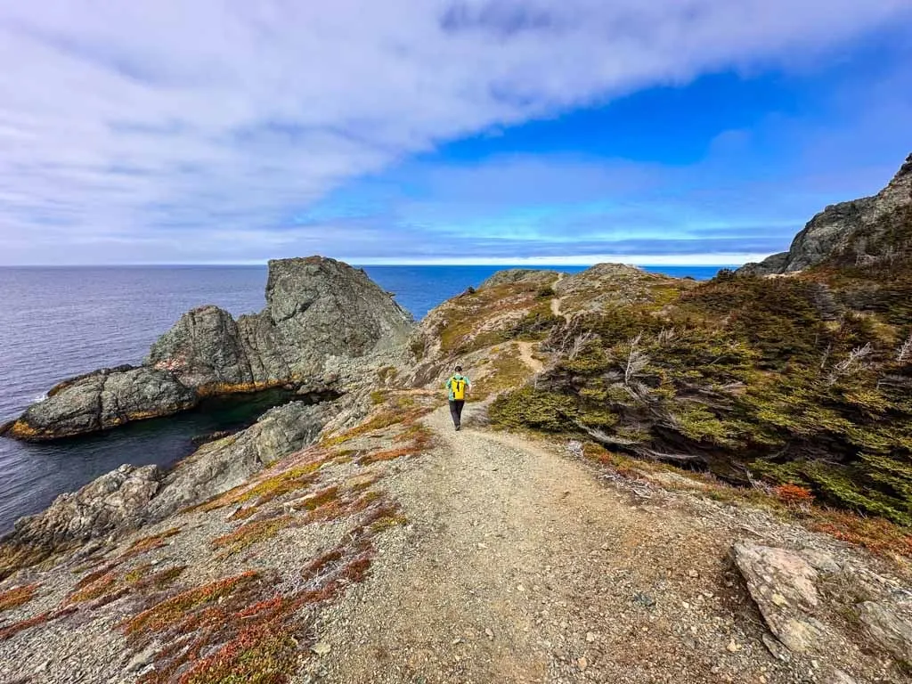
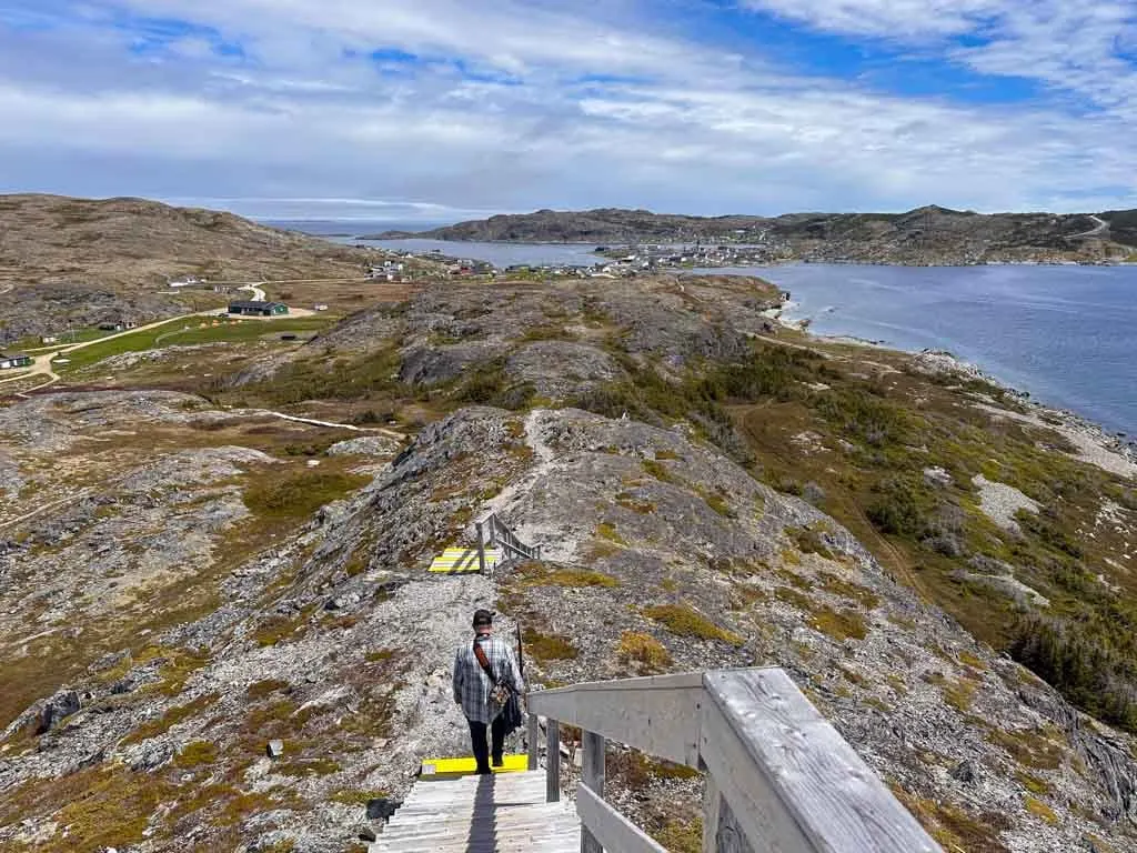
French Head (Rock Cut Trails), Twillingate
Difficulty: Easy
Time Needed: 1 hour
Distance: 2.5 km loop
Elevation Gain: 100 m
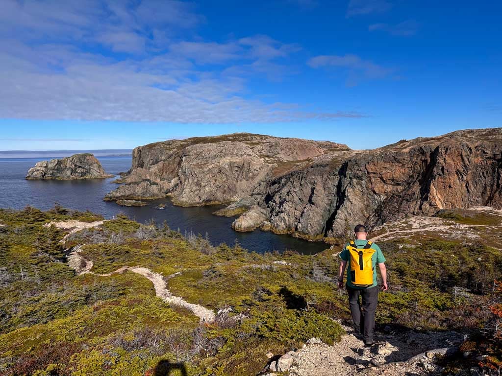
In the last few years, the town of Twillingate has created an incredible trail system on the east side of Twillingate Island called the Rockcut Trails. Please donate to support their work if you are able. I only had time to hike a short part of the network so I chose the quick, but beautiful French Head section.
From the trailhead, you walk a short distance to French Beach, which is so beautiful. From there, the trail loops up and over several small hills out to the end of French Head and then back to the beach.
The views of the coastline are incredible: To the east, you can see Spillers Point with Fogo Island in the far distance. To the west, you can see Carter Head, Burnt Island, and Twillingate Lighthouse, which you can visit at the start of the Nanny’s Hole hike (above). We actually did both Nanny’s Hole and French Beach on the same day since they were both short and easy.
The Rockcut Trails actually include a few backcountry campgrounds, so that’s on my list for my next visit. But if you’re looking for drive-in camping, I recommend Dildo Run Provincial Park. It’s an easy 20-minute drive from Twillingate, has oceanfront campsites and showers… and a hilarious name.
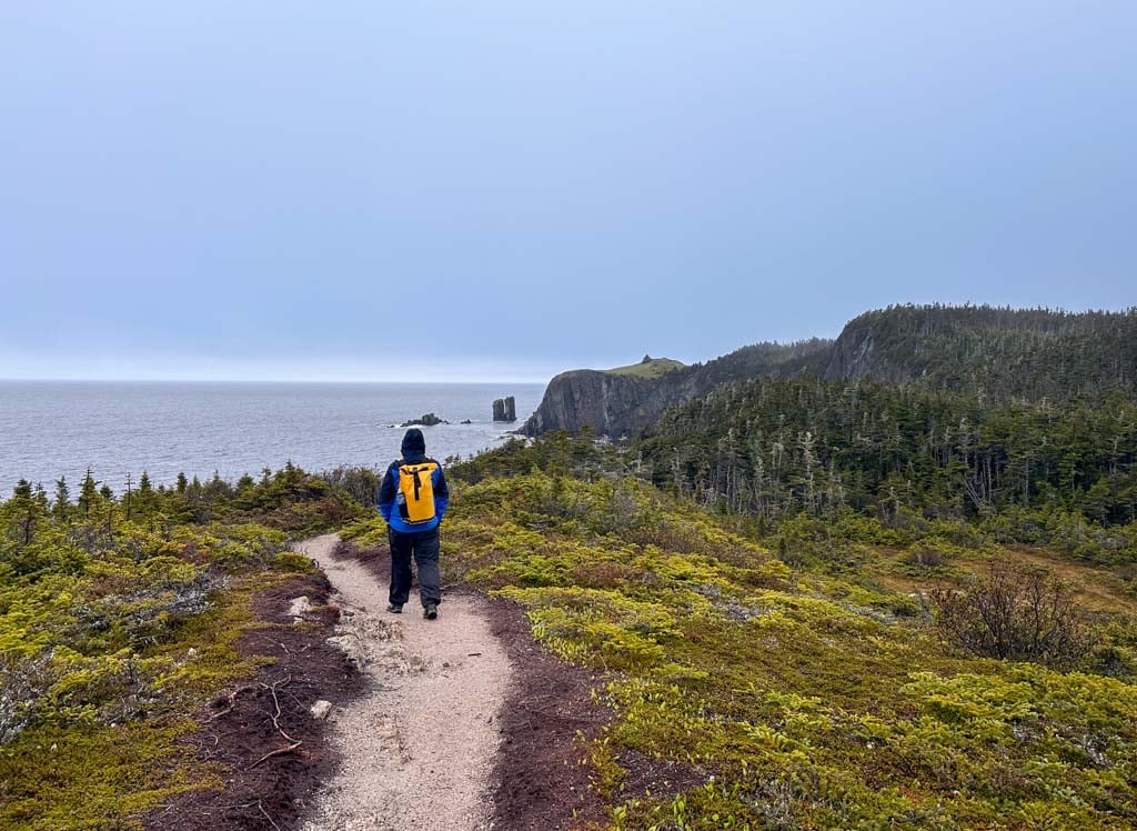
Brimstone Head, Fogo Island

Difficulty: Moderate
Time Needed: 45 minutes to 1 hour
Distance: 2 km round-trip
Elevation Gain: 90 m
Fogo Island was one of my favourite places in Newfoundland. The stark landscapes were otherworldly. Thanks to investment from a local girl turned tech millionaire, Fogo Island has a unique social enterprise and arts community. For hikers, one of the benefits is the great hiking trails all over the island.
Brimstone Head provides the best effort-to-reward ratio of all of Fogo’s hikes. It’s a short but steep climb with the help of stairs to the top of Brimstone Head. There is a great view from the top of the town of Fogo.
Brimstone Head is also considered to be one of the four corners of the Earth by the Canadian Flat Earth Society, so don’t fall off since you’ll never be seen again! On the way down, be sure to take the detour onto the “scenic route” to loop around to a viewpoint overlooking Back Cove and the Brimstone Head RV Park. We spent the night in our tent here and were treated to an incredible sunset.
There are lots of other great short hikes on Fogo, and I honestly had trouble picking just one to include in this guide. I also recommend the Joe Batts Arm Trail and Shoal Bay Trails. They both have an artsy surprise!
Best Hikes in Western Newfoundland
Green Gardens, Gros Morne National Park
Difficulty: Moderate
Time Needed: 3.5 to 4.5 hours
Distance: 9 km round-trip
Elevation Gain: 350 m
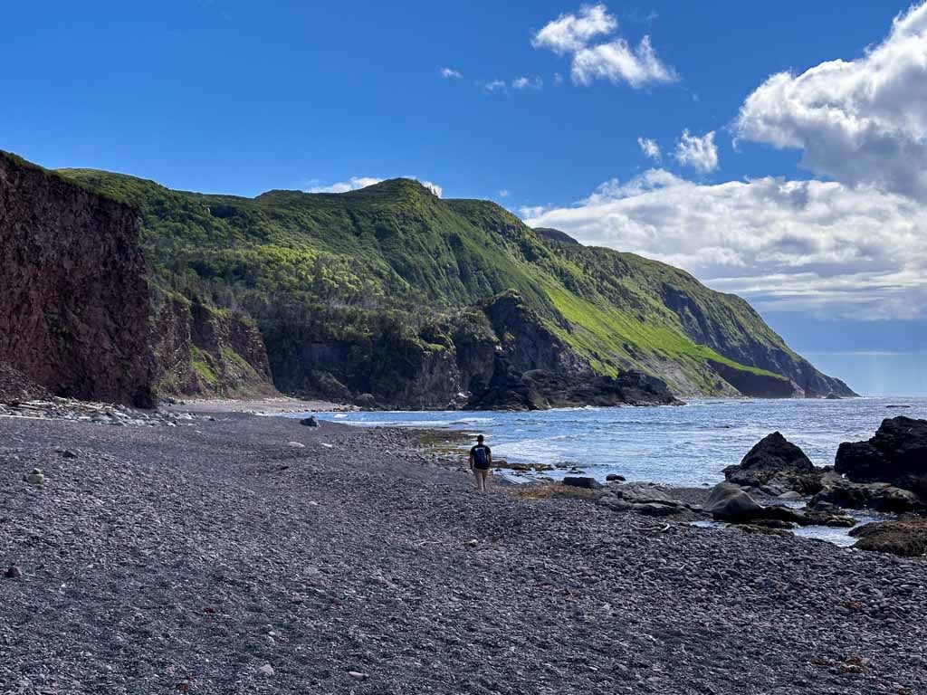
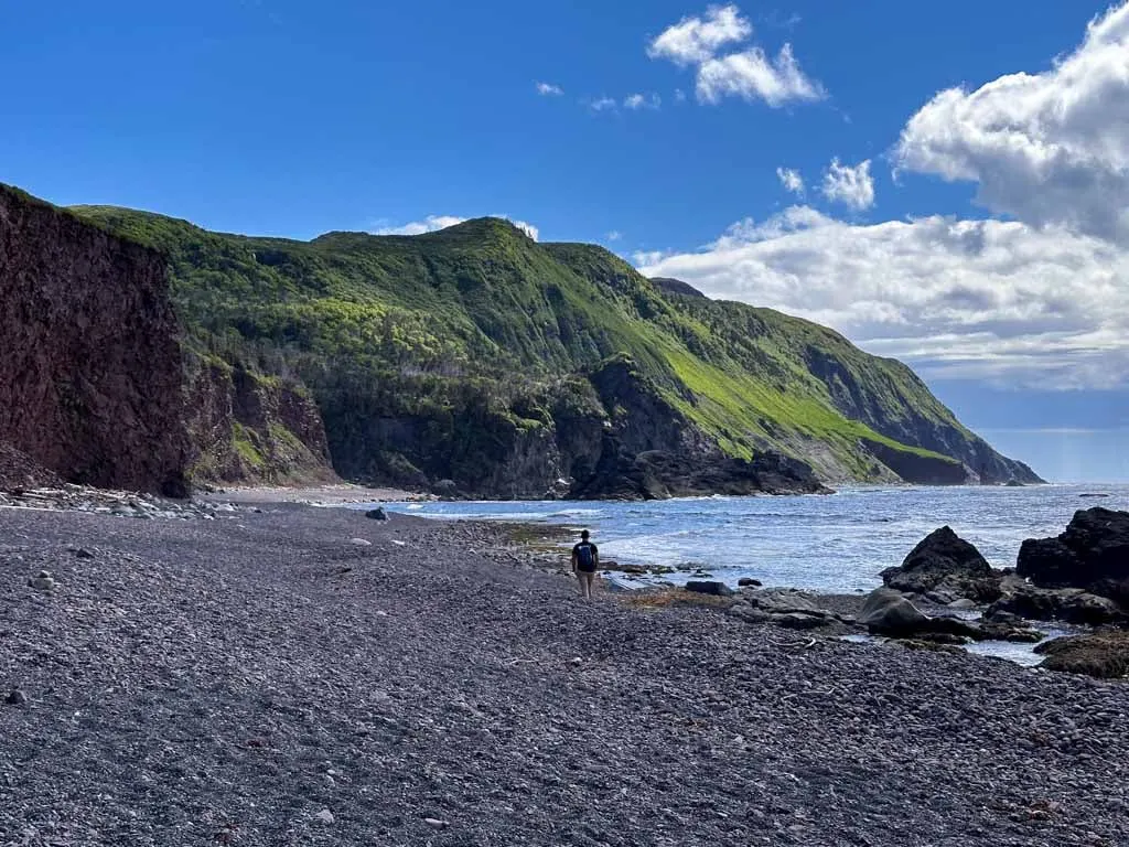
Green Gardens is one of the best hikes in Gros Morne National Park in western Newfoundland. It starts in the open barrens of the Tablelands before descending through the trees to the coastline. As the trail works its way downhill the vegetation changes and becomes more and more lush thanks to the fertile volcanic soil – a real contrast to the desolate rocks of the Tablelands.
The trail ends at a backcountry campground a bluff above Old Man’s Cove. The tops of the cliff have dense meadows of grasses and wildflowers. You can follow a rough staircase downhill to the beach. The normally frigid Atlantic is tempered by a warm current here, so you might even want to swim. (Sticking my feet in was enough for me.)
You can also continue down the beach to a waterfall tucked into a small canyon. Save your energy for the hike back to the trailhead – it’s all uphill.
After your hike, be sure to make the short drive to the village of Trout River to have a delicious cod dinner at the Seaside Restaurant, which has been in the same family since 1981. Time your visit for sunset – it’s spectacular.
Tablelands, Gros Morne National Park
Difficulty: Easy or Challenging
Time Needed: 1 or 5 hours
Distance: 4 or 7.5 km round-trip
Elevation Gain: 90 to 530 m
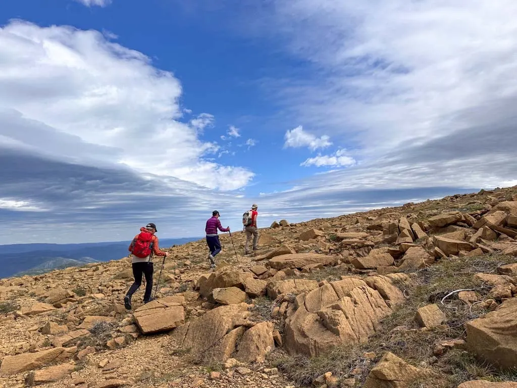
The Tablelands are one of the most interesting parts of Gros Morne National Park. The barren moonscape rocks here is actually part of the Earth’s mantle – the middle layer of the planet below the crust.
There are two ways to do this hike. The first is the easy Tablelands Trail. It’s a gentle 4 km hike on an old road bed that skirts around the base of the mountain. It has great views of the Tablelands and ends at glacier-carved Winter House Brook Canyon.
The other option, (and the one that I did) is an off-trail hike to the top of the Tablelands. This hike follows the main trail for the first 0.7 km then veers uphill and off trail to a viewpoint overlooking Winter House Brook Canyon.
There is no trail or established route so you need to be comfortable with route finding, loose rock, and steep slopes. You can pick your own path, but the rough track on Gaia GPS or AllTrails+ is a good starting point. (You don’t have to do the full loop on there – just go to the top of the canyon, and head back down.)
I did this hike with guides from Wild Gros Morne and they were great at explaining the unique geology. They also pointed out some really cool plants, including carnivorous pitcher plants and sundews. Before the hike, they took us out on a Zodiac tour in Bonne Bay so we could see the Tablelands from the water. Oh, and the best part: the packed lunch included the most delicious lobster roll sandwich I’ve ever had!
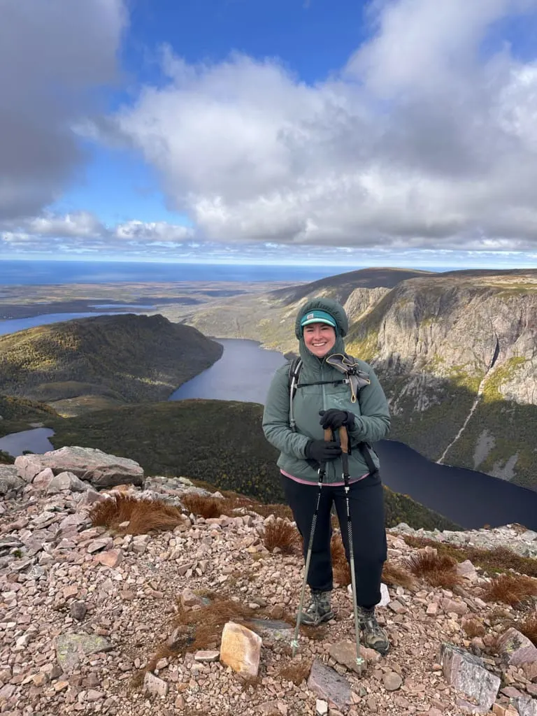
Gros Morne Mountain, Gros Morne National Park

Difficulty: Very Challenging
Time Needed: 7 to 9 hours
Distance: 17 km loop
Elevation Gain: 868 m
When I hiked to the summit of Gros Morne Mountain on my first trip to Newfoundland I thought it was the tallest mountain in Newfoundland. But on a more recent trip, I learned that it is actually the second tallest mountain! Gros Morne tops out at 806 m, but The Cabox a few kilometres away is 812 m tall. I’ll have to do that one next time!
Despite being number two, Gros Morne Mountain is a great hike, albeit a long and challenging one. The first half of the trail is a steady climb through the forest to the base of the peak. From there, you head up a steep and rocky gully full of boulders to the summit. The summit has a strangely flat and rocky summit. But it has incredible views of 10 Mile Pond and the ocean. I actually spotted caribou from the top too!
To descend, you follow stairs down the backside of the mountain and then loop back around, passing the backcountry campsite at Ferry Gulch, which is the end of the Long Range Traverse.
There is a seasonal closure each May and June to protect wildlife and prevent erosion. As well, it’s not a great place for dogs due to the fragile ecosystem, the likelihood of stressing wildlife, and the rocky terrain that can cut dog’s paws.
Long Range Traverse, Gros Morne National Park

Difficulty: Very Challenging
Time Needed: 3 to 5 days
Distance: ~35 km one-way
Elevation Gain: 1270 m
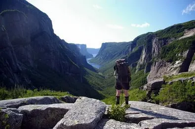
The first time I went to Newfoundland we planned our trip specifically to hike the Long Range Traverse. It’s a spectacular multi-day backpacking trip through the Long Range Mountains in Gros Morne National Park.
There is no official trail – instead, you have to use a map and compass or GPS to navigate. The route starts with the tourist boat across Western Brook Pond. From there, you bash your way through a thickly vegetated valley and up a steep glaciated headwall. The next few days see you finding your own route through bogs, around lakes, and across tundra. The traverse ends on the Gros Morne Mountain Trail, which makes a logical add-on to the trip.
My Long Range Traverse trip was spectacular. We had days of gorgeous sun and thick fog. We saw moose, caribou, and a bear. I stepped into a mud puddle that was up over my knees. And I came away with so many fond memories.
I didn’t have time to do the Long Traverse on my most recent trip to Newfoundland, but I know if I go back it will be at the top of my to-do list since it is the most epic backpacking trip in Newfoundland.
Bottle Cove/South Head Lighthouse Trail, Lark Harbour
Difficulty: Easy or Challenging
Time Needed: 30 minutes or 4 to 5 hours
Distance: 1 km or 8 km round-trip
Elevation Gain: 30 m or 500m
The Bay of Islands region outside of Corner Brook was an area I hadn’t heard about until my most recent trip to Newfoundland. It’s a gorgeous area with little fishing towns in sheltered coves, windswept headlands, and big views. The trails starting at Bottle Cove were some of my favourites in Western Newfoundland.
From the trailhead, you can hike the short and easy trail to the lookout above Bottle Cove. It has a great view of the rocky headland and sea cave across the cove.
But I suggest continuing onward (and upward) on the steep South Head Lighthouse Trail. At the top, there are incredible views of the islands at the mouth of the Bay of Islands. You can also look down at the location of the former South Head Lighthouse, which must have been a very inhospitable place to live so exposed to the weather.
Keep in mind that this trail is in the Blow Me Down Mountains, and they live up to their name. I was nearly blown off my feet on the top!
Volunteers from Outer Bay of Islands Enhancement Committee have built and maintained several trails in the area including the Bottle Cove and South Head Lighthouse Trails. Please consider making a donation if you hike here.
Be sure to stop at the Saltbox Restaurant in Benoit’s Cove for great seafood on their waterfront patio. The restaurant is the home of Everoutdoor Adventures, a hiking and guiding company, as well as an interpretive centre for the Cabox Aspiring Geopark, a proposed UNESCO Geopark. They have lots of great maps and info boards about the local geology and history.
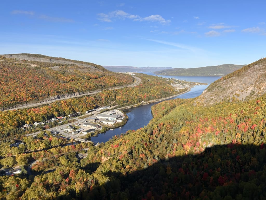
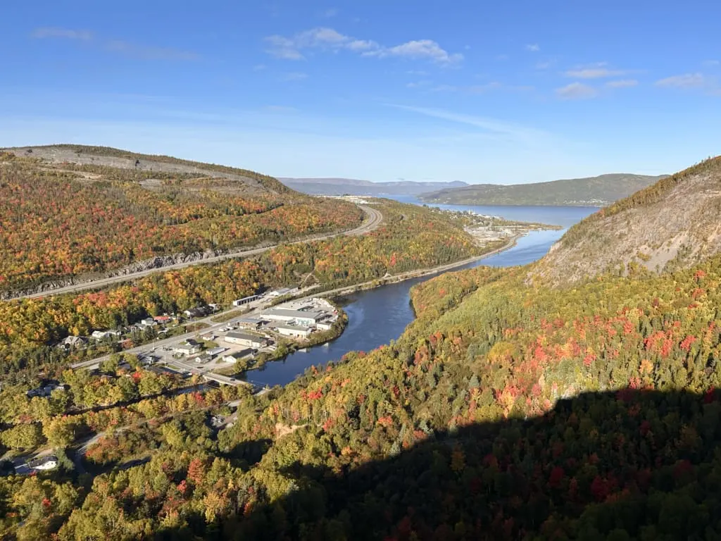
Man in the Mountain (Humber Valley Trail), Corner Brook
Difficulty: Challenging
Time Needed: 2.5 to 3.5 hours
Distance: 5 km round-trip
Elevation Gain: 360 m
If you’re driving Highway 1 just east of Corner Brook, look up and see if you can spot the face in the rocks, known as Man in the Mountain. If you’re a hardy hiker, you can also hike to the top of the man’s face for a great view of Corner Brook and the Humber Valley.
The Man in the Mountain viewpoint is actually part of the 14.5 km-long Humber Valley Trail, which itself is part of the International Appalachian Trail Newfoundland and Labrador. So you can just do the short hike up to the Man in the Mountain viewpoint… or you can continue for days.
I did a short loop using the steep Bear Head Trail and part of the Humber Valley Trail to visit Arne’s Lookout with Glen from Everoutdoor Adventures. You can also continue to the top of Man in the Mountain (a face in the rocks you can see from the Highway below).
Newfoundland Hiking Tips
National Park Entry Fees
You need to pay park entry fees to hike in Terra Nova and Gros Morne National Parks. All other hikes in Newfoundland are free. Here’s the fee breakdown for the National Parks:
Terra Nova National Park: $6.50/adult/day
Gros Morne National Park: $11/adult day
Parks Canada Discovery Pass: $75.25/adult or $151.25 for a group of up to 7 people in the same car. Valid for one year. This is the best deal if you plan to spend more than a few days in the parks.
Weather in Newfoundland
Newfoundland has a temperate marine climate which means it is never too hot but is often wet and chilly. The best time of year to hike in Newfoundland is between mid-June and early October when the weather is warmest and there is less rain. The snow in the mountains will all be melted by then too.
I think the best time to hike is in the fall. I spent 10 days hiking in Gros Morne and Western Newfoundland in fall. I was treated to mostly sunny weather and gorgeous fall colours.
Wet weather is a reality in Newfoundland. Read my tips for hiking in the rain to get ready.
Watch the forecast carefully when you are in Newfoundland. Even if it is calling for rain, it often will only rain for a few hours out of the day, leaving the rest of the day open for dry hiking!
Cell Phone Service in Newfoundland
Cell phone service can be spotty or non-existent in parts of Newfoundland. You’ll probably have at least some signal near towns, but away from towns, you often won’t have any service. Look up all the info you will need for your hike while you still have service. I like the use the Gaia GPS app or AllTrails+ to download offline maps of the trails before I go.
Also, keep in mind that without cell service you won’t be able to call for help in an emergency. We brought our Garmin inReach Mini 2 satellite messenger as a just-in-case backup.
What to Bring Hiking in Newfoundland
Just like on any hike anywhere in the world, you need to be prepared. Don’t forget the 10 Essentials, a list of key items you should bring on every hike.
You’ll also want moisture-wicking and quick-drying synthetic hiking clothes. Skip the cotton – it doesn’t dry and will make you cold and uncomfortable.
Bring a good rain jacket. On this trip, I wore my MEC Flashcloud, but it is discontinued. I also love my Mountain Hardwear Minimizer because it is super light and compact but still breathable. For a budget option, I recommend the Outdoor Research Helium Rain Jacket.
Make sure that your jacket has a fresh waterproof treatment to stop it from wetting out. (Read my guide to why rain jackets wet out for more info.)

On most hikes in Newfoundland I usually also pack my rain pants, just in case. I’ve gotten caught out in unexpected rain a few times and was glad I had them. I use the basic MEC Hydrofoil Stretch pants and they’ve held up well, including on my incredibly wet Skerwink Trail hike.
You’ll also want waterproof footwear because even if it isn’t raining, a lot of the trails have lots of mud and deep puddles. I wore my Salomon XA Pro Goretex Trail runners and they were great – lightweight, lots of traction, and waterproof.
If your backpack came with a rain cover, that’s great. But if not, you can buy one separately. I like the MEC silicone rain cover since it packs down so small. Or use a dry bag to protect gear inside your pack. I use Sea to Summit Lightweight dry bags.
It can also be chilly in Newfoundland so a fleece or synthetic insulated jacket is a great idea. Skip down jackets since they don’t provide any warmth when wet. I brought my Arc’teryx Proton insulated jacket and Outdoor Research Trail Mix Fleece and wore them both a lot.
Leave No Trace
Learn the Leave No Trace principles before you hike in Newfoundland. This is a sensitive ecosystem with a short growing season. Pack out all your trash. Use toilets at trailheads or villages before you hike. If you have to go on the trail, dig a cat hole or bring a WAG bag to pack our your poop.
Guided Hikes
If you’d rather have a local show you around, there are lots of guided hiking tour operators in Newfoundland. Going with a guide can be a great way to learn more about the local plants, animals, geology, and history. Guides can often show you off-the-beaten path hikes you wouldn’t otherwise have heard about – that’s how I heard about the South Head Lighthouse Trail.
In Western Newfoundland, I recommend Gros Morne Adventures, Tour Gros Morne, Wild Gros Morne, and EverOutdoor Adventures. I did a hike with each of these companies thanks to Go Western Newfoundland.
In Eastern Newfoundland, I’ve heard good things about Great Canadian Trails guided trips on the East Coast Trail. You can find more regional tour operators through Newfoundland and Labrador Tourism.
Give Back to Trailhead Communities
Many hikes in Newfoundland are located in small towns and villages that depend on tourism for their livelihood and have spent lots of money and time on building trails to attract tourists. Often hikers visit a community, hike a free trail, and then leave.
Where possible, be sure to give back to trailhead communities by shopping at local stores, eating at local restaurants, and staying at local hotels or campgrounds. You can also make donations to local trail maintenance groups.
Indigenous Context
Newfoundland is the traditional territory of the Beothuk and Mi’kma’ki. It is important to be respectful of this land.
Final Thoughts
So that’s my big list of the best hikes in Newfoundland. I’m already dreaming of going back to Newfoundland someday to hike more! Do you have questions about Newfoundland? Ask me in the comments.
READ NEXT:
- 20 Incredible Things to Do in Newfoundland
- Things to Do in Gros Morne National Park
- 18 Best Things to Do in St. John’s, Newfoundland
- 12 Things To Do in Trinity, Newfoundland
- 10 Things To Do in Bonavista, Newfoundland
- 10 Things To Do in Twillingate, Newfoundland
- Things to do on Fogo Island, Newfoundland
- Things to Do in Corner Brook, Newfoundland
- The 10 Essentials: Things You Should Bring on Every Hike
- 40+ Tips for Hiking in the Rain
- Why Do Rain Jackets Wet Out?


- 10 Best Things to Do in Nanaimo - April 16, 2026
- 25+ Women’s Adventure Books That Will Inspire You - April 13, 2026
- 10 Best Things to Do in Saskatchewan - March 22, 2026