
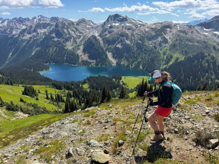
Tenquille Lake near Pemberton is one of the most spectacular hiking locations in the Sea to Sky area… and that’s saying a lot since I think it’s the most beautiful part of BC. I’ve made two trips into this area, so I’ve put together a complete Tenquille Lake Trail hiking and backpacking guide for you.
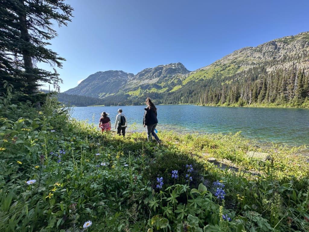
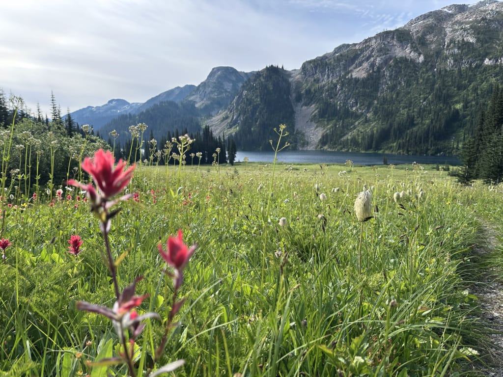
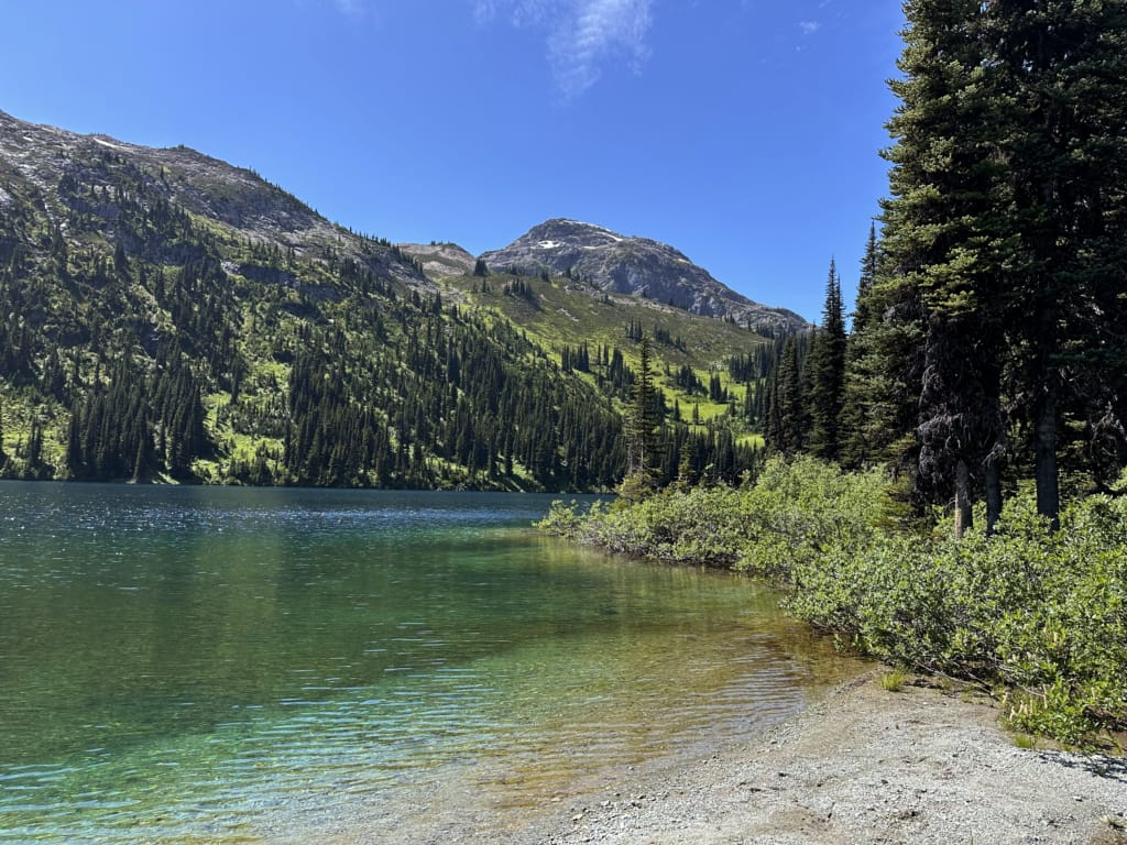
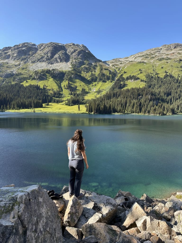
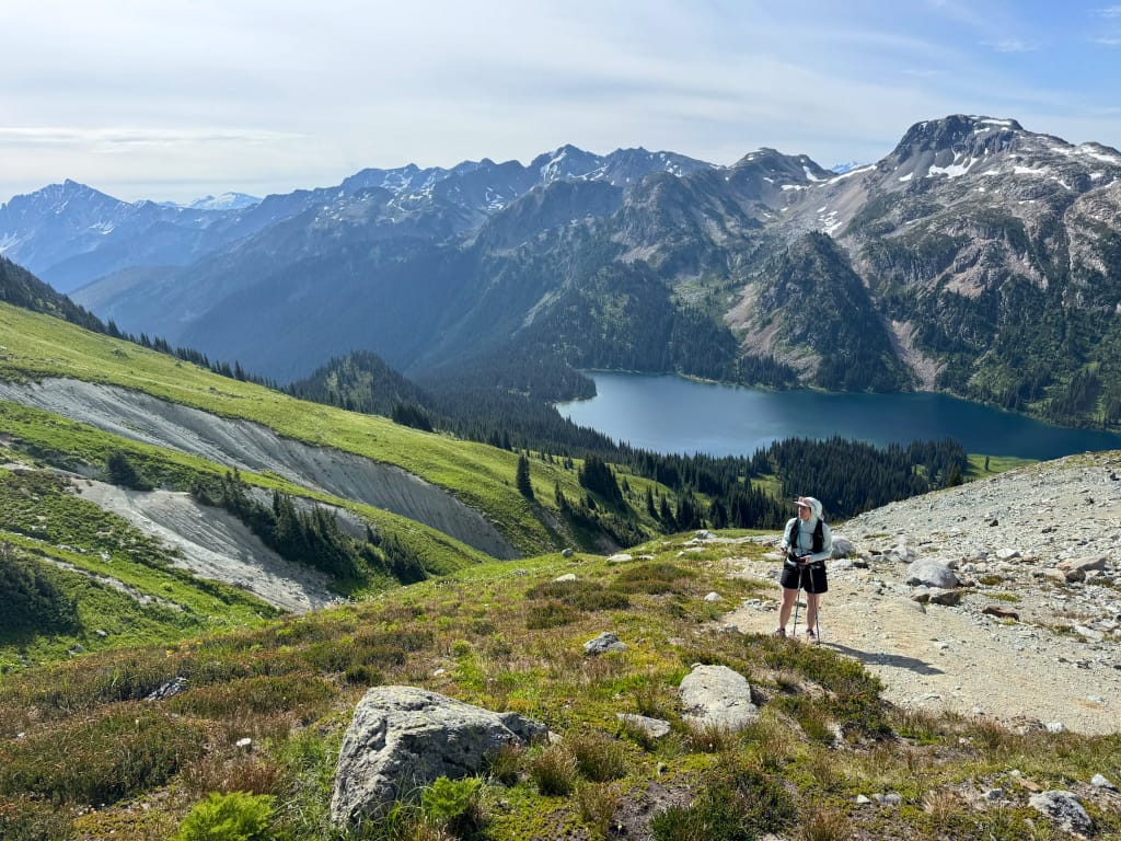
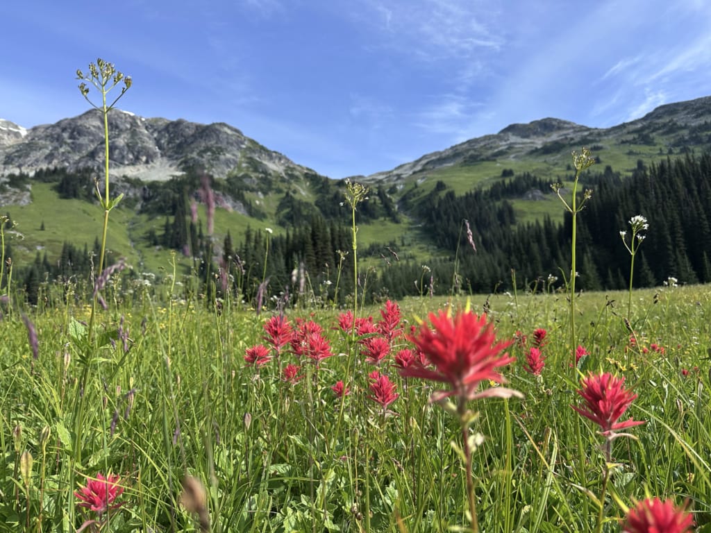
Is Tenquille Lake worth hiking? For me, it’s a big yes. The hike itself is pretty and only moderately difficult, but the lake is spectacular. The cobalt blue waters of Tenquille Lake sit in a bowl surrounded by tall, rocky peaks. The lakeside meadows extend up the shoulders of the mountains, making it easy to explore off-trail to the summits. In late July and early August, the wildflowers are spectacular, creating a blanket of white, yellow, blue, red, and purple in the meadows.
While it makes a great day hike, I highly recommend making it into a backpacking trip and spending a night or two at Tenquille Lake, either in the cabin or at the backcountry campground. It’s a gorgeous spot worth savouring over a few days.
The Tenquille Lake area is not that busy for two reasons. The first is thanks to careful management by volunteers from the Pemberton Wildlife Association and the Lil’wat and N’Quatqua Nations, who have set up a reservation system for the cabin and backcountry campground. The area is known as Hawint and is a culturally important place for these Indigenous Nations.
The second reason why Tenquille Lake is not that busy is the access road. You’ll have to drive over 24 kilometres of bumpy gravel roads to get to the trailhead. The final few kilometres require 4×4 and high clearance, but any car can get within 5 kilometres of the trailhead, and then walk the remaining road.
The bottom line: Tenquille Lake is one of the best alpine hikes near Pemberton if you’re willing to tackle the rough access road. The hike is moderate, but the lake makes a beautiful backpacking destination with a cabin, campground, wildflower-filled meadows, and several nearby peaks to explore off-trail.
I’m a hiking guidebook author and have backpacked all over BC, so I’ve put together a detailed Tenquille Lake hiking and backpacking guide for you. It includes:
- Quick facts about the Tenquille Lake Trail, including distance, how long to spend, best time to go, and more
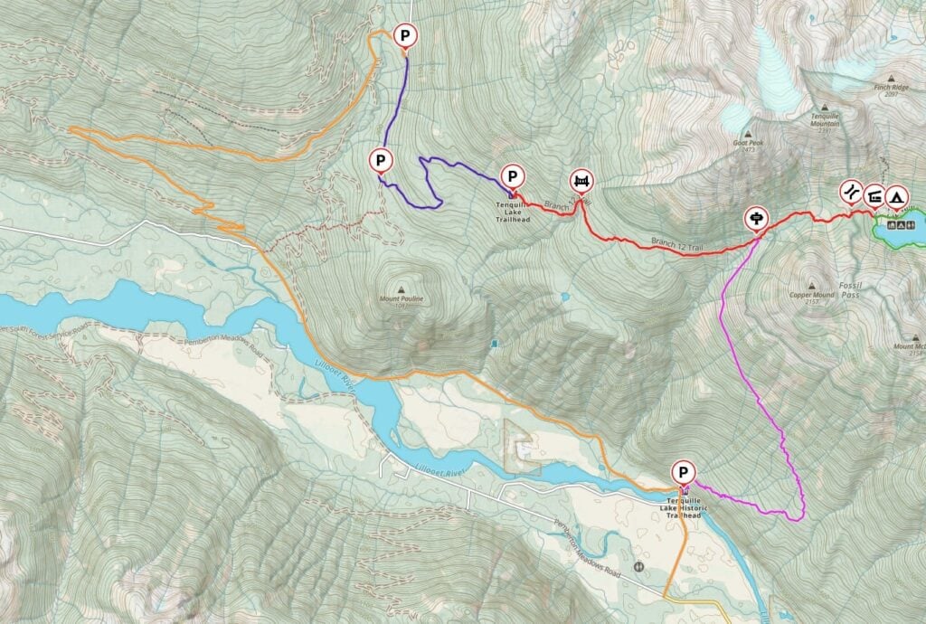
- A custom map that shows all the trails
- Detailed trail description and info on alternative trails to Tenquille Lake
- Camping and cabin info, including how to book
- Extending your trip – day hikes and scrambles from Tenquille Lake
- How to get to Tenquille Lake Trailhead, including options for both 2WD and 4×4 vehicles
- Tips for hiking to Tenquille Lake – advice for bears, weather, and more
This is a sensitive wilderness area. Learn how to Leave No Trace to keep the wilderness wild. Make sure you are prepared by bringing the 10 Essentials. Get ready for adventure with this checklist of things to do before every hike.
Hey there: Some of the links in this post are affiliate links, which means I earn a small commission at no cost to you. Thanks for your support. -Taryn
Tenquille Lake Trail Quick Facts
Location: Accessed via the Hurley River FSR northwest of Pemberton
Highlights: Cobalt blue alpine lake, wildflowers, easy off-trail scrambling
Distance: 13.5 km round trip from the Branch 12 trailhead
Elevation Gain: 710 m
Duration: 6 to 7 hours or a 2 to 3-day backpacking trip
Difficulty: Moderate
Best Time to Go: July to early October (Early August has the best wildflowers)
Road access: Via 24 km of gravel logging roads with parking areas for 2WD low clearance cars, 2WD high clearance cars, and 4WD high clearance cars
Cabin and Camping: You must make reservations to camp or stay in the cabin and pay fees. More info in the camping section below.
Dogs: Not allowed
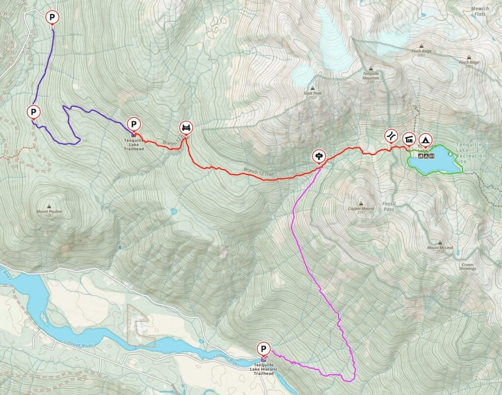
Tenquille Lake Trail Map
The trail to Tenquille Lake is well-marked and easy to follow. But if you want to explore any of the peaks near the lake, you’ll need to be comfortable with off-trail navigation.
I use the Gaia GPS app on my hikes. It is helpful to know where I am on the trail to figure out how much higher I have to climb and where the next viewpoint is. All Trails+ is also great.
I made you a trail map using Gaia GPS. Click through to zoom in and explore. You can also save it to your routes in Gaia GPS or export the GPX file.
Join the Backpacking in BC Facebook Group
Tenquille Lake Trail Description
By far the most common way to hike to Tenquille Lake is via the Branch 12 Trail, so that’s the trail I’ll describe below. However, there are a few other ways to get to the lake – scroll down to the Other Routes section for that.
Branch 12 Trail Key Locations
| KM | Elevation | Landmark |
|---|---|---|
| 0 | 1,270 m | Trailhead |
| 1.3 km | 1,450 m | Mowich Creek Bridge |
| 4.3 km | 1,560 m | Historic Trail Junction |
| 6 km | 1,710 m | Tenquille Pass |
| 6.4 km | 1,670 m | Tenquille Lake Cabin |
| 6.7 km | 1,670 m | Tenquille Lake Campground |
Branch 12 parking lot to Historic Tenquille Trail Junction
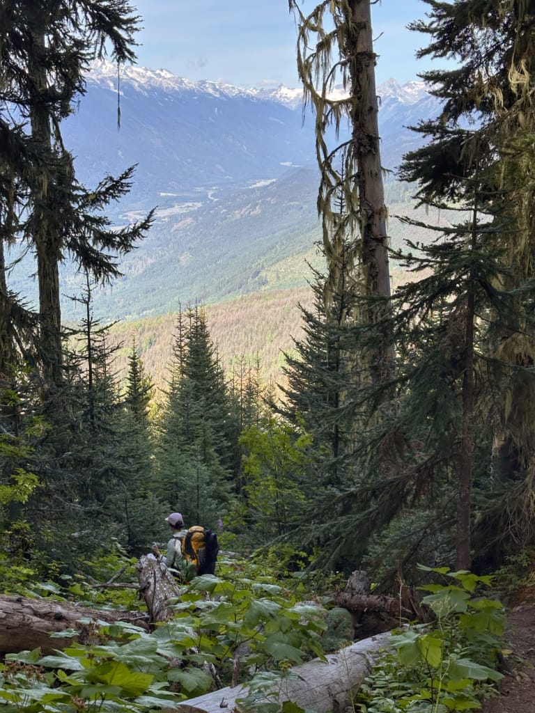
From the parking area, follow the trail uphill on a few short dusty switchbacks in an old cutblock. The trail transitions into an older forest and begins a rising traverse to the east. There are great views of the mountains across the Pemberton Valley through this section, but they are behind you, so be sure to turn around!
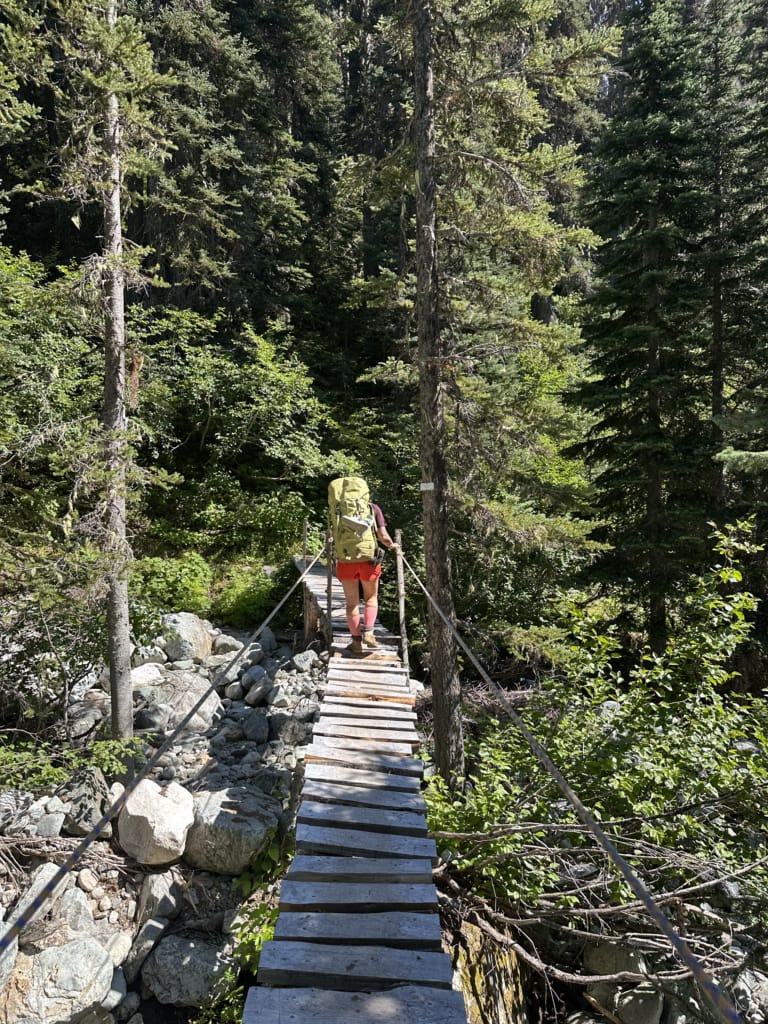
About 1.3 km from the trailhead, the path swings north and dips into the Mowich Creek Valley. Cross the creek on a long and narrow bridge. It has rope railings, but it may be a bit daunting to those who have a severe fear of heights.
After the bridge, the trail continues its rising easterly traverse through the forest. The grade eases around the 2.5-kilometre point and starts to open up a bit with clearings breaking up the dense forest. You’ll also cross several brushy avalanche paths.
Reach a junction with the historic Tenquille Lake Trail at 4.3 km. This trail drops over 1,200 m to the Lillooet River Valley below.
Historic Tenquille Trail Junction to Tenquille Lake
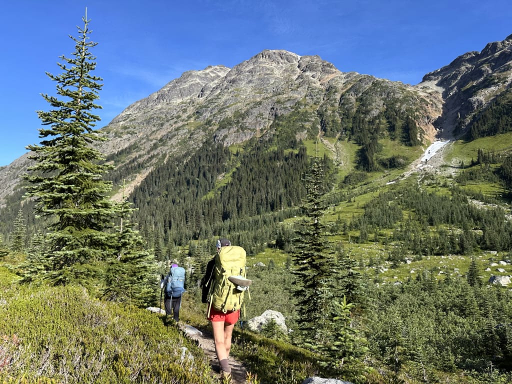
Past the junction, the grade intensifies again. However, the forest thins out further ,and you’ll get glimpses of Goat Peak and Tenquille Mountain above you to your left.
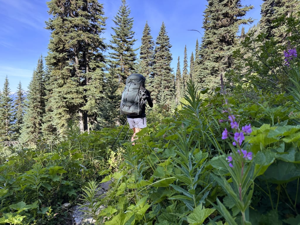
By about 5.2 km, the forest has mostly melted away, and you’ll be in alpine meadows with incredible mountain views and lots of wildflowers. Follow the trail as it skirts the southern part of the meadows to avoid wet areas. However, there are still a few muddy spots, especially in the early season.
You’ll crest Tenquille Pass at the 6 km mark, but the saddle is gentle, so it’s hard to tell where the highest point truly is. A short descent through the trees leads you to the cabin at the 6.4 km mark.
To continue to the camping area, cross the wooden bridge in front of the cabin, then turn right to follow the trail across the meadow to a clump of trees.
Other Routes to Tenquille Lake
There are a few other ways to get to Tenquille Lake, but they are not as popular as the Branch 12 Trail described above because they are longer and harder.
Historic Tenquille Lake Trail
The traditional way to get to Tenquille Lake before the Branch 12 Trail was built was to climb all the way up from the Lillooet River Valley. This trail starts at the bridge over the Lillooet River at the start of the Lillooet River FSR. It gains 1,240 meters over 7.1 km to the junction with the Branch 12 Trail. From there, it’s another 2.4 km and 150 m of elevation gain to Tenquille Lake.
The trail travels through an old forest fire scar with lots of burned trees, so it doesn’t have very much shade. It’s also not that popular and sees little maintenance, so it can have a lot of blowdown to climb over and under. However, this route does avoid all gravel road driving.
Owl-Tenquille Traverse
This is a rough 31-kilometre route from Pemberton to Tenquille Lake. Parts of it have a defined trail, but some sections require route finding. The route finishes partway along the Mount Barbour Trail, which you can find at the east end of Tenquille Lake.
Tenquille Creek Trail
You might find old info online about accessing the Tenquille Lake area via the Tenquille Creek Trail. However, the road to this area is now closed and gated to protect grizzly bear habitat, and the trail is also closed. I hiked this trail about 10 years ago before it was closed.
From the current gate on the Birkenhead Lake FSR, it’s a 5 km road walk through a cut block with no shade. From there, it’s three more kilometres through steep forest to the junction at the east end of Tenquille Lake.

Tenquille Lake Camping and Cabin
If you want to stay overnight (which I recommend), you can book a spot at the cabin or campground. Details on both, as well as info on how to reserve, are below.
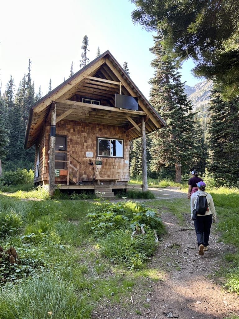
Tenquille Lake Cabin
The Tenquille Lake Cabin was built in 2012 and is used year-round by hikers, mountaineers, and skiers. It’s a family-friendly hut, and parties are not tolerated.
Sleeps: 12 people on supplied sleeping pads in the communal loft
What’s included: Wood stove for heat, firewood, solar LED lighting, propane cooking stove (bring your own 1 lb green propane canister), cutlery, plates, and pots, picnic tables
Outhouse: Near the cabin – follow the trail across the creek
Drinking water: Collect water from the stream outside the cabin. Be sure to filter or purify it before use.
Tenquille Lake Campground
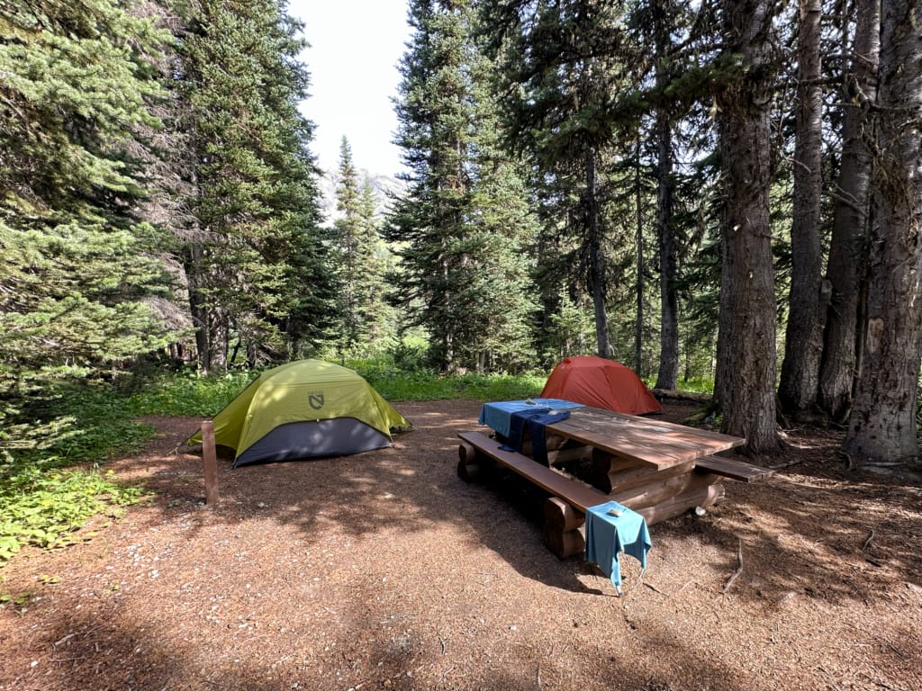
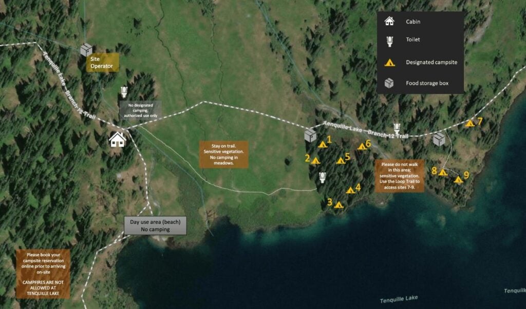
While camping used to be allowed in a few different areas around the lake, since 2022, the only place you may camp is in the designated campground, a few hundred meters from the cabin on the north side of the lake.
Campsites: 9 sites – 6 on the west side of the creek and 3 on the east side
Campsite capacity: Each site is allowed a max of 4 adults and 2 tents
Outhouses: Two, one in each part of the campground
Food storage: Two, one in each part of the campground
Drinking water: Collect from the creek that runs through the middle of the campground
Which campsite at Tenquille Lake is best?
When you make a reservation, you pick a specific campsite. Below, I’ve got my advice on how to choose. But in general, I recommend booking campsites 3 or 4 since they are big, have picnic tables, and are close to the lake. If you value privacy, book sites 7, 8 or 9.
| Site | Location | Details |
|---|---|---|
| 1 | Beside the food western food cache. | Small site but could fit two tents close together. |
| 2 | Beside the western outhouse. | Slightly sloped. Small site best suited for one tent or two small tents close together. |
| 3 | Close to lake and good swimming spot. | Has a picnic table. Room for two tents. |
| 4 | Close to lake and creek access. | Has a picnic table. Large flat area easily fits two tents. |
| 5 | In the trees near western outhouse. | Small site in the trees. Could squeeze in two tents. |
| 6 | In tight trees near creek. | Very small site. Suitable for only one tent. |
| 7 | Next to main lakeshore trail. | Has a bench. Slightly sloped. Could fit two tents. |
| 8 | Close to lake and creek. | Rocky and small site. Best for one tent. Far from outhouse. |
| 9 | Beside lake. | Slightly sloped. May be hard to fit two tents. Far from outhouse. |
Tenquille Lake Camping and Cabin Fees and Reservations
You must make reservations and pay fees to stay at the campground or cabin. There is no cell service in the area, so you will need to make reservations in advance. A site operator is stationed at the lake in a white prospector tent near the cabin during the summer to check reservations and ensure the area stays clean and quiet.
Cabin Fees: $28.50/person/night
Camping Fees: $28.50/site/night
When to Book: Up to 60 days in advance
Where to Book: Pemberton Wildlife Association
Day Hikes and Scrambles from Tenquille Lake
This is a gorgeous area, and I recommend spending a few days here so you can explore. Below are some options for day hikes and scrambles in the area.
Keep in mind that most options are routes, not trails, so you will need to be comfortable with off-trail navigation and, in some cases, scrambling.
If you choose to tackle any of the peaks, consider downloading GPX routes from AllTrails or other websites to aid in route finding. I also recommend picking up a copy of Scrambles in Southwest British Columbia by Matt Gunn since it describes these routes well. Unfortunately, it is out of print.
Tenquille Lake Loop: This 3 km loop trail goes around the lake and is mostly flat. It has great views of the surrounding peaks. The trail is well-maintained with a few bridges and boardwalks.
Finch Ridge and Tenquille Mountain: An unofficial and sometimes faint trail leads to the north behind the cabin outhouse up to a saddle between Finch Ridge and Tenquille Mountain. From the saddle, you can choose to ascend either peak. Finch Ridge is more straightforward, while Tenquille Mountain requires route-finding to bypass cliff bands.
Copper Mound and Mount McLeod: Another unofficial and sometimes faint trail leads to Fossil Pass from the Tenquille Lake Loop near the cabin. From the pass, you can ascend either peak. Both require a bit of off-trail route-finding.
Join the Backpacking in BC Facebook Group
How to Get to the Tenquille Lake Branch 12 Trailhead
Heads up: The final section of Branch 12 FSR requires a high-clearance 4WD vehicle. If your car isn’t suitable, you can park farther down the road and walk either 3 km or 5 km to the trailhead.
For some people, the most difficult part of the trip to Tenquille Lake will be the drive! It requires quite a bit of travel on gravel roads, and to get all the way to the trailhead, you need a 4×4 with high clearance. However, 2WD vehicles can get close enough to the trailhead to make it worthwhile to walk the extra few kms of logging road.
I recommend using an offline topo map like Gaia GPS or AllTrails to navigate the logging roads since Google Maps doesn’t work and there is no cell service.
The route starts on paved roads in Pemberton, before heading off onto gravel logging roads. Plan to spend about 1 hour driving from Pemberton to the trailhead. Here are driving directions.
| KM | Location | Road Surface | Recommended Vehicle |
|---|---|---|---|
| 0-24 km | Pemberton Meadows Road | Paved | All |
| 24-32 km | Lillooet River FSR | Mostly smooth gravel | All |
| 32-43 km | Hurley River FSR | Bumpy and sometimes steep gravel | All |
| 43-45 km | Lower Branch 12 | Gravel with water bars | 2WD high clearance |
| 45-48 km | Upper Branch 12 | Steep and narrow gravel with loose sections and water bars | 4WD high clearance |
| 48 km | Tenquille Lake Trailhead | Parking for 8-10 vehicles | 4WD high clearance |
Pemberton to Lillooet River FSR
From Highway 99, go north onto Pemberton Portage Road into the village of Pemberton. Go left at the roundabout onto Birch Street, and then turn right two blocks later at the T-junction onto Pemberton Meadows Road. Stay on Pemberton Meadows Road for 24 km, then turn right onto Lillooet River FSR. The first 1.5 km of Lillooet River FSR are paved.
Lillooet River FSR and Hurly River FSR
Cross a single-lane bridge. The road turns to gravel after the bridge. Park here for the Historic Tenquille Lake Trail. For the Branch 12 Trail, continue along the Lillooet River FSR for another 8 km.
Follow a signed road uphill onto the Hurley River FSR. This road has some steep sections and is bumpy, but it is usually well-graded and suitable for all vehicles as long as you go slow. Check road conditions online before you go.
Stay on the Hurley River FSR for 10.5 km.
Branch 12 FSR
At a sharp hairpin bend, turn right onto Branch 12 FSR. If you are driving a 2WD vehicle with low clearance, park on the side of the Hurley.
This road has water bars right from the start, but they are passable in 2WD or AWD vehicles with decent clearance, such as small SUVs or Subarus. There are very few places to park or turn around in this section.
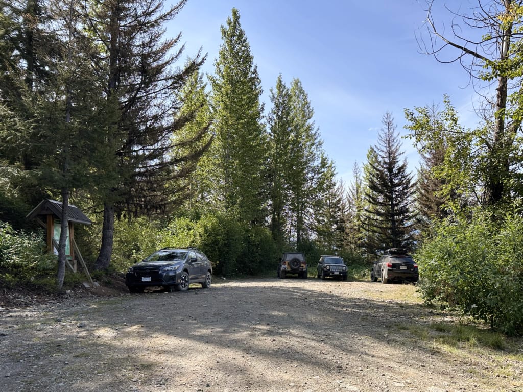
About 2 km from the start of Branch 12 road, reach a clearing with a large signboard and a small parking area that will fit 4 to 5 vehicles.
The remaining 3 km to the trailhead gains 340 m and is 4WD high clearance only. There are a few steep sections that are a bit loose and a few water bars. In general, the road is narrow, but there are a few wider areas where you could park or turn around. I did see a few Subarus and smaller SUVs at the trailhead, but if you aren’t confident in your driving, please don’t tackle this part of the road. Play it safe and park further back.
The trailhead has room for 8 to 10 cars to park. It also has an outhouse, an info sign, and a stream where you can collect drinking water. (Just be sure to filter or purify it first.)
Tips for Hiking the Tenquille Lake Trail
Check road conditions before you go. I recommend using both I Survived the Hurley and Backroad Status to check conditions on the Lillooet River, Hurley River, and Branch 12 FSRs.
Spend two nights: That gives you a middle day to explore the peaks around the lake.
Bears: This is grizzly and black bear country. Grizzly bears are sometimes spotted in the meadows near the campground and cabin. Bring bear spray, make noise while hiking, and store your food securely. See my bear safety tips for more info.
Dogs: Not allowed on this trail.
Fires: Not allowed in this area.
Mosquitos and Black Flies: Bugs can be bad in July and early August, especially at the parking areas. Bring bug spray and a head net.
Cell phone service: None. You’ll lose cell service just outside the town of Pemberton. Bring offline maps such as Gaia GPS or AllTrails Plus for navigation.
Check the weather before you go: The high mountains are notorious for fickle weather. Rainstorms can blow in at any time. Expect overnight lows near freezing on some summer days. City weather forecasts are useless in the mountains. Use an algorithmic spot forecast for Tenquille Lake, like Spotwx. (Read my guide to weather apps for hikers for more tips.)
Bring a rain jacket and warm clothing just in case. It can be much colder and rainier in the mountains than in the city. If you are staying overnight, you will need to bring typical backpacking gear. Use my backpacking checklist to make sure you have everything you need.
Bring water and snacks. It is not safe to drink the water from the lakes without boiling, filtering, or treating it because you never know if people or animals have pooped or died upstream. Gross! (I use a Katadyn BeFree.)
Bring the 10 Essentials. These are key safety items you should have on every hike.
Swimming: The lake is cold but still warm enough for a quick dip. There are lots of trails down to the water from the campground, and one near the cabin. Please wipe off sunscreen and bug spray before you swim to avoid contaminating drinking water and harming fish.
Respect Indigenous culture: While it is always important to acknowledge and respect the Indigenous people who have stewarded these lands since time immemorial, it is especially important at Tenquille Lake. This area is known as Hawint and is culturally important for the Lil’wat Nation. Please treat it with the reverence and respect it deserves.
Final Thoughts
My recent trip to Tenquille Lake was a two-night backpacking trip since we knew we wanted to have a free day at the lake to explore some of the peaks. On the hike out, we were already discussing coming back to Tenquille since we only scratched the surface of the hike options. Maybe next time we will stay even longer!
If you’re planning a trip to Tenquille Lake, you might like these other posts:
- 25 Best Backpacking Trips in BC
- Backpacking Checklist: Gear You Need To Go Backpacking
- The Best Hikes in Whistler: A Guide to All the Trails
- Backcountry Huts in British Columbia and the Canadian Rockies
- Tenquille Lake Trail Hiking and Backpacking Guide - August 10, 2026
- Things to Do in Grand Falls-Windsor, Newfoundland - August 6, 2026
- Things to Do on Newfoundland’s Great Northern Peninsula - July 29, 2026