
A couple years ago my sister moved to Galiano Island, one of the Gulf Islands that lie between Vancouver Island and the mainland. The Gulf Islands are a short ferry ride away but have a totally different climate zone (think warmer and drier) than Vancouver thanks to the rain shadow effect. That means that Galiano is a great place to explore year round and you’ll have it mostly to yourself when the summer crowds are gone. It’s possible to head to the island as a day trip from Vancouver or Victoria, but spending a few nights there is really the way to experience it since there is a fair amount to see. Here are some outdoor adventure suggestions to get you started.
Hey there: Some of the links in this post are affiliate links, which means I earn a small commission at no extra cost to you if you make a purchase. Thanks for supporting my website! -Taryn
Hiking at Montague Harbour Provincial Park
The hike around the Gray Peninsula in Montague Harbour Provincial Park is the easiest and most laid-back hike on Galiano. It is also the prettiest. The hike starts and finishes at the main picnic area parking lot and loops around the headlands and beaches of the Gray peninsula. If the tide is out you can forgo the trail almost entirely and walk on the beaches.
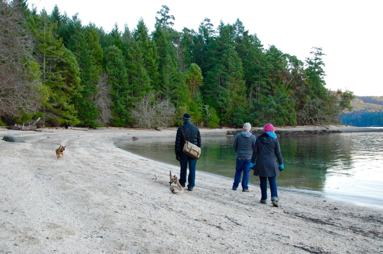
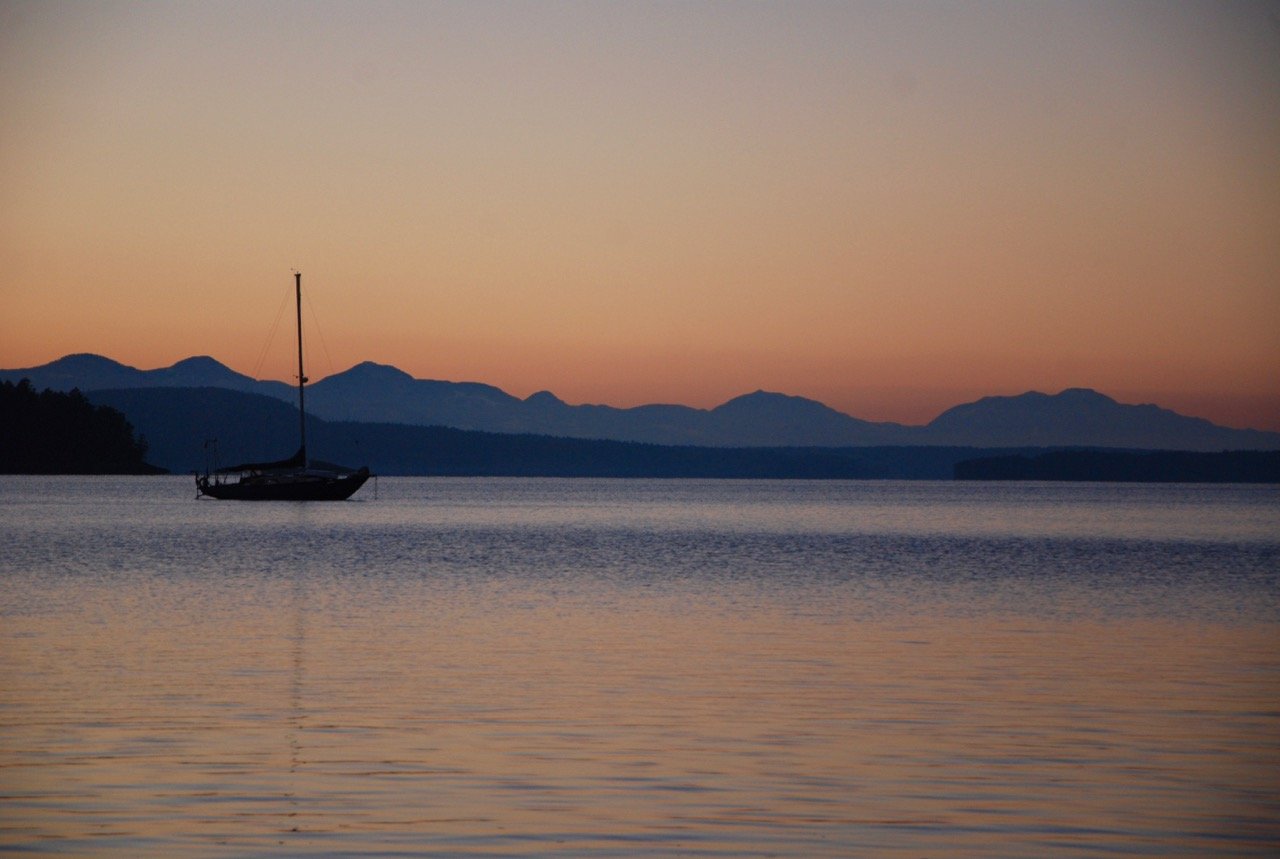
This shorter trail is only 2km long but can take up to an hour to walk as you’ll want to stop along the way to snap photos and take in the views of Montague Harbour, nearby Parker Island, and Saltspring Island across the channel. I also have it on good authority (from my sister) that this is the best place on the island to watch the sunset. I have to agree: it was spectacular.
Hiking the Bodega Ridge Trail
This trail isn’t by the ocean. Instead you’ll spend the whole hike walking along the spine of Galiano Island in Bodega Ridge Provincial Park. The trail follows the ridge top from southern the trailhead at the end of Cottage Way north to another trailhead on Manastee Road near the Bodega Ridge resort, a total distance of about 8km but reportedly the northern section is a bit overgrown and has no views. Therefore the best way to do this hike is to do a quick out and back hike from the Cottage way trailhead, covering about 5km total distance. After a short stretch of hiking in the trees for about half a kilometer you’ll emerge at the cliff edge with panoramic views to the west across to Wallace Island, Saltspring Island and the mountains of Vancouver Island.
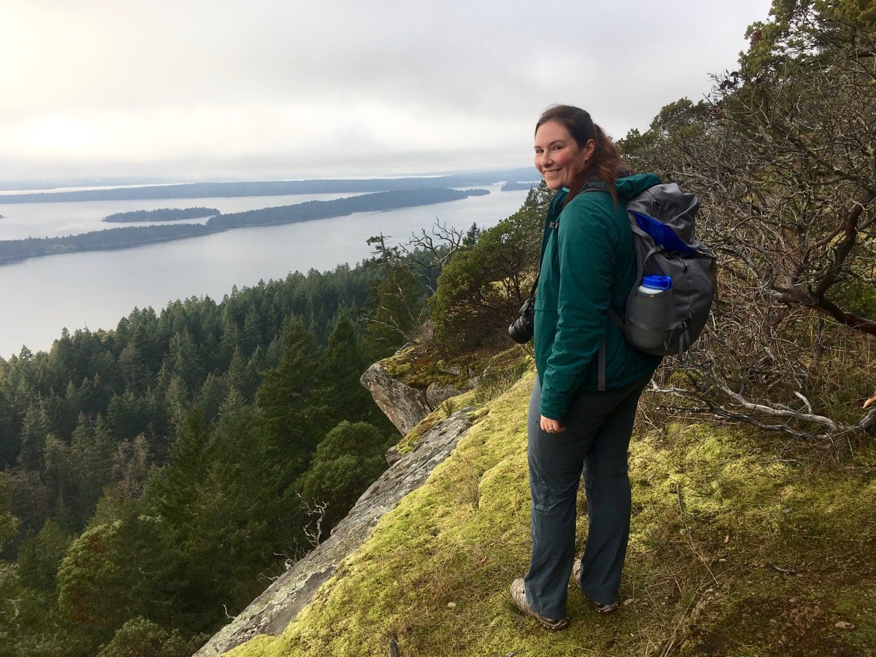
The path follows the cliff for another couple of kilometers, ducking in and out of groves of arbutus trees and manzanita bushes as you get more views to the north as well. Turn around whenever you’ve had enough, or when the trail starts to go sharply downhill.
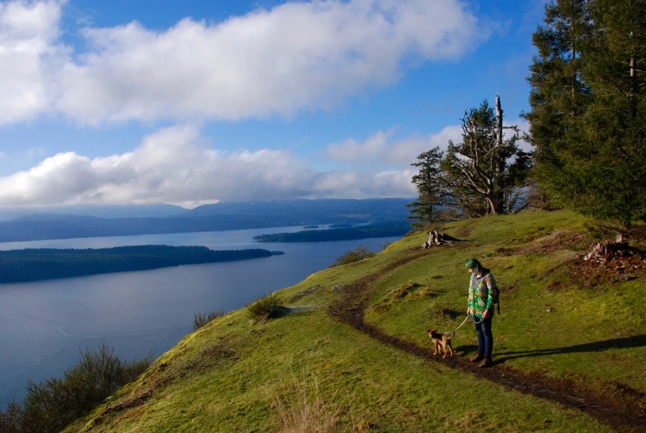
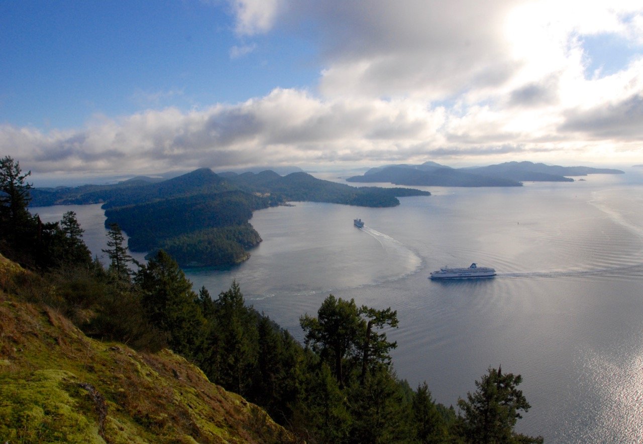
Hiking to the Summit of Mount Galiano
Fittingly the highest point on Galiano Island is Mount Galiano, standing tall at a whole 311 meters high! The hike up to the top follows locally maintained trails and some forest roads and has nothing special to see, but that’s not why you hike here. You hike here for the spectacular view! You emerge from the trees onto an open bluff with a little grove of Garry Oaks and an incredible view down to the ferries doing tight turns to get through Active Pass.
It’s a great spot to bring a picnic lunch. The hike is about 6km round trip and gains about 250m in elevation so it’s a steady climb uphill but never exceptionally steep. There are four different trailheads but they all meet up and share the same trail to the top and all junctions have little laminated signs. I like the Alistair Ross trail from Georgeson Road since it has the easiest parking and it isn’t too steep.

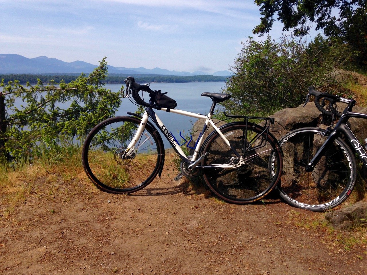
Biking the Length of the Island
All of the Gulf Islands are a road cyclists dream: good pavement, little traffic and lots of good views. The only downsides are the hills (so many little hills) and the lack of shoulder. But if you are in reasonable shape, you’ll do fine. Since Galiano is a long and narrow island the only logical route is to cycle from the ferry terminal in the south to the end of the paved road in the north, and then back, covering about 50 scenic kilometers along the way. On the weekends you can probably time the morning and early evening ferries so that you can do this as a day trip and avoid bringing your car but it’s also a great outing if you are staying the night on the island. The nicest biking on Galiano is the 10 or so kilometers at the northern end of the island which are mostly flat and often have views of the ocean.
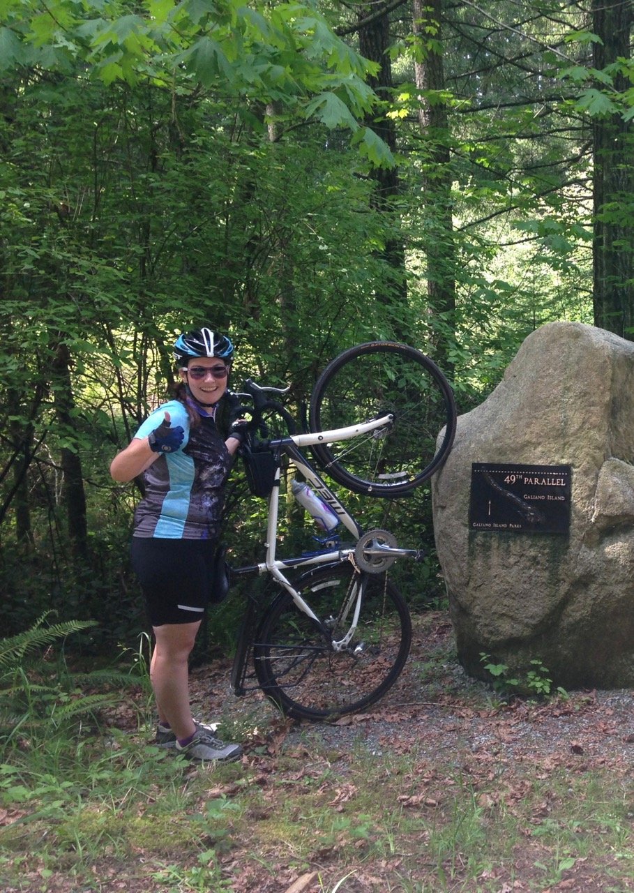
There are a couple of great places to stop along the way including a few marked beach access trails down to pocket coves, the Lover’s Leap roadside viewpoint, a cairn marking the 49th parallel and the Tapovan Sri Chinmoy Peace Park which has walking trails and an outhouse (the only public washroom on the route).
These are just some of the most popular outdoor adventures on Galiano – my sister tells me there are many more so I’ll just have to go back and see. Have you hiked on the Gulf Islands? Tell me about it in the comments.
Read Next
Hiking the Big Tree Trail on Meares Island


- Things to Do on Newfoundland’s Great Northern Peninsula - July 29, 2026
- Best Sun Hoodies for Hiking - June 3, 2026
- Lower Stein Valley Trail Hiking and Backpacking Guide - May 27, 2026
christina
Friday 3rd of July 2020
Hey Taryn! Do you think a road bike would do ok around the island?
Taryn Eyton
Monday 6th of July 2020
Most of the roads are paved but some are gravel - I rode my cyclocross-style bike on Galiano. It's a road bike with wide tires. As long as you don't have really skinny tires on your road bike, you should be fine. And even then, a road bike with skinny tires will be fine on almost all roads.
Clare
Wednesday 10th of May 2017
Would you recommend stopping at Dionisio Park if cycling the length of the Island? Some resources are telling me that it's possible to enter the park on foot, but is there any place to park your bike, and can you hike into the park easily? We're going to do a cycling tour of the Gulf Islands in June, I'm getting really excited about it!
Taryn Eyton
Wednesday 10th of May 2017
Hi Clare. I haven't actually been to Dionisio so I can't comment on access directly, but I do know people who have cycled there. There are a few things to keep in mind if you do plan to go: the route to Dionisio is actually on the east side of the island - the main route up and down the island is Porlier Pass road. If you follow Porlier pass road to its northern end you'll get to the First Nations reserve and you can't get to Dionisio from there.
Instead you need to turn off Porlier pass road at Vineyard road which turns into Bodega Beach Road. I've heard you can follow Bodega Beach road north to Dionisio but the road is a private road. It is gated near the beginning and there are signs saying it is private and that trespassing is not allowed. A few years ago, I heard about people cycling or walking it without any trouble but more recently I have heard that the land owners don't like people using the road to get to the park. My advice would be not to use the private road as it is private property.
c
Thursday 19th of May 2016
Thx for this report. I'm planning a day trip there in July. Have you done the walk from ferry to trailhead? We aren't taking cars or bikes...Seems that it would add about 8km to the 12km hike?
Taryn Eyton
Thursday 19th of May 2016
I haven't done the walk from the ferry terminal but it is about 4km one way. The hike of Mount Galiano is 6km return (so only 3km each way) - that makes the walk to the trailhead longer than the hike. Here's a link to goolge maps with the directions from the ferry to the trailhead https://goo.gl/maps/pgV1hStzAZr. Google says it will take an hour to walk. But the hike is worth it and the walk to the trailhead is mostly on quiet side roads.
Another option would be to try to follow some of the local trails rather than taking the road the whole way. Have a look at the trails in Bluffs Park to plan your route. I haven't gone this way but it could be an interesting option: http://www.galiander.ca/galianotrails/galianosouthtrails.html
Let me know how it goes!