
I’ve hiked to lots of alpine lakes near Vancouver, but so far I haven’t made it to the famous Rocky Mountains in Colorado. And that’s a shame since there are so many awesome hikes in Colorado. So I’m pretty stoked about this post. It’s from Colorado local Sarah Maurer of missadventurepants.com. She gives us a run-down on the 11 most beautiful lake hikes in Colorado. (Spoiler: these lakes are gorgeous! Brb… booking a trip to Colorado ASAP) Thanks Sarah! -Taryn
Hey there: Some of the links in this post are affiliate links, which means I earn a small commission at no extra cost to you if you make a purchase. Thanks for your support! -Taryn
Nothing lowers your blood pressure faster than sitting among the wildflowers beside a beautiful mountain lake. Alpine lakes delight the eye with dashes of colour and reflections that can make the surrounding scenery seem twice as grand. So in this post, we’ll look at 11 of the best lake hikes in Colorado, a state known for its challenging trails and dramatic scenery.
A quick note on this list: I’ve been a Colorado resident since 1999 and I’m a former backpacking guide. I compiled this list of Colorado’s most Instagrammable lakes by reviewing 20 years worth of my own photos. I tried to include both some classics and some hidden gems that don’t normally make these types of lists. But I’m sure there are some amazing ones that I don’t even know about, so feel free to add your favorites in the comments.
This is a sensitive wilderness area. Learn how to Leave No Trace to keep the wilderness wild. Make sure you are prepared by bringing the 10 Essentials. Get ready for adventure with this checklist of things to do before every hike.
Colorado Hiking Tips
If you’re new to Colorado hiking, know that this state presents some unique hazards due to high elevation and the changeability of the weather. Here are some tips for a safe, enjoyable hiking vacation in Colorado:
- If coming from sea level, consider spending a night in Denver or Boulder and a day or two relaxing in the mountains before hiking. This helps your body adjust to the higher elevations and can help to prevent altitude sickness.
- The sun is very strong at altitude. Use good sun protection. (My dermatologist recommends 50+ with minerals like zinc or titanium.)
- Most of the lakes on this list can be hiked year-round, but you may need winter clothing, snowshoes and avalanche training to reach them between November and June. Colorado’s trails are usually snow-free from July to September, with new snow accumulation beginning in October.
- The Colorado Rockies have significant lightning danger in the summer. Start hiking early to beat the crowds and avoid afternoon thunderstorms. If you’re going above tree line, be sure to come back below it before noon.
- Be cautious when walking on frozen lakes. Colorado’s hot sun can melt weak spots in the ice, even when it’s below freezing. Avoid the ice if you see puddles or mushy spots.
- If you are hiking in winter, be aware of avalanche danger. You can learn about Colorado’s avalanche hazards and check the forecast at the Colorado Avalanche Information Center (CAIC, pronounced “cake”).
- Many of these lakes are in sensitive, heavily traveled areas. Be sure to follow Leave No Trace practices to preserve their beauty for future hikers.
Looking for a Good Guidebook to Help You Plan Your Hikes?
Definitely consider grabbing a copy of Colorado Lake Hikes by Dave Muller. It covers 100 hikes to 145 lakes around the state. The book is printed on durable, water resistant paper and meant to be carried in your backpack!
East Rocky Mountain National Park Lake Hikes
Rocky Mountain National Park is a truly breathtaking area and a great introduction to Colorado. Most visitors enter through the east side of the park near the town of Estes Park. When planning your trip, keep in mind that parking can be scarce at the eastern trailheads, especially in the summer. Rather than rising before the sun, consider taking the hiker shuttle from Estes Park. Note that the park also has entrance fees.
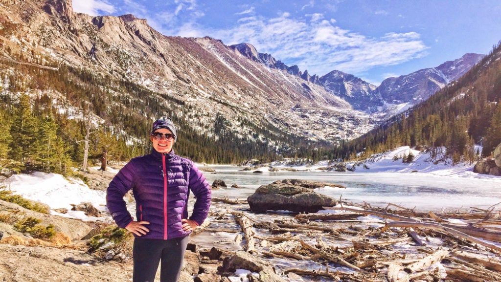
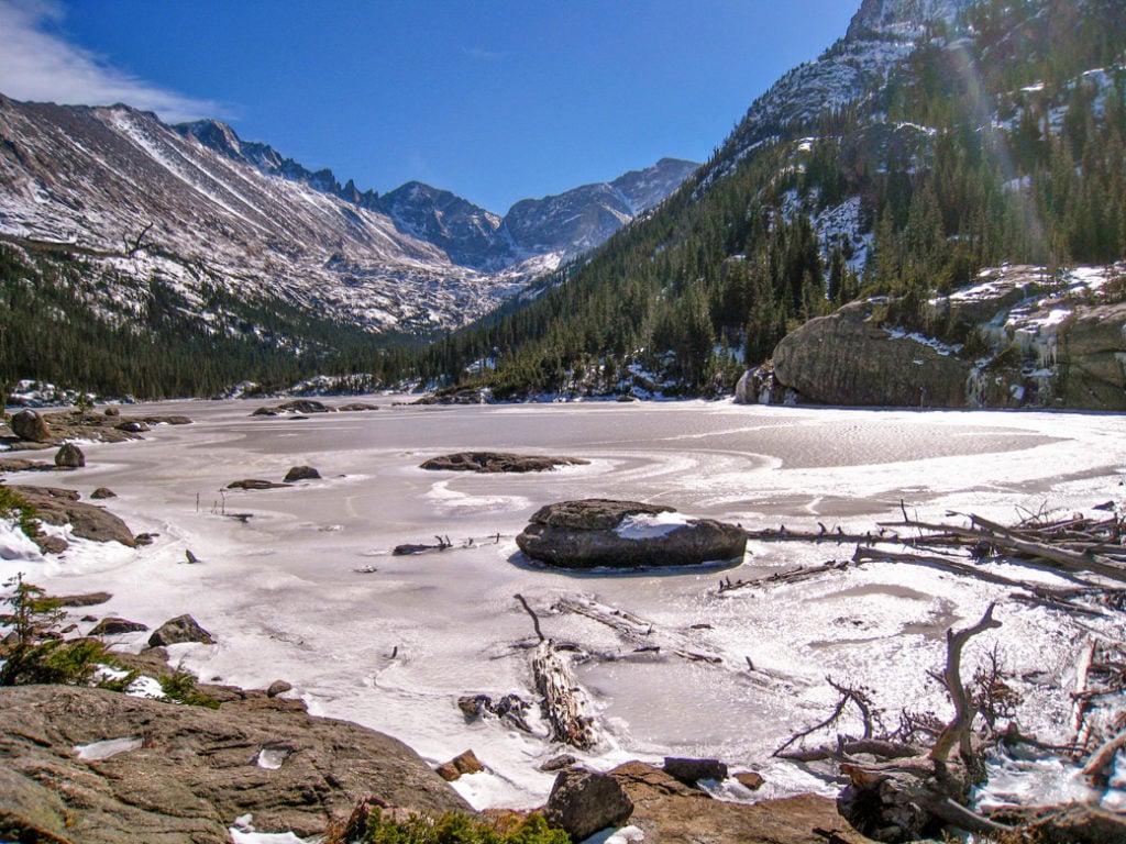
Chasm Lake
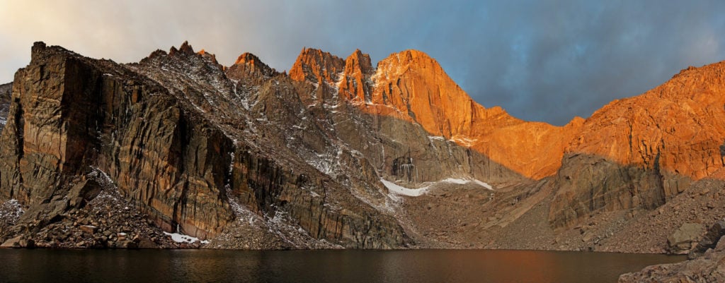

In my opinion, this is one of the most beautiful lake hikes in Colorado, and it’s definitely my favorite in Rocky Mountain National Park. You’ll begin by ascending above tree line on the Longs Peak trail. Look for the krummholtz, or elfin forest, as your emerge from the trees. These hardy plants have been twisted by the fierce winds and thin soil. You’ll soon turn into a valley filled with cascading waterfalls and colorful pools. The Chasm Lake trail crosses steep, rocky slopes that can be treacherous when snow-covered — save this hike for summer when the trail is dry! The lake itself lies just below the famous “diamond” face of Longs Peak, a Colorado 14er.
Trailhead: Longs Peak. Distance and elevation gain: 13.5 km (8.4 mi.), 749 m (2,456 ft.).
Max elevation: 3604 m (11,823 ft.).
Approximate hiking time: 5 hours.
Trail info: Rocky Mountain National Park, and this trip report at Miss Adventure Pants.
Driving directions: From Estes Park, drive 14 km (9 mi.) south on Colorado Route 7 to the well-signed Longs Peak Trailhead turn-off. Follow the road for about 1.6 km (1 mi.) to the parking lot. From the south, including Denver and Boulder, drive to the town of Lyons and follow CO-7 for about 48 km (30 mi.) to the trailhead.
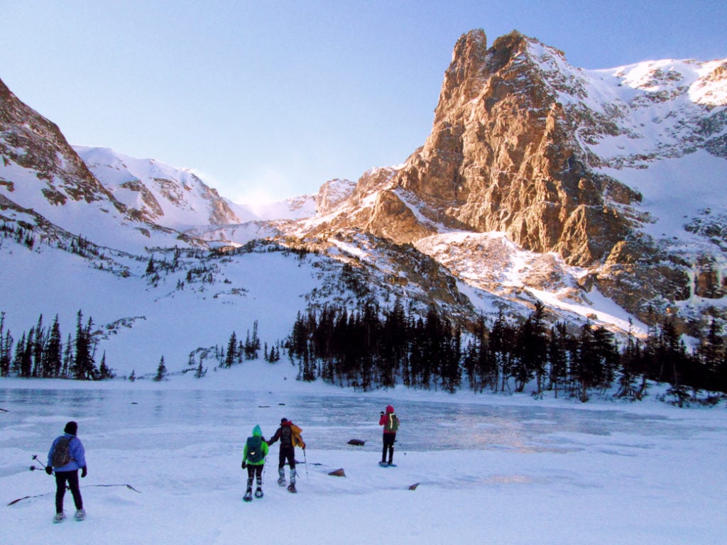
Nymph, Dream and Emerald Lakes
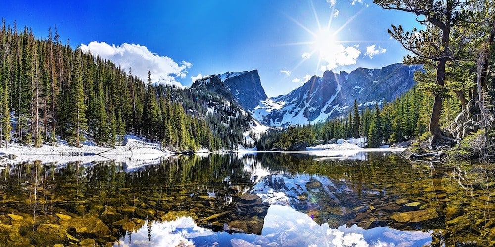


This short string of breathtaking lakes makes an excellent beginner hike or snowshoe. Start with a short jaunt to Nymph Lake, which will be covered with lilies in the summer. Just a few minutes later, you’ll be treated to a breathtaking vista of Hallett Peak over Dream Lake. The trail continues past Dream Lake, then climbs a bit to reach the aptly named Emerald Lake in a deep glacial cirque. You may see mountaineers climbing the couloirs (snow gullies) near Emerald Lake. Be aware that there is avalanche danger in the area; play it safe and stay near the trail unless you are trained in snow travel.
Trailhead: Bear Lake.
Distance and elevation gain: 5.6 km (3.5 mi.), 198 m (650 ft.) Max elevation: 3081 m (10,110 ft.)
Approximate hiking time: 2 hours.
Trail info: Rocky Mountain National Park
Driving directions: From Estes Park, take US-36 and enter Rocky Mountain National Park through the Beaver Meadows Entrance. Right after the toll booth, turn left onto Bear Lake Road and follow it for 16 km (10 mi.). The road ends at the Bear Lake Parking area.
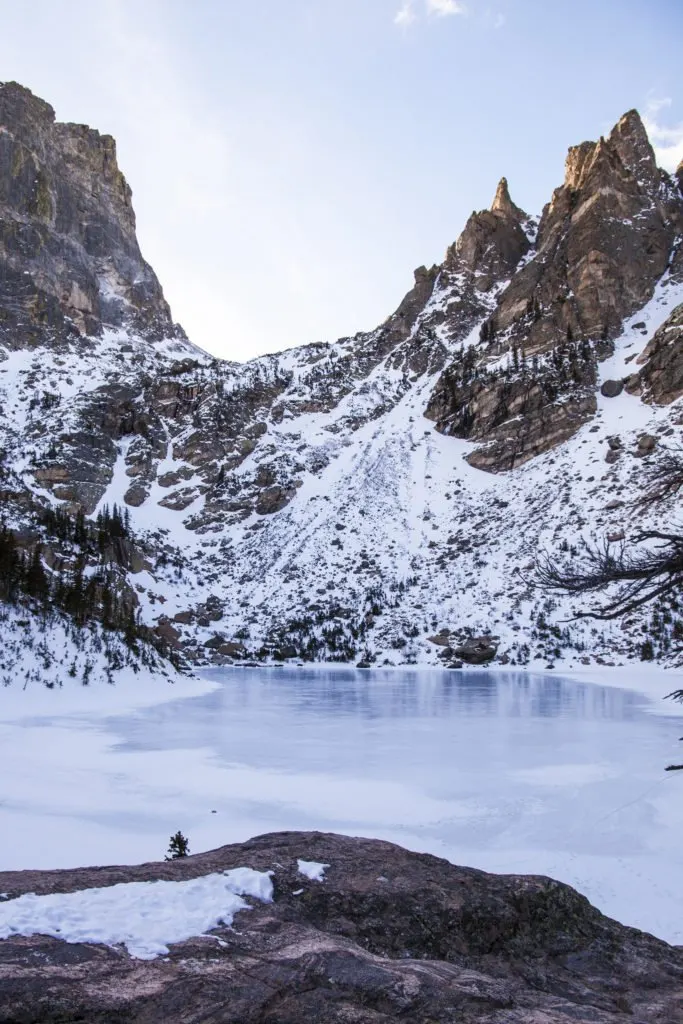
The Loch

Sitting just below tree-line, The Loch is a large, sub-alpine lake. Gazing across it, you’ll have wide, unobstructed views of some of Rocky Mountain National Park’s biggest peaks, including Thatchtop, the Shark’s Tooth (a favorite of technical rock climbers), and Taylor Mountain, which is home to a small glacier. The trail to the Loch also passes Alberta Falls, which is especially spectacular when frozen in winter. This moderate hike is a great introduction to the park for fit beginners and can be hiked or snowshoed year-round.
Trailhead: Glacier Gorge.
Distance and elevation gain: 8.7 km (5.4 mi)., 335 m (1,100 ft.). Max elevation: 3107 m (10,192 ft.).
Approximate hiking time: 3 hours.
Trail info: Rocky Mountain National Park
Driving directions: From Estes Park, take US-36 and enter Rocky Mountain National Park through the Beaver Meadows Entrance. Right after the toll booth, turn left onto Bear Lake Road and follow it for 13.5 km (8.4 mi.) to the Glacier Gorge Parking Area.
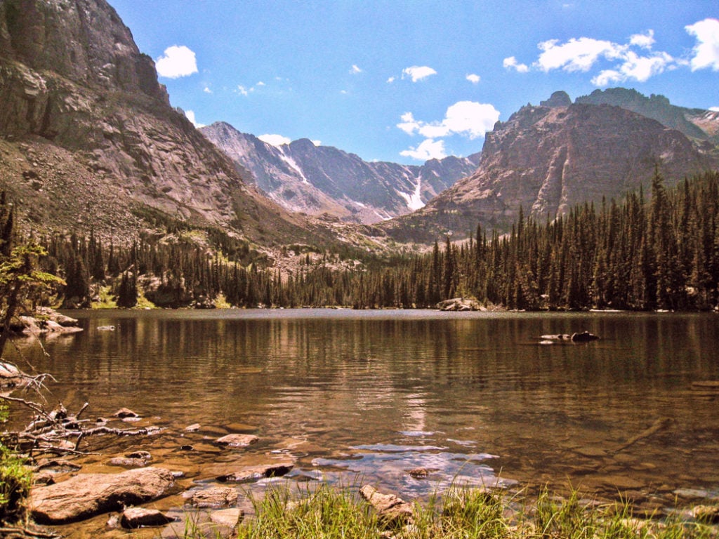
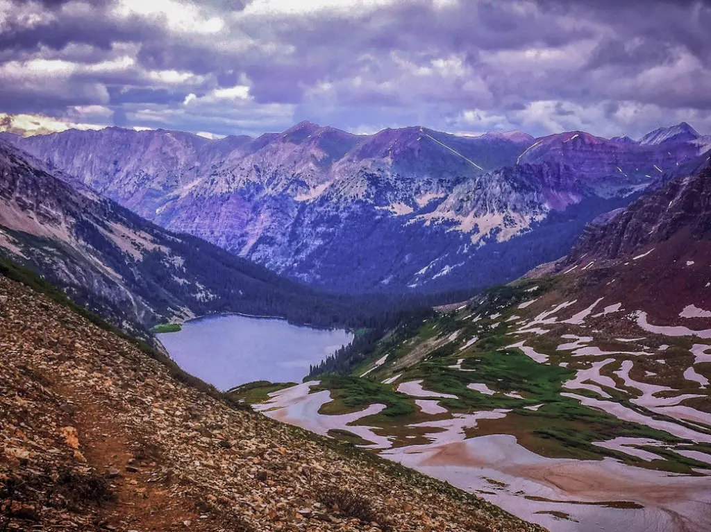
Mills Lake, Black Lake and Green Lake


This trifecta of jaw-dropping lakes has something for everyone. Beginners will enjoy hiking or snowshoeing to enormous Mills Lake and taking in spectacular views of the backside of Longs Peak. The rugged ridge on the peak’s shoulder is known as Keyboard of the Winds. From here, many parties continue to Black Lake, which lies just below McHenry’s Peak and the aptly named Spearhead. Continuing up to Green Lake takes a bit of route finding, so bring your map, compass, GPS and some basic skills. If you’re super ambitious, check out Frozen and Blue Lakes, also located in the upper basin.
Trailhead: Glacier Gorge.
Distance and elevation gain: 19.8 km (12.3 mi.), 910 m (3,000 ft.). Max elevation: 3521 m (11,555 ft.).
Approximate hiking time: 8 hours.
Trail info: see Rocky Mountain National Park and Hiking RMNP.
Driving directions: From Estes Park, take US-36 and enter Rocky Mountain National Park through the Beaver Meadows Entrance. Right after the toll booth, turn left onto Bear Lake Road and follow it for 13.5 km (8.4 mi) to the Glacier Gorge Parking Area.
Lake Helene

Lake Helene lies just off the main trail to from Bear Lake Trailhead to Odessa and Fern Lakes. It’s a small but spectacular lake with amazing views of Notchtop Mountain and the scrambling peak Little Matterhorn. Finding the lake can be a bit tricky, especially in summer when you don’t have a boot pack to follow. Look for an unmarked trail that splits off to the left about 5.1 km (3.2 mi.) from the trailhead. There may or may not be a cairn marking this spot. This hike also makes a great introduction to snowshoeing for fit beginners.
Trailhead: Bear Lake.
Distance and elevation gain: 10.5 km (6.5 mi.), 411 m (1,350 ft.). Max elevation: 3260 m (10,697 ft.).
Approximate hiking time: 3 hours.
Trail info: see Rocky Mountain Hiking Trails.
Driving directions: From Estes Park, take US-36 and enter Rocky Mountain National Park through the Beaver Meadows Entrance. Right after the toll booth, turn left onto Bear Lake Road and follow it for 16 km (10 mi.). The road ends at the Bear Lake Parking area.
West Rocky Mountain National Park Lake Hikes
Looking to escape the crowds in Rocky Mountain National Park? Heat west across Trail Ridge Road, or drive to the western park entrance near Granby. It’s not exactly solitude at the height of summer, but it’s way quieter than Bear Lake. Note that the park has entrance fees.
Lake of the Clouds
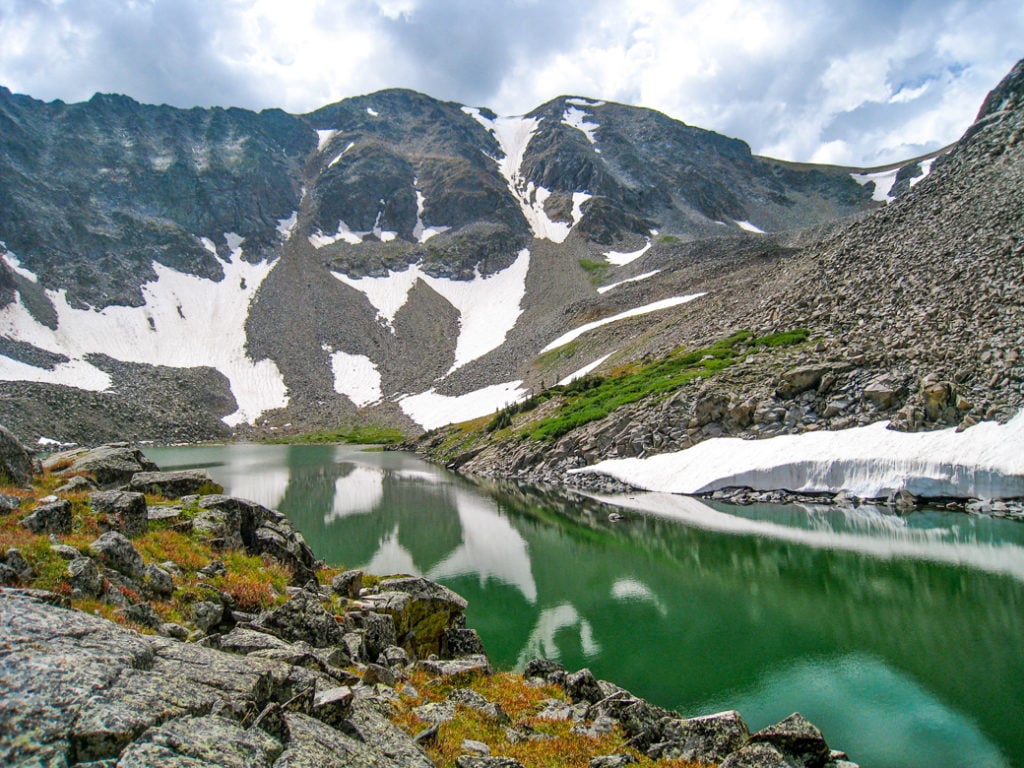

This stunning alpine lake lies just above treeline and makes a rewarding day hike for experienced hikers. To reach it, you’ll need to travel 11.2 km (7 mi.) one way and route find yourself across a wide boulder field that for some reason seems to be a favorite habitat of spiders. Bring a map, compass, and GPS and be prepared to navigate. Note that the cairns in the area may be misleading! Your reward for perseverance is a spectacular, emerald-colored lake that you might have all to yourself, even in summer.
Trailhead: Colorado River.
Distance and elevation gain: 22.5 km (14 mi.), 731 m (2,400 ft.). Max elevation: 3484 m (11,430 ft.).
Approximate hiking time: 9 hours.
Trail info: see Rocky Mountain Day Hikes
Driving directions: From the Denver area, drive to the town of Granby, then take US-34 (Trail Ridge Road) for 19 km (12 mi.) to the Colorado River Trail parking area. Note that Trail Ridge Road closes seasonally; check COtrip.org for updates.
Aspen Area Lake Hikes
Aspen is located on Colorado’s western slope about 4 hours from Denver. The Elk Range dominating the skyline is home to many of Colorado’s most demanding mountaineering routes. But with a little preparation and fitness, you can safely enjoy some astounding lake hikes in this beautiful area.
Capitol Lake
Capitol Peak is widely considered Colorado’s most difficult 14er (peak over 14,000 ft. or 4267 m), but you don’t have to risk your life to enjoy the beautiful blue lake at its feet. The approach hike is long and occasionally steep, but you’ll forget it all when you see one of Colorado’s tallest peaks reflected in Capitol Lake’s waters. To truly appreciate the color of this lake, take a stroll up the first part of the Capitol Peak Trail and enjoy the views from above. If you’d like to make this long day hike into an overnight backpacking trip, snag one of the dispersed camping spots in the area.
Trailhead: Capitol Creek.
Distance and elevation gain: 21.2 km (13.2 mi.), 1006 m (3,300 ft.). Max elevation: 3535 m (11,597 ft.).
Approximate hiking time: 8 hours (makes a great backpack).
Trail info: see 14ers.com.
Driving Directions: From Glenwood Springs, drive 42 km (26 mi.) southeast on CO-82 and turn right on Snowmass Creek Road. Continue 16 km (10 mi.) to the trailhead. The upper section of the road is easy 4WD and requires good clearance.
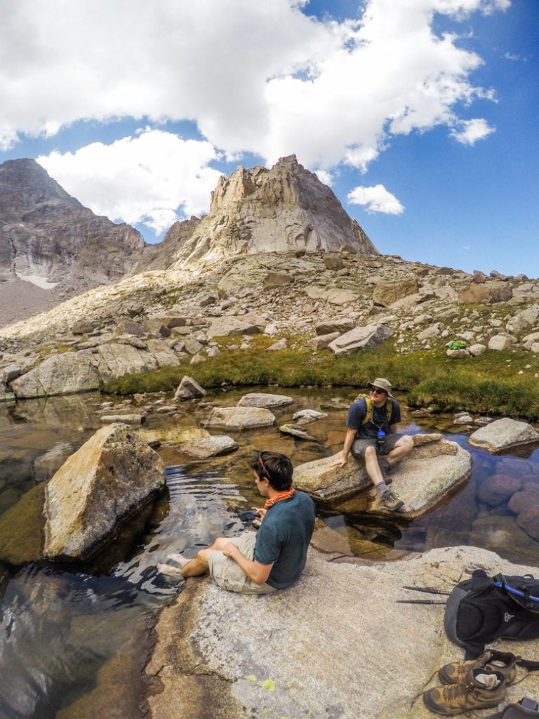
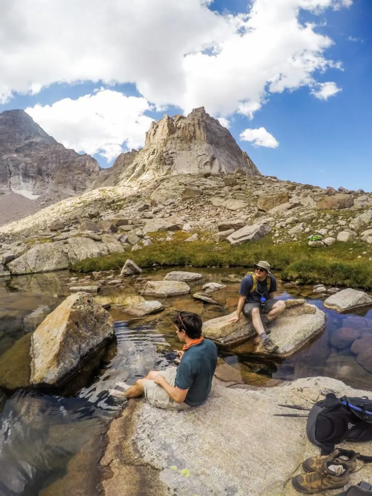
Snowmass Lake

It’s a challenge to reach this lake at the foot of Snowmass Mountain (a Colorado 14er). But when you get there, the views of the towering mountain and its reflection will set your imagination running wild. Along the way, you’ll summit Buckskin Pass, where you’ll be treated to slightly sinister views of jaggy Pyramid Peak (also a 14er). While it’s possible to knock this one out in a long day hike, I highly recommend camping at Snowmass Lake and waking up to views of the morning light on Snowmass Mountain. Note that bear canisters are required for overnight visits to the Maroon-Snowmass Wilderness Area and campfires are prohibited. For the best views, continue up the trail toward Trail Rider Pass and watch Snowmass Lake emerge from above.
Trailhead: Maroon Lake.
Distance and elevation gain: 27.4 km (17 mi.), 1463 m (4,800 ft.) Max elevation: 3798 m (12,462 ft.) at Buckskin Pass.
Approximate hiking time: 12 hours.
Trail info: see AllTrails
Driving Directions: From Aspen, follow Maroon Creek Road for 15.3 km (9.5 mi.) to the trailhead. Entrance fee is $10/car. Note that traffic on the road is restricted during the summer, so consider taking the shuttle bus from Aspen Highlands ($6).
Hanging Lake
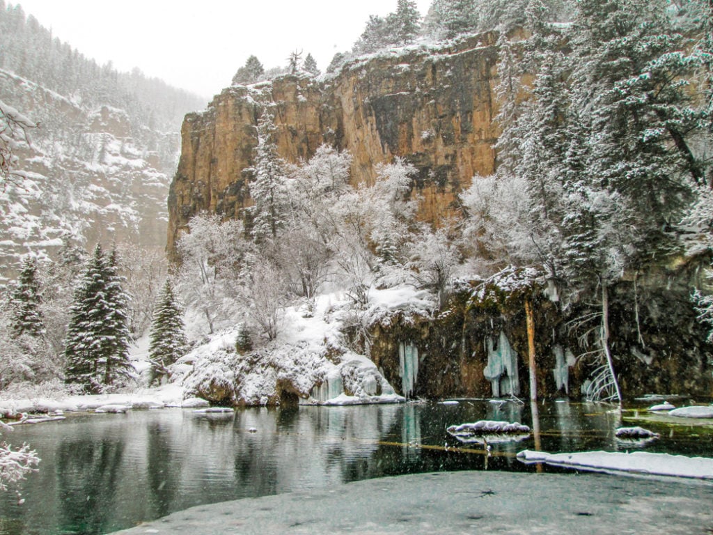
Many visitors ask if Hanging Lake, one of Colorado’s most popular hikes, is a tourist trap. My answer: it’s incredibly beautiful and worth seeing — especially now that steps are being taken to protect and preserve this fragile mini-ecosystem. Hanging Lake lies in a type of soft limestone called travertine. Dissolved travertine gives the lake a brilliant green-blue color and also creates unique rock formations around its edges. The springs feeding Hanging Lake create fantastic blue ice sculptures in the winter. The trail to the lake is short but steep. Snowshoes aren’t usually required, but foot traction may be helpful if you visit in winter.
Important: Beginning in May 2019, you must have a permit to visit Hanging Lake. Permits cost $10–$12, depending on the date of your visit. Check the Visit Glenwood website for permit info.
Trailhead: Hanging Lake November–April, or shuttle bus from Glenwood Springs Hanging Lake Welcome Center in peak season.
Distance and elevation gain: 3.9 km (2.4 mi)., 335 m (1,100 ft.). Max elevation: 2232 m (7,323 ft.).
Approximate hiking time: 2 hours.
Trail info: US Forest Service web page and trail fact sheet and Visit Glenwood website.
Driving Directions: Parking is permitted at the trailhead from November through April. From Glenwood Springs, head east on I-70 for 12.8 km (8 mi.) and take Exit 125 for Hanging Lake. Note that there is no westbound access to the trailhead from I-70. From May to October, visitors must take the shuttle from the Hanging Lake Welcome Center in Glenwood Springs.
South West Colorado Lake Hikes
The San Juan Mountains of southwest Colorado are considered the state’s most rugged and beautiful. While not exactly quiet, these trails are far less crowded than some of the famous hikes on the Colorado front range. You may recognize the scenery from these two classic lake hikes from calendars or postcards!
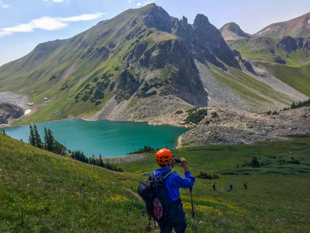
Ice Lakes Basin (Ice Lakes, Island Lake)
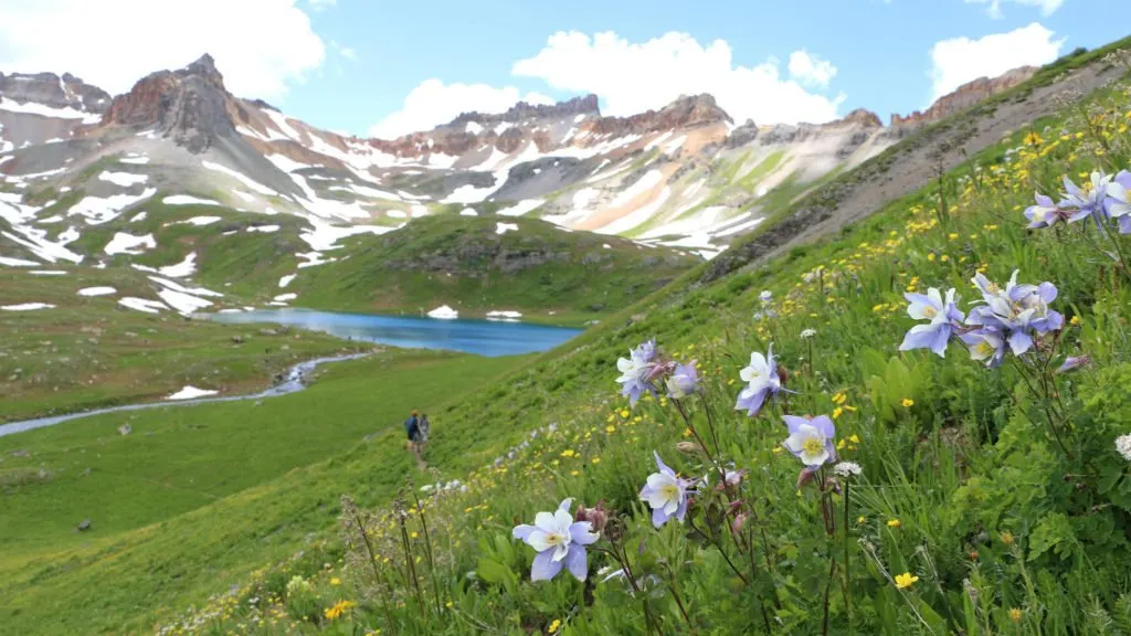
These brilliant blue alpine lakes near Silverton are considered to be some of Colorado’s most beautiful. The area is especially sublime in July and August when the wildflowers are at their peak. From the trailhead, follow the trail past Lower Ice Lake, which is a spectacular destination in itself. From here, separate valleys lead to Upper Ice Lake and Island Lake. Choose one, or hit both in a single extended day hike. You’ll also enjoy waterfalls, towering 13ers, and mining ruins throughout this hike.
Trailhead: South Mineral Campground (arrive early; parking is limited).
Distance and elevation gain: 13.5 km (8.4 mi.), 792 m (2,600 ft.) to Island Lake. Max elevation: 3777 m (12,392 ft.). At Island Lake.
Approximate hiking time: 6–8 hours.
Trail info: see Hiking & Walking, US Forest Service, and Rocky Mountain Hiking Trails.
Driving Directions: From Silverton, drive 2.3 km (2 mi.) north on Highway 550 to County Road 7 and turn left. Follow this gravel road for 7 km (4.4 mi.) The trailhead parking area is on the right side of the road across from the campground.
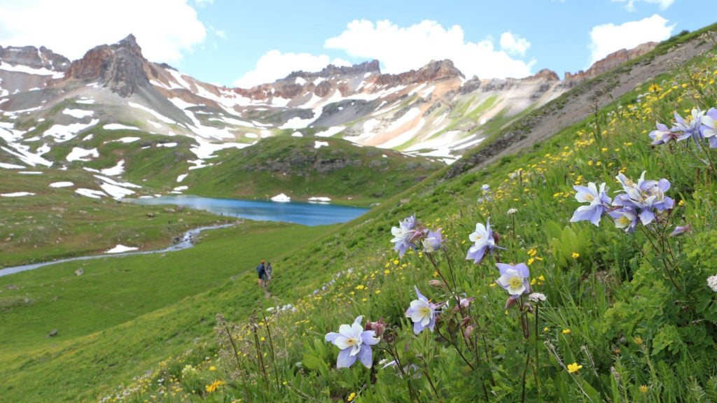
Blue Lakes
Like the idea of looking across an otherworldly blue alpine lake at Mt. Sneffels (14,150 ft./4312 m)? Then this one is the lake hike for you. The Blue Lakes trail is actually part of a thru hike that leads past the Blue Lakes, over the shoulder of Mt. Sneffels, and ends in Yankee Boy Basin. For a pleasant day hike, climb past two alpine lakes and make an optional ascent to the ridge for sweeping views.
Trailhead: North Blue Lakes Trail.
Distance and elevation gain: 13.8 km (8.6 mi.), 731 m (2,400 ft.). Max elevation: 3572 m (11,720 ft.).
Approximate hiking time: 6 hours.
Trail info: Hiking & Walking, US Forest Service, and Rocky Mountain Hiking Trails.
Driving Directions: From Ridgway, head west on Highway 62 and continue for approximately 7.7 km (4.8 mi.) to the intersection with County Road 7, East Dallas Creek. Continue on CR 7 for about 14.5 km (9 miles) to the parking area.
So there you have ‘em, the 11 best lake hikes in Colorado, according to one long-time local. Have you tried any of these hikes? Do you have any to add to the list? Comment below to share.
- The 11 Most Beautiful Lake Hikes in Colorado - March 28, 2019
acevisiontreks
Thursday 8th of September 2022
Thank you so much for sharing an informative post, Colorado is on my bucket list for travel.
nathan
Monday 3rd of August 2020
Hi,
The picture of dream lake is superbe. Do you have the name of the author?
Thanks!
Taryn Eyton
Monday 3rd of August 2020
the photo is a free stock image credited to a user named skeeze on Pixabay
Kay
Saturday 13th of April 2019
WOW. I'd love to do ALL of these, especially that last one at Blue Lake! I'm such a sucker for alpine lakes AND for Colorado, so, of course, reading your post and seeing these photos was a TOTAL dream :)
Sophie van der Meulen
Friday 12th of April 2019
These all sound amazing! Pinning for my upcoming US trip
Lisa
Friday 12th of April 2019
Colorado is definitely on our bucket list to visit and go hiking. Thanks for all of the tips.