
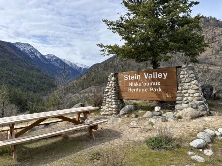
The Lower Stein Valley Trail near Lytton, BC, is one of my favourite places. I’ve made 8 hiking and backpacking trips to the eastern portion of Stein Valley Nlaka’pamux Heritage Park over the years. It is southern BC’s only intact watershed and is a truly special place.
There are a few reasons why I love the Lower Stein Valley. First, it has a unique microclimate, which means it is warmer and drier than other areas. It’s fiery hot in the summer, but it makes an ideal spring and fall trip. (It’s on my list of the best spring backpacking trips in BC.)
Secondly, the trail is mostly flat and fairly easy. It also has four backcountry campgrounds, so it’s a great backpacking trip for beginners, families, or times when you just want a laid-back hike. (It’s on my list of the best easy backpacking trips in BC.)
Thirdly, it’s an incredibly important spiritual place for the local Nlaka’pamux Nation and is home to one of Canada’s largest pictograph panels. I’m not a religious person, but feeling the vibration of spring flood waters bounce off the cliffs while admiring the pictographs is a spiritual experience.
I’ve been visiting this area for two decades, but recently it underwent a huge change: the 2023 wildfires affected huge swaths of the Lower Stein Valley. Thankfully, most of the trail was spared, but the views are now of charred slopes rather than verdant green. I’ve got more info about what the trail looks like now in the trail description below.
I’m a hiking guidebook author and have hiked all over BC, so I’ve put together a detailed Lower Stein Valley hiking and backpacking guide for you. It includes:
- Quick facts about the Lower Stein Valley, including distance, how long to spend, best time to go, and more.
- A custom map that shows all the campgrounds
- Detailed trail description, broken down into sections with distances and elevation gain
- Camping info for each of the four campgrounds on the trail
- Lower Stein Valley itinerary options, from day hikes to backpacking trips
- How to get to the Lower Stein Valley, including ferry info
- Info on the Indigenous pictographs in the valley
- Tips for hiking in the Lower Stein Valley – advice for bears, weather, and more
This is a sensitive wilderness area. Learn how to Leave No Trace to keep the wilderness wild. Make sure you are prepared by bringing the 10 Essentials. Get ready for adventure with this checklist of things to do before every hike.
Hey there: Some of the links in this post are affiliate links, which means I earn a small commission at no cost to you. Thanks for your support. -Taryn
Lower Stein Valley Quick Facts
Route Overview: The trail follows the Stein River upstream from its mouth near Lytton to Earl’s Cabin Camp. The route stays close to the river, passing several campgrounds as well as viewpoints and Indigenous pictographs. Note: This route is the eastern-most part of the much longer (and often impassable) Stein Valley Traverse.
Distance: 4 to 20 km round trip
Elevation Gain: 80 to 630 m
Difficulty: Easy
Duration: 2 days
Best Time to Go: April to October
Reservations and Fees: None. Campsites are free and are first come, first served.
Indigenous Context: This area is in the traditional territory of the Nlaka’pamux Nation. It is a very important cultural and spiritual place for the Nlaka’pamux, so please remember you are a visitor here and be respectful.
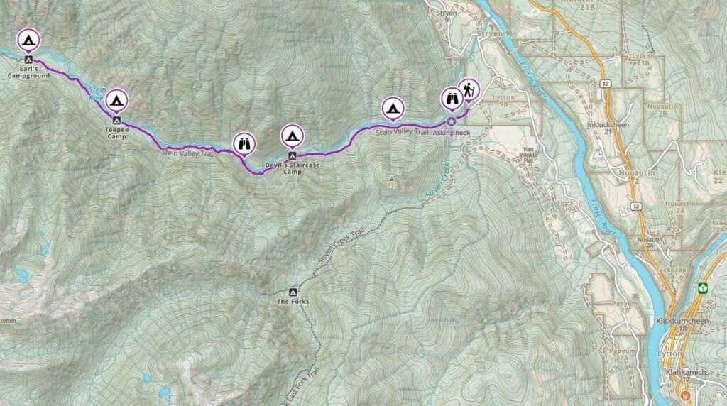
Lower Stein Valley Trail Map
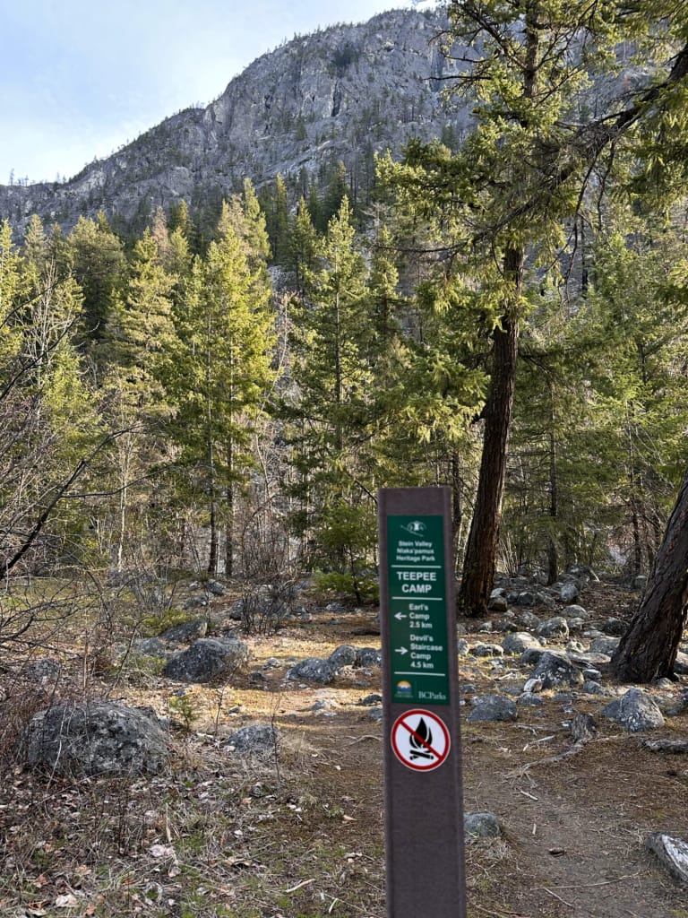
For the most part, the trail in the Lower Stein Valley is very well-marked and easy to follow. There are signs at every campsite.
I used the Gaia GPS app on my hikes. It is helpful to know where I am on the trail to figure out how much higher I have to climb and where the next viewpoint is. All Trails+ is also great.
I also made you a trail map using Gaia GPS. Click through to zoom in and explore. You can also save it to your routes in Gaia GPS or export the GPX file.
PS: Want to save 10% on a premium subscription to Gaia GPS (the app I use for all my hikes)? Use my link – the discount appears in cart.
Join the Backpacking in BC Facebook Group
Lower Stein Valley Trail Description
The route described here is an easy hike through the Lower Stein Valley near Lytton. It’s the eastern-most part of the much longer (and sometimes impassable) Stein Valley Traverse. I’ve chosen to highlight the route from the trailhead up to Earls Cabin Camp since it has the easiest and most beautiful trail. It’s also frequently maintained, unlike the rest of the trail upstream.
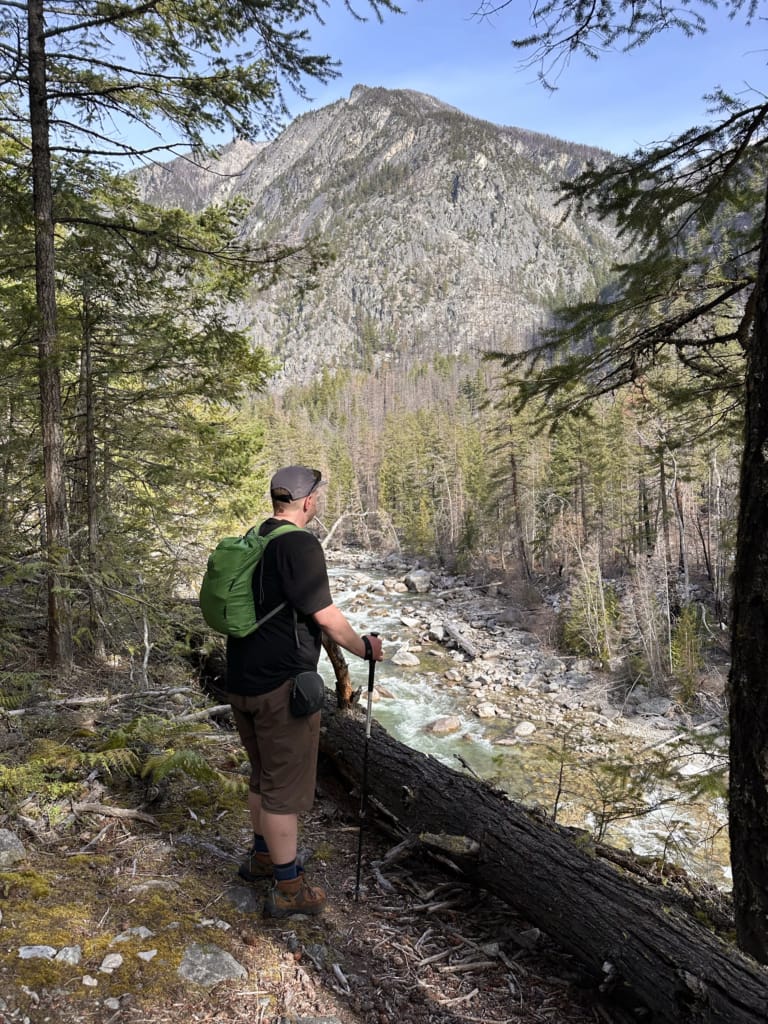
It’s worth noting that some sections of the Lower Stein Valley burned in the 2023 wildfires. Most of the damage in the lower part of the valley is on the north side of the Stein River, which is the opposite side of the river from the trail.
While most of the trail I describe in this post is unburned, there are a few burned sections, especially between Teepee Camp and Earl’s Camp. Despite this, I think the Stein Valley is still beautiful and worth hiking. There’s something special about watching a landscape begin to grow again.
Read on for my detailed description of the Lower Stein Valley hike.
Key Locations
| KM | Elevation | Landmark |
|---|---|---|
| 0 km | 240 m | Trailhead |
| 0.5 km | 230 m | Asking Rock |
| 1.7 km | 290 m | Loop Camp |
| 3.8 km | 370 m | Devil’s Staircase Camp |
| 5.1 km | 410 m | Pictographs |
| 8 km | 430 m | Teepee Camp |
| 10.2 km | 460 m | Earl’s Cabin Camp |
Trailhead to Loop Camp
Distance: 1.7 km
Elevation Gain: 45 m
Elevation Loss: 45 m
Hiking Time: 20 to 30 minutes
The trailhead parking lot has an outhouse, picnic tables, a shelter, and some interesting info plaques that explain the history of the area. It’s worth reading them before starting your hike.
While there is a rough and steep trail directly from the parking lot, it’s worth walking a few metres back down the road to the official trailhead at the big Stein Valley Nlaka’pamux Heritage Park sign. It makes a great photo op and has good views of the Stein River Valley.
From the sign, descend slightly to river level and follow the trail for a few minutes to a wooden bridge across Stryen Creek.
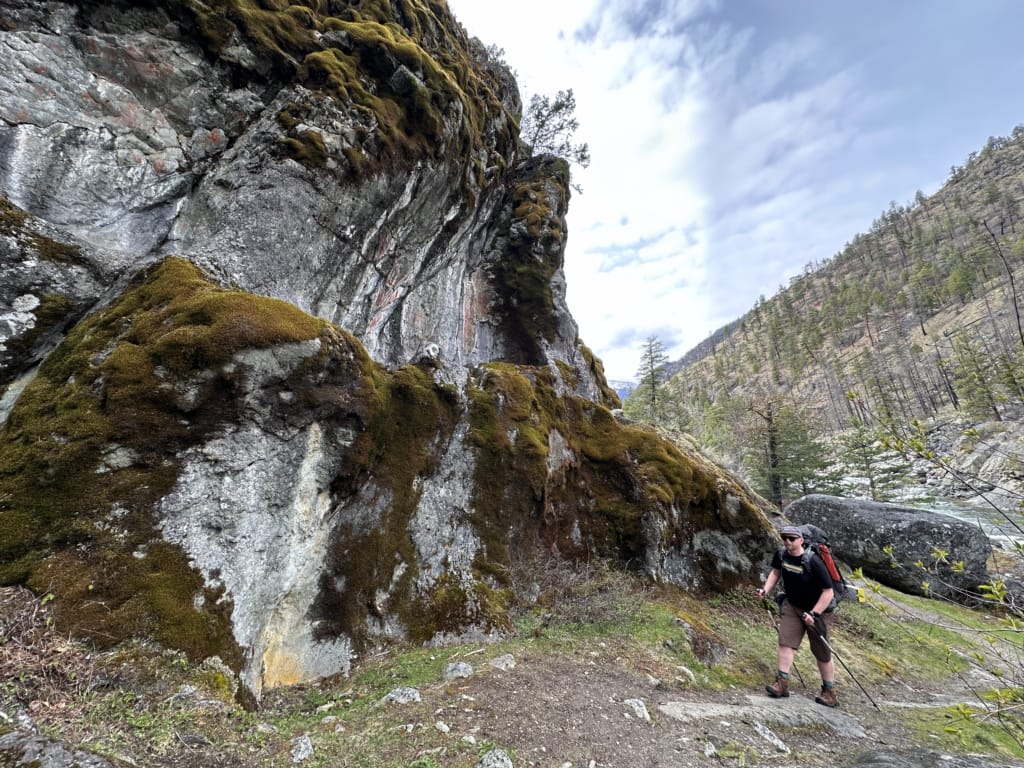
Just past the bridge, arrive at a prominent rock outcropping called the Asking Rock. This is an important spiritual place for the Nlaka’pamux Nation since it marks the entrance to the sacred Stein Valley. If you look up, you’ll see red pictographs on the rock. You may see offerings left on the rock shelf. Respect this area and do not leave your own offerings.
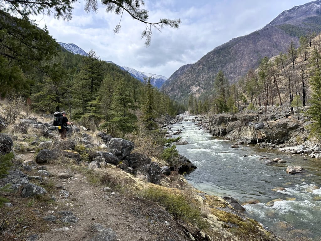
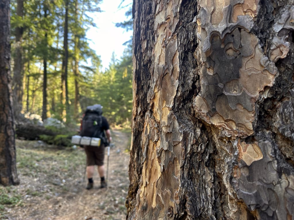
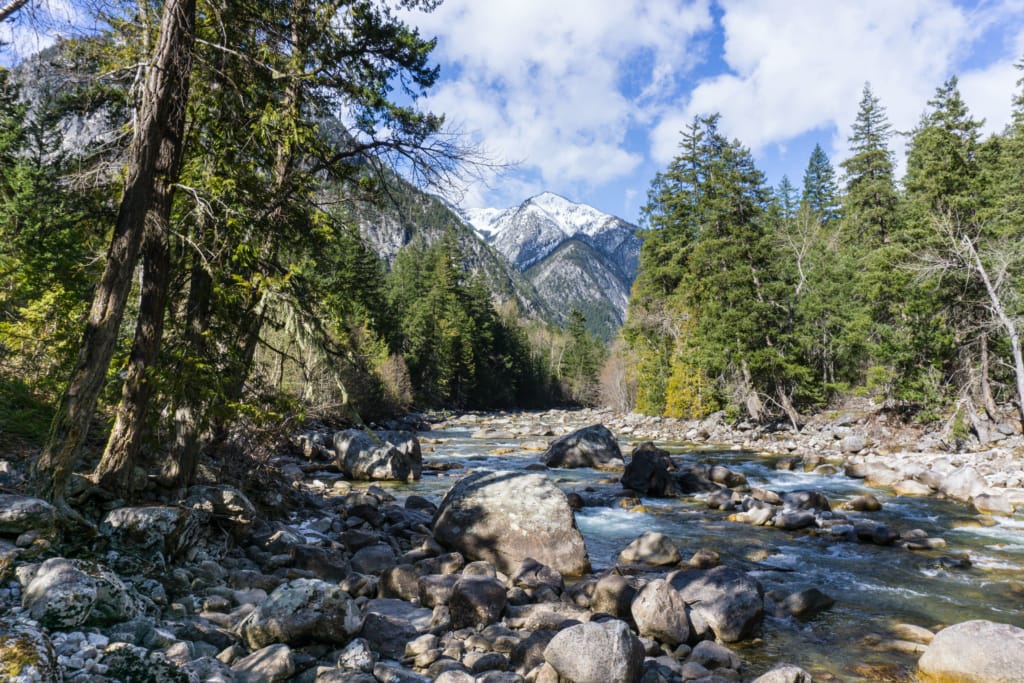
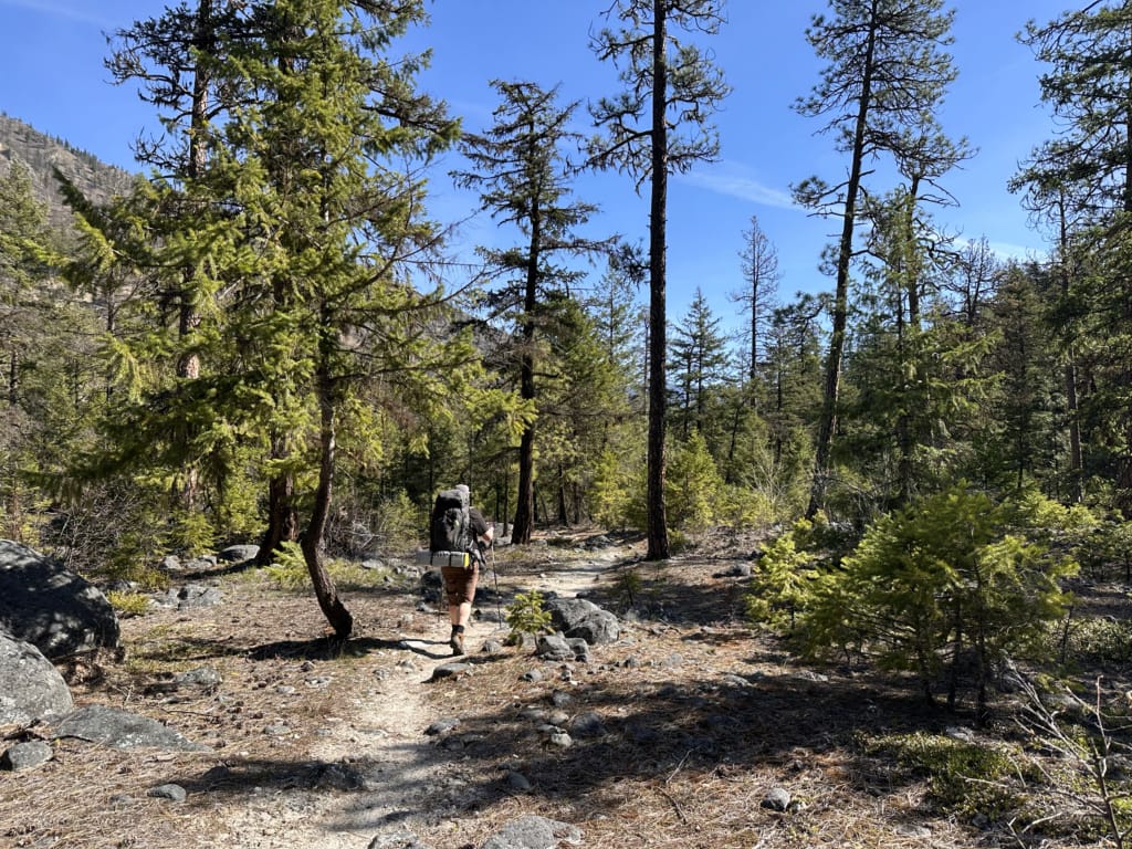
Continuing on from the Asking Rock, the trail leads through open ponderosa pine forest with its intriguing puzzle piece bark. The river is just out of sight through the trees to your right. This is one of my favourite sections of the trail since it is such a different ecosystem than we typically find in Southwestern British Columbia.
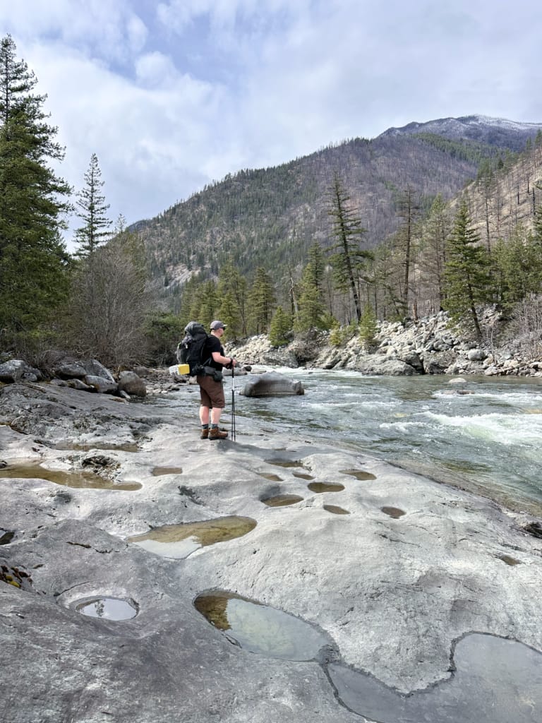
The trail dips down to river level to pass over a water-smoothed rock outcropping. I usually take a quick snack break here to admire the views upriver. At times of very high water, the river can come right up to the edge of the slab. When that happens, scramble over the sloping rocks to get back on the trail.
About 1.7 km from the trailhead, arrive at Loop Camp.
Loop Camp to Devil’s Staircase Camp
Distance: 2.2 km
Elevation Gain: 75 m
Elevation Loss: 10 m
Hiking Time: 25 to 40 minutes
Continue through Loop Camp on the trail as you pass through more open ponderosa pine forest. In places, you’ll have to watch your footing due to smooth river stones on the path. You’re walking on the flat benches of an old river bed, a few metres higher than the current river.
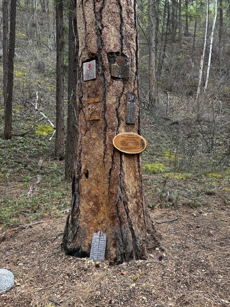
About 1 km after leaving Loop Camp, just after descending a small hill, look for a memorial tree off to the left. This tree holds memorial plaques for members of the Nlaka’pamux Nation. Please be very respectful here. If you look closely, you’ll see bear claw scratches on one of the trees.
About 3.8 km from the trailhead, arrive at a fork. Devil’s Staircase Camp is straight ahead on a spur trail. Turning left will take you further into the Stein Valley.
Devil’s Staircase Camp to Teepee Camp
Distance: 4.2 km
Elevation Gain: 240 m
Elevation Loss: 135 m
Hiking Time: 1 to 2 hours
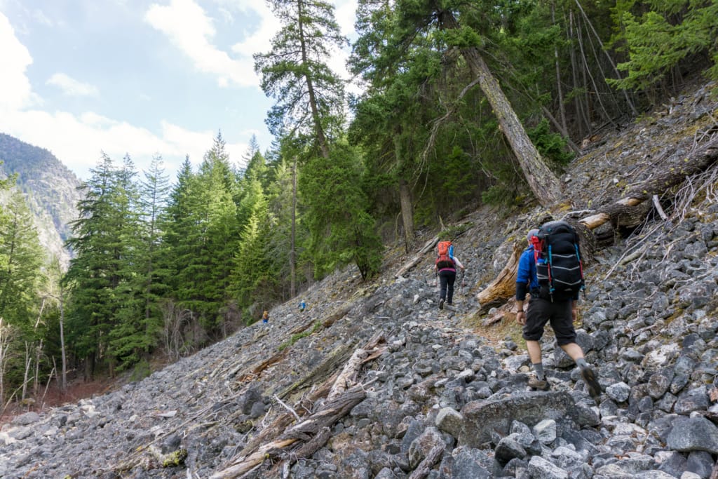
The next section of trail is the most challenging since it involves the big climb up and over Devil’s Staircase Hill. From the fork, follow the trail uphill as it switchbacks through trees and then crosses wide talus slopes.
The trail continues along the top of a bluff. In a few places, it’s narrow and close to the edge, but it is never too precipitous. In one short section, you’ll pass through remnants of the 2023 wildfires.
The trail dips down to cross a rubble-filled gully below Christina Falls. Do not linger here – the rubble is from previous washouts and it can shift.
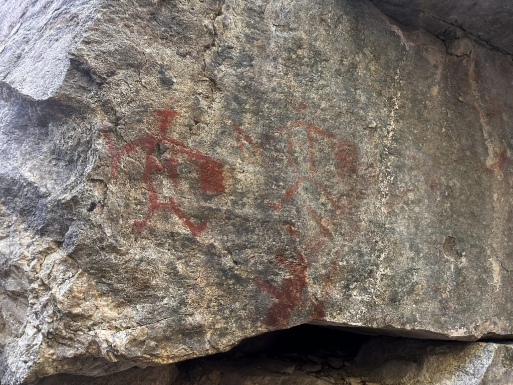
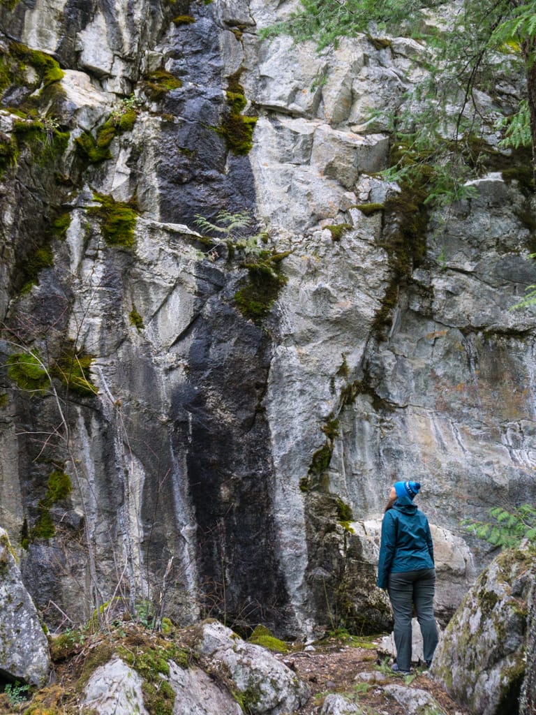
About one kilometre after leaving Devil’s Staircase Camp, the trail starts to head downhill on some short and slightly loose switchbacks. A spur trail to the right leads to the base of a cliff and the largest pictograph panel on the trail.
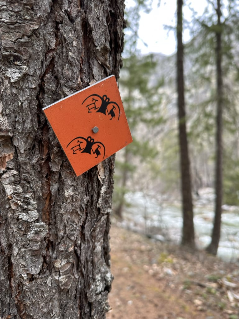
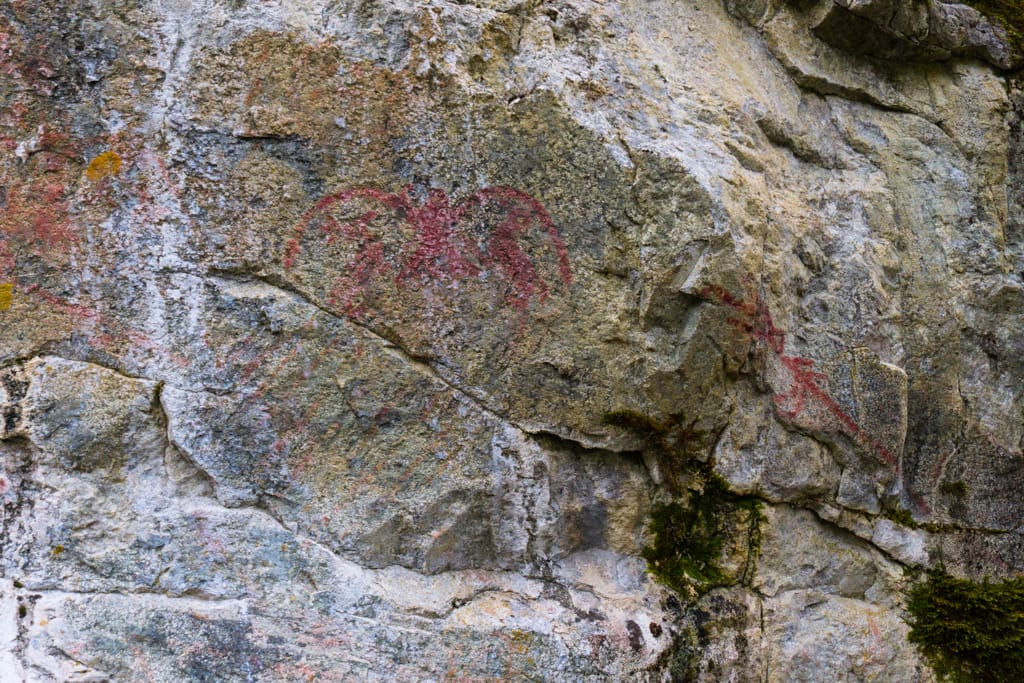
This pictograph panel is truly special and is the main reason I keep coming back to the Lower Stein Valley. The cliff has dozens of pictographs, most of which are in good condition. It’s important to be very respectful of this important cultural, spiritual, and historical site. Never touch the pictographs since the oils from your hands can damage them. I’ve got more info about the pictographs at the bottom of this post.
Past the pictographs, the trail stays close to the river. The ponderosa pine forest is mostly behind you. Now you are walking through stands of black cottonwood, aspen, and birch. At one point, the trail passes between two large boulders. Look for pictographs on its smooth face.
Shortly after walking through a small wildfire-affected area, arrive at Teepee Camp about 8 km from the trailhead.
Teepee Camp to Earl’s Cabin Camp
Distance: 2.2 km
Elevation Gain: 60 m
Elevation Loss: 20 m
Hiking Time: 25 to 40 minutes
The trail leaving Teepee Camp meanders through river rock and trees just out of earshot of the river. This section also has a few short steep hills where you climb up from river level to small bluffs. One of these has a good view down to the river.
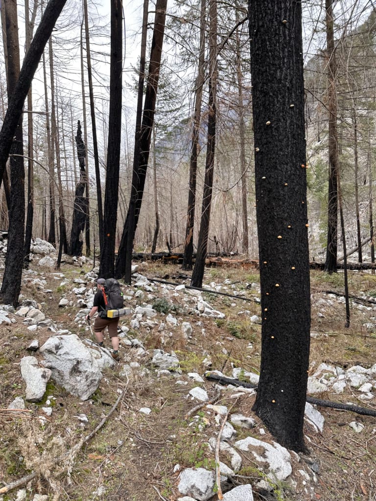
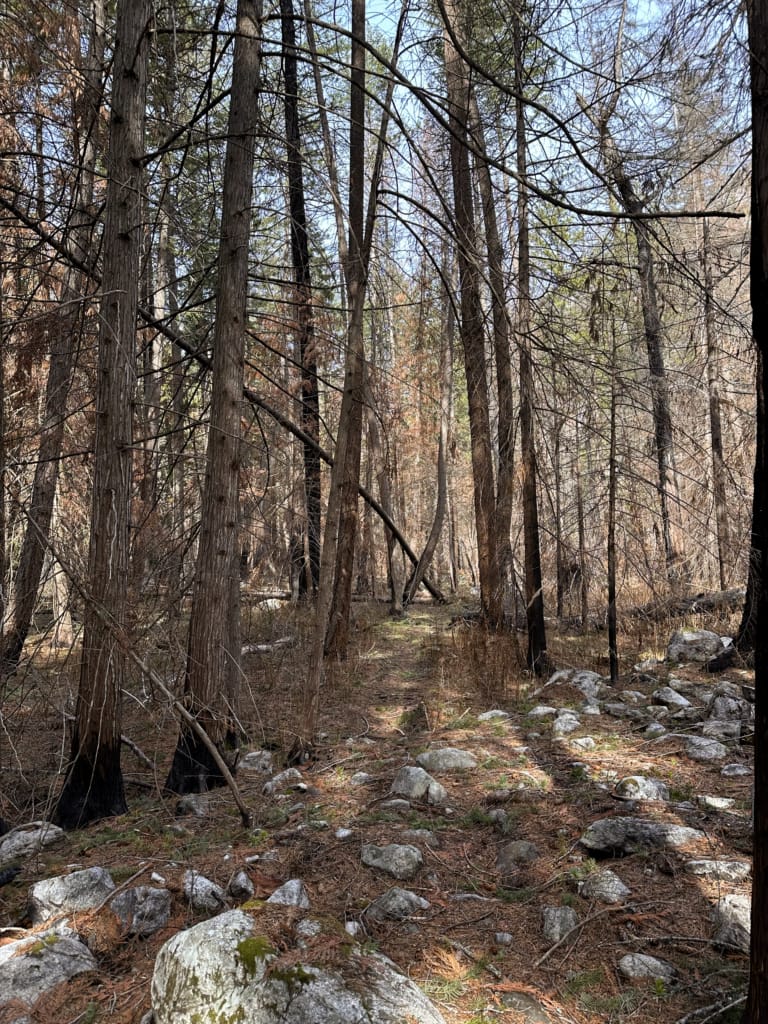
As you get closer to Earl’s Camp, more and more of the trail is affected by the 2023 wildfires. However, the trail crews have done a great job of clearing and marking the trail, so navigation is easy.
Unfortunately, the most affected area was my favourite place on the whole trail: Teaspoon Creek. This used to be a gorgeous grove of cedar trees with a creek meandering through it. The grove was deliciously cool on hot days. The 2023 fire burned so hot here that it scorched the top of the soil in this area, dropping the trail bed and surrounding by land about one foot!
Past Teaspoon Creek, emerge into an unburned stretch and then arrive at Earl’s Cabin Camp.
Beyond Earls Cabin Camp
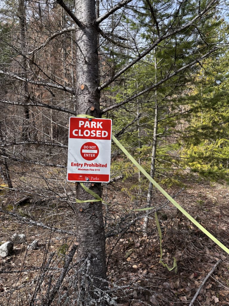
As of 2026, the trail past Earls Cabin Camp is officially closed due to wildfire damage. When the trail is open, it continues to Suspension Bridge Camp and the Suspension Bridge, 13 km from the trailhead.
From taking a peek about 100 m down the trail past Earl’s Camp, I can tell you that the burn damage is extensive: the bridge over Earl’s Creek is gone, and there are fallen and burnt trees everywhere. I’ve also heard there is a landslide just before the Suspension Bridge.
The Suspension Bridge was damaged by falling trees and landslide/avalanche debris prior to the fires, and is not safe to cross.
The Suspension Bridge is the spot I used to recommend people use as their turnaround point. While the trail continues upriver and into the mountains, the 30-km-long section of trail in the mid-valley between the Suspension Bridge and the alpine receives very little maintenance and isn’t that visually interesting.

Camping on the Lower Stein Valley Trail
All of the campgrounds in Stein Valley Nlaka’pamux Heritage Park are free and do not require reservations – they are first-come, first-served. However, the campgrounds are not large, so BC Parks asks groups larger than four people to call (250-371-6200) or email ([email protected]) before their trip.
Info about each of the campgrounds is below.
Loop Camp
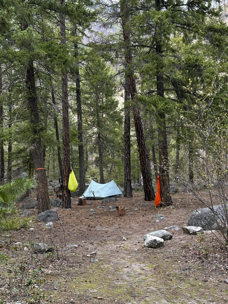
This camp used to be called Easy Camp since it is so close to the trailhead. It was renamed when a trail looping back to the trailhead from here was built about 15 years ago. However, that trail was never popular and is now overgrown and closed.
It has an outhouse and a metal food cache on the left side of the trail and an open area for about six tents on the right side of the trail. To access water, follow trails downhill towards the river.
While it is too close to the trailhead for most visitors, I think this is the most beautiful campground on the Lower Stein Valley Trail.
Devil’s Staircase Camp
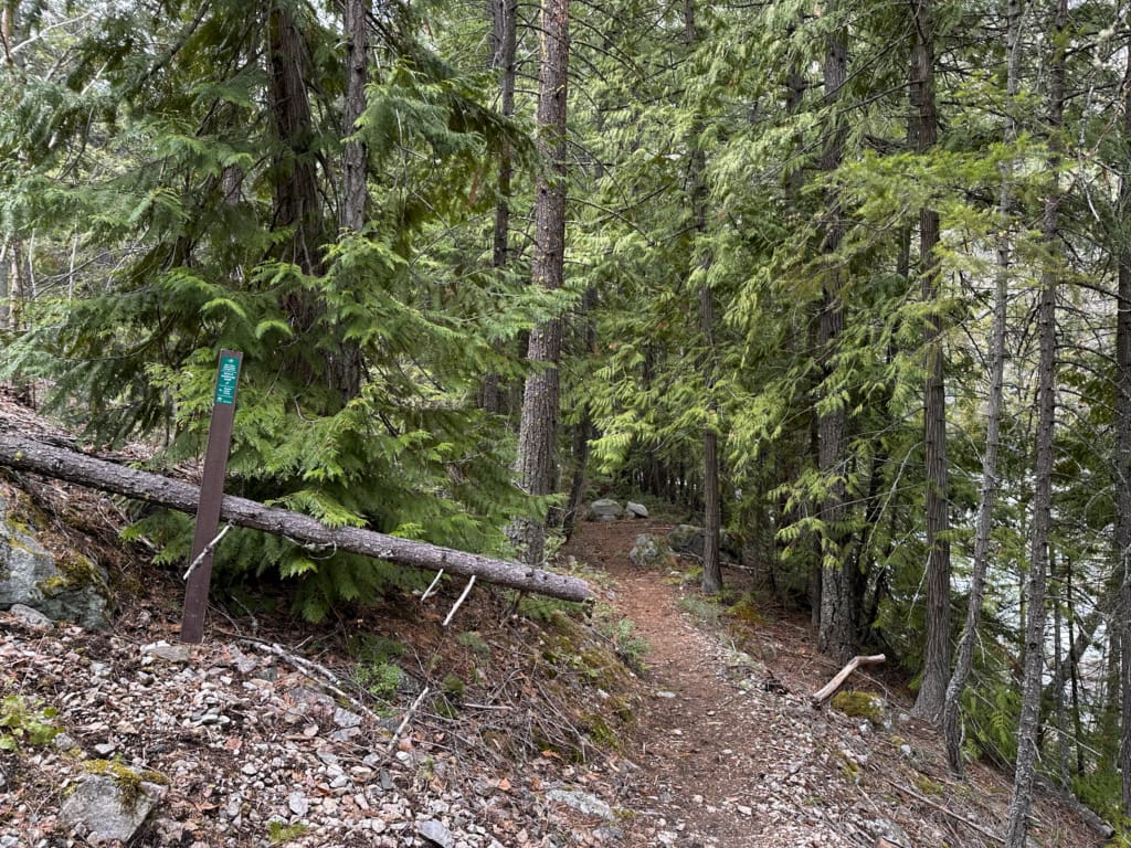
The spur trail to Devil’s Staircase Camp is about 100 m long. The camp is set amongst tall conifers and large boulders. It is very shaded, which is great on hot summer days, but makes it a less-than-ideal campsite in spring and fall since it gets very little sun.
The campground has a metal food cache and an outhouse. There is space for about six tents. Follow paths to the river to get water.
Teepee Camp
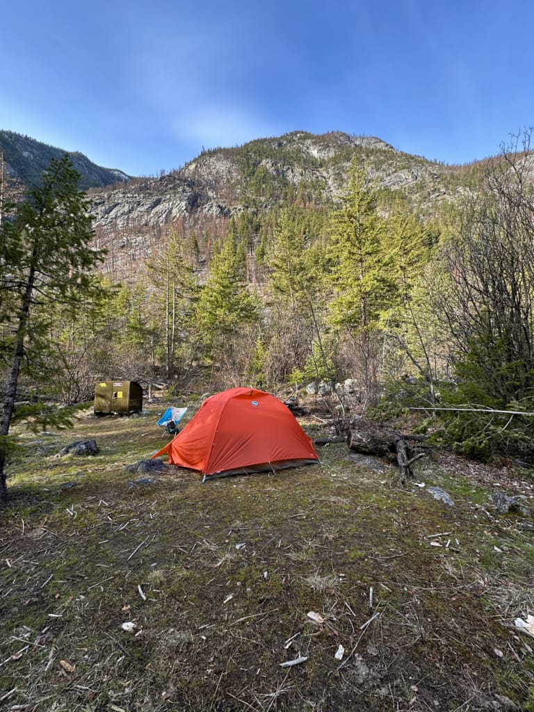
The camp gets its name from a large teepee that once stood here, erected as part of a Nlaka’pamux youth program.
The campsite has an open grassy area with benches that can fit two tents, which is by far the best site at Teepee Camp. There is space for a few more tents right beside the trail.
If you’re looking for a bit of privacy, walk a few hundred meters along the trail past an open rocky area to find a flat area amongst trees on the left that functions as an overflow camping area. It’s a longer walk to the outhouse and food cache, but you won’t be camped right next to a stranger.
The campground has a metal food locker near the trail as well as an outhouse on an inland spur trail. A trail from near the benches leads down to the river to get water.
Earl’s Cabin Camp
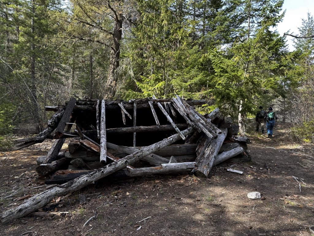
The falling down remains of a trapper’s cabin sit in the middle of Earl’s Cabin Camp. There are a few clearings near the trail and the cabin that can fit about six tents.
There is an outhouse behind the cabin and a metal food locker near the trail. Follow a trail down the bank to the river to get water.
The large open area just beyond the cabin has great views of the cliffs on the other side of the river. The rocks used to be studded with trees, but they burned in the 2023 fire. I’ve spotted mountain goats high on the cliffs on several visits.
Lower Stein Valley Trail Itineraries
With four campgrounds to choose from, various itineraries for day hiking and backpacking are possible. In general, I recommend spending one night on the trail. The pictographs at the base of the Devil’s Staircase are also a must-see.
Day Hiking Itinerary:
Hike to the pictographs and back (10.2 km round trip with 285 m of elevation gain.
Easy Backpacking Itinerary:
Day 1: Hike 1.7 km to Loop Camp. Set up camp, then hike to the pictographs and back (7.1 km round trip with 225 m elevation gain).
Day 2: Hike back to the trailhead (1.7 km).
Hot Summer Backpacking Itinerary:
Day 1: Hike 3.8 km to Devil’s Staircase Camp (best campsite for shade). Set up Camp, then hike to the pictographs and back (2.7 km with 165 m of elevation gain).
Day 2: Hike back to the trailhead (3.8 km)
Regular Backpacking Itinerary:
Day 1: Hike 8 km to Teepee Camp or 10.1 km to Earl’s Cabin Camp. Try to get the grassy campsite with the benches at Teepee Camp since it’s the best spot.
Day 2: Hike back to the trailhead with a detour to the pictographs – they look best in the morning light.
Join the Backpacking in BC Facebook Group
How to Get to the Lower Stein Valley Trail
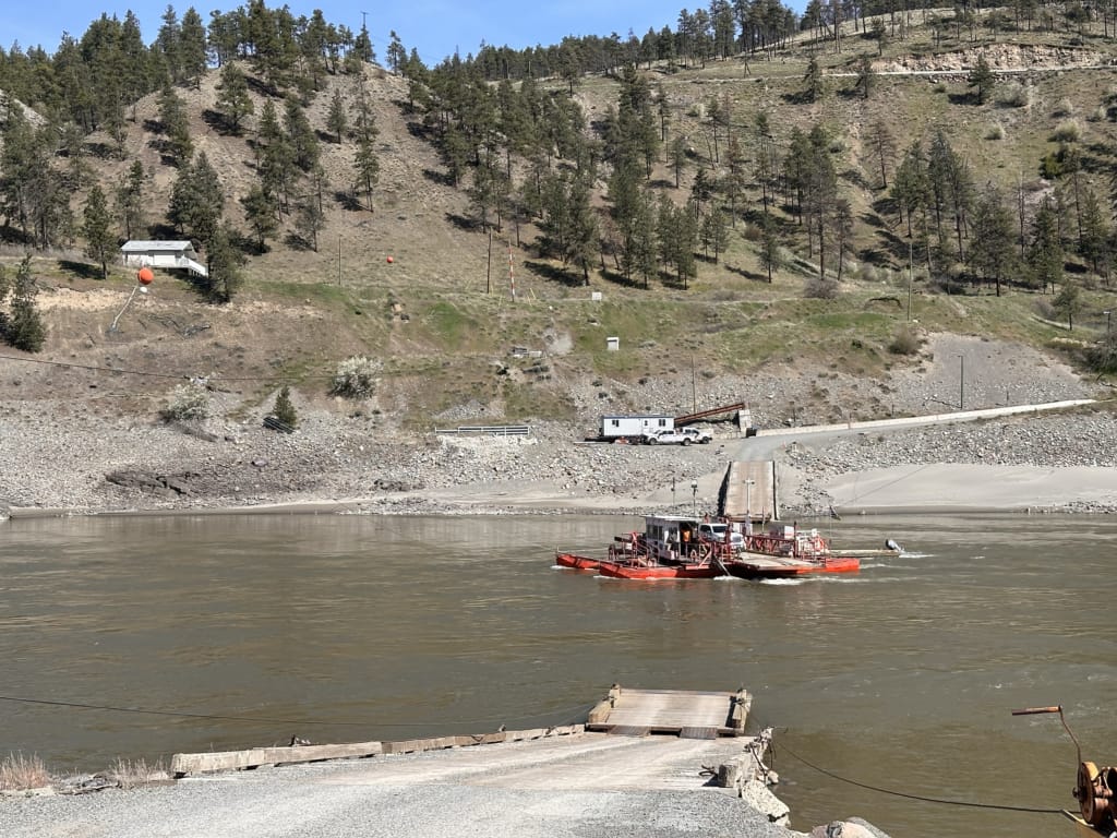
The trailhead for the Lower Stein Valley Trail is near Lytton in British Columbia’s Fraser Canyon. The drive is fairly straightforward, but it does involve taking a small ferry over the Fraser River.
Driving Directions
From Vancouver, drive Highway 1 east to Hope, then continue on Highway 1 north through the Fraser Canyon to Lytton. In Lytton, turn left onto Highway 12 and follow it through town and across the bridge. Make the first left onto Lytton Ferry Road.
Take the reaction ferry (more info on the ferry below) across the Fraser River and follow the signs for the Stein Valley for about 4 km on gravel roads through the Lytton First Nation reserve. Turn left onto Stein Trail Road. This road is bumpy, but it’s fine for 2WD vehicles.
The drive to the trailhead takes about 4 hours from Vancouver. Here are Google Maps driving directions.
Lytton Ferry Info
The Lytton Reacton Ferry is a small two-car ferry that crosses the Fraser River just north of Lytton. It doesn’t have a motor. Instead, it uses the river current to push the ferry across the river and is attached to cables that keep it from getting pushed downstream.
The Lytton Reaction Ferry runs 24 hours a day, but there are several 15- and 30-minute breaks for the crew when the ferry doesn’t run. The crossing takes about five minutes. The ferry is completely free and does not accept reservations – just drive up and get in line. You will rarely have to wait more than one sailing.
At times of high water, such as during the spring melt, the ferry does not run. This varies from year to year, but is typically in late May for a week or two. Check DriveBC for current ferry conditions. If you are travelling in spring, ask the ferry operator about current conditions when you cross – the river can rise overnight, so the ferry could stop running while you are hiking.
If the ferry is not running, it is possible to get to the trailhead from Lillooet via the Texas Creek Road. This is a gravel road that is bumpy and twisty with many blind corners. However, it is usually 2WD-accessible.
Indigenous Pictographs in the Lower Stein Valley
The Nlaka’pamux name for the valley is “Stagyn”, which means hidden place. It refers to the fact that the size of the Stein River watershed is not obvious when viewed from the mouth of the Stein River on the Fraser River. The modern name Stein comes from “Stagyn”.
The Stein River valley has been a significant spiritual place for the Nlaka’pamu Nation for thousands of years. As an important part of their culture, youth were sent alone on quests into the valley to bond with nature and find their guardian spirit.
As part of the quest, these youth made pictographs in key “power spots” using a mix of rock dust, red ochre clay, tree sap, and water. Since the youth were alone, it is difficult to interpret individual pictographs since they represent each individual’s dreams or experiences.
Adults made some of the other pictographs in the valley for a variety of reasons, including calling upon guardian spirits or recording historical events. The Nlaka’pamux also believe that the spirits made some of the pictographs.
Modern archaeologists and members of the Nlaka’pamux Nation have discovered over a dozen rock painting sites in the Stein Valley. The largest site includes about 200 pictographs and is one of the largest rock art sites in Canada. Most of the pictographs in the valley were made between 1800 and 1860.
If you want to learn more about the pictographs, I recommend They Write Their Dreams on the Rock Forever by Annie York, Richard Daly, and Christ Arnett. The book is a collaboration between Nlaka’pamux elder Annie York, who shares her oral history, ethnographer Richard Daly, and art historian Christ Arnett. I find myself flipping through it after each visit to the Stein Valley.
Stein Valley History
The Nlaka’pamux people have lived near the confluence of the Stein and Fraser Rivers since time immemorial. The first archeological evidence of their presence is about 6500 years old.
Western settlers arrived in the area in the early 1800s due to the fur trade and later the Gold Rush. Both Indigenous and settler trappers worked in the Stein Valley, creating trails. There were plans to log the valley in the 1960s and 1970s.
Indigenous groups and environmental activists led a campaign to save the valley and keep the Stein River watershed intact in the 1970s and 1980s. The campaign included several music festivals and trail upgrades in an attempt to popularize the area for recreation. The valley trail from the mouth of the river all the way to headwaters was cleared and formalized. Unfortunately, sections of it have fallen into disuse over the last 15 years.
The watershed was finally protected in 1995 when Stein Valley Nlaka’pamux Heritage Park was established. The park is cooperatively managed by Lytton First Nations and BC Parks in a way that allows the First Nations to use the park and its resources for traditional cultural and spiritual activities.
Tips for Hiking the Lower Stein Valley Trail
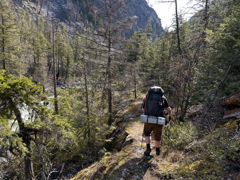
Weather: Check the weather before you go. Lytton and the Stein Valley area are a unique micro-climate in BC that can often be hotter and drier than the rest of southwestern BC. That makes the area a great spot for spring and fall trips, but means it can be scorching hot (40C) in mid-summer.
Ferry Status: Be sure to check the ferry status on DriveBC the day before and the day of your trip.
Ticks: There can be ticks on the trail, especially in late spring and early summer. Try to avoid walking through brush and wear long pants tucked into socks. Read these tips for hiking in tick habitat.
Bears: This is grizzly and black bear country. Bring bear spray, make noise while hiking, and store your food securely. See my bear safety tips for more info.
Dogs: Allowed on leash in the park.
Fires: Not allowed in the park. As you will see, wildfires here can be devastating.
Bring warm gear in shoulder season: If you are planning a fall or spring trip to the Lower Stein Valley, you will likely be able to hike in shorts and a t-shirt during the day. However, temperatures often fall to freezing overnight. Bring warm base layers, a puffy jacket, a warm sleeping bag, and an insulated sleeping pad. Read my tips for staying warm in a tent.
Bring a water filter: While the Stein River looks pristine, you never know if humans or animals have pooped (or died) upstream. Use a water filter just in case. I use the Katadyn BeFree.
Respect Indigenous culture: While it is always important to acknowledge and respect the Indigenous people who have stewarded these lands since time immemorial, it is especially important in the Stein Valley. This valley is the equivalent of a church or other holy site for the Nlaka’pamux Nation and is considered sacred. Please treat it with the reverence and respect it deserves.
Final Thoughts
On paper, the Lower Stein Valley can seem unassuming. It’s an easy, low-elevation hike without a big stand-out view and it doesn’t look impressive on social media. But after 8 trips here, I can assure you, it’s special in a way that just doesn’t translate to photos or words – you just have to feel it.
As I’ve said, I’m not a religious or spiritual person. But there’s an energy in the Stein that feels powerful and ancient, but also calming.
Since it’s an easy trip, I find it’s a great way to slow down and connect with nature. I’ve spent countless hours scanning the cliffs with binoculars hoping to spot goats, staring into the patterns of the ripples in the river, or watching the clouds float overhead. I feel grounded here, and I always head home refreshed.
I hope you enjoy the Lower Stein Valley as much as I do!
READ NEXT:
- 10 Things to Do on a Fraser Canyon Road Trip
- 25 Spring Backpacking Trips in British Columbia
- 25 Easy Backpacking Trips In BC For Beginners

- Things to Do in Twillingate, Newfoundland: Icebergs, Hiking, and More - August 24, 2026
- 20+ Best Things to do in Squamish, BC (From a Local) - August 22, 2026
- Tenquille Lake Trail Hiking and Backpacking Guide - August 10, 2026